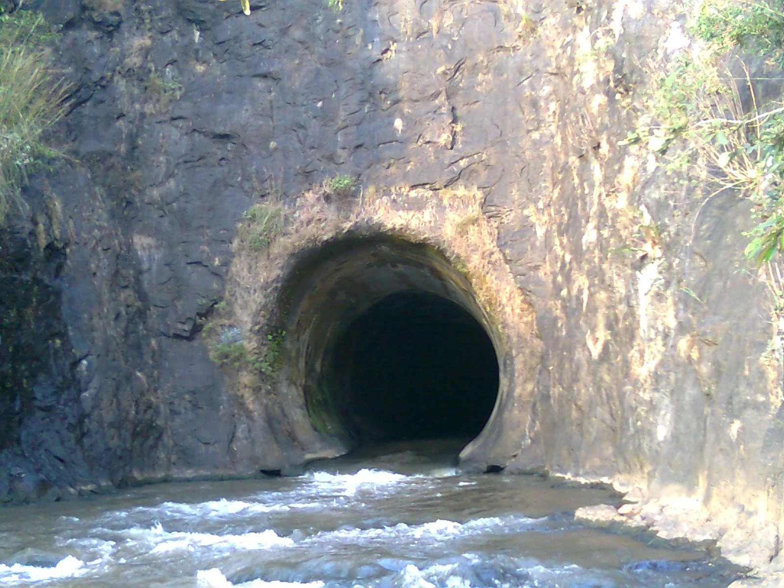
The opening at Anchuruli invites a simple question: where does that dark circle lead? For a visitor, the more useful question is what travels through it. The tunnel carries water from the Erattayar side towards Idukki reservoir. Its outlet makes one part of a much larger diversion system visible from outside the hill.
An outlet, not a natural cave
Look at the contrast between the regular curve of the opening and the rough surrounding rock. The passage is engineered, while the hillside retains its uneven surfaces. Water emerges from the dark interior and passes over rock towards the reservoir. That direction is central to understanding the site: Anchuruli is the receiving end beside Idukki, not the source of a stream flowing back towards Erattayar.
A photograph can make the interior appear like a passage waiting to be explored. It is working water infrastructure. Conditions upstream are outside the view at the mouth, and low flow at the moment of arrival does not establish safe entry. The exterior gives the important information: the opening, the level at which it meets the hill and the onward movement of water.
Why water was diverted towards Idukki
The Irrigation Department’s Periyar basin report describes the Kallar and Erattayar diversion works in relation to the Idukki system. They added water from neighbouring catchments to reservoir storage. Anchuruli therefore belongs to the collection side of the hydroelectric scheme. It is separate from the route taken by water after generation at Moolamattom.
The 1985 Economic Review records partial commissioning of the augmentation works in August 1984 and additional generation during the following year. That places the tunnel within a later expansion of Idukki’s water supply, rather than making it a natural feature discovered when the reservoir filled. The project’s purpose is clearer when the outlet is read as one stage in a managed journey.
How the outlet meets the reservoir
The outlet and the reservoir form two different edges. One is the fixed, circular opening through the hill; the other is a changing waterline against the shore. Between them, water crosses exposed rock before joining the stored water. Their relationship can look different as flow and reservoir level change, while the tunnel continues to serve the same direction of transfer from Erattayar towards Idukki.
The visible relationships are enough to begin with. One opening cuts into the hill; a short discharge section carries the emerging water; the reservoir receives it beyond. Turn from the mouth towards the water and the scale expands from a circular piece of engineering to a shoreline extending between wooded slopes.
This is also why a visit to Anchuruli differs from a dam-top tour. There is no need to look for the Idukki arch dam in the frame. The tunnel shows the less familiar work of bringing water into a reservoir whose larger structures lie elsewhere. Seeing that connection makes a short exterior stop more meaningful without extending the visit into a controlled space.
Sources: Kerala Tourism’s Anchuruli account and the Irrigation Department’s Periyar basin study inform the landscape and engineering distinction. Keep to the admitted exterior viewpoint on arrival.
Plan the visit: Anchuruli.