Begin with the inland locality
Aruvikkuzhi Waterfall belongs to the Pallickathodu area of Kottayam district. That is the locality a visitor needs for the final road journey. Kumarakom is a wider tourism hub elsewhere in the district, not the village at the waterfall or an alternative name for it.
The distinction matters because a district itinerary can place backwaters and waterfalls on the same day while concealing the change in landscape and arrival. A waterside stay in Kumarakom and the bridge approach at Aruvikkuzhi require separate directions.
The waterfall’s surroundings explain the difference
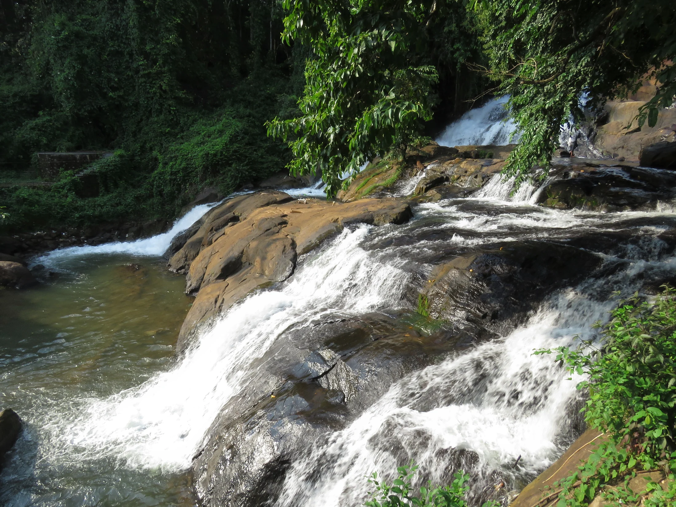
The district administration describes Aruvikkuzhi within a rubber-growing landscape. The photographs show a rocky cascade enclosed by vegetation rather than an open lake shore. This is a compact inland watercourse setting, with the road approach playing an important role in how visitors see it.
The image with this story looks across the cascade from one side. Water moves over dark rock while foliage contains the view. There is no backwater horizon or boat-boarding point in that frame, and the visit should not inherit the facilities or expectations of a Kumarakom lake outing.
The district and DTPC descriptions use slightly different spellings and nearby-distance figures. Aruvikkuzhi and Aruvikuzhy refer to this waterfall in the Pallickathodu setting. Matching the locality and arrival reference is more useful than treating every spelling variation as a separate attraction.
Use the bridge approach as the final reference
The mapped visitor base is at the Aruvikkuzhi Bridge approach on the local road. That gives a concrete arrival point beside the waterfall setting, rather than directing a vehicle into the stream or to a general Pallickathodu marker. The final permitted viewing space still depends on the site’s current condition.
Give that reference to the driver and agree a suitable drop-off without obstructing the bridge. A bridge beside an attraction remains a transport structure; it should not become a waiting bay simply because the water is visible nearby.
For a bus arrival, use Pallickathodu as the local transport context and establish the last connection. Do not assume that a service useful for reaching Kottayam or Kumarakom completes the waterfall approach without another stage.
Combine places without merging their identities
Aruvikkuzhi can sit within a wider Kottayam visit, but give it its own time and route. A short waterfall stop and a backwater programme have different reporting points, surfaces and seasonal conditions. Planning them separately produces a clearer day than treating them as interchangeable attractions within one town.
The same care improves the record of the visit. Caption a waterfall photograph with Aruvikkuzhi and its actual inland setting, while leaving Kumarakom for images and experiences that belong there. The district connects the itinerary; the locality identifies the place.
Once that geography is clear, the visit becomes straightforward: an inland approach through the Pallickathodu area, a specific bridge-side arrival and time with the cascade as it appears that day.
Sources: Kottayam district: Aruvikuzhy Waterfalls and DTPC Kottayam.
Plan the visit: Aruvikkuzhi Waterfall.