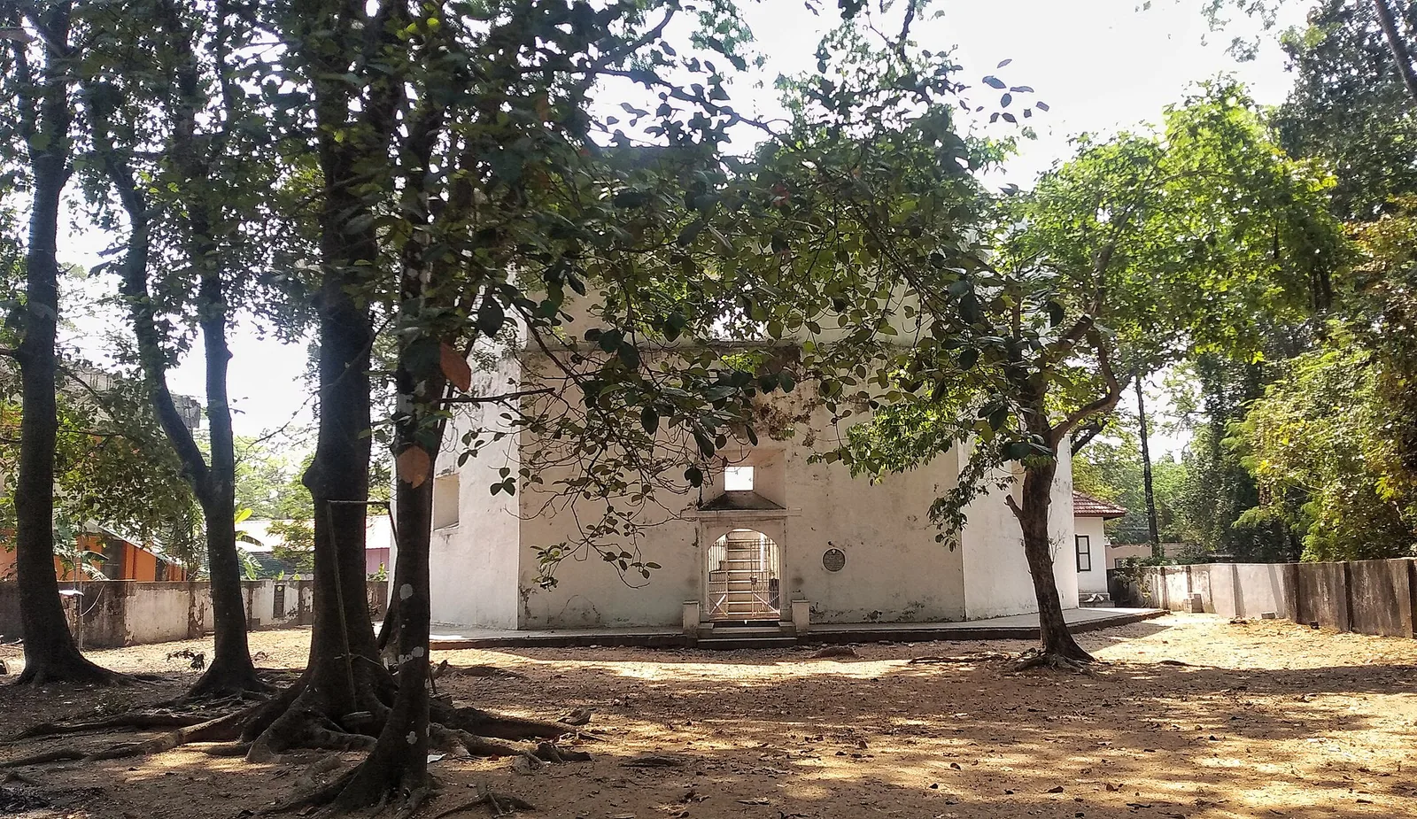
Pallipuram Fort is a hexagonal laterite tower at the northern tip of Vypin, three storeys high, with a footprint smaller than a tennis court. It held about twenty men. British records called it an outpost rather than a fort, and they were being accurate.
It is also one of two buildings named in the ultimatum that began the Third Anglo-Mysore War — the war that ended with Tipu Sultan ceding half his territory. Almost nothing on site tells you this, partly because the fort does not appear in the record under the name on the signboard.
The name problem
In European and treaty papers this building is Ayacotta — also written Jacottah, Jyacottah, Jaycotta, Palliport and Munampam, depending on who was writing and in what language. Locally it is ayikkotta or alikotta. If you go looking for “Pallipuram Fort” in eighteenth-century campaign accounts you will not find it; if you look for Ayacotta, it is everywhere.
That is worth flagging because it is why the connection is so often missed. Two names, one small building, and a chapter of South Indian history filed under the name the tourist literature does not use.
A sale, and an insult
The Dutch had held the fort since the early 1660s. By the 1780s the Dutch East India Company’s position on the Malabar coast was collapsing, and in 1789 it sold two of its remaining coastal positions — Ayacotta and the fort at Kodungallur (Cranganore) — to the Kingdom of Travancore, whose Dewan, Raja Kesava Das, was buying up the coast’s defences.
Tipu Sultan of Mysore regarded this as a direct challenge. His position was that both forts stood in the territory of Cochin, and that Cochin was his tributary — so the Dutch had no right to sell them and Travancore no right to buy them. The transaction was, in his reading, an infringement of his sovereignty conducted behind his back.
He served an ultimatum on the Maharaja of Travancore: demolish the Travancore Lines — the Nedumkotta, the great defensive wall running across the north of the kingdom — and return the two forts. Travancore refused.
- Travancore was an ally of the British East India Company. An attack on it obliged the Company to respond.
- Tipu’s assault on the Nedumkotta is therefore treated as the immediate cause of the Third Anglo-Mysore War (1790–92).
- That war ended with the Treaty of Seringapatam, under which Tipu ceded roughly half his territory and gave two sons as hostages.
- The chain begins with the sale of a watchtower on Vypin island that you can walk round in five minutes.
And then it surrendered
Here the story stops being flattering to the building. Tipu attacked the Nedumkotta in December 1789 and was repulsed with heavy losses. He came back and breached the lines in late April 1790. On 8 May he took Cranganur — one of the two forts he had demanded — and Ayacotta and Parur surrendered shortly afterwards.
So Pallipuram Fort did not hold. The tower that a war was declared over changed hands without a notable fight, which is the honest outcome for a three-storey outpost with a garrison the size of a cricket team facing a field army.
This matters for one practical reason: the popular version of the local legend, told at the church beside the fort, has Tipu’s men passing the island by without finding it. He did not pass it by. He came for it specifically, and he took it.
Stopped by the river, not the fort
What actually halted the advance was water. Travancore’s army fell back across the Periyar and prepared to contest the crossing, and a small party under Vaikom Padmanabha Pillai and Kunjai Kutty Pillai went upstream and breached the dam walls at Bhoothathankettu, sending a flash flood down the river. With the monsoon arriving, cholera and malaria in his camp, a regrouped Travancore army in front of him and a British declaration of war behind him, Tipu withdrew.
The fort went back to Travancore and stayed Travancore’s until Indian independence. Contrary to the usual telling of Kerala’s colonial sequence, the British never owned it.
Standing there now
Entry is free, it takes twenty minutes, and it is closed on Mondays. What you are looking at is a Portuguese work of 1503–07, protected since 1964 by the Kerala State Department of Archaeology — not the ASI, whatever the guidebooks say — and part of the Muziris Heritage Project.
The useful thing to hold in mind is proportion. This is a tiny building whose value was never its strength but its position, at the point where the Kochi backwaters open to the sea. Whoever held it watched the channel. That was worth going to war over in 1789, and it is the only reason anything was ever built here.
Frequently asked questions
What is Ayacotta?
It is Pallipuram Fort, on the northern tip of Vypin island. European and treaty records call it Ayacotta, and also Jacottah, Jaycotta, Palliport and Munampam; locally it is ayikkotta or alikotta. Eighteenth-century accounts of the fort use these names rather than “Pallipuram Fort”.
Did Pallipuram Fort cause the Third Anglo-Mysore War?
It was one of the two immediate causes. In 1789 the Dutch sold Ayacotta and Kodungallur to Travancore; Tipu Sultan held both lay in Cochin, his tributary, and demanded their return along with the demolition of the Travancore Lines. Travancore refused, Tipu attacked, and because Travancore was a British ally the war followed.
Did Tipu Sultan capture Pallipuram Fort?
Yes. After breaching the Nedumkotta in late April 1790 he took Cranganur on 8 May, and Ayacotta and Parur surrendered soon after. The local legend that his forces passed the island by without finding it is devotion rather than history.
What stopped Tipu’s advance into Travancore?
The Periyar. Travancore fell back across the river and a small party breached the dam at Bhoothathankettu upstream, flooding it. Combined with the monsoon, cholera and malaria in his camp, and a British declaration of war, Tipu withdrew.
Who owned Pallipuram Fort after Tipu withdrew?
Travancore, which held it until Indian independence. The British never took possession of it, despite the usual Portuguese-Dutch-British telling of the Kerala coast.
Can you visit Pallipuram Fort?
Yes — entry is free, it takes twenty to thirty minutes, and it is normally closed on Mondays. It sits on the Cherai–Munambam road at the north end of Vypin, and pairs naturally with Cherai Beach to the south and Munambam harbour to the north.