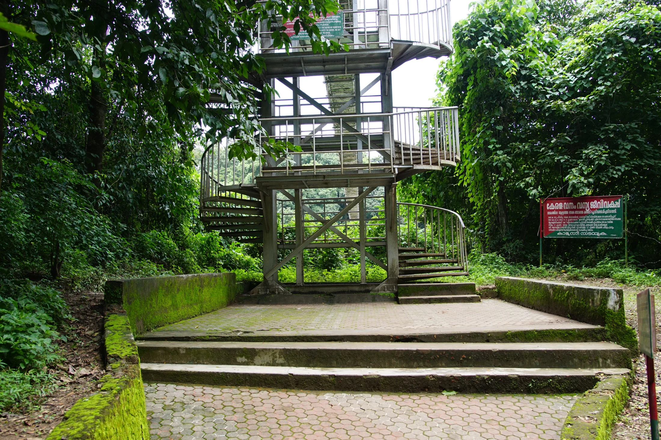
An old photograph of the approach to Conolly’s Plot shows a metal spiral stair and a raised bridge structure beside the river. It is a striking piece of access infrastructure, and it can easily become the image a visitor remembers when planning the journey. The important next step is to recognise its date: the photograph records an earlier crossing arrangement, not a guarantee of the route available today.
The river is part of the place
Conolly’s Plot is associated with the Chaliyar river landscape near Nilambur. Kerala Tourism’s account describes the grove in relation to the river and adjoining watercourse, rather than as an isolated plantation beside an ordinary town street. The approach is therefore part of understanding how the plot sits within its surroundings.
The bridge photograph makes that relationship physical. A raised structure and a stair are needed because the visitor route changes level and crosses water. The image contains more than an attractive line against green vegetation: it records the effort required to connect a visitor approach with a river-side destination.
Read the structure before the itinerary
The spiral stair turns around a central support, while the bridge deck continues at a higher level. Metal railings define the narrow passage. These visible features explain how people moved between levels when the photographed arrangement was in use. They do not establish the present condition of the deck, supports or access gates.
A current itinerary needs current operating information. The Forest Department’s ecotourism record for Conolly’s Plot explicitly marks the jankar service as unavailable. That statement concerns a particular crossing service; it should neither be ignored because an older bridge looks inviting nor expanded into an unsupported claim that every form of site access is permanently closed.
Keep the arrival point precise
The useful planning question is which visitor approach the current programme uses and how a group reaches the admitted part of the plot. A destination name alone may lead to an old crossing or the wrong riverbank. The agreed reporting point matters more than reproducing a route from an undated travel account.
This is especially relevant when combining the plot with Nilambur Teak Museum. The museum is a separate road destination with its own entrance. A convenient town itinerary still needs to respect the river-side access arrangement at the plot rather than assuming both places function like adjacent buildings.
An archival image still has value
The photograph remains useful because it shows how access infrastructure became part of the visitor experience. It can be read as a record of the place without being used as a current directions image. A clear date and caption allow that distinction to remain visible.
When visiting, compare the actual admitted approach with the wider river setting. Notice where the grove lies in relation to water and the road journey, while following the operating arrangement in force. The result is a better understanding of Conolly’s Plot and a more dependable plan than treating one old bridge photograph as a ticket to cross.
Sources: Archival bridge photograph, Kerala Tourism’s location account and Forest Department ecotourism.
Plan the visit: Conolly’s Plot.