Start below the ramp
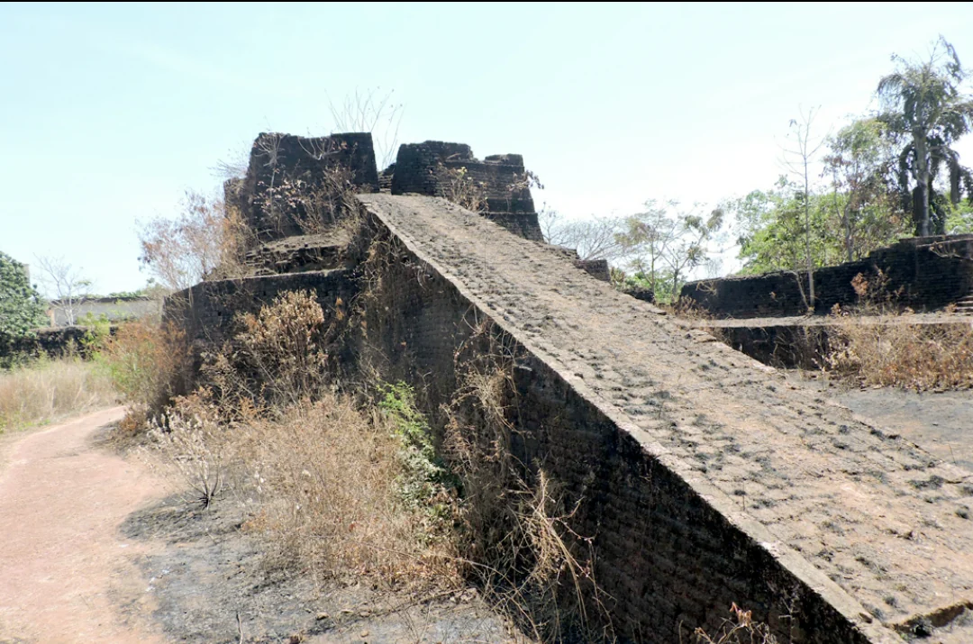
Hosdurg’s broad ramp provides a clear line through the surviving structure. From lower ground, its incline leads the eye towards the raised rounded bastion. Looking from here first explains the relationship between approach and fortification without requiring a climb onto an uncertain upper edge.
The ramp and the curved wall do different visual work. One draws a straight rising line; the other presents a heavy rounded mass. Their meeting is the most useful starting point for understanding the fort’s surviving form.
Read the stone where it remains exposed
Laterite surfaces are visible between patches of vegetation. Individual blocks and joints give a sense of the wall’s construction, while weathering and plant growth change how clearly those details can be seen. A shaded surface can appear almost flat until another angle reveals the curve.
The photograph with this story shows the ramp as a substantial approach rather than a narrow ornamental stair. Its width and the masonry above it belong together. Include both in a view if you want to explain the structure instead of isolating a few stones.
Vegetation is part of the present appearance, but it should not hide the distinction between masonry and ground. Keep to the established open approach. An overgrown edge may conceal a change in level, and the presence of a wall in a photograph does not turn its top into a visitor walkway.
The bastion belongs to a defensive family
Kerala Tourism identifies round bastions and wall walkways in its account of Hosdurg. It also compares the style of the bastions and watchtower with regional forts such as Bekal and Kumbala. The comparison is most useful when it stays with the specific forms rather than assigning an identical plan to every fort.
At Hosdurg, the remaining curved mass is readable even when details are partly covered. Move between safe positions at lower level and notice how the outline changes. A view straight up the ramp explains the approach; a position to one side reveals more of the curve.
The surrounding town completes the picture
The fort does not occupy an isolated landscape. Modern buildings, roads and a cemetery or crematorium setting appear close to its remains. Kerala Tourism’s historical account explicitly notes the nearby cemetery. That proximity is part of the present place, not a reason to crop out every sign of current life.
Leave local access clear and avoid photographing people engaged in private or ceremonial activity. A good visit can concentrate on the ramp, masonry joints, vegetation and bastion outline without entering adjoining spaces.
These few elements provide a substantial close reading of Hosdurg. The raised form, the route towards it and the town around it explain more than an imagined tunnel itinerary or a claim that every surviving upper surface can be explored.
Sources: Kerala Tourism: Hosdurg Fort, the state tourism historical account and DTPC Kasaragod.
Plan the visit: Hosdurg Fort.