Most descriptions of Kanakamala give you an adjective. Steep, they say, or strenuous, or a challenging ascent. None of that helps you decide whether to bring a small child or how much water to carry, so here are the numbers instead, taken from the mapped path and from public elevation models rather than from anybody’s memory of the day.
The path is 1,039 metres long. It starts beside the parish church at the foot of the hill, at about 37 metres above sea level, and ends at the door of the summit shrine at about 314 metres. So: roughly 280 metres of climb in a kilometre of walking. For comparison, that is a steeper average than most of the Western Ghats trekking routes people describe as hard work, and it is done without switchbacks to soften it.
What the profile looks like
The climb does not ease off anywhere. Sampled along its length, the path is at 74 metres by the time you have walked 220, at 155 metres by 430, at 237 metres by 684, and at 314 metres by around 900 — after which it is essentially there. There is no flat middle to catch your breath on and no false summit to be disappointed by. The steepest running section is the third quarter, where it gains close to 40 metres of height for every 100 metres of ground covered.
OpenStreetMap grades the route mountain_hiking with good trail visibility. In mapper’s shorthand that means a real hill path — you can see where it goes, you do not need to scramble with your hands, but it is not a stepped and railed pilgrim staircase of the kind laid up some Kerala shrine hills. Nothing motorised reaches the top. The tarred road ends at the church.
The surface is the part nobody mentions
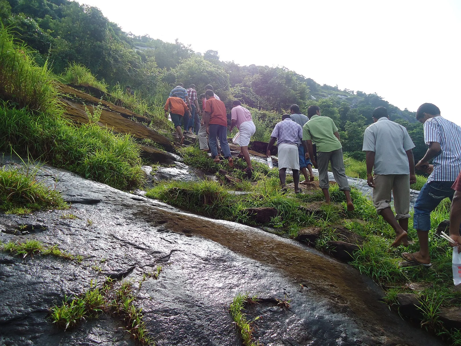
Much of the upper hill is bare gneissic sheet rock, tilted and worn smooth, with grass rooted in the seams and low scrub along the crest. In the dry months it grips well and radiates the day’s heat back up at you. After rain it is slick, and the photograph at the top of this page — taken in September, in the tail of the monsoon — shows a group picking their way along the grassy joints rather than walking straight up the slab, which is what you would do too.
That matters more here than it would elsewhere, because a good number of pilgrims climb barefoot as an act of penance. On stone steps barefoot is a discipline. On wet, tilted sheet rock it is also a balance problem, and on the same rock at one in the afternoon in April it is a heat problem. None of that is an argument against doing it; it is an argument for knowing what you are choosing.
The fourteen crosses
Fourteen crosses mark the ascent. They are the Stations of the Cross — the fourteen moments of Christ’s Passion that Catholics walk in Lent, laid out along a route so that the walking becomes the praying. Kanakamala did not invent the device; it is used on pilgrim hills across the Catholic world, and on more than one hill in Kerala. What Kanakamala does with it is set the fourteen against a real climb, so that the last stations arrive when your legs are already telling you something.
The first station is not on the slope at all. It stands on flat ground under the trees before the ground starts to rise: a plain white-painted concrete cross on a low black plinth, with room around it for twenty or so people to stand. Groups gather there and pray before setting off, and quite often leave their sandals at its base. If you have arrived at Kanakamala and are looking at a white cross under trees, you are at the start, not the finish.
The belief attached to the far end is worth stating precisely, because it is the reason people climb rather than drive around the hill and look at the view: that whoever goes up past all fourteen crosses and prays at the chapel on the summit will have the sins they have committed wiped away. The order is part of it. It is the completed ascent, then the prayer.
When to go
April is the crowded month, and the reason is Holy Week — Kanakamala is a Holy Week pilgrimage and particularly a Good Friday one, and Easter falls in late March or April. If crowds and atmosphere are what you want, that is the window. If the climb is what you want, come between November and February, when the rock is dry, the air is cooler and the view west over the Chalakudy plain is at its clearest. Between June and September the upper slab is genuinely slippery and the sensible plan is an early start or another day.
Allow an hour and a half to two and a half hours for the round trip from the church, plus whatever time you want at the top and at the stations. Carry water — there is nothing on the path. Park at the church, where there is a marked parking area beside the parish hall and the cemetery; the road goes no further, and neither does anything with wheels.
For where the hill sits and how to reach it, see Kanakamala Kurishumudi.
Frequently asked questions
How long does the climb take?
Most people take 35 to 60 minutes up and rather less down, so 1.5 to 2.5 hours round trip including time at the summit and the stations. On a Holy Week day it takes as long as the group in front of you takes.
Is there a stepped path or a handrail?
No. The route is graded mountain_hiking on OpenStreetMap — a clear hill path, but much of the upper section is bare sheet rock rather than constructed steps, and there is no railing.
Where does the first Station of the Cross stand?
On flat ground below the slope, under trees near the parish church: a white-painted concrete cross on a black plinth. Groups gather and pray there before starting up, often leaving their footwear at its base.
Can I drive up?
No. The tarred road ends at the parish church at about 30 m above sea level. The summit shrine at about 310 m is reached on foot only.
What should I bring?
Water, footwear with grip unless you are deliberately climbing barefoot, and sun cover. There are no shops, taps or shade on the path itself.