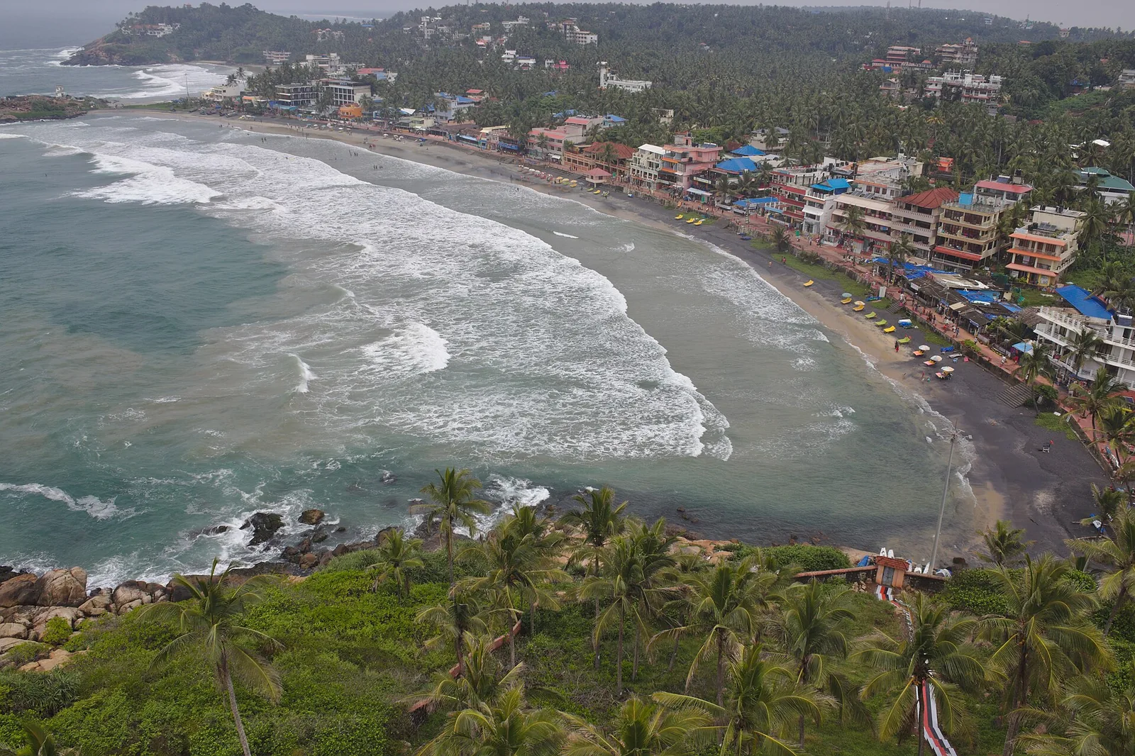
Look up from Lighthouse Beach and the striped tower seems to belong entirely to Kovalam. On the Directorate General of Lighthouses and Lightships record, it has another name: Vizhinjam Lighthouse. The beach borrowed its identity from a navigation aid named for the neighbouring harbour.
A harbour before a visitor gallery
The lighthouse authority describes Vizhinjam as a fishing harbour and records a daymark there in 1960. It says the major lighthouse was commissioned on 20 May 1972. That is the date for the working light, and it corrects the earlier article’s 30 June 1972 date. The record does not establish exactly when the phrase “Lighthouse Beach” entered common use.
Why the tower has two names
Kerala Tourism calls the striped landmark the Kovalam lighthouse in visitor material and also identifies it as the Vizhinjam Lighthouse. Both make sense in context: one locates the tourist viewpoint, the other is the official navigational name. The distinction matters when checking the authority’s records rather than following a beach sign.
The coast from above
Kerala Tourism describes a public viewpoint and lists visiting hours on its lighthouse page. Hours, access and lift operation can change, so confirm them before travelling. From above, the beach’s crescent is visible as one piece of a longer coast with Hawa and Samudra beyond. The tower’s job remains navigation; the view is the reason most visitors learn its name.
The story has one firm date and one open question. The light entered service on 20 May 1972. We cannot date the beach nickname from the sources here. What we can see is how a working aid to the neighbouring harbour became the landmark by which visitors describe Kovalam’s busiest shore.
A newer landmark names an older coast
The beach existed long before the present tower entered service. This is why “Lighthouse Beach” is a useful modern wayfinder, not a claim that the whole cove began in 1972. The light’s official date pins down the landmark. The exact moment its name became common in visitor speech needs different evidence, such as dated maps, advertisements or local records.
The lighthouse history follows the daymark and working light. The Kovalam resort story follows how travellers arrived in different decades. Put those histories together and the name makes sense: a prominent navigational structure became the easiest label for one of several beach coves.
From the sand, look up at the headland before taking another photograph of the surf. The tower is a clue to both the beach’s visitor identity and the working coast beside it.
Frequently asked questions
When did Vizhinjam Lighthouse start operating?
The Directorate General of Lighthouses and Lightships gives 20 May 1972.
Why is it called Vizhinjam Lighthouse?
That is its official name in the lighthouse authority’s record. Kerala Tourism also uses “Kovalam lighthouse” for visitors to the nearby beach.
Can visitors go up the tower?
Kerala Tourism describes a public viewpoint. Check current access, hours and any restrictions before visiting.