This is a corrective piece, and it corrects something we published ourselves. Our own page used to say that the canal trip usually takes in the historic Perumon bridge, an old Dutch church, and the S-curve.
One of those three is on the trip. The other two are about two kilometres away, on open water, in two different directions.
Where the canoe actually goes
The canal-trip ground is on the island’s eastern side, and OpenStreetMap has the courtesy to name it, which no tourism page does. Three places sit within about two hundred metres of each other there.
Munore Island S Valavu — valavu means bend — is the S-curve, mapped as a locality at roughly 8.9878, 76.6215. It is the one item of the old three that is genuinely on the route.
Kandal Cave sits at about 8.9868, 76.6223. Kandal is Malayalam for mangrove, so despite the name this is not a cave; it is the mangrove tunnel section, the stretch of low canopy and exposed stilt roots that every photograph of Munroe Island is taken in. Calling it a cave is a fair description of what it feels like from a canoe.
Ottakkandal — the lone mangrove — is at about 8.9852, 76.6178. The boarding cluster itself is mapped at roughly 8.9880, 76.6208.
Knowing those four names is more use than any itinerary, because it lets you ask a boatman for a specific stretch of water rather than for a duration.
The bridge is 1.8 km south
The Perumon rail bridges are at about 8.9716, 76.6080 — roughly 1.8 km south of the canoe grounds, at the island’s southern tip, out on the open Ashtamudi. A narrow-channel canoe trip does not go there and should not claim to.
They are worth seeing from the ferry or from the Perumon side, and there are two of them standing side by side: the Perumon Old Rail Bridge and the Perumon New Rail Bridge. The older one is the site of the Peruman railway accident of 8 July 1988, when the Island Express derailed and ten of fourteen coaches went into the lake; 105 people died. The Commissioner of Railway Safety’s inquiry proposed a tornado as the cause, a finding widely disbelieved in Kerala, and the cause has never been settled. That story belongs to Ashtamudi Lake, which tells it properly; the point here is only that the bridge is a landmark of the open water, not of the canals.
The church is 2 km west
The church known locally as the Dutch Church is on the island’s western shore, at about 8.9815, 76.6086, facing open Ashtamudi — roughly two kilometres from the boating area and in the opposite direction from the bridge.
It carries a carved A.D. 1878 date-stone on its pediment, and it is emphatically worth a visit, on foot or by road, as its own outing. It is also not Dutch: the Dutch position in Kerala ended with the fall of Cochin in 1795, more than eighty years before that date-stone was cut. The name describes a style.
What you will pass instead
The things actually on the water are smaller and better. Coir retting frames standing in the shallows. Prawn traps being lifted. Houses whose front steps go straight down into the channel, many carrying an open unwalled storey on top — which is not an unfinished house but the place the family moves to when the water rises.
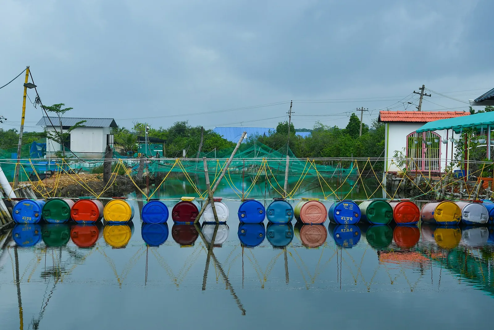
And the footbridges, which are the most quietly impressive thing on the island. Some are pontoon walkways floating on a line of coloured plastic drums lashed together with rope, laid across a channel so people can cross on foot. They are the reason to stop calling this a scenic waterway and start seeing it as a village street network that happens to be made of water.
And one piece of advice to discard
While correcting things: ignore anyone who tells you to book at high tide. The NCESS team measured the tide here with three gauges at four locations across three seasons and found the inland range almost identical at spring and neap, the twice-daily signal largely dissipated by friction and lag inside the estuary, and the island’s flooding unrelated to the open ocean’s spring tide.
There is no tidal window. What decides which channels are open is the season — November to March is the settled advice — and what decides whether the morning is any good is the hour. Go at first light, and let the tide do whatever it is doing.
Frequently asked questions
Does the canal trip pass the Perumon bridge?
No. The Perumon rail bridges are about 1.8 km south at roughly 8.9716, 76.6080, on open Ashtamudi at the island’s southern tip. They are worth seeing from the ferry or the Perumon side as a separate outing.
Does it pass the Dutch Church?
No. The church is about 2 km west at roughly 8.9815, 76.6086, on the island’s western shore — the opposite direction from the bridge. Visit it on foot or by road.
What is the S-curve and where is it?
A real mapped place: OpenStreetMap records "Munore Island S Valavu" (valavu = bend) at about 8.9878, 76.6215, beside the boating point at 8.9880, 76.6208 and the mangrove section mapped as "Kandal Cave" at 8.9868, 76.6223. All three sit within about 200 m of each other on the island’s eastern side.
Is Kandal Cave a cave?
No. Kandal is Malayalam for mangrove; it is the mangrove tunnel section of the canal, a stretch of low canopy and exposed stilt roots. The name is a fair description of how it feels from a canoe rather than a geological claim.
Should I time my trip to the tide?
No. NCESS measurements using three tide gauges at four locations across three seasons found the inland tidal range almost the same at spring and neap tides and the flooding here unrelated to the ocean’s spring tide. Plan around the season (November to March) and go at first light.