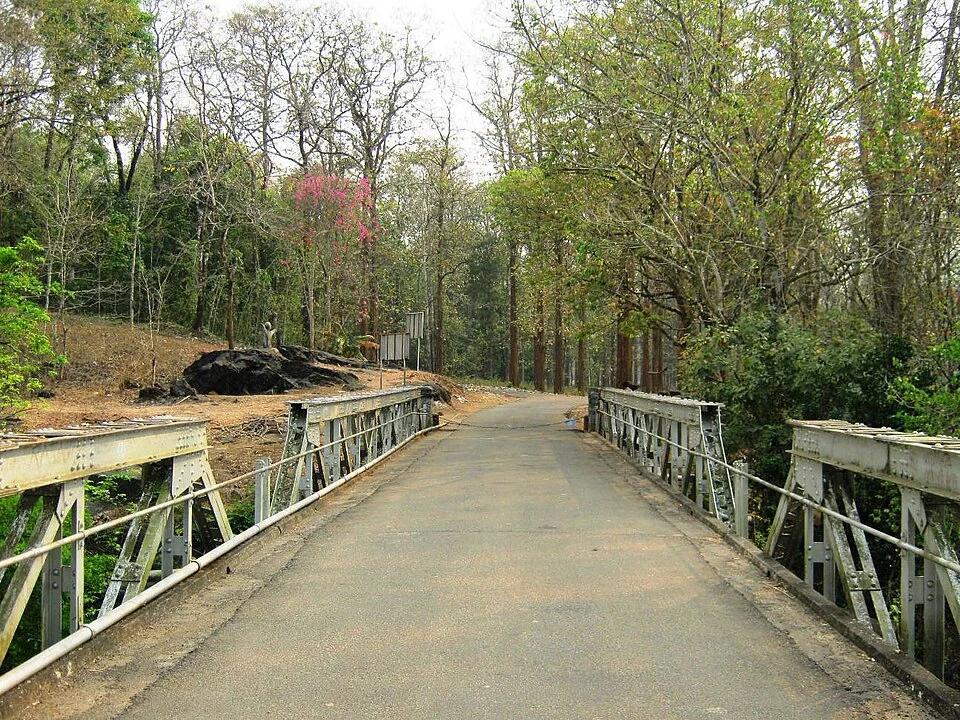
The metal sides of Nedumkayam’s bridge draw the eye towards a road continuing into trees. It is a functional-looking scene: a crossing, an approach and woodland beyond. That is exactly why the bridge is a useful introduction to the place. Nedumkayam’s history includes the organisation of forest work, not only a later appreciation of its scenery.
Start with the documented structure
The Forest Department and Karulai Village Office date the iron bridge to 1933. Departmental destination inventories call it the Dawson Girder Bridge and list Dawson’s grave among the local heritage sights. These references give the bridge a specific historical identity beyond the broad adjective British-era.
Look at how the metal members form repeated sections along the crossing. The road passes between them, while the river is visible through and beside the structure. Its interest lies partly in that continued relationship with movement: it connects one side of the forest approach with the other.
Do not obstruct the crossing while reading or photographing it. A heritage feature can also remain part of an access route. Use the viewing position staff allow and leave space for other visitors or authorised movement.
Put the kraal in the past tense
The Karulai account describes Nedumkayam as a former centre for training captured wild elephants. It says that work ended years ago and identifies the surviving Anapanthi enclosure as a reminder. This is different from advertising a present-day elephant-training show.
The distinction changes what a visitor comes to understand. A kraal can be evidence of a former practice even when no demonstration takes place. Its historical meaning does not depend on an animal being placed inside for tourists.
The rest house, teak plantation and forest depot add other parts of the setting. Together they suggest a landscape organised around accommodation, timber and transport. Access to each feature still depends on current staff directions; a historical mention is not permission to enter every building.
Keep Nilambur’s different sites separate
Conolly’s Plot and Nedumkayam appear as separate entries in Forest Department inventories. They contribute different parts of the Nilambur forest story. A visitor should not carry the famous plantation claims associated with one site into every stand of trees at the other.
That separation makes a combined itinerary more interesting. The sites can be connected through the wider history of forestry while retaining their own rivers, structures and visitor arrangements. Treating them as interchangeable would erase the details that justify seeing both.
Use the Karulai Village Office account and the Forest Department’s destination inventory for the heritage identities. Read old tariffs as historical data, then use the current operator arrangement for the visit. The bridge is a good place to see how those two times—the forest’s past and its present use—meet.
Plan the visit: Nedumkayam rainforest trek.