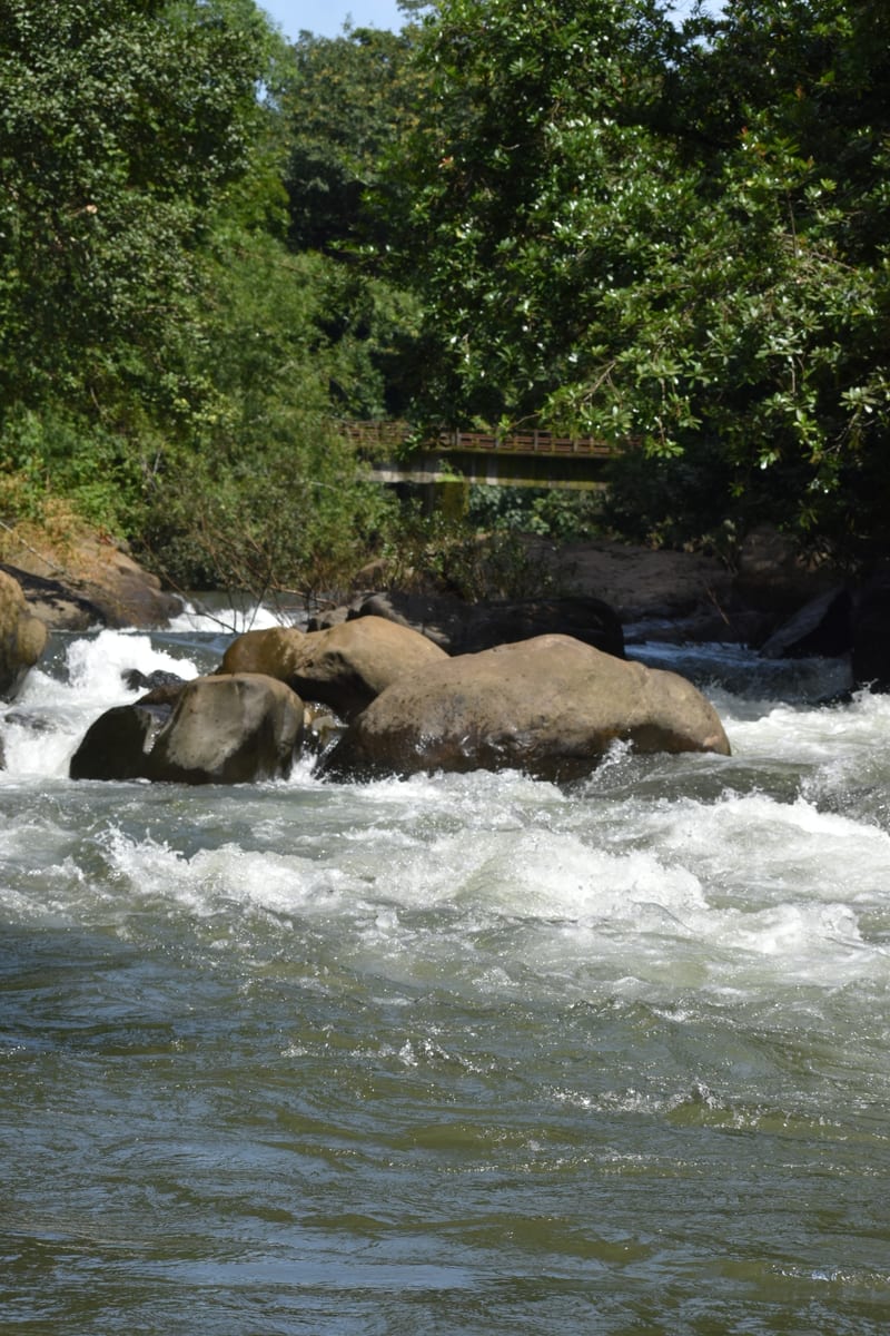
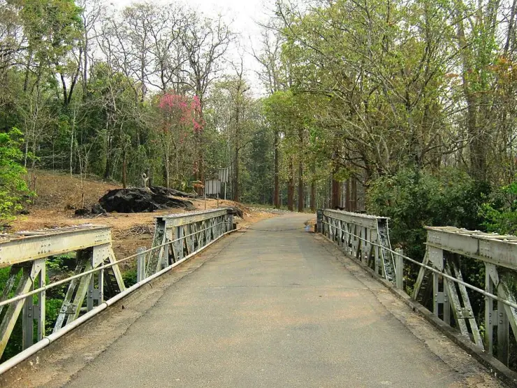
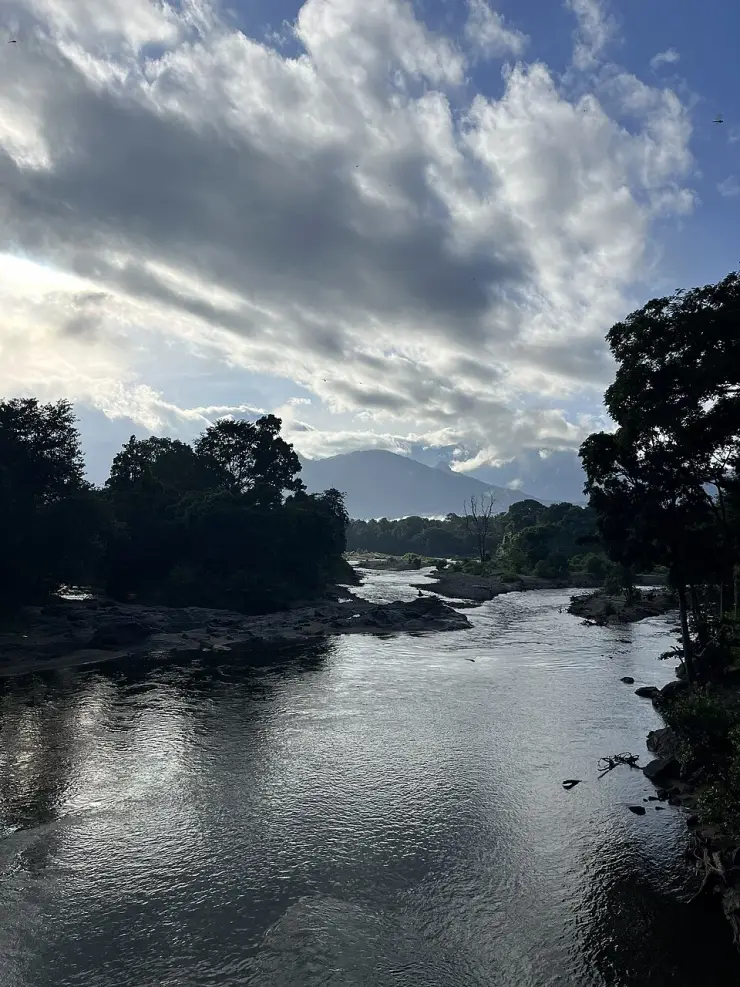
The bridge at Nedumkayam is a useful place to begin understanding the destination. Its metal sides frame a road continuing into trees; below, the river moves between rock and wooded banks. Transport, water and forest management meet in one small view.
The story of Nedumkayam rainforest trek
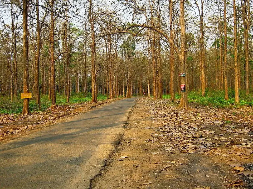
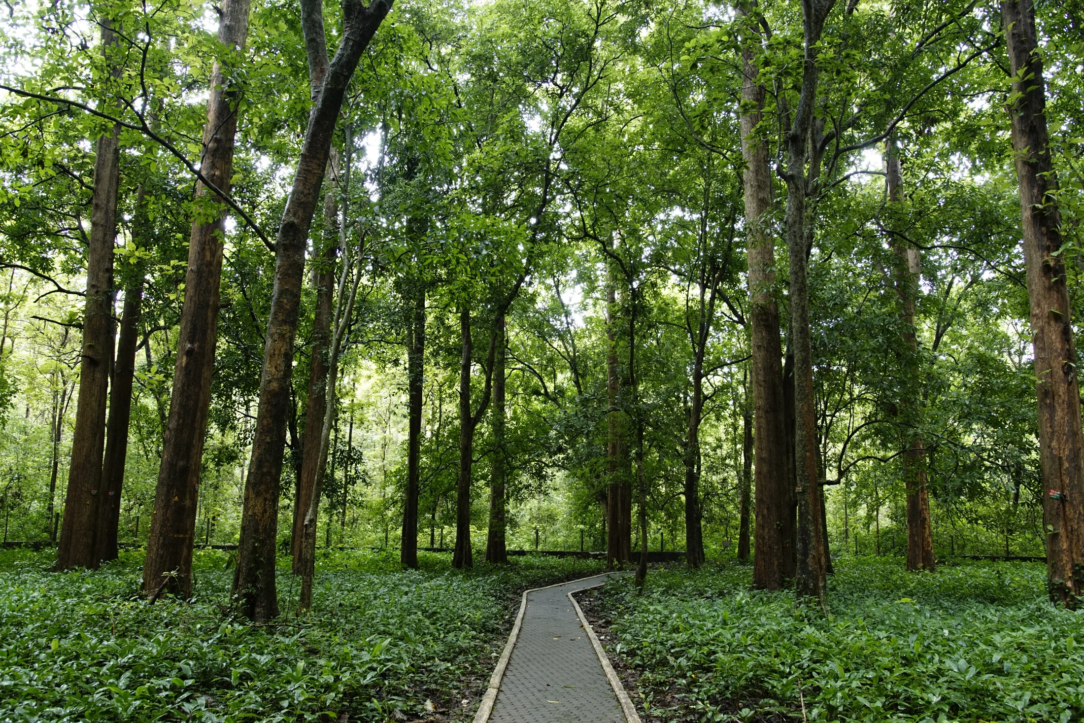
The road is part of the experience rather than a feature to edit out of it. Tall trunks stand close to the approach, with low vegetation and fallen leaves along the verge. In some stretches the view runs between relatively open stems; elsewhere bamboo and thicker growth interrupt it. These differences give a short visit more variety than the single label rainforest suggests.
The photographed dry-season approach is not uniformly dark or evergreen-looking. Sunlight reaches the road, many branches carry few leaves and the ground is brown with leaf litter. That scene belongs to Nedumkayam too. A traveller arriving outside the wettest season should not expect every frame to resemble dense, rain-soaked canopy.
Karimpuzha is the river name attached to the bridge in the Forest Department’s destination inventories and the Karulai Village Office account. The wider drainage is connected with the Chaliyar system, which explains why that broader name appears in some destination summaries. At the visitor bridge, use the specific Karimpuzha name when asking about the river.
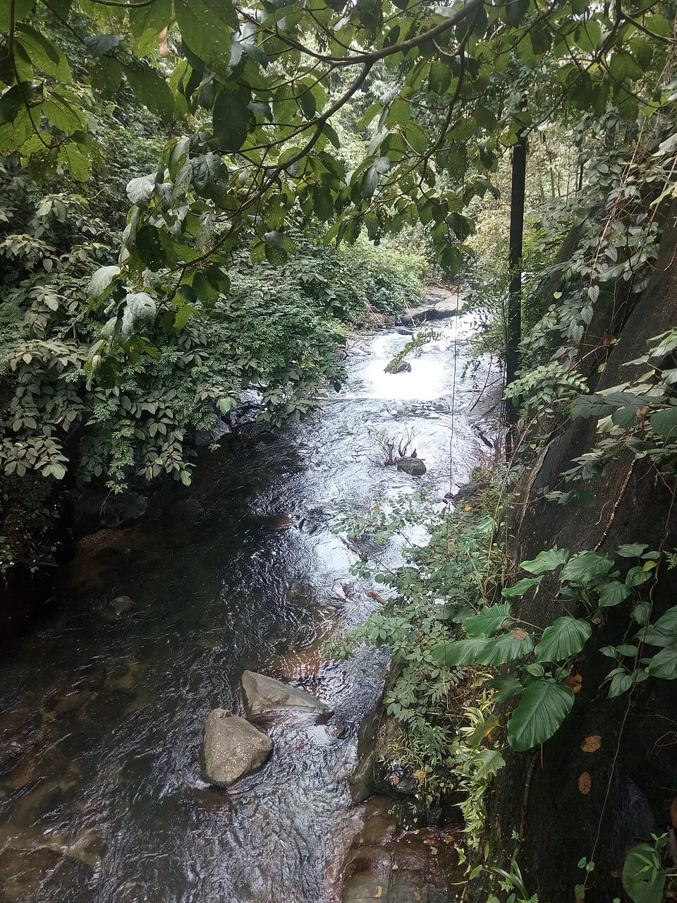
From an allowed viewing position, notice the river’s different surfaces. An open reflective reach can sit beside water broken by exposed rock, with the far bank in deep shade. Those contrasts make a strong photograph, but they do not reveal the depth or strength of the current. A beautiful pool is not evidence of a safe bathing place.
The forest has a history of organised work. The local Revenue Department account identifies an old teak plantation, a forest depot and a former elephant-training enclosure, alongside the rest house and Dawson’s burial place. These features belong to the development and use of the forest, not to a story of land without human presence.
Nedumkayam is also a living locality. The Karulai account describes a settlement beside the river. Residents and their daily routines should not become an unarranged attraction within somebody else’s forest itinerary. Ask before entering a residential lane or taking a person’s photograph, and keep a permitted sightseeing circuit distinct from an invited community encounter.
The Karimpuzha also carries a less visible part of the forest’s wildlife. A 2010 study by Fibin Baby and colleagues sampled this river at Nedumkayam and Maanchery, together with three other waterways in New Amarambalam Reserve Forest. Across the study area, the researchers recorded 43 freshwater fish species in 13 families. That total belongs to the wider survey, rather than to a single pool beneath the visitor bridge. Their account describes a network of cascades, riffles and pools: different water speeds and stream shapes within one connected drainage system. Seen from the bridge, the contrast between a smooth reach and broken water therefore has an ecological dimension as well as a visual one. The authors singled out the Maanchery reach for conservation attention. For a visitor at Nedumkayam, the study is a reminder that protecting the river involves stretches upstream and downstream of the place where people stop to look. Watching from the bank leaves those aquatic habitats undisturbed.
The bridge offers a useful starting point for reading Nedumkayam’s engineering. In the photograph, its metal framework runs across the river while the forest rises behind it. Look at the repeated members, the line of the crossing and the way the structure meets each bank from the public position permitted by staff. A bridge links two sides of a working landscape: it makes movement possible where a river would otherwise interrupt a road or path. That function helps explain why the crossing belongs in the same historical account as the rest house and depot.
Its recorded 1933 date also changes the way the visitor can look at the forest. The bridge is a surviving piece of a particular period of management, while the trees and river continue to change around it. It is possible to appreciate the structure as an object and also ask what work the crossing supported. The local heritage account supplies the forestry context; the visible girders supply the physical evidence of a designed crossing.
The name Dawson appears in the bridge and grave descriptions, while the village account also records the locally used form Dowson Sayyip. This is a connection between a named individual and the remembered forestry site. It gives a visitor a useful question for interpretation at the entrance: which permitted stops explain that history today? A grave, a rest house and a bridge are separate features, and understanding their relationship is more rewarding than assuming that one roadside building stands for the entire colonial history of Nilambur.
The Anapanthi adds a different kind of material memory. An enclosure built for elephant handling tells a story about how large animals were incorporated into forest work. The village office explicitly describes the former training activity as discontinued. Seen in that light, the feature belongs to the history of changing forestry practices. The useful subject is the enclosure and its former purpose, with present access directed by staff, rather than a timetable for an animal demonstration that the current account does not offer.
Small subjects can interrupt the scale of the trees and bridge. The Nedumkayam butterfly photograph in this gallery shows patterned wings folded beneath a leaf, with the insect occupying only a tiny part of the vegetation around it. Such a scene rewards slowing down along the permitted route and looking at the underside of leaves that can be seen without handling the plant. A photograph can preserve the wing pattern for later identification. There is no need to catch the insect, pull a branch towards the camera or claim that one species represents every season of the forest.
A forest visit can be organised around three different kinds of attention: the road explains approach and movement, the bridge introduces the river crossing, and the historical features explain the people and work associated with the place. Moving between those subjects makes a compact managed visit substantial even when a longer trail is unavailable. Ask the entrance staff which stops are accessible on the day, then spend time at each permitted feature instead of measuring the experience only by kilometres walked.
Nilambur’s teak story makes a useful second chapter if there is time elsewhere in the trip. Conolly’s Plot concerns a specific historic plantation; the Teak Museum interprets the tree and its uses; Nedumkayam combines woodland, river and forestry heritage in a different setting. Treat each as a separate stop with its own access and travel requirement. Their common association with teak gives a longer Nilambur stay a coherent theme, connecting cultivation, timber use and the forest landscape.