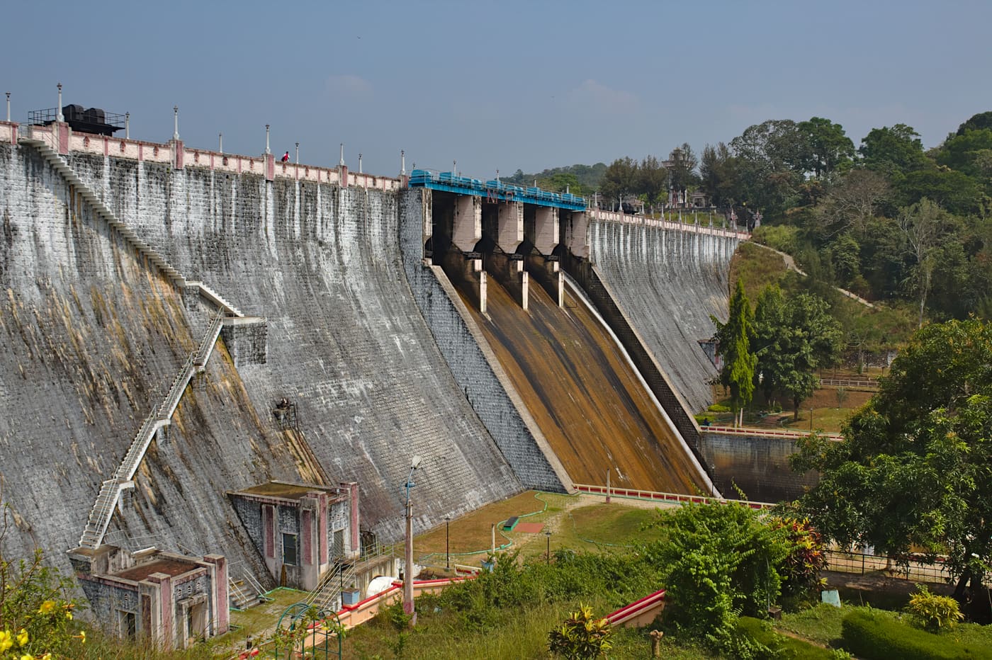
A reservoir makes a convincing destination. Water gathers between forested slopes, and the dam gives visitors a place from which to look back at it. At Neyyar, however, the view conceals the direction that mattered to the engineers: out of the reservoir, through canals, towards farmland. The lake is the most visible part of a much longer working landscape.
A project built for the fields
The Irrigation Department describes a masonry dam across the Neyyar and two main canals, with branches distributing the stored water. Its detailed project page says construction began in 1951 under the First Five-Year Plan. The planned system was intended to irrigate two paddy crops, linking a hill reservoir to farming beyond the dam-side visitor area.
Read those components together and the setting changes. The dam holds the supply; the reservoir stores it; the channels distribute it. A holiday photograph usually includes the first two and leaves out the third. Following a canal on a map therefore adds something a wider camera lens cannot: the purpose of the water once it leaves the hills.
Why one year does not settle the history
Kerala Tourism dates the dam to 1958. The Irrigation Department’s detailed project page gives a construction span of 1951–1973, while its departmental overview says the project was completed in 1976. These are different published accounts, checked in September 2026. They should not be collapsed into one certain completion year for every part of the scheme.
There may be distinctions between the dam, commissioning stages, canal works and the completed irrigation project, but the pages reviewed here do not resolve them. It would also be a mistake to dismiss 1958 as merely a date borrowed from the wildlife sanctuary: Kerala Tourism explicitly uses it for the dam. A component-by-component construction record would be needed to reconcile the accounts.
A lake with a working level
The detailed project page gives the reservoir’s water spread as 9.1 square kilometres at full reservoir level. The last phrase matters. That is a reference condition, not a promise that the same shoreline appears throughout the year. Stored water is part of an operating system; visitors see it at a particular stage in weather, supply and management.
This makes the banks worth looking at as carefully as the distant hills. Where access permits, observe the relationship between the present water line and the surrounding slopes. Do not move beyond barriers to obtain a better angle. The dam is functioning infrastructure, and a scenic setting does not make restricted paths public.
Forest behind, farmland beyond
Neyyar Wildlife Sanctuary shares the landscape, bringing a second purpose into the same view. The forested catchment and the stored water are related physically, although sanctuary access and dam access have separate rules. You can read more about that connection in the Neyyar river-basin story.
The useful image is a sequence: rain and streams in the hills, water held at the dam, distribution towards people and crops. You do not need to see every channel during a short visit to understand that sequence. Knowing it lets the reservoir become a chapter in a water system rather than a lake whose history consists only of a year on a sign.
Plan a visit around what is operating
Use the Neyyar Dam place page for the location, then confirm the permitted visitor area and any boat service before travelling. An irrigation-history page cannot establish a current boat departure, entrance price or safari opening. Choose the reservoir outing for the landscape you can actually access and arrange any separate forest programme through its operator.
Before leaving, turn once more towards the wall and imagine the channels extending beyond your photograph. The attraction of Neyyar is still the water and the hills. Its purpose gives that attraction a longer story: the reservoir was made to send water elsewhere.