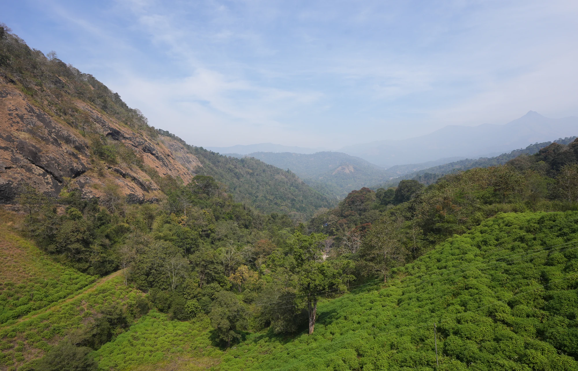
A dam-side visit can become a single photograph of water. Ponmudi rewards a second look in the other direction. The reservoir side is a broad surface enclosed by hills; the lower side opens towards a wooded valley with exposed rock and more distant ridges. The difference is visible within one short stop, wherever the admitted route allows both outlooks.
Start with the line between water and land
Across the reservoir, the permanent trees usually stand above a more changeable margin. At a higher level the water lies closer to the vegetation. At a lower level, reddish soil and bare rock occupy a wider band. The shape of a cove becomes easier to see, while features near the waterline appear larger and more separate from one another.
That changing margin is part of a managed reservoir. It should not be read as a fixed walking circuit or a seasonal beach. A path-like line may simply follow a former water level, and an exposed surface may have different footing from the ground above it. Observe the patterns from the visitor route instead of using them to choose a descent.
Turn towards the drop below the wall
The valley side gives the quiet water surface a new context. The crest stands high above lower ground, and the engineered wall is much more apparent. Beyond the maintained area, vegetation follows folds in the hills. Some slopes carry exposed rock, while others appear almost entirely green. The view is layered rather than a single uninterrupted forest canopy.
Haze can make the far ridges pale blue while the nearer trees remain strongly coloured. This is a useful photographic distinction: a wide frame can show depth through successive slopes without needing a close view of the edge. Including a portion of the rock hill helps connect the panorama back to the particular landscape of Ponmudi.
Notice the road around the rock
Near the abutment, the approach road bends around a tall rock face. From across the reservoir that face can look like one smooth hillside. At road scale it is broken by joints, ledges, grass and trees. The change in viewpoint reveals how closely the route follows the terrain and why stopping on a blind bend would interfere with the journey of others.
The surrounding towns help place this landscape correctly. Kerala Tourism locates Ponmudi in Konnathadi in relation to Rajakkadu and Vellathooval. Those names are more useful for arranging the final road leg than the broad Idukki district label. They also keep this reservoir visit separate from the much better-known Ponmudi hill station in southern Kerala.
Let the permitted route determine the photograph
A complete visual account does not require standing on the shoreline or descending the service stair. The waterline, rocky abutment and lower valley can be read from the accepted viewing areas when they are open. If access is shortened, treat the available outlook as the visit rather than trying to recreate a photograph taken from another position or under different rules.
Location reference: Kerala Tourism’s Ponmudi locality entry. The reservoir’s operational purpose is described by KSEB.
Plan the visit: Ponmudi Dam.