Ponmudi Dam

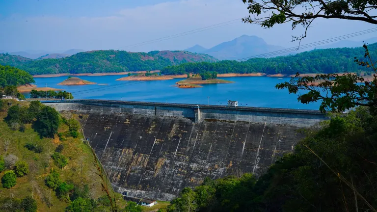
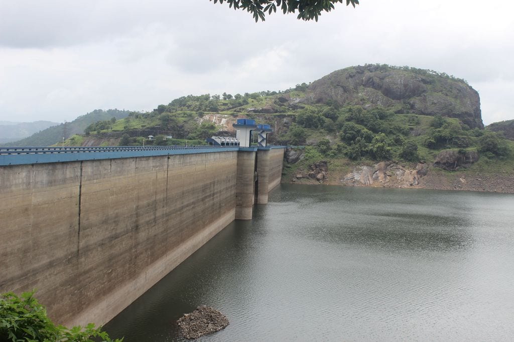
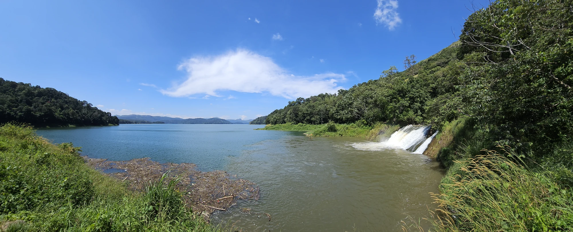
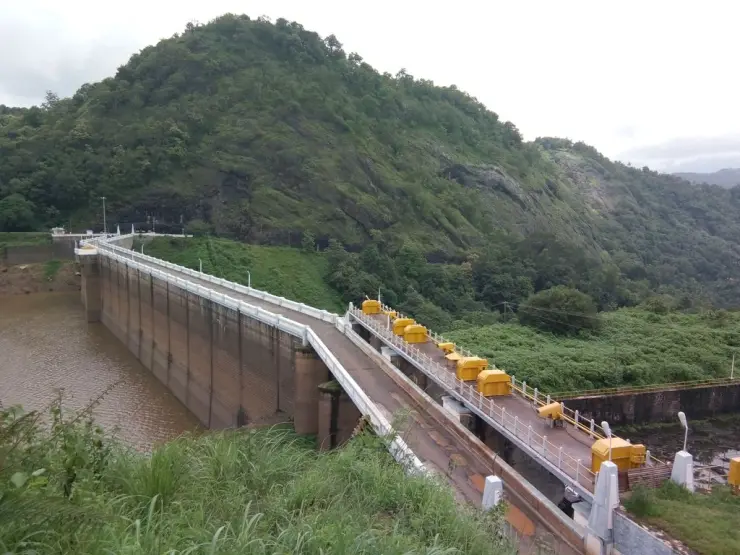
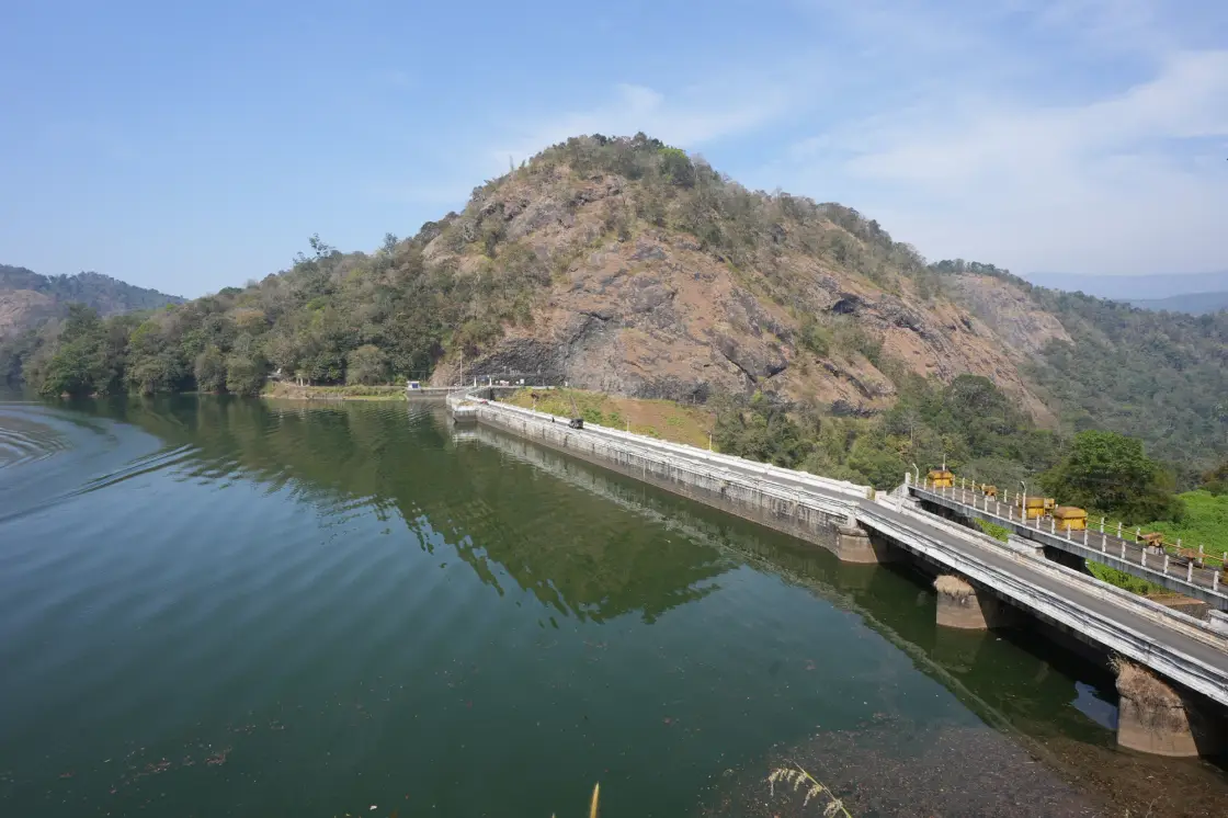
Ponmudi Dam stands across the Panniyar River in Konnathadi, Idukki, near the Rajakkadu and Vellathooval road network. A long masonry barrier meets a steep rocky hill, holding a reservoir enclosed by wooded slopes. The view combines the dam’s gates and waterline with the wider high-range landscape; this Ponmudi is entirely separate from the hill station near Thiruvananthapuram.

Ponmudi Dam, Idukki and Cheruthoni
Practical guide

Plan Ponmudi Dam

Who's going?Tailor Ponmudi Dam to your trip
Typedam
AreaIdukki and Cheruthoni
DistrictIdukki
Best timeChoose daylight with a clear hill-road…
Time neededAllow around one hour as a planning…
Places to visit12Listed businesses17

Plan around the visitor approach to the dam and the areas KSEB permits on the day. Ponmudi is listed in KSEB’s hydel-tourism network, but a tourism listing does not give access to gate machinery, maintenance stairs or the power station. The reservoir outlook is the core stop, with nearby town services forming the rest of the journey.

The story

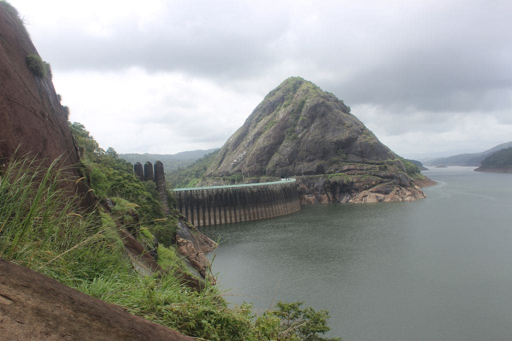
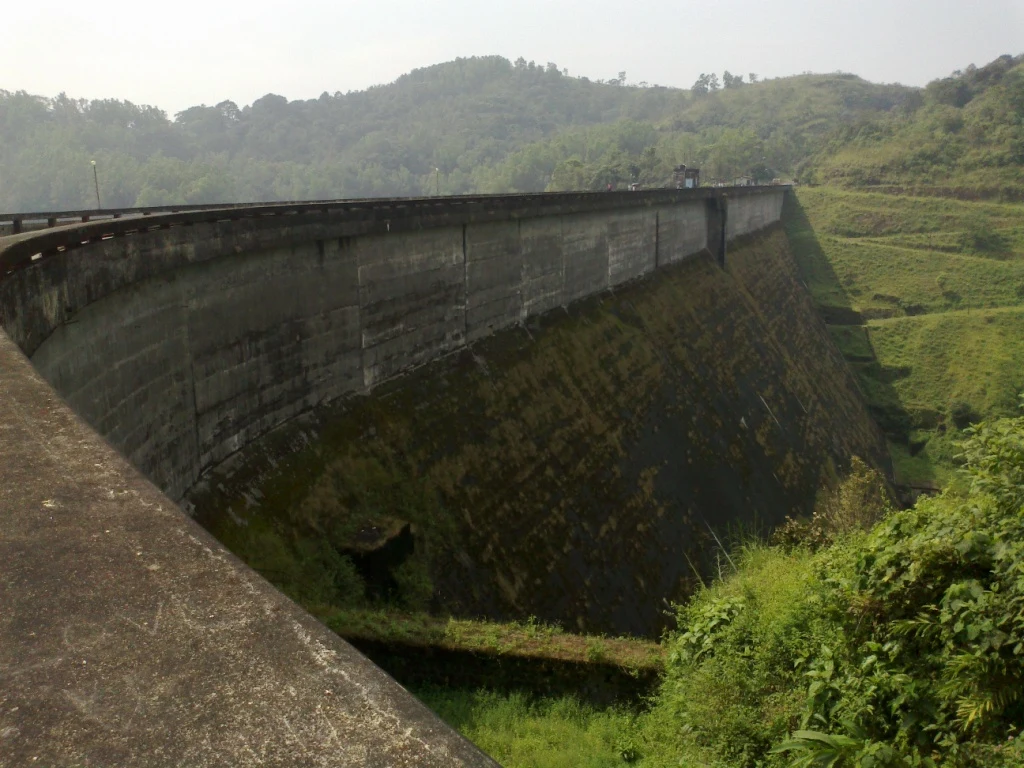
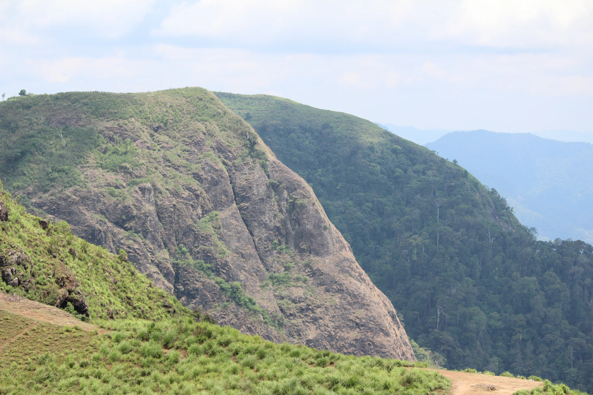
The rock hill beside Ponmudi makes the scale of the dam unusually easy to read. Trees cling to its upper slopes, a road curves around its foot, and the pale parapet draws a long horizontal line across the dark reservoir face.

The story of Ponmudi Dam

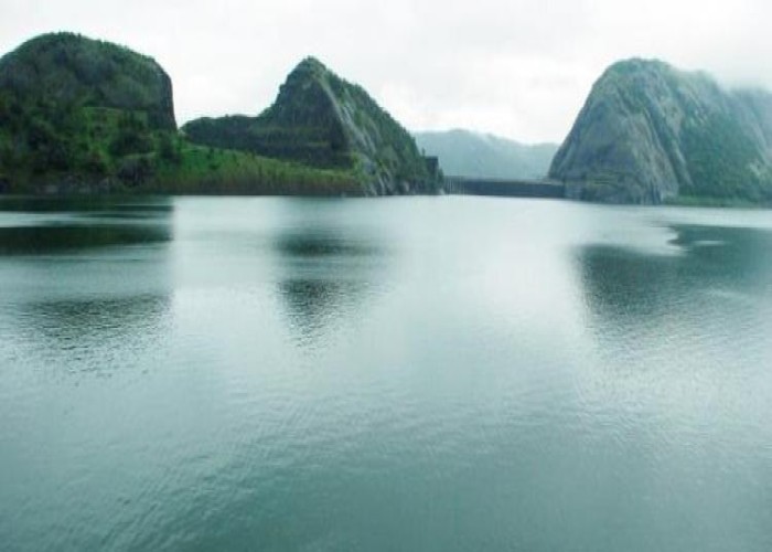
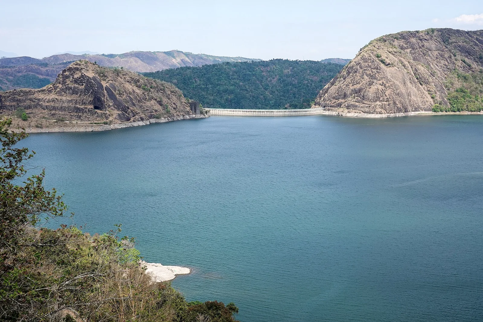
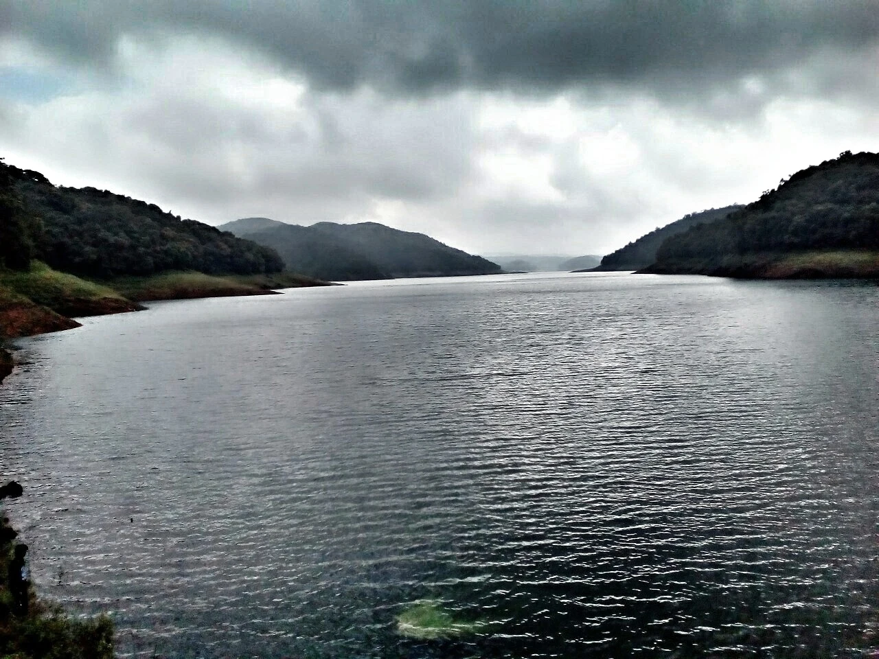
The first view can feel like a lake enclosed by hills. Looking along the waterline changes that impression: the regular blocks, gate piers and level crest belong to a working storage structure. The wooded coves are part of the reservoir formed behind it. Both the landscape and the engineering belong in the visit, because neither explains Ponmudi fully on its own.

This is the Panniyar hydroelectric project’s dam. KSEB identifies its purpose as hydropower and describes water being taken through a conductor system towards Panniyar Power Station, on the left bank of the Mudirapuzha. The generating station is a separate installation. Electricity is not produced by the yellow equipment visible above the gates; those structures belong to the dam’s control of water.

The Panniyar sits within the wider Periyar drainage. In travel terms, this connects Ponmudi with a high-range network of reservoirs rather than making it part of the same lake as Idukki Arch Dam. Anayirankal is upstream in the Panniyar scheme. Idukki, Cheruthoni and Kulamavu belong to a different reservoir arrangement, so their visitor entrances and seasonal opening announcements should not be transferred to Ponmudi.

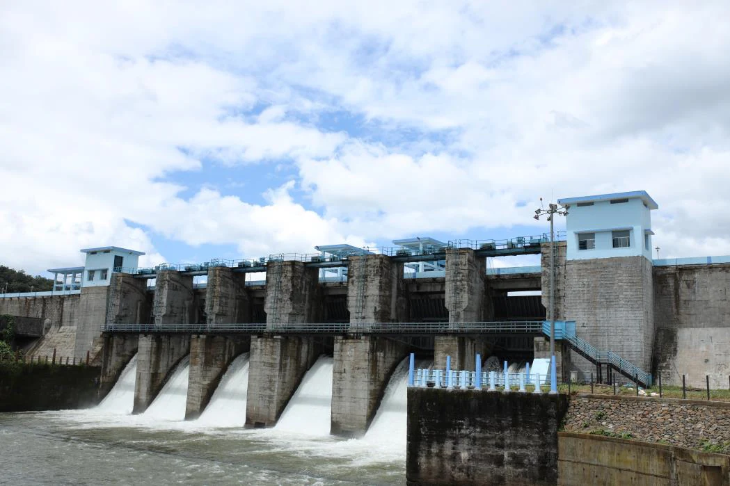
From the reservoir side, the spillway occupies only part of the long barrier. Repeated piers divide its gated bays, while the remaining wall continues towards the rock abutment. The arrangement becomes particularly legible at a lower water level, when more of the upstream face is exposed. The machinery is easiest to understand by observing these relationships from the accepted visitor area.

Water level also alters the shore beyond the dam. Narrow green margins in one view become broad reddish bands in another. Terraced-looking lines can appear around coves, with rocks and tree stumps exposed below the permanent vegetation. These are reservoir margins, not a beach with a fixed edge. An appealing strip of bare ground should not determine where a visitor walks.

The valley side offers a different perspective. Below the crest, a steep engineered face meets maintained ground and a long stair; beyond it, trees cover folds in the terrain. Turning towards that side helps explain why the height of the structure cannot be judged from the quiet water surface alone. The drop is part of the working site and should be viewed without crossing its barriers.

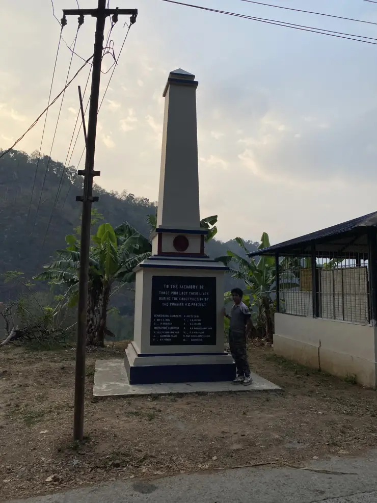
A small obelisk near the approach adds a human account of construction. Its English inscription commemorates people who lost their lives during the Panniyar hydroelectric project works and separates departmental labourers from contractors’ labourers. The monument brings individual workers into a setting more often described through dimensions and generating capacity. Reading it takes only a short pause but gives the visit a different emphasis.

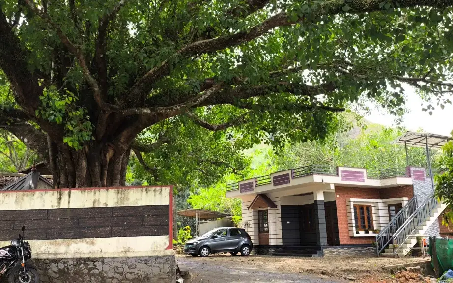
The monument’s modest scale matters. It stands beside the everyday approach, with a broad tree, small buildings and the hill landscape around it, rather than occupying a grand formal memorial park. Its relation to the working site makes it worth noticing before the reservoir takes over the view. There is no need to infer an accident date or a single disaster from an inscription that does not supply those details.

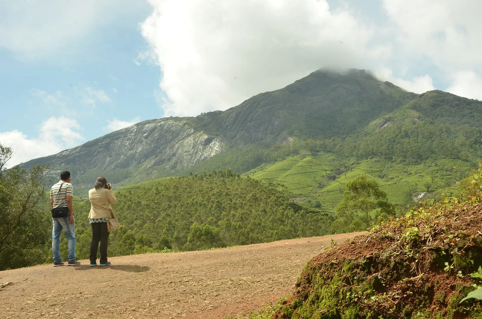
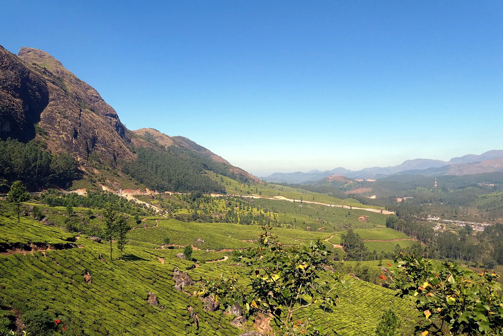
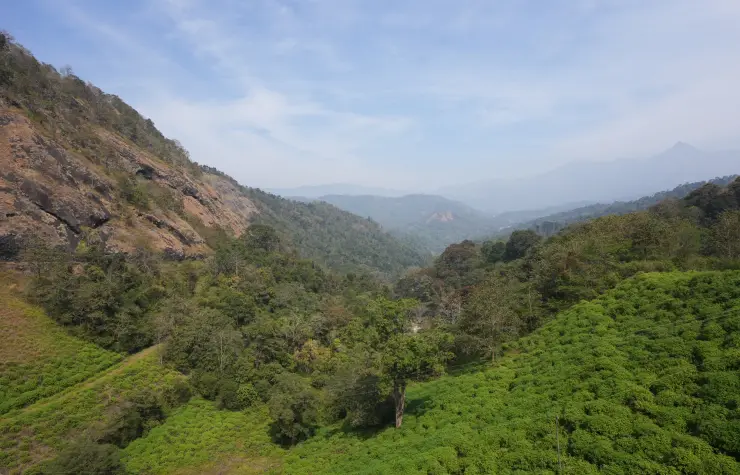
Ponmudi’s surrounding slopes show more than one kind of green. Trees occupy the steeper folds, while cultivated areas and buildings appear within the wider valley landscape. The road bends around exposed rock, bringing the viewer close to surfaces that look small from across the water. This varied setting is more informative than treating the whole area as a uniform forest or tea estate.

The dam works well as a focused stop within the Rajakkadu–Vellathooval part of Idukki. Its value lies in observing how a barrier, reservoir, hill and road fit together, then recognising the labour remembered at the approach. A long checklist of unrelated district attractions would obscure those details; the local journey gives enough context for a rewarding visit.
Read the full history of Ponmudi Dam 171 more words

History

KSEB’s Dam Safety Organisation records Ponmudi’s completion in 1965 and classifies it as a masonry-gravity dam. Its project setting is the Panniyar hydroelectric scheme in Idukki. The broad masonry structure and gated spillway belong to that generating system, while visitor access is managed around the operational asset.

The official dimensions are 288.80 metres in length and 57.71 metres in height from the deepest foundation. Height from foundation is an engineering measurement, not the depth of water a visitor can see. The spillway has three radial gates.
KSEB established its hydel-tourism centre in 1999 and lists Ponmudi among its Munnar-area facilities. That visitor function sits alongside the dam’s original power purpose. It does not convert the reservoir, control equipment or downstream channel into unrestricted recreation space.

Why visit

See a masonry-gravity dam framed by a prominent rocky hill rather than only a distant reservoir panorama.

Understand how the Panniyar scheme differs from the better-known Idukki reservoir.

Notice the workers’ memorial beside the approach.

Compare reservoir-side and valley-side landscapes from the areas open to visitors.

What to expect

Highlights

  • The contrast between the straight dam, its spillway section and the large exposed rock hill at the abutment.
  • Reservoir coves and wooded banks that change appearance with the operating water level.
  • A memorial beside the approach remembering workers lost during construction of the Panniyar hydroelectric project.
Getting there

How to visit

  • Navigate to Ponmudi Dam in Konnathadi, using Rajakkadu or Vellathooval as the local approach. Adding Idukki to a search is essential when arranging a driver or locating the destination.
  • Begin at the visitor entrance and follow the access permitted by the dam staff. Keep any walk on the accepted visitor route, leaving service stairs and operating areas to authorised personnel.
  • Allow time to look towards both the reservoir and the valley side, then return to the same agreed pickup point. A separate stop at a distant reservoir viewpoint requires another road approach.

Distance by road

  • Kochi107 km
  • Madurai172 km
  • Thiruvananthapuram226 km
  • Coimbatore252 km
  • Kozhikode276 km

Road km to Idukki; ghat roads and traffic vary — allow extra.

Timing

Best time

Choose daylight with a clear hill-road forecast. Lower water exposes wider bands of soil along the reservoir, while wetter periods bring greener slopes and potentially more operational restrictions. A calm-looking surface does not indicate whether gates will operate. Leave enough daylight for the road journey back to the town where you are staying.

Weather in Ponmudi DamSeasonal guide

Live forecast loads in your browser.

Today at Ponmudi Dam
Sunrise6:10 am
Sunset6:07 pm
Golden hour best light5:07 pm–6:07 pm
Blue hour after sunset6:07 pm–6:32 pm
Sun sets toward compass bearingW · 263°
Moon tonight🌑 New moon · 0%
Retreating monsoon. October and November still see spells of rain from the retreating monsoon, though it is usually lighter than mid-year. Conditions are generally good but worth checking.

Sun and moon are calculated for this location and shown in IST. Photography windows are the hour around sunrise and sunset; the sunset bearing is degrees clockwise from true north. Moon phase is accurate to about half a day.

Visitor notes

  • KSEB’s dam inventory places Ponmudi in Konnathadi village and panchayat. Idukki and Cheruthoni is the wider guide grouping; Cheruthoni is not the final approach town.
  • Anayirankal is another reservoir in the Panniyar system, not a second name for this dam. Its boating arrangements and admission details do not apply here.
  • A current Ponmudi-specific admission tariff and guaranteed daily gate schedule are not verified. Use the linked KSEB hydel-tourism office for the day’s access before making a special journey.
Safety

Good to know

  • Keep away from the waterline, spillway channel and downstream river margins. Reservoir operation can change conditions beyond what a visitor sees at the entrance.
  • Stay inside visitor barriers. The maintenance stair descending beside the dam is infrastructure, not a shortcut to a lower viewpoint.
  • The approach includes rock-side bends. Stop only where the vehicle can stand clear of moving traffic and dam access.
Official eco & forest programmes

Experiences around Ponmudi Dam

These are official or public-sector eco offerings that match this place, town or forest destination. Confirm availability, permits, tariffs and reporting times with the official operator before travel.

Idukki Wildlife Sanctuary, Ponmudi Dam
wildlifeboatingviewpoint

Idukki Wildlife Sanctuary eco visit

Forest and reservoir wildlife sanctuary around the Idukki-Cheruthoni dam landscape.

Kerala Forest Department
Official source →
Kalvari Mount, Ponmudi Dam
viewpointtrek

Kalvari Mount ecotourism viewpoint

Idukki reservoir viewpoint and pilgrimage hill, connected with Kerala Forest Ecotourism listings.

Kerala Forest Department / local tourism authorities
Official source →
Stay · eat · do · rent · see · shop

Stays, food & things to do near Ponmudi Dam

Browse listed stays, food, activities, sights, shops and rentals around Ponmudi Dam. Check each listing’s locality and contact the business directly for current arrangements.

Dam and reservoir viewpoint · Idukki and Cheruthoni
Kulamavu Dam Kerala Tourism

Dam and reservoir viewpoint in Idukki and Cheruthoni. Kulamavu, Idukki district, Kerala · Kulamavu, Dam, Idukki Reservoir.

DirectionsView guide
Wildlife sanctuary · Idukki and Cheruthoni
Idukki Wildlife Sanctuary Kerala Tourism

Wildlife sanctuary in Idukki and Cheruthoni. Idukki Wildlife Sanctuary, Idukki district, Kerala · Idukki, Wildlife sanctuary, Cheruthoni.

DirectionsView guide
Silver House homestay · Idukki and Cheruthoni
Panchami Homestay Cheruthoni

Panchami Homestay Cheruthoni is a Kerala Tourism-listed Silver House homestay at Idukki Colony P.O., Alinchuvadu, useful for travellers comparing simple Cheruthoni/Painavu stays with homely Kerala food, Wi-fi, car hire, parking and Idukki reservoir route access. Homestay tariff · Cheruthoni, Idukki Colony, Homestay.

Directions Commission-freeView details
Kuttikkanam restaurant · Idukki and Cheruthoni
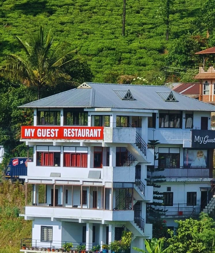
My Guest Restaurant Kuttikkanam

Kuttikkanam restaurant in Idukki and Cheruthoni. My Guest Restaurant, NH-183, Theni By-Pass, Pambanar, Peerumade, Idukki, Kerala 685531 · Restaurant menu pricing · Kuttikkanam, Pambanar, Restaurant.

Directions Commission-freeView details
Ayurveda and wellness centre · Idukki and Cheruthoni
Sahyadri Ayurvedic Centre Peermade

Kerala Tourism destination record for Peermade Ayurveda, Panchakarma, herbal medicine, yoga and wellness stays.

Directions Commission-freeView details
Premium serviced villa · Idukki and Cheruthoni
Mistara by Driveholicz Parunthumpara

Kerala Tourism-certified serviced villa at Parunthumpara with infinity pool, food and activity evidence.

Directions Commission-freeView details
Serviced villa · Idukki and Cheruthoni
Elam Villa Parunthumpara Peermade

Elam Villa Parunthumpara Peermade is a Kerala Tourism-listed serviced villa record for travellers comparing Parunthumpara, Pambanar and Peerumedu stays with direct phone, email and website evidence. Parunthumpara, Peermade, Serviced villa.

Directions Commission-freeView details
Plantation hotel · Idukki and Cheruthoni
Paradisa Plantation Retreat Peermade

Kerala Tourism-listed plantation retreat at Murinjapuzha with restaurant, pool and estate-walk evidence.

Directions Commission-freeView details
Homestay · Idukki and Cheruthoni
The Placid Rill Homestay Peermade

Kerala Tourism-listed Ladrum Estate homestay with stream, food, Wi-fi, car-hire and activity evidence.

Directions Commission-freeView details
Serviced villa · Idukki and Cheruthoni
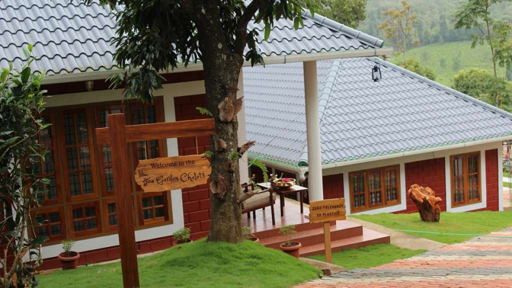
Tea Garden Chalets Unit I Peermade

Kerala Tourism-listed serviced villa near Pambanar and Peermade, surrounded by tea and cardamom plantations.

Directions Commission-freeView details
Government eco lodge · Idukki and Cheruthoni
Eco Lodge Peerumedu

Government Yathri Nivas eco lodge at the Peerumedu Government Guest House compound. A simple budget Kerala Tourism-run lodge base for Peermade and Kuttikkanam.

Directions Commission-freeView details
Government eco lodge · Idukki and Cheruthoni
Eco Lodge Idukki Painavu

Government Yathri Nivas eco lodge behind DTPC Idukki Park near IDA Ground, Painavu. A budget Kerala Tourism-run lodge base for Cheruthoni, the Idukki Arch Dam and Kalvari Mount.

Directions Commission-freeView details
Kuttikkanam restaurant · Idukki and Cheruthoni
Agincourt Restaurant Kuttikkanam

Kuttikkanam restaurant in Idukki and Cheruthoni. Agincourt, Kuttikkanam, Peerumedu, Idukki, Kerala 685531 · Kuttikkanam, Restaurant, Peerumedu.

Directions Commission-freeView details
Serviced villa · Idukki and Cheruthoni
Jacobs Heaven Kuttikkanam

Jacobs Heaven is a Kerala Tourism-listed serviced villa at Kuttikkanam. The villa has an Ayurveda centre, homely Kerala food, Wi-Fi and online reservation for a quiet high-range stay.

Directions Commission-freeView details
Kuttikkanam homestay · Idukki and Cheruthoni
White Vivid Homestay Kuttikkanam

Kerala Tourism-listed Kuttikkanam homestay with address, phone, email, food and Wi-fi evidence. MBC College Road, Pallikkunnu P.O., Peerumade, Kuttikanam, Idukki, Kerala 685531 · Budget to mid-range homestay · Kuttikkanam, Peerumade, Homestay.

Directions Commission-freeView details
Kuttikkanam homestay suites · Idukki and Cheruthoni
Monsoon Mist Kuttikkanam

Monsoon Mist Kuttikkanam is a Kerala Tourism-listed homestay on Dreamland Road, useful for travellers comparing private-suite stays with kitchen access, Western Ghats views, rooftop pool context and Peermade high-range routes. Premium homestay suites · Kuttikkanam, Peermade, Homestay.

Directions Commission-freeView details
Plantation resort · Idukki and Cheruthoni
Misty Mountain Plantation Resort Peermade

Misty Mountain Plantation Resort sits at Kuttikanam, Peermade. The Kerala Tourism-listed plantation resort offers a restaurant, tea-estate experiences and estate walks across the high-range plantations.

Directions Commission-freeView details
Hotel restaurant · Idukki and Cheruthoni
Igloo Heritage Restaurant Cheruthoni

Hotel restaurant in Idukki and Cheruthoni. Igloo Heritage Resorts, Cheruthoni, Idukki district, Kerala · Hotel restaurant.

Directions Commission-freeView details
Cheruthoni resort and hotel · Idukki and Cheruthoni
Igloo Heritage Resorts Cheruthoni

Cheruthoni resort and hotel in Idukki and Cheruthoni. Idukki-Adimali Road, Cheruthoni, Kerala 685602 · Cheruthoni, Idukki, Resort.

Directions Commission-freeView details
Official hydel tourism attraction · Idukki and Cheruthoni
Idukki Arch Dam Hydel Tourism

Kerala Hydel Tourism source for the Idukki Arch Dam attraction. Idukki Arch Dam, Hydel Tourism, Cheruthoni.

DirectionsView guide
Visitor information · Idukki and Cheruthoni
Cheruthoni Dam DTPC Idukki

DTPC Idukki source for Cheruthoni Dam near the Idukki Arch Dam reservoir system. Cheruthoni, Dam, Idukki.

DirectionsView guide

Book with the place itself. India’s cyber-crime coordination centre warned in April 2025 that convincing copies of hotel and pilgrimage booking sites are being pushed through sponsored search and social ads, taking payment for rooms the property never hears about. Use the contact and source details on each profile to confirm the exact business and booking channel. A directory entry or map pin alone does not establish an operator’s identity or current availability. Roampedia takes no commission and does not collect booking payments. If a booking page reached you through an ad, check the address bar against the property’s own site before you pay. Fraud can be reported on cybercrime.gov.in or on 1930.

Options

More ways to explore Idukki and Cheruthoni

Rajakkadu and Vellathooval are the relevant local towns. The dam is separate from Cheruthoni’s visitor circuit and from Ponmudi hill station in southern Kerala.

Across the whole of Idukki and Cheruthoni

Nearby guides

Top experiences around Ponmudi Dam

20 more places around Idukki and Cheruthoni. Open a guide to plan the visit and onward journey.

A
Amrithamedu
Place
trekAmrithamedu

A Peerumedu ridge walk through plantation and high-range scenery, with access dependent on the chosen trail, land permission and current weather.

A
Ayyappancoil Hanging Bridge
Place
heritageAyyappancoil Hanging Bridge

The long pedestrian suspension bridge above the Idukki reservoir at Ayyappancoil, valued for water and hill views as well as the crossing itself.

M
Madammakkulam Waterfalls
Place
waterfallMadammakkulam Waterfalls

A secluded waterfall below Kuttikkanam whose approach has depended on estate tracks and regulated jeep routes; current legal access must be established first.

damIdukki Arch Dam

Major hydroelectric dam and one of Kerala’s landmark engineering sites.

damCheruthoni Dam

The 138-metre concrete gravity dam a kilometre west of the Idukki arch dam, carrying the five radial gates that are the only spillway for the whole Idukki reservoir — the gates opened in a south-west monsoon for the first time on 9 August 2018.

viewpointHill View Park

The DTPC’s eight-acre garden and viewing park on the Vellappara shoulder above the Idukki reservoir, about 350 ft above the water. It is the dependable way to see the Idukki arch dam — strung between Kuravanmala and Kurathimala, roughly 1.6 km east-north-east — because the dam crest itself is shut most of the year and this is open every day from 08:00 to 19:00.

viewpointKalvari Mount

Reservoir-view hill point near Idukki and Cheruthoni, useful for scenic drives, photos and central high-range itineraries.

waterfallCheeyappara Waterfalls

Waterfall on the Kochi-Munnar road, commonly paired with Valara as a high-range arrival stop.

waterfallValara Waterfalls

Valara is the forest-framed Deviyar cascade beside NH85 between Neriamangalam and Adimali in Idukki. It is a separate roadside stop from Cheeyappara, with viewing from the road and no assumed access to the waterfall base.

hill stationPeermade

Peermade, also written Peerumedu or Peermede, is a plantation settlement and highland landscape on the Kottayam–Kumily road in Idukki. The map uses the town centre as a visitor base, not a single hilltop attraction.

viewpointPanchalimedu

Meadow and hill-viewpoint landscape near the Peermade/Kuttikkanam side of Idukki.

hill stationKuttikkanam

Peermade-side hill-station and adventure-tourism area, useful for tea estates, pine roads and central high-range routing.

damKulamavu Dam

Kulamavu is KSEB’s gravity dam on Kilivallithodu and one of three dams forming the Idukki reservoir. Visit through the hydel-tourism arrangements; reservoir views do not authorise entry to restricted infrastructure.

waterfallThommankuthu Waterfalls

Seven-step cascade and eco-tourism trekking spot on the Kaliyar river near Thodupuzha, with rock pools, forest paths and a Forest Department eco-tourism trail.

damMalankara Dam

An Irrigation Department dam and reservoir at Muttom near Thodupuzha, storing Thodupuzha River runoff and Idukki power-station tailwater for the Muvattupuzha Valley Irrigation Project; the visitor park has its own permitted areas.

viewpointAnchuruli

The Anchuruli reservoir-side landscape near Kattappana, where the Erattayar diversion tunnel discharges towards Idukki reservoir. Plan an exterior viewpoint visit; the water tunnel is working infrastructure.

wildlifeIdukki Wildlife Sanctuary

Protected forest around the Idukki and Cheruthoni reservoirs near Painavu, with hilly evergreen woodland, elephants and boat-and-trek access arranged through the Forest Department.

townPainavu

The hill headquarters town of Idukki district near the arch dam, a quiet high-range base for Idukki–Cheruthoni dam-side sightseeing and the surrounding reservoir viewpoints.

viewpointParunthumpara

A rock-and-grass viewpoint near Peermade on the Pambanar side of Idukki, overlooking steep wooded ravines; known as Eagle Rock and for the profile-like Tagore Rock formation.

viewpointNadukani Viewpoint

Ghat viewpoint on the Thodupuzha–Puliyanmala road overlooking the Idukki high range, a popular stop for valley views and cool breezes.

Roampedia is commission-free — own or know a stay, eatery, guide or shop near Ponmudi Dam? Submit public business details for review.

Add a nearby business
Before you go

Ponmudi Dam — at a glance

Photography: The rocky abutment and repeated gate piers create a clear composition from the admitted route. Follow the site’s photography directions and avoid equipment close-ups or positions requiring entry into controlled areas.

Parking: Use the vehicle area indicated at the approach. Leave the crest, turning space and dam-operating access clear.

Getting here

How to reach Ponmudi Dam

  • ✈︎ By air Cochin International Airport serves the western approach to this part of Idukki. Arrange the onward road journey specifically to the Konnathadi dam, rather than to a property or viewpoint sharing the Ponmudi name.
  • 🚆︎ By train The final approach is by road; there is no railway station at Ponmudi Dam. Aluva is a practical rail-to-road gateway when approaching the Munnar side from the Kochi region, with the onward journey continuing through the high-range road network.
  • 🚗︎ By road Reach the Rajakkadu–Vellathooval area, then follow the local approach to Ponmudi Dam in Konnathadi. Kerala Tourism places Ponmudi locality in relation to both towns. Use the full dam name in navigation to avoid the Thiruvananthapuram hill-station route.
  • 🚌︎ By bus Plan the inter-town bus journey around Rajakkadu or Vellathooval and arrange the final local leg separately. A current direct dam-entrance bus timetable is not established.
Getting back

Agree the pickup at the same dam approach used for arrival. A crest walk should not become an unplanned through-route to another town or an attempt to meet a vehicle on the opposite bank.

Do

Things to do

  • Observe the dam’s solid wall and separate gated spillway section.
  • Read the workers’ memorial at the approach when that area is accessible.
  • Compare the reservoir waterline with the vegetation boundary on the opposite shore.
  • Look towards the lower valley from behind the visitor barrier.
Facilities

On site

  • KSEB lists Ponmudi within its hydel-tourism network. The entrance staff are the point for current access and any visitor charges.
  • Use Rajakkadu or Vellathooval for a planned meal and town services. A current inventory of toilets, drinking-water points and staffed refreshments at the dam is not verified.
Getting around Ponmudi Dam
From the entrance
Ponmudi Dam visitor approach, Konnathadi, Idukki
Step-free access
The photographed crest is paved with parapets, but the complete route from vehicle drop-off to an admitted viewpoint has not been verified as step-free. Ask staff about the shortest usable approach and assess gradients before proceeding. Lower service stairs are outside the visit plan.

Checked 7 September 2026 against source 1source 2. Conditions change and surfaces vary with weather — if step-free access is essential, confirm with the site before you travel.

Eat nearby

What to eat in Idukki and Cheruthoni

Keep food stops tied to the Rajakkadu–Vellathooval approach. These local towns make more sense for this visit than travelling to Cheruthoni solely for a meal.

Explore food in Idukki and Cheruthoni →
01

Rajakkadu lunch

A town restaurant fits a journey approaching from the Rajakkadu side before the final dam road.

02

Vellathooval tea break

Use a town bakery or tea shop on the return when your onward route runs through Vellathooval.

03

Meal at your stay

For a rural property, arrange dinner around the actual return route instead of assuming a restaurant beside the reservoir.

Nearby

What’s near Ponmudi Dam

waterfallPower House Waterfalls

The Muthirapuzha spread sideways over bare rock at 796 m, below the tailrace of Pallivasal — the first hydroelectric station Kerala built. Free, unmanaged and very quiet, down about a kilometre of steep narrow lane. ⚠ Not the Chinnakanal falls that Kerala Tourism describes under this name, 21 km east.

waterfallAttukad Waterfalls

Waterfall area near Munnar commonly used for short scenic drives and monsoon views.

trekChokramudi Peak trek

Forest Department peak trek from the counter at Gap Road, 13.2 km from Munnar: a mapped 2.09 km path climbing about 460 m of grassland and shola to a summit whose altitude four sources disagree about.

viewpointLockhart Gap

The pass itself on the Munnar–Bodimettu highway, where the ridge drops away east — and the lay-by the Chokramudi Peak trek reports from, 51 m from the forest counter. A second, busier viewpoint signed "Lockhart Gap Road View Point" sits 1.7 km east.

viewpointPothamedu Viewpoint

A road-accessible viewpoint in Pothamedu south of Munnar, looking across planted hills and wooded valleys. The viewpoint marker is separate from the wider village and from private plantation walking routes.

viewpointBlossom Hydel Park

The Kerala State Electricity Board’s riverside flower park on the Munnar–Aluva road, 3.3 km below Munnar town and 1.2 km from the KSRTC stand at Old Munnar. It runs along the east bank of the Muthirapuzha immediately above the 1944 R. A. Headworks weir that feeds Pallivasal, Kerala’s first hydroelectric station — which is what the "hydel" in the name means. Open daily 09:15 to 20:15 with tickets sold online by Kerala Hydel Tourism Centre.

hill stationDevikulam / Sita Devi Lake

Hill-station and lake landscape near Munnar associated with Devikulam and Sita Devi, best planned as a quieter high-range side trip.

hill stationMunnar

Kerala’s most famous hill station, known for tea estates, viewpoints and cool weather.

museumTea Museum

Tea-history museum in Munnar linked with the plantation story of the high ranges.

damIdukki Arch Dam

Major hydroelectric dam and one of Kerala’s landmark engineering sites.

damCheruthoni Dam

The 138-metre concrete gravity dam a kilometre west of the Idukki arch dam, carrying the five radial gates that are the only spillway for the whole Idukki reservoir — the gates opened in a south-west monsoon for the first time on 9 August 2018.

viewpointHill View Park

The DTPC’s eight-acre garden and viewing park on the Vellappara shoulder above the Idukki reservoir, about 350 ft above the water. It is the dependable way to see the Idukki arch dam — strung between Kuravanmala and Kurathimala, roughly 1.6 km east-north-east — because the dam crest itself is shut most of the year and this is open every day from 08:00 to 19:00.

12 detailed place guides in Idukki and Cheruthoni →

Road and walking figures are route estimates, with travel times dependent on access, traffic and conditions. Figures marked “straight line” show direct separation and do not describe a road or walking route. Fare estimates use Kerala’s 26 April 2022 auto/taxi notification and exclude waiting, night and applicable one-way surcharges. Confirm the current meter or operator quote before travelling. Routing: © openrouteservice.org by HeiGIT | Map data © OpenStreetMap contributors

On the map

Where Ponmudi Dam is

Good to know

Ponmudi Dam — frequently asked

Is Ponmudi Dam near Ponmudi hill station?

No. This dam is in Konnathadi, Idukki, near Rajakkadu and Vellathooval. Ponmudi hill station is in Thiruvananthapuram district.

Which river is Ponmudi Dam built across?

It holds the Panniyar River, within the Periyar basin, and serves the Panniyar hydroelectric project.

Is Ponmudi Dam the same as Anayirankal Dam?

They are separate structures and reservoirs in the Panniyar system. A boat booking or entrance ticket for Anayirankal does not cover Ponmudi.

Can visitors walk across Ponmudi Dam?

The site has a hydel-tourism visitor function and photographs show visitors on the crest. Access remains subject to the dam staff’s current permission; do not assume that the full crossing is available every day.

Does a Ponmudi visit include Panniyar Power Station?

The Panniyar power station is a separate operational site near Vellathooval. A visit to Ponmudi Dam does not include a power-station tour.

What is the small memorial near the dam?

It commemorates workers who died during construction of the Panniyar hydroelectric project. The inscription distinguishes departmental and contractors’ labourers.

Can I swim or walk around the exposed reservoir shore?

Do not swim in the reservoir or walk onto its exposed banks. Water levels change, and the shore can have uncertain footing. Remain on the admitted visitor route.

Is the dam visit suitable for someone avoiding stairs?

Assess the entrance and permitted crest approach with the staff. A continuous accessible route and adapted toilet are not verified, and the service stair below the dam is not a visitor alternative.

When is the best time to visit Ponmudi Dam?

Choose daylight with a clear hill-road forecast. Lower water exposes wider bands of soil along the reservoir, while wetter periods bring greener slopes and potentially more operational restrictions. A calm-looking surface does not indicate whether gates will operate. Leave enough daylight for the road journey back to the town where you are staying.

How do I reach Ponmudi Dam?

Navigate to Ponmudi Dam in Konnathadi, using Rajakkadu or Vellathooval as the local approach. Adding Idukki to a search is essential when arranging a driver or locating the destination. Begin at the visitor entrance and follow the access permitted by the dam staff. Keep any walk on the accepted visitor route, leaving service stairs and operating areas to authorised personnel. Allow time to look towards both the reservoir and the valley side, then return to the same agreed pickup point. A separate stop at a distant reservoir viewpoint requires another road approach.

How much time do I need for Ponmudi Dam?

Allow around one hour as a planning estimate for an admitted dam-side visit and the approach-side memorial. The estimate covers viewing and a short permitted walk, not a power-station tour or a trip around the entire reservoir.

What else is near Ponmudi Dam?

Nearby you can pair Power House Waterfalls, Attukad Waterfalls, Chokramudi Peak trek, Lockhart Gap.

What should I know before visiting Ponmudi Dam?

Keep away from the waterline, spillway channel and downstream river margins. Reservoir operation can change conditions beyond what a visitor sees at the entrance. Stay inside visitor barriers. The maintenance stair descending beside the dam is infrastructure, not a shortcut to a lower viewpoint. The approach includes rock-side bends. Stop only where the vehicle can stand clear of moving traffic and dam access.

Read before you go

Ponmudi Dam guides, stories & itineraries

Stories & history of Ponmudi Dam

Written about Ponmudi Dam itself — its history, its legends and the arguments about them.

Around Idukki and Cheruthoni

These reads cover nearby destinations, each with its own arrival point and visit arrangements.

Kerala-wide guides & itineraries

Route-level itineraries and practical guides for the rest of Kerala.

See all 153 Idukki guides & stories →

Image credits

Photographs: Ingo Mehling (CC BY-SA 4.0), Vinayaraj (CC BY-SA 4.0), Department of Tourism, Government of Kerala (© Kerala Tourism), Alanjs (CC BY-SA 4.0), KSEB (CC BY-SA 2.5), Timothy A. Gonsalves (CC BY-SA 4.0), Wikistranger (Public domain), കാക്കര (CC BY-SA 3.0), Visakh wiki (CC BY-SA 3.0), Ezhuttukari (CC BY-SA 3.0), Vi1618 (Public domain), jiju M Iype (CC BY 3.0), Kiran Gopi (CC BY-SA 3.0), Kerala Irrigation Department (© Kerala Irrigation Department; official source photograph), Vis M (CC BY-SA 4.0), PranavMurali (CC BY-SA 4.0), Praveenp (CC BY-SA 4.0), Jaseem Hamza (CC BY 3.0), Kerala Tourism (Official tourism image), Amal94nath (CC BY-SA 4.0), Gnan.prabhakar (CC BY-SA 4.0), Kondephy (CC BY-SA 4.0), Vasant944 (CC BY-SA 4.0), Kerala Hydel Tourism (Official website image), KSEB / CC BY-SA 2.5 / Wikimedia Commons, Vinayaraj / CC BY-SA 4.0 / Wikimedia Commons, Ingo Mehling / CC BY-SA 4.0 / Wikimedia Commons, Jayeshj at Malayalam Wikipedia / CC BY-SA 3.0 / Wikimedia Commons, Vis M / CC BY-SA 4.0 / Wikimedia Commons, Sibyperiyar / CC BY-SA 3.0 / Wikimedia Commons, Shinto Veleeparambil / CC BY-SA 4.0 / Wikimedia Commons, SYROSH MATHEW / CC BY-SA 4.0 / Wikimedia Commons, Timothy A. Gonsalves / CC BY-SA 4.0 / Wikimedia Commons, Rainer Halama / CC BY-SA 4.0 / Wikimedia Commons, My Guest Restaurant (Official website image), Igloo Heritage Resorts (Official website image), Kerala Hydel Tourism Centre (Official hydel tourism image). Wikimedia Commons.