Valara Waterfalls

Valara Waterfalls is a forest-framed cascade on the Deviyar beside the Neriamangalam–Adimali road, on the approach towards Munnar. Plan a short daylight view from a safe roadside position; the visible drop lies beyond the road, and this guide does not describe a public route to its pool or upper lip.

Valara Waterfalls, Idukki and Cheruthoni
Know before you go. This is in the Munnar high range, where heavy south-west monsoon rain (roughly June–September) has caused deadly landslides — including the 2020 Pettimudi disaster near Rajamala — and can block or damage the ghat roads at short notice. Check current road, weather and access conditions with the district administration or Kerala State Disaster Management Authority before you travel, especially in the monsoon.
Practical guide

Plan Valara Waterfalls

Who's going?Tailor Valara Waterfalls to your trip
Typewaterfall
AreaIdukki and Cheruthoni
DistrictIdukki
Best timeMonsoon and post-monsoon periods…
Time neededAllow about 15–30 minutes for a safe…
Places to visit12Listed businesses17

Cheeyappara and Valara are neighbouring stops, not two names for one waterfall. At Valara, look for the broad exposed rock face, the concentrated white fall and the trees surrounding the ravine. The amount of water changes with season and recent conditions.

The story

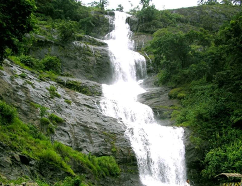
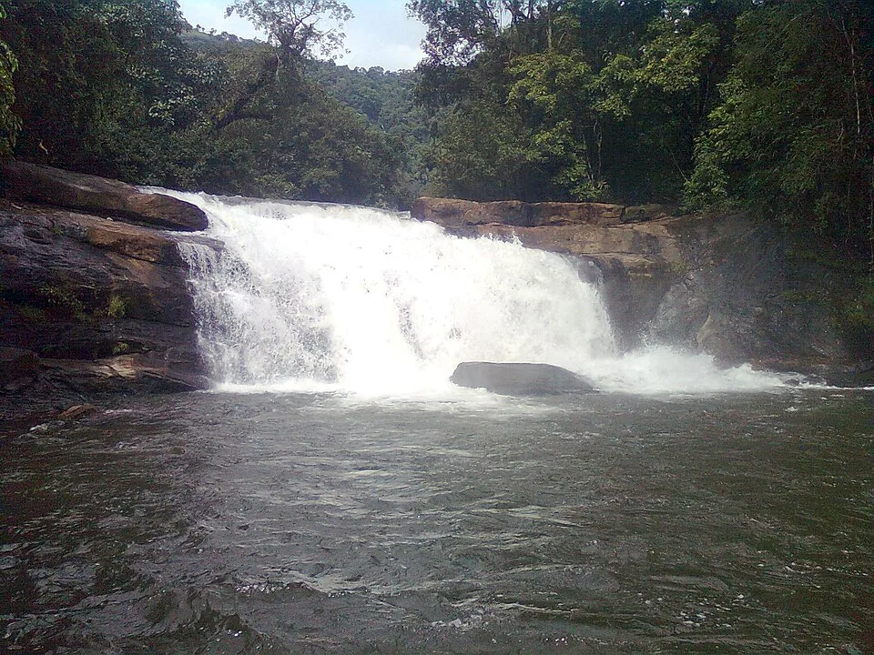
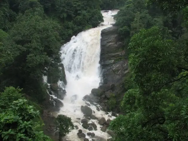
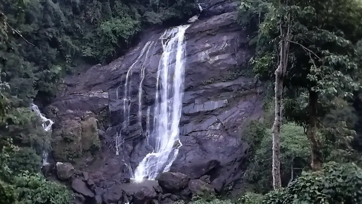
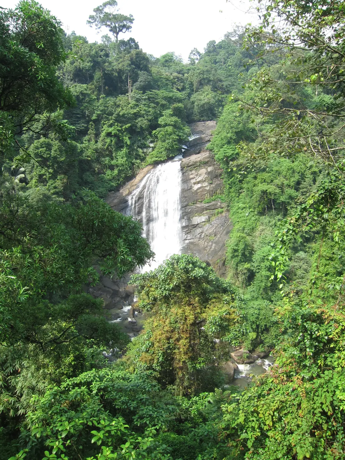
Valara appears through a break in dense green cover: a white fall crossing a broad dark rock face, with smaller channels above and boulders below. Trees frame the scene at several distances. The road is close enough to reveal the cascade, but the space between the viewer and the water remains a steep, uneven ravine.

The story of Valara Waterfalls

Valara lies between Neriamangalam and Adimali on the road used by travellers approaching Munnar from the Kochi side. It is a roadside viewing stop in Idukki district, not a waterfall inside Munnar town. A route description that begins only with “near Munnar” hides the useful geography: the stop belongs to the lower approach corridor before the later climb and tea-town destination.

The current Kerala Tourism destination account identifies Valara as part of a chain of cascades on the Deviyar. OpenStreetMap maps the named Deviyar watercourse through the waterfall as well. Older tourism material describes the broader Periyar relationship. These are best understood at different scales: the immediate waterfall is on the Deviyar, within the wider Periyar basin, rather than a drop in the broad main river beside Neriamangalam.

The cascade’s form is clearer if the eye follows the water from top to bottom. Above the main fall, the channel crosses smaller changes of level between trees and rock. The larger exposed face concentrates the flow into a brighter drop, while boulders and vegetation interrupt the view below. The visible main fall is one part of the channel’s descent, not a complete picture of the river from source to confluence.

In lighter flow, the rock becomes the main visual subject. Dark wet streaks show where water spreads thinly, while paler or drier surfaces reveal ledges and fractures around the principal channel. A narrow stream can split around a projection and rejoin lower down. These details make a quieter-season visit different from a monsoon view without making it worthless; the structure of the slope is easier to read when it is not hidden by a broad sheet of water.

Heavier flow changes the balance. White water can occupy more of the face, spray softens the contrast and the lower channel becomes harder to distinguish among boulders. The most dramatic-looking image can therefore reveal less of the underlying rock. It also gives no reliable measure of present conditions: a photograph records the flow at one moment, while rainfall and catchment conditions keep changing.

The trees are part of the composition and part of the terrain. Near branches can frame the view; taller trees rise around the upper slopes; climbing vegetation covers patches beside the fall. The interruption of those layers is what allows the water to be seen from the road. Moving closer to remove a branch from a photograph is not necessary when doing so would mean leaving a stable viewing position.

Valara and Cheeyappara are often presented together because they lie on the same travel corridor. That pairing is useful for planning, but it encourages facts and photographs to migrate between them. Cheeyappara is the waterfall Kerala Tourism describes through its seven tiers. Valara’s more concentrated fall and forest framing are its own visual identity. A caption should be checked against the actual rock-and-water pattern, not merely against a file labelled with the joint destination.

The visitor experience is also different from an enclosed attraction with a ticket counter and a managed path. Here the immediate decision is whether the roadside offers a safe place to stop and stand. A waterfall that is visible from a highway does not automatically have a parking area, pavement, viewing deck or staffed rescue provision. Those facilities need to be present and identifiable on the day rather than supplied by an itinerary’s expectations.

The map deliberately anchors the highway opposite the cascade rather than the waterfall node in the channel. Navigating to a point on falling water can produce a misleading final route, especially when software tries to find the nearest track. The road anchor is a way to identify the correct stretch of the journey. It does not instruct a driver to halt at an exact metre of carriageway regardless of traffic or restrictions.

Vehicle doors, people waiting for a photograph and vendors can all occupy the same limited roadside space. A driver needs room to pull clear, and passengers need a safe way to get out on the protected side. If either is missing, a drive-by glimpse is the sensible visit. The cascade does not require a longer stop simply because it appears in a package itinerary.

Upstream and downstream conditions matter even when the sky directly over the road looks clear. Water arriving at the drop has travelled through a catchment outside the frame. A brief lull in local rain is not proof that the channel is stable, and a small visible pool is not a reliable guide to the force passing through it. The roadside view avoids turning an accessible sight into an unnecessary water-entry attempt.

A short stop can still be attentive. First establish the whole scene from a safe position, then look at the channel above the main fall, the exposed face and the lower boulders in turn. There is no need to descend into the ravine to understand that sequence. A closer camera view, where it can be taken without moving towards an edge, can reveal details that the eye initially misses.

Adimali and Neriamangalam provide the useful road context for the rest of the journey. A meal, fuel stop or longer rest is better planned at an actual town facility than assumed at a narrow waterfall halt. Munnar can remain the onward destination, but its hotel and activity schedule should not pressure a driver into a rushed stop or a risky overtake immediately after leaving Valara.
Read the full history of Valara Waterfalls 268 more words

History

Valara’s visitor identity is closely tied to the road approach through the Neriamangalam–Adimali landscape. Kerala Tourism’s Munnar material names both Valara and Cheeyappara along this corridor. That is the strongest documented travel relationship: two distinct waterfalls encountered on a larger journey, rather than a single jointly named cascade.

Hydropower is a modern part of the wider river landscape. Kerala’s Information and Public Relations Department reported the 40 MW Thottiyar project operational in December 2024. The waterfall’s appearance should therefore not be treated as an unchanging scene preserved by an old travel photograph. For a roadside visit, recent conditions matter more than a promised volume of falling water; this is not an invitation to enter the separate power infrastructure.

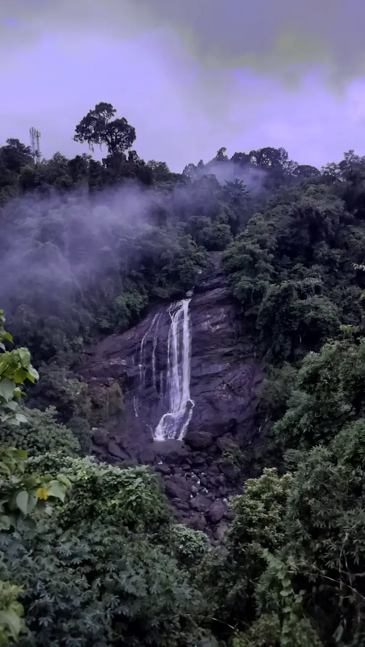
The available photographs document different appearances of the same main face: fuller white flow, narrower streams over dark rock and views in mist. They are useful visual records of change, but they do not supply an exact height, a flood chronology or a permanent visitor-access policy. The visible rock pattern is a firmer basis for recognising Valara than an unsourced numerical superlative.

Why visit

To see the Deviyar’s descent through a forested ravine from the main travel corridor, with the main fall and its surrounding rock visible together.

To compare Valara with Cheeyappara as two different waterfalls, noticing how the shape of the channel changes the appearance of falling water.

To make a brief, focused landscape stop on a longer road journey when safe stopping space and visibility allow it.

To look at seasonal change: stronger flow emphasises movement, while lighter flow reveals more of the ledges, wet streaks and exposed face.

What to expect

Highlights

  • A separate Deviyar waterfall framed by forest on the NH85 approach towards Adimali and Munnar.
  • A rock face whose ledges, channels and changing wet surface remain interesting even when the flow is narrower than in monsoon photographs.
  • A chance to understand the contrast with Cheeyappara without transferring its tier count, access descriptions or images to Valara.

Getting there

How to visit

  • Approach along NH85 between Neriamangalam and Adimali. Tell the driver Valara specifically; Cheeyappara is a different stop on the same journey.
  • The map marks the highway opposite the waterfall as a route anchor, not the waterfall lip and not a certified parking bay. Stop only if the driver can clear moving traffic and leave a safe place for passengers to stand.
  • Keep the visit to the roadside view. If the verge is crowded, visibility poor or stopping prohibited, continue rather than creating an unsafe halt or descending towards the water.

Distance by road

  • Kochi107 km
  • Madurai172 km
  • Thiruvananthapuram226 km
  • Coimbatore252 km
  • Kozhikode276 km

Road km to Idukki; ghat roads and traffic vary — allow extra.

Timing

Best time

Monsoon and post-monsoon periods generally bring stronger flow, while summer can be much lighter. Choose a clear daylight interval with safe road conditions; heavy rain is a reason to shorten or omit the stop, not to approach the water.

Weather in Valara WaterfallsSeasonal guide

Live forecast loads in your browser.

Today at Valara Waterfalls
Sunrise6:11 am
Sunset6:14 pm
Golden hour best light5:14 pm–6:14 pm
Blue hour after sunset6:14 pm–6:39 pm
Sun sets toward compass bearingW · 267°
Moon tonight🌖 Waning gibbous · 86%
South-west monsoon. June to September brings heavy rain to Kerala. Trails, falls and ghat roads can be slippery, swollen or closed at short notice, and forest departments sometimes suspend access. Check locally on the day before you travel.

Check the official alert before you travel. Kerala’s beaches, waterfalls and trekking routes close at short notice during heavy rain, and district alert levels change day to day. We do not publish an alert level of our own — read it from the state authority: Kerala State Disaster Management Authority, or the district control room on 1077.

Sun and moon are calculated for this location and shown in IST. Photography windows are the hour around sunrise and sunset; the sunset bearing is degrees clockwise from true north. Moon phase is accurate to about half a day.

Visitor notes

  • The paired tourism destination often combines two waterfalls in one article. The seven-tier description belongs to Cheeyappara and should not be used as Valara’s identity.
  • A narrow dry-season ribbon can reveal more of the rock face than a heavy-flow photograph. Do not expect a permanently full curtain of white water.
  • A path visible on a map or a person photographed near water does not establish an authorised visitor trail. This visit is based on the roadside view.
Safety

Good to know

  • Stay on the safe road-side viewing area and away from parapet tops, ravine edges and wet rock. Do not enter the pool or climb towards the cascade.
  • Watch the road as well as the waterfall. The carriageway carries through traffic, and a photograph does not justify stepping into a lane or stopping on a blind bend.
Official eco & forest programmes

Experiences around Valara Waterfalls

These are official or public-sector eco offerings that match this place, town or forest destination. Confirm availability, permits, tariffs and reporting times with the official operator before travel.

Idukki Wildlife Sanctuary, Valara Waterfalls
wildlifeboatingviewpoint

Idukki Wildlife Sanctuary eco visit

Forest and reservoir wildlife sanctuary around the Idukki-Cheruthoni dam landscape.

Kerala Forest Department
Official source →
Kalvari Mount, Valara Waterfalls
viewpointtrek

Kalvari Mount ecotourism viewpoint

Idukki reservoir viewpoint and pilgrimage hill, connected with Kerala Forest Ecotourism listings.

Kerala Forest Department / local tourism authorities
Official source →
Stay · eat · do · rent · see · shop

Stays, food & things to do near Valara Waterfalls

Verified hotels, homestays, restaurants, experiences, sights, shops and rentals around Valara Waterfalls — commission-free, with direct contact. Filter by what you need.

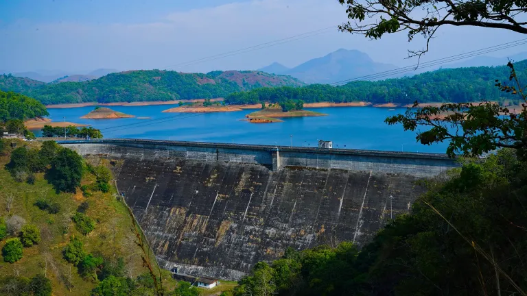
Kulamavu Dam Kerala Tourism — Dam and reservoir viewpoint in Idukki and CheruthoniPhoto: Kerala Tourism
Top pick
Dam and reservoir viewpoint · Idukki and Cheruthoni
Kulamavu Dam Kerala Tourism
64.9 km · 65 min drive~₹1270–1480 by taxi

Dam and reservoir viewpoint in Idukki and Cheruthoni. Kulamavu, Idukki district, Kerala · Kulamavu, Dam, Idukki Reservoir.

DirectionsView guide
Idukki Wildlife Sanctuary Kerala Tourism — Wildlife sanctuary in Idukki and CheruthoniPhoto: Kerala Tourism
Top pick
Wildlife sanctuary · Idukki and Cheruthoni
Idukki Wildlife Sanctuary Kerala Tourism
94.6 km · 125 min drive~₹1810–2090 by taxi

Wildlife sanctuary in Idukki and Cheruthoni. Idukki Wildlife Sanctuary, Idukki district, Kerala · Idukki, Wildlife sanctuary, Cheruthoni.

DirectionsView guide
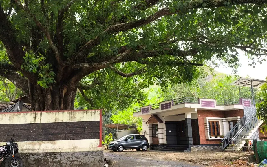
Panchami Homestay Cheruthoni — Silver House homestay in Idukki and CheruthoniPhoto: Kerala Tourism
Top pick
Silver House homestay · Idukki and Cheruthoni
Panchami Homestay Cheruthoni
51.2 km · 52 min drive~₹1030–1190 by taxi

Panchami Homestay Cheruthoni is a Kerala Tourism-listed Silver House homestay at Idukki Colony P.O., Alinchuvadu, useful for travellers comparing simple Cheruthoni/Painavu stays with homely Kerala food, Wi-fi, car hire, parking and Idukki reservoir route access. Homestay tariff · Cheruthoni, Idukki Colony, Homestay.

Directions Commission-freeView details
Kuttikkanam restaurant · Idukki and Cheruthoni
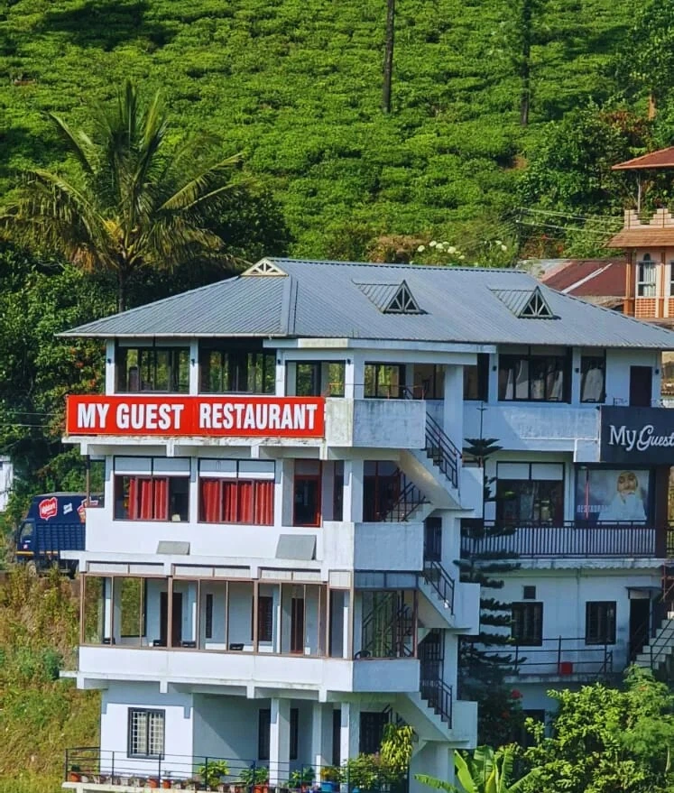
My Guest Restaurant Kuttikkanam
97.4 km · 108 min drive~₹1860–2150 by taxi

Kuttikkanam restaurant in Idukki and Cheruthoni. My Guest Restaurant, NH-183, Theni By-Pass, Pambanar, Peerumade, Idukki, Kerala 685531 · Restaurant menu pricing · Kuttikkanam, Pambanar, Restaurant.

Directions Commission-freeView details
Sahyadri Ayurvedic Centre Peermade — Ayurveda and wellness centre in Idukki and CheruthoniPhoto: Kerala Tourism
Top pick
Ayurveda and wellness centre · Idukki and Cheruthoni
Sahyadri Ayurvedic Centre Peermade
103.8 km · 116 min drive~₹1970–2280 by taxi

Kerala Tourism destination record for Peermade Ayurveda, Panchakarma, herbal medicine, yoga and wellness stays.

Directions Commission-freeView details
Premium serviced villa · Idukki and Cheruthoni
Mistara by Driveholicz Parunthumpara
104.5 km · 114 min drive~₹1990–2290 by taxi

Kerala Tourism-certified serviced villa at Parunthumpara with infinity pool, food and activity evidence.

Directions Commission-freeView details
Serviced villa · Idukki and Cheruthoni
Elam Villa Parunthumpara Peermade
103.5 km · 111 min drive~₹1970–2270 by taxi

Elam Villa Parunthumpara Peermade is a Kerala Tourism-listed serviced villa record for travellers comparing Parunthumpara, Pambanar and Peerumedu stays with direct phone, email and website evidence. Parunthumpara, Peermade, Serviced villa.

Directions Commission-freeView details
Plantation hotel · Idukki and Cheruthoni
Paradisa Plantation Retreat Peermade
114.0 km · 115 min drive~₹2160–2490 by taxi

Kerala Tourism-listed plantation retreat at Murinjapuzha with restaurant, pool and estate-walk evidence.

Directions Commission-freeView details
Homestay · Idukki and Cheruthoni
The Placid Rill Homestay Peermade
97.6 km · 115 min drive~₹1860–2150 by taxi

Kerala Tourism-listed Ladrum Estate homestay with stream, food, Wi-fi, car-hire and activity evidence.

Directions Commission-freeView details
Serviced villa · Idukki and Cheruthoni
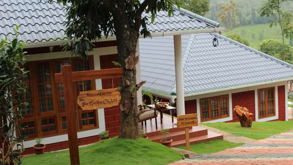
Tea Garden Chalets Unit I Peermade
101.9 km · 115 min drive~₹1940–2240 by taxi

Kerala Tourism-listed serviced villa near Pambanar and Peermade, surrounded by tea and cardamom plantations.

Directions Commission-freeView details
Government eco lodge · Idukki and Cheruthoni
Eco Lodge Peerumedu
103.7 km · 115 min drive~₹1970–2280 by taxi

Government Yathri Nivas eco lodge at the Peerumedu Government Guest House compound. A simple budget Kerala Tourism-run lodge base for Peermade and Kuttikkanam.

Directions Commission-freeView details
Government eco lodge · Idukki and Cheruthoni
Eco Lodge Idukki Painavu
52.7 km · 54 min drive~₹1050–1220 by taxi

Government Yathri Nivas eco lodge behind DTPC Idukki Park near IDA Ground, Painavu. A budget Kerala Tourism-run lodge base for Cheruthoni, the Idukki Arch Dam and Kalvari Mount.

Directions Commission-freeView details
Kuttikkanam restaurant · Idukki and Cheruthoni
Agincourt Restaurant Kuttikkanam
105.0 km · 118 min drive~₹1990–2300 by taxi

Kuttikkanam restaurant in Idukki and Cheruthoni. Agincourt, Kuttikkanam, Peerumedu, Idukki, Kerala 685531 · Kuttikkanam, Restaurant, Peerumedu.

Directions Commission-freeView details
Serviced villa · Idukki and Cheruthoni
Jacobs Heaven Kuttikkanam
105.2 km · 117 min drive~₹2000–2310 by taxi

Jacobs Heaven is a Kerala Tourism-listed serviced villa at Kuttikkanam. The villa has an Ayurveda centre, homely Kerala food, Wi-Fi and online reservation for a quiet high-range stay.

Directions Commission-freeView details
Kuttikkanam homestay · Idukki and Cheruthoni
White Vivid Homestay Kuttikkanam
104.3 km · 119 min drive~₹1980–2290 by taxi

Kerala Tourism-listed Kuttikkanam homestay with address, phone, email, food and Wi-fi evidence. MBC College Road, Pallikkunnu P.O., Peerumade, Kuttikanam, Idukki, Kerala 685531 · Budget to mid-range homestay · Kuttikkanam, Peerumade, Homestay.

Directions Commission-freeView details
Kuttikkanam homestay suites · Idukki and Cheruthoni
Monsoon Mist Kuttikkanam
105.0 km · 118 min drive~₹2000–2310 by taxi

Monsoon Mist Kuttikkanam is a Kerala Tourism-listed homestay on Dreamland Road, useful for travellers comparing private-suite stays with kitchen access, Western Ghats views, rooftop pool context and Peermade high-range routes. Premium homestay suites · Kuttikkanam, Peermade, Homestay.

Directions Commission-freeView details
Plantation resort · Idukki and Cheruthoni
Misty Mountain Plantation Resort Peermade
115.7 km · 116 min drive~₹2190–2530 by taxi

Misty Mountain Plantation Resort sits at Kuttikanam, Peermade. The Kerala Tourism-listed plantation resort offers a restaurant, tea-estate experiences and estate walks across the high-range plantations.

Directions Commission-freeView details
Hotel restaurant · Idukki and Cheruthoni
Igloo Heritage Restaurant Cheruthoni
49.7 km · 50 min drive~₹1000–1160 by taxi

Hotel restaurant in Idukki and Cheruthoni. Igloo Heritage Resorts, Cheruthoni, Idukki district, Kerala · Hotel restaurant.

Directions Commission-freeView details
Cheruthoni resort and hotel · Idukki and Cheruthoni
Igloo Heritage Resorts Cheruthoni
49.7 km · 50 min drive~₹1000–1160 by taxi

Cheruthoni resort and hotel in Idukki and Cheruthoni. Idukki-Adimali Road, Cheruthoni, Kerala 685602 · Cheruthoni, Idukki, Resort.

Directions Commission-freeView details
Official hydel tourism attraction · Idukki and Cheruthoni
Idukki Arch Dam Hydel Tourism
52.7 km · 56 min drive~₹1050–1220 by taxi

Kerala Hydel Tourism source for the Idukki Arch Dam attraction. Idukki Arch Dam, Hydel Tourism, Cheruthoni.

DirectionsView guide
Visitor information · Idukki and Cheruthoni
Cheruthoni Dam DTPC Idukki
52.5 km · 56 min drive~₹1050–1220 by taxi

DTPC Idukki source for Cheruthoni Dam near the Idukki Arch Dam reservoir system. Cheruthoni, Dam, Idukki.

DirectionsView guide

Book with the place itself. India’s cyber-crime coordination centre warned in April 2025 that convincing copies of hotel and pilgrimage booking sites are being pushed through sponsored search and social ads, taking payment for rooms the property never hears about. Every listing here links to the business’s own contact details and its own Google or Bing profile — we take no commission and sit in nobody’s payment path. If a booking page reached you through an ad, check the address bar against the property’s own site before you pay. Fraud can be reported on cybercrime.gov.in or on 1930.

Ranked

More ways to explore Idukki and Cheruthoni

This collection spans the wider Idukki highlands. Peermade, Kulamavu and the Neriamangalam–Adimali waterfall corridor are separate bases; select a stay or onward stop by its actual road location.

Across the whole of Idukki and Cheruthoni

Ranked guides

Top experiences around Valara Waterfalls

4 separate places to consider after Valara Waterfalls. Open each guide before deciding: their access, hours and return arrangements are independent.

waterfallCheeyappara Waterfalls

1.7 km · 20 min walk

Waterfall on the Kochi-Munnar road, commonly paired with Valara as a high-range arrival stop.

waterfallThommankuthu Waterfalls

42.2 km · 52 min drive

Seven-step cascade and eco-tourism trekking spot on the Kaliyar river near Thodupuzha, with rock pools, forest paths and a Forest Department eco-tourism trail.

waterfallAttukad Waterfalls

21.4 km · ~36 min by cab

Waterfall area near Munnar commonly used for short scenic drives and monsoon views.

waterfallPower House Waterfalls

23.7 km · ~40 min by cab

The Muthirapuzha spread sideways over bare rock at 796 m, below the tailrace of Pallivasal — the first hydroelectric station Kerala built. Free, unmanaged and very quiet, down about a kilometre of steep narrow lane. ⚠ Not the Chinnakanal falls that Kerala Tourism describes under this name, 21 km east.

Roampedia is commission-free — own or know a stay, eatery, guide or shop near Valara Waterfalls? List it and it appears here once verified.

Add a nearby business
Before you go

Valara Waterfalls — at a glance

TimingsNo authoritative fixed opening schedule is published for this roadside view. Plan in daylight and obey any temporary road, police or Forest Department restriction; visibility from the highway does not imply unrestricted access at all hours
Best timeMonsoon and post-monsoon periods generally provide stronger flow; summer can reveal much more exposed rock. Choose safe road conditions and clear daylight over maximum water volume, and omit the stop during severe rain or poor visibility.

Entry: The official destination and Munnar pages checked do not publish a Valara roadside-view admission tariff. This is not a promise of free parking or of included trekking, guiding or other services

Photography: Photograph from a firm, permitted roadside position clear of traffic. Use the existing view rather than climbing a parapet or moving down the ravine to remove foliage from the frame. Avoid flash or close disturbance of wildlife and keep equipment out of the roadway.

Parking: A dedicated, currently managed Valara car park is not established in the official visitor sources checked. Use only an available legal pull-off that leaves the carriageway clear and gives passengers safe standing space. Do not double-park, block a bend or interpret a parked vehicle in an old photograph as permission.

Getting here

How to reach Valara Waterfalls

  • ✈︎ By air Cochin International Airport is the practical airport gateway for the western approach. Continue by road towards Neriamangalam and Adimali, with Valara as an optional safe stop on that journey. No fixed airport transfer time is assumed.
  • 🚆︎ By train Aluva and Angamaly are practical rail gateways for the Kochi-side approach, followed by road through the lower towns towards Neriamangalam. There is no railway station at the falls. Distance figures printed for Munnar in paired tourism pages should not be presented as station-to-Valara measurements.
  • 🚗︎ By road Use NH85, the Kochi–Dhanushkodi corridor, between Neriamangalam and Adimali. The map marks the road opposite Valara as a route anchor. Cheeyappara is a separate nearby waterfall; ask for Valara by name and stop only where the vehicle can clear through traffic.
  • 🚌︎ By bus Buses on the Neriamangalam–Adimali corridor are transport through the area, not guaranteed sightseeing services. Confirm the actual permitted stop with the conductor. For a short waterfall look with a reliable onward journey, an agreed taxi stop is more practical than getting off an intercity bus beside a narrow verge.
Getting around

Getting around Valara Waterfalls

Valara works as a short vehicle stop on NH85. Keep the same vehicle for arrival and departure, use only a legal pull-off, and remain at the safe roadside view; there is no verified visitor circuit from the highway to the pool or waterfall lip.

Getting back

Treat Valara as a pause in an onward vehicle journey. Agree the stopping and departure arrangement before passengers get out; do not rely on finding a taxi beside the cascade. If travelling by bus, confirm a safe boarding point and onward service before leaving it.

Do

Things to do

  • Read the main waterfall from top channel to broad rock face and lower boulders without leaving the safe road-side view.
  • Compare the visible wet streaks with exposed rock to understand how a smaller flow spreads across the face.
  • Frame the waterfall with the surrounding trees from a stable position, keeping the foreground road and its hazards in mind.
  • Make a separate Cheeyappara stop only if traffic and safe access allow, then compare the two cascades’ forms rather than treating them as one attraction.
Included

What’s included

  • A roadside view of Valara’s separate rock face and changing flow when a safe stopping position is available.
  • A visual comparison with Cheeyappara only through a second, separately safe stop farther along the route.
  • An onward journey through the Neriamangalam–Adimali corridor; swimming, trekking and access to the cascade base are not included.
Plan

Good to know

  • Tell the driver Valara, not simply the paired Cheeyappara–Valara name, and agree where everyone will re-enter the vehicle.
  • Judge the stop by traffic, visibility and verge space rather than by water volume; continue when passengers cannot stand clear of the road.
  • Use a longer lens or accept foliage in the frame instead of descending towards the ravine for an unobstructed photograph.
Facilities

On site

  • Plan longer meals, fuel and toilets at an identified facility in Adimali or Neriamangalam, rather than assuming them at the waterfall verge.
  • Kerala Tourism mentions roadside refreshment stalls in the paired waterfall area; individual stalls and their opening vary, and their presence does not establish a formal visitor centre.
  • No managed swimming area or authorised base-access trail is included in the roadside visit described here.
Stay safe

Safety

  • Stay out of the pool, ravine and waterfall lip. Wet rock, falling water and sudden changes in flow make a close approach hazardous.
  • Keep children on the protected side of the group and away from both the road edge and any drop.
  • Do not stop on a blind bend, climb a barrier or walk along the carriageway to reach a preferred camera angle.
  • Follow current official weather and road restrictions. A clear patch of sky over the viewpoint does not describe rainfall across the upstream catchment.
Getting around Valara Waterfalls
From the entrance
The mapped base is the highway opposite Valara, not the waterfall lip or pool. Stop only where the vehicle clears traffic and passengers have a safe standing position; the pin does not certify a parking bay.
Step-free access
A drive-by view may be the suitable option when no safe unloading position is available. An accessible viewing platform and a continuous protected route from parking have not been verified for this stop.
  • Do not use the carriageway as a viewing platform.
  • Wet rock, the steep river approach and the pool are outside the planned roadside visit.

Checked 5 September 2026 against source 1source 2. Conditions change and surfaces vary with weather — if step-free access is essential, confirm with the site before you travel.

Practical things near Valara Waterfalls

These services are listed within about 1.2 km of Valara Waterfalls. Walking distances follow mapped routes; access and opening hours can change. Other services may be closer but are not included here.

Eat nearby

What to eat in Idukki and Cheruthoni

Plan a proper break in Neriamangalam or Adimali. Roadside stalls in the paired waterfall corridor vary, and no particular refreshment outlet or toilet is guaranteed at the Valara stopping point.

Explore food in Idukki and Cheruthoni →
01

Before the ghat section

Neriamangalam is the useful lower-road stop for tea or a meal before continuing towards the cascade and Adimali.

02

At Valara

Buy only where the vehicle and passengers can remain clear of NH85; do not cross or stand in the carriageway for a roadside stall.

03

After the waterfall

Adimali offers a more dependable meal stop and onward transport connection than waiting beside the falls after the brief view.

Nearby

What’s near Valara Waterfalls

waterfallCheeyappara Waterfalls

Waterfall on the Kochi-Munnar road, commonly paired with Valara as a high-range arrival stop.

1.7 km · 20 min walk
waterfallAttukad Waterfalls

Waterfall area near Munnar commonly used for short scenic drives and monsoon views.

21.4 km · ~36 min by cab · straight line
waterfallPower House Waterfalls

The Muthirapuzha spread sideways over bare rock at 796 m, below the tailrace of Pallivasal — the first hydroelectric station Kerala built. Free, unmanaged and very quiet, down about a kilometre of steep narrow lane. ⚠ Not the Chinnakanal falls that Kerala Tourism describes under this name, 21 km east.

23.7 km · ~40 min by cab · straight line
museumTea Museum

Tea-history museum in Munnar linked with the plantation story of the high ranges.

24.3 km · ~40 min by cab · straight line
hill stationMunnar

Kerala’s most famous hill station, known for tea estates, viewpoints and cool weather.

24.5 km · ~41 min by cab · straight line
viewpointPothamedu Viewpoint

A road-accessible viewpoint in Pothamedu south of Munnar, looking across planted hills and wooded valleys. The viewpoint marker is separate from the wider village and from private plantation walking routes.

24.6 km · ~41 min by cab · straight line
viewpointBlossom Hydel Park

The Kerala State Electricity Board’s riverside flower park on the Munnar–Aluva road, 3.3 km below Munnar town and 1.2 km from the KSRTC stand at Old Munnar. It runs along the east bank of the Muthirapuzha immediately above the 1944 R. A. Headworks weir that feeds Pallivasal, Kerala’s first hydroelectric station — which is what the "hydel" in the name means. Open daily 09:15 to 20:15 with tickets sold online by Kerala Hydel Tourism Centre.

25.0 km · ~42 min by cab · straight line
wildlifeRajamala

Rajamala is the designated tourism and awareness zone of Eravikulam National Park near Munnar. It is not a separate unrestricted summit trek or the whole national park.

26.1 km · ~44 min by cab · straight line
damPonmudi Dam

KSEB’s Panniyar-project dam at Konnathadi near Rajakkadu and Vellathooval in Idukki; a reservoir-and-engineering visit, distinct from Ponmudi hill station in Thiruvananthapuram.

36.4 km · 42 min drive
waterfallThommankuthu Waterfalls

Seven-step cascade and eco-tourism trekking spot on the Kaliyar river near Thodupuzha, with rock pools, forest paths and a Forest Department eco-tourism trail.

42.2 km · 52 min drive
damMalankara Dam

An Irrigation Department dam and reservoir at Muttom near Thodupuzha, storing Thodupuzha River runoff and Idukki power-station tailwater for the Muvattupuzha Valley Irrigation Project; the visitor park has its own permitted areas.

47.1 km · 51 min drive
townPainavu

The hill headquarters town of Idukki district near the arch dam, a quiet high-range base for Idukki–Cheruthoni dam-side sightseeing and the surrounding reservoir viewpoints.

54.5 km · 56 min drive

All 12 places to visit in Idukki and Cheruthoni →

Walking and driving times are real routed distances, except the few marked “straight line”, which are direct-line estimates and will read short. Fare figures are estimates from Kerala’s notified auto/taxi tariff and exclude waiting and night charges. Routing: © openrouteservice.org by HeiGIT | Map data © OpenStreetMap contributors

Nearby toilets, pharmacies, ATMs, seating and vets are community-mapped and may be incomplete or out of date. Map data © OpenStreetMap contributors | Walking times © openrouteservice.org by HeiGIT

On the map

Where Valara Waterfalls is

Good to know

Valara Waterfalls — frequently asked

Are Valara and Cheeyappara the same waterfall?

No. They are separate stops between Neriamangalam and Adimali. The paired destination name reflects proximity. Cheeyappara’s seven-tier description should not be transferred to Valara, and a driver should be told which stop is intended.

Which river forms Valara Waterfalls?

Kerala Tourism’s current destination account names the Deviyar, which is also the mapped watercourse through the fall. It belongs to the broader Periyar basin. The immediate channel should not be confused with the wide main Periyar river at Neriamangalam.

Can I reach the base of Valara from the road?

This guide covers the roadside view only. A currently authorised public route to the waterfall base has not been established in the official access sources checked. Do not descend through vegetation, follow an informal track or enter the pool on the strength of a tourism photograph.

Is swimming allowed at Valara?

Do not plan swimming here. The visible pool and boulders sit below a working cascade in steep terrain, and no managed public bathing arrangement is established for this visit. Advice about dipping at another waterfall in a paired article does not apply automatically to Valara.

Will there be heavy water flow in summer?

Not necessarily. Kerala Tourism specifically describes lower summer flow. Recent rainfall and the wider water system affect what you see, so a monsoon photograph is not a year-round promise. A lighter fall can still reveal the rock face clearly.

Does the map identify a parking area?

No. It identifies the highway opposite the correct waterfall as a route anchor. The driver must choose only a legal, safe stopping position with room clear of traffic. If none is available, continue; the marker is not permission to stop in a lane.

Can I walk from Cheeyappara to Valara?

Do not assume the connecting highway has a continuous safe pedestrian route. These are normally separate vehicle stops on the same journey. Traffic, bends and verge conditions matter more than their apparent closeness on a map, particularly in rain or poor visibility.

Is Valara inside Munnar town?

No. It is on the Neriamangalam–Adimali approach corridor in Idukki. A stay in Munnar still involves onward road travel after the stop. Use the actual hotel route and current traffic rather than treating a waterfall visit as a short walk from the town centre.

How do I reach Valara Waterfalls?

Follow the Neriamangalam–Adimali highway to the Valara reach. The pin is the road opposite the mapped cascade; the driver must find a lawful stopping position clear of traffic.

How much time do I need for Valara Waterfalls?

A brief roadside view is the planned visit. It does not include an assumed walk to the base, and Cheeyappara needs a separate stopping decision.

What should I know before visiting Valara Waterfalls?

If safe roadside space is unavailable, continue rather than stopping in the carriageway. Do not descend towards the pool or waterfall lip on the strength of an unmarked opening in the vegetation.

When is the best time to visit Valara Waterfalls?

Monsoon and post-monsoon periods generally bring stronger flow, while summer can be much lighter. Choose a clear daylight interval with safe road conditions; heavy rain is a reason to shorten or omit the stop, not to approach the water.

What are the entry fee and timings at Valara Waterfalls?

Entry: The official destination and Munnar pages checked do not publish a Valara roadside-view admission tariff. This is not a promise of free parking or of included trekking, guiding or other services. Timings: No authoritative fixed opening schedule is published for this roadside view. Plan in daylight and obey any temporary road, police or Forest Department restriction; visibility from the highway does not imply unrestricted access at all hours.

What else is near Valara Waterfalls?

Nearby you can pair Cheeyappara Waterfalls (1.7 km), Attukad Waterfalls (21.4 km), Power House Waterfalls (23.7 km), Tea Museum (24.3 km).

Read before you go

Valara Waterfalls guides, stories & itineraries

Stories & history of Valara Waterfalls

Written about Valara Waterfalls itself — its history, its legends and the arguments about them.

Around Idukki and Cheruthoni

These reads cover nearby destinations, each with its own arrival point and visit arrangements.

Kerala-wide guides & itineraries

Route-level itineraries and practical guides for the rest of Kerala.
See all 153 Idukki guides & stories →