The name of Puthuvype beach is not decoration. Puthu means new; Puthuvype is the new Vypin. It is a statement about how recently this ground came into existence, and the island keeps a calendar to back it up.
Land with a birthday
The tradition of this coast holds that in 1341 a catastrophic flood came down the Periyar and dumped an immense load of silt where the river met the sea — choking the ancient port of Muziris out of existence and throwing up the long sandbar that became Vypin island. The people who settled the new ground started counting from it. The Puthuvype era, the Era of the New Deposit, begins in 1341 and has been used on this coast ever since.
Think about how unusual that is. Most places have a founding date for a settlement. Vypin has a founding date for the dirt. You are walking on a deposit roughly seven hundred years old, and the community that lives on it has never stopped noting the fact.
Historians hedge the single-night version, and reasonably. No eyewitness account of the 1341 flood survives, and coastal siltation is more often a decades-long process than an evening’s work. But nobody disputes that this ground is young, or that the calendar exists.
And the sea is taking it back
Shoreline studies along the Ernakulam coast record persistent erosion across much of it, and Puthuvype is part of that. Land that is said to have arrived in one night is leaving a metre at a time, and the defences built to stop it have a complicated record: seawalls absorb energy where they stand and deflect it elsewhere, so a structure that saves one stretch can accelerate loss on the next one along.
That is the quiet irony of the place, and it is visible if you know to look for it. Walk the strand and note where the sand is backed by rock armour and where it is not, and where the vegetation line has been cut back. The island’s name is a boast about being new. The newness is precisely what is not holding.
- A sandbar traditionally dated to a Periyar flood in 1341.
- A local calendar — the Puthuvype era — counted from that year.
- Active shoreline erosion along much of the Ernakulam coast, this stretch included.
- Sea defences whose effect is contested: they hold one section and can worsen the next.
The argument on the shore
There is a second layer of contest here that a visitor will not read off the sand. Puthuvype is the site of a large LNG regasification terminal, commissioned in 2013, built on one of the most heavily fished stretches of the Kerala coast. The fishing community here has spent much of two decades disputing what is built on their shore and how much sea they are permitted to work — from protests in 2009 over sea walls being cut for a proposed LPG terminal, to objections over proposed fishing exclusion zones around the terminal, to a long campaign that eventually secured a new fish landing centre.
We are not going to adjudicate any of that, and a travel page is the wrong place to try. But it is worth knowing, because it changes what the emptiness means. A wide, quiet, beautiful and strikingly undeveloped beach next to a major industrial installation is not undeveloped by accident, and the people with the longest claim on this shoreline are the ones with the least control over it.
Why to come anyway
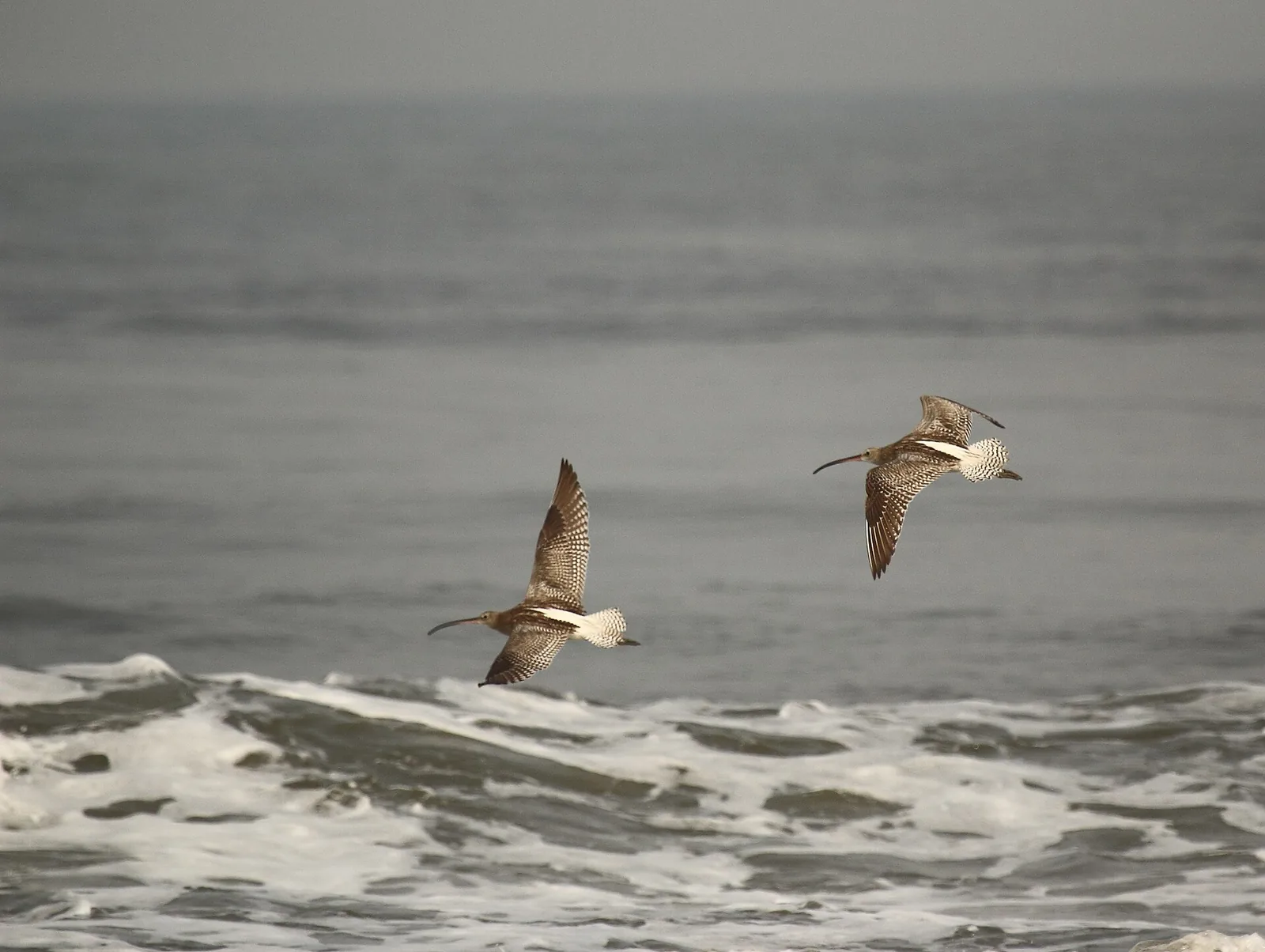
Because it is the least crowded good beach in Kochi and it has the tallest lighthouse in Kerala standing over it. Because the strand is genuinely good for shorebirds — curlews, waders, terns working the tideline. And because the sunsets here match anything at Fort Kochi with almost none of the audience.
Treat it as a walking beach: no lifeguards, no shacks, eroding shoreline, and a working sea. Come late in the afternoon, climb the lighthouse first while it is still open, and be on the sand for the last of the light.
Frequently asked questions
What does Puthuvype mean?
"New Vypin" — puthu means new. It refers to the recent geological origin of the island, which the tradition of this coast dates to a Periyar flood in 1341. The local calendar, the Puthuvype era or Era of the New Deposit, is counted from that year.
Is Puthuvype beach eroding?
Yes. Shoreline studies record persistent erosion along much of the Ernakulam coast, and this stretch is affected. Sea defences are in place along parts of it, though their effect is debated — a seawall that protects one section can increase loss on the adjacent one.
Is there an LNG terminal at Puthuvype?
Yes — a liquefied natural gas regasification terminal, commissioned in 2013, on one of the most heavily fished stretches of the Kerala coast. It has been the subject of long-running disputes with the local fishing community over shore access, sea walls and fishing exclusion zones.
Is Puthuvype beach worth visiting?
Yes, if you want a quiet beach rather than a busy one. It is wide, largely undeveloped, excellent for shorebirds and sunsets, and it has the tallest lighthouse in Kerala standing over it — which you can climb. It is a walking and watching beach, not a swimming or shack one.
What birds can I see at Puthuvype beach?
The strand and tideline attract waders and shorebirds — Eurasian curlews are recorded here, along with terns and gulls. The cooler months and the hours around dawn and dusk are the most productive.
How is Puthuvype different from Cherai Beach?
They are at opposite ends of the same island. Cherai, in the north, is the long golden swimming beach with shacks and crowds. Puthuvype, in the south, is quiet, undeveloped, industrial at its edges and closest to Fort Kochi — better for a walk, a lighthouse and an empty sunset than for a day on the sand.