What to expect
Highlights
- Sea views and sunset at Puthuvype Beach
- Nearby seafood, cafes or beach walks where available
- Easy pairing with local stays and short day trips
A quieter Vypin-island beach near the Ochanthuruth lighthouse, reached by ferry or the Goshree bridges from Ernakulam.
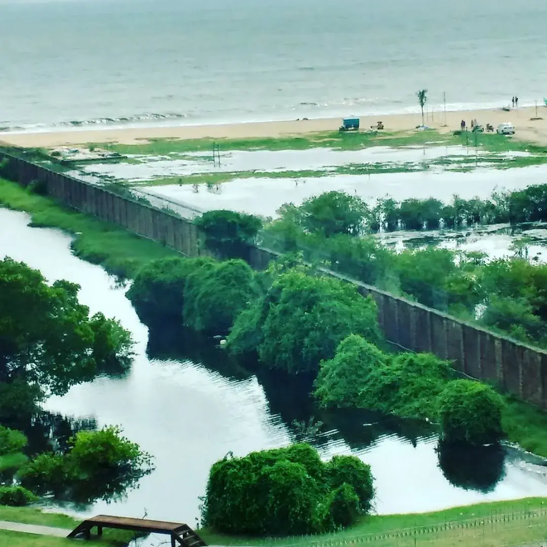
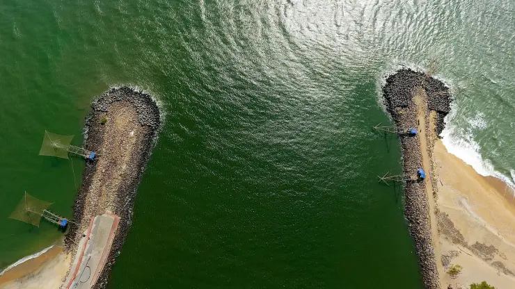
Puthuvype Beach unspools along the southern tip of Vypin Island, where the Kochi backwaters finally spill into the Arabian Sea beside the harbour mouth. It is a long, quiet, dark-sand shore watched over by Kerala’s tallest lighthouse — a place to walk, watch ships slide in and out of port, and catch a big open-sky sunset without the crowds of the city’s busier beaches.
Come to Puthuvype (also spelt Puthuvypin or Puthuvypeen) for the space. Where Fort Kochi’s waterfront can feel busy and Cherai draws the weekend beach parties, this stretch near the island’s tip stays wide, plain and largely empty on weekday mornings. The sand runs dark — an ashy grey-brown that turns almost black where the last wave has soaked it — and the shoreline stretches far enough that walkers, joggers and the odd fisherman never quite crowd one another.
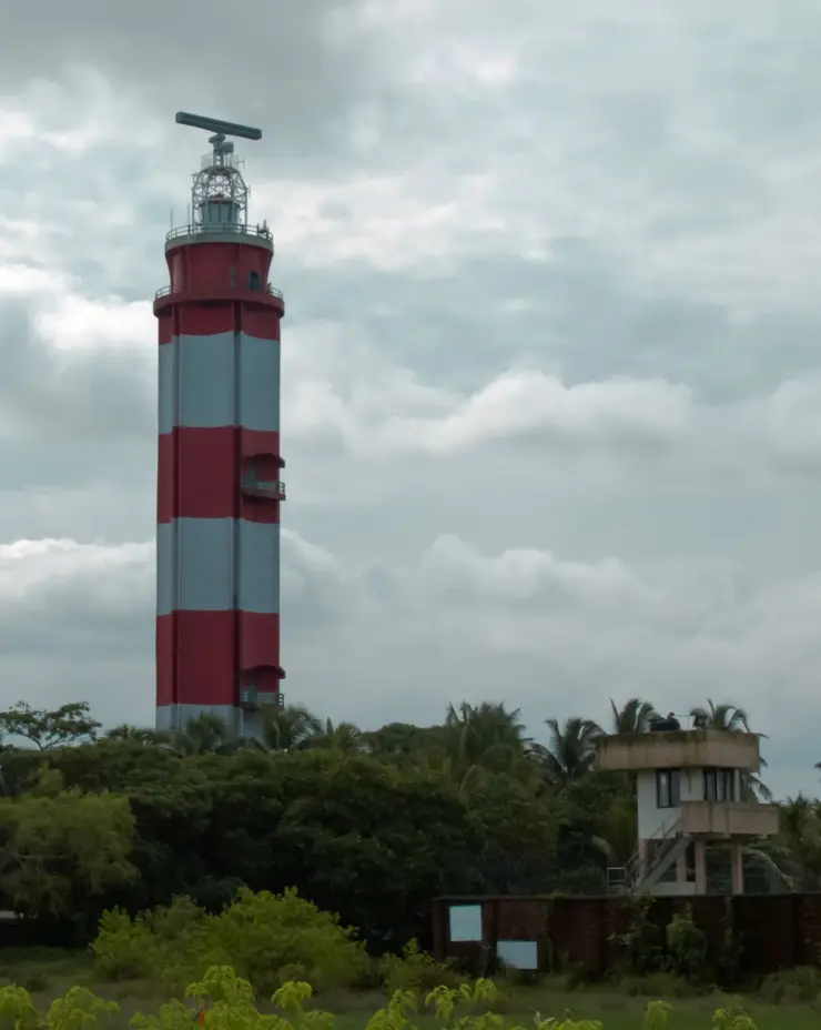
The great landmark is the lighthouse. Painted in bold white-and-red horizontal bands and rising to roughly forty-six metres, the Puthuvype (Vypin) light is the tallest in Kerala, and on the days its gallery is open you can ride most of the way up by lift, climb the last flight, and step out onto a viewing balcony. From there the whole geography of the place clicks into focus: the Arabian Sea on one side, the mouth of the Kochi backwaters on the other, container cranes and church spires and coconut fringe laid out below.
This is often described as a drive-in beach, and that captures its character. Reaching it means crossing the Goshree bridges from the city and driving out along Vypin, past the fishing harbour and the container terminal, and many visitors simply park close to the sand and take in the sea from near their vehicle. It gives the whole outing an easy, unhurried feel — a short escape rather than a full-blown beach day.
The setting beside the harbour mouth means the water here is working water. Ships and fishing craft pass on their way to and from the port, and the interplay of river current and sea makes the near-shore livelier than it looks. That same restlessness is why locals treat the sea with respect: the beach is lovely to sit beside and paddle along, but it is not a carefree swimming pool.
Evenings are when Puthuvype comes into its own. Families drift down as the heat softens, children chase the shallow edge of the waves, and the sun drops straight into the Arabian Sea in a wide, unobstructed arc. With the lighthouse throwing its first sweeps of the night and boats lit up on the water, it is one of the more atmospheric sunset spots around Kochi.
It remains, above all, an uncommercial place. There is no boardwalk of stalls, no ticket gate at the sand, only a scatter of snack carts, the lighthouse, and a long horizon. That plainness is exactly the appeal for the travellers who seek it out — a genuine slice of coastal Vypin, close to the city yet a world away from it.
The name is the story, and almost nobody who comes here knows it. Puthuvype means the new Vypin — puthu, new — and it is not a piece of estate-agent branding from the 1980s. It is a claim about geology, and the island keeps a calendar to prove it.
The tradition holds that in 1341 a catastrophic flood came down the Periyar and dumped an enormous load of silt where the river met the sea, choking the ancient port of Muziris out of existence and throwing up a long sandbar that became Vypin Island. The people who settled the new ground began counting years from that event. The Puthuvype era — the Era of the New Deposit — starts in 1341 and has been used on this coast ever since. There are not many places on earth where the land has a birthday and the locals still date documents by it.
Stand on this beach with that in your head and the sand changes character. You are not on a coastline; you are on a deposit, a pile of river silt about seven hundred years old, temporarily above water. Historians hedge the single-night version — no eyewitness account of the flood survives, and silting can be a slow business — but nobody disputes that this ground is young, or that a calendar was started for it.
Which makes what is happening now uncomfortably apt. The sea is taking it back. Shoreline studies along the Ernakulam coast record persistent erosion, and the seawalls built to stop it have in places made matters worse by deflecting energy down the beach instead of absorbing it. Land that arrived in a single flood is leaving a metre at a time. The island's own name is a boast about being new, and the newness is exactly what is not holding.
The modern shoreline carries its own argument on top of that. Puthuvype is also the site of a large LNG regasification terminal, commissioned in 2013, on one of the most heavily fished stretches of the Kerala coast — and the fishing community here has spent much of two decades contesting what gets built on their shore and how much sea they are allowed to work, from the 2009 protests over sea walls being cut for a proposed LPG terminal to the long campaign that eventually won a new fish landing centre. A visitor walking the sand sees a wide, empty, beautiful beach. What they are actually looking at is contested ground in the most literal sense, and the people who use it hardest have the least say over it.
One thing on this beach is older than the beach's modern reputation and it is the light. The tower here was not built for Puthuvype at all. Kochi's light began at Fort Kochi in 1839 as an oil lamp, gained new reflecting gear in 1902, was modified in 1914, got a ten-metre tower in the 1920s and a twenty-five-metre steel structure with a gaslight in 1936. It moved across the harbour mouth to Puthuvype in 1979 for the plainest of reasons: Fort Kochi had run out of land. There was no room to build the taller, stronger light the port needed, and Vypin — the new ground of 1341 — had room to spare. The island that was created by a flood ended up carrying the light because the old town was full.
The present tower started work on 15 November 1979: forty-six metres of double-layered concrete on an octagonal plan, painted in white and red horizontal bands, with a focal plane at forty-nine metres and a beam visible twenty-eight nautical miles out — about fifty-two kilometres. Its characteristic is four white flashes every twenty seconds, which is the thing to count if you are on the beach after dark and want to know you are looking at the right light. It is the tallest lighthouse in Kerala, and it is open to visitors, which very few working lights of that height are.
Vypin Island itself owes its shape to the sea. The island and the natural harbour mouth beside it are widely traced to the great Periyar flood of 1341, when the river is said to have shifted course, silted up the old port at Kodungallur, and carved open the deep-water entrance that made Kochi one of the finest natural harbours on the coast — the making of Vypin and, indirectly, of the modern city.
For centuries the low, sandy spit at the harbour mouth was prime ground for a guiding light. The lineage of the lighthouse that now stands at Puthuvype reaches back to 1839, when an oil-fuelled lamp was first lit on the Fort Kochi side to steer vessels into the port. Over the following decades the light was repeatedly upgraded — new optics early in the twentieth century, a ten-metre tower in the 1920s, and by 1936 a taller steel tower carrying a gaslight.
As shipping grew and the old Fort Kochi site ran short of room, the light was rebuilt across the harbour mouth at Puthuvype on Vypin Island around 1979. The present tower — octagonal, double-walled concrete, in its white-and-red livery — rises to about forty-six metres, making it the tallest lighthouse in Kerala, with a beam reported to reach roughly twenty-eight nautical miles out to sea.
The lighthouse is a working aid to navigation under the national lighthouse authority, not merely a monument, and its flashing character still marks the entrance to the port every night. In recent years the authorities have opened many such towers to the public with viewing galleries, and Puthuvype’s gallery has become the beach’s headline attraction.
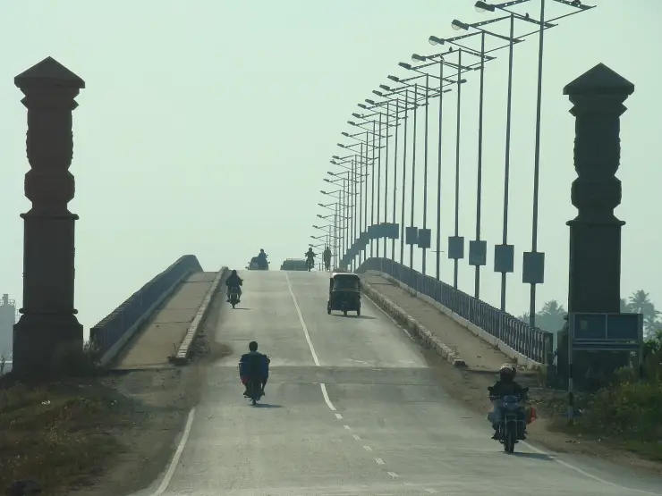
The wider area has changed fast in the modern era. The Goshree bridges knitted the once-isolated Vypin islands to mainland Kochi, and the growth of the harbour — including the container terminal at Vallarpadam nearby — has put heavy maritime traffic just offshore. Puthuvype today sits at the meeting point of that industrial harbour world and a quiet, still-rural stretch of island coast.
Because the tallest lighthouse in Kerala is here, it is open to visitors, and the view from its gallery makes the whole geography of Kochi legible in one turn — sea, harbour mouth, backwater and island.
You get Kerala’s tallest lighthouse with a public viewing gallery — a lift most of the way up and a balcony with sweeping views over sea, harbour mouth and island (open days and hours permitting).
The beach is long, uncrowded and peaceful, one of the cleaner and calmer shores around Kochi, ideal for an unhurried walk far from the city bustle.
It is an easy drive-in escape: cross the Goshree bridges, drive out along Vypin past the fishing harbour, and you are at the sand within a short trip from the city.
The harbour-mouth setting is genuinely scenic — ships and fishing boats passing, the backwaters meeting the Arabian Sea, and a real working coastline rather than a manicured one.
Sunsets are wide open and dramatic, with the sun dropping straight into the sea and the lighthouse beginning its nightly sweep — one of the best evening spots on this side of Kochi.
It pairs neatly with the rest of Vypin — Cherai Beach, the fishing harbour, and the ferry hop to Fort Kochi — for a full day exploring the islands.
Road km to Ernakulam; ghat roads and traffic vary — allow extra.
November to February for dry weather; avoid rough-sea days during monsoon warnings.
Live forecast loads in your browser.
Sun and moon are calculated for this location and shown in IST. Photography windows are the hour around sunrise and sunset; the sunset bearing is degrees clockwise from true north. Moon phase is accurate to about half a day.
Browse listed stays, food, activities, sights, shops and rentals around Puthuvype Beach. Check each listing’s locality and contact the business directly for current arrangements.
Restaurant at Cherai Beach Resorts for Vypin Island and Cherai beach visitors. Beach resort restaurant.
Maliekal Heritance is a beach-and-lake resort at Cherai Beach, Kochi. The operator lists garden-view and lake-view Jacuzzi categories, a Wooden Cottage labelled for couples only, and separate Insignia Private Pool and Infinity 360 Sea View Private Jacuzzi Pool categories. Choose the exact category; a Jacuzzi room does not establish an included private swimming pool.
A Beach Road hotel in Cherai with several room categories, including Superior, Deluxe and Suite options in its property description. The choice between sea-facing and backwater-facing rooms matters more than the general beach label. Confirm the assigned room’s view, beach access and meal plan before paying.
Cherai Beach Palace is a Cherai Beach Road stay useful for simple beach-base enquiries, direct room checks and Cherai / Vypin trip planning. Cherai, Beach Road, Hotel.
Beach and backwater resort at Cherai with direct official contacts. Cherai P.O., Kochi, Kerala 683514 · Cherai, Beach stay, Backwaters.
Cherai beach activity context for Vypin Island visitors comparing water-sport options. Beach water sports.
Kerala Tourism-listed Club Mahindra property on MLA Road, useful for family beach-stay planning around Cherai.
Visitor information in Cherai and Vypin. Cherai Beach, Vypeen Island, Kochi, Kerala.
Book with the place itself. India’s cyber-crime coordination centre warned in April 2025 that convincing copies of hotel and pilgrimage booking sites are being pushed through sponsored search and social ads, taking payment for rooms the property never hears about. Use the contact and source details on each profile to confirm the exact business and booking channel. A directory entry or map pin alone does not establish an operator’s identity or current availability. Roampedia takes no commission and does not collect booking payments. If a booking page reached you through an ad, check the address bar against the property’s own site before you pay. Fraud can be reported on cybercrime.gov.in or on 1930.
Find food, accommodation and activities across Cherai and Vypin. Browse the guides for places to eat, stay and explore along your route.
5 more places around Cherai and Vypin. Open a guide to plan the visit and onward journey.
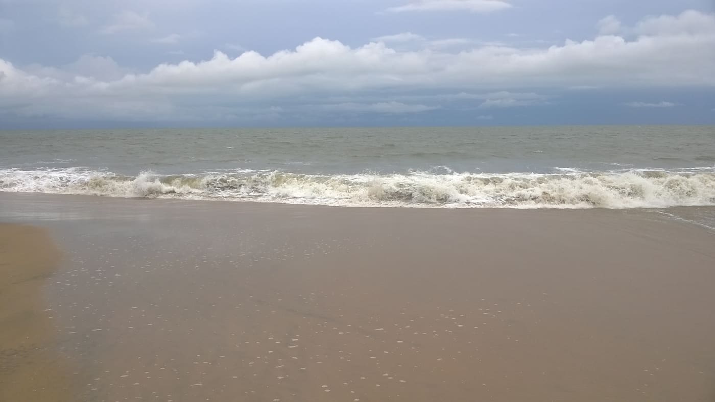
A relatively quiet Vypin Island beach north of Kochi, with an open sandy shore and village approach distinct from Cherai and Puthuvype.
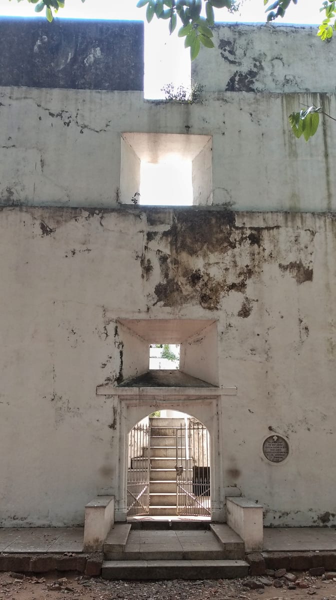
Built by the Portuguese in 1503 at the north tip of Vypin, the oldest surviving European fort in India — a hexagonal laterite tower now protected as a monument.
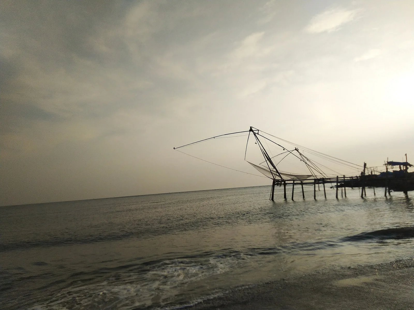
A quiet sand beach at the northern tip of Vypin where the backwaters meet the sea, with the Pulimuttu breakwater at its end — about a kilometre south-west of the working fishing harbour, and a completely different visit.
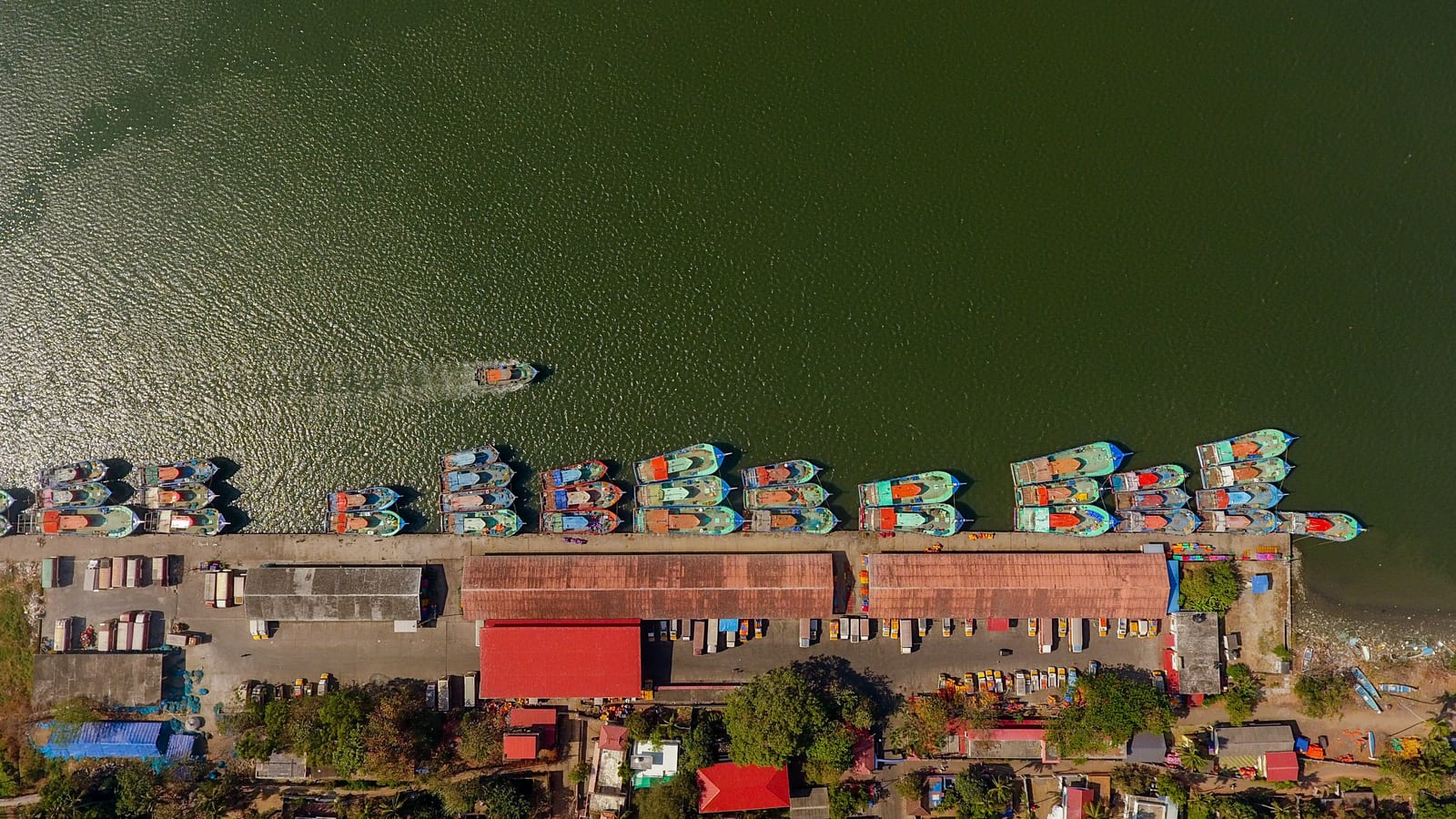
One of Kerala’s biggest fishing harbours, at the northern tip of Vypin — a working quay of steel trawlers, ice plants and a dawn auction, and the yard where much of the south-west coast’s trawler fleet is actually built.
Roampedia is commission-free — own or know a stay, eatery, guide or shop near Puthuvype Beach? Submit public business details for review.
Add a nearby businessEntry: No charge to enter the beach. The lighthouse gallery has a small fee of about ₹10–20 per person with an extra small charge for cameras, cash only.
Festivals: There is no major festival tied to the beach itself. Vypin and greater Kochi mark the usual Kerala calendar — Onam in late summer and church feasts through the year at the island’s many churches — while nearby Fort Kochi hosts the Cochin Carnival around the new year and, in season, the Kochi-Muziris Biennale.
Photography: Cameras are welcome on the beach. Photography from the lighthouse gallery usually carries a small extra fee, and steady tripods or drones may be restricted near the working harbour — check on the spot.
If you are travelling by bus or ferry, check the return service with the operator before setting out. Leave time to reach the stop or jetty after your visit.
Ask at the bus stand for the time of the last service back, not the next one. If you miss it, an auto or app cab is the fallback — agree the fare before you get in.
If you need step-free access, contact the site before travelling. Ask about a level entrance, steps along the route, the nearest drop-off point, seating and accessible toilets.
These services are listed within about 1.2 km of Puthuvype Beach. Walking distances follow mapped routes; access and opening hours can change. Other services may be closer but are not included here.
Published emergency and visitor-assistance contacts. For an immediate emergency, call 112. Shared Kerala contact sources checked 4 October 2026; publication does not establish a tested live response.
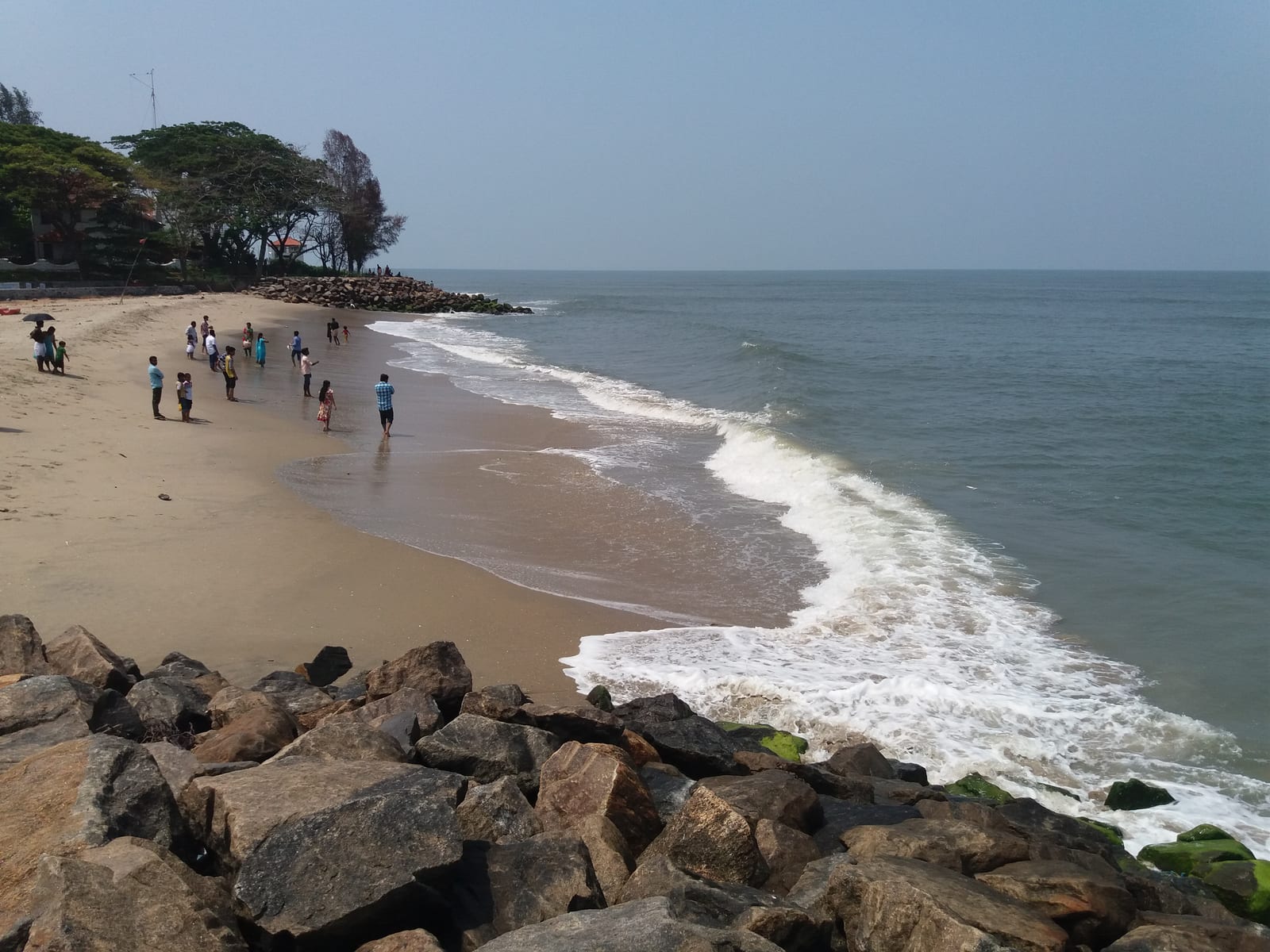
Public seafront beside the Chinese fishing nets — a walking-and-sunset beach, not a swimming beach.
4.2 km · straight line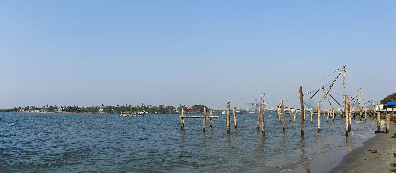
Kochi’s iconic cantilevered shore-operated fishing nets along the Fort Kochi seafront at Vasco da Gama Square, best photographed at sunset.
4.3 km · straight line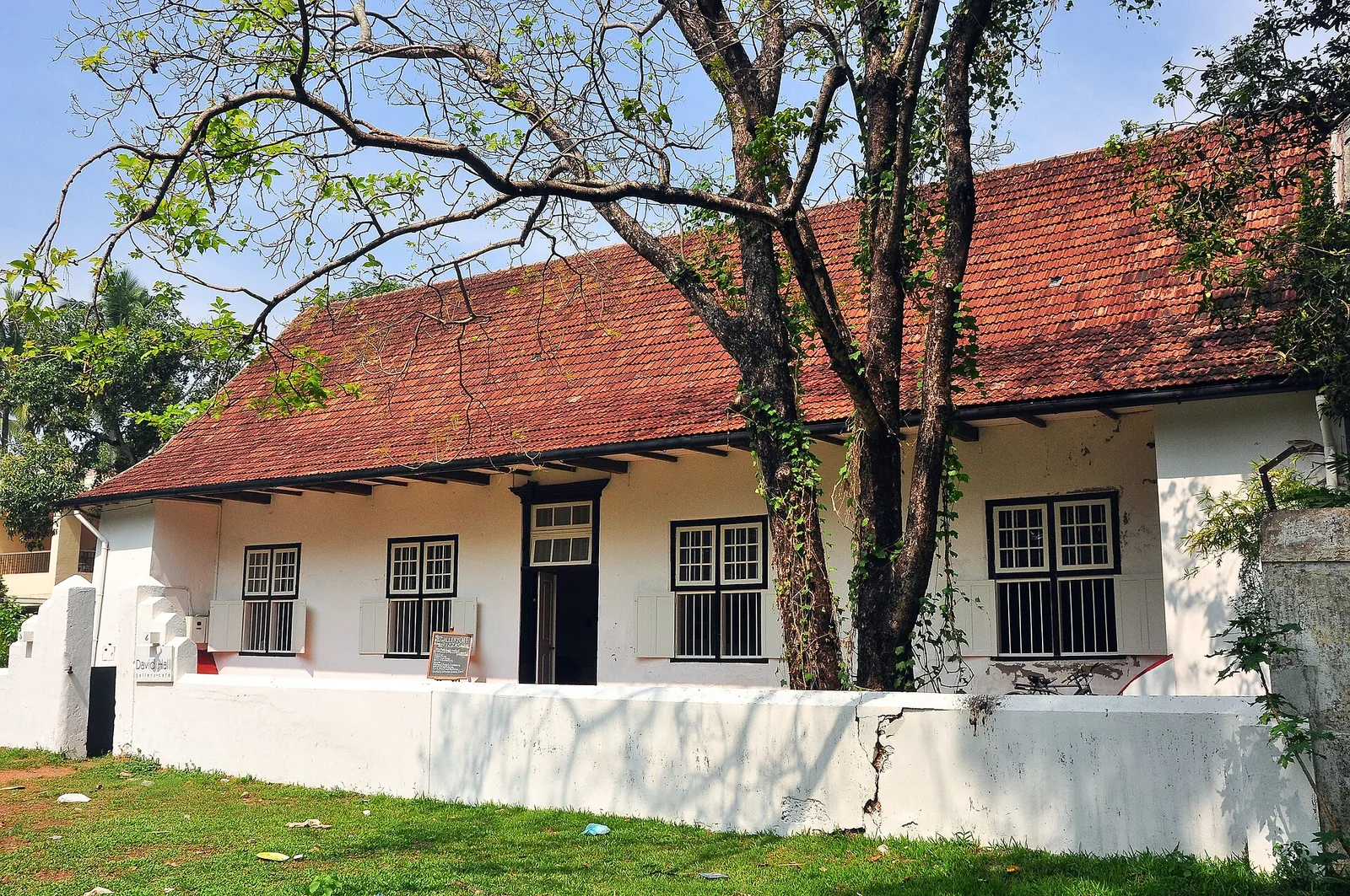
A restored 17th-century Dutch bungalow on the Fort Kochi parade ground, now a contemporary art gallery and cafe.
4.4 km · straight line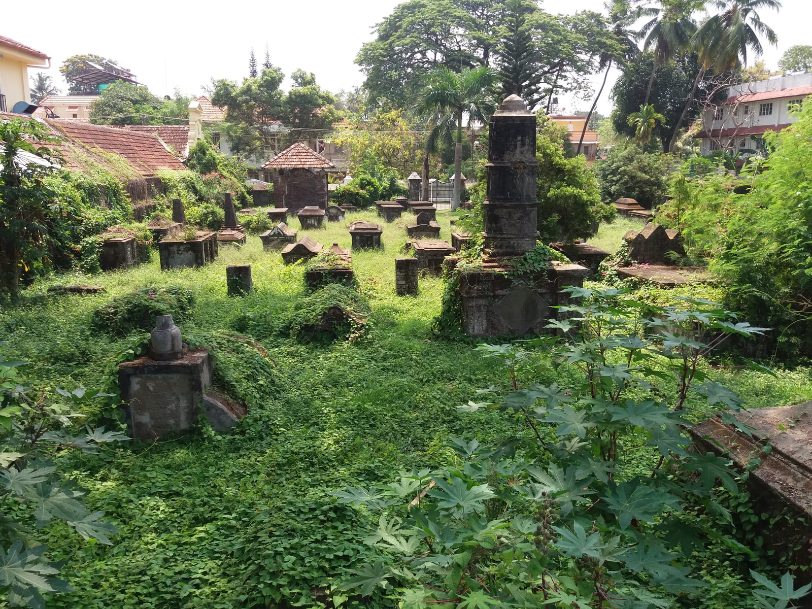
The 1724 burial ground of Kochi’s Dutch colonial officials and merchants, beside St Francis Church — ASI-protected, and usually locked.
4.4 km · straight line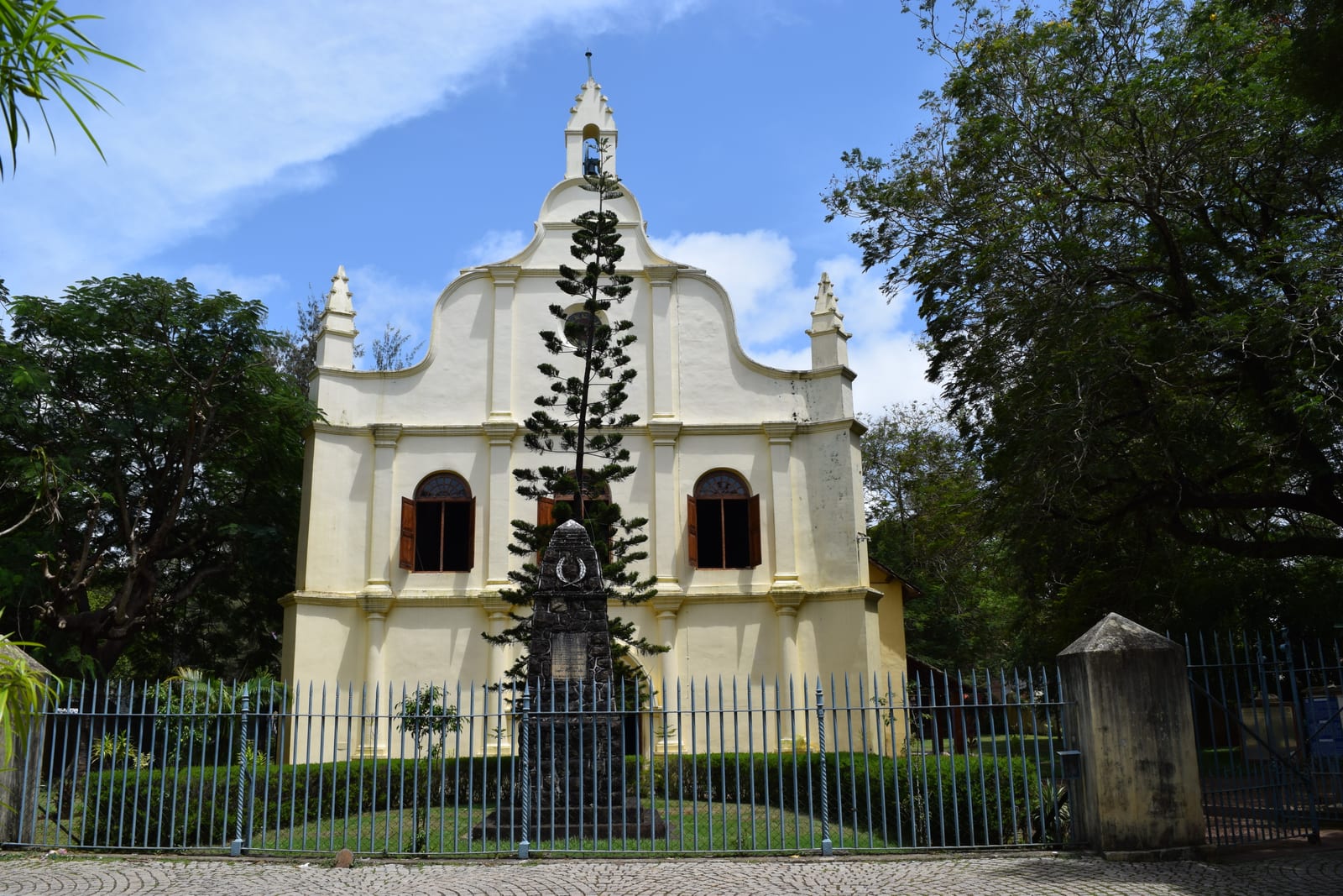
Believed to be the oldest European church in India (1503); Vasco da Gama was buried here before his remains were moved to Lisbon.
4.4 km · straight line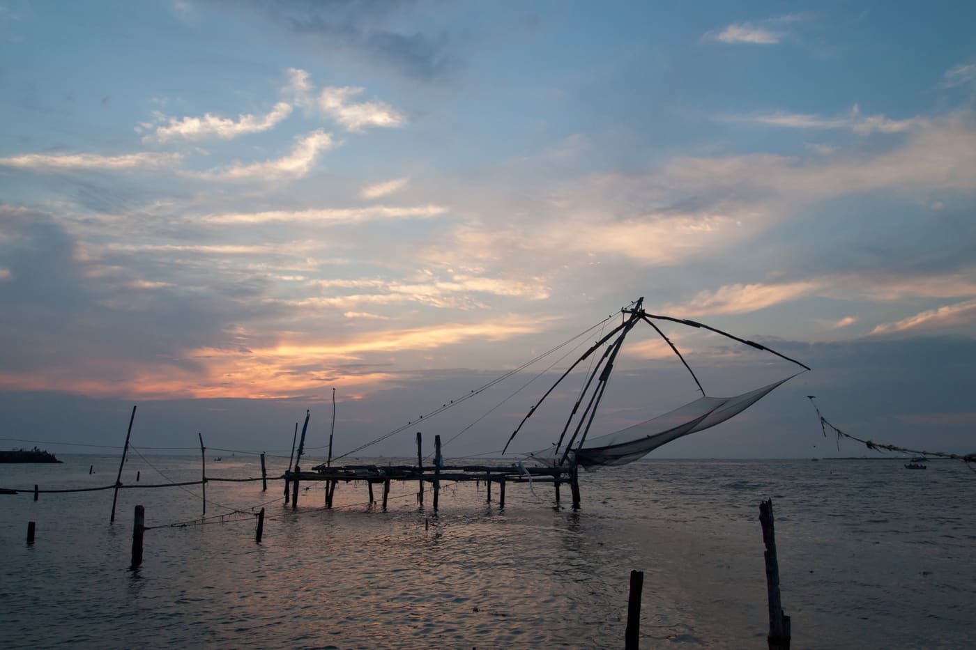
Kerala’s most walkable heritage quarter, with Chinese fishing nets, colonial churches, art cafes and Mattancherry nearby.
4.4 km · straight line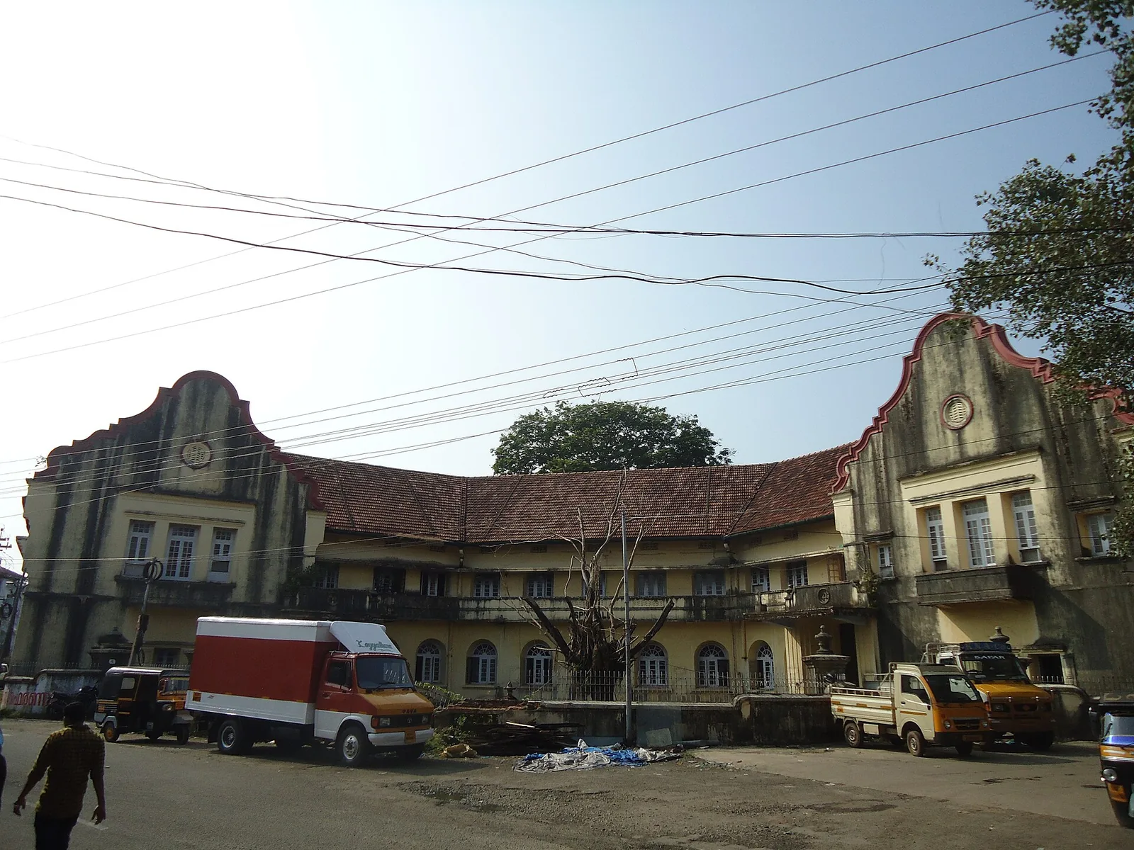
A large 19th-century waterfront trading compound in Fort Kochi, the principal venue of the Kochi-Muziris Biennale.
4.5 km · straight line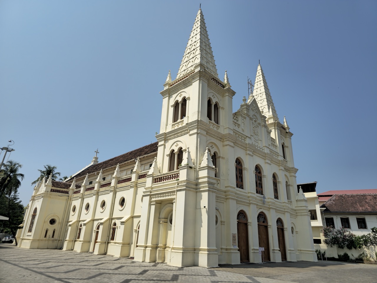
One of the finest churches in Kerala, with a richly painted interior, beside the Kerala Kathakali Centre in Fort Kochi.
4.6 km · straight line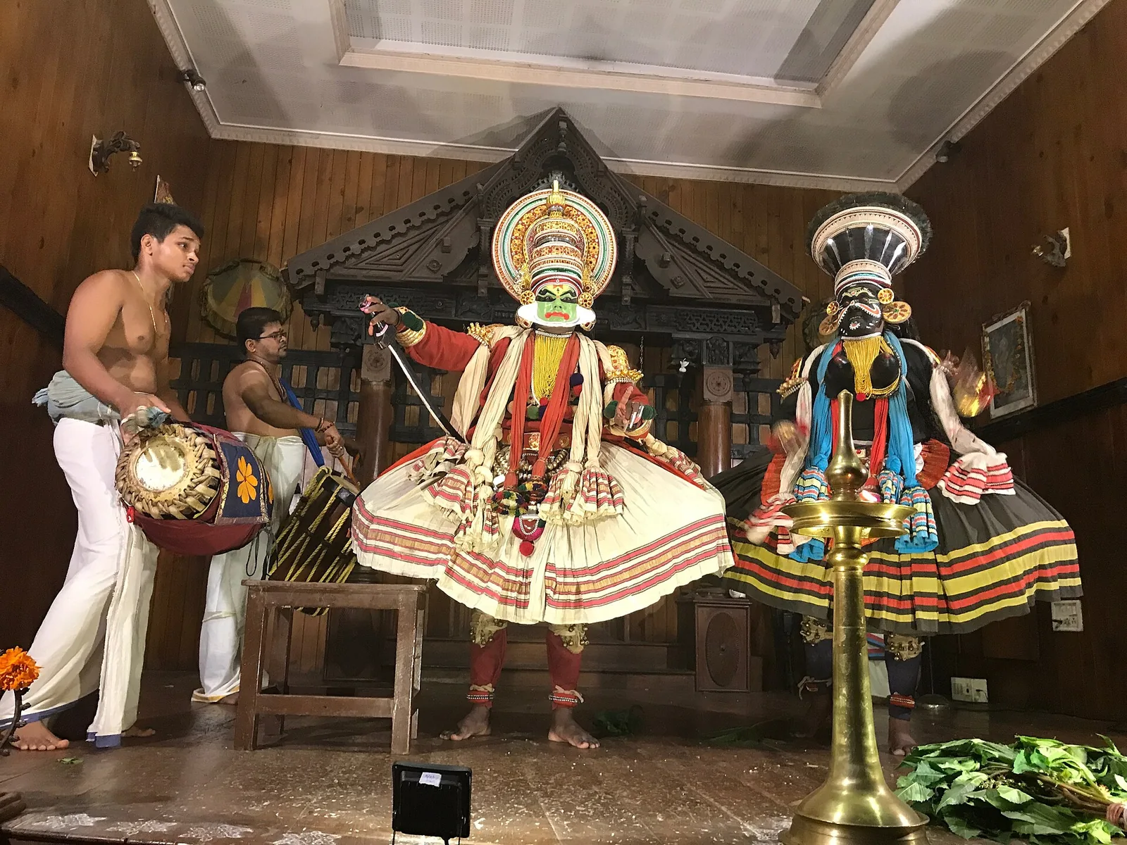
Evening Kathakali and Kerala classical-art performances in Fort Kochi, with make-up shown before the show.
4.7 km · straight line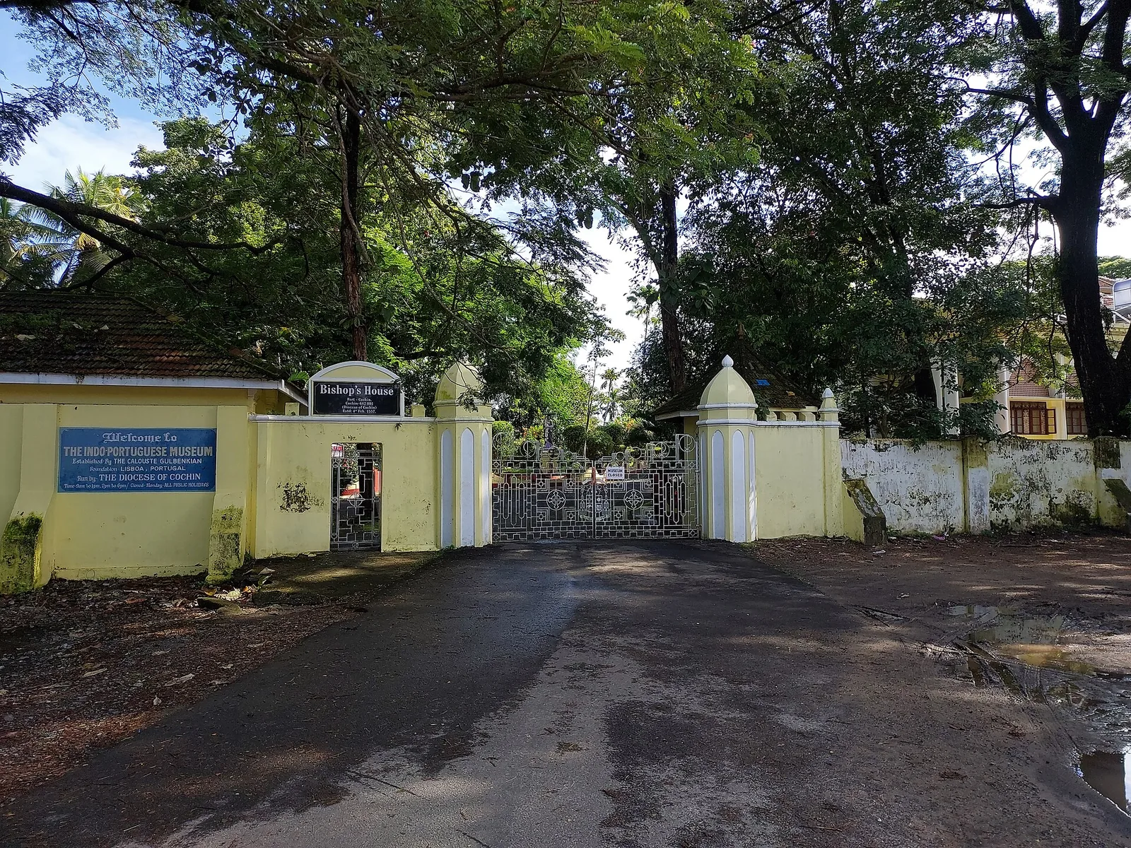
Museum of Kerala’s Indo-Portuguese Catholic heritage in the Bishop’s House garden, Fort Kochi.
4.7 km · straight line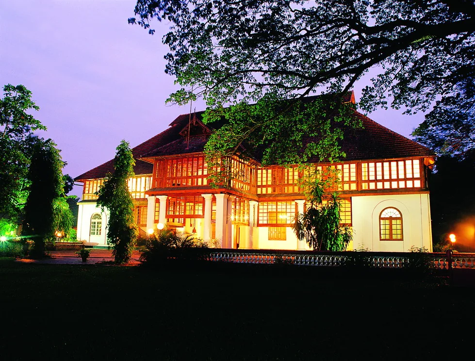
A 1744 Dutch palace on Bolgatty Island, one of the oldest existing Dutch palaces outside the Netherlands, set in island gardens (now a KTDC heritage hotel).
5.5 km · straight line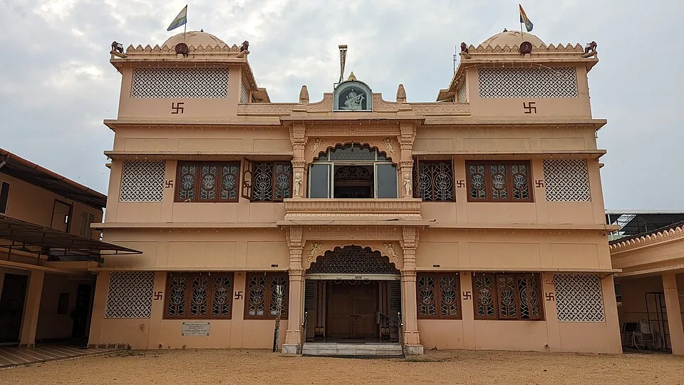
An ornate Jain temple in Mattancherry’s Gujarati quarter, raised in 1904 by Hirubai in memory of her husband Jivraj Dhanji and dedicated to Dharmanatha, the fifteenth Tirthankara — known for its white marble work and the daily midday feeding of the pigeons outside.
5.7 km · straight lineRoad and walking figures are route estimates, with travel times dependent on access, traffic and conditions. Figures marked “straight line” show direct separation and do not describe a road or walking route. Fare estimates use Kerala’s 26 April 2022 auto/taxi notification and exclude waiting, night and applicable one-way surcharges. Confirm the current meter or operator quote before travelling. Routing: © openrouteservice.org by HeiGIT | Map data © OpenStreetMap contributors
Nearby toilets, pharmacies, ATMs, seating and vets are community-mapped and may be incomplete or out of date. Map data © OpenStreetMap contributors | Walking times © openrouteservice.org by HeiGIT
Forty-six metres, on an octagonal plan in double-layered concrete, with the focal plane at forty-nine metres and a beam visible about twenty-eight nautical miles — roughly fifty-two kilometres. It is the tallest lighthouse in Kerala and it is open to visitors, with a lift for most of the height and a final flight of stairs to the gallery. Its characteristic is four white flashes every twenty seconds.
Because Fort Kochi ran out of room. The light began there in 1839 as an oil lamp and was upgraded repeatedly — new reflecting gear in 1902, modifications in 1914, a ten-metre tower in the 1920s, a twenty-five-metre steel structure with gaslight in 1936. There was no land left to build the taller, stronger tower the port needed, so it moved across the harbour mouth to Puthuvype, where the present light started work on 15 November 1979.
The new Vypin — puthu meaning new. It refers to the tradition that Vypin island was thrown up by a catastrophic Periyar flood dated to 1341, which silted the ancient port of Muziris out of existence and opened the estuary that became Kochi harbour. The island kept a calendar to match: the Puthuvype era, the Era of the New Deposit, counts its years from 1341.
Treat it with caution. The shore sits right by the harbour mouth, where river current meets the sea, and there are generally no lifeguards on duty. Many visitors paddle at the edge but avoid going deep; strong or inexperienced swimmers especially should stay in the shallows, and waves can build during the monsoon.
Yes, on days it is open to visitors. There is a lift for most of the height plus a short climb to the viewing gallery. Opening days, timings and fees are set by the lighthouse authority and do change, so confirm locally before planning your visit around it.
Reported timings are roughly 10am to 1pm and 2pm to 6pm, usually closed on Mondays, with a small entry fee of about ₹10–20 per person and a separate small charge for cameras — cash only, and often a short time limit inside.
No — the beach is open and free to enter. Any fee applies only to the lighthouse gallery, not the shore.
Drive from Kochi city across the Goshree bridges onto Vypin Island and continue to the island’s tip, or take the ferry across from Fort Kochi to Vypin and then a short local hop to Puthuvype. It lies near the far southern end of Vypin, by the harbour mouth.
Late afternoon into sunset is ideal for the light, the sea breeze and the evening crowd. October to March is the most comfortable season overall; the monsoon months bring rain and rougher water.
November to February for dry weather; avoid rough-sea days during monsoon warnings.
Entry: No charge to enter the beach. The lighthouse gallery has a small fee of about ₹10–20 per person with an extra small charge for cameras, cash only. Timings: The beach is open through the day and there is no gate; late afternoon to sunset is the pleasantest window. The lighthouse gallery keeps separate hours — reported as roughly 10am–1pm and 2pm–6pm, usually closed Mondays.
Base yourself in Cherai and Vypin or a nearby town in Ernakulam, then confirm the last-mile route locally before leaving. Arrive before sunset if you want photos and a calmer walk; beach roads can slow down in the evening. If the visit depends on forest, temple, boat, ferry, weather or seasonal access, check the official/local rule on the day before travel.
1 to 3 hours, longer if staying for food or sunset.
Nearby you can pair Fort Kochi Beach (4.2 km, approximate straight-line separation), Chinese Fishing Nets (4.3 km, approximate straight-line separation), David Hall Art Gallery (4.4 km, approximate straight-line separation), Dutch Cemetery (4.4 km, approximate straight-line separation).
Do not swim during rough-sea warnings. Avoid isolated stretches after dark unless with a trusted local/operator.
Written about Puthuvype Beach itself — its history, its legends and the arguments about them.
These guides explore Cherai and Vypin and the surrounding area. Choose a visit that fits your interests, allowing separately for travel between stops.


Route-level itineraries and practical guides for the rest of Kerala.
Photographs: Nandukrishna_t_ajith (CC0), Vijayanrajapuram (CC BY-SA 4.0), Ranjithsiji (CC BY-SA 4.0), Gannu03 (CC BY-SA 4.0). Wikimedia Commons.