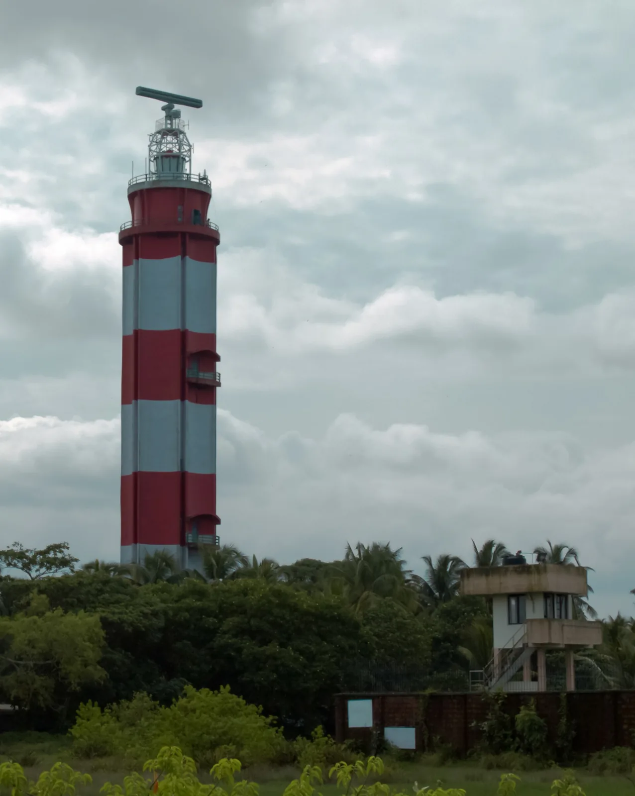
The single best reason to make the short crossing to Puthuvype beach is standing right behind it: a 46-metre double-shell concrete tower, the tallest lighthouse in Kerala, throwing a beam that carries 28 nautical miles out into the Arabian Sea. You can go up it. Almost nobody does.
A light that kept moving
The tower is from 1979 but the light is much older, and its history is a small chronicle of how marine technology arrived on this coast. It began in 1839 as an oil-fuelled lamp at Fort Kochi, on the other side of the harbour mouth. In 1902 a new light and reflecting mechanism were installed. Further modifications followed in 1914. In the 1920s a ten-metre tower went up; in 1936 that was replaced by a twenty-five-metre steel tower carrying a gaslight.
Then, in 1979, the whole thing crossed the water. The light was re-established at Puthuvype in the concrete tower that stands today — taller than everything that came before it put together, in a material none of its predecessors used. A hundred and forty years of incremental improvement, and then one decisive move to the other side of the channel.
- Height: 46 m (151 ft) — the tallest lighthouse in Kerala.
- Construction: double-layered concrete.
- Range: the beam is visible at 28 nautical miles (about 52 km).
- Lineage: oil lamp at Fort Kochi, 1839 → new optic 1902 → 1914 modifications → 10 m tower in the 1920s → 25 m steel tower with gaslight, 1936 → Puthuvype, 1979.
Going up
It is open to visitors — daily except Mondays, generally 10am to 1pm and 2pm to 6pm, so it keeps a lunch break and you should plan around it. Confirm on the day; lighthouse access in India is administered by the Directorate General of Lighthouses and Lightships and hours are subject to change without much notice.
What you get from the gallery is the view that explains the whole geography of Kochi in one turn: the Arabian Sea to the west, the harbour mouth and Fort Kochi to the south, Vembanad Lake and the backwaters inland, and the long thin line of Vypin running north towards Cherai and Munambam. If you have spent two days trying to work out how the islands, the lake and the sea fit together, ten minutes up here will do it.
The beach below
Puthuvype beach itself is wide, quiet and largely undeveloped — a very different proposition from Cherai up the coast. That emptiness is the appeal and also the warning: there are no lifeguards, no shacks and no crowd to notice if something goes wrong, and the shoreline here is actively eroding, with sea defences in place along parts of it. Treat it as a walking and watching beach.
It rewards that. The strand attracts waders and shorebirds — Eurasian curlews among them — and the sunsets are the equal of anywhere in Kochi with a fraction of the audience.
Getting there
Puthuvype is at the southern end of Vypin, which makes it the closest part of the island to Fort Kochi and the easiest to reach: the Vypin ferry from Fort Kochi crosses in a few minutes, and the Goshree bridges connect the island to Ernakulam by road. Pair it with Fort Kochi rather than with Cherai — it is on the wrong end of the island for a Cherai day.
Frequently asked questions
How tall is the lighthouse at Puthuvype?
46 metres (151 feet), which makes it the tallest lighthouse in Kerala. It is built of double-layered concrete and its beam is visible at 28 nautical miles, roughly 52 km.
Can you climb the Vypin lighthouse?
Yes — it is open to visitors, generally daily except Mondays, from about 10am to 1pm and 2pm to 6pm. Hours are set by the lighthouse authority and can change, so confirm locally before making a special trip.
How old is the Puthuvype lighthouse?
The tower dates from 1979, but the light it continues began in 1839 as an oil lamp at Fort Kochi across the harbour. It was upgraded in 1902 and 1914, given a 10-metre tower in the 1920s and a 25-metre steel tower with a gaslight in 1936, before moving to Puthuvype in 1979.
Is Puthuvype beach good for swimming?
It is best treated as a walking and watching beach. It is wide, quiet and largely undeveloped, with no lifeguards and no facilities, and the shoreline is actively eroding with sea defences along parts of it. For swimming on this coast, Cherai is the beach.
What is the view from the top of the lighthouse?
The clearest single explanation of Kochi’s geography you will get: the Arabian Sea west, the harbour mouth and Fort Kochi south, Vembanad Lake and the backwaters inland, and the length of Vypin island running north towards Cherai and Munambam.
How do I get to Puthuvype from Fort Kochi?
Puthuvype is at the southern tip of Vypin, directly across the harbour mouth from Fort Kochi. The Vypin ferry crosses in a few minutes and is the easiest way; by road, the Goshree bridges connect the island to Ernakulam. It pairs naturally with a Fort Kochi day rather than a Cherai one.