Vypin is a barrier island about twenty-seven kilometres long and rarely more than two and a half wide, hung between the Arabian Sea and the Kochi backwaters, and it is one of the most crowded pieces of ground in India. Six gram panchayats sit end to end along it — Pallippuram, Kuzhuppilly, Edavanakkad, Nayarambalam, Njarakkal and Elamkunnapuzha — and the whole strip is younger than the Malayalam calendar it is dated by. Travellers come for Cherai’s sand and leave without noticing that they have crossed a village every two kilometres. That is the island worth reading: a place with its own era, its own reform history, a temple whose founding legend hands the discovery of a god to an untouchable woman, and the memory of the worst liquor poisoning in Kerala’s history.
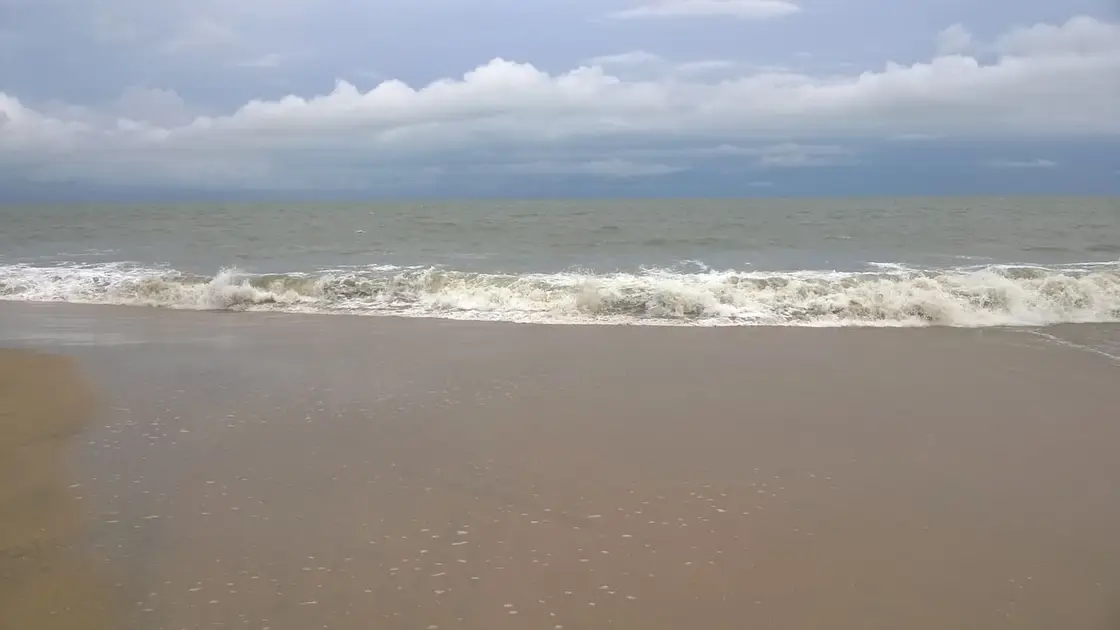
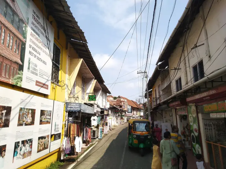
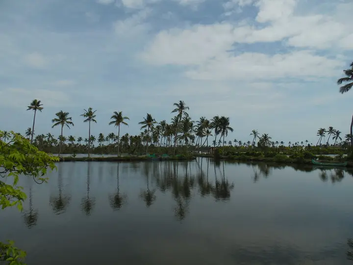
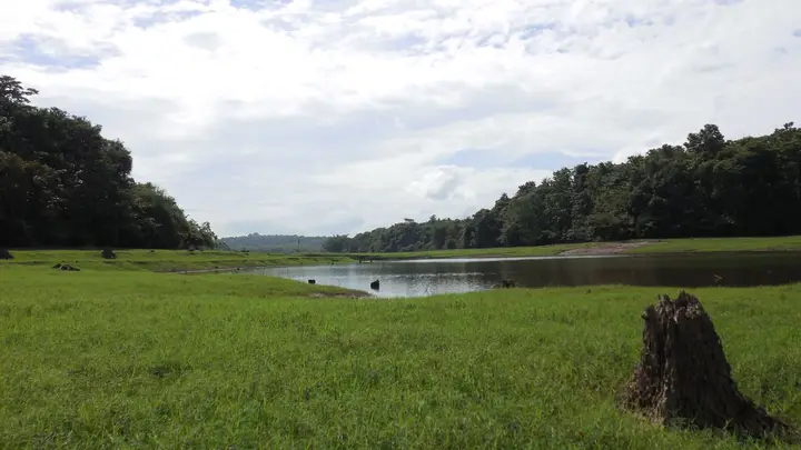
Start with the shape, because everything else follows from it. Vypin runs roughly twenty-seven kilometres north to south with an average width of about two and a half kilometres, sea on one side and backwater on the other, which means no point on the island is much more than a kilometre from water. There is one road down the spine and the settlements are strung along it without a break. You do not arrive in a town on Vypin. You pass through six of them and only the boards tell you which.
The population figures are worth handling carefully, because the ones in circulation do not agree and one of them is arithmetically odd. English Wikipedia’s list of islands by population density gives Vypin 198,400 people on 27 km², a density of 7,348 per square kilometre, on a page that carries its own warning that it needs better citations. Malayalam Wikipedia gives 181,789 people on 64.87 km². Those two areas cannot both be right for the same island, and the second is the one the geometry supports: twenty-seven kilometres of length by about two and a half of width comes to something near sixty-five square kilometres, not twenty-seven. The 27 looks very much like the island’s length used by mistake as its area. On the larger and more plausible figure the density is closer to 2,800 per square kilometre — still extraordinary for rural coastal land, still among the densest inhabited islands anywhere, and about a third of the number usually printed. We would rather give you the working than the confident wrong answer.
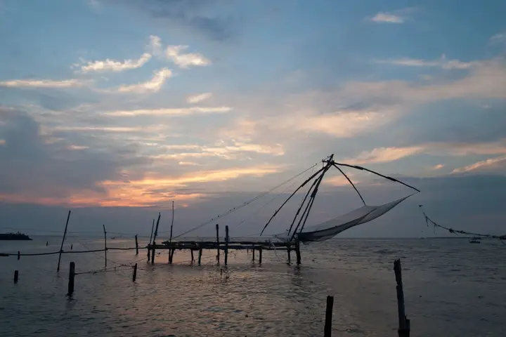
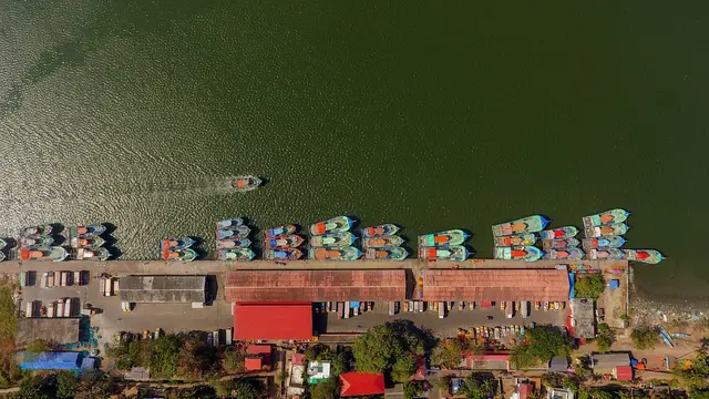
What that density looks like on the ground is a coastline with no gaps. Njarakkal, roughly in the middle, is the island’s commercial centre and one of its most crowded stretches; it is also where the Agency for Development of Aquaculture Kerala runs a fish farm, given as 18.4 hectares in the agency’s own listing and described in press coverage as about thirty-six acres of ponds near Arattuvazhi, raising karimeen — the pearl spot, Kerala’s state fish — alongside milkfish. Those two figures do not match either; 18.4 hectares is about forty-five acres. It is open as an aqua-tourism site and it is the easiest place on Vypin to see the backwater side working rather than posing.
The island’s religious map is unusually legible because everything on it arrived within recorded memory. At Elamkunnapuzha, towards the southern end, stands a Subrahmanya temple described in the record as pre-fifteenth century, notable for its wood carving, its two-storeyed dwitala vimana on a square plan and walls carrying a large body of mural painting in natural pigments. Its principal image is a chathurbahu, four-armed, and unusually it is made in two materials: stone above, panchaloham — the traditional five-metal alloy — below.
At Cherai the Gowreeswara temple is barely a century old and is the island’s biggest public event. It was built in 1912 and its image was consecrated by Sree Narayana Guru, the reformer whose movement gave the Ezhava community temples of its own at a time when it was excluded from others. Temple sources give the consecration as Kollavarsham 1087, Makaram 9, on the Avittam asterism, and record that the Guru installed Subrahmanya first and then Ganapati to the south, Parvati to the north and Parameswara to the west. The annual festival falls across late January and early February and is described in Malayalam sources as the largest temple festival in the district, with an elephant pageant — thirty caparisoned elephants is the figure usually given — and panchavadyam, kathakali and ottanthullal through the nights.
Two claims attached to that temple should be attributed rather than asserted. It is popularly called Malayala Pazhani, the Pazhani of Malayalam country, after the great Murugan hill shrine in Tamil Nadu, and it is advertised as having a sreekovil with doors on all four sides, said to be the only one in Asia. Both come from temple and pilgrimage sites rather than from any scholarly source; the English Wikipedia entry is a stub and carries neither. Treat the four-door claim as local pride until someone documents it.
The Christian and Muslim island is just as old. At Fort Vypin, on the southern tip, the Church of Our Lady of Hope was founded in 1605 and consecrated by Bishop Dom Andrea de Santa Maria — a Latin Catholic parish whose patron is the protector of fishermen and navigators and whose emblem is an anchor, which on this island is not decoration. At Cherai, St Mary’s Orthodox Syrian Church dates itself to April 1802, established with the sanction of Shakthan Thampuran. Nayarambalam has its Juma Masjid and its Bhagavathy temple within a few hundred metres of each other, which is the ordinary condition of a Vypin village rather than anything remarkable.
And then the island’s modern connection, which closes a circle. Until 2004 Vypin was reached by boat; the Goshree bridges ended that, and we tell that story separately. What is newer is that the boat came back as infrastructure. The Kochi Water Metro’s first passenger route was Vypin to High Court, and it began service on 26 April 2023 — air-conditioned catamarans of fifty or a hundred seats running on lithium titanate batteries that charge in ten to fifteen minutes, at about fifteen kilometres an hour, for twenty to forty rupees a trip or six hundred a month. By 22 September 2025 the system had carried more than five million passengers. An island that spent six centuries dependent on ferries, then twenty years driving over bridges, now has the most advanced commuter boat in the country arriving at the same jetty.
Legend & myth
The founding legend of this island belongs to the temple at Elamkunnapuzha, and it is one of the strangest in Kerala because of who it makes the discoverer. The story starts not here but at Tiruchendur on the Tamil coast, at the great Murugan temple by the sea. An image from there, the tradition says, was put into the ocean, and it floated — upside down — until it came ashore in a village then called Elakunnappuzha. There it lay half sunk in the mud and nobody knew what it was.
A Pulaya woman came to the water and used the exposed part of the stone to sharpen her sickle. Blood came out of it. She fell into a trance, and speaking from that trance she said that the power in the image had not been fully withdrawn, and that it must be installed somewhere fit for it. To find the place, five arrows were shot. Four could be pulled out of the ground where they fell. The fifth could not, and the temple was built where the fifth arrow stuck.
Read that carefully, because two of its parts are doing quite different work. The arrow-siting is a standard device — Indian foundation legends across the subcontinent settle a temple’s position by an object that refuses to be moved, and it tells you the site was chosen and then explained rather than the other way round. The sharpening of a blade on a buried god, on the other hand, is not a stock motif. It is a specific, physical, slightly shocking image, and the detail that survives is the blood on a working woman’s sickle.
The identity of that woman is the part worth sitting with. She is a Pulaya — of a community that within living memory could not approach a temple, let alone consecrate one — and the legend gives her the discovery, the trance and the instruction. It is not an argument against caste; legends of this kind are usually old settlements of a much messier reality, and one should be careful about reading modern politics backwards into them. But it is an odd inheritance for an island where, in 1917, seating Pulayas at a meal was the most scandalous thing a man could do. Sahodaran Ayyappan was born at Cherai in 1889, a few kilometres up the same road, and when he did exactly that, the retaliation recorded in the Malayalam sources was that cow dung water was poured over his head at a temple. The island had told itself a story in which an untouchable woman found the god, and then poured filth on the man who acted as though she might sit down to eat.
The second thing this island owns is a calendar, and it is the only piece of the 1341 flood that our other pages have not already used. Vypin does not merely have a traditional birth date; it has an era counted from it — the Puthuvaippu era, the Era of the New Deposit, whose year one is 1341 CE. That is Kollavarsham 516: the Malayalam era begins in 825 CE, and 825 plus 516 lands exactly on 1341, which is the sort of arithmetic worth doing yourself rather than taking on trust. Documents in old Kochi were dated by it. An island with its own year zero is a rare thing, and it means the ground here is one of very few landscapes anywhere that is younger than the paperwork describing it.
It also means the evidence is thinner than the confidence. No direct historical account of the 1341 flood survives. What exists is the era itself, sediment work on Vypin and the Fort Kochi shore, and the Pattanam excavations in the Kodungallur–North Paravur belt; the scholarship describes a possible extreme weather event, most likely a deluge, rather than a documented night. So the honest position is that the calendar is the primary evidence for the flood, and the flood is the usual explanation for the calendar. That is not circular in a fatal way — a community does not start a new era over nothing — but it is not a dated eyewitness either, and the single-night, one-catastrophe version told on every signboard is reasoned backwards from a year number. The geology of it belongs to our beach records; the year belongs here.
The Christian island has its own arrival-by-water story. At the Church of Our Lady of Hope at Fort Vypin there is a figure of the Ecce Homo, six feet tall, carved from a single piece of rosewood and kept for more than four hundred years. Church tradition holds it was given by the captain of a Portuguese vessel that was passing on its way to Macau. It is venerated on the fourth Sunday of Lent. Whether or not a Macau-bound captain is the literal history, the shape of the claim is the same as the temple’s: the sacred object came off a boat.
So does the third. The Sree Varaha temple at Azheekkal was founded by Gowda Saraswat Brahmins who had fled Portuguese persecution in Goa and settled on Vypin — a family of the Kastoori name, the account says, installing their household deities Varahamoorthy, Devaki and Krishnamoorthy. Kerala Tourism dates the founding to 1565 CE; Malayalam Wikipedia gives the Azhikkal Varaha Devasthanam as 1869; the temple’s own history says the original was dismantled after severe flood erosion, moved inland near Pallipuram, and reconsecrated in 1880. The three dates are probably describing a founding, a relocation and a reinstallation rather than contradicting each other outright, but nobody states which is which, and we are not going to pretend to know. The claim that it is the sampoorna kshetram, the only complete temple of its type in South India, comes from the community’s own sources and should be read that way.
One legend that gets pulled onto this island does not belong to it. Stand at the northern tip and the green shore across the water is Kodungallur, and with it comes the tale of the Chera king who watched the moon split and sailed to Arabia. It is a good story and it is not Vypin’s — it belongs to the far bank, and we tell it on our Munambam harbour page. Vypin’s own legends are all smaller and all the same shape: something floated here, and people built around it. On ground that itself floated into place in 1341, that is about right.
More about Cherai and Vypin
History
1341 — the traditional year one. The Puthuvaippu era, the Era of the New Deposit, counts from this date, equivalent to Kollavarsham 516, and is the principal evidence that the island was thrown up by a Periyar flood. English and Malayalam sources also circulate 1331 and 1343 for the island taking its present shape; 1341 is the figure the calendar itself supports and the one we use.
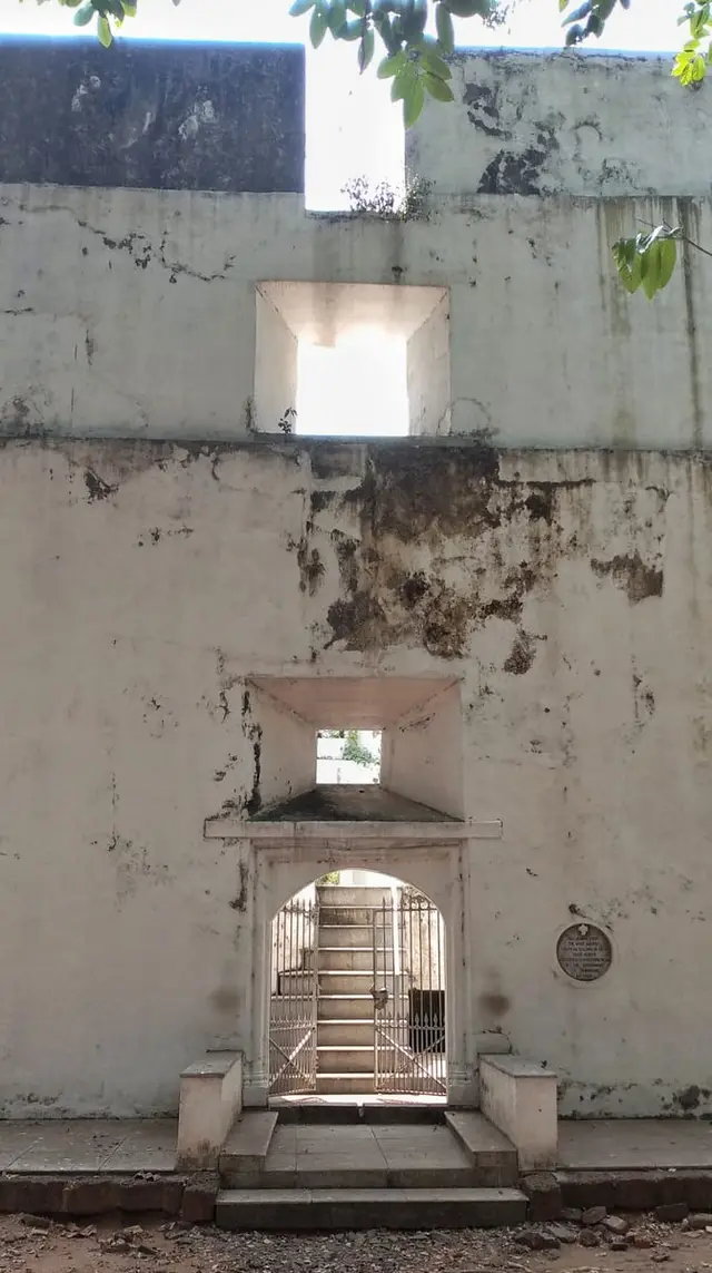
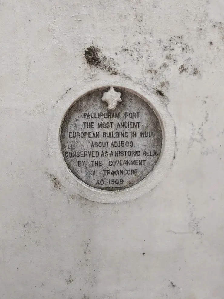
1503–1605 — the European century. The Portuguese fortify the northern tip in 1503 (told in full on our Pallipuram Fort page) and bring the Latin Catholic church to the island; the Church of Our Lady of Hope at Fort Vypin is founded in 1605 and consecrated by Bishop Dom Andrea de Santa Maria. Sixteenth-century Gowda Saraswat Brahmin families, driven out of Goa, settle around Azheekkal and build the Varaha temple there. Until the Portuguese arrived the island is described as thinly settled by a fishing community; the growth of a dense population on Vypin is a colonial-era and post-colonial development, not an ancient one.
1802–1912 — the island acquires its institutions. St Mary’s Orthodox Syrian Church at Cherai is established in April 1802 under Shakthan Thampuran’s sanction. In 1912 the Gowreeswara temple is built at Cherai and its image consecrated by Sree Narayana Guru — an SNDP-era temple, built by and for a community that was barred from others, and now the site of the district’s largest temple festival.
1917 — the misra bhojanam. Sahodaran Ayyappan, born at Cherai on 21 August 1889 into an Ezhava family of ayurvedic physicians, organises an inter-caste meal at Cherai. Sources give the date as 29 May 1917 (Malayalam Wikipedia) or 30 May 1917 (English Wikipedia); around two hundred people attend, including Pulayas, then regarded as untouchable. English Wikipedia places it at the house of his nephew Raman Pillai; Malayalam Wikipedia names the location as Thundipparambu. The participants are expelled from the Vijnanodayini Sabha and socially boycotted, and cow dung water is thrown over Ayyappan at a temple. He is mocked as Pulaya Ayyappan and adopts the name. He founds the Sahodara Sangham the same year, runs the journal Sahodaran from Mattancherry until 1956, founds the rationalist magazine Yukthivadi in 1929, enters the Cochin Legislative Council in 1928 and holds the seat for twenty-one years, becomes a minister from 1947, and dies on 6 March 1968. His revision of Sree Narayana Guru’s motto — jathi venda, matham venda, daivam venda manushyanu, no caste, no religion, no God for mankind — is the sharpest sentence produced by the Kerala renaissance, and it was written on this island.
1982 — the hooch tragedy, and the darkest date on Vypin. At Onam, hundreds of people, most of them fish workers and labourers, drank liquor bought from government-licensed arrack shops on the island. It was contaminated with methanol, which doctors identified as the victims reached hospital. English-language sources give the death toll as seventy-seven; Malayalam Wikipedia gives seventy-eight. Sixty-three people were blinded, fifteen crippled, and around six hundred and fifty families reduced to destitution. It is the worst liquor poisoning in Kerala’s recorded history and it happened on the festival day. The English Wikipedia article on it carries a standing note that the investigation, prosecutions and long-term outcomes for the victims are still not documented there, and we could not source them either — a gap forty-odd years old, on an event this size, that is itself part of the story. The disaster entered Malayalam culture through John Abraham’s 1986 film Amma Ariyan and Subhash Chandran’s 2010 novel Manushyanu Oru Aamukham.
2004 and 2023 — the island connected twice. The Goshree bridges ended Vypin’s dependence on ferries in 2004, and the story of how is told in our Goshree guide. Nineteen years later the boat returned as modern transport: the Kochi Water Metro opened its first route, Vypin to High Court, on 26 April 2023, and by 22 September 2025 the system had carried over five million passengers.
Why visit
It is the only island in Kerala that dates itself by its own calendar era, counted from the year the ground is said to have appeared.
The Elamkunnapuzha Subrahmanya temple is a pre-fifteenth-century shrine with mural-covered walls, fine wood carving and a founding legend in which a Pulaya woman finds the god.
Cherai holds Sahodaran Ayyappan’s birth house and the sculpted wall commemorating the 1917 inter-caste meal that made him a national name in Kerala’s reform history.
The Gowreeswara temple festival in late January and early February is the district’s biggest, with an elephant pageant and nights of panchavadyam, kathakali and ottanthullal.
It is one of the most densely inhabited islands anywhere, and driving its single spine road through six panchayats without a break is a genuinely unusual experience of Kerala.
You can arrive by battery-powered catamaran on the Water Metro for twenty rupees, which is the best-value boat ride in India.