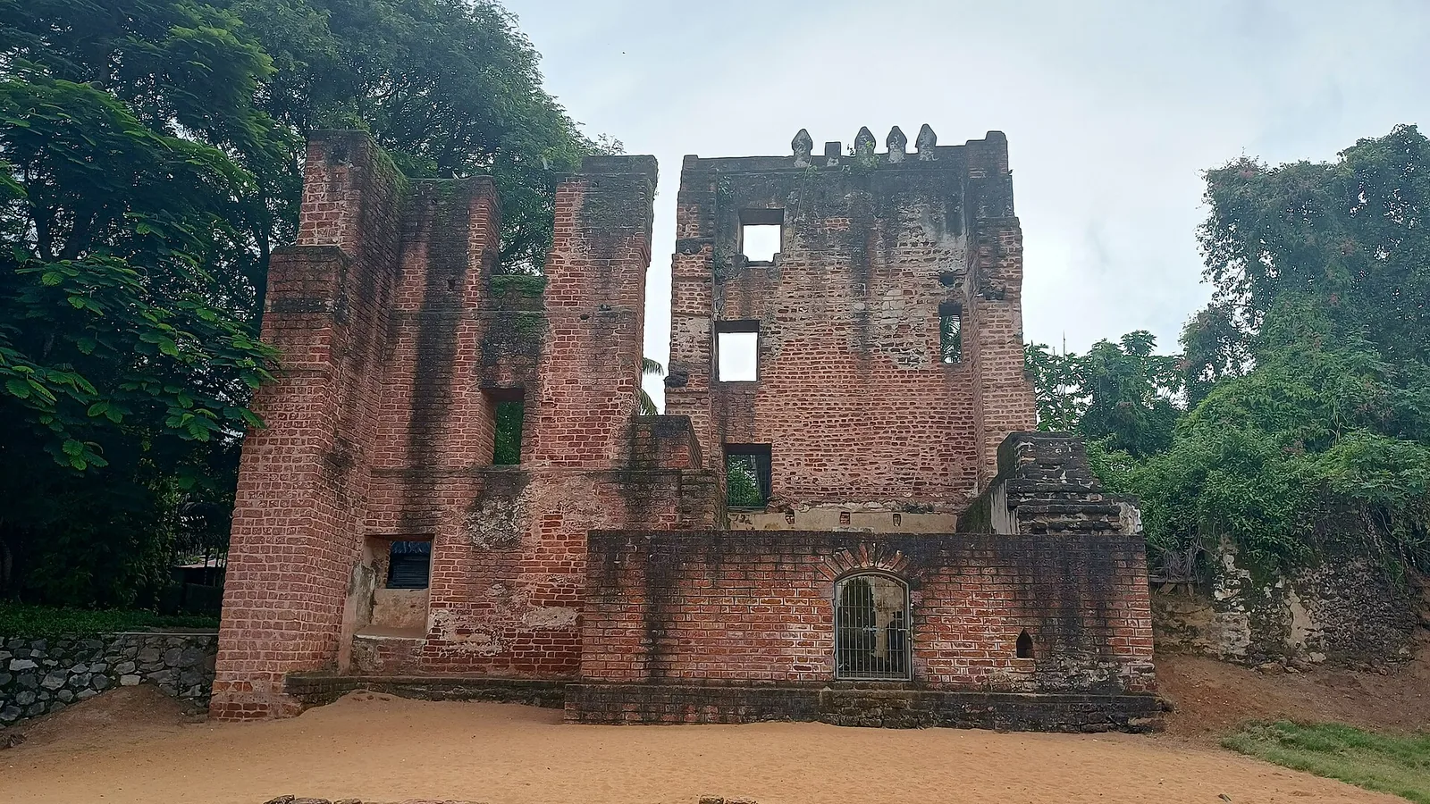
A few hundred metres from the lighthouse there is a low, broken run of masonry that every sign, every guidebook and every tourism page calls St Thomas Fort. What none of them can agree on is who built it, or when.
This is not a case of a folk memory contradicting the historians. It is a case of two departments of the Government of India publishing accounts that cannot both be right.
Account one: the Portuguese, in the 1510s
The standard story, carried by Kerala Tourism, by the ASI-adjacent literature and by most reference works, runs like this. The Portuguese reached this coast at the start of the sixteenth century and wanted the pepper. After coming to terms with the ruler of Kollam they raised a fortified trading post on the cape and named it for St Thomas. The Dutch took it in the mid-seventeenth century, and the British took it from the Dutch in 1795.
The trouble starts with the year of the foundation. You will find 1517 in print. You will find 1518. You will find 1519. These are not variant spellings of the same claim; they are three different years, each stated flatly, and each cited to sources that in turn cite each other.
We should own our part in this: our own pages have carried both 1518 and 1519, in different places, for some time. That is the ordinary way this kind of error propagates — nobody chose to disagree, everybody copied a different upstream page.
Account two: the Dutch, in 1665
Now read what the Directorate General of Lighthouses and Lightships publishes on its own station page for this lighthouse, which is the page a visitor is most likely to be handed at the gate. In full, verbatim:
- "In the 17th century Quilon was a separate principality. Its Raja gave trading rights and permission to Dutch to build a fort at Quilon in 1665."
That is the whole of the DGLL's pre-British history of this place. There is no Portuguese in it. The fort is not taken from anybody; it is built, by the Dutch, by permission, in 1665 — around a century and a half after the date the tourism literature gives for its construction, and four years after the year the same literature gives for the Dutch capture of it.
Two publications of the same government, describing the same ruin, a few hundred metres apart on the same cape.
What is probably going on
The likeliest reconciliation — and we want to be clear that this is a reading rather than a finding — is that both are describing real events and each has dropped the other's half. A Portuguese foundation, substantially rebuilt or formally re-established by the Dutch under a treaty with the Kollam ruler in the 1660s, would produce exactly this pair of accounts if each source knew only one phase of the work.
That is plausible. It is not evidence. What would settle it is a Dutch East India Company record or an archaeological report on the fabric of the surviving walls, and we have not found either in a form we can cite. So the honest position is that the date of St Thomas Fort is unresolved, and this page is not going to pick a year in order to look tidier than the sources.
The cemetery has the same problem, in reverse
Walk from the fort to the graveyard and the confusion inverts.
Everyone in Kollam calls it the Dutch cemetery. Photographs are captioned that way, directions are given that way, and the Dutch association is the first thing a visitor is told. But the monument has been centrally protected by the Archaeological Survey of India since 1920, and the ASI's name for it is the Portuguese Cemetery.
Both usages are defensible. A burial ground begun under one empire and filled under the next belongs, in an obvious sense, to both. What is worth noticing is the direction of the drift: the popular name has moved towards the later occupier and the official name has stayed with the earlier one, which is precisely the opposite of what happened to the fort a few hundred metres away.
A footnote on the map
One more small thing, for anyone who goes looking at the old cartography. The seventeenth-century European plan of this port that circulates online is routinely described as a Dutch map of Quilon. Look at the title cartouche and it reads COVLÃO — the Portuguese form of the name, tilde and all.
It is a one-word reminder that the labels on this cape have been changing hands for five hundred years, and that most of what is written about it was copied by someone who did not look.
Frequently asked questions
When was St Thomas Fort built?
Genuinely unresolved. The tourism and reference literature dates it to a Portuguese foundation in the 1510s, but you will find 1517, 1518 and 1519 all stated as fact. The DGLL, a Government of India body, instead says the Raja of Quilon gave the Dutch permission to build a fort here in 1665 and does not mention the Portuguese at all. We are not picking a year.
Who held the fort, and when?
The broad sequence is not in dispute: a European trading post that passed to the Dutch in the mid-seventeenth century — usually given as 1658 or 1661 — and then to the British in 1795. It is the foundation date and the builder that the sources contradict each other on.
Is the graveyard Dutch or Portuguese?
Both names are in use. Locally and in almost all photographs it is the Dutch cemetery; the Archaeological Survey of India, which has protected it as a centrally protected monument since 1920, calls it the Portuguese Cemetery.
Is the fort protected?
The fort ruins and the cemetery at Thangassery are managed under the Archaeological Survey of India. What survives of the fort is fragmentary — low ramparts and stonework rather than a standing structure.
Why do so many sources disagree about this one small ruin?
Because the surviving fabric is fragmentary, because the site changed hands three times, and because most modern accounts are copied from other modern accounts rather than from records. The clearest single illustration is that two Government of India publications, on the same cape, describe the fort's origin in ways that cannot both be true.
