The reason a settlement of a temple and a scatter of houses is worth a page is where it sits. Achankovil stands at the head of a river that runs 128 kilometres west from here, through Kollam, Pathanamthitta and Alappuzha districts, to join the backwater system down on the coast. The same water passes Konni, and reaches the Onattukara country far downstream. You are at the top of a system that shapes three districts.
The source, and an honest caveat about it
The river is described as formed near here by the convergence of three streams — recorded as the Rishimala, the Pasukidamettu and the Ramakkaltheri — rising off Devarmalai in the Western Ghats.
We repeat that because it is what the sources say, and we flag it because of how they say it: the description recurs almost word for word across them, which usually means a single origin being repeated rather than several independent observations. We have no reason to doubt it and no independent confirmation of it. A reader should treat named tributaries in Ghats headwaters as approximate in general — these are small forest streams whose names and courses are recorded inconsistently, and precision in a printed list of them is often typographic rather than hydrological.
What the river does downstream
It is the feature that brought the Konni stretch onto the tourist map — the forests, the plantations and the elephant training centre there all sit on this water. Reed grows thickly along it on the Konni side. Further west it becomes part of the low, canal-threaded country of Alappuzha, where a river stops being a river in the hill sense and becomes one thread of a backwater system.
That whole range — forest headwater to backwater — happens inside one name and about a hundred and thirty kilometres, which is a fair description of what makes rivers on this side of the Ghats different from most rivers.
What you can actually see here
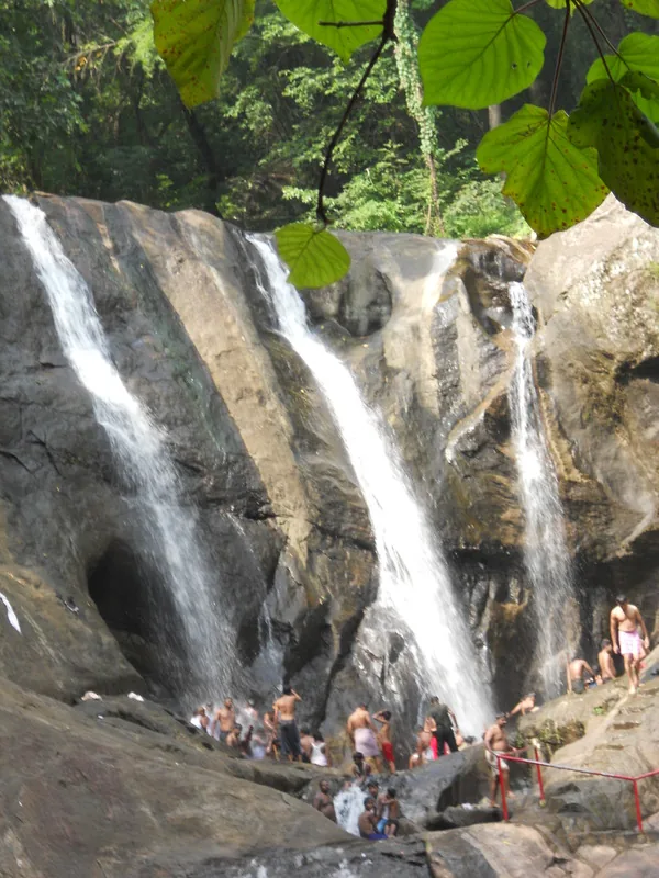
The forest, the shrine, and the water. There is no source monument, no viewpoint built for the purpose and no interpretation. The nearest thing to a set-piece on this river is Kumbhavurutty Waterfalls, downstream on the route to Konni. The rest is the honest offer of this place: the near-total absence of the built landscape that covers almost all of lowland Kerala.
Frequently asked questions
Where does the Achankovil river start?
Near the settlement of Achankovil in eastern Kollam district, from the convergence of three streams — recorded as the Rishimala, the Pasukidamettu and the Ramakkaltheri — rising off Devarmalai in the Western Ghats.
How long is the Achankovil river and where does it go?
About 128 km, flowing west through Kollam, Pathanamthitta and Alappuzha districts before joining the backwater system near the coast.
Is there a viewpoint at the source?
No. There is no source monument, viewpoint or interpretation at Achankovil. The nearest set-piece on the river is Kumbhavurutty Waterfalls, downstream on the road to Konni.