What to expect
Marudhanadhi Dam
An irrigation dam across the Maruthanathi river in the Athoor block of Dindigul district. It supplies water to farmland and sits amid hilly terrain near the Western Ghats foothills. It is a lesser-visited reservoir close to the Kamarajar Lake area.
M
Marudhanadhi Dam
Place
Practical guide
Plan Marudhanadhi Dam
Who's going?Tailor Marudhanadhi Dam to your trip
Typedam
Nearest baseAthoor
DistrictDindigul
Best timeOctober to March is the cooler, drier…
Time neededAbout an hour
EntryFree
Places to visit2→Marudhanadhi Dam is planned from Athoor, one of the travel bases in Dindigul district. Use Athoor for stays, food and local transport, then plan this place as a focused stop.
Getting there
How to visit
- Base yourself in Athoor or nearby in Dindigul, then confirm the last-mile route locally before travel.
- If access depends on temple, museum or seasonal rules, check on the day before you go.
Timing
Best time
October to March is the cooler, drier season in the Cauvery delta.
Weather in Marudhanadhi DamSeasonal guide
Live forecast loads in your browser.
Today at Marudhanadhi Dam
Sunrise6:08 am
Sunset6:02 pm
Golden hour best light5:02 pm–6:02 pm
Blue hour after sunset6:02 pm–6:27 pm
Sun sets toward compass bearingW · 261°
Moon tonight🌒 Waxing crescent · 24%
Retreating monsoon. October and November still see spells of rain from the retreating monsoon, though it is usually lighter than mid-year. Conditions are generally good but worth checking.
Sun and moon are calculated for this location and shown in IST. Photography windows are the hour around sunrise and sunset; the sunset bearing is degrees clockwise from true north. Moon phase is accurate to about half a day.
Stay · eat · do · rent · see · shop
Stays, food & things to do near Marudhanadhi Dam
Verified hotels, homestays, restaurants, experiences, sights, shops and rentals around Marudhanadhi Dam — commission-free, with direct contact. Filter by what you need.
Verified inventory is being added here.
Verified places are being added. The category filters will fill in as approved stays, restaurants, experiences, sights, shops and nature listings go live.
List your placeRanked guides
Top experiences around Athoor
One more place around Athoor worth a day of its own.
K
Kamarajar Lake
Place
damKamarajar Lake
13.3 km · ~22 min by cab
A roughly 400-acre monsoon-fed reservoir near Athoor, formed by the Kamarajar Sagar Dam and overlooked by the Western Ghats. A noted birdwatching spot, it hosts hundreds of bird species, with coracle fishermen and coconut, banana and cardamom estates along its shores. It is one of the most scenic water bodies in the district.
Roampedia is commission-free — own or know a stay, eatery, guide or shop near Marudhanadhi Dam? List it and it appears here once verified.
Add a nearby businessBefore you go
Marudhanadhi Dam — at a glance
TimingsDaylight hours (roughly 6:00 AM - 6:00 PM)
Best timeAugust to December (post-monsoon)
Entry: Free
Getting here
How to reach Marudhanadhi Dam
Athoor block ~25 km from Dindigul town; nearest railhead Kodaikanal Road (~25 km); Madurai Airport (IXM) ~90 km.
Getting around Marudhanadhi Dam
If you need step-free access, contact the site before travelling. Ask about a level entrance, steps along the route, the nearest drop-off point, seating and accessible toilets.
If you need help at Marudhanadhi Dam
112All emergencies (police · fire · medical)The single number to call in any emergency (ERSS).100Police101Fire108Ambulance (emergency / EMS)1091Women’s helpline (distress)1098Child helpline1363Tourist helpline (India, 24×7, multilingual)
Emergency numbers are verified against official government and state tourism sources. 112 works anywhere in India.
Nearby
What’s near Marudhanadhi Dam
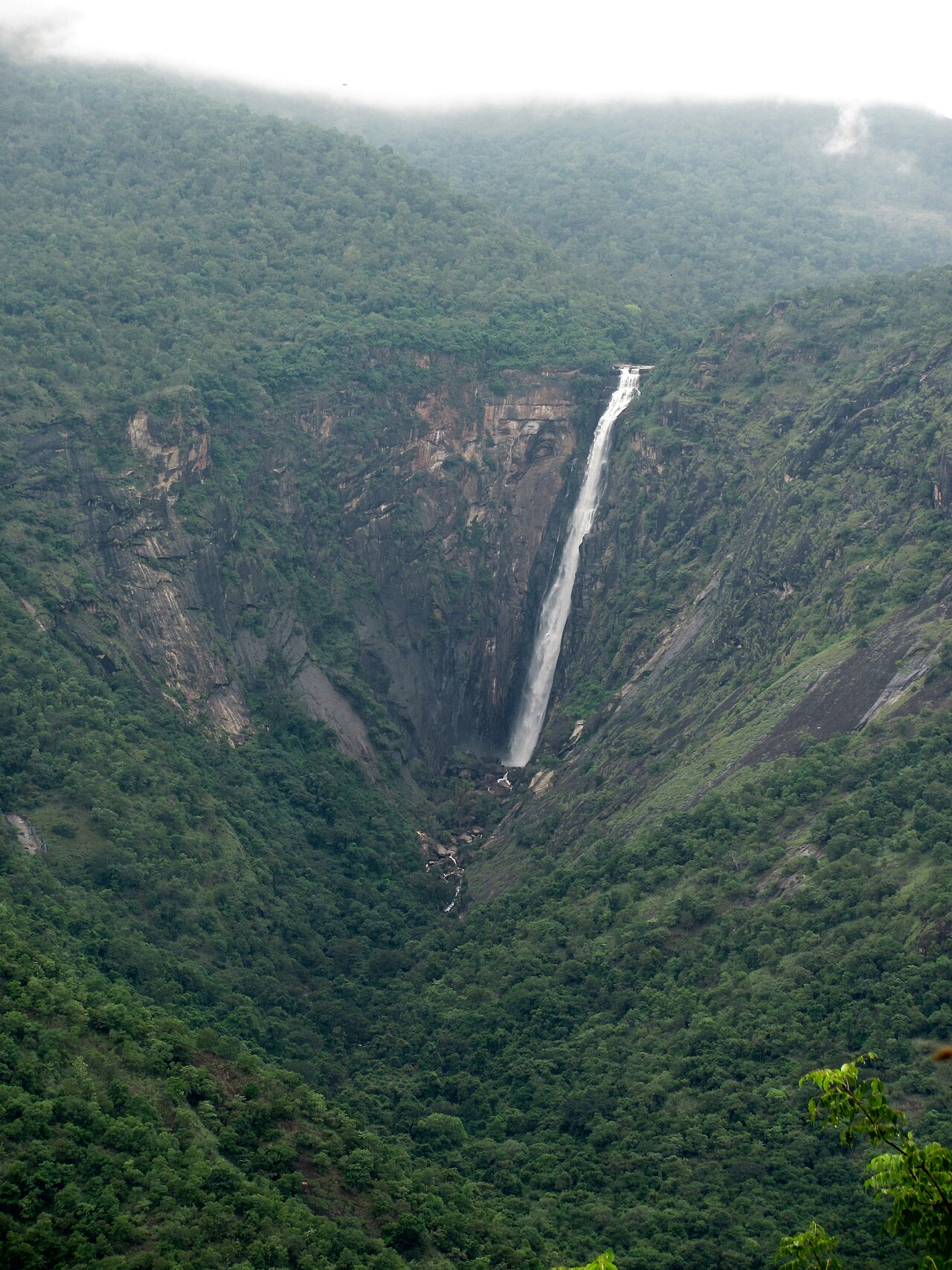
waterfallThalaiyar Falls
Also called Rat Tail Falls, at about 297 m it is one of the tallest waterfalls in Tamil Nadu, plunging down the Palani hills and visible from the Kodaikanal ghat road.
11.3 km · ~19 min by cab · straight line
damManjalar Dam
A picturesque irrigation dam across the Manjalar river, about ten kilometres from Batlagundu in Dindigul district. Set against the backdrop of the Western Ghats, it has calm blue waters and green surroundings. It is a popular local picnic and sightseeing spot.
12.2 km · ~20 min by cab · straight lineK
Kamarajar Lake
Place
damKamarajar Lake
A roughly 400-acre monsoon-fed reservoir near Athoor, formed by the Kamarajar Sagar Dam and overlooked by the Western Ghats. A noted birdwatching spot, it hosts hundreds of bird species, with coracle fishermen and coconut, banana and cardamom estates along its shores. It is one of the most scenic water bodies in the district.
13.3 km · ~22 min by cab · straight line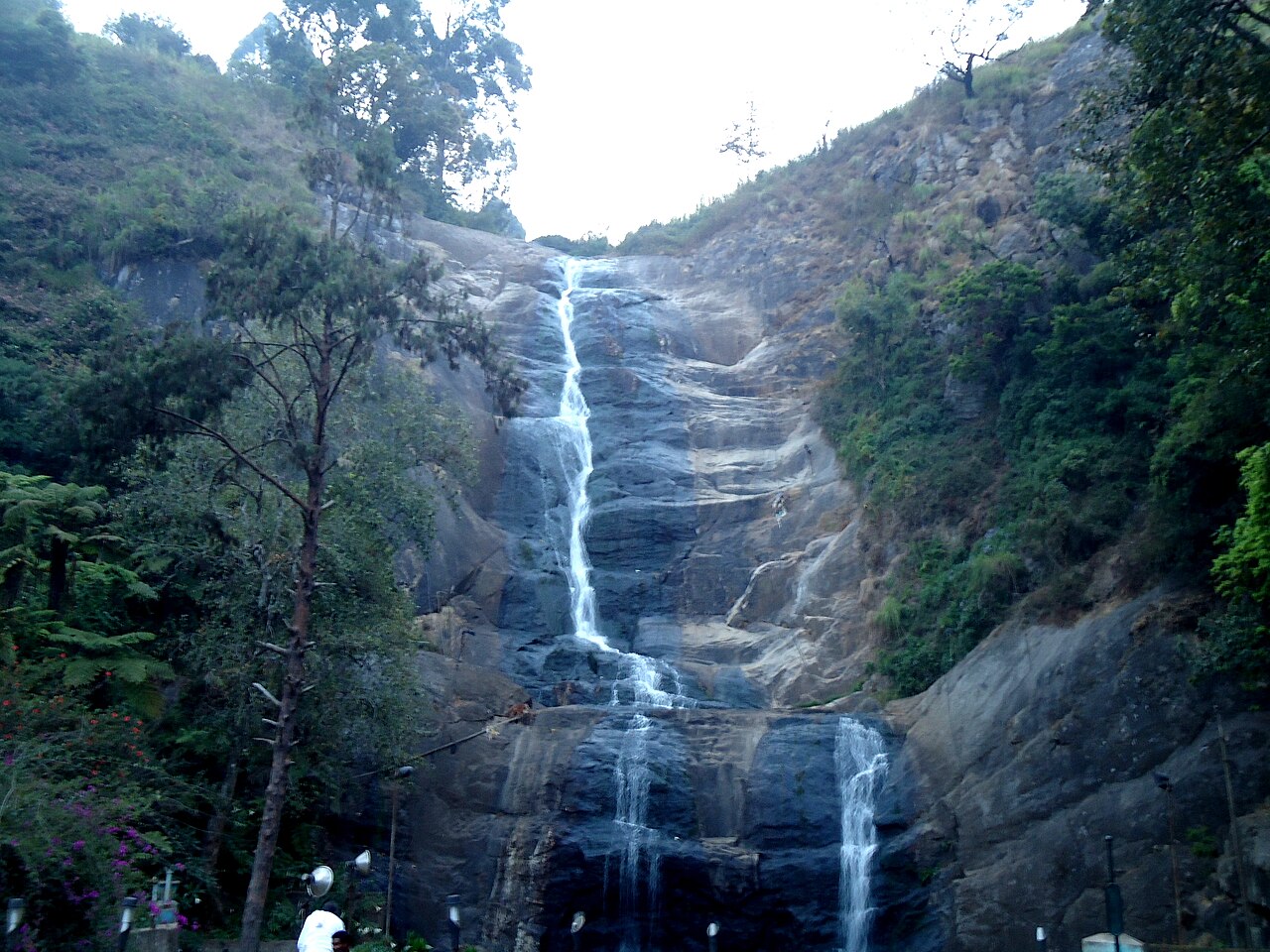
waterfallSilver Cascade Falls
A roughly 30 m (100 ft) waterfall formed by the overflow of Kodaikanal Lake, on the ghat road about 8 km from town.
20.3 km · ~34 min by cab · straight line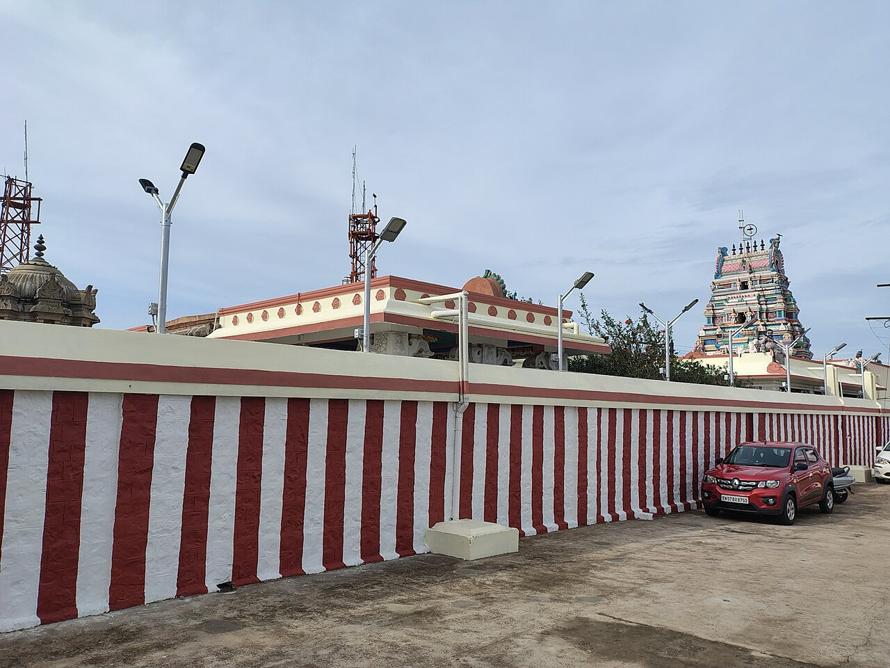
templeKurinji Andavar Temple
A Murugan temple built in 1936, associated with the Kurinji flower that blooms once every twelve years, offering hill views about 3 km from Kodaikanal Lake.
21.1 km · ~35 min by cab · straight lineA
Anjaneyar Temple, Anaipatti
Place
templeAnjaneyar Temple, Anaipatti
A Hanuman temple at Anaipatti in Nilakottai taluk, reputed to be around 300 years old. It is traditionally said to have been established by Rani Mangammal, the Nayak queen of Madurai. Set beside a river, it is one of the older village shrines of the area.
21.6 km · ~36 min by cab · straight lineK
Kannadi Perumal Temple
Place
templeKannadi Perumal Temple
A small Vishnu temple on a hillock about 9 km south of Palani, just off the Palani-Kodaikanal highway. It is dedicated to Kannadi Perumal, a form of Lord Vishnu. Its elevated setting offers views over the surrounding plains.
22.1 km · ~37 min by cab · straight line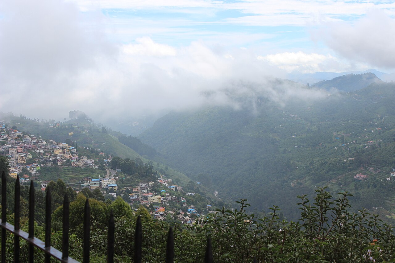
viewpointCoaker's Walk
A 1 km paved cliff-edge promenade laid out by Lt. Coaker in 1872, offering panoramic views over the valley and plains below Kodaikanal.
22.2 km · ~37 min by cab · straight lineL
La Salette Church, Kodaikanal
Place
churchLa Salette Church, Kodaikanal
One of the oldest Catholic churches in Kodaikanal, built in a distinctive Tamil-French architectural style. The main shrine houses a statue of Our Lady of La Salette, and the grounds include a Pilgrim Hall, the La Salette Grotto and a Way of the Cross. It is a popular Marian pilgrimage site in the hill town.
22.3 km · ~37 min by cab · straight lineV
Vellagavi
Place
heritageVellagavi
A remote hamlet in the Palani Hills reached only by a forest trek of several kilometres from the Kodaikanal side. Villagers are known for their hospitality and for selling home-grown spices and fruits such as oranges, butter fruit, guava and passion fruit. It is a well-known destination on the Kodaikanal-Vellagavi trekking route.
22.4 km · ~37 min by cab · straight line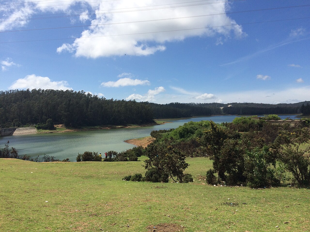
damKamaraj Sagar Dam
A small dam and reservoir near Kodaikanal, also known as Shola Dam, a quiet picnic and film-shooting spot away from the crowded lake.
22.4 km · ~37 min by cab · straight line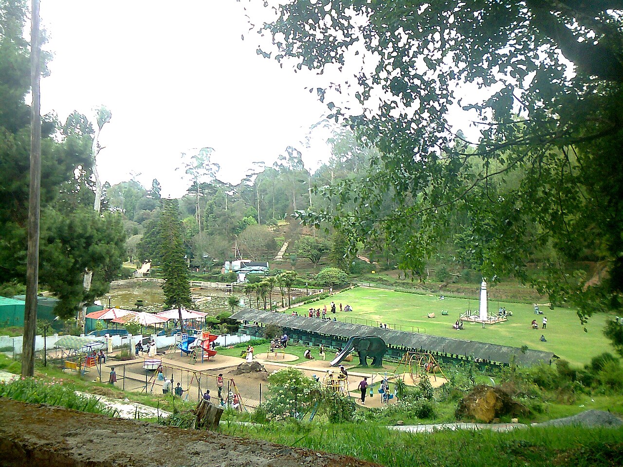
parkBryant Park
A 20-acre botanical garden beside Kodaikanal Lake laid out in 1908, home to hundreds of species of trees, shrubs and cacti and an annual flower show.
22.4 km · ~37 min by cab · straight lineOn the map
Where Marudhanadhi Dam is
Good to know
Marudhanadhi Dam — frequently asked
When is the best time to visit Marudhanadhi Dam?
October to March is the cooler, drier season in the Cauvery delta.
What are the entry fee and timings at Marudhanadhi Dam?
Entry: Free. Timings: Daylight hours (roughly 6:00 AM - 6:00 PM).
How do I reach Marudhanadhi Dam?
Base yourself in Athoor or nearby in Dindigul, then confirm the last-mile route locally before travel. If access depends on temple, museum or seasonal rules, check on the day before you go.
How much time do I need for Marudhanadhi Dam?
About an hour.
What else is near Marudhanadhi Dam?
Nearby you can pair Thalaiyar Falls (11.3 km), Manjalar Dam (12.2 km), Kamarajar Lake (13.3 km), Silver Cascade Falls (20.3 km).
Read before you go
Marudhanadhi Dam guides, stories & itineraries
We have not published a story about Marudhanadhi Dam itself yet. These cover Athoor and the wider district, with separate journeys between stops.
Tamil Nadu-wide guides & itineraries
Route-level itineraries and practical guides for the rest of Tamil Nadu.
The story of Vellagavi
Place story
The story of Vellagavi
4 min read · Read →
Vellagavi: history and local significance
History & significance
Vellagavi: history and local significance
4 min read · Read →
Sri Kottai Mariamman Temple, Dindigul: story and tradition
Story & tradition
Sri Kottai Mariamman Temple, Dindigul: story and tradition
4 min read · Read →
Sri Kottai Mariamman Temple, Dindigul: myths, tradition and meaning
Myth & meaning
Sri Kottai Mariamman Temple, Dindigul: myths, tradition and meaning
4 min read · Read →
The story of Abirami Amman Temple, Dindigul
Place story
The story of Abirami Amman Temple, Dindigul
4 min read · Read →
Abirami Amman Temple, Dindigul: history, architecture and significance
History & significance
Abirami Amman Temple, Dindigul: history, architecture and significance
4 min read · Read →