What to expect
Manakudy Estuary
An estuary formed where the Pazhayar river meets the sea between East and West Manakudy villages near Kanyakumari. It is an important wetland and birding site where greater flamingos and other migratory waterbirds gather. The Manakudy and Rajakkamangalam backwaters draw birdlife through much of the year.
M
Manakudy Estuary
Place
Practical guide
Plan Manakudy Estuary
Who's going?Tailor Manakudy Estuary to your trip
Typeheritage
Nearest baseManakudy
DistrictKanniyakumari
Best timeOctober to March is the cooler, drier…
Time neededAbout an hour
EntryFree
Manakudy Estuary is planned from Manakudy, one of the travel bases in Kanniyakumari district. Use Manakudy for stays, food and local transport, then plan this place as a focused stop.
Getting there
How to visit
- Base yourself in Manakudy or nearby in Kanniyakumari, then confirm the last-mile route locally before travel.
- If access depends on temple, museum or seasonal rules, check on the day before you go.
Timing
Best time
October to March is the cooler, drier season in the Cauvery delta.
Weather in Manakudy EstuarySeasonal guide
Live forecast loads in your browser.
Today at Manakudy Estuary
Sunrise6:07 am
Sunset6:04 pm
Golden hour best light5:04 pm–6:04 pm
Blue hour after sunset6:04 pm–6:29 pm
Sun sets toward compass bearingW · 261°
Moon tonight🌒 Waxing crescent · 24%
Sun and moon are calculated for this location and shown in IST. Photography windows are the hour around sunrise and sunset; the sunset bearing is degrees clockwise from true north. Moon phase is accurate to about half a day.
Stay · eat · do · rent · see · shop
Stays, food & things to do near Manakudy Estuary
Verified hotels, homestays, restaurants, experiences, sights, shops and rentals around Manakudy Estuary — commission-free, with direct contact. Filter by what you need.
Verified inventory is being added here.
Verified places are being added. The category filters will fill in as approved stays, restaurants, experiences, sights, shops and nature listings go live.
List your placeRoampedia is commission-free — own or know a stay, eatery, guide or shop near Manakudy Estuary? List it and it appears here once verified.
Add a nearby businessBefore you go
Manakudy Estuary — at a glance
TimingsDaylight hours; best at dawn for birding
Best timeNovember to February
Entry: Free
Getting here
How to reach Manakudy Estuary
About 10 km from Kanyakumari; nearest railway Nagercoil Junction (~10 km) or Kanyakumari (~11 km); nearest airport Thiruvananthapuram (TRV) ~85 km.
Getting around Manakudy Estuary
If you need step-free access, contact the site before travelling. Ask about a level entrance, steps along the route, the nearest drop-off point, seating and accessible toilets.
If you need help at Manakudy Estuary
112All emergencies (police · fire · medical)The single number to call in any emergency (ERSS).100Police101Fire108Ambulance (emergency / EMS)1091Women’s helpline (distress)1098Child helpline1363Tourist helpline (India, 24×7, multilingual)
Emergency numbers are verified against official government and state tourism sources. 112 works anywhere in India.
Nearby
What’s near Manakudy Estuary
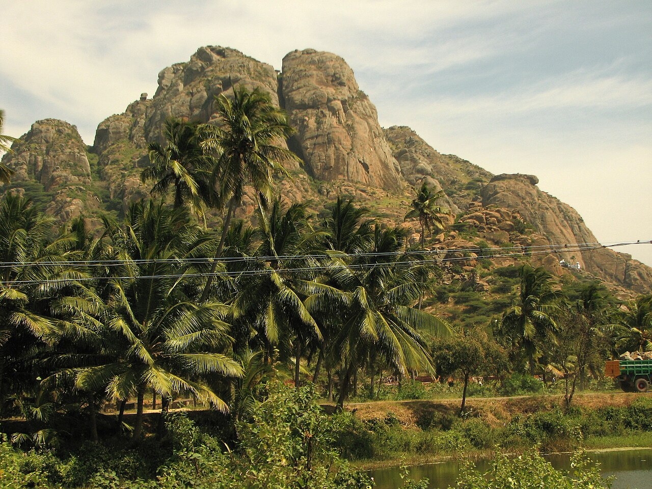
heritageMarunthuvazh Malai
A medicinal hill locally believed to be a fragment of the Sanjeevani mountain dropped by Hanuman in the Ramayana, said to be rich in rare herbs. A short trek leads to an ashram linked to the Agastya Muni tradition partway up the slope. From there visitors get views over the surrounding greenery and the sea near Kanyakumari.
5.4 km · ~13 min by auto · straight line
viewpointKanyakumari View Tower
Elevated viewing platform in Kanyakumari town giving panoramic views of the offshore memorials, temple, and coastline below.
7.1 km · ~18 min by auto · straight line
viewpointKanyakumari Lighthouse
British-era lighthouse near the shore offering panoramic views of the tri-sea confluence and the offshore memorials from its viewing gallery.
7.1 km · ~18 min by auto · straight line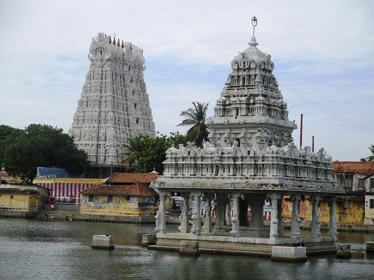
templeSuchindram Thanumalayan Temple
Ancient temple uniquely dedicated jointly to the Hindu Trinity (Brahma, Vishnu, Shiva) with a famed musical pillar hall and a tall gopuram.
7.3 km · ~18 min by auto · straight line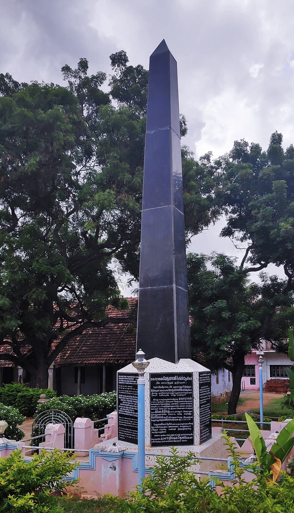
heritageRingeltaube Vethamanickam Memorial Church
A memorial church commemorating the German missionary W. T. Ringeltaube of the London Missionary Society and Vedamanickam, the first Protestant convert in the region in the early 19th century. Mylaudy is regarded as a cradle of Protestant Christianity in south Travancore, and the church marks the beginnings of the LMS mission in the area.
7.3 km · ~18 min by auto · straight line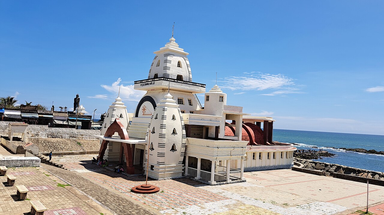
heritageGandhi Memorial Mandapam
Memorial built where Mahatma Gandhi's ashes were kept before immersion at the tri-sea confluence; designed so sunlight strikes the memorial spot on his birthday, 2 October.
7.4 km · ~19 min by auto · straight line
heritageTsunami Memorial Park
Seafront monument in Kanyakumari town commemorating the victims of the 2004 Indian Ocean tsunami, which struck this coastline hard.
7.6 km · ~19 min by auto · straight line
churchOur Lady of Ransom Church
Prominent Gothic-style Catholic church on the Kanyakumari seafront, its striped exterior a local landmark dating back to the colonial era.
7.6 km · ~19 min by auto · straight line
viewpointKanyakumari sunrise/sunset point
India's southernmost tip and the only place in the country to view both sunrise and sunset over the sea, at the meeting point of the Bay of Bengal, Arabian Sea and Indian Ocean.
7.6 km · ~19 min by auto · straight line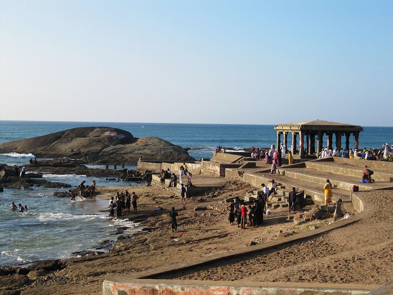
templeKanyakumari Bhagavathy Amman Temple
Ancient shrine to Goddess Kanyakumari (Kumari Amman), one of the 108 Shakti Peethas, standing right at the shore and giving the town its name.
7.6 km · ~19 min by auto · straight line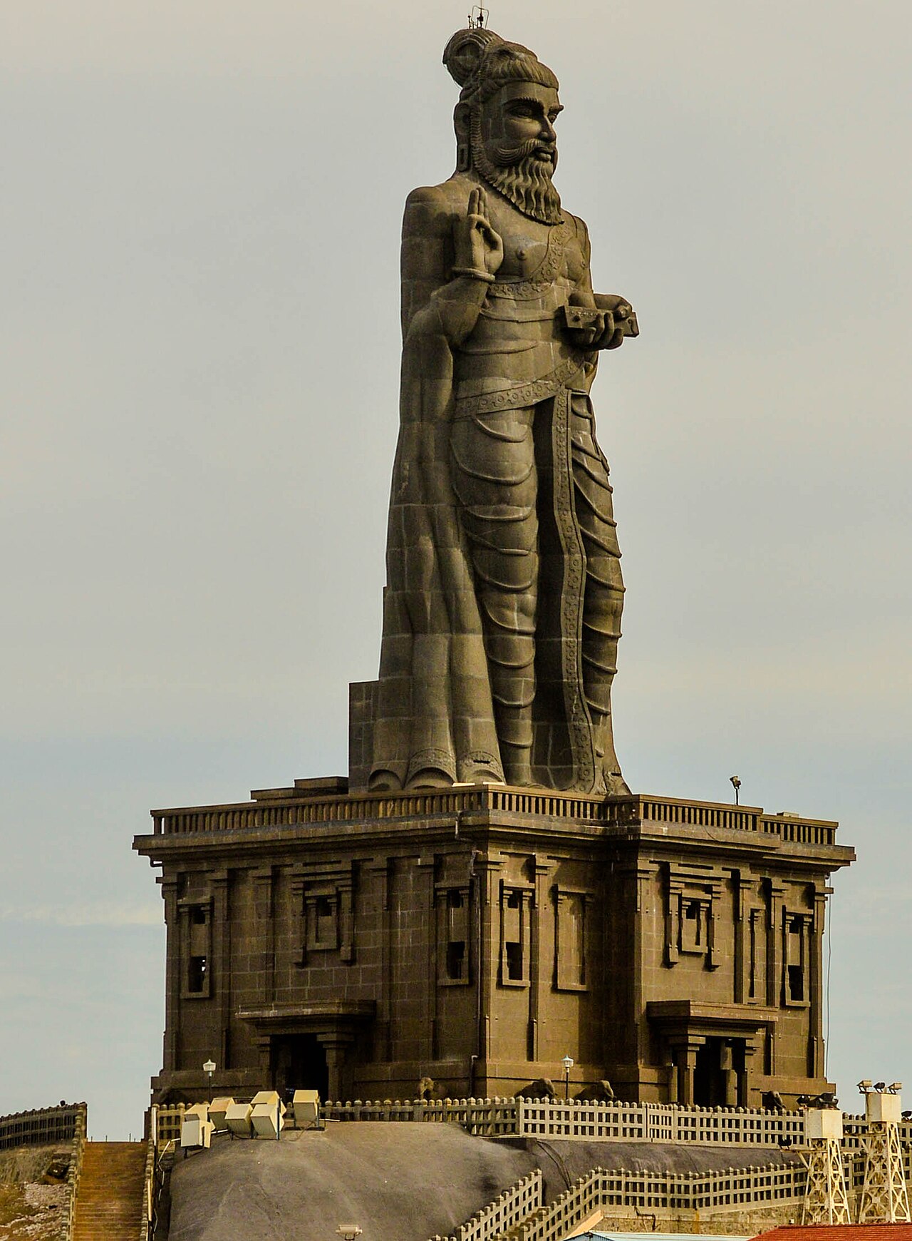
heritageThiruvalluvar Statue
133-foot stone statue of the Tamil poet-philosopher Thiruvalluvar standing on an islet next to the Vivekananda Rock, unveiled in 2000.
7.9 km · ~20 min by auto · straight line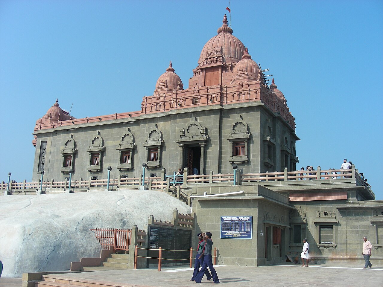
viewpointVivekananda Rock Memorial
Rock memorial built in 1970 on an offshore islet where Swami Vivekananda is said to have meditated in 1892. Reached by a short ferry ride from the mainland jetty.
8.0 km · ~20 min by auto · straight lineOn the map
Where Manakudy Estuary is
Good to know
Manakudy Estuary — frequently asked
When is the best time to visit Manakudy Estuary?
October to March is the cooler, drier season in the Cauvery delta.
What are the entry fee and timings at Manakudy Estuary?
Entry: Free. Timings: Daylight hours; best at dawn for birding.
How do I reach Manakudy Estuary?
Base yourself in Manakudy or nearby in Kanniyakumari, then confirm the last-mile route locally before travel. If access depends on temple, museum or seasonal rules, check on the day before you go.
How much time do I need for Manakudy Estuary?
About an hour.
What else is near Manakudy Estuary?
Nearby you can pair Marunthuvazh Malai (5.4 km), Kanyakumari View Tower (7.1 km), Kanyakumari Lighthouse (7.1 km), Suchindram Thanumalayan Temple (7.3 km).
Read before you go
Manakudy Estuary guides, stories & itineraries
We have not published a story about Manakudy Estuary itself yet. These cover Manakudy and the wider district, with separate journeys between stops.
Tamil Nadu-wide guides & itineraries
Route-level itineraries and practical guides for the rest of Tamil Nadu.
The story of Udayagiri Fort
Place story
The story of Udayagiri Fort
4 min read · Read →
Thiruvithamcode Arappally (St. Mary's Orthodox Church): story and tradition
Story & tradition
Thiruvithamcode Arappally (St. Mary's Orthodox Church): story and tradition
4 min read · Read →
The story of Thirunanthikarai Cave Temple
Place story
The story of Thirunanthikarai Cave Temple
4 min read · Read →
The story of Peer Mohammed Dargah
Place story
The story of Peer Mohammed Dargah
4 min read · Read →
The story of Parthasarathy Temple, Parthivapuram
Place story
The story of Parthasarathy Temple, Parthivapuram
4 min read · Read →
The story of Ringeltaube Vethamanickam Memorial Church
Place story
The story of Ringeltaube Vethamanickam Memorial Church
4 min read · Read →