What to expect
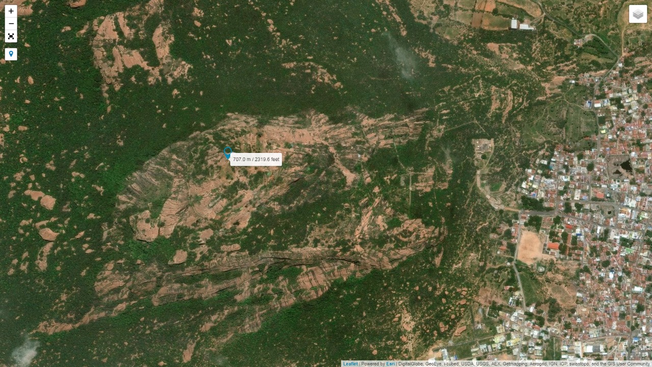
Sangagiri Fort
A 15th-century hill fort on the Salem-Erode highway, with fortified gateways and temples within its walls.
Practical guide
Plan Sangagiri Fort
Who's going?Tailor Sangagiri Fort to your trip
Typeheritage
Nearest baseSankagiri
DistrictSalem
Best timeOctober to March is the cooler, drier…
Time neededAbout an hour
EntryFree
Sangagiri Fort is planned from Sankagiri, one of the travel bases in Salem district. Use Sankagiri for stays, food and local transport, then plan this place as a focused stop.
Getting there
How to visit
- Base yourself in Sankagiri or nearby in Salem, then confirm the last-mile route locally before travel.
- If access depends on temple, museum or seasonal rules, check on the day before you go.
Timing
Best time
October to March is the cooler, drier season in the Cauvery delta.
Weather in Sangagiri FortSeasonal guide
Live forecast loads in your browser.
Today at Sangagiri Fort
Sunrise6:08 am
Sunset6:00 pm
Golden hour best light5:00 pm–6:00 pm
Blue hour after sunset6:00 pm–6:25 pm
Sun sets toward compass bearingW · 261°
Moon tonight🌒 Waxing crescent · 24%
Sun and moon are calculated for this location and shown in IST. Photography windows are the hour around sunrise and sunset; the sunset bearing is degrees clockwise from true north. Moon phase is accurate to about half a day.
Photos
Sangagiri Fort in pictures
Stay · eat · do · rent · see · shop
Stays, food & things to do near Sangagiri Fort
Verified hotels, homestays, restaurants, experiences, sights, shops and rentals around Sangagiri Fort — commission-free, with direct contact. Filter by what you need.
Verified inventory is being added here.
Verified places are being added. The category filters will fill in as approved stays, restaurants, experiences, sights, shops and nature listings go live.
List your placeRoampedia is commission-free — own or know a stay, eatery, guide or shop near Sangagiri Fort? List it and it appears here once verified.
Add a nearby businessBefore you go
Sangagiri Fort — at a glance
Timings9 AM - 5:30 PM
Best timeOct-Mar for cooler climbing weather
Entry: Free
Getting here
How to reach Sangagiri Fort
On the Salem-Erode highway (NH 544), ~35 km from Salem Junction (SA)
Getting around Sangagiri Fort
If you need step-free access, contact the site before travelling. Ask about a level entrance, steps along the route, the nearest drop-off point, seating and accessible toilets.
If you need help at Sangagiri Fort
112All emergencies (police · fire · medical)The single number to call in any emergency (ERSS).100Police101Fire108Ambulance (emergency / EMS)1091Women’s helpline (distress)1098Child helpline1363Tourist helpline (India, 24×7, multilingual)
Emergency numbers are verified against official government and state tourism sources. 112 works anywhere in India.
Nearby
What’s near Sangagiri Fort
S
Sundhara Kandaswamy Temple
Place
templeSundhara Kandaswamy Temple
A Murugan temple about 22 km from Salem on the Tiruchengode road at Kalipatti, dating to around the 18th century. It is described as one of the seven richest temples in the district and draws pilgrims to its Lord Murugan shrine.
19.1 km · ~32 min by cab · straight lineK
Kalangi Siddhar Temple
Place
templeKalangi Siddhar Temple
A siddhar shrine on the slope of Kanja Malai about 12 km from Salem, dedicated to Kalangi Siddhar, counted among the eighteen Tamil Siddhas. It is a pilgrimage spot tied to the Siddha tradition.
25.9 km · ~43 min by cab · straight line
viewpointKanjamalai
A hill on Salem's outskirts known for iron ore deposits and views over the city, with a small hilltop temple.
26.9 km · ~45 min by cab · straight line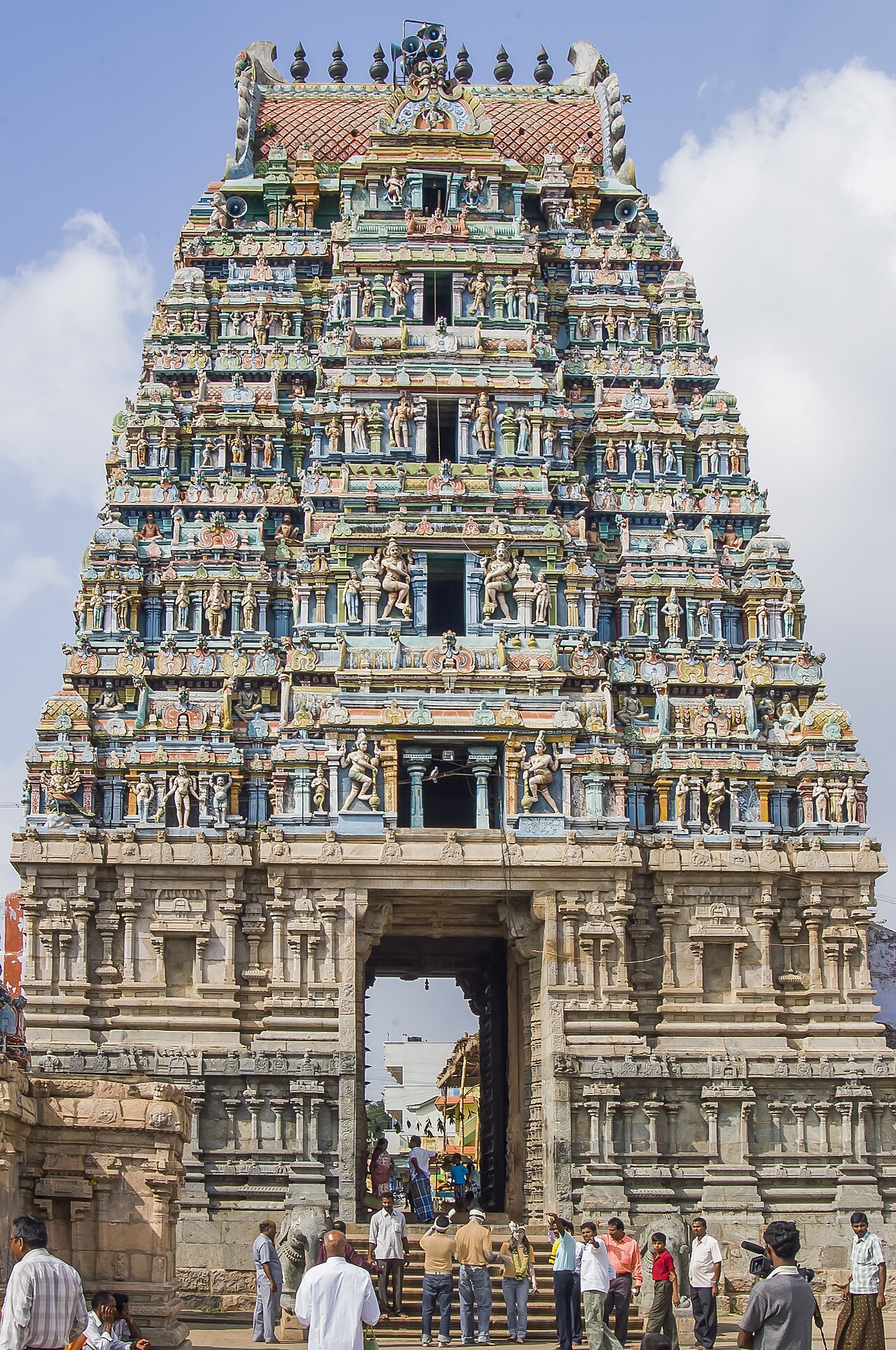
templeTharamangalam Kailasanathar Temple
A large Shiva temple about 30 km from Salem, expanded by the Gatti Mudali chieftains between the 13th and 17th centuries over an older core. Its five-tier gopuram, roughly 90 ft tall, is carved to resemble a chariot drawn by elephants and horses, and the complex is known for intricate stone sculpture and a west-facing Vengai-wood door. It is dedicated to Kailasanathar (Shiva) and Sivakami Amman.
35.0 km · ~58 min by cab · straight line
templeKottai Mariamman Temple
Kottai Mariamman Temple is a prominent Amman shrine in Salem’s old fort area, serving as an active place of worship and an important local landmark. Festival days can bring larger congregations and altered visitor arrangements.
36.3 km · ~61 min by cab · straight line
templeSugavaneswarar Temple
Sugavaneswarar Temple is a historic Shiva shrine in central Salem, valued for its living worship tradition, sculpted halls and Dravidian architecture. Visitors should dress for active worship and follow the temple's current photography and access rules.
37.2 km · ~62 min by cab · straight line
museumSalem Government Museum
A government museum in Salem city displaying archaeological finds, inscriptions, arms and mineral specimens from the region.
37.3 km · ~62 min by cab · straight lineC
Christ Church, Salem
Place
churchChrist Church, Salem
A colonial-era Anglican church on Fort Road in Salem, consecrated in 1875. It is one of the city's historic Christian landmarks.
37.4 km · ~62 min by cab · straight line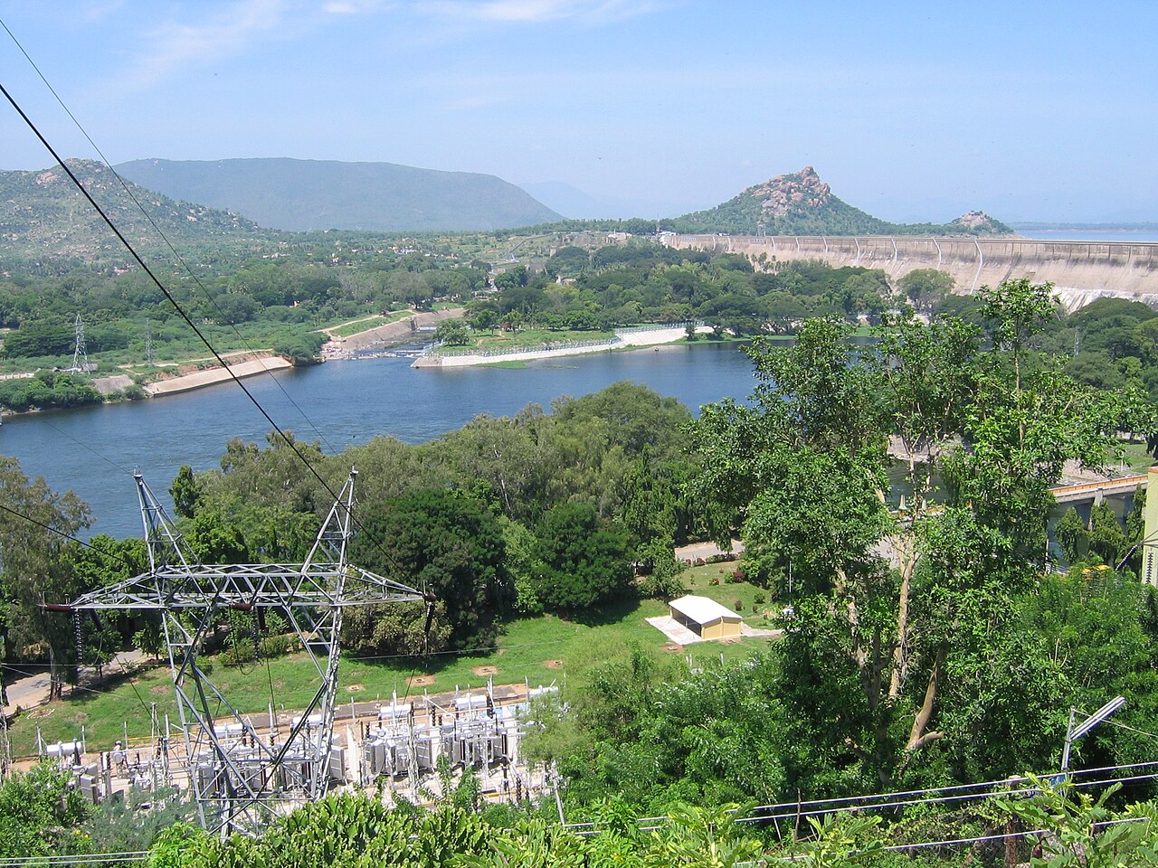
damMettur Dam
A major working dam across the Kaveri forming Stanley Reservoir; visitors must use designated public areas rather than the operational crest.
37.7 km · ~63 min by cab · straight lineK
Kumaragiri Murugan Temple
Place
templeKumaragiri Murugan Temple
A hilltop Murugan temple on the Udayapatti bypass road about 6 km from Salem city. It is a locally popular pilgrimage and viewpoint spot on the outskirts of Salem.
39.4 km · ~66 min by cab · straight lineB
Badrakaliamman Temple
Place
templeBadrakaliamman Temple
An amman temple at Mecheri, about 33 km from Salem on the Salem-Dharmapuri highway in the Mettur area. It is a locally significant goddess shrine that draws regular pilgrims.
41.4 km · ~69 min by cab · straight lineS
Salem Jama Masjid
Place
mosqueSalem Jama Masjid
Described as the oldest mosque in Salem, standing on the southern bank of the Thirumanimutharu river in the city centre. It is a long-standing centre of the local Muslim community.
41.5 km · ~69 min by cab · straight lineOn the map
Where Sangagiri Fort is
Good to know
Sangagiri Fort — frequently asked
When is the best time to visit Sangagiri Fort?
October to March is the cooler, drier season in the Cauvery delta.
What are the entry fee and timings at Sangagiri Fort?
Entry: Free. Timings: 9 AM - 5:30 PM.
How do I reach Sangagiri Fort?
Base yourself in Sankagiri or nearby in Salem, then confirm the last-mile route locally before travel. If access depends on temple, museum or seasonal rules, check on the day before you go.
How much time do I need for Sangagiri Fort?
About an hour.
What else is near Sangagiri Fort?
Nearby you can pair Sundhara Kandaswamy Temple (19.1 km), Kalangi Siddhar Temple (25.9 km), Kanjamalai (26.9 km), Tharamangalam Kailasanathar Temple (35.0 km).
Read before you go
Sangagiri Fort guides, stories & itineraries
We have not published a story about Sangagiri Fort itself yet. These cover Sankagiri and the wider district, with separate journeys between stops.
Tamil Nadu-wide guides & itineraries
Route-level itineraries and practical guides for the rest of Tamil Nadu.
The story of Tharamangalam Kailasanathar Temple
Place story
The story of Tharamangalam Kailasanathar Temple
4 min read · Read →
The story of Attur Fort
Place story
The story of Attur Fort
4 min read · Read →
The story of Deer Park
Place story
The story of Deer Park
4 min read · Read →
Deer Park: ecology and conservation story
Ecology & context
Deer Park: ecology and conservation story
4 min read · Read →
The story of Kurumbapatti Zoological Park
Place story
The story of Kurumbapatti Zoological Park
4 min read · Read →
Kurumbapatti Zoological Park: ecology and conservation story
Ecology & context
Kurumbapatti Zoological Park: ecology and conservation story
4 min read · Read →
Image credits
Photographs: Dhivaharraj (CC BY-SA 4.0), JayakanthanG (CC BY-SA 3.0), Gautham5210 (CC BY-SA 4.0), Mohanprasath19four7 (CC BY-SA 4.0). Wikimedia Commons.