What to expect
Highlights
- High Wavy mountain landscape
- Tea estates and forest mosaic
- Remote reservoir and valley views
Meghamalai is a dispersed High Wavy Mountains landscape of estates, reservoirs and protected forest roads—not one viewpoint at the route pin.

Meghamalai is a dispersed High Wavy Mountains landscape of estates, reservoirs and protected forest roads—not one viewpoint at the route pin. Plan a named property, permitted road or recognised viewpoint before climbing. Mobile coverage, fuel, food and same-day access can all be limited.
Tea estates and shola–grassland habitat form the landscape, while forest and estate ownership restrict where visitors may stop or walk.
Weather, landslips, wildlife movement and road works can change access quickly. A resort booking does not authorise entry to every estate or forest track.
Travel in daylight with a capable vehicle, carry essentials and avoid approaching elephants or sharing sensitive wildlife locations.
For the visit itself, allow a full day; an overnight plan is safer. The best time is clear daylight outside severe rain, subject to current access. Confirm a named destination and current road conditions. Arrange accommodation or a firm return plan. Remote roads, fog, landslips and wildlife require cautious driving.
Clear daylight outside severe rain, subject to current access.
Verified hotels, homestays, restaurants, experiences, sights, shops and rentals around Meghamalai (High Wavy Mountains) — commission-free, with direct contact. Filter by what you need.
Verified places are being added. The category filters will fill in as approved stays, restaurants, experiences, sights, shops and nature listings go live.
List your place8 more places around Cumbum. Open a guide to plan the visit and onward journey.

A protected shola-grassland sanctuary in the High Wavy Mountains that forms part of the Srivilliputhur-Megamalai Tiger Reserve. It shelters tigers, elephants, gaur, Nilgiri tahr and rich birdlife.
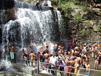
A seasonal cascade near Cumbum whose bathing and forest access depend on current conditions.

A fertile valley between the Western Ghats and the plains famed for large-scale grape cultivation, earning Cumbum the nickname Grapes City of South India. The Panneer Thratchai grape and vineyard visits draw agri-tourists.

The main town of the Cumbum Valley and a commercial hub for the region's grape and vegetable trade. It is the gateway town for Suruli Falls and the Meghamalai foothills.

A smaller waterfall near the main Suruli Falls set within forested hill terrain. It is a quieter bathing and trekking spot in the Cumbum region.
This Shiva temple sits on the hill above Suruli Falls near Cumbum, reached by a climb from the falls. It is an old rock-and-cave shrine linked to the Suruli hills and hosts festivals during Chithra Pournami and Thai Amavasai. Its forest-edge setting at the Western Ghats gate makes it both a pilgrimage and scenic spot.
Kodi Lingam is a Shiva shrine near Suruli Falls in the Cumbum area, notable for housing a large number of Shiva lingams. It stands close to the Western Ghats forest gate and is visited by pilgrims who combine it with a trip to the falls.
This dargah near Suruli Falls, associated with a Muslim saint and traditionally dated to around the 16th century, is a pilgrimage site for the local Muslim community. Its location beside the popular Suruli Falls makes it part of the wider religious and scenic circuit in that part of the district.
Roampedia is commission-free — own or know a stay, eatery, guide or shop near Meghamalai (High Wavy Mountains)? List it and it appears here once verified.
Add a nearby businessEntry: Accommodation, estate and forest arrangements are separate.
Do not use the broad centre coordinate as a visitor entrance; route to a confirmed named destination.
If you need step-free access, contact the site before travelling. Ask about a level entrance, steps along the route, the nearest drop-off point, seating and accessible toilets.
Emergency numbers are verified against official government and state tourism sources. 112 works anywhere in India.
It is a broad mountain and estate region; access depends on the exact destination.
No. Obtain the owner’s permission and respect protected-forest rules.
Clear daylight outside severe rain, subject to current access.
Entry: Accommodation, estate and forest arrangements are separate. Timings: No single opening time; confirm road, forest and property access.
Confirm a named destination and current road conditions. Arrange accommodation or a firm return plan.
Allow a full day; an overnight plan is safer.
Remote roads, fog, landslips and wildlife require cautious driving.
Written about Meghamalai (High Wavy Mountains) itself — its history, its legends and the arguments about them.


These guides explore Cumbum and the surrounding area. Choose a visit that fits your interests, allowing separately for travel between stops.
Route-level itineraries and practical guides for the rest of Tamil Nadu.
Photographs: Mprabaharan at English Wikipedia (Public domain), Nrr1729 (CC BY-SA 4.0), Mprabaharan (CC BY-SA 3.0), Roshan Gracious (CC0). Wikimedia Commons.
