Vandavasi is a compact municipal town where a surviving brick fort, unusually detailed eighteenth-century battle maps, a living hill-lamp tradition and Thennangur’s devotional architecture form one honest day. The essential skill is separating the town from the much larger taluk and separating a famous imperial result from the people and terrain that made the battle possible.
Begin in central Vandavasi, around the bus stand and market streets. The fort is roughly 0.8 km to the north-west, while Thennangur is a separate road trip of about 6.3 km; keeping those two scales distinct makes the day much easier to plan.
The modern arrival is prosaic and useful. Buses enter a busy market town, central roads carry bakeries, banks and pharmacies, and the bus-stand quarter sits beside the fort landscape. This is not a preserved colonial enclave. Historic fabric survives inside a functioning municipal centre rather than behind a visitor gate.
The municipality’s institutional history begins in 1886, when Vandavasi was constituted as a town panchayat. It became a selection town panchayat in 1942, a third-grade municipality in 1994 and a second-grade municipality under a 1998 order. Those dates explain the civic town around the monument better than generic claims of timeless antiquity.
Vandavasi Fort lies about 0.8 km north-west of the town centre, roughly a ten-minute walk. Traffic and road crossings matter more than an optimistic driving estimate over such a short distance.
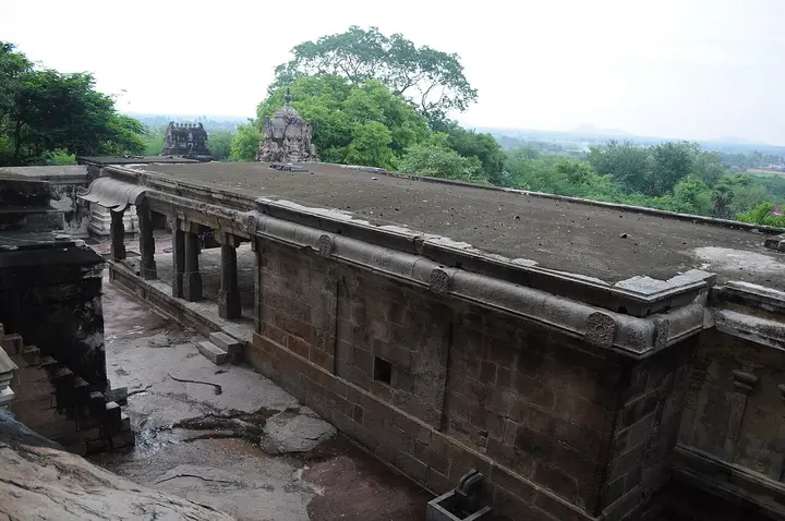
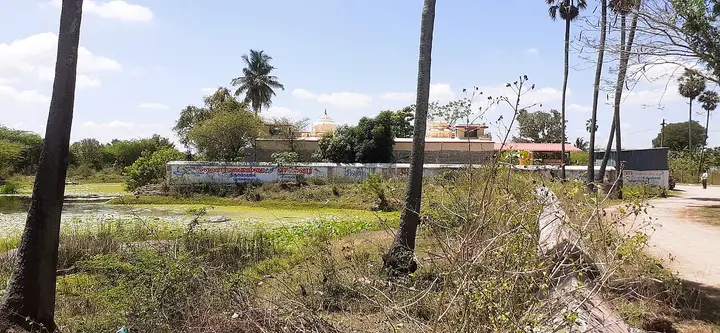
The surviving fort is a fragment, not a restored complex. Tamil Nadu Archaeology identifies a moat, cannon platform, Hanuman temple and ruined masonry. Vegetation, broken ground and changes of level make daylight essential. A low wall is still unsafe merely because generations of people have climbed it.
A historical plan transforms the visit. Public-domain French and British collection images preserve the fort’s former geometry: bastions, water defences, roads and settlement relationships that a single surviving brick face cannot communicate. Use a plan as interpretation, never as a promise that every drawn element remains.
The place is best known in English-language histories as Wandiwash, an anglicised form of Vandavasi. Searching both spellings opens different archives. Modern maps favour Vandavasi; older documents variously print Wandewash, Wandiwash, Vandavachy and Vandavashy. Use the town’s present name when speaking to residents and drivers.
On 22 January 1760, forces of the British East India Company under Eyre Coote defeated French forces commanded by Thomas Arthur, Comte de Lally. The encounter belongs to the Third Carnatic War and the wider Seven Years’ War. A battle on these plains was therefore local ground inside a global contest.
The shorthand “British defeated French” is incomplete. Company armies contained Indian sepoys, cavalry and allied contingents; military movement depended on local supplies, water, roads, animals and information. The maps return terrain and movement to a story too often reduced to two European surnames.
Tamil Nadu Archaeology describes the 1760 engagement as central to the English consolidation of power, while a state history text places it before the fall of Pondicherry. The careful claim is that Vandavasi decisively damaged French military prospects in the Carnatic, not that every later act of British rule followed automatically in one afternoon.
The fort’s history did not freeze in 1760. The archaeology department says it later became property of the Nawabs of Arcot and records further fighting in 1780 against Hyder Ali’s force. Repeated conflict contributed to ruin. Visitors should resist treating the wall as scenery for a single labelled event.
The department itself raises the counterfactual that southern Indian history might have followed another course had the French prevailed. That is a prompt for thought, not a licence to romanticise another empire. Both European companies pursued political and commercial power through armed intervention.
Read the moat before the masonry. Water and earthworks controlled approach, artillery placement and the movement of men and animals. Drains, vegetation and later roads obscure parts of that system today, but historic plans preserve the relationship between fort and surrounding plain.
Read the cannon platform as evidence rather than a stage. Do not climb for a photograph or take loose brick as a souvenir. The best frames use distance and side light to show scale without putting a person on unstable fabric.
The Hanuman shrine recorded inside the fort matters because sacred and military uses can occupy one enclosure across time. If worship is active, temple etiquette overrides inspection: remove footwear where required, lower your voice and ask before photographing people or ritual objects.
After the fort, return through the town rather than driving immediately away. Vandavasi’s market streets show the civic settlement that inherited this strategic junction. A 2014 Government of India photo set records students, women’s self-help groups and public-information activity—evidence that the town’s story did not end with colonial war.
New Golden Bakery & Sweets is on Kanchipuram–Vandavasi Road. It is listed as a nearby bakery rather than a reviewed restaurant, so check today’s hours, products, ingredients, seating and payment at the counter.
That restraint is deliberate. Search results can make an unverified business look current long after closure. This page does not manufacture a hotel list from aggregators. Travellers who need a room should confirm directly or use a larger base such as Kanchipuram, Tindivanam or Tiruvannamalai.
For the second stop, travel north to Thennangur. District tourism places its Pandurangan temple about five kilometres from Vandavasi on the Kanchipuram highway; the routed journey from central Vandavasi is about 6.3 km.
Thennangur is a village, not a Vandavasi neighbourhood. It belongs here as a close official excursion whose access runs through town. That is different from pretending every attraction in Vandavasi taluk can fit into a town walk.
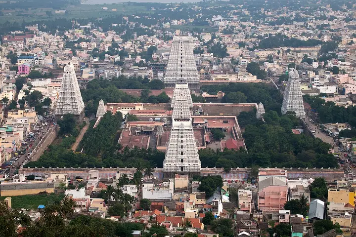
The district describes north-Indian nagara architectural vocabulary, a tall entrance, a large painted hall and tall images of Panduranga and Rukmayee. The contrast with the fort is productive: one stop is fragmentary military archaeology, the other a maintained devotional environment organised around worship.
The district also describes changing adornment across the week. Treat that as living ritual, not costume theatre. Ask whether photography is permitted today, never obstruct darshan, and do not assume a freely licensed older photograph proves cameras remain welcome inside.
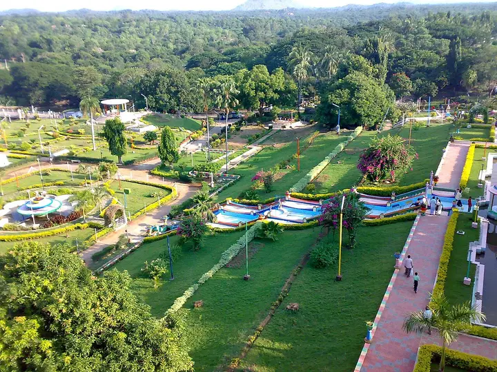
The panorama and architectural files were opened before selection. They show gardens, a long hall and distinct tower profiles. An elephant photograph records a past occasion; its caption explicitly refuses to promise an elephant, procession or performance during a future visit.
Current dependable daily hours are not published by the district. Many secondary pages repeat split morning and evening schedules, but that is insufficient for a promise. Confirm locally before leaving Vandavasi, particularly near midday, festivals or maintenance.
A hired auto is often simplest for Thennangur. Agree outward fare, waiting time and return before departure. The router’s eight minutes assumes free-flowing traffic; buses, road works, livestock and festival movement can lengthen the trip.
Venkundram carries the town’s strongest documented living tradition. Vandavasi Municipality identifies Tavalagirisvara Temple on Venkundram Hill, about five kilometres away, and says pujas take place on every full-moon day. This is municipal evidence for practice, not folklore copied from a commercial blog.
The municipality further records Karthigai Deepam in November or December, with people from surrounding villages climbing for the great hilltop lamp. Its figure of about one lakh people is best read as a civic estimate. Attendance varies, and a festival crowd is not interchangeable with an ordinary-day hike.
The hill tradition links fire, elevation, lunar observance and a network of villages. It is not a Vandavasi version of the battle and should never be forced into that story. One tradition concerns worship and community time; the other archive concerns armies and imperial power.
This page does not create a Venkundram route card because a dependable exact OSM temple object could not be read. The municipal distance remains in the story, while map and route modules use only verified coordinates. That is better than placing a hill shrine on a guessed summit.
If planning Venkundram, ask locally for the current starting point, path condition, opening and return. Carry water, use suitable footwear and avoid darkness outside an organised festival. Full-moon worship does not guarantee lighting or crowd management on every approach.
Karthigai fire is sometimes flattened into a generic “festival of lights.” Here the material action matters: people converge on a hill and a large flame makes the sacred summit visible across the plain. Respect smoke, queues and instructions; never fly a drone over worshippers.
The old page failed its geography audit. It assigned Seeyamangalam Cave Temple and Vedapureeswarar Temple at Cheyyar to Vandavasi. District history places Seeyamangalam near Desur, while the second shrine is in Cheyyar. Both were removed before measuring a single route.
The audit also moved Vandavasi Fort out of Munugapattu and Thennangur out of Arani. These are not cosmetic changes. Wrong ownership distorts maps, driving time, nearby cards and what a traveller believes can fit into one morning.
There is no passenger railway station in Vandavasi. Older generated copy claimed one nearby, but no such station exists on the current network. Select a real railhead—often Melmaruvathur or Tindivanam according to the train—and arrange the onward road leg before boarding.
Buses are the defining public transport. Services link surrounding towns and temple country, but online timetables are not dependable enough for a late return promise. Ask at the stand, note the bay and keep an auto or car alternative for a fixed appointment.
Chennai is the practical major airport, but its road transfer is substantial. Arrival traffic can erase a neat estimate. Do not land late and expect to interpret the fort before dark; sleep nearer the route or schedule Vandavasi for the following morning.
Heat is the predictable physical constraint. Brick, open roads and temple paving store afternoon sun. November through February is gentler; in hotter months begin early, carry water and pause in shade. Cloud cover does not remove humidity or ultraviolet exposure.
Rain changes a ruin differently from a temple. Wet vegetation can conceal holes at the fort, earthen edges soften and brick becomes slippery. Thennangur has covered spaces, but roads and paving remain wet. Postpone any hill climb during storms or lightning.
Accessibility needs honest limits. No complete step-free route, accessible toilet or handrail system is verified at the fort, and the hill involves elevation. Vehicles can approach the fort quarter and Thennangur entrance, but contact locally about final surfaces.
A wheelchair user may gain a meaningful fort view from public roadside positions if traffic is managed safely, and Thennangur may have level portions near its entrance. These are possibilities, not guarantees. “Near the gate” is not an audited accessible circuit.
Families should keep children beside them at the ruin and explain why broken walls are not playground equipment. At the temple, prepare for footwear removal, queues and quiet waiting. During Karthigai, establish a meeting point before entering the crowd.
Solo travellers should share the Venkundram plan and return time. At the fort, remain in visible public areas and avoid overgrown recesses where nobody can see a fall, snake or confrontation developing.
Photography has three ethical settings here. Fort masonry and public-domain plans invite documentation; civic-event images identify real people in a specific 2014 context; temple interiors and worshippers require present consent. A Creative Commons licence does not erase courtesy.
The gallery mixes ruins, historic maps, modern civic life and devotional architecture. Repetition is controlled: one wall shows a bastion, another the moat-facing length, while maps reveal different scales. Captions state what each frame proves and what it cannot.
Food planning is simple: eat in town before village stops. A mapped bakery can provide snacks, but it does not prove a full meal, seating or dietary handling. Carry only what temple rules permit and remove every wrapper.
Cash is a useful backup for buses, autos, offerings and small purchases. Do not rely on one ATM immediately before departure. Keep small notes, agree fares in rupees and distinguish an offering from a compulsory entry fee.
Save the map, historical plans, driver number and return instructions offline. A screenshot is more useful than a page that cannot reload. Keep the phone dim and silent in worship spaces.
The strongest half-day order is fort first, food in town, then Thennangur after confirming it is open. A full day adds Venkundram only with a verified trailhead and daylight buffer. Distant Cheyyar and Seeyamangalam belong to separate routes.
A history-focused visitor can spend longer at the fort without pretending more masonry survives. Compare plans, locate the moat, read the archaeology account and consider how armies crossed cultivated plains. Depth comes from questions, not unrelated monuments.
A devotion-focused visitor can reverse the route around temple hours, but should still see the fort from public ground. Vandavasi’s distinction is the proximity of military archive, municipal town and living sacred landscape.
The fort’s brick deserves close attention without touching it. Fired-brick faces, curved corners and later repairs reveal construction choices that disappear in a frontal photograph. Compare bonding, vegetation and erosion from safe public ground. A section that looks solid from below may have lost material behind its outer skin, which is why climbing is both dangerous and destructive.
The archival sheets also carry the biases of military map-making. They emphasise walls, firing lines, water and roads because those mattered to officers, while homes, cultivation and civilian experience appear selectively. Read what the cartographer chose to record and what vanished from the page. A precise battle plan is not a complete social history of the town.
Language can expose another bias. “English victory” often replaces “East India Company victory,” making a commercial corporation sound like a modern nation-state. “French army” likewise compresses company troops, European regiments, Indian soldiers and alliances. Use the familiar labels to find the event, then expand them so the people present do not disappear behind flags.
The route to Thennangur should remain a village road rather than a race between attractions. Slow for pedestrians, animals and buses; do not park across an entrance or residential threshold. If a festival fills the road, follow police and temple directions instead of insisting that a normal eight-minute routing estimate grants priority.
Visitors interested in textiles or market life should observe rather than manufacture a shopping claim. Vandavasi’s wider region has agricultural and craft economies, but this audit found no current official directory strong enough to recommend named craft sellers. Ask locally, inspect quality and price, request a bill where appropriate and never describe ordinary goods as “tribal” or “heritage” without evidence.
A dawn visit and an evening Deepam are not automatically one continuous plan. Hours of exposed heat, uncertain hill access and a dark return can make that combination unsafe. Use midday for rest, food and confirmation, or split the experiences across dates. The aim is to understand Vandavasi, not to collect every label before sleep.
The visitor should also distinguish commemoration from celebration. A battle marker records a violent event whose consequences extended far beyond the officers named on it. Read inscriptions carefully, notice whose names and casualties are absent, and avoid victory poses. Historical seriousness does not require solemn silence, but it does require more imagination than choosing a team.
For teachers, the town makes a useful source-comparison exercise. Put the archaeology department’s short account beside a military history, a government textbook and two rival cartographic traditions. Ask which facts recur, which numbers differ and why the fort appears differently at each scale. Students can learn historical method without entering unsafe masonry or repeating a simplified imperial slogan.
For older travellers, the compact distance from bus stand to rampart is an advantage, but shade and seating cannot be assumed. Carry a light folding aid if appropriate, keep medicines accessible and choose a vehicle for Thennangur even if the distance looks modest. A shorter itinerary experienced comfortably is more valuable than a complete circuit endured in heat.
The final discipline is uncertainty. Fort access has no staffed timetable, temple hours change, the exact Venkundram shrine coordinate remains unverified, festival attendance is an estimate and app taxis are not assured. Naming uncertainty lets a traveller plan around it instead of meeting it at a gate.