Highlights
- The plateau-and-fort viewpoints.
- The Jogi Siddeshwara tomb and forest.
- The cool reserve-forest hilltop.
A reserve-forest hill station south of Chitradurga with viewpoints over the plateau and the fort, the tomb of the ascetic Jogi Siddeshwara, and the surrounding Jogimatti wildlife reserve. This viewpoint guide is organized from Chitradurga in Chitradurga district, with practical planning for routes, timing, nearby stays, food, operators and direct local inventory. Use it to compare what to see, how long to spend, when to go and which verified stays, local guides, jeep or taxi operators, food stops, permits and safety-aware activity providers should be verified around Jogimatti.
Jogimatti is a reserve-forest hill station south of Chitradurga.
It offers viewpoints over the plateau and the fort, the tomb of the ascetic Jogi Siddeshwara, and the surrounding Jogimatti wildlife reserve.
Road km to Chitradurga; ghat roads and traffic vary — allow extra.
October to February; the monsoon for greenery.
Live forecast loads in your browser.
Sunset is in about 2 hours.
Sun and moon are calculated for this location and shown in IST. Photography windows are the hour around sunrise and sunset; the sunset bearing is degrees clockwise from true north. Moon phase is accurate to about half a day.
Verified hotels, homestays, restaurants, experiences, sights, shops and rentals around Jogimatti — commission-free, with direct contact. Filter by what you need.
A mapped regional restaurant near the Nijalingappa memorial. Nr. Nijalingappa Memorial, NH 48, Seebara, 577501.
Book with the place itself. India’s cyber-crime coordination centre warned in April 2025 that convincing copies of hotel and pilgrimage booking sites are being pushed through sponsored search and social ads, taking payment for rooms the property never hears about. Every listing here links to the business’s own contact details and its own Google or Bing profile — we take no commission and sit in nobody’s payment path. If a booking page reached you through an ad, check the address bar against the property’s own site before you pay. Fraud can be reported on cybercrime.gov.in or on 1930.
5 more places around Chitradurga, each worth a day of its own.
9.5 km · 18 min drive
The marquee monument of the district — the "Kallina Kote" or Elu Suttina Kote, a vast seven-walled hill fort on granite outcrops, held by the Chitradurga Nayakas and later Hyder Ali, with temples, granaries, water tanks and the legendary Onake Obavva rock cleft within.
11.9 km · 21 min drive
The narrow rock cleft in the Chitradurga fort where, in the 1770s, the woman Obavva is said to have single-handedly held off Hyder Ali’s soldiers with only an onake (pestle) as they tried to slip through one by one — a celebrated episode of Kannada valour, marked within the fort.
13.5 km · 24 min drive
An archaeological valley between three hills ~4 km from the fort where Satavahana, Maurya, Roman and Chinese coins have been found, with the subterranean Ankali Mutt cave-monastery, the Bhairaveshwara shrine and Chandravalli lake — one of the older excavated settlement sites of Karnataka.
5.2 km · 10 min drive
A Shiva cave-shrine set among boulders about 5 km south-west of the fort, famous for the Nandi Teertha — a perpetual spring of water that flows from the mouth of a stone Nandi into a tank — with an adjoining mini-zoo and deer park in the forest.
14.2 km · 22 min drive
The great Jagadguru Murugharajendra Brihanmath of Chitradurga, a 17th-century Lingayat monastery and one of the most influential mathas of central Karnataka, with the adjoining Muruga Vana — a sculpture garden and green retreat.
Roampedia is commission-free — own or know a stay, eatery, guide or shop near Jogimatti? List it and it appears here once verified.
Add a nearby businessEntry: Forest entry may apply
About 10 km south of Chitradurga up a ghat road; by taxi or two-wheeler
Work out your return before you settle in for the sunset. Public transport here thins out sharply in the evening, and Jogimatti is easier to reach than to leave. We do not publish departure times: there is no official live feed we are permitted to republish, and a wrong time here would strand you. Check the operator directly on the day.
Ask at the bus stand for the time of the last service back, not the next one. If you miss it, an auto or app cab is the fallback — agree the fare before you get in.
We have not assessed physical access at this place yet. Across India, step-free routes, handrails and accessible toilets are the exception rather than the rule, and pavements are often interrupted — if step-free access matters to you, contact the site or a local operator before committing to the trip.
Emergency numbers are verified against official government and state tourism sources. 112 works anywhere in India.
Walking and driving times are real routed distances, except the few marked “straight line”, which are direct-line estimates and will read short. Routing: © openrouteservice.org by HeiGIT | Map data © OpenStreetMap contributors
October to February; the monsoon for greenery.
Entry: Forest entry may apply. Timings: Daylight hours only.
About 10 km south of Chitradurga up a ghat road; by taxi or two-wheeler — the road is narrow. A protected forest — carry water, do not litter and avoid the drive after dark.
2 to 3 hours with the drive.
Nearby you can pair Adumalleshwara (5.2 km), Chitradurga Fort (9.5 km), Onake Obavva Kindi (11.9 km), Chandravalli (13.5 km).
We have not published a story about Jogimatti itself yet. These cover Chitradurga, the town it sits in, and the wider district.
Jogimatti sits in Chitradurga, so these cover the streets, buildings and surroundings around it.
Written about Chitradurga as a whole rather than about Jogimatti — its history, its streets, and how to spend a day in it.
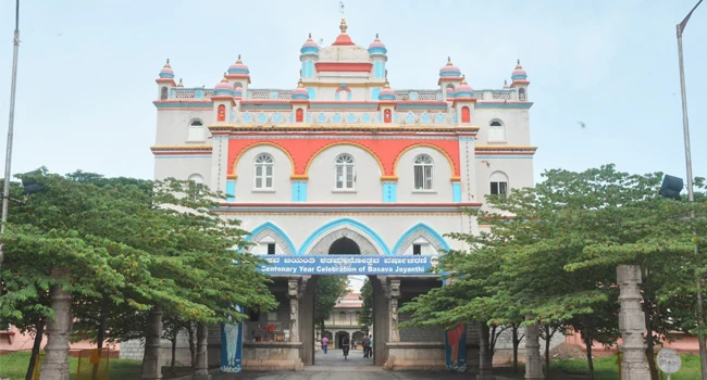
Photographs: Hari K Patibanda, CC BY 2.0, via Wikimedia Commons (CC BY 2.0). Wikimedia Commons.