What to expect
Highlights
- A shola-grassland ridge trek on the state border.
- Views over both Kodagu and Wayanad.
- The biodiversity of the Brahmagiri Wildlife Sanctuary.
The Brahmagiri Peak and Wildlife Sanctuary lie on the Kodagu–Wayanad border in south Kodagu, trekked from Iruppu Falls. The shola-grassland ridge, rising to about 1,600 m, marks the Karnataka–Kerala state line, and the sanctuary protects rich Western Ghats flora and fauna.

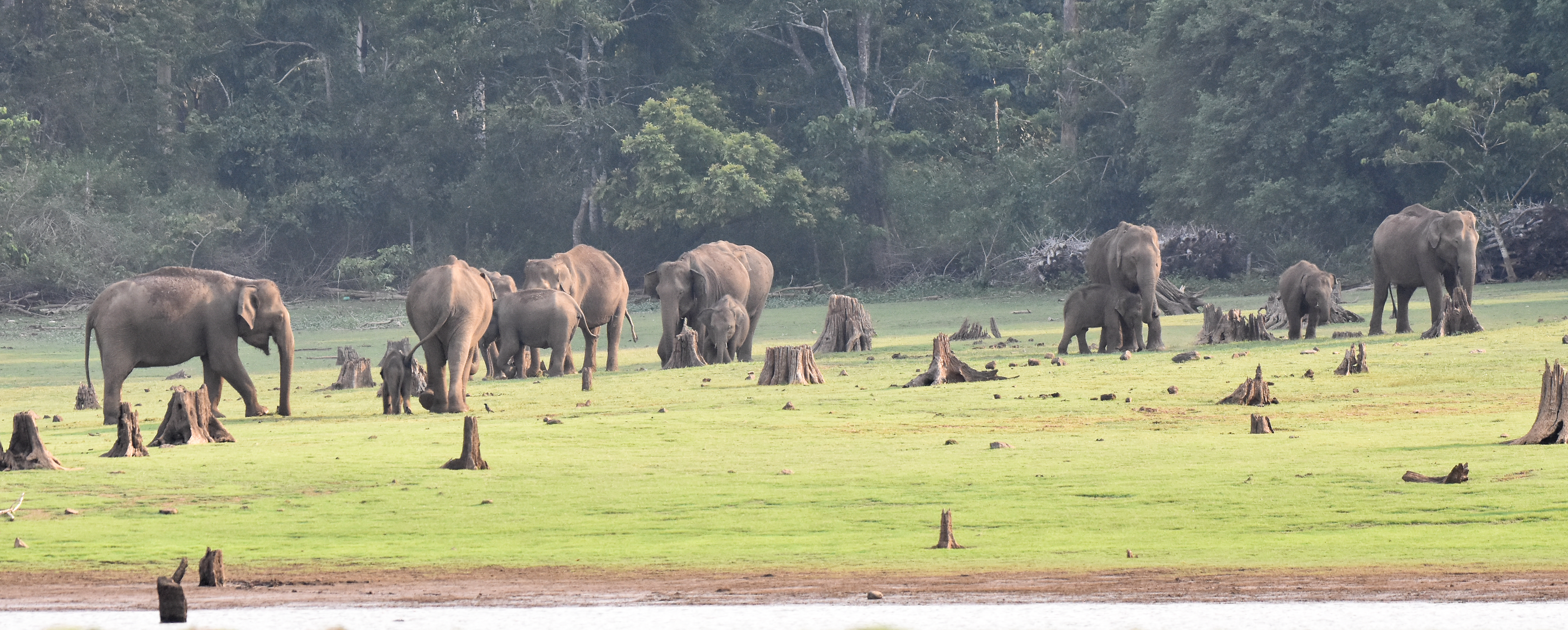
The trek from Iruppu climbs through forest to open grassland with wide views over both states; it needs a forest permit and is often done with a guide. Wildlife includes elephants, Nilgiri langur and varied birds.
Road km to Kodagu; ghat roads and traffic vary — allow extra.
October to February, in clear weather; the sanctuary and trek may close in the monsoon.
Live forecast loads in your browser.
Sun and moon are calculated for this location and shown in IST. Photography windows are the hour around sunrise and sunset; the sunset bearing is degrees clockwise from true north. Moon phase is accurate to about half a day.
Verified hotels, homestays, restaurants, experiences, sights, shops and rentals around Brahmagiri Peak — commission-free, with direct contact. Filter by what you need.
Place of worship. Kurchi Village & PO, Srimangalanadu, virajpet, southkodagu.

Book with the place itself. India’s cyber-crime coordination centre warned in April 2025 that convincing copies of hotel and pilgrimage booking sites are being pushed through sponsored search and social ads, taking payment for rooms the property never hears about. Every listing here links to the business’s own contact details and its own Google or Bing profile — we take no commission and sit in nobody’s payment path. If a booking page reached you through an ad, check the address bar against the property’s own site before you pay. Fraud can be reported on cybercrime.gov.in or on 1930.
3 more places around Srimangala. Open a guide to plan the visit and onward journey.

38.1 km · 458 min walk
A 52 m waterfall on the Lakshmana Tirtha in south Kodagu near Srimangala, sacred for its Rameshwara Shiva temple and set at the foot of the Brahmagiri hills; it is the starting point of the Brahmagiri trek and is fullest during and after the monsoon.

53.6 km · 643 min walk
The Kodagu side of Nagarhole (Rajiv Gandhi) National Park, a tiger reserve of teak and rosewood forest entered from the Kutta and Nanachi gates in south Kodagu; jeep safaris offer elephants, gaur, deer and wild dogs and, with luck, tiger or leopard (the park is shared with Mysuru’s Kabini side).
7.6 km · ~19 min by auto
A private rainforest reserve of about 120 hectares near Brahmagiri in south Kodagu, created to protect Western Ghats forest and wildlife; it offers guided nature walks and eco-stays amid elephants, birds and rich flora.
Roampedia is commission-free — own or know a stay, eatery, guide or shop near Brahmagiri Peak? List it and it appears here once verified.
Add a nearby businessEntry: Forest permit required (trekker numbers capped)
Trailhead at Iruppu Falls near Srimangala
If you are travelling by bus or ferry, check the return service with the operator before setting out. Leave time to reach the stop or jetty after your visit.
Ask at the bus stand for the time of the last service back, not the next one. If you miss it, an auto or app cab is the fallback — agree the fare before you get in.
If you need step-free access, contact the site before travelling. Ask about a level entrance, steps along the route, the nearest drop-off point, seating and accessible toilets.
Emergency numbers are verified against official government and state tourism sources. 112 works anywhere in India.
A private rainforest reserve of about 120 hectares near Brahmagiri in south Kodagu, created to protect Western Ghats forest and wildlife; it offers guided nature walks and eco-stays amid elephants, birds and rich flora.
7.6 km · ~19 min by auto · straight lineA 52 m waterfall on the Lakshmana Tirtha in south Kodagu near Srimangala, sacred for its Rameshwara Shiva temple and set at the foot of the Brahmagiri hills; it is the starting point of the Brahmagiri trek and is fullest during and after the monsoon.
38.1 km · 458 min walk
The highest peak in Kodagu at about 1,748 m, near Kakkabe, and one of the most popular treks in Coorg — a half-day climb through shola forest and rolling grassland to a summit with sweeping Western Ghats views; the historic Nalknad Palace lies at its base.
47.6 km · ~79 min by cab · straight lineThe Kodagu side of Nagarhole (Rajiv Gandhi) National Park, a tiger reserve of teak and rosewood forest entered from the Kutta and Nanachi gates in south Kodagu; jeep safaris offer elephants, gaur, deer and wild dogs and, with luck, tiger or leopard (the park is shared with Mysuru’s Kabini side).
53.6 km · 643 min walk
A 1792 palace of the Kodagu (Haleri) kings tucked among coffee estates at the foot of Tadiandamol near Kakkabe, its wooden halls painted with faded murals; it was the last refuge of the Kodagu royals before the British annexation.
97.9 km · 1175 min walkA cascade on a tributary of the Kaveri near Cheyyandane, close to Kakkabe, tumbling over a broad rock face; a short walk from the road (the descent to the base is often restricted), it is best just after the monsoon.
101.6 km · 1219 min walk
A hilltop fort in the heart of Madikeri, first built in the 17th century by the Haleri rajas and rebuilt in stone by Tipu Sultan and the British, now enclosing government offices, a small museum, a church and views over the town.
105.3 km · 1263 min walk
An 1820 Shiva temple in Madikeri built by Lingarajendra II in an unusual blend of Kerala, Gothic and Islamic styles, with a domed roof, minaret-like towers and a central tank.
105.7 km · 1269 min walkThe most important temple of the Kodava people, near Kakkabe, dedicated to Igguthappa (a form of Subramanya/Kartikeya); a Kerala-influenced shrine that is the focus of the community’s Kailpodh and other festivals.
108.6 km · 1303 min walk
A forest camp on the banks of the Kaveri near Kushalnagar where trained elephants are bathed and fed; reached across the river and known for its elephant interactions and coracle rides.
114.3 km · 1371 min walk
The Golden Temple at Bylakuppe near Kushalnagar, the largest teaching centre of the Nyingma school of Tibetan Buddhism in the world, with gilded 12–18 m Buddha statues, vivid murals and hundreds of resident monks.
123.2 km · 1478 min walk
A 64-acre river island of bamboo, sandalwood and teak on the Kaveri near Kushalnagar, reached by a hanging bridge, with a deer park, boating, a treehouse and easy forest walks.
127.6 km · 1531 min walkWalking and driving times are real routed distances, except the few marked “straight line”, which are direct-line estimates and will read short.Routing: © openrouteservice.org by HeiGIT | Map data © OpenStreetMap contributors
October to February, in clear weather; the sanctuary and trek may close in the monsoon.
Entry: Forest permit required (trekker numbers capped). Timings: Full-day trek from Iruppu; start early.
Trailhead at Iruppu Falls near Srimangala; obtain a forest-department permit at the range office before climbing. A full-day trek — start early, and go with a guide as the grassland can be disorienting in mist.
A full day for the trek.
Nearby you can pair SAI Sanctuary (7.6 km), Iruppu Falls (38.1 km), Tadiandamol (47.6 km), Nagarhole National Park (53.6 km).
We have not published a story about Brahmagiri Peak itself yet. These cover Srimangala and the wider district, with separate journeys between stops.
These guides explore Srimangala and the surrounding area. Choose a visit that fits your interests, allowing separately for travel between stops.


Route-level itineraries and practical guides for the rest of Karnataka.
Photographs: Jaseem Hamza, CC BY 3.0, via Wikimedia Commons (CC BY 3.0). Wikimedia Commons.


