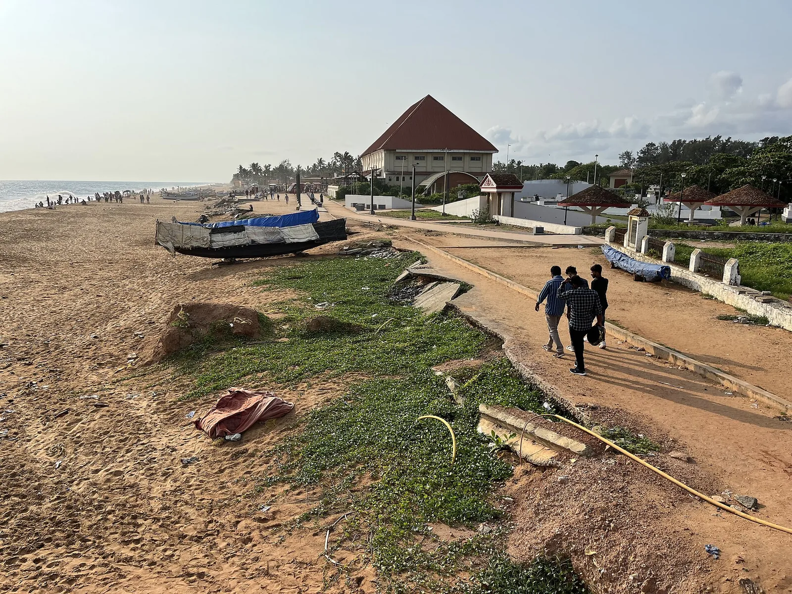
A photograph of Shanghumugham Beach shows broken road slabs tipped into sand. A road is meant to make a line through a landscape; here the line stopped. What happened to the coast around it is a bigger story than a dramatic image can tell on its own.
The visible loss
The former airport approach-road remains make erosion tangible. They show that infrastructure at the shore was damaged, but a photograph does not date every loss or measure a long-term shoreline trend. A precise annual retreat rate needs a dated sequence of surveys at specified points; a single number repeated without its measurement period can mislead.
From damaged road to a named hotspot
Kerala’s 2024 Economic Review lists Shanghumugham among ten coastal erosion hotspots for which the National Centre for Coastal Research was asked to undertake site-specific studies. That is a stronger statement than simply calling the beach “under repair”: it means the state identified a place needing an investigation and a local design response. The review does not establish that one cause explains every episode of erosion here.
Why one culprit is too easy
Waves, seasonal sand movement, shoreline structures and longer-term sediment supply can all matter on a coast. Their contribution at Shanghumugham needs evidence specific to this site. A Kerala government account discussing Vizhinjam Port says expert committees did not attribute this beach’s erosion to the port. That is the government’s reported finding, not a complete independent explanation of the shoreline. The state’s call for site-specific studies is the sounder place to leave the causal question.
Reading the beach now
The broken road is a warning against treating the shoreline as fixed. It is not a route instruction: sections may be closed or unsafe after rough weather. Follow current barriers and access advice, and keep away from damaged edges. The question to carry from the road to the beach is what the local studies find and how their recommended protection works over time.
Frequently asked questions
What are the concrete slabs at Shanghumugham?
Photographs identify them as remains of a former airport approach road damaged by coastal erosion. Check current access conditions before trying to reach any particular spot.
How fast is the beach eroding?
An exact annual rate needs a cited survey period and location.
What is the state doing about the coast?
Kerala’s 2024 Economic Review names Shanghumugham among ten erosion hotspots selected for site-specific study by the National Centre for Coastal Research.
Did Vizhinjam Port cause the road damage?
The cited materials do not establish that. A Kerala government account says expert committees did not attribute the beach’s erosion to the port; site-specific coastal evidence is needed for a fuller causal account.