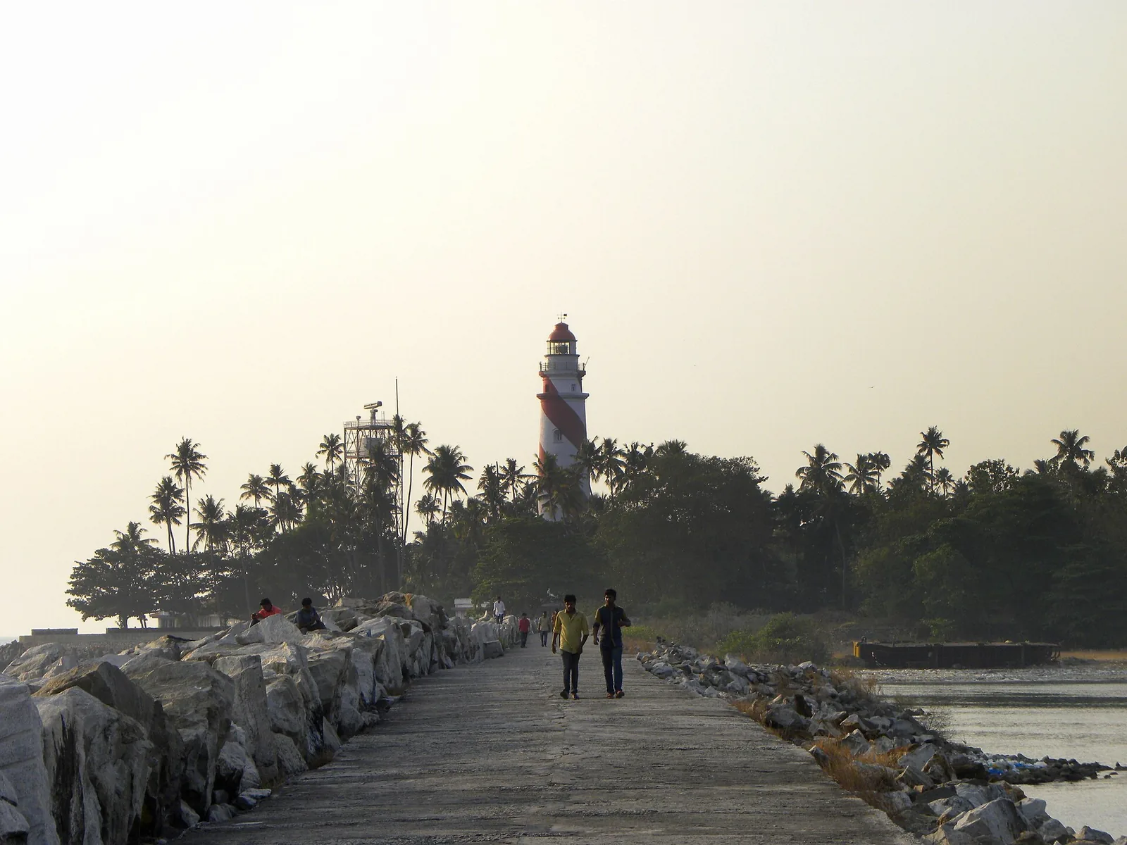
Stand at the foot of the lighthouse and walk inland. Within a few hundred metres you will have crossed what was, until the middle of the twentieth century, an international frontier.

Thangassery — Tangasseri on the old maps — was a British enclave. Not a British-influenced town, not a treaty port, but sovereign British Indian territory: ninety-nine acres, under four-tenths of a square kilometre, with the Arabian Sea on one side and the princely state of Travancore on every other.

How ninety-nine acres end up on a map

The sequence begins with the Dutch, who held the cape from the seventeenth century as a warehouse and fortified post gathering pepper and coast produce. When Dutch power in India collapsed at the end of the eighteenth century, their possessions changed hands, and on 20 October 1795 the British East India Company formally took over here.

What is unusual is not the transfer. It is that the transfer did not dissolve. Travancore, meanwhile, entered into treaty with the British and became a protectorate in the same year — the DGLL's own station history puts it in one sentence: "Travancore state entered into a treaty with the British and became their protectorate in 1795." A protectorate is not the same thing as British territory, and that distinction is exactly what left Thangassery stranded.

So the cape stayed under direct British administration as part of the Madras Presidency, while everything around it for a hundred kilometres in any direction was a princely state with its own maharaja, its own courts, its own revenue system and — crucially for what follows — its own immunity from a good deal of British Indian law.

Governed from the far side of the mountains

Ninety-nine acres is not enough to hang an administration on, so the enclave was tacked onto whichever mainland district was convenient. It was attached at different times to the Anjengo district — Anjengo being Anchuthengu, the other little English toehold up the coast near Attingal — and to the great Malabar District of the Madras Presidency, several hundred kilometres north.

We should be honest that the order of those attachments is reported inconsistently. Some accounts put Anjengo first and Malabar later; others describe the enclave as Malabar's until the twenties. We have not found a document that settles the sequence, so we are not going to assert one.

What is consistently reported is the last move, and it is the strangest. From 1 July 1927 the enclave was administered from Tirunelveli — Tinnevelly — which is not merely in another district but on the other side of the Western Ghats, in Tamil country, reached from here through the Shencottah Gap. A resident of this cape with official business had, in principle, a mountain pass between themselves and their district headquarters.

A customs gate on a village lane

The border was not notional. The Tangasseri Arch, which still stands, worked as a customs check-post and a border gateway, regulating goods and people entering the settlement. A gate of that kind on a lane you can cross in a few minutes is the most legible thing the enclave left behind: a village with a frontier post.

It also explains the cape's social texture, which visitors notice before they know any of this history. Thangassery held an Anglo-Indian and Latin Catholic community, with churches, cemeteries and surnames that belong to a different administrative world from the streets a short walk inland. Enclaves breed distinct populations because the rules on either side of the line differ for long enough to matter.

Why the lighthouse and the cemetery are both central government property

Here is where the abstraction becomes something you can go and look at.

The Portuguese Cemetery at Thangassery has been a centrally protected monument under the Archaeological Survey of India since 1920 — a strikingly early date for a monument in what is now Kerala. The reason, on our reading, is precisely the enclave: the Ancient Monuments Preservation Act was British Indian law, and it did not run inside a princely state. On these ninety-nine acres it did. The ASI could protect a monument here in 1920 for the same reason it could not have protected one a kilometre inland.

The lighthouse follows the same logic. A light commissioned on 1 March 1902 on British territory was a Madras Presidency asset, built and maintained by the imperial lighthouse establishment — which is why the tower sits today on the register of the Directorate General of Lighthouses and Lightships, a Government of India body, as station F-0712, with a Union government staff of four living in Union government quarters in a compound in the middle of a Kerala town.

Two central-government footprints on one small cape, both of them inherited from a border that no longer exists.

The end

The enclave outlasted Indian independence by nearly two years. It was absorbed when Travancore and Cochin were merged into the new state of Travancore–Cochin on 1 July 1949, and the ninety-nine acres finally became administratively continuous with the town they had always been physically part of.

None of this is signposted. There is no plaque on the arch explaining that it was a customs post between two jurisdictions, and no marker where the boundary ran. But it is the reason the cape feels like a separate place, and it is the reason two arms of the Government of India own property on it.

Frequently asked questions

Was Thangassery really not part of Travancore?

Correct. It was a British enclave of about 99 acres — under 0.4 square kilometres — surrounded on all landward sides by the princely state of Travancore. The British East India Company took formal control on 20 October 1795 and it remained British Indian territory, not princely-state territory, until 1949.

Which district administered it?

It was attached at different times to the Anjengo district and to the Malabar District of the Madras Presidency; the order is reported inconsistently and we have not been able to settle it. From 1 July 1927 it was administered from Tirunelveli (Tinnevelly), on the other side of the Western Ghats.

When did it stop being an enclave?

It was absorbed when Travancore and Cochin merged to form Travancore–Cochin on 1 July 1949, nearly two years after Indian independence.

Is there anything left of the border?

The Tangasseri Arch, which functioned as a customs check-post and border gateway into the settlement. It is unmarked as such — there is no plaque explaining what it was for.

Why is the cemetery protected by the ASI and not the state?

It has been a centrally protected monument since 1920. Our reading is that this was possible because the Ancient Monuments Preservation Act was British Indian law and did not apply inside princely Travancore, but did apply on these 99 acres. The same logic explains why the 1902 lighthouse is a Government of India station today.