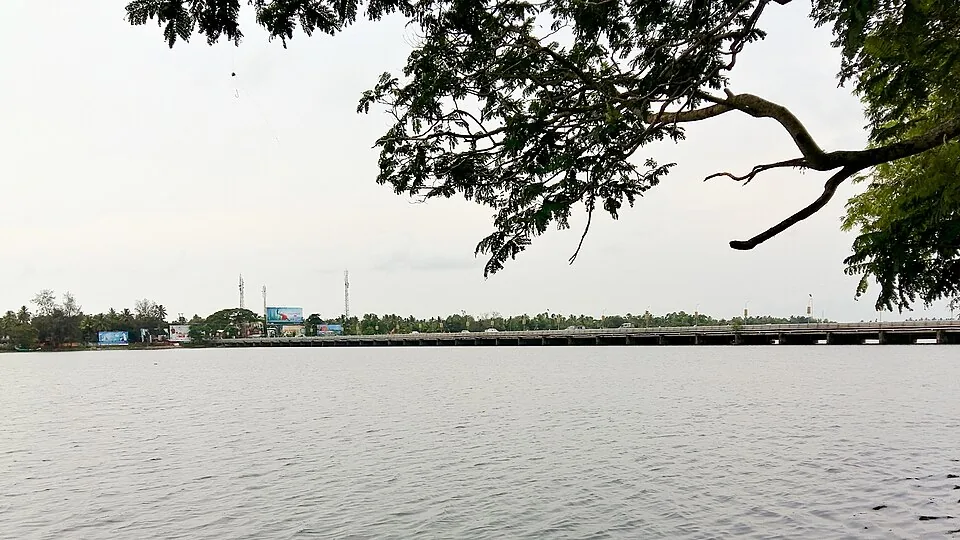
Look up the Thottappally spillway and you will be told it was designed to discharge 19,500 cubic metres of water per second.
That number is wrong
The Kerala Irrigation Department, on its own site, states it plainly: the actual design capacity of Thottappally spillway is 1,800 cubic metres per second, but it gets reduced to 600 cubic metres per second due to silt deposited at the bottom of the channel.
The printed figure is about eleven times the real one. It is also, on a moment’s reflection, absurd — 19,500 cumecs is a discharge in the class of the world’s great rivers in flood, not of a line of shutters across a Kerala channel.
We mention it not to score a point but because the error flatters the structure. It suggests Kuttanad is protected by something enormous. The truth is the opposite, and considerably more serious: the district’s principal flood outlet has been operating at roughly a third of its intended capacity for decades.
Three problems, compounding
The reasons are on record and they work against each other.
First, the sea. During the monsoon, sea-breeze-driven conditions raise the level of the sea relative to Kuttanad — so at exactly the moment the land most needs to drain, it has the least fall to drain with.
Second, the bar. Sand accumulates west of the spillway and closes the outlet. This is not a rare event; it is the normal state of the mouth for most of the year.
Third, the pipe is too small. The leading canal that brings water to the spillway is too narrow, so even a fully open mouth cannot be fed fast enough.
A drain needs gradient, an open outlet and adequate capacity. Thottappally has a problem with all three simultaneously, and the monsoon presents them all at once.
August 2018
The mouth had been opened to 200 metres, well before the flood. It was not enough.
That August brought the worst flooding in Kerala in nearly a century — all fourteen districts on red alert, a Level 3 Calamity declaration, and comparisons in every conversation to the great flood of 99, the Malayalam-era year corresponding to 1924. The Achankovil, Manimala, Pamba, Puthanar and Thalavadiyar overflowed to roof height.
The emergency measures on record tell you how bad it was better than any adjective. Every shutter raised. Desilting round the clock. And the partial dismantling of a national highway bridge that was obstructing the flow.
A road bridge taken apart to let a river out. That is the scale at which this problem operates.
The mirror at the other end of the lake
It helps to see Thottappally beside its opposite number. Some twenty kilometres north, the Thanneermukkom bund exists to keep water out — closed against the tide so that salt does not reach the paddy during the cropping season.
Thottappally exists to let water out, and fast. One holds a line; the other opens a valve. Kuttanad needs both to work, at opposite ends of the same year, and this is the one running at a third of capacity.
The department’s stated aim is to open the mouth to about 320 metres with sufficient depth in the channel. Whether that happens, and whether it is enough, is the most consequential open question in the district.
Frequently asked questions
What is the Thottappally spillway’s capacity?
The Kerala Irrigation Department gives a design capacity of 1,800 cubic metres per second, reduced to about 600 in practice by silt in the channel. The figure of 19,500 cumecs that circulates widely is roughly eleven times too high and is not the department’s.
Why does it underperform?
Three compounding reasons: during the monsoon the sea rises relative to Kuttanad, reducing the available fall; a sand bar forms west of the spillway and closes the outlet; and the leading canal feeding the spillway is too narrow.
What happened in the 2018 flood?
The estuary mouth had been opened to 200 m in advance and Kuttanad still flooded. August 2018 was Kerala’s worst flooding in nearly a century, with all 14 districts on red alert and a Level 3 Calamity declared. Emergency measures included raising all shutters, continuous desilting, and partially dismantling a national highway bridge that impeded flow.
How does it relate to the Thanneermukkom bund?
They are opposites on the same system. Thanneermukkom keeps salt water out of the paddy during the cropping season; Thottappally lets floodwater out to the sea. Kuttanad depends on both, at opposite ends of the year.