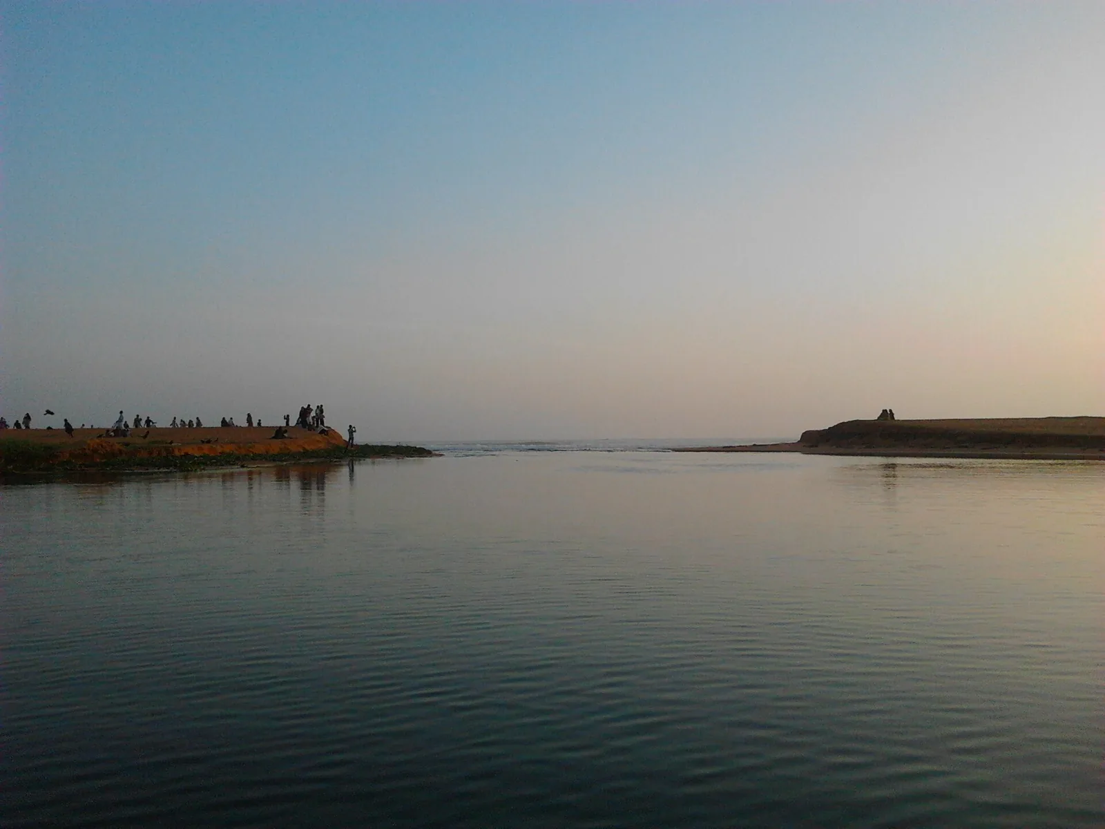
The thing everybody photographs at Veli is the seam: a strip of sand with flat lagoon on one side and open surf on the other, and a gap where the two meet.

It reads as scenery. It is actually the control valve for a water body two kilometres long, and almost everything that puzzles a visitor about this coast’s lagoons follows from it.

One opening

The Veli–Akkulam system is a single connected backwater running inland from this bar. Akkulam is its landward end; Veli is the seaward one. And the gap in the sand at Veli is the only opening the whole system has.

That is an unremarkable sentence with substantial consequences. Water and everything in it — runoff from a built-up catchment, sewage entering the drains, silt, nutrients — arrives at the inland end and has to travel the length of the lagoon and out through this single mouth, or stay.

Near the mouth, tidal exchange works: salt water pushes in, fresh water flushes out, the water turns over. Two kilometres inland it barely does. So the same body of water can be reasonably clear at Veli and turbid, weed-choked and low in oxygen at Akkulam on the same afternoon, and visitors reasonably conclude they are looking at two different lakes.

Why the bar moves

A sand bar across a lagoon mouth is not a fixed structure. It is a running argument between two forces. The sea builds it: longshore drift carries sand along the coast and deposits it across the opening, and the south-west monsoon swell is very good at this. The lagoon cuts it: water backing up behind the bar eventually has enough head to breach it and scour a channel out.

Left alone the mouth would open and close on its own cycle, wide after heavy rain, narrowing or sealing in the dry months. Where a lagoon sits behind a city, that cycle is not left alone — the bar gets cut mechanically to relieve flooding or to flush the system, and it closes again.

This is why the geography at Veli is not a permanent feature you can rely on looking the same. The width of that gap on the day you visit is a snapshot of an argument, not a fact about the coast.

What it means for the lagoon behind

Flushing is the single most important variable in a coastal lagoon’s health, and it is entirely a function of the mouth. A wide, open mouth exchanges water on every tide, exports nutrients, keeps salinity variable enough to suppress freshwater weed, and moves dissolved oxygen inland. A narrow or closed mouth does none of it.

That is the mechanism behind Akkulam’s condition. Studies of the Akkulam–Veli system report sustained sewage and urban run-off and, more tellingly, that on the order of 99% of the contaminant load sits in the sediments rather than in the water column — the signature of a system that receives and retains rather than one that receives and exports. The inland end of a poorly flushed lagoon is a settling tank, whatever anyone intended it to be.

The engineering answer, and its limits

The historical response to a coast full of half-closed lagoons was to link them into a navigable chain — the Parvathy Puthanar and the other Travancore cuts, and now the Akkulam–Chettuva waterway opened on 26 February 2026, which makes Akkulam the southern head of a 280 km route north to Thrissur.

Navigation and flushing are not the same problem, though they overlap. Deepening a channel so a boat can pass does improve exchange, and clearing weed helps. But a canal system built to move craft is not designed to move a city’s nutrient load out to sea, and no amount of dredging fixes what is arriving at the top.

Standing on the bar

Go out to the sand at Veli in the late afternoon and look inland rather than out. The lagoon narrowing away towards the coconut line is the beginning of a two-kilometre cul-de-sac, and you are standing on its only exit.

It is the most instructive spot on this coast for understanding why some Kerala backwaters are jewels and others are problems. The difference is very often just how well the mouth works.

Frequently asked questions

Where does Veli lagoon meet the sea?

At the sandbar in front of the tourist village, where a gap in the sand connects the lagoon to the Arabian Sea. It is the only opening the entire Veli–Akkulam system has.

Why is the water different at Veli and Akkulam?

Because Veli is at the mouth and Akkulam is two kilometres inland at the closed end. Tidal exchange turns the water over near the opening and barely reaches the far end, so the seaward end flushes while the landward end accumulates — the same water body behaving very differently at its two ends.

Does the sandbar open and close?

Yes. Longshore drift and monsoon swell build sand across the mouth; water backing up behind it eventually breaches and scours a channel. Behind a city the cycle is also managed, with the bar cut mechanically to relieve flooding or flush the system. The width of the gap on any given day is not a permanent feature.

Why does the mouth matter so much?

Because flushing determines a lagoon’s health. An open mouth exchanges water each tide, exports nutrients, varies salinity enough to suppress freshwater weed and carries oxygen inland. A narrow or closed mouth does none of that, and the inland end becomes a settling tank.

Is Akkulam part of the same water as Veli?

Yes — one connected backwater system, with Akkulam at the landward end and Veli at the seaward one. They are usually visited together and are a couple of kilometres apart.

Has the waterway project changed the flushing?

Only partly, and that is not what it was for. The Akkulam–Chettuva waterway opened on 26 February 2026 makes Akkulam the head of a 280 km navigable route north to Thrissur, and deepening and weed clearance do help exchange. But a channel designed to move boats is not designed to export a city’s nutrient load, and it does nothing about what arrives at the top.