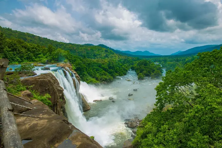
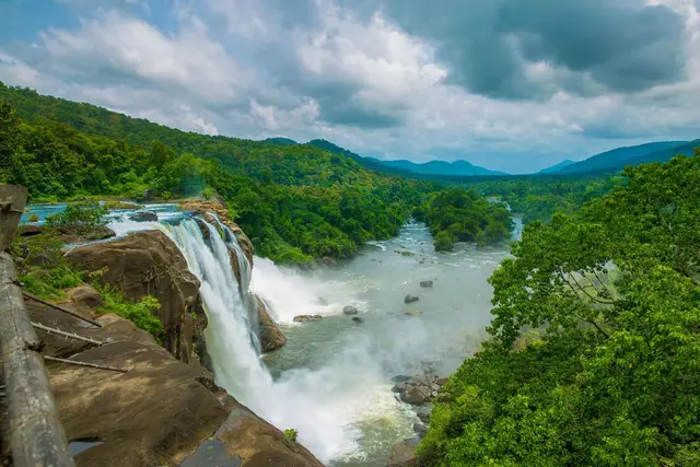
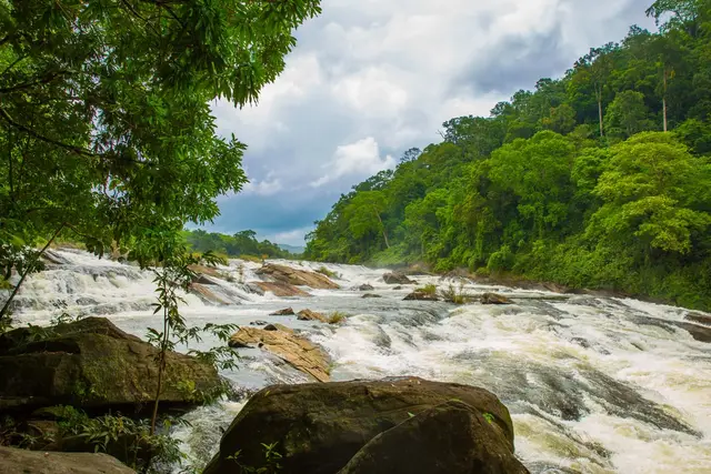
Athirappilly and Vazhachal are usually sold as two waterfalls and a car park. They are better understood as the lower end of a road: State Highway 21 leaves Chalakudy, follows the Chalakudy river past Thumboormuzhi, Athirappilly, Charpa and Vazhachal, climbs through the Sholayar forests and tops out at Malakkappara on the Tamil Nadu border, 86 km up and 948 m above the sea. Everything that makes this belt matter is strung along that road rather than concentrated at the viewpoints — a river that carries 98 of Kerala’s 152 freshwater fish species, a ribbon of low-elevation riparian rainforest measured in hectares rather than square kilometres, the only stretch in the state where all four South Indian hornbills nest, and the Kadar settlements whose community forest rights turned a conservation argument into a legal one.
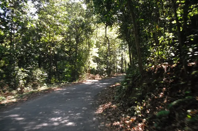
Treat this as a drive, not a destination. The road up from Chalakudy is State Highway 21, and it passes the Thumboormuzhi check dam, then Athirappilly, then Charpa, then Vazhachal, then the Sholayar reservoir, before finishing among tea at Malakkappara — 86 km from Chalakudy by Kerala’s reckoning, and 89 km from Pollachi if you come at it from the Tamil Nadu side through Valparai. Most visitors turn round at Vazhachal, five kilometres above Athirappilly, and never see the four-fifths of the belt that lies beyond it. The upper road is the quiet part, and it is where the forest stops being scenery and starts being a place people live.
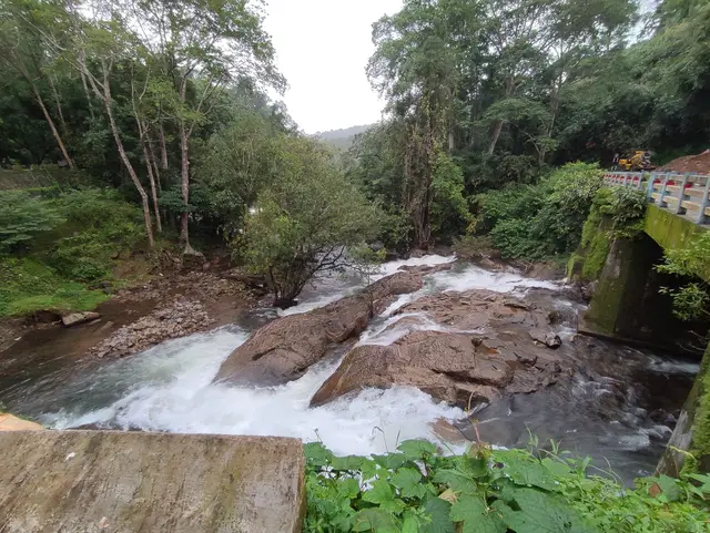
Charpa deserves a warning rather than a recommendation. It sits directly beside the road between Athirappilly and Vazhachal, and in June, July and August the water lands on the tarmac itself, which is the whole appeal — you drive through it. In the dry months it stops completely. There is no reduced version and no trickle to photograph; there is a bare rock face and a wet stain. If a plan for the day lists Charpa as a stop in February, that plan was written by someone who has not been in February.
The river the road follows is the reason for everything else. The Chalakudy runs 145.5 km from the Anaimalai high ranges to the sea, drains a basin of 1,704 sq km — 1,404 of them in Kerala, the rest in Tamil Nadu — and carries an average discharge of about 52 cubic metres a second. Those are ordinary numbers. The extraordinary one is the fish count: 98 species of freshwater fish have been recorded in the Chalakudy, out of 152 known from the whole of Kerala. The National Bureau of Fish Genetic Resources has assessed that it could well be the richest river in India for fish diversity.
That figure is not a curiosity, it is a conservation problem. Of the 98 species, 35 are endemic to the Western Ghats and 31 are formally threatened — 11 vulnerable, 16 endangered and four critically endangered. Two are found in this river and effectively nowhere else: Horabagrus nigricollaris, a yellow catfish, and Sahyadria chalakkudiensis, the denison barb’s close relative, a fish better known to the international aquarium trade than to the people who live above it. A river can be rich and fragile at the same time, and this one is the standard example.
The forest that matters here is smaller than almost anyone assumes. The riparian strip — the true low-elevation riverine rainforest, the habitat the arguments are about — has been surveyed as running 10.5 km downstream of Peringalkuthu and covering 58.5 hectares, of which 26.4 hectares lie in the Vazhachal stretch. That is well under a square kilometre in total. Within it, 319 species of flowering plants have been recorded, 24 of them endemic and ten rare or endangered. When people say this belt holds the last substantial low-elevation riverine forest in Kerala, that is the size of the thing they are describing.
The hornbills follow from the forest, not from the falls. The Athirappilly–Vazhachal–Nelliyampathy low-elevation riparian belt is described in the ornithological literature as the only place where all four South Indian hornbill species occur together — the great hornbill, the Malabar pied, the Malabar grey and the Indian grey — and, more narrowly, as the only known nesting location in Kerala for the Malabar pied hornbill. A preliminary survey of the Vazhachal division in 2004–05 located 23 great hornbill nests and two Malabar pied nests. Those are the actual numbers behind a claim that gets repeated as a slogan.
What happened next is the part of the story that gets left out. From 1999 a nest-protection programme grew out of a small group of hornbill enthusiasts into the Western Ghats Hornbill Foundation, founded and led by the researcher K. H. Amitha Bachan and working with the Kerala Forest Department. The number of nests under protection has gone from 57 to 114, and around 72 Kadar young people are employed in the work, for a fixed monthly income rather than a volunteer’s thanks. Senthil Kumar, a conservationist from the Kadar community, has described the change plainly: the birds were once poached for meat and their eggs taken for herbal preparations, and the practice ended completely over those two decades.
The river above you is already heavily engineered, and being honest about that changes how the belt reads. Peringalkuthu, begun in 1949 and opened on 15 May 1957, was the first hydroelectric project on the Chalakudy — a concrete dam 23 m high and 290.25 m long, impounding about 32 million cubic metres. Above it the Sholayar project at Malakkappara followed in the 1960s. Downstream, the Thumboormuzhi check dam serves irrigation and, these days, a butterfly garden and a hanging bridge. The Peringalkuthu reservoir also takes water released from the Parambikulam–Aliyar system, an inter-state, inter-basin scheme that moves water from these west-flowing catchments towards the dry plains of Tamil Nadu. Six reservoirs already hold this basin. The project fought over for decades would have been the seventh.
The Kadar who defended this river against that seventh dam were themselves moved here by earlier ones. In an interview published by the Kerala Museum, Geetha Vazhachal describes a community originally of Parambikulam, displaced by a colonial-era dam and then shifted through Kuriyarkutty, Mukkampuzha, Vachumaram and Anakkayam before settling at Vazhachal. It is worth holding that sequence in mind at the viewpoint: the people who hold the legal veto over the next dam are living where they are because of the last ones, and many families still lack title to the ground their houses stand on.
Practical reality on the upper road: this is elephant country, one bull known locally as Kabali has a reputation along the Athirappilly–Vazhachal–Malakkappara sector, and the forest checkposts close in the evening. Do not plan to come down after dark, do not stop between the settlements, and treat the posted instructions as the local knowledge they are rather than as bureaucracy.
Legend & myth
Start with what this page is not going to do. The etymology of the name Athirappilly, the “Niagara of India” label, the Baahubali cliff that does not exist, the argument about whether the fall is one curtain or four drops, and the safety of the rocks above the lip all belong to the waterfall itself and are dealt with there. This is the belt around it, and it has its own set of things people believe that are not quite so.
The names along the road are less settled than the confident guide at the car park suggests. Vazhachal, Charpa, Malakkappara, Peringalkuthu, Thumboormuzhi — each has at least one tidy Malayalam gloss offered locally, and we have not found a source that settles any of them. We searched the Malayalam Wikipedia article on അതിരപ്പിള്ളി, which turns out to be an administrative page about the gram panchayat and carries no ഐതിഹ്യം section at all, and the Malayalam page on വാഴച്ചാൽ, which describes the falls and their measurements and offers neither an etymology nor a legend. That absence is worth stating rather than filling. It is not evidence that the belt has no oral tradition; it is evidence that the oral tradition here has not been written down in the places we can check, which is a different and rather more common thing.
What has been written down is a colonial ethnographer’s account, and it needs handling with care. Edgar Thurston’s Castes and Tribes of Southern India, published in 1909, records the religion of the Kadir — the Kadar — of the Anaimalai hills, the same forest complex that reaches down to this river. He names four objects of worship, and what is striking is how little architecture any of them require. Paikutlātha was a projecting rock overhanging a slab, with two stones set on end. Iyappaswāmi was a single stone set up beneath a teak tree, and was appealed to as a protector against sickness and disease. Māsanyātha was a recumbent female figure in stone on a masonry wall in the open near Anaimalai village, and before her, Thurston records, trial by ordeal was carried out. The fourth, Vanathavāthi, had no shrine at all and was, in his phrase, worshipped anywhere as an invisible god.
That last one is the most interesting thing in the record, and the easiest to lose. A god with no building, no image and no fixed address is a god you can carry, which is exactly what a community that moves through a forest needs. It is also, in a landscape that has since displaced these people at least four times, a form of religion that survives relocation better than a temple does. None of this should be read as a description of current practice at Vazhachal — it is a hundred-and-fifteen-year-old outsider’s account of a wider region, and many Kadar today identify as Hindu — but it is the oldest specific thing anyone recorded about belief in these hills, and it deserves better than being ignored because it is inconvenient.
Thurston also recorded two customs that visitors sometimes hear about in garbled form and should not go looking for. The first is the chipping of the incisor teeth, upper and lower, into a sharp-pointed cone; the reason given to him was that chipped teeth made a man or woman handsome, and that a person whose teeth had not been so treated had teeth and ate like a cow. This is a documented historical custom, not a spectacle on offer, and asking to see it is the sort of thing that makes a settlement dread visitors. The second is honey collection, and it is the one image in the whole account that still explains this landscape: men descending giddy precipices at night, torch in hand, on a stout creeper suspended over the abyss, to smoke out the bees and take the honey. The cliffs are still there. So is the honey.
The bird carries the belt’s one genuine modern reversal, and it is a better story than a legend. The great hornbill is malamuzhakki vezhambal in Malayalam — roughly, the one whose call resounds through the mountains — and within living memory it was hunted here for meat, with its eggs taken for herbal preparations of doubtful value. Today the people who hunted it are paid to guard its nests, and the number of protected nests has doubled. Nothing supernatural occurred. A community changed its mind, and was given a reason and an income to make the change stick.
Then there is the myth this belt attracts most, which is the idea of untouched wilderness. Almost every description of Athirappilly and Vazhachal reaches for words like virgin and pristine. The river has six reservoirs on it, part of its upper catchment is diverted across the state border to Tamil Nadu under the Parambikulam–Aliyar scheme, the tea at the top of the road is an estate, and the forest has been inhabited and worked by the Kadar for longer than any of it. This is a lived-in, heavily managed, legally contested landscape. That is not a lesser thing than wilderness. It is the reason the place still exists, because wilderness has no one with standing to defend it and this forest does.
The last belief is the most consequential and it was argued in court rather than around a fire: that a dam immediately upstream would leave the falls essentially as they are. Opponents held that the falls would run to a regulated trickle outside release hours, that the 58.5 hectares of riparian forest could not survive an altered flow regime, and that the hornbills’ nesting trees would go with it. Whatever else the long fight settled, it settled this — the argument was never about the view from the viewpoint.
More about Athirappilly and Vazhachal
History
The defining modern history of this belt is a proposal that was never built, and the dates matter because they are routinely reported wrongly. The 163-megawatt Athirappilly hydroelectric project would have dammed the Chalakudy just above the falls — a barrage of 23 metres by 311 metres, about five kilometres above the Athirappilly fall and four hundred metres above Vazhachal, which would have been the seventh large dam on a river 144 kilometres long. Four different starting dates are in circulation and none of them can be dismissed. The Malayalam Wikipedia article devoted to the project says flatly that the electricity board has been seeking clearance from the Union environment ministry for a scheme of this kind since 1970. Mongabay-India and Down To Earth date the proposal to 1979. English Wikipedia dates the 163-megawatt proposal to 1994. The News Minute says 1996. The likeliest reading is that these mark different steps in one very long process rather than four rival answers to one question, but no source we have found says so, and we are not going to invent the reconciliation. What can be said plainly is that the scheme has been pursued for half a century and never built.
The rest of the sequence is better attested. A first environmental clearance was obtained in 1998. It was suspended in 2001 after the Kerala High Court ordered a public hearing. A second clearance followed in 2005 and was quashed by the High Court for procedural violations. A third was granted in 2007. In 2010 the then Union Environment Minister, Jairam Ramesh, opposed the project after visiting the site and consulting stakeholders. In 2012 the Western Ghats Ecology Expert Panel, chaired by Madhav Gadgil, called it undesirable — though in 2015 the Expert Appraisal Committee for river valley and hydroelectric projects nonetheless approved it.
It came back one more time. In June 2020 the Kerala government issued a no-objection certificate giving the KSEB seven years to pursue a fresh environmental clearance, which reopened the whole argument. It did not last. By October 2021 the state had abandoned the project in the face of sustained opposition from environmental and tribal organisations, and the forest department agreed to return the Rs 4.11 crore the electricity board had deposited two decades earlier for tree removal. As S. P. Ravi of the Chalakudy River Protection Forum put it, even if the government rethinks a revival, it will have to begin at zero. Campaigners still say shelved rather than settled, and three decades of revivals support them.
The legal fact underneath the campaign is the one that changed the odds. In 2014, nine tribal settlements in and around the Vazhachal forest division became the first community in Kerala to receive Community Forest Resource rights under the Forest Rights Act of 2006, over an area on the order of 400 square kilometres, covering more than 160 Kadar families. The Kadar are classified a Particularly Vulnerable Tribal Group. What the title does is convert a gram sabha resolution from a moral objection into a statutory one, and one of the affected settlements lies about 400 metres from the proposed dam site.
One person is inseparable from that outcome. Geetha Vazhachal is the first woman to hold the position of moopathi, or ooru moopathi, among the Kadar — one of only two women serving as tribal village heads in Kerala. She began teaching in the local anganwadi at seventeen, went to a convent boarding school at Pariyaram and was the first from her settlement to complete class ten. She led her community through the Community Forest Rights claim and through the opposition to the dam, working through legal and government channels; contemporary accounts credit the ooru moopathi of Vazhachal and the ooru moopan of Pokalappara with taking the project to the Kerala High Court. She has received the P. V. Thampy Memorial Endowment Award, a 2016 Karma Award and the Eastern Bhoomika Award in 2018, and she has faced threats for opposing illegal liquor sales in the settlements.
The engineering history is older and quieter. Peringalkuthu was begun in 1949 and opened on 15 May 1957, the first hydroelectric scheme on the river; the Sholayar project above it followed in the 1960s; and the Parambikulam–Aliyar arrangement has for decades moved water from parts of this catchment eastwards into Tamil Nadu. The Kadar of Vazhachal, by their own account, were displaced from Parambikulam by a colonial-era dam long before any of it, and moved through Kuriyarkutty, Mukkampuzha, Vachumaram and Anakkayam on the way here.
Why visit
Because the belt is a road, and the four-fifths of it above Vazhachal — Sholayar, Nadukani, the tea at Malakkappara — is the part almost nobody drives.
Because the Chalakudy holds 98 of Kerala’s 152 freshwater fish species and has been assessed as possibly the richest river in India for fish diversity.
Because this is the only belt in Kerala where all four South Indian hornbills occur together, and the only known nesting site in the state for the Malabar pied.
Because Charpa lands on the road itself in July and vanishes completely by February, which tells you more about this landscape than any viewpoint does.
Because the forest here is inhabited, legally defended and already six times dammed, and knowing that is more interesting than being told it is pristine.
And because the community that stopped the seventh dam was moved here by the earlier ones.