What to expect
Perunchani Dam
A major reservoir built across the Paraliyar river where it emerges from the forested Western Ghats. It is a key irrigation source for Kanyakumari district and a scenic picnic spot with hill backdrops. It complements the nearby Pechiparai and Chittar dams in the district's reservoir network.

Practical guide
Plan Perunchani Dam
Who's going?Tailor Perunchani Dam to your trip
Typeheritage
Nearest basePerunchani
DistrictKanniyakumari
Best timeOctober to March is the cooler, drier…
Time neededAbout an hour
Entry₹5
Perunchani Dam is planned from Perunchani, one of the travel bases in Kanniyakumari district. Use Perunchani for stays, food and local transport, then plan this place as a focused stop.
Getting there
How to visit
- Base yourself in Perunchani or nearby in Kanniyakumari, then confirm the last-mile route locally before travel.
- If access depends on temple, museum or seasonal rules, check on the day before you go.
Timing
Best time
October to March is the cooler, drier season in the Cauvery delta.
Weather in Perunchani DamSeasonal guide
Live forecast loads in your browser.
Today at Perunchani Dam
Sunrise6:08 am
Sunset6:04 pm
Golden hour best light5:04 pm–6:04 pm
Blue hour after sunset6:04 pm–6:29 pm
Sun sets toward compass bearingW · 261°
Moon tonight🌒 Waxing crescent · 24%
Sun and moon are calculated for this location and shown in IST. Photography windows are the hour around sunrise and sunset; the sunset bearing is degrees clockwise from true north. Moon phase is accurate to about half a day.
Stay · eat · do · rent · see · shop
Stays, food & things to do near Perunchani Dam
Verified hotels, homestays, restaurants, experiences, sights, shops and rentals around Perunchani Dam — commission-free, with direct contact. Filter by what you need.
Verified inventory is being added here.
Verified places are being added. The category filters will fill in as approved stays, restaurants, experiences, sights, shops and nature listings go live.
List your placeRoampedia is commission-free — own or know a stay, eatery, guide or shop near Perunchani Dam? List it and it appears here once verified.
Add a nearby businessBefore you go
Perunchani Dam — at a glance
TimingsDaily 9:00 AM to 5:30 PM
Best timeOctober to January
Entry price
- Indian adult
- ₹5
Government monuments, museums and forest reserves in India often charge foreign visitors more. We have not verified whether this site does — ask at the counter.
Fees change without notice. Check the current rate at the counter.
Entry: Nominal entry fee
Getting here
How to reach Perunchani Dam
About 12 km from Kulasekharam; nearest railway Kuzhithurai (~22 km) or Nagercoil Junction (~35 km); nearest airport Thiruvananthapuram (TRV) ~65 km.
Getting around Perunchani Dam
If you need step-free access, contact the site before travelling. Ask about a level entrance, steps along the route, the nearest drop-off point, seating and accessible toilets.
If you need help at Perunchani Dam
112All emergencies (police · fire · medical)The single number to call in any emergency (ERSS).100Police101Fire108Ambulance (emergency / EMS)1091Women’s helpline (distress)1098Child helpline1363Tourist helpline (India, 24×7, multilingual)
Emergency numbers are verified against official government and state tourism sources. 112 works anywhere in India.
Nearby
What’s near Perunchani Dam
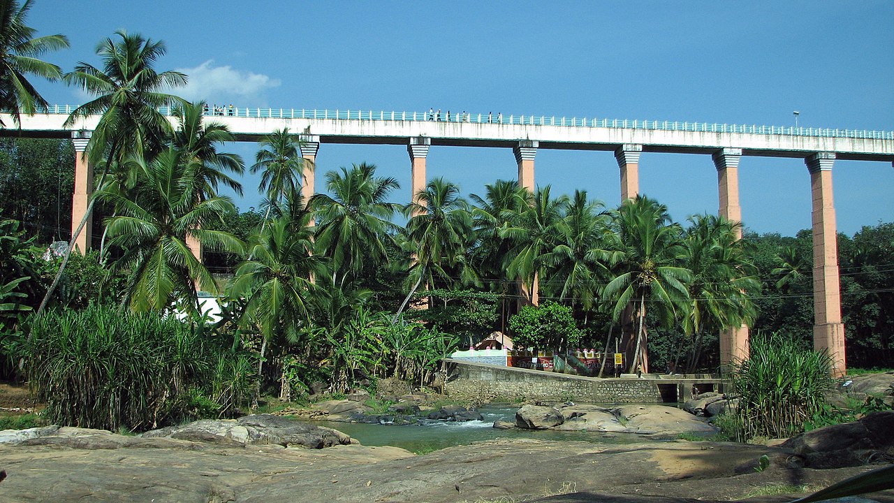
heritageMathur Aqueduct
One of Asia's tallest and longest trough bridges, carrying an irrigation canal across a valley on tall stone piers; built in 1966.
7.6 km · ~19 min by auto · straight line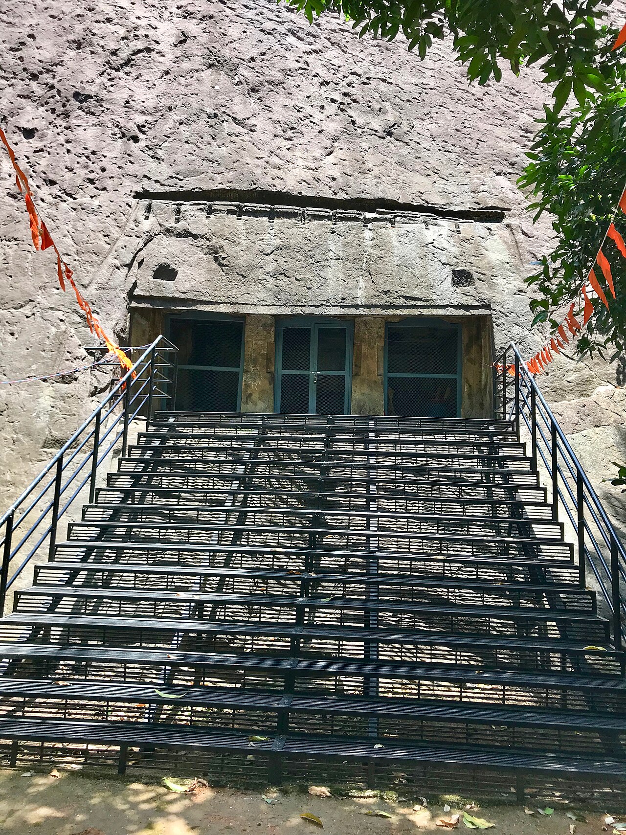
heritageThirunanthikarai Cave Temple
A rock-cut cave temple dedicated to Shiva as Nandeeswarar, dated to around the 8th-9th century and regarded as a showcase of Pallava-era cave architecture. Its interior frescoes and murals are considered early examples of the Kerala mural style, and the cave carries old inscriptions. It is one of the few surviving rock-cut cave shrines in the far south of Tamil Nadu.
7.7 km · ~19 min by auto · straight lineB
Bala Subramanya Swamy Temple, Vellimalai
Place
heritageBala Subramanya Swamy Temple, Vellimalai
A Murugan temple standing atop the roughly 200-foot Vellimalai hill, reached by about 106 stone steps leading to a shrine that occupies an acre at the summit. The hill sits between the Western Ghats to the north and the ocean to the south. It offers wide views over the far south of the peninsula.
9.5 km · ~16 min by cab · straight line
templeAdikesava Perumal Temple
One of the 108 Divya Desams of Vaishnavism, dedicated to Adikesava Perumal (Vishnu), set amid three rivers and known for its reclining deity image.
10.8 km · ~18 min by cab · straight line
damPechiparai Dam
Reservoir and dam across the Kodayar river built 1897-1906, a scenic Western Ghats picnic spot with a garden and boating facility.
11.1 km · ~19 min by cab · straight lineC
Chittar Dam
Place
heritageChittar Dam
A pair of dams, Chittar I and Chittar II, built across the Chittar tributaries of the Kodayar river system in the Western Ghats foothills. Together with Pechiparai and Perunchani, they form the district's main irrigation reservoir network. They are visited for their forested, hilly surroundings.
11.2 km · ~19 min by cab · straight line
waterfallThirparappu Falls
Popular man-made cascade on the Kodayar river, about 50 feet high, a well-known picnic and swimming spot with a small Shiva temple nearby.
11.2 km · ~19 min by cab · straight line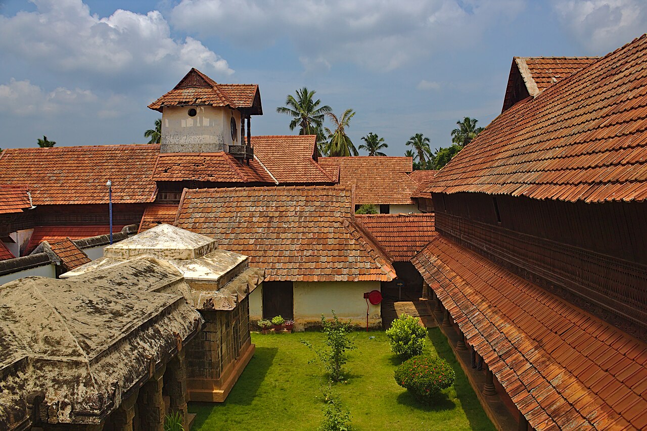
heritagePadmanabhapuram Palace
Former capital and wooden palace complex of the Kingdom of Travancore, one of the largest surviving wooden palaces in Asia, noted for its carved teak ceilings.
13.1 km · ~22 min by cab · straight line
heritageSt. Mary's Basilica, Mulagumoodu
A prominent Roman Catholic church in the Diocese of Kottar, raised to the status of a minor basilica. It is a major centre of the strong Catholic community of interior Kanyakumari district. The basilica is a well-known pilgrimage and festival church in the Marthandam-Kuzhithurai belt.
13.6 km · ~23 min by cab · straight line
heritageChitharal Jain Monuments
Rock-cut Jain temple (locally Bhagavathy Amman koil) carved into a hillock, dating to the 9th century, with sculpted Tirthankara images and a rock-cut stepped approach.
13.6 km · ~23 min by cab · straight lineP
Peer Mohammed Dargah
Place
heritagePeer Mohammed Dargah
The dargah of Peer Mohammed Appa, a 17th-18th-century Sufi philosopher and Tamil poet who settled at Thuckalay and kept close ties with the Travancore rulers. It is one of the most renowned Sufi pilgrim centres in Kanyakumari district. His annual Urs in the Islamic month of Rajab is a local holiday drawing devotees of all faiths from Tamil Nadu and Kerala.
13.7 km · ~23 min by cab · straight line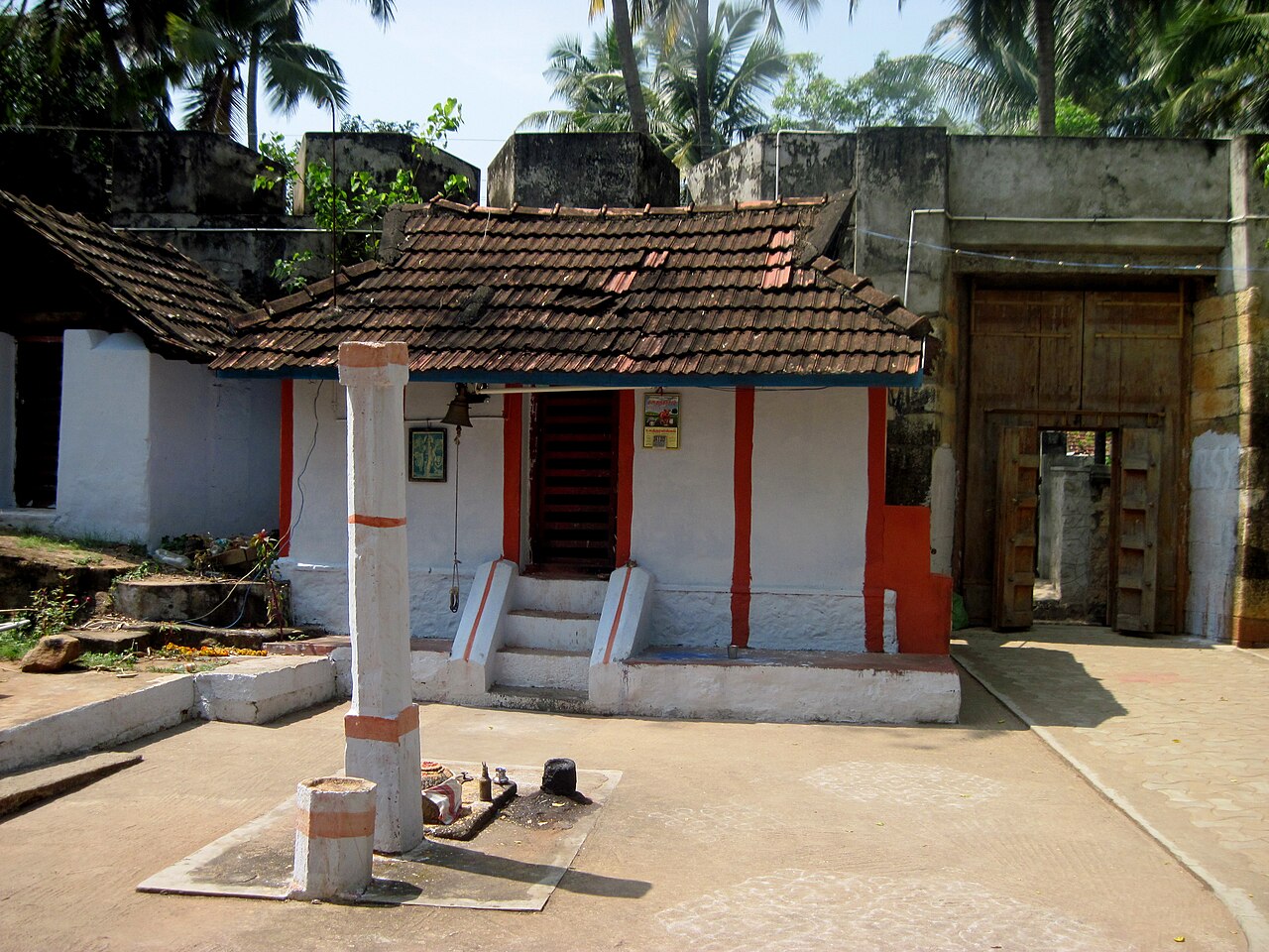
heritageUdayagiri Fort
This 17th-century fort was rebuilt between 1741 and 1744 by Maharaja Marthanda Varma under the Flemish commander Eustachius De Lannoy, and served as Travancore's chief military barracks and gun-casting foundry. De Lannoy, his wife and son are buried in a ruined chapel inside the fort, marked by a bilingual Tamil-Latin tombstone. The 90-acre granite-hillock site is now managed as a biodiversity park by the Tamil Nadu Forest Department.
13.8 km · ~23 min by cab · straight lineOn the map
Where Perunchani Dam is
Good to know
Perunchani Dam — frequently asked
When is the best time to visit Perunchani Dam?
October to March is the cooler, drier season in the Cauvery delta.
What are the entry fee and timings at Perunchani Dam?
Entry: Nominal entry fee. Timings: Daily 9:00 AM to 5:30 PM. The rupee figure quoted is the Indian adult rate. Government monuments, museums and forest reserves in India often charge foreign visitors more, and we have not verified whether this site does.
How do I reach Perunchani Dam?
Base yourself in Perunchani or nearby in Kanniyakumari, then confirm the last-mile route locally before travel. If access depends on temple, museum or seasonal rules, check on the day before you go.
How much time do I need for Perunchani Dam?
About an hour.
What else is near Perunchani Dam?
Nearby you can pair Mathur Aqueduct (7.6 km), Thirunanthikarai Cave Temple (7.7 km), Bala Subramanya Swamy Temple, Vellimalai (9.5 km), Adikesava Perumal Temple (10.8 km).
Read before you go
Perunchani Dam guides, stories & itineraries
We have not published a story about Perunchani Dam itself yet. These cover Perunchani and the wider district, with separate journeys between stops.
Tamil Nadu-wide guides & itineraries
Route-level itineraries and practical guides for the rest of Tamil Nadu.
The story of Udayagiri Fort
Place story
The story of Udayagiri Fort
4 min read · Read →
Thiruvithamcode Arappally (St. Mary's Orthodox Church): story and tradition
Story & tradition
Thiruvithamcode Arappally (St. Mary's Orthodox Church): story and tradition
4 min read · Read →
The story of Thirunanthikarai Cave Temple
Place story
The story of Thirunanthikarai Cave Temple
4 min read · Read →
The story of Peer Mohammed Dargah
Place story
The story of Peer Mohammed Dargah
4 min read · Read →
The story of Parthasarathy Temple, Parthivapuram
Place story
The story of Parthasarathy Temple, Parthivapuram
4 min read · Read →
The story of Ringeltaube Vethamanickam Memorial Church
Place story
The story of Ringeltaube Vethamanickam Memorial Church
4 min read · Read →
Image credits
Photographs: Manukrishnan80, CC BY-SA 4.0, via Wikimedia Commons (CC BY-SA 4.0). Wikimedia Commons.