What to expect
Highlights
- Tea-country outlook
- Short viewpoint walk
- Views toward the plains
Lamb’s Rock is a shorter Coonoor viewpoint walk overlooking tea country and the plains, often paired with Dolphin’s Nose but reached through its own access.
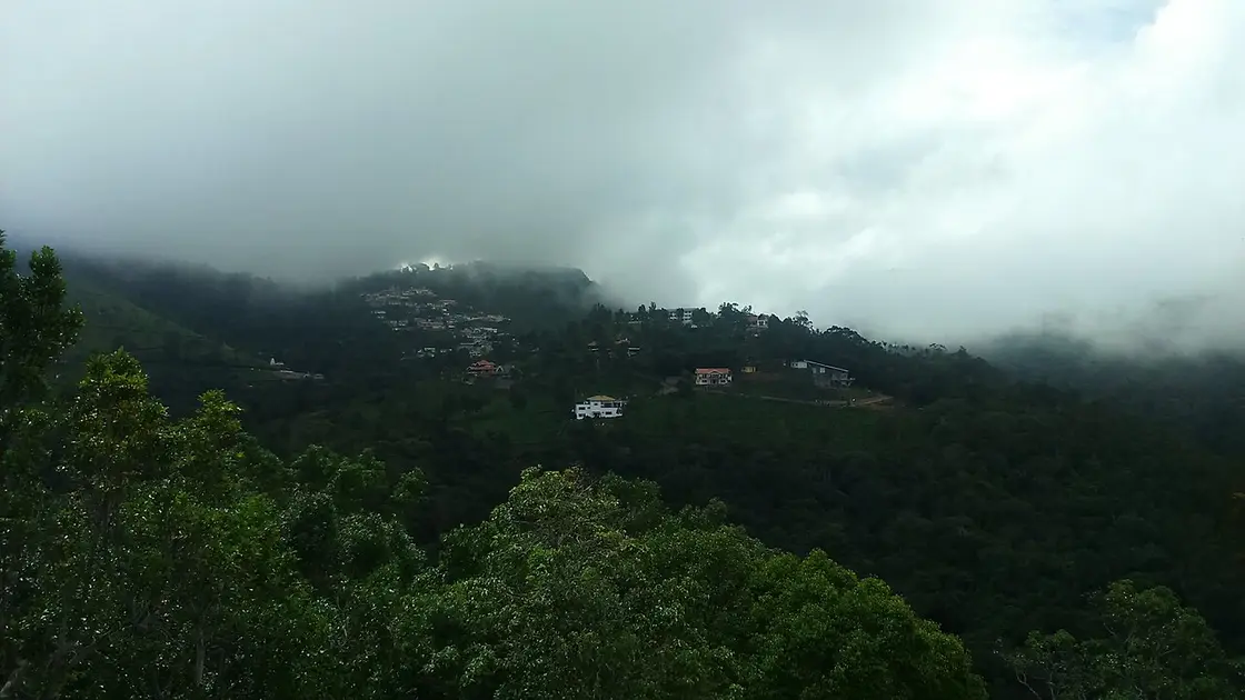
Lamb’s Rock is a shorter Coonoor viewpoint walk overlooking tea country and the plains, often paired with Dolphin’s Nose but reached through its own access. Allow time for the final walk and wait for cloud gaps. Sharing a road circuit with Dolphin’s Nose does not make the two viewpoints one stop.
The district identifies Lamb’s Rock as a favoured picnic viewpoint near Coonoor. The foreground of tea and forest gives it a different composition from the more projecting Dolphin’s Nose.
Follow the maintained approach and viewing rails. Guides may offer help, but agree any service and price before starting rather than accepting an unclear obligation.
Rain and moss make stone slippery. Turn back if visibility, lightning or footing becomes unsafe, and do not step around barriers for an unobstructed photograph.
For the visit itself, allow one to two hours including the drive from Coonoor. The best time is clear, dry daylight, commonly earlier in the day. Use the signed entrance and public path. Agree guide or parking charges before accepting a service. Stay behind viewpoint barriers and wear grippy shoes.
Clear, dry daylight, commonly earlier in the day.
Live forecast loads in your browser.
Sun and moon are calculated for this location and shown in IST. Photography windows are the hour around sunrise and sunset; the sunset bearing is degrees clockwise from true north. Moon phase is accurate to about half a day.
Verified hotels, homestays, restaurants, experiences, sights, shops and rentals around Lamb's Rock — commission-free, with direct contact. Filter by what you need.
A nineteenth-century Scottish-style house on Kotagiri Road, run by Neemrana. It keeps its own award-winning gardens and a tea estate.
A colonial bungalow of 113 years on the Leewood Estate at Highfield. Five grades of room, and lawns used for weddings.
Three grades of room in the old McIver Villa on Orange Grove Road. The view runs right across the Coonoor valley.
A two-bedroom farmstay inside a working tea estate. The kitchen cooks Badaga food, which few places serve visitors.
A two-suite plantation bungalow on Paradise Hill, closed in by hills on three sides. Meals and guided estate walks come with it.
A chocolate counter, gelato bar and bakery on Church Road at Bedford. The chocolate is couverture, made with cocoa butter rather than refined oil.
A working tea factory on Walker Hill Road that walks visitors through the process. Entry is ₹30, or ₹100 with a tasting.
A ninety-minute sit-down tasting of Nilgiri teas at Grays Hill. Two sittings a day, by reservation only.
The smaller of the two Ibex houses at Coonoor, out at Burliar. Three mountain-view rooms with private sit-outs, and a restaurant called Sparrow.
A two-bedroom colonial cottage on Hatherly Road, let as a whole house. Meals are cooked to order with a day’s notice.
A house of more than 150 years on six acres, two kilometres out of town. Let by the room or as a whole cottage.
The town’s club since 1885, with heritage guest suites looking onto the garden. A dining room, a bar, tennis, and a library of 3,000 books.
The chain’s Coonoor cafe, on Figure of Eight Road beside UPASI. Open nine in the morning to ten at night, every day.
Beauty salon. A6, Thilaga Nagar, Devaiyampalayam, Periyanaickenpalayam, 641020.
Book with the place itself. India’s cyber-crime coordination centre warned in April 2025 that convincing copies of hotel and pilgrimage booking sites are being pushed through sponsored search and social ads, taking payment for rooms the property never hears about. Every listing here links to the business’s own contact details and its own Google or Bing profile — we take no commission and sit in nobody’s payment path. If a booking page reached you through an ad, check the address bar against the property’s own site before you pay. Fraud can be reported on cybercrime.gov.in or on 1930.
Find food, accommodation and activities across Coonoor. Browse the guides for places to eat, stay and explore along your route.
15 more places around Coonoor. Open a guide to plan the visit and onward journey.
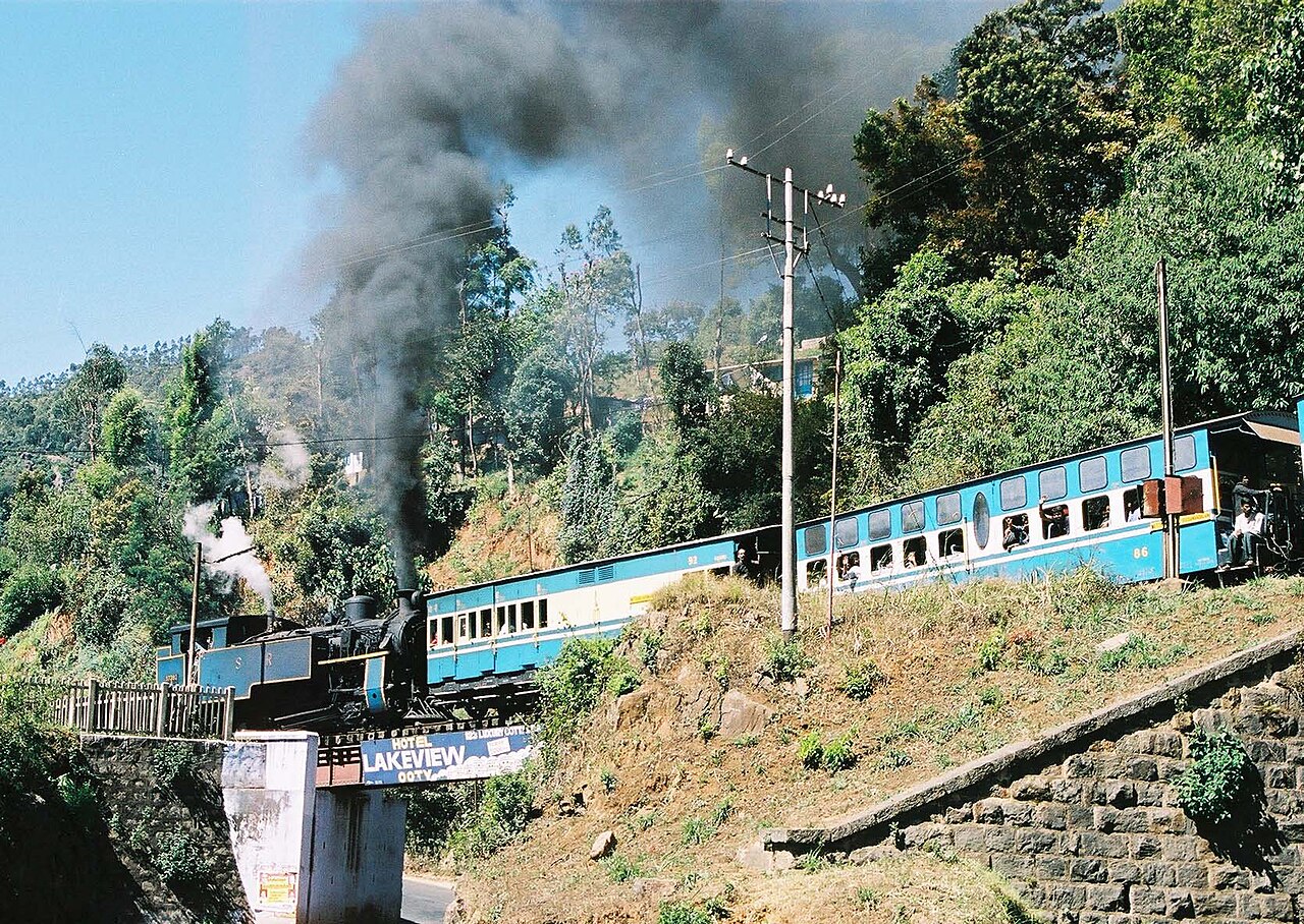
A UNESCO World Heritage metre-gauge rack railway connecting Mettupalayam to Ooty via Coonoor, opened in stages between 1899 and 1908.
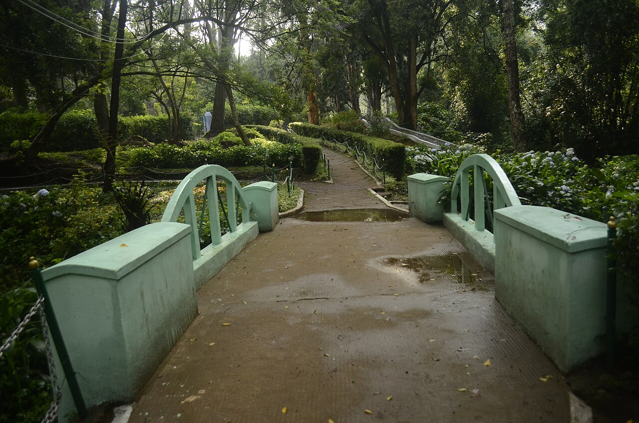
4.1 km · ~10 min by auto
A 12-hectare botanical park in Coonoor established in 1874, laid out in irregular Japanese style with a small lake and rare tree species.
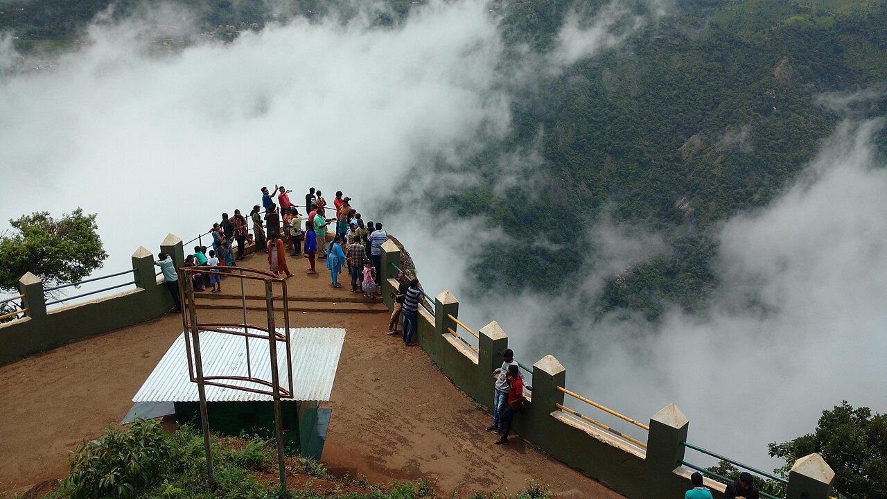
3.1 km · ~8 min by auto
A rocky outcrop near Coonoor offering sweeping views of the Nilgiri escarpment, Catherine Falls, and the plains below.
3.9 km · ~10 min by auto
Droog Fort sits at about 6,000 feet on a hilltop roughly 13 km from Coonoor and is reached by a trek through tea estates and shola. It is said to have been used as an outpost by Tipu Sultan in the 18th century, with surviving remnants including a wall and a clock tower. The summit gives sweeping views over the plains and hills.
3.6 km · ~9 min by auto
Law's Falls lies about 5 km from Coonoor on the Coonoor-Mettupalayam ghat road, where the Coonoor river drops through a wooded gorge. It is named after Colonel Law, who built the Coonoor ghat road in the 1830s. Surrounded by dense greenery, it is a relatively uncrowded picnic spot.
Ralliah (Rallia) Dam sits on the Coonoor-Kattabettu-Kotagiri road and was built in 1914 as a catchment supplying drinking water to Coonoor and Kotagiri. Ringed by eucalyptus forest and reached by a short walk, it is a peaceful, little-visited spot popular for gentle trekking.
4.6 km · ~11 min by auto
Lady Canning's Seat is an elevated colonial-era vantage point near Coonoor named after the wife of Lord Canning, Viceroy of India. It is prized for its sunrise and sunset views over the surrounding valleys and tea slopes.
4.5 km · ~11 min by auto
Kattery Park is a horticultural park spread over about 5.5 acres near Coonoor, with landscaped flower beds, a children's play area and a small waterfall on the Kallar river nearby. It is a compact garden stop on the outskirts of the town.
An Anglican church in Coonoor, now of the Church of South India, on the Kattabettu road out of the town — stained glass, antique woodwork and an old pipe organ in a Gothic hall. Its founding is published as both 1851 and 1854 and we have found no official source that settles it, so both are printed. We have no checked coordinate for it, so no distance to it is printed.
The hinge of the Nilgiri Mountain Railway, 370 m from the Coonoor bus stand. The Abt rack section that carries the train up the gorge from Kallar ends at this platform and the run on to Udhagamandalam above it is worked on plain track, which is why the locomotive shed is here and why the Coonoor-Ooty shuttles exist. Southern Railway gives the whole line as 45.88 km of metre gauge, opened to Coonoor on 15 June 1899.
3.9 km · ~10 min by auto
A vaccine institute on sixteen acres above the town, founded after Lily Pakenham Walsh died of hydrophobia in 1902 without reaching treatment in time. One lakh rupees of Henry Phipps's gift to Lord Curzon paid for it, Coonoor was chosen for its cool and equitable climate, and it began work on 6 April 1907. It has made antirabies vaccine ever since and DPT vaccines since 1982. A manufacturer, not a clinic.
840 m · 10 min walk
A working tea factory 9.5 km east of the Coonoor bus stand on the estate road toward the viewpoints, where the leaf from the surrounding slopes is withered, rolled, oxidised and graded. Coonoor has been the administrative centre of the Nilgiri tea trade since the first plantation in these hills was established beside it in 1854.
A waterfall 11.5 km west of Coonoor below the Katary dams, on a different catchment from the Ralliah dam east of the town despite the similar name - a confusion that had put Ralliah's own pin ten kilometres out until it was corrected. Reached off the Coonoor-Ooty road and far less visited than Catherine Falls.
3.9 km · ~10 min by auto
The junction a kilometre above the bus stand where the town's shops give out and the estate roads begin, and the second place in Coonoor to find an auto. The tea slopes above it run up to Highfield, and the road east from here is the one that leads to Lamb's Rock and Dolphin's Nose.

4.0 km · ~10 min by auto
Highfield is a long-established tea estate and working factory near Coonoor that offers guided tours explaining the tea-making process from plucking to packaging. Visitors can walk the plantation slopes and buy estate-fresh Nilgiri tea, making it one of Coonoor's popular tea-tourism stops.
Roampedia is commission-free — own or know a stay, eatery, guide or shop near Lamb's Rock? List it and it appears here once verified.
Add a nearby businessEntry: Visitor, guide or parking charges may be separate; confirm first.
Reached by road from Coonoor, then a short walk.
If you need step-free access, contact the site before travelling. Ask about a level entrance, steps along the route, the nearest drop-off point, seating and accessible toilets.
Emergency numbers are verified against official government and state tourism sources. 112 works anywhere in India.
A working tea factory 9.5 km east of the Coonoor bus stand on the estate road toward the viewpoints, where the leaf from the surrounding slopes is withered, rolled, oxidised and graded. Coonoor has been the administrative centre of the Nilgiri tea trade since the first plantation in these hills was established beside it in 1854.
840 m · 10 min walk · straight lineA rocky outcrop near Coonoor offering sweeping views of the Nilgiri escarpment, Catherine Falls, and the plains below.
3.1 km · ~8 min by auto · straight lineLaw's Falls lies about 5 km from Coonoor on the Coonoor-Mettupalayam ghat road, where the Coonoor river drops through a wooded gorge. It is named after Colonel Law, who built the Coonoor ghat road in the 1830s. Surrounded by dense greenery, it is a relatively uncrowded picnic spot.
3.6 km · ~9 min by auto · straight lineDroog Fort sits at about 6,000 feet on a hilltop roughly 13 km from Coonoor and is reached by a trek through tea estates and shola. It is said to have been used as an outpost by Tipu Sultan in the 18th century, with surviving remnants including a wall and a clock tower. The summit gives sweeping views over the plains and hills.
3.9 km · ~10 min by auto · straight lineThe junction a kilometre above the bus stand where the town's shops give out and the estate roads begin, and the second place in Coonoor to find an auto. The tea slopes above it run up to Highfield, and the road east from here is the one that leads to Lamb's Rock and Dolphin's Nose.
3.9 km · ~10 min by auto · straight lineA vaccine institute on sixteen acres above the town, founded after Lily Pakenham Walsh died of hydrophobia in 1902 without reaching treatment in time. One lakh rupees of Henry Phipps's gift to Lord Curzon paid for it, Coonoor was chosen for its cool and equitable climate, and it began work on 6 April 1907. It has made antirabies vaccine ever since and DPT vaccines since 1982. A manufacturer, not a clinic.
3.9 km · ~10 min by auto · straight lineHighfield is a long-established tea estate and working factory near Coonoor that offers guided tours explaining the tea-making process from plucking to packaging. Visitors can walk the plantation slopes and buy estate-fresh Nilgiri tea, making it one of Coonoor's popular tea-tourism stops.
4.0 km · ~10 min by auto · straight lineA 12-hectare botanical park in Coonoor established in 1874, laid out in irregular Japanese style with a small lake and rare tree species.
4.1 km · ~10 min by auto · straight line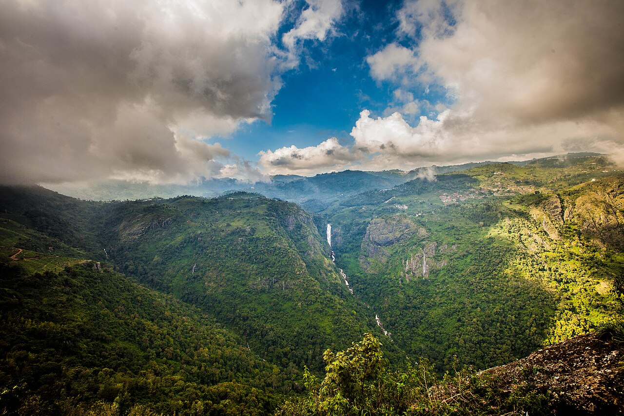
A twin-tiered waterfall near Kotagiri, one of the tallest in the Nilgiris, formed on the Kallar river. Tamil Nadu Tourism and the district administration both say it takes its name from the wife of M.D. Cockburn, the planter credited with bringing coffee to Kotagiri, though the older form St Catherine's Falls was already in use.
4.1 km · ~10 min by auto · straight lineKattery Park is a horticultural park spread over about 5.5 acres near Coonoor, with landscaped flower beds, a children's play area and a small waterfall on the Kallar river nearby. It is a compact garden stop on the outskirts of the town.
4.5 km · ~11 min by auto · straight lineLady Canning's Seat is an elevated colonial-era vantage point near Coonoor named after the wife of Lord Canning, Viceroy of India. It is prized for its sunrise and sunset views over the surrounding valleys and tea slopes.
4.6 km · ~11 min by auto · straight line
A garrison club that dates itself from the brick cricket pavilion put up for the troops in 1873, though it only took the name Wellington Gymkhana in 1916, and it now runs an eighteen-hole hill golf course at about six thousand feet. Its own history records a race course here before Ooty's longer track was built, nine-hole golf, polo and rugby by the 1930s, its first Indian member in 1943, and the fact that the whole club stands on military land and pays a yearly rent to the Defence Department.
4.6 km · ~12 min by auto · straight lineNo. They are separate viewpoints commonly combined on one road circuit.
No. Mist and cloud may obscure it.
Clear, dry daylight, commonly earlier in the day.
Entry: Visitor, guide or parking charges may be separate; confirm first. Timings: Use daylight and check the current entrance arrangement.
Use the signed entrance and public path. Agree guide or parking charges before accepting a service.
Allow one to two hours including the drive from Coonoor.
Nearby you can pair Brooklane Coonoor Tea Factory (840 m), Dolphin's Nose, Coonoor (3.1 km), Law's Falls (3.6 km), Droog Fort (3.9 km).
Stay behind viewpoint barriers and wear grippy shoes.
We have not published a story about Lamb's Rock itself yet. These cover Coonoor and the wider district, with separate journeys between stops.
These guides explore Coonoor and the surrounding area. Choose a visit that fits your interests, allowing separately for travel between stops.
Route-level itineraries and practical guides for the rest of Tamil Nadu.
Photographs: Mrunmaikulkarni (CC BY-SA 4.0). Wikimedia Commons.