The Nilgiris district
The Nilgiris is a district of Tamil Nadu. Browse its towns, famous tourist places, treks, beaches, temples, backwaters and local businesses. Hotels and homestays can list for free, and travellers contact them directly.
The Nilgiris at a glance
The Nilgiris is a district of Tamil Nadu — Nilgiri highlands and tea country, with its headquarters at Udhagamandalam (Ooty). It is best known for Ooty, Coonoor and mountain railway. Signature sights include Ooty, Coonoor, Nilgiri Mountain Railway. The nearest airport is Coimbatore (CJB) and the main rail gateway is Udhagamandalam / Mettupalayam. November to February is the coolest, most comfortable season; April to June is very hot, and the October–December north-east monsoon brings the delta its main rains. Most travellers spend 1–2 days here, and while Tamil is the local language, English is widely understood.
Best time, weather & festivals in The Nilgiris
November to February is the coolest, most comfortable season across The Nilgiris; April to June is hot, and the October–December north-east monsoon brings the main rains. Live conditions below are for Udhagamandalam (Ooty).
Live forecast loads in your browser.
Tamil Nadu festivals worth timing your trip around
Celebrated across Tamil Nadu, including The Nilgiris. Dates shift with the Tamil calendar — confirm the year's exact dates before booking.
- Pongal Jan (14–17) — Tamil Nadu’s four-day harvest festival — Bhogi, Thai Pongal, Mattu Pongal and Kaanum Pongal, marked with the boiling-over of the first rice.
- Thyagaraja Aradhana Jan — Carnatic music festival at Thiruvaiyaru near Thanjavur, honouring the composer-saint Thyagaraja.
- Tamil New Year (Puthandu) Mid-April — The Tamil solar new year, celebrated across the state.
- Chithirai Thiruvizha Apr – May — The grand Meenakshi temple festival in Madurai, one of the largest in Tamil Nadu.
- Navaratri Sep – Oct — Nine nights of worship with the golu doll display in many Tamil homes and temples.
Where to go in The Nilgiris
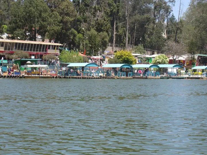 Featured: Ooty Lake
Ooty
The Nilgiris capital and queen of hill stations, base for the botanical gardens, Ooty Lake, Doddabetta and the toy train.
 Tea-country town
Coonoor
Quieter second hill station below Ooty, ringed by tea estates and viewpoints like Dolphin's Nose and Lamb's Rock.
 Eastern hill town
Kotagiri
The oldest of the three Nilgiri hill stations and the middle one for height, on the eastern rim of the plateau — the first place in these hills the British came up to, in 1819, and the gateway to Kodanad, Catherine Falls and a Ramsar-listed shola on the town's own edge.
 Wildlife village
Masinagudi
The village on the Sigur plateau below the hill stations, at the edge of Mudumalai — the base for the tiger reserve, the Theppakadu elephant camp and the elephant country of the Moyar valley, and the foot of the Kalhatti ghat up to Ooty.
 Featured: Needle Rock View Point
Gudalur
The municipality at the western door of the Nilgiris, where the plateau breaks and the road drops into Kerala — a Tamil Nadu town that speaks mostly Malayalam, sitting between the Mudumalai forest, the old Wynaad gold country around Devala and the cinchona slopes of Naduvattam.
 Valley village
Ketti
A revenue village of Coonoor taluk strung along the Ooty–Coonoor road in the valley it is named after, with a station on the Nilgiri Mountain Railway, the needle works the place is known for, and a hillside of boarding schools and colleges above it. Upper Ketti is the separate village of Yellanahalli.
 Cantonment town
Wellington
An army cantonment of about twenty thousand people three kilometres above Coonoor, governed by a board under the Ministry of Defence rather than by a municipality, and home to the Madras Regimental Centre and the Defence Services Staff College. It has no bus stand: its station on the Nilgiri Mountain Railway is the way in.
 Reservoir country
Kundah
The high, empty western end of the plateau, a country of hydro-electric reservoirs — Upper Bhavani, Parsons Valley, Porthimund — and the Sispara pass over into Kerala, most of it needing Forest Department permission to enter.
Map of The Nilgiris
Every place on this guide with a verified location. Tap a pin for its name and guide link.
Places in The Nilgiris
Every verified place across The Nilgiris district — filter by what you’re after.
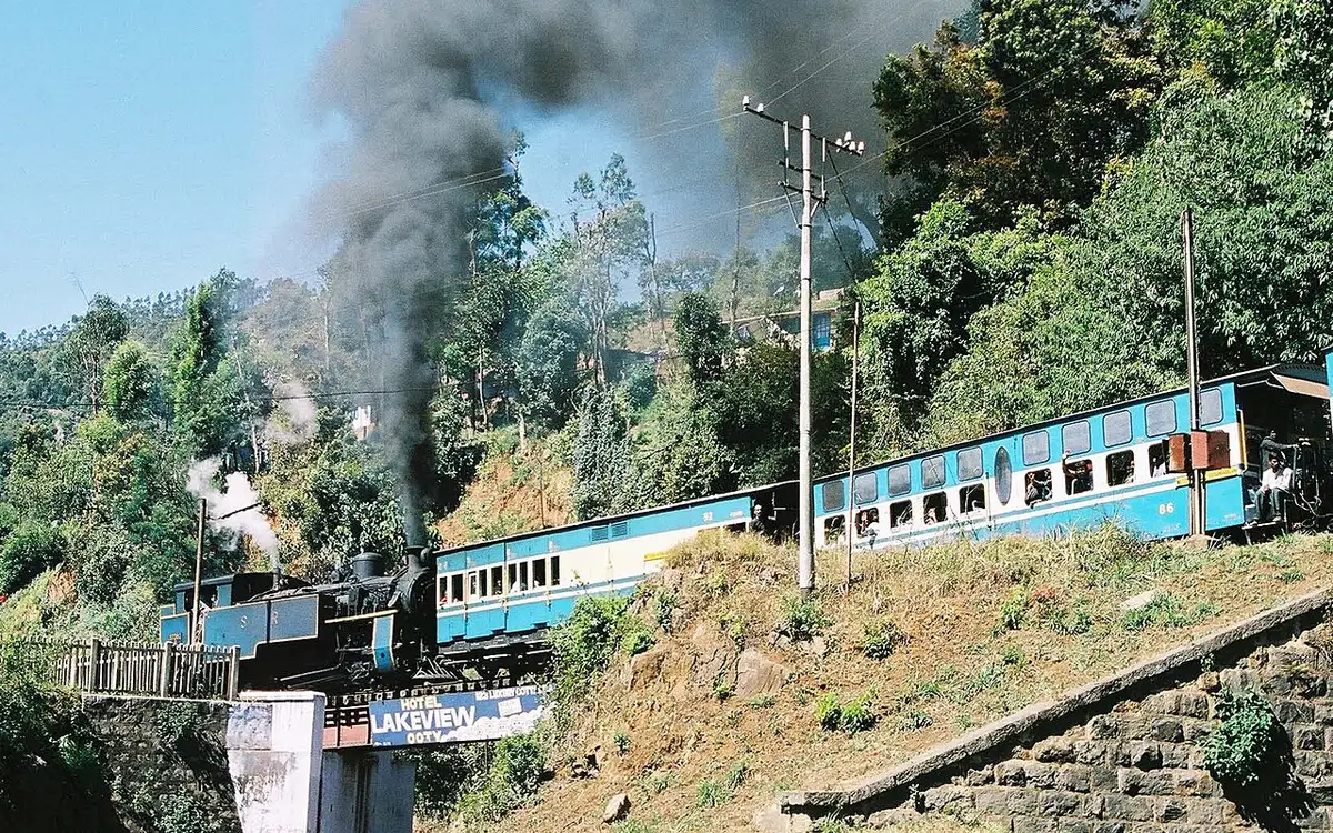
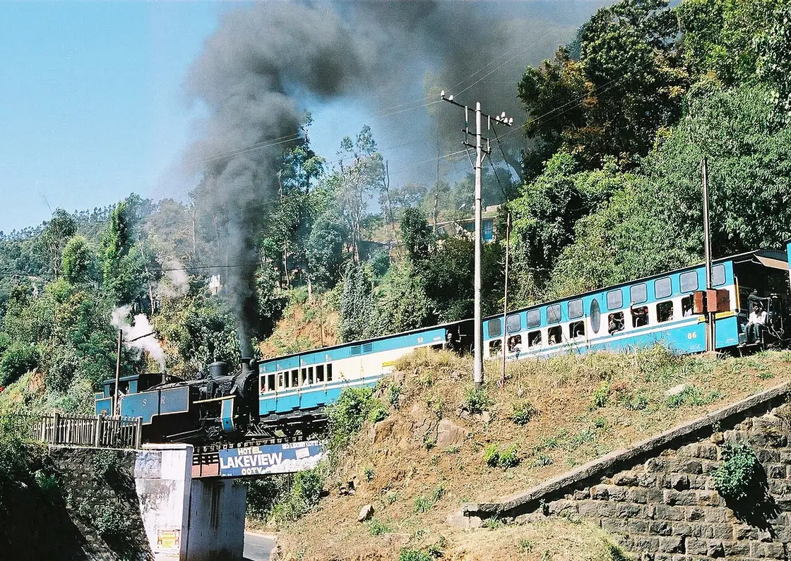
A UNESCO World Heritage metre-gauge rack railway connecting Mettupalayam to Ooty via Coonoor, opened in stages between 1899 and 1908. This activity guide belongs to the Coonoor planning base in The Nilgiris, Tamil Nadu, with route context, best-time notes and verified inventory categories for stays, food, operators, shops, wellness and transport as they are approved.
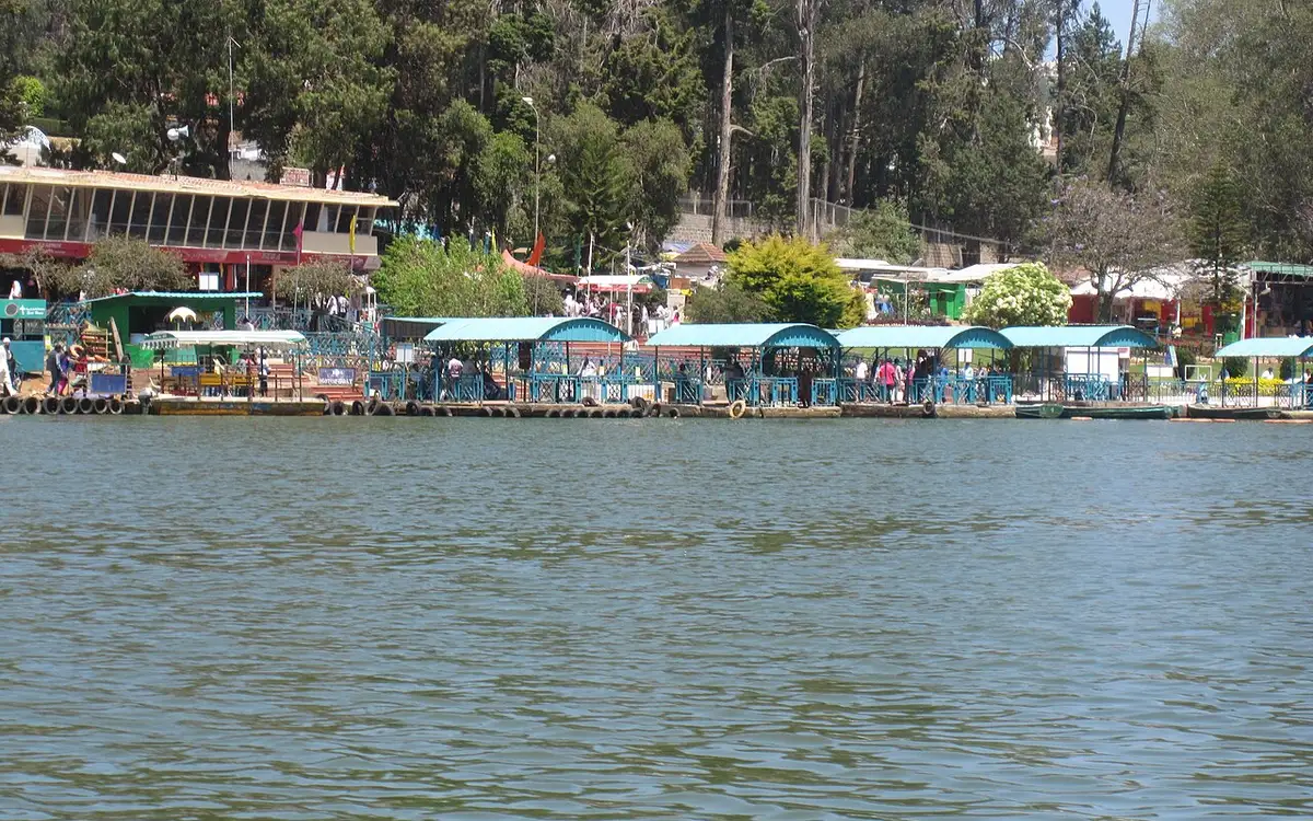
An artificial lake created in 1824 by John Sullivan, the founder of Ooty, now used for boating amid eucalyptus-lined banks. This dam guide belongs to the Ooty planning base in The Nilgiris, Tamil Nadu, with route context, best-time notes and verified inventory categories for stays, food, operators, shops, wellness and transport as they are approved.
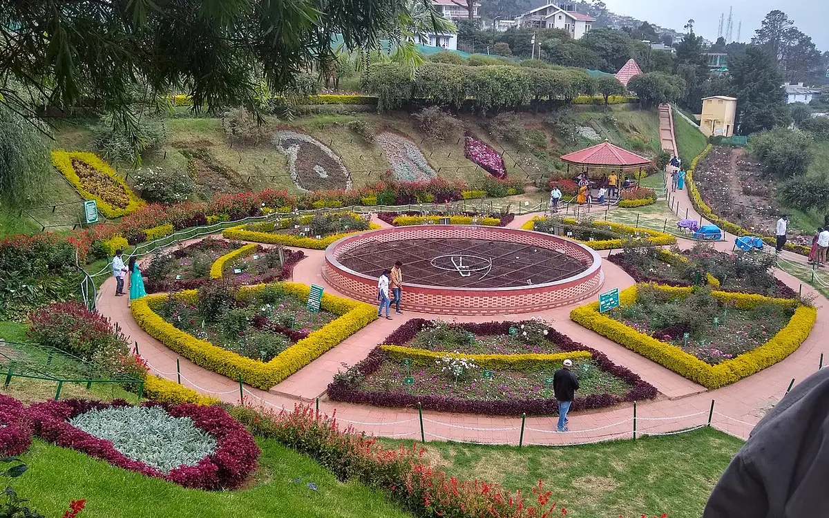
A terraced garden of 55 acres below Doddabetta, run by the Tamil Nadu Horticulture Department, holding a fossilised tree trunk reckoned at 20 million years old and hosting the flower show every May. Its founding year is published two ways, 1848 and 1897. This park guide belongs to the Ooty planning base in The Nilgiris, Tamil Nadu, with route context, best-time notes and verified inventory categories for stays, food, operators, shops, wellness and transport as they are approved.
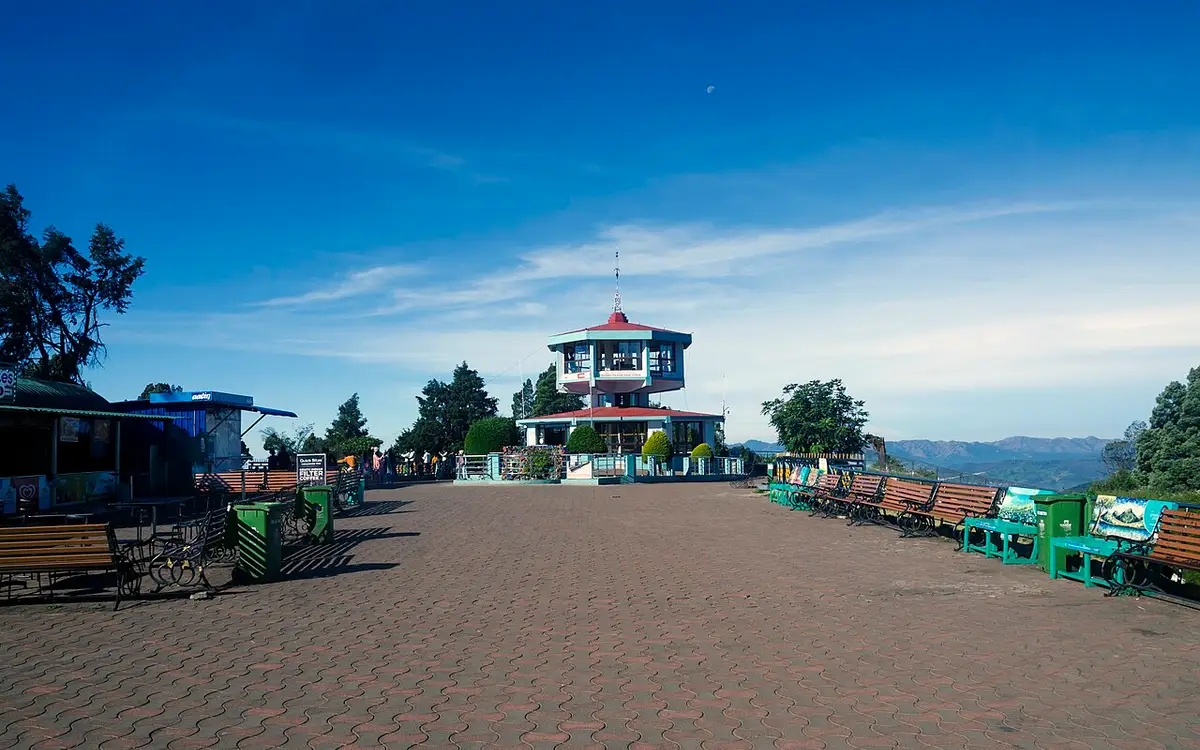
The highest peak in the Nilgiris and in Tamil Nadu, with a telescope house at the top. Three arms of the government publish three different heights for it — 2,623 m, 2,636 m and 2,637 m. This viewpoint guide belongs to the Ooty planning base in The Nilgiris, Tamil Nadu, with route context, best-time notes and verified inventory categories for stays, food, operators, shops, wellness and transport as they are approved.
Four hectares in five terraces on the slopes of Elk Hill, with more than 3,000 varieties of roses on the district administration’s own count, and an International Rose Society award for the best rose garden in South Asia in 2006. This park guide belongs to the Ooty planning base in The Nilgiris, Tamil Nadu, with route context, best-time notes and verified inventory categories for stays, food, operators, shops, wellness and transport as they are approved.
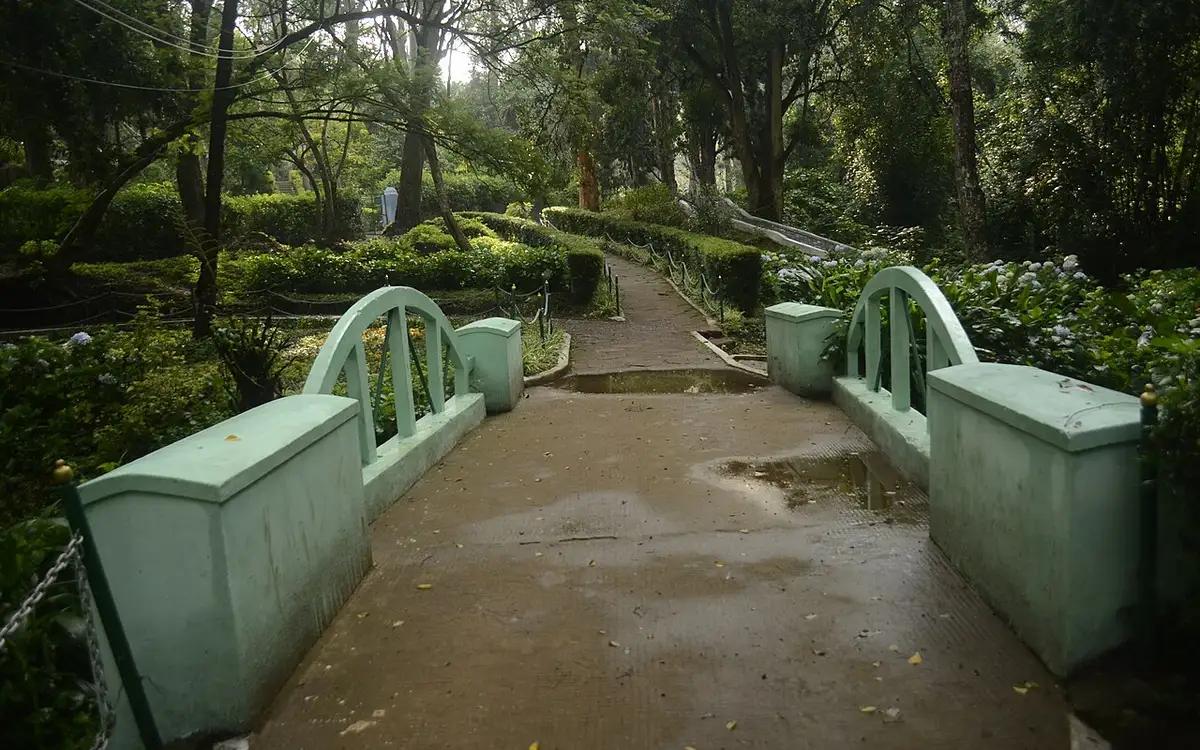
A 12-hectare botanical park in Coonoor established in 1874, laid out in irregular Japanese style with a small lake and rare tree species. This park guide belongs to the Coonoor planning base in The Nilgiris, Tamil Nadu, with route context, best-time notes and verified inventory categories for stays, food, operators, shops, wellness and transport as they are approved.
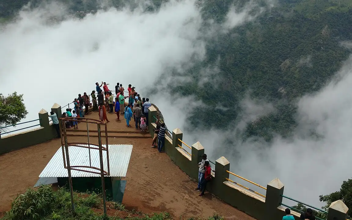
A rocky outcrop near Coonoor offering sweeping views of the Nilgiri escarpment, Catherine Falls, and the plains below. This viewpoint guide belongs to the Coonoor planning base in The Nilgiris, Tamil Nadu, with route context, best-time notes and verified inventory categories for stays, food, operators, shops, wellness and transport as they are approved.
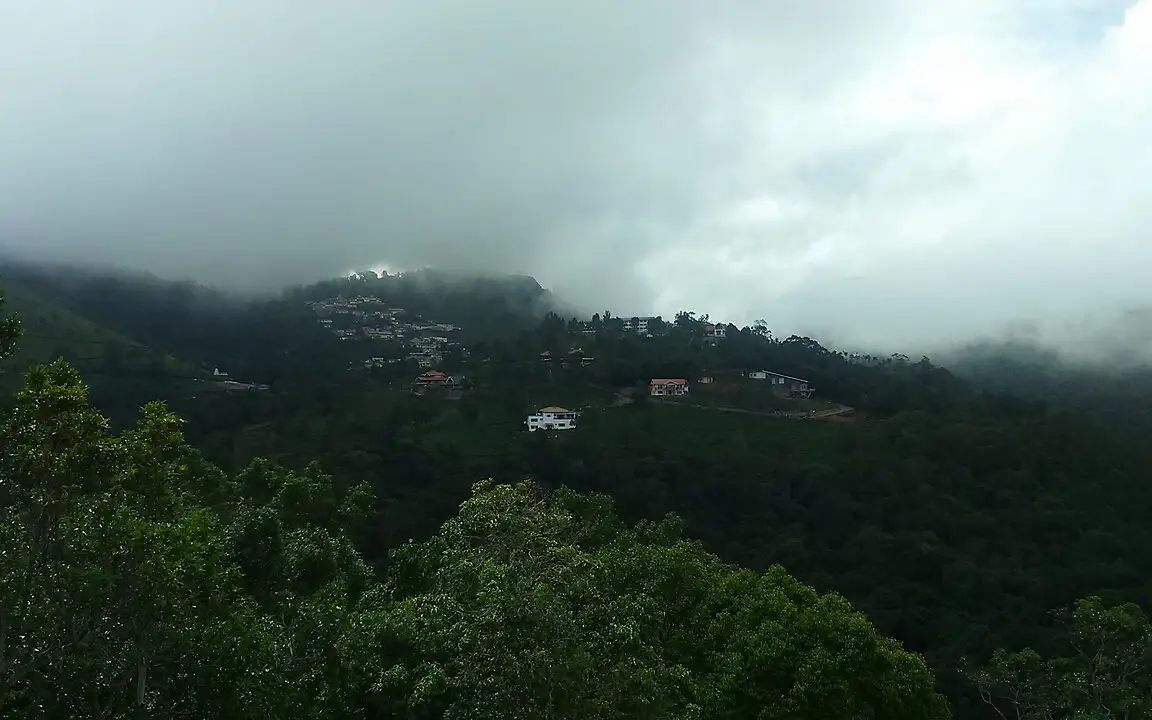
A viewpoint near Coonoor overlooking tea and coffee plantations and the Coimbatore plains, named after a former collector of the region. This viewpoint guide belongs to the Coonoor planning base in The Nilgiris, Tamil Nadu, with route context, best-time notes and verified inventory categories for stays, food, operators, shops, wellness and transport as they are approved.
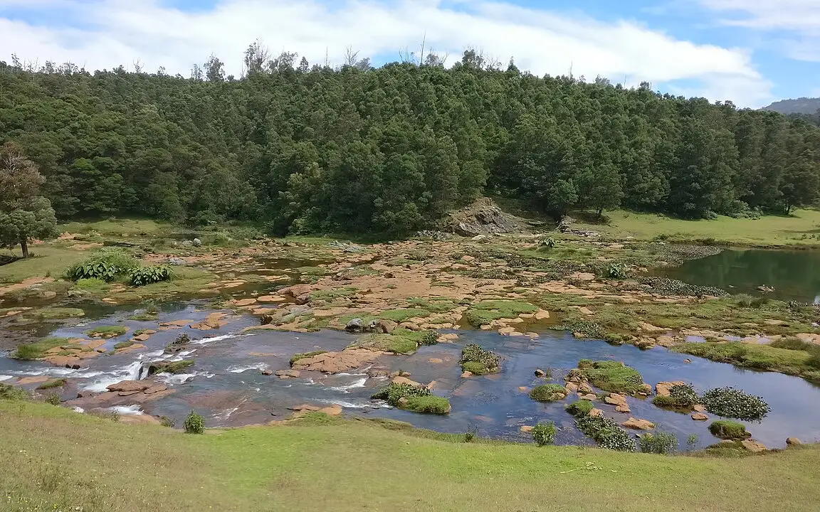
The Pykara river drops here in two stages of 55 and 61 metres, on the Mysuru road 22.5 km from the Ooty bus stand by routed road — the municipality publishes it as about 20 km. The river above the falls is held sacred by the Toda. This waterfall guide belongs to the Ooty planning base in The Nilgiris, Tamil Nadu, with route context, best-time notes and verified inventory categories for stays, food, operators, shops, wellness and transport as they are approved.
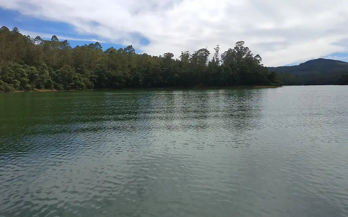
The reservoir on the Pykara river 22.2 km from the Ooty bus stand by routed road, with a boathouse running motorboat trips over water ringed by pine, shola and grassland; gaur graze the banks. The river above it is held sacred by the Toda, and the falls two kilometres downstream are part of the same site. This dam guide belongs to the Ooty planning base in The Nilgiris, Tamil Nadu, with route context, best-time notes and verified inventory categories for stays, food, operators, shops, wellness and transport as they are approved.
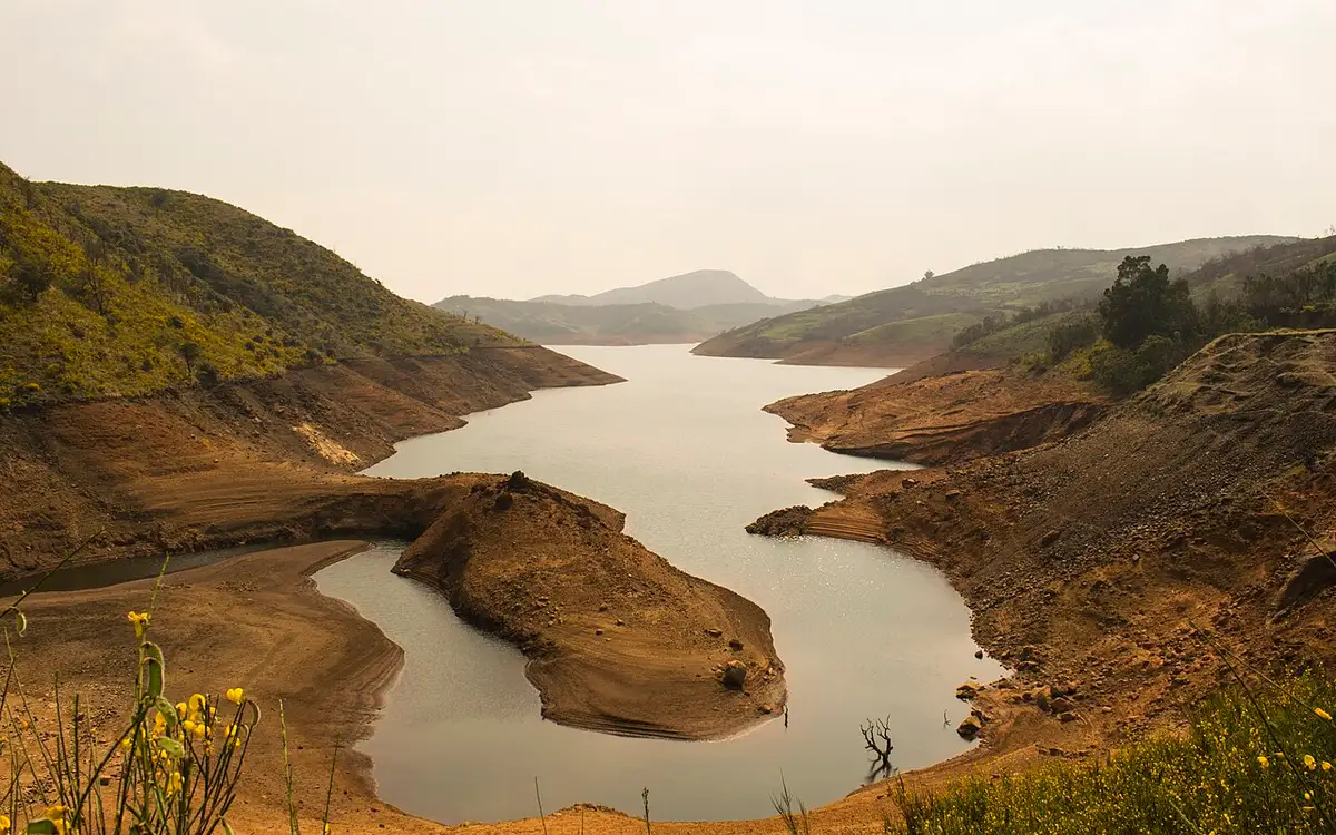
A reservoir among sholas and grassland on the road toward Upper Bhavani, 22.5 km from the Ooty bus stand by routed road — the district and the municipality both publish it as 28 km. It sits inside a protected forest zone where access is controlled, so check before setting out. This dam guide belongs to the Ooty planning base in The Nilgiris, Tamil Nadu, with route context, best-time notes and verified inventory categories for stays, food, operators, shops, wellness and transport as they are approved.
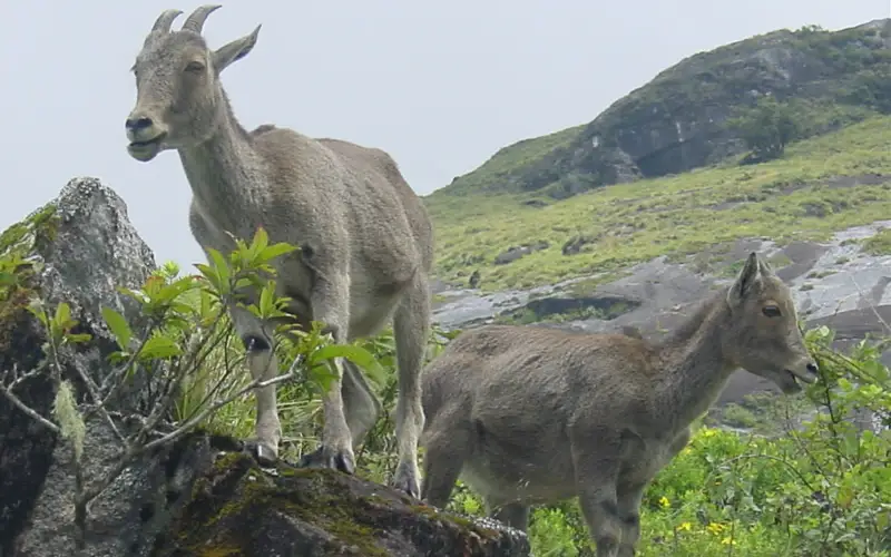
A high-altitude park in the western Nilgiris protecting shola-grassland ecosystems and the endangered Nilgiri tahr, part of the Nilgiri Biosphere Reserve. There is no public road into it; entry is on permit from the Kundah side, and Sispara Pass and Bangitappal lie within its western reach. This wildlife guide belongs to the Kundah planning base in The Nilgiris, Tamil Nadu, with route context, best-time notes and verified inventory categories for stays, food, operators, shops, wellness and transport as they are approved.
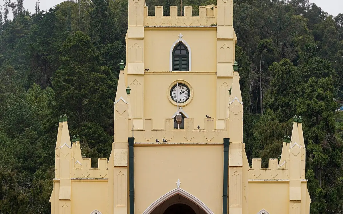
Consecrated in 1830, this is the oldest church in the Nilgiris, built partly from timber salvaged from Tipu Sultan's summer palace in Srirangapatna. This church guide belongs to the Ooty planning base in The Nilgiris, Tamil Nadu, with route context, best-time notes and verified inventory categories for stays, food, operators, shops, wellness and transport as they are approved.
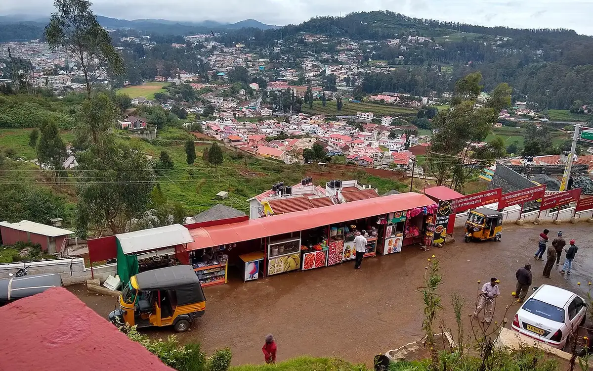
A working tea factory near Ooty with a small museum explaining tea-processing history and a shop selling estate teas. This museum guide belongs to the Ooty planning base in The Nilgiris, Tamil Nadu, with route context, best-time notes and verified inventory categories for stays, food, operators, shops, wellness and transport as they are approved.
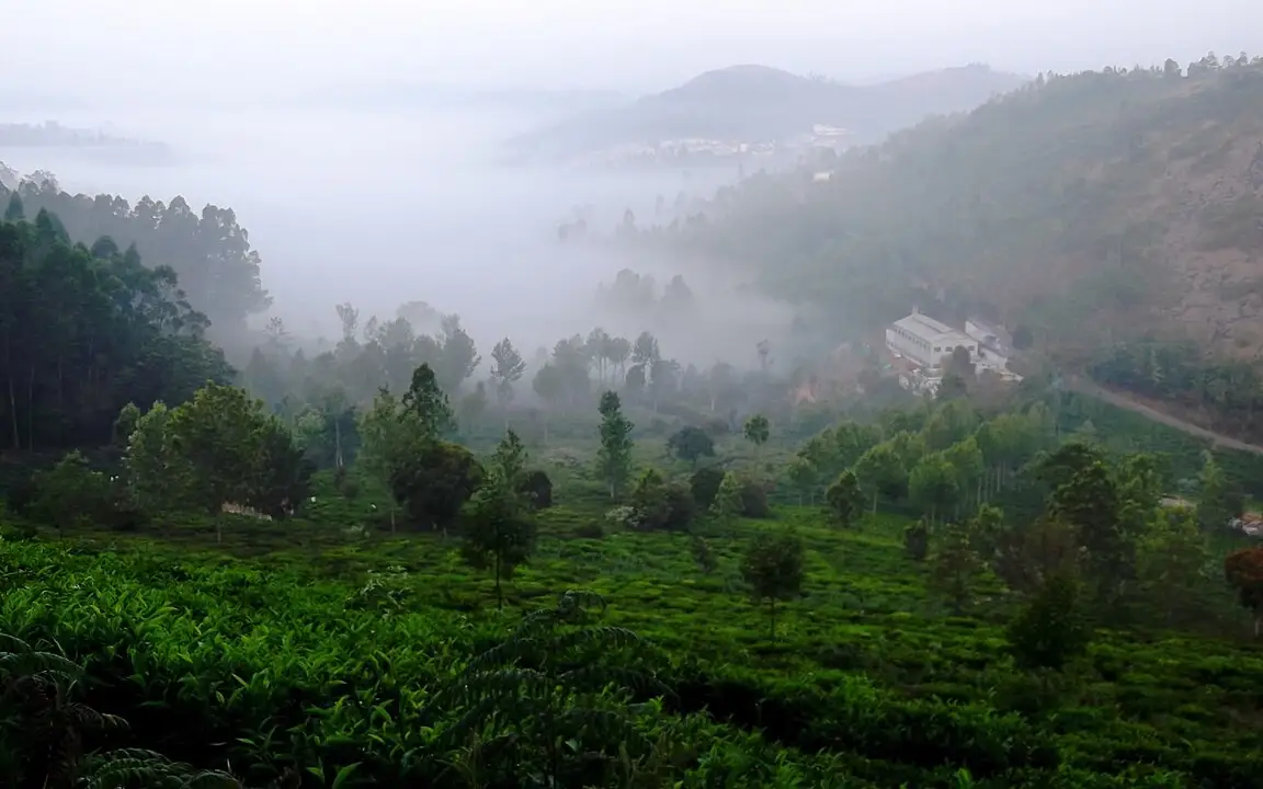
A viewpoint near Kotagiri overlooking the Bhavani valley and, on clear days, the plains beyond. This viewpoint guide belongs to the Kotagiri planning base in The Nilgiris, Tamil Nadu, with route context, best-time notes and verified inventory categories for stays, food, operators, shops, wellness and transport as they are approved.
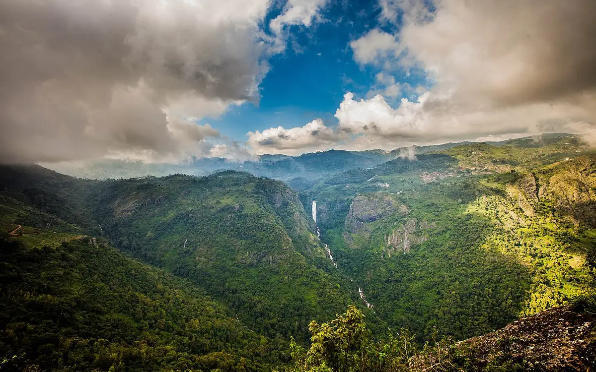
A twin-tiered waterfall near Kotagiri, one of the tallest in the Nilgiris, formed on the Kallar river. Tamil Nadu Tourism and the district administration both say it takes its name from the wife of M.D. Cockburn, the planter credited with bringing coffee to Kotagiri, though the older form St Catherine's Falls was already in use. This waterfall guide belongs to the Kotagiri planning base in The Nilgiris, Tamil Nadu, with route context, best-time notes and verified inventory categories for stays, food, operators, shops, wellness and transport as they are approved.
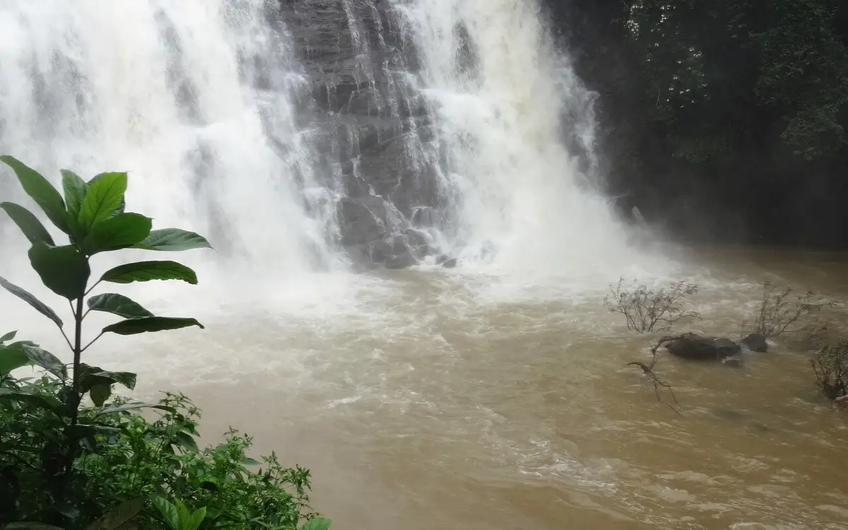
A waterfall on the Ooty-Gudalur road near Kalhatti village, plunging beside an old Shiva shrine set into the rock. This waterfall guide belongs to the Ooty planning base in The Nilgiris, Tamil Nadu, with route context, best-time notes and verified inventory categories for stays, food, operators, shops, wellness and transport as they are approved.
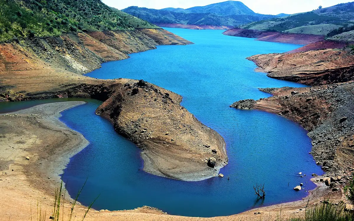
A quiet reservoir near Avalanche in the upper Nilgiris, surrounded by tea plantations and sholas, less visited than Ooty Lake. This dam guide belongs to the Ooty planning base in The Nilgiris, Tamil Nadu, with route context, best-time notes and verified inventory categories for stays, food, operators, shops, wellness and transport as they are approved.
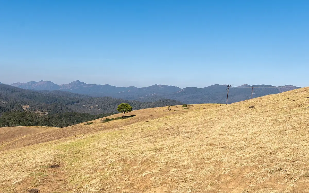
Rolling open grassland west of Ooty named after a former Governor of Madras, used for golf, horse riding, and as an ecologically sensitive shola-grassland tract. This park guide belongs to the Ooty planning base in The Nilgiris, Tamil Nadu, with route context, best-time notes and verified inventory categories for stays, food, operators, shops, wellness and transport as they are approved.
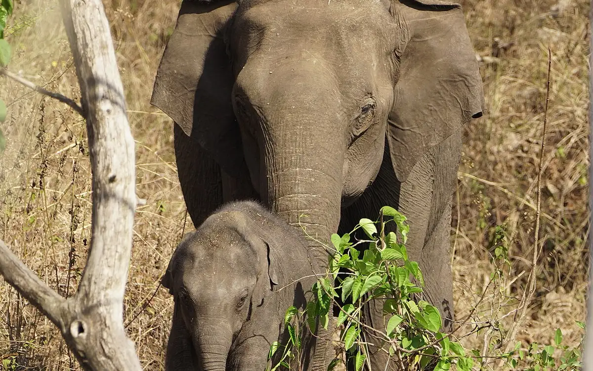
The national park and tiger reserve that Masinagudi sits at the edge of, running along the northern slopes of the Nilgiris where they fall away to the Mysore plateau, at the meeting point of Tamil Nadu, Kerala and Karnataka. The National Tiger Conservation Authority gives it a core or critical tiger habitat of 321.00 sq km and a buffer of 367.59 sq km, 688.59 sq km in all, and it joins Bandipur in Karnataka and Wayanad in Kerala to make one of the largest stretches of protected elephant country in Asia. It was made a sanctuary in 1940, a national park in 1990 and a tiger reserve in April 2007. This wildlife guide belongs to the Masinagudi planning base in The Nilgiris, Tamil Nadu, with route context, best-time notes and verified inventory categories for stays, food, operators, shops, wellness and transport as they are approved.
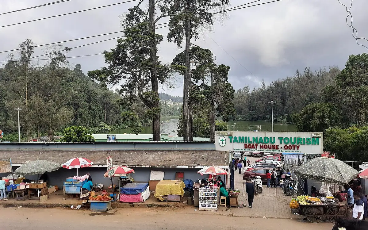
An indoor exhibit near the Botanical Garden displaying handcrafted thread-and-wire replicas of flowers, said to be one of the largest thread gardens in the world. This museum guide belongs to the Ooty planning base in The Nilgiris, Tamil Nadu, with route context, best-time notes and verified inventory categories for stays, food, operators, shops, wellness and transport as they are approved.


A protected shola forest reserve on Kotagiri's eastern edge, known for birdwatching and for sightings of endemic species such as the Nilgiri wood pigeon. It was designated a Ramsar Wetland of International Importance on 24 May 2023, covering 116.01 hectares. This park guide belongs to the Kotagiri planning base in The Nilgiris, Tamil Nadu, with route context, best-time notes and verified inventory categories for stays, food, operators, shops, wellness and transport as they are approved.
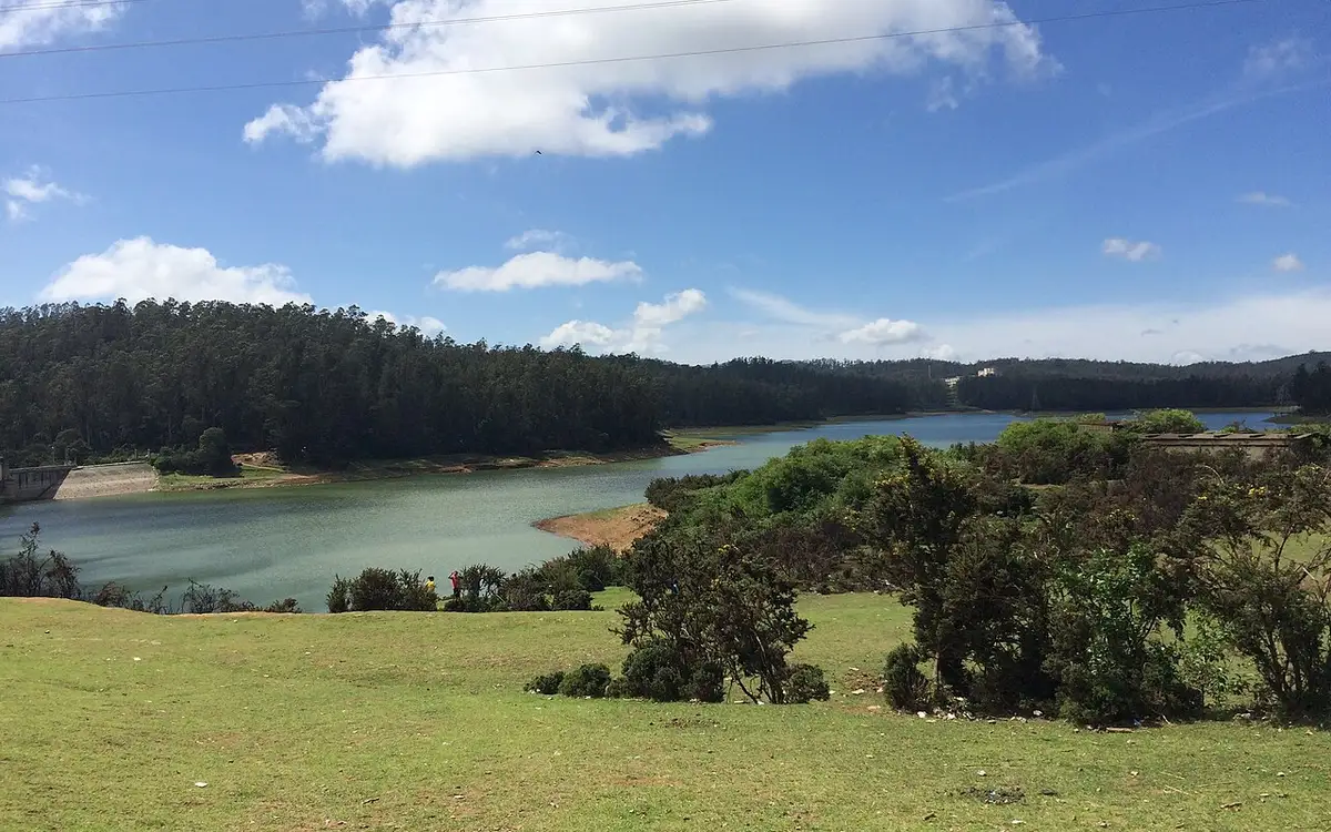
A small reservoir and dam near Ooty on the outskirts of town, popular as a quiet picnic and photography spot away from the crowds. This dam guide belongs to the Ooty planning base in The Nilgiris, Tamil Nadu, with route context, best-time notes and verified inventory categories for stays, food, operators, shops, wellness and transport as they are approved.
Book with the place itself. India’s cyber-crime coordination centre warned in April 2025 that convincing copies of hotel and pilgrimage booking sites are being pushed through sponsored search and social ads, taking payment for rooms the property never hears about. Every listing here links to the business’s own contact details and its own Google or Bing profile — we take no commission and sit in nobody’s payment path. If a booking page reached you through an ad, check the address bar against the property’s own site before you pay. Fraud can be reported on cybercrime.gov.in or on 1930.
Famous tourist places and treks in The Nilgiris
A practical tourist-guide list for the district. Full place pages, hotels, homestays, restaurants and local operators are added progressively under each town or attraction.
 activity
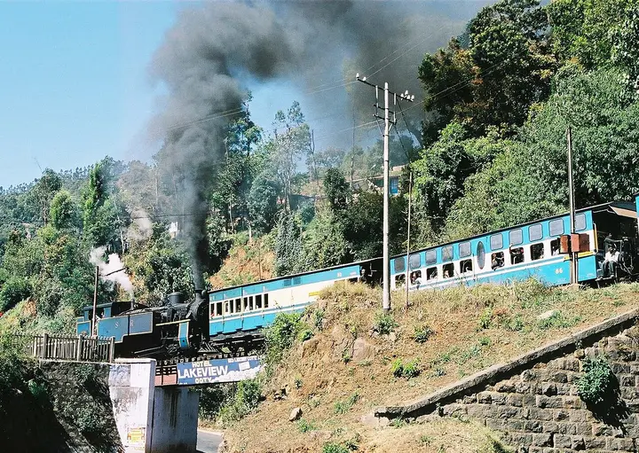
Nilgiri Mountain Railway
A UNESCO World Heritage metre-gauge rack railway connecting Mettupalayam to Ooty via Coonoor, opened in stages between 1899 and 1908. This activity guide belongs to the Coonoor planning base in The Nilgiris, Tamil Nadu, with route context, best-time notes and verified inventory categories for stays, food, operators, shops, wellness and transport as they are approved.
damOoty Lake
An artificial lake created in 1824 by John Sullivan, the founder of Ooty, now used for boating amid eucalyptus-lined banks. This dam guide belongs to the Ooty planning base in The Nilgiris, Tamil Nadu, with route context, best-time notes and verified inventory categories for stays, food, operators, shops, wellness and transport as they are approved.
 park
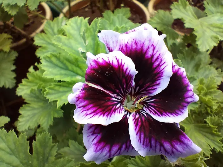
parkGovernment Botanical Garden, Ooty
A terraced garden of 55 acres below Doddabetta, run by the Tamil Nadu Horticulture Department, holding a fossilised tree trunk reckoned at 20 million years old and hosting the flower show every May. Its founding year is published two ways, 1848 and 1897. This park guide belongs to the Ooty planning base in The Nilgiris, Tamil Nadu, with route context, best-time notes and verified inventory categories for stays, food, operators, shops, wellness and transport as they are approved.
 viewpoint
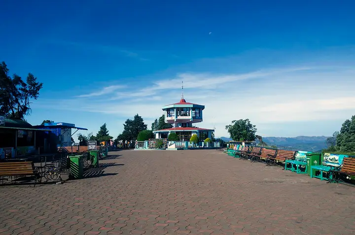
Doddabetta Peak
The highest peak in the Nilgiris and in Tamil Nadu, with a telescope house at the top. Three arms of the government publish three different heights for it — 2,623 m, 2,636 m and 2,637 m. This viewpoint guide belongs to the Ooty planning base in The Nilgiris, Tamil Nadu, with route context, best-time notes and verified inventory categories for stays, food, operators, shops, wellness and transport as they are approved.
 park
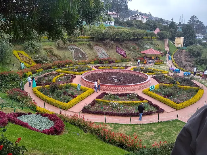
parkGovernment Rose Garden, Ooty
Four hectares in five terraces on the slopes of Elk Hill, with more than 3,000 varieties of roses on the district administration’s own count, and an International Rose Society award for the best rose garden in South Asia in 2006. This park guide belongs to the Ooty planning base in The Nilgiris, Tamil Nadu, with route context, best-time notes and verified inventory categories for stays, food, operators, shops, wellness and transport as they are approved.
 park
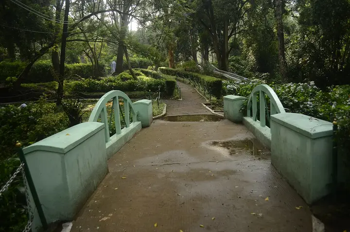
parkSim's Park
A 12-hectare botanical park in Coonoor established in 1874, laid out in irregular Japanese style with a small lake and rare tree species. This park guide belongs to the Coonoor planning base in The Nilgiris, Tamil Nadu, with route context, best-time notes and verified inventory categories for stays, food, operators, shops, wellness and transport as they are approved.
 viewpoint
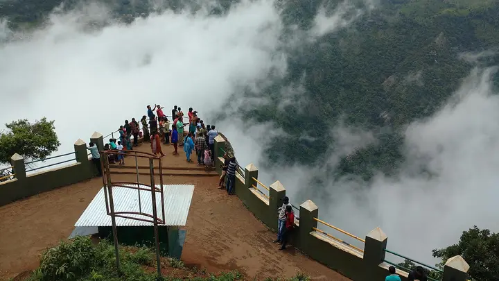
Dolphin's Nose, Coonoor
A rocky outcrop near Coonoor offering sweeping views of the Nilgiri escarpment, Catherine Falls, and the plains below. This viewpoint guide belongs to the Coonoor planning base in The Nilgiris, Tamil Nadu, with route context, best-time notes and verified inventory categories for stays, food, operators, shops, wellness and transport as they are approved.
 viewpoint
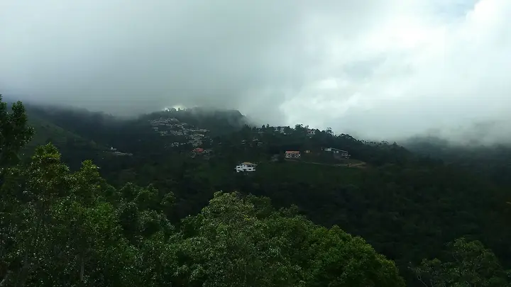
Lamb's Rock
A viewpoint near Coonoor overlooking tea and coffee plantations and the Coimbatore plains, named after a former collector of the region. This viewpoint guide belongs to the Coonoor planning base in The Nilgiris, Tamil Nadu, with route context, best-time notes and verified inventory categories for stays, food, operators, shops, wellness and transport as they are approved.
 waterfall
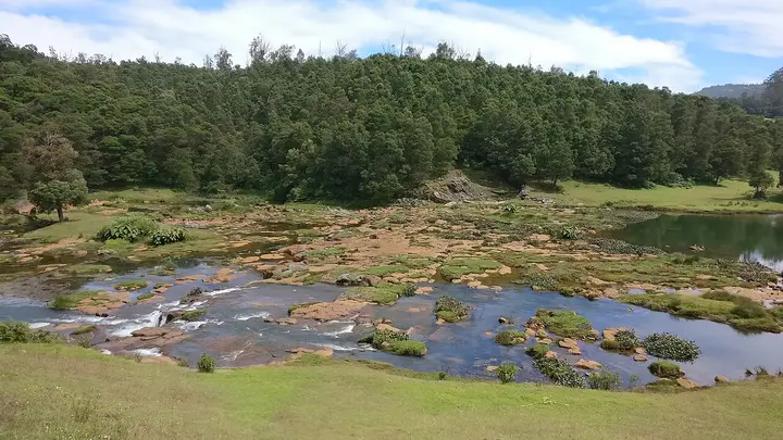
Pykara Falls
The Pykara river drops here in two stages of 55 and 61 metres, on the Mysuru road 22.5 km from the Ooty bus stand by routed road — the municipality publishes it as about 20 km. The river above the falls is held sacred by the Toda. This waterfall guide belongs to the Ooty planning base in The Nilgiris, Tamil Nadu, with route context, best-time notes and verified inventory categories for stays, food, operators, shops, wellness and transport as they are approved.
 dam
damPykara Lake
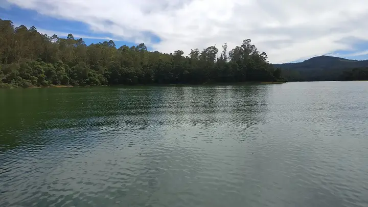
The reservoir on the Pykara river 22.2 km from the Ooty bus stand by routed road, with a boathouse running motorboat trips over water ringed by pine, shola and grassland; gaur graze the banks. The river above it is held sacred by the Toda, and the falls two kilometres downstream are part of the same site. This dam guide belongs to the Ooty planning base in The Nilgiris, Tamil Nadu, with route context, best-time notes and verified inventory categories for stays, food, operators, shops, wellness and transport as they are approved.
 dam
damAvalanche Lake
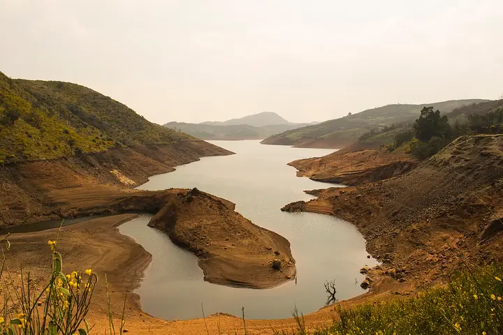
A reservoir among sholas and grassland on the road toward Upper Bhavani, 22.5 km from the Ooty bus stand by routed road — the district and the municipality both publish it as 28 km. It sits inside a protected forest zone where access is controlled, so check before setting out. This dam guide belongs to the Ooty planning base in The Nilgiris, Tamil Nadu, with route context, best-time notes and verified inventory categories for stays, food, operators, shops, wellness and transport as they are approved.
 wildlife
Mukurthi National Park
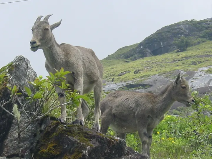
A high-altitude park in the western Nilgiris protecting shola-grassland ecosystems and the endangered Nilgiri tahr, part of the Nilgiri Biosphere Reserve. There is no public road into it; entry is on permit from the Kundah side, and Sispara Pass and Bangitappal lie within its western reach. This wildlife guide belongs to the Kundah planning base in The Nilgiris, Tamil Nadu, with route context, best-time notes and verified inventory categories for stays, food, operators, shops, wellness and transport as they are approved.
 church
St. Stephen's Church, Ooty
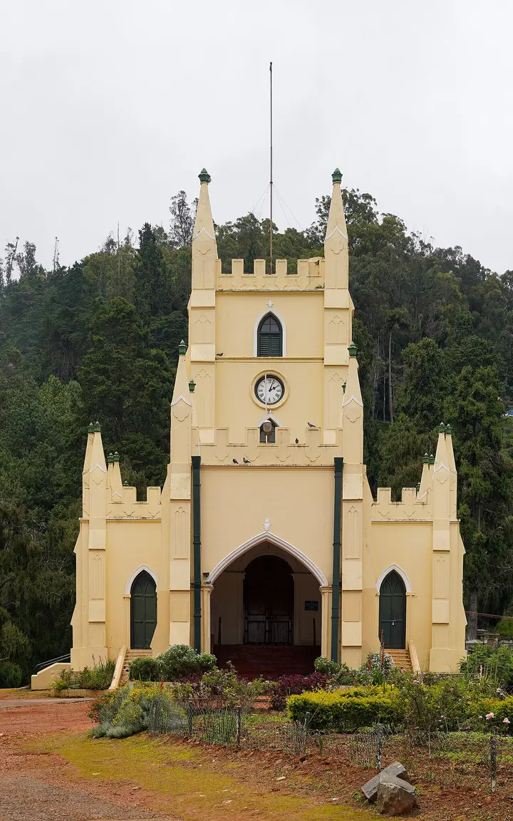
Consecrated in 1830, this is the oldest church in the Nilgiris, built partly from timber salvaged from Tipu Sultan's summer palace in Srirangapatna. This church guide belongs to the Ooty planning base in The Nilgiris, Tamil Nadu, with route context, best-time notes and verified inventory categories for stays, food, operators, shops, wellness and transport as they are approved.
 museum
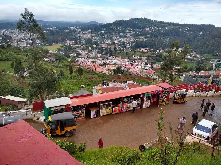
Tea Museum and Factory, Ooty
A working tea factory near Ooty with a small museum explaining tea-processing history and a shop selling estate teas. This museum guide belongs to the Ooty planning base in The Nilgiris, Tamil Nadu, with route context, best-time notes and verified inventory categories for stays, food, operators, shops, wellness and transport as they are approved.
 viewpoint
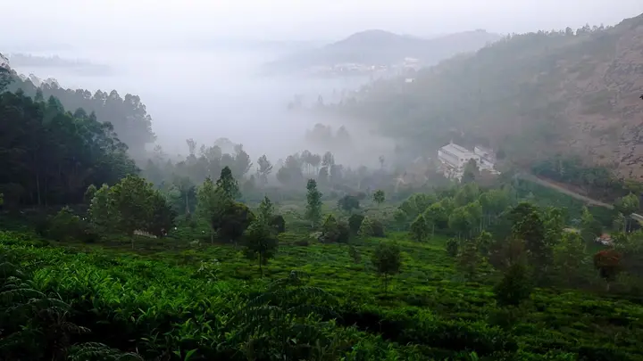
Kodanad View Point
A viewpoint near Kotagiri overlooking the Bhavani valley and, on clear days, the plains beyond. This viewpoint guide belongs to the Kotagiri planning base in The Nilgiris, Tamil Nadu, with route context, best-time notes and verified inventory categories for stays, food, operators, shops, wellness and transport as they are approved.
 waterfall
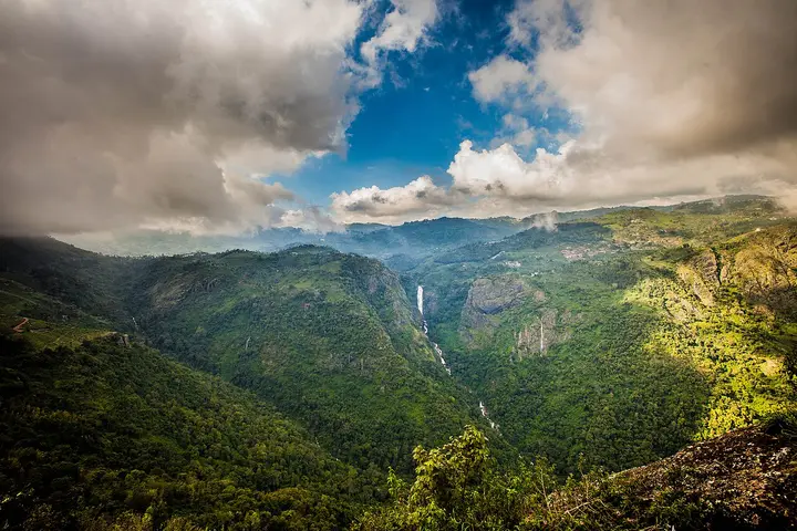
Catherine Falls
A twin-tiered waterfall near Kotagiri, one of the tallest in the Nilgiris, formed on the Kallar river. Tamil Nadu Tourism and the district administration both say it takes its name from the wife of M.D. Cockburn, the planter credited with bringing coffee to Kotagiri, though the older form St Catherine's Falls was already in use. This waterfall guide belongs to the Kotagiri planning base in The Nilgiris, Tamil Nadu, with route context, best-time notes and verified inventory categories for stays, food, operators, shops, wellness and transport as they are approved.
 waterfall
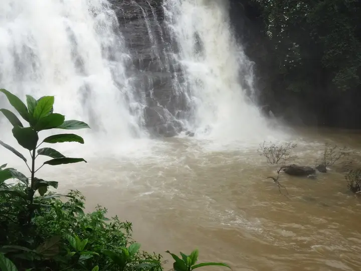
Kalhatti Falls
A waterfall on the Ooty-Gudalur road near Kalhatti village, plunging beside an old Shiva shrine set into the rock. This waterfall guide belongs to the Ooty planning base in The Nilgiris, Tamil Nadu, with route context, best-time notes and verified inventory categories for stays, food, operators, shops, wellness and transport as they are approved.
 dam
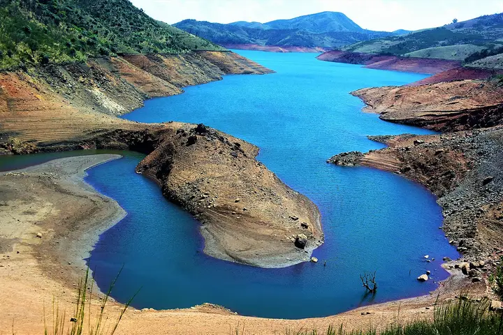
damEmerald Lake, Ooty
A quiet reservoir near Avalanche in the upper Nilgiris, surrounded by tea plantations and sholas, less visited than Ooty Lake. This dam guide belongs to the Ooty planning base in The Nilgiris, Tamil Nadu, with route context, best-time notes and verified inventory categories for stays, food, operators, shops, wellness and transport as they are approved.
 park
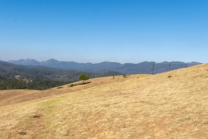
parkWenlock Downs
Rolling open grassland west of Ooty named after a former Governor of Madras, used for golf, horse riding, and as an ecologically sensitive shola-grassland tract. This park guide belongs to the Ooty planning base in The Nilgiris, Tamil Nadu, with route context, best-time notes and verified inventory categories for stays, food, operators, shops, wellness and transport as they are approved.
 wildlife
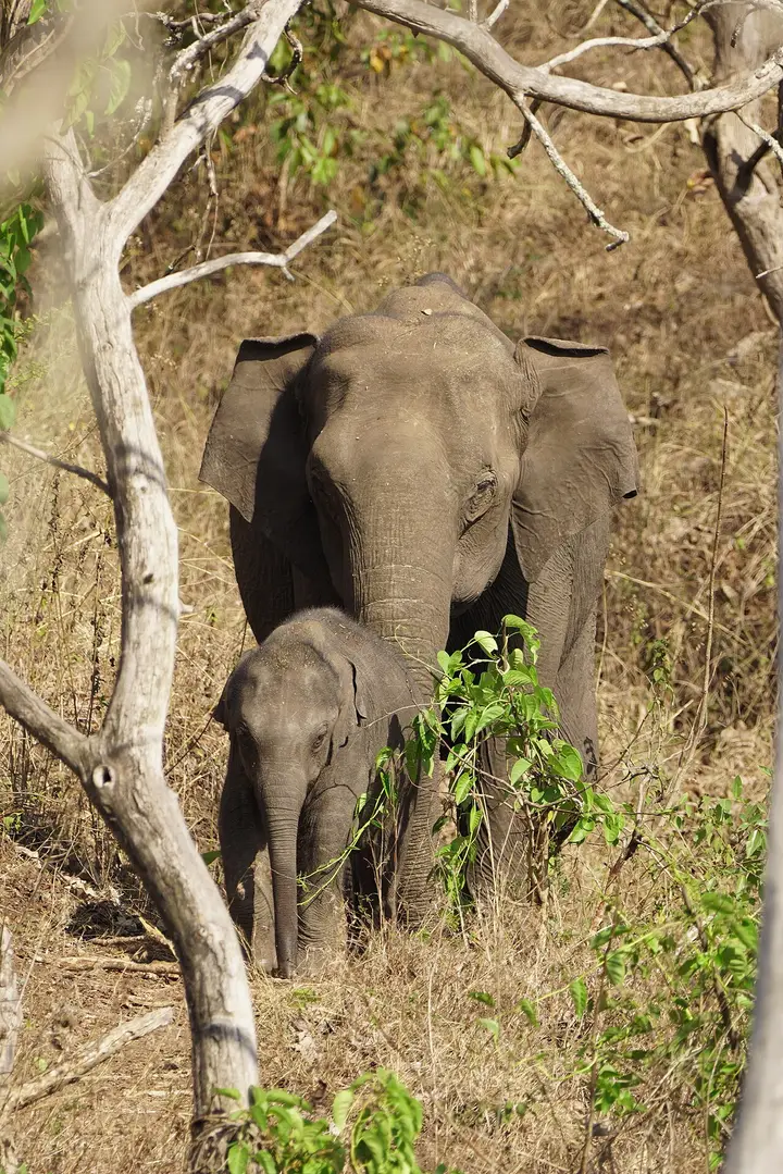
Mudumalai National Park
The national park and tiger reserve that Masinagudi sits at the edge of, running along the northern slopes of the Nilgiris where they fall away to the Mysore plateau, at the meeting point of Tamil Nadu, Kerala and Karnataka. The National Tiger Conservation Authority gives it a core or critical tiger habitat of 321.00 sq km and a buffer of 367.59 sq km, 688.59 sq km in all, and it joins Bandipur in Karnataka and Wayanad in Kerala to make one of the largest stretches of protected elephant country in Asia. It was made a sanctuary in 1940, a national park in 1990 and a tiger reserve in April 2007. This wildlife guide belongs to the Masinagudi planning base in The Nilgiris, Tamil Nadu, with route context, best-time notes and verified inventory categories for stays, food, operators, shops, wellness and transport as they are approved.
 museum
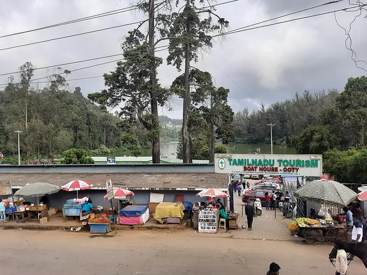
Ooty Thread Garden
An indoor exhibit near the Botanical Garden displaying handcrafted thread-and-wire replicas of flowers, said to be one of the largest thread gardens in the world. This museum guide belongs to the Ooty planning base in The Nilgiris, Tamil Nadu, with route context, best-time notes and verified inventory categories for stays, food, operators, shops, wellness and transport as they are approved.
 viewpoint
Rangaswamy Pillar and Peak
A rock pillar and viewpoint east of Kotagiri associated with a local Rangaswamy temple legend, offering views over the Nilgiri plateau. Sources place it differently: OpenStreetMap maps the cliff at one point and Wikipedia gives another about 4.5 km further east, while Wikipedia's own text calls it 20 km from Kotagiri, which matches neither. This viewpoint guide belongs to the Kotagiri planning base in The Nilgiris, Tamil Nadu, with route context, best-time notes and verified inventory categories for stays, food, operators, shops, wellness and transport as they are approved.
 park
parkLongwood Shola
A protected shola forest reserve on Kotagiri's eastern edge, known for birdwatching and for sightings of endemic species such as the Nilgiri wood pigeon. It was designated a Ramsar Wetland of International Importance on 24 May 2023, covering 116.01 hectares. This park guide belongs to the Kotagiri planning base in The Nilgiris, Tamil Nadu, with route context, best-time notes and verified inventory categories for stays, food, operators, shops, wellness and transport as they are approved.
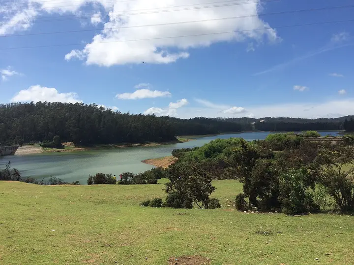 dam
damKamaraj Sagar Dam
A small reservoir and dam near Ooty on the outskirts of town, popular as a quiet picnic and photography spot away from the crowds. This dam guide belongs to the Ooty planning base in The Nilgiris, Tamil Nadu, with route context, best-time notes and verified inventory categories for stays, food, operators, shops, wellness and transport as they are approved.
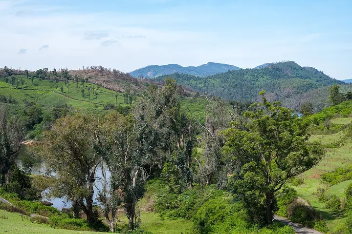 viewpoint
Glenmorgan
A tea-estate area west of Ooty toward Gudalur, known for scenic valley views, a reservoir, and rolling tea gardens. This viewpoint guide belongs to the Ooty planning base in The Nilgiris, Tamil Nadu, with route context, best-time notes and verified inventory categories for stays, food, operators, shops, wellness and transport as they are approved.
Wax World Museum, Ooty
An indoor wax museum set in a 19th-century colonial mansion about a kilometre from Ooty Railway Station. It displays life-size wax figures of Indian freedom fighters, leaders and spiritual icons such as Mahatma Gandhi, A.P.J. Abdul Kalam and Mother Teresa, alongside dioramas of village life. It is one of Ooty's popular family attractions. This heritage guide belongs to the Ooty planning base in The Nilgiris, Tamil Nadu, with route context, best-time notes and verified inventory categories for stays, food, operators, shops, wellness and transport as they are approved.
Tribal Research Centre Museum, Ooty
Part of the Tribal Research Centre campus at Muthorai near Ooty. It preserves ornaments, tools, weapons, pottery and artwork documenting dozens of ethnic communities of Tamil Nadu, including the Toda, Kota, Kurumba and Irula tribes of the Nilgiris. It is listed on the official Nilgiris district tourism site. This heritage guide belongs to the Ooty planning base in The Nilgiris, Tamil Nadu, with route context, best-time notes and verified inventory categories for stays, food, operators, shops, wellness and transport as they are approved.
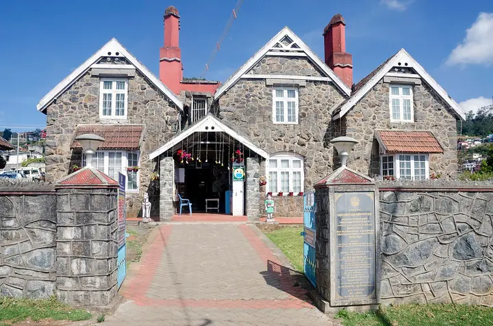 heritage
Stone House, Ooty
Regarded as the first British bungalow in Ooty, built around 1822 by John Sullivan, the collector who founded the hill station. Locals nicknamed it 'Kal Bangla', the stone bungalow. It now stands within the Government Arts College campus and is a heritage landmark of the town. This heritage guide belongs to the Ooty planning base in The Nilgiris, Tamil Nadu, with route context, best-time notes and verified inventory categories for stays, food, operators, shops, wellness and transport as they are approved.
Raj Bhavan, Ooty
The former Government House stands on the western slopes of Doddabetta and served as the summer seat of the Governor of Madras during the colonial era. Built in mid-19th-century colonial style amid extensive gardens, it remains a heritage landmark listed on the Nilgiris district tourism site. This heritage guide belongs to the Ooty planning base in The Nilgiris, Tamil Nadu, with route context, best-time notes and verified inventory categories for stays, food, operators, shops, wellness and transport as they are approved.
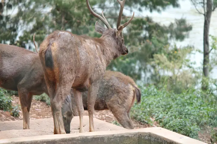 heritage
Deer Park, Ooty
One of the highest-altitude deer parks in India, lying near Ooty Lake. Spread over wooded grounds, it shelters spotted deer, sambar and other herbivores and makes a short stop for families visiting the lake area. This heritage guide belongs to the Ooty planning base in The Nilgiris, Tamil Nadu, with route context, best-time notes and verified inventory categories for stays, food, operators, shops, wellness and transport as they are approved.
Elk Hill Murugan Temple, Ooty
A hilltop temple to Lord Murugan crowning Elk Hill in Ooty, reached by a climb to the summit. It commands wide views over the town and hosts a large Thaipusam festival in January-February. It is among the most visited pilgrimage sites in Ooty. This heritage guide belongs to the Ooty planning base in The Nilgiris, Tamil Nadu, with route context, best-time notes and verified inventory categories for stays, food, operators, shops, wellness and transport as they are approved.
 heritage
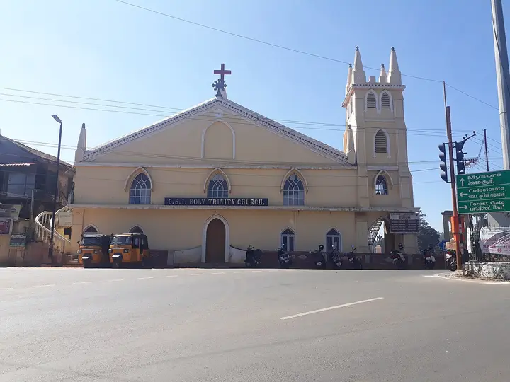
Holy Trinity Church, Ooty
One of Ooty's oldest churches, a dedicated place of worship from 1858, built in Gothic and Tudor style. The Tamil scholar George Uglow Pope helped initiate it and served as its chaplain in 1858-59. It was originally used as a school on weekdays and a church on Sundays. This heritage guide belongs to the Ooty planning base in The Nilgiris, Tamil Nadu, with route context, best-time notes and verified inventory categories for stays, food, operators, shops, wellness and transport as they are approved.
 heritage
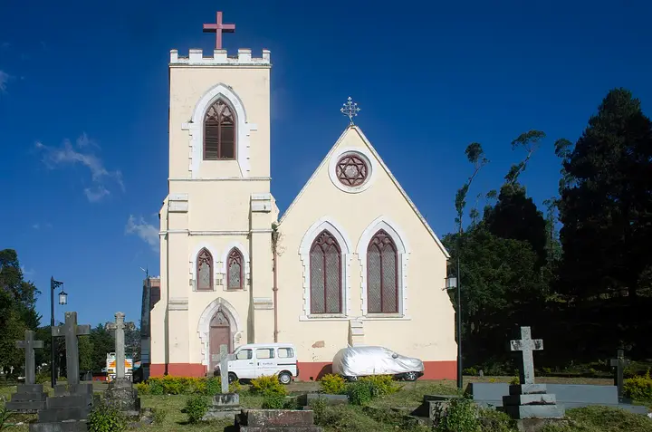
St. Thomas Church, Ooty
Built in 1870, St. Thomas Church overlooks Ooty Lake and holds the grave of William Patrick Adam, a former Governor of Madras. Its picturesque setting served as a filming location for the Hollywood film 'A Passage to India'. It has been a town landmark for around a century and a half. This heritage guide belongs to the Ooty planning base in The Nilgiris, Tamil Nadu, with route context, best-time notes and verified inventory categories for stays, food, operators, shops, wellness and transport as they are approved.
Mariamman Temple, Ooty
A temple dedicated to the goddess Mariamman, the folk deity associated with rain. Its annual Mariamman festival, held in April, draws large crowds of devotees to Ooty. It is one of the town's principal Hindu places of worship. This heritage guide belongs to the Ooty planning base in The Nilgiris, Tamil Nadu, with route context, best-time notes and verified inventory categories for stays, food, operators, shops, wellness and transport as they are approved.
 viewpoint
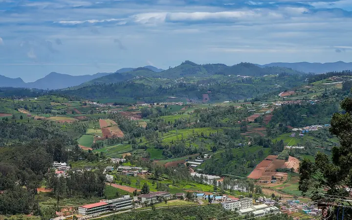
Ketti Valley View Point
The roadside viewpoint above the Ketti valley on the Ooty–Coonoor road, with a telescope room and a long view down a valley floor of Badaga hamlets, vegetable terraces and tea. On a clear day the plains toward Coimbatore show at the far end. It is 4.4 km by road from Ketti railway station and 5.1 km from the Ooty bus stand, so it is reached from either side. This viewpoint guide belongs to the Ketti planning base in The Nilgiris, Tamil Nadu, with route context, best-time notes and verified inventory categories for stays, food, operators, shops, wellness and transport as they are approved.
 heritage
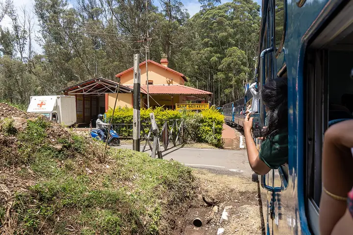
Ketti railway station
Station code KXT, an NSG-6 halt on the Nilgiri Mountain Railway in the Salem division of Southern Railway, and part of the Mountain Railways of India World Heritage Site. The Udhagamandalam passenger stops here on its way up from Coonoor, and the platform sits directly beside the village road, which is why the station building — orange walls, red tile, a board reading Ketti in Tamil, Hindi and English — is the one piece of Ketti most visitors actually see. This heritage guide belongs to the Ketti planning base in The Nilgiris, Tamil Nadu, with route context, best-time notes and verified inventory categories for stays, food, operators, shops, wellness and transport as they are approved.
Needle Industries, Ketti
The needle works the village is known for, on the valley floor 1.2 km east of the station, with further plants at Yellanahalli under the Pony Needle name. It is the largest industrial employer in the valley and, with the tea and the vegetable terraces, one of the reasons Ketti is a working village rather than a viewpoint. It is a factory and not a visitor attraction: there is no tour, no gate open to the public and, so far as any picture index reaches, no photograph of it. This heritage guide belongs to the Ketti planning base in The Nilgiris, Tamil Nadu, with route context, best-time notes and verified inventory categories for stays, food, operators, shops, wellness and transport as they are approved.
St. George's Homes and Laidlaw Memorial School, Ketti
A boarding institution on a 220-acre campus on the southern slope of the valley, whose own school dates itself to 1914. It began as St. George's Homes, an orphanage founded by John Breeden with money given by the Glasgow-born draper Robert Laidlaw, and the published record of when it reached Ketti does not agree with itself — the school says 1914 and the standard reference account says the institution moved here from Kodaikanal in 1922, and we have found no source that settles the gap. The naturalist M. A. Wynter-Blyth was headmaster from 1941. Its boarding cottages still carry the English names they were given — Oldham, Hesketh, Lancashire, Lewis, Oakshott. This heritage guide belongs to the Ketti planning base in The Nilgiris, Tamil Nadu, with route context, best-time notes and verified inventory categories for stays, food, operators, shops, wellness and transport as they are approved.
 heritage
CSI College of Engineering, Ketti
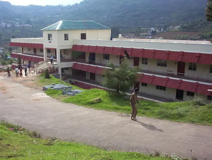
A self-financing engineering college founded in 1998 by the Coimbatore Diocesan Council of the Church of South India, approved by AICTE and affiliated to Anna University. It sits on the valley floor below the Ooty road and is the long red-roofed block visible from the viewpoint. A. P. J. Abdul Kalam addressed its students here on 21 February 2012. This heritage guide belongs to the Ketti planning base in The Nilgiris, Tamil Nadu, with route context, best-time notes and verified inventory categories for stays, food, operators, shops, wellness and transport as they are approved.
Ketti Valley Reserved Forest
The reserved forest on the slope south of the village, between the valley floor and the ridge the boarding schools stand on. It is what is left of the shola-and-grassland cover that the valley has otherwise been cleared of for tea, vegetables and building. It is a reserved forest rather than a park: there is no gate, no ticket and no laid-out path, and it is looked at from the road rather than entered. This park guide belongs to the Ketti planning base in The Nilgiris, Tamil Nadu, with route context, best-time notes and verified inventory categories for stays, food, operators, shops, wellness and transport as they are approved.
Hethai Amman Shrine, Ketti
A Hethai Amman shrine in the village, the characteristic place of worship of the Badaga, who are the valley's largest community and whose language is the one most spoken in Ketti. Hethai Amman is the Badaga mother goddess and her festival falls in the cold months around December and January. It is a living village shrine and not a monument, and it is entered on the community's terms. This temple guide belongs to the Ketti planning base in The Nilgiris, Tamil Nadu, with route context, best-time notes and verified inventory categories for stays, food, operators, shops, wellness and transport as they are approved.
St. Michael's Church, Shanthoor
The Catholic church at Shanthoor, the settlement at the lowest point of the Ketti valley, 2.8 km from the station. Christian missions were active in this valley from the early 1900s and the schools, colleges and churches strung along the slope — this one, the Needle Church by the works, the CSI institutions above — are what that left behind. Shanthoor has the valley's own post office. This heritage guide belongs to the Ketti planning base in The Nilgiris, Tamil Nadu, with route context, best-time notes and verified inventory categories for stays, food, operators, shops, wellness and transport as they are approved.
Tiger Hill, Ooty
Tiger Hill lies at the lower end of Doddabetta peak near Ooty and offers panoramic views of the surrounding Nilgiri ranges and valleys. Its grassy slopes and quiet trails make it a spot for short treks and camping away from the busier tourist points. This heritage guide belongs to the Ooty planning base in The Nilgiris, Tamil Nadu, with route context, best-time notes and verified inventory categories for stays, food, operators, shops, wellness and transport as they are approved.
 heritage
Marlimund Lake, Ooty
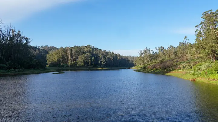
A quiet reservoir on Ooty's western circuit, framed by eucalyptus and pine slopes. Less frequented than Ooty Lake, it is valued for its calm setting and birdlife and is often included in half-day drives around the town. This heritage guide belongs to the Ooty planning base in The Nilgiris, Tamil Nadu, with route context, best-time notes and verified inventory categories for stays, food, operators, shops, wellness and transport as they are approved.
 heritage
Pine Forest, Ooty
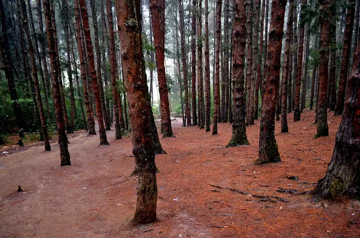
A dense stand of tall, closely planted pines on the slope below the Shooting Point area on the Ooty-Gudalur road. Its symmetrical rows of trees and filtered light have made it a favourite spot for photography and countless Tamil film songs. It is usually visited together with the adjoining 9th Mile Shooting Point. This heritage guide belongs to the Ooty planning base in The Nilgiris, Tamil Nadu, with route context, best-time notes and verified inventory categories for stays, food, operators, shops, wellness and transport as they are approved.
Droog Fort
Droog Fort sits at about 6,000 feet on a hilltop roughly 13 km from Coonoor and is reached by a trek through tea estates and shola. It is said to have been used as an outpost by Tipu Sultan in the 18th century, with surviving remnants including a wall and a clock tower. The summit gives sweeping views over the plains and hills. This heritage guide belongs to the Coonoor planning base in The Nilgiris, Tamil Nadu, with route context, best-time notes and verified inventory categories for stays, food, operators, shops, wellness and transport as they are approved.
Law's Falls
Law's Falls lies about 5 km from Coonoor on the Coonoor-Mettupalayam ghat road, where the Coonoor river drops through a wooded gorge. It is named after Colonel Law, who built the Coonoor ghat road in the 1830s. Surrounded by dense greenery, it is a relatively uncrowded picnic spot. This heritage guide belongs to the Coonoor planning base in The Nilgiris, Tamil Nadu, with route context, best-time notes and verified inventory categories for stays, food, operators, shops, wellness and transport as they are approved.
Ralliah Dam
Ralliah (Rallia) Dam sits on the Coonoor-Kattabettu-Kotagiri road and was built in 1914 as a catchment supplying drinking water to Coonoor and Kotagiri. Ringed by eucalyptus forest and reached by a short walk, it is a peaceful, little-visited spot popular for gentle trekking. This heritage guide belongs to the Coonoor planning base in The Nilgiris, Tamil Nadu, with route context, best-time notes and verified inventory categories for stays, food, operators, shops, wellness and transport as they are approved.
Lady Canning's Seat
Lady Canning's Seat is an elevated colonial-era vantage point near Coonoor named after the wife of Lord Canning, Viceroy of India. It is prized for its sunrise and sunset views over the surrounding valleys and tea slopes. This heritage guide belongs to the Coonoor planning base in The Nilgiris, Tamil Nadu, with route context, best-time notes and verified inventory categories for stays, food, operators, shops, wellness and transport as they are approved.
Kattery Park
Kattery Park is a horticultural park spread over about 5.5 acres near Coonoor, with landscaped flower beds, a children's play area and a small waterfall on the Kallar river nearby. It is a compact garden stop on the outskirts of the town. This heritage guide belongs to the Coonoor planning base in The Nilgiris, Tamil Nadu, with route context, best-time notes and verified inventory categories for stays, food, operators, shops, wellness and transport as they are approved.
All Saints Church, Coonoor
An Anglican church in Coonoor, now of the Church of South India, on the Kattabettu road out of the town — stained glass, antique woodwork and an old pipe organ in a Gothic hall. Its founding is published as both 1851 and 1854 and we have found no official source that settles it, so both are printed. We have no checked coordinate for it, so no distance to it is printed. This heritage guide belongs to the Coonoor planning base in The Nilgiris, Tamil Nadu, with route context, best-time notes and verified inventory categories for stays, food, operators, shops, wellness and transport as they are approved.
Coonoor railway station
The hinge of the Nilgiri Mountain Railway, 370 m from the Coonoor bus stand. The Abt rack section that carries the train up the gorge from Kallar ends at this platform and the run on to Udhagamandalam above it is worked on plain track, which is why the locomotive shed is here and why the Coonoor-Ooty shuttles exist. Southern Railway gives the whole line as 45.88 km of metre gauge, opened to Coonoor on 15 June 1899. This heritage guide belongs to the Coonoor planning base in The Nilgiris, Tamil Nadu, with route context, best-time notes and verified inventory categories for stays, food, operators, shops, wellness and transport as they are approved.
Pasteur Institute of India, Coonoor
A vaccine institute on sixteen acres above the town, founded after Lily Pakenham Walsh died of hydrophobia in 1902 without reaching treatment in time. One lakh rupees of Henry Phipps's gift to Lord Curzon paid for it, Coonoor was chosen for its cool and equitable climate, and it began work on 6 April 1907. It has made antirabies vaccine ever since and DPT vaccines since 1982. A manufacturer, not a clinic. This heritage guide belongs to the Coonoor planning base in The Nilgiris, Tamil Nadu, with route context, best-time notes and verified inventory categories for stays, food, operators, shops, wellness and transport as they are approved.
Brooklane Coonoor Tea Factory
A working tea factory 9.5 km east of the Coonoor bus stand on the estate road toward the viewpoints, where the leaf from the surrounding slopes is withered, rolled, oxidised and graded. Coonoor has been the administrative centre of the Nilgiri tea trade since the first plantation in these hills was established beside it in 1854. This heritage guide belongs to the Coonoor planning base in The Nilgiris, Tamil Nadu, with route context, best-time notes and verified inventory categories for stays, food, operators, shops, wellness and transport as they are approved.
Katary Falls
A waterfall 11.5 km west of Coonoor below the Katary dams, on a different catchment from the Ralliah dam east of the town despite the similar name - a confusion that had put Ralliah's own pin ten kilometres out until it was corrected. Reached off the Coonoor-Ooty road and far less visited than Catherine Falls. This waterfall guide belongs to the Coonoor planning base in The Nilgiris, Tamil Nadu, with route context, best-time notes and verified inventory categories for stays, food, operators, shops, wellness and transport as they are approved.
Bedford, Coonoor
The junction a kilometre above the bus stand where the town's shops give out and the estate roads begin, and the second place in Coonoor to find an auto. The tea slopes above it run up to Highfield, and the road east from here is the one that leads to Lamb's Rock and Dolphin's Nose. This heritage guide belongs to the Coonoor planning base in The Nilgiris, Tamil Nadu, with route context, best-time notes and verified inventory categories for stays, food, operators, shops, wellness and transport as they are approved.
 heritage
Highfield Tea Estate and Factory
Highfield is a long-established tea estate and working factory near Coonoor that offers guided tours explaining the tea-making process from plucking to packaging. Visitors can walk the plantation slopes and buy estate-fresh Nilgiri tea, making it one of Coonoor's popular tea-tourism stops. This heritage guide belongs to the Coonoor planning base in The Nilgiris, Tamil Nadu, with route context, best-time notes and verified inventory categories for stays, food, operators, shops, wellness and transport as they are approved.
 heritage
Wellington railway station
The cantonment's own halt on the Nilgiri Mountain Railway, and the point every distance on the Wellington page is measured from, because the town has no bus stand at all. It sits above the rack: the toothed third rail that hauls the train up the gorge ends at Coonoor, so everything through this single platform runs on plain track, and the station opened in 1908 with the extension to Udhagamandalam rather than with the line itself in 1899 — the barracks below it were forty-eight years old before the train arrived. This heritage guide belongs to the Wellington planning base in The Nilgiris, Tamil Nadu, with route context, best-time notes and verified inventory categories for stays, food, operators, shops, wellness and transport as they are approved.
 heritage
Madras Regiment War Memorial
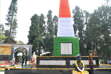
The memorial of the Madras Regiment, the oldest infantry regiment of the Indian Army, raised in 1758 and at Wellington since February 1947. The Cantonment Board's own history places the Defence Services Staff College directly in front of it, which makes this small square the centre of military Wellington rather than the barracks themselves; the ground around it is cantonment land, and what you may photograph is decided at the gate, not by the memorial. This heritage guide belongs to the Wellington planning base in The Nilgiris, Tamil Nadu, with route context, best-time notes and verified inventory categories for stays, food, operators, shops, wellness and transport as they are approved.
 heritage
Wellington Gymkhana Club
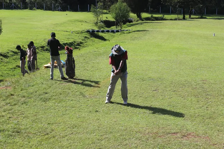
A garrison club that dates itself from the brick cricket pavilion put up for the troops in 1873, though it only took the name Wellington Gymkhana in 1916, and it now runs an eighteen-hole hill golf course at about six thousand feet. Its own history records a race course here before Ooty's longer track was built, nine-hole golf, polo and rugby by the 1930s, its first Indian member in 1943, and the fact that the whole club stands on military land and pays a yearly rent to the Defence Department. This heritage guide belongs to the Wellington planning base in The Nilgiris, Tamil Nadu, with route context, best-time notes and verified inventory categories for stays, food, operators, shops, wellness and transport as they are approved.
FM Manekshaw Bridge
The bridge that separates the barracks from the bazaar, first thrown across the Mynala stream in 1878 as the Waterloo Bridge and known for a century as the Black Bridge because it was built of Burmese teak and painted black. It was rebuilt in March 2009 — forty-three and a half metres of it — and renamed for Field Marshal Sam Manekshaw, who died at the Military Hospital here on 27 June 2008. This heritage guide belongs to the Wellington planning base in The Nilgiris, Tamil Nadu, with route context, best-time notes and verified inventory categories for stays, food, operators, shops, wellness and transport as they are approved.
 heritage
Wellington Cantonment
The barracks quarter on the far side of the stream from the market, begun in 1852 and finished in 1860, called Wellington Barracks for a century and renamed Srinagesh Barracks after General S. M. Srinagesh, the first Indian Colonel of the Madras Regiment. The Cantonment Board still governs the whole 1,647-acre town from here under the Ministry of Defence, which is why Wellington has a board and seven wards rather than a municipality and a mayor. This heritage guide belongs to the Wellington planning base in The Nilgiris, Tamil Nadu, with route context, best-time notes and verified inventory categories for stays, food, operators, shops, wellness and transport as they are approved.
 heritage
Aravankadu railway station
The next halt up the mountain line from Wellington and the reason there is a factory town in this valley at all: Aruvankadu was chosen in 1898 for the Cordite Factory because making cordite needs a cool climate, nitroglycerine freezing at forty degrees Fahrenheit. The station serves a township that the Nilgiris district administration counts alongside Wellington Cantonment as one of its two local bodies outside the panchayat system, and the factory itself is a defence installation you look at from the road and no closer. This heritage guide belongs to the Wellington planning base in The Nilgiris, Tamil Nadu, with route context, best-time notes and verified inventory categories for stays, food, operators, shops, wellness and transport as they are approved.
 heritage
Cordite Factory, Aruvankadu
India's first smokeless propellant factory, opened on 19 January 1904 and still an ordnance factory today, three and a half kilometres up the valley from Wellington station. Captain Babington was sent to find a site in 1898 and chose about 350 acres here for a reason that is pure Nilgiris — cordite has to be made in a cool climate, because nitroglycerine freezes at forty degrees Fahrenheit — and the Kateri hydroelectric dams of 1902 and 1916 were built to power it. It is a prohibited place within the meaning of the Official Secrets Act: you see the township, the school and the gate from the road, and you photograph none of it. This heritage guide belongs to the Wellington planning base in The Nilgiris, Tamil Nadu, with route context, best-time notes and verified inventory categories for stays, food, operators, shops, wellness and transport as they are approved.
St. George's Garrison Church, Wellington
The Anglican garrison church of the cantonment, and by local reckoning the largest church in the Nilgiris, seating about six hundred under a vaulted roof carried on six Ionic columns, with a white marble altar and a lit cross on the spire. The Wellington Cantonment Board's own history records it as built in 1885 to the design of Major Morant of the Royal Engineers — the same officer who argued the mountain railway into existence — with the Roman Catholic St. Joseph's following in 1888; it passed to the Church of South India in 1947. Some travel accounts instead give 1826 and Colonel J. T. Boileau, a date that predates the barracks the church served. Because published directions can lead to St. Antony's Church in Coonoor, identify the garrison church through Wellington Cantonment before setting out. This church guide belongs to the Wellington planning base in The Nilgiris, Tamil Nadu, with route context, best-time notes and verified inventory categories for stays, food, operators, shops, wellness and transport as they are approved.
Hidden Valley, Coonoor
A wooded fold in the hills behind the Wellington golf course, with quiet shola and grassland well away from the tour-bus circuit. Public sources place it in the Wellington side of Coonoor but do not publish a dependable visitor entrance. Arrange the approach with a responsible local guide or property, respect cantonment and private-land restrictions, and do not attempt an unguided route based on a generic online marker. This heritage guide belongs to the Wellington planning base in The Nilgiris, Tamil Nadu, with route context, best-time notes and verified inventory categories for stays, food, operators, shops, wellness and transport as they are approved.
Elk Falls, Kotagiri
Elk Falls, also called Uyilatty Falls after the village beside it, drops in the hills north of Kotagiri; the district administration lists it among the town's waterfalls and the usual published figure is about 7 km out. The fall itself is on no map we can read, so the marker here sits on Uyilatty village, 7.4 km from the bus stand by routed road, and not on the water. This heritage guide belongs to the Kotagiri planning base in The Nilgiris, Tamil Nadu, with route context, best-time notes and verified inventory categories for stays, food, operators, shops, wellness and transport as they are approved.
 heritage
John Sullivan Memorial (Kannerimukku Bungalow), Kotagiri
This restored stone bungalow at Kannerimukku near Kotagiri was one of the earliest European residences in the Nilgiris, associated with John Sullivan, the British collector who opened up the hills from 1819. It now houses a memorial and small museum on Nilgiri history run by a heritage trust, 3.4 km from the Kotagiri bus stand by routed road. This heritage guide belongs to the Kotagiri planning base in The Nilgiris, Tamil Nadu, with route context, best-time notes and verified inventory categories for stays, food, operators, shops, wellness and transport as they are approved.
viewpointNeedle Rock View Point
Oosi Malai — needle mountain — the conical rock 9.1 km east of Gudalur by routed road, on NH-181 towards Ooty; Wikipedia and Tamil Nadu Tourism both publish it as about 8 km. A walk of roughly a kilometre from the road brings you out on a near 360-degree panorama that takes in Wilson pine plantations, Frog Hill, Kokkal Hill, the Rockwood hills, the Silver Cloud tea estates, Gudalur town below and the Mudumalai forest running north; the official description adds Bandipur on a clear day, and names sunrise and sunset as the hours to be there. No entry charge or opening time is published by the Forest Department, whose Nilgiris ecotourism list does not include this viewpoint at all, so ask at the gate rather than trusting a figure off a booking site. This viewpoint guide belongs to the Gudalur planning base in The Nilgiris, Tamil Nadu, with route context, best-time notes and verified inventory categories for stays, food, operators, shops, wellness and transport as they are approved.
Frog Hill View Point
A lay-by on NH-181 at the first hairpin bend below Naduvattam, 12.2 km from Gudalur by routed road, looking across at the ridge that gives the place its name: seen from here the hills fold into the shape of a crouching frog. It is also signed as Valley View Point, and it is the spot to stand in if you want to see Needle Rock itself — the actual 1,440-metre rock, as opposed to the viewpoint named after it, rises about ten kilometres west across the valley alongside Morapu Malai. Tea estates, forested slopes and scattered hamlets fill the ground in between. This viewpoint guide belongs to the Gudalur planning base in The Nilgiris, Tamil Nadu, with route context, best-time notes and verified inventory categories for stays, food, operators, shops, wellness and transport as they are approved.
Nadugani Ghat
The pass that carries NH-181 off the Nilgiris and down into Kerala, 12.1 km south-west of Gudalur — the road to Nilambur, 49.5 km on, and to Kozhikode at 109.5 km. It is the western door of the district, and the reason a Tamil Nadu town at the top of it does most of its trade in Malayalam. The descent runs through the reserved forest of the Nilambur slope, elephants cross it, and the two routing engines we check agree on its length to within 200 metres, which is not true of any road out of here heading north. The marker sits on Nadugani village itself, on the map as node/402240869; the ghat is the road below it, not a point. This heritage guide belongs to the Gudalur planning base in The Nilgiris, Tamil Nadu, with route context, best-time notes and verified inventory categories for stays, food, operators, shops, wellness and transport as they are approved.
Devala
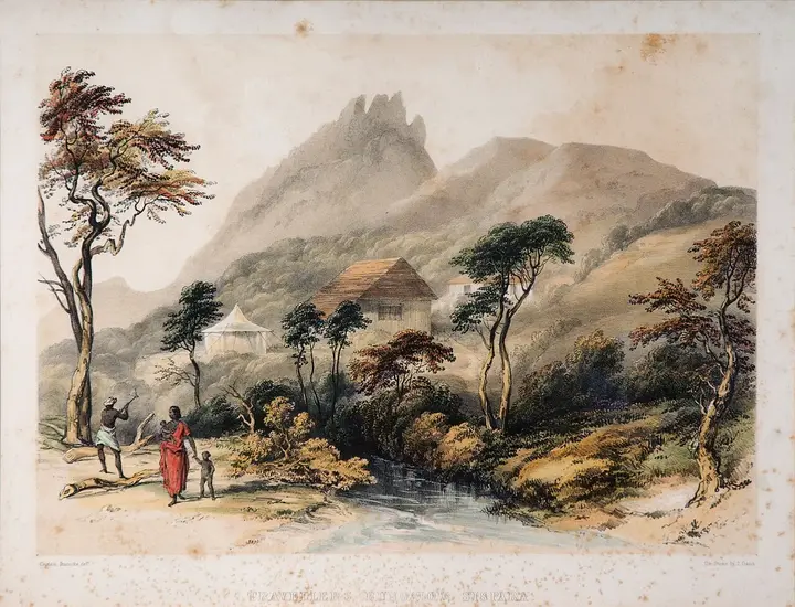
A village 16.6 km west of Gudalur that was, for about a decade, the centre of a gold rush. Mining in this country is documented from the 1830s, but it was an Australian named Withers who founded the Alfa Gold Mine in 1874 — the first company to mine gold in the Wynaad — and bought close to a thousand acres near Devala. When an Australian expert's report was published in 1879 at least fifty British and Indian companies poured into the Pandalur–Devala hills, and the rush that followed ruined the district's coffee industry without ever paying for itself. What is left is tunnelling: adits through these hills run anywhere from 500 to 3,000 metres. They are unlit, unmaintained and on private estate land, so this is a place to read about on the way through rather than to go looking for a way into. This heritage guide belongs to the Gudalur planning base in The Nilgiris, Tamil Nadu, with route context, best-time notes and verified inventory categories for stays, food, operators, shops, wellness and transport as they are approved.
Naduvattam
The village 15.9 km up the Ooty road from Gudalur where quinine came from. On 30 August 1862 the Governor of Madras, Sir William Denison, planted out the first cinchona permanently established in the Nilgiris here, and the government factory that grew up around it was run by W. G. McIvor, the gardener who had brought the seedlings on. The plantations were worked by convicts, and at McIvor's own request five hundred Chinese prisoners were sent up to Naduvattam to do it — a piece of the hills' history that gets far less telling than the tea does. The cinchona estates are still there on the slopes above the highway, and the first hairpin below the village is the Frog Hill lay-by. This heritage guide belongs to the Gudalur planning base in The Nilgiris, Tamil Nadu, with route context, best-time notes and verified inventory categories for stays, food, operators, shops, wellness and transport as they are approved.
 heritage
Sispara Pass
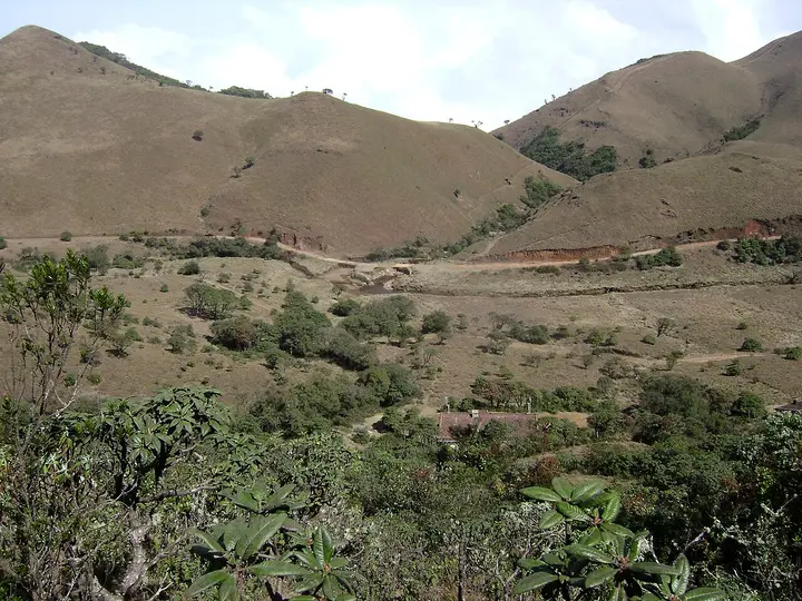
A historic pass through the western escarpment towards Malabar, now deep inside protected high country. It is not an independent day hike or an ordinary attraction: enter only on the route, date and guide authorised by the Wildlife Warden, and expect that no programme may be available. This heritage guide belongs to the Kundah planning base in The Nilgiris, Tamil Nadu, with route context, best-time notes and verified inventory categories for stays, food, operators, shops, wellness and transport as they are approved.
 heritage
Bangitappal
A remote grassland basin behind Sispara where streams meet and a trekking shed stands. The shed and track do not make it public: Bangitappal belongs only inside a specifically permitted, guided Mukurthi itinerary. This heritage guide belongs to the Kundah planning base in The Nilgiris, Tamil Nadu, with route context, best-time notes and verified inventory categories for stays, food, operators, shops, wellness and transport as they are approved.
 heritage
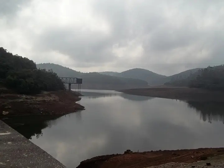
Upper Bhavani Reservoir
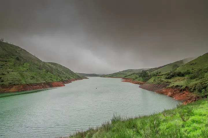
A high working reservoir in protected shola-grassland at the headwaters of the Bhavani. The approach crosses controlled forest and inspection roads; confirm permission before leaving, stop at every barrier, and do not treat the shore as a picnic or boating area. This heritage guide belongs to the Kundah planning base in The Nilgiris, Tamil Nadu, with route context, best-time notes and verified inventory categories for stays, food, operators, shops, wellness and transport as they are approved.
 heritage
Parsons Valley Reservoir
A protected drinking-water catchment in dense shola west of Ooty. There are no ordinary visitor hours or shore facilities, and a route drawn over a water-board or forest road is not permission to follow it. This heritage guide belongs to the Kundah planning base in The Nilgiris, Tamil Nadu, with route context, best-time notes and verified inventory categories for stays, food, operators, shops, wellness and transport as they are approved.
Sandynallah Reservoir
A reservoir on the Ooty-Gudalur side of the plateau, set amid tea slopes and eucalyptus. Nearby lies a historic government experimental agricultural and sheep-breeding farm. The calm waters and quiet surroundings make it a peaceful, lesser-known drive from Ooty. This heritage guide belongs to the Ooty planning base in The Nilgiris, Tamil Nadu, with route context, best-time notes and verified inventory categories for stays, food, operators, shops, wellness and transport as they are approved.
 heritage
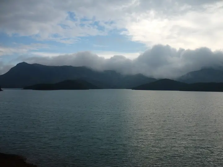
Porthimund Dam
A working reservoir in the Kundah hydro-electric system, surrounded by controlled forest and departmental roads. See it only from a safe public-road point when the approach is open; do not pass a power or forest barrier or approach the water. This heritage guide belongs to the Kundah planning base in The Nilgiris, Tamil Nadu, with route context, best-time notes and verified inventory categories for stays, food, operators, shops, wellness and transport as they are approved.
 heritage
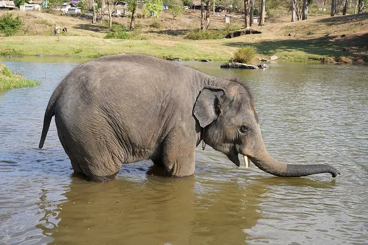
Theppakadu Elephant Camp
The elephant camp on the bank of the Moyar inside Mudumalai, 6.7 km from the Masinagudi bus stand, which the Forest Department calls the oldest elephant camp in Asia. It keeps 28 elephants including two calves, and they are working animals rather than an exhibit: they are the kumkis the department sends to drive wild elephants away from villages and to help in captures. Visitors may watch the feeding at 8.30 to 9.00 in the morning and 5.30 to 6.00 in the evening. It became famous far beyond the Nilgiris when The Elephant Whisperers, filmed here with the mahout couple Bomman and Bellie and the orphaned calves Raghu and Ammu, won the Academy Award for best documentary short in March 2023. This heritage guide belongs to the Masinagudi planning base in The Nilgiris, Tamil Nadu, with route context, best-time notes and verified inventory categories for stays, food, operators, shops, wellness and transport as they are approved.
 dam
damMaravakandy Dam
The small dam and reservoir on the Maravakandy stream 2.2 km east of the Masinagudi bus stand, and the one place here you can reach on foot from the village in under half an hour. It is a working irrigation and power dam rather than a landscaped one, and the reason to walk out is what comes to drink: the reservoir sits in open scrub on the elephant plateau and is a reliable evening watering point for elephant, gaur and spotted deer. Because the water is the draw, the same rules apply as anywhere in this country — stay in or beside the vehicle, keep your distance, and be off the road before dark. This dam guide belongs to the Masinagudi planning base in The Nilgiris, Tamil Nadu, with route context, best-time notes and verified inventory categories for stays, food, operators, shops, wellness and transport as they are approved.
 waterfall
Moyar Falls
Moyar Falls is a remote cascade on the Moyar River within the protected Mudumalai landscape, where access is governed by forest and wildlife rules. It lies below Theppakadu, about 5 km from Masinagudi as the crow flies. Visitors should not attempt to find an independent route through the reserve; ask authorised safari or Forest Department staff which public views are available on the day. This waterfall guide belongs to the Masinagudi planning base in The Nilgiris, Tamil Nadu, with route context, best-time notes and verified inventory categories for stays, food, operators, shops, wellness and transport as they are approved.
 viewpoint
Moyar Gorge
The gorge the Moyar has cut along the northern edge of the plateau, running roughly 85 km east from the reserve towards Sathyamangalam and forming the corridor elephants use between the Western and Eastern Ghats. It matters for something most visitors never hear about: the cliffs and the riverside Terminalia arjuna trees hold the largest nesting colony of Gyps vultures left in peninsular India, and the Forest Department is building its first Vulture Safe Zone around this valley. There is a viewpoint marked on the map north of Masinagudi, but it is inside the reserve and there is no public way to it: one routing engine refuses it outright and the other only reaches it by forest track. In practice you see the gorge from the safari or from the rim on the Sigur side. This viewpoint guide belongs to the Masinagudi planning base in The Nilgiris, Tamil Nadu, with route context, best-time notes and verified inventory categories for stays, food, operators, shops, wellness and transport as they are approved.
 heritage
Kalhatti Ghat Road
The steep mountain road between the Masinagudi side and the Ooty plateau is subject to an official vehicle restriction. A Nilgiris district notice dated 29 April 2026 says tourist vehicles are not permitted; only TN-43 and local vehicles may use it, while eligible local residents with other registrations require a police entry pass. Visitors travelling between Masinagudi and Ooty should use the Gudalur route rather than following a shorter navigation suggestion onto Kalhatti Road. This heritage guide belongs to the Masinagudi planning base in The Nilgiris, Tamil Nadu, with route context, best-time notes and verified inventory categories for stays, food, operators, shops, wellness and transport as they are approved.
Get listed in The Nilgiris for free
Roampedia is commission-free. Travellers find your business and contact you directly. Basic listings stay free; optional Gold and Platinum monthly packages will vary by business type, with no booking commission.
Top things to do in The Nilgiris
Our editors' pick of the standout experiences, ordered by what we'd prioritise on a first visit — an honest judgement call, not a rated ranking.
Mukurthi National Park
A 7,846-hectare national park protecting the western plateau’s shola-grassland and one of the Nilgiri tahr’s principal landscapes. There is no ordinary public road, gate ticket or self-guided trail: go only on a programme authorised by the Wildlife Warden, and accept that permission may not be available.
2Upper Bhavani Reservoir
High stored water in the working Kundah system, inside controlled forest and reservoir country. It is not a boating lake or an unrestricted drive. Confirm the approach before leaving Manjoor and stop at the first barrier.
3Parsons Valley Reservoir
A drinking-water catchment within protected shola. The useful fact is the restriction: there are no normal visitor hours or shore facilities, and a navigation line over an inspection road is not public access.
4Porthimund Dam
Part of the hydro-electric landscape rather than a picnic stop. See it only from a public, safe road position if the approach is open; never pass an electricity or forest gate for a photograph.
5Bangitappal
The remote grassland basin and old trekking shed behind Sispara. Both the shed and its track exist, but neither makes it a public attraction. Entry belongs inside a specifically permitted, guided Mukurthi itinerary.
6Sispara Pass
The historic way down the western escarpment towards Malabar, now deep in protected country. It is a controlled multi-day expedition when the department runs one, not an independent day trek.
7Ketti railway station
The reason to come, and the thing most visitors drive past. A working halt on the Nilgiri Mountain Railway — part of a World Heritage site — one stop below Lovedale and two below Ooty, with the platform on the village road so you can stand at it without travelling. Ride one stop rather than photographing it from a car.
8Ketti Valley View Point
4.4 km up the Ooty road and the only thing here anybody has heard of. Come before eleven in the morning: for much of the year the valley fills with cloud by midday and the telescope shows you nothing. Ignore the "second largest valley in the world" board — there is no measurement behind it.
9Needle Industries, Ketti
A kilometre and a quarter east on the valley floor, and the reason this is a working village rather than a viewpoint — the needle works that employ more of the valley than tea does. There is no tour and no public gate; it is passed, not visited. No photograph of it exists in any index we can reach.
10St. George's Homes and Laidlaw Memorial School, Ketti
Two hundred and twenty acres of boarding school on the southern slope, begun as an orphanage with a Bombay draper’s money and dating itself to 1914. Its cottages still carry the English names they were given — Oldham, Hesketh, Lancashire. Seen from the public road only: children live here and the estate road is private.
11CSI College of Engineering, Ketti
The long red-roofed block you can pick out on the valley floor from the viewpoint, 1.85 km from the station. Founded in 1998 by the Church of South India’s Coimbatore diocese and affiliated to Anna University; A. P. J. Abdul Kalam spoke to its students here in February 2012.
12Hethai Amman Shrine, Ketti
The nearest of Ketti’s places to the platform at 880 metres, and the one that tells you whose valley this is — a shrine to the Badaga mother goddess, in a valley where Badaga is the first language you will hear. A living village shrine, busiest around December and January. Ask before you enter or photograph.
13St. Michael's Church, Shanthoor
Down at the lowest point of the valley, 2.75 km out, in the settlement that holds the valley’s post office. The missions worked these slopes hard from the early 1900s and left classrooms more than congregations; this church and the schools above it are what remain. Sunday morning is the reliable time.
14Needle Rock View Point
The one unmissable thing here: 9.1 km east on NH-181, then about a kilometre on foot, for a near 360-degree view over the pine plantations, the tea, the town and the Mudumalai forest. Go for sunrise or sunset and allow an hour and a half.
15Frog Hill View Point
Three kilometres further up the same road at 12.2 km, on the first hairpin below Naduvattam. It is the only place you can see the real Needle Rock, ten kilometres west across the valley, rather than the lay-by named after it.
16Nadugani Ghat
The road off the western edge of the Nilgiris, 12.1 km out, dropping through reserved forest towards Nilambur and Calicut. Drive it even if you turn round: it explains why this town takes its rain, its language and its nearest airport from Kerala.
17Naduvattam
Fifteen kilometres up the Ooty road, where the Governor of Madras planted the first cinchona permanently established in these hills on 30 August 1862. The quinine came off these slopes; there is no signboard and no visitor centre, just the plantations.
18Devala
Sixteen kilometres west, at the centre of the Wynaad gold rush of the 1870s that ruined the district’s coffee. The tunnels under these hills run up to three kilometres and are unlit and unmaintained — a drive to understand the landscape, not a place to go underground.
19Theppakadu Elephant Camp
Six point seven kilometres from the bus stand and about seven minutes, on the bank of the Moyar — the camp the Forest Department calls the oldest in Asia, with 28 elephants including two calves. Come for the feeding, 8.30 to 9.00 in the morning or 5.30 to 6.00 in the evening; those two half-hour windows are the fixed points of a day here. These are working kumkis, the animals sent out to move wild elephants away from villages, and the camp is where The Elephant Whisperers was filmed.
20Mudumalai National Park
The reserve Masinagudi stands inside the buffer of: 321 square kilometres of core and 367.59 of buffer by the National Tiger Conservation Authority’s own figures, joined to Bandipur in Karnataka and Wayanad in Kerala. The Forest Department runs the safaris itself, a flat 4,200 rupees a vehicle, six departures a day from Theppakadu. Book with the department — it warns in its own words about private jeeps that never enter the reserve at all.
21Maravakandy Dam
The one thing here you can reach on foot: 2.2 km by road, or about two kilometres and twenty-five minutes walking. A working irrigation dam rather than a landscaped one, and the reason to go is what comes to drink at the reservoir in the evening — elephant, gaur, spotted deer. Go in daylight, stay near the road, and be back before dusk.
22Moyar Falls
The fall on the Moyar below Theppakadu, about five kilometres out as the crow flies and inside the reserve, so it is seen from the safari rather than visited. Two independent records agree on where it is to within about three hundred metres, which is as much as anyone can say for it — there is no official listing.
23Moyar Gorge
The gorge the river has cut along the northern edge of the plateau, running some 85 km east towards Sathyamangalam and carrying the elephants’ route between the Western and Eastern Ghats. It also holds the largest nesting colony of Gyps vultures left in peninsular India, on the riverside arjuna trees, and the Forest Department is building its first Vulture Safe Zone around it. There is no public way to the rim: it is inside the reserve.
24Kalhatti Ghat Road
The climb from the village to the plateau: about 1,300 metres of height in sixteen and a half kilometres, and the reason Ooty is either half an hour away or an hour and a half depending on your number plate. The ghat is mapped as open only to Nilgiris-registered vehicles and every navigation app refuses to route it, sending cars 74.8 km round through Gudalur instead of 29.7 km over the hill. Everyone prints thirty-six hairpin bends; the mapped road carries about two dozen.
25Longwood Shola
A Ramsar Wetland of International Importance three and a half kilometres from the bus stand — site 2538, designated 24 May 2023, 116.01 hectares, and the only major piece of natural shola left near this town. The official sheet counts 177 bird species in it, fourteen endemic to the Western Ghats, along with 44 amphibians and reptiles and 78 butterflies; a frog new to science was described here. It supplies water to eighteen villages. Our pin for it sat outside its own mapped boundary until this page was measured.
26Kodanad View Point
The best view in the district, 17.9 km east and about eighteen minutes: the plateau ends and falls into the Bhavani valley, with the Moyar country and the plains beyond. Go first thing — the cloud comes up that slope by early afternoon and the buses back thin out. Our stored pin for it was 9.4 km wrong until this page was measured.
27John Sullivan Memorial (Kannerimukku Bungalow), Kotagiri
The Pethakal bungalow at Kannerimukku, 3.4 km out, built in 1819 and generally reckoned the first European house in the Nilgiris — three years before Sullivan built Stone House at Ooty. Restored in 2002, it now holds the Nilgiris Documentation Centre and a small museum on the district and its indigenous peoples. Published hours are ten to five; telephone before making the trip.
28Catherine Falls
Two steps on the Kallar river 7.3 km from the town, with a combined drop of about 76 metres that makes the upper fall the second highest in the Nilgiris, and a viewpoint above it at 8.1 km. The state and the district both say it is named for the wife of the planter M.D. Cockburn; the older form St Catherine’s Falls was in use before that story. Look from the viewpoint — people have died at the lip.
29Elk Falls, Kotagiri
The honest entry on this rail. Elk Falls, or Uyilatty Falls, is listed by the district among Kotagiri’s waterfalls and usually published as about 7 km out — but it is on no map we can read: no OpenStreetMap feature, no Wikidata item, no geotagged photograph. The 7.4 km here is routed to Uyilatty, the village it is named after. Access has been restricted after accidents, so this is not one to go hunting for alone.
30Nilgiri Mountain Railway
Coonoor is the hinge of the line, not a stop on it. The Abt rack that hauls the train up from Kallar ends at this platform and the run on to Ooty above it is worked on plain track — which is why the shed is here, and why the Coonoor–Ooty shuttles are the easiest seats on a railway that otherwise sells out ninety days ahead. Southern Railway gives the line as 45.88 km, UNESCO-listed on 15 July 2005.
31Sim's Park
Twelve hectares laid out from 1874 on ground steep enough that the paths double back, named after J. D. Sim, then secretary of the Madras Club. Over a thousand plant species, a small lake with pedal boats, and a fruit show every May — 2.8 km from the bus stand by road, about twenty-five uphill minutes on foot.
32Wellington railway station
The town’s front door rather than a sight: Wellington has no bus stand at all, and this single platform — code WEL, opened in 1908 with the extension above Coonoor — is how you arrive. It stands above the rack section, so every train through it runs on plain track, and the Coonoor–Udhagamandalam shuttles that stop here are the easiest seats on the whole mountain railway.
33Wellington Cantonment
The barracks quarter 1.9 km from the station, begun in 1852 and finished in 1860, called Wellington Barracks for a century and renamed Srinagesh Barracks after the first Indian Colonel of the Madras Regiment. The Regimental Centre has held them since February 1947, and the Cantonment Board governs all 1,647 acres of the town from here under the Ministry of Defence rather than the state.
34Madras Regiment War Memorial
The memorial of the oldest infantry regiment in the Indian Army, raised in 1758, 1.72 km from the station — with the Defence Services Staff College standing directly in front of it, which is the Cantonment Board’s own description of where the college is. This is a working regimental centre, so what you may see, and photograph, is decided at the gate.
35FM Manekshaw Bridge
The line between the barracks and the bazaar, 1.47 km out. It went up in 1878 as the Waterloo Bridge, was built of Burmese teak and painted black, and was the Black Bridge for a century; it was rebuilt 43.5 metres long in March 2009 and renamed for Field Marshal Sam Manekshaw, who had died at the Military Hospital up the hill nine months earlier.
36Wellington Gymkhana Club
A garrison club that counts its age from the brick cricket pavilion of 1873 and took the name only in 1916, with eighteen holes of hill golf at about six thousand feet on ground it rents from the Defence Department. Members and their guests, not green fees — and gaur come onto the course. Routed 2.47 km, though one of our two engines insists on 3.04.
37Aravankadu railway station
One stop and 2.76 km up the line, the halt for a factory town built in 1904. The Cordite Factory was put in this valley precisely because making cordite needs cool air — nitroglycerine freezes at forty degrees Fahrenheit — and the Kateri dams of 1902 and 1916 were built to power it. The factory is closed to everyone; the township and the platform are not.
38Dolphin's Nose, Coonoor
A walled promontory 13.6 km east on a single-track estate road, running out into the gorge with the drop on three sides and Catherine Falls on the opposite wall. Wikipedia gives it as 10 km; routed from the bus stand it is 13.6. Not the Kodaikanal viewpoint of the same name, which is two hundred kilometres away.
39Lamb's Rock
On the same estate road 7.4 km out, where the plateau simply stops and the Coimbatore plains open two thousand metres below. Named after a former collector of the district. Wikipedia puts it at 5.5 km; routed it is 7.4, and the road is slower than the number looks.
40Pasteur Institute of India, Coonoor
Sixteen acres on a knoll 2.8 km from the stand, put here in 1907 for the cool and even climate after a young woman died of hydrophobia in 1902 without reaching treatment in time. Antirabies vaccine every year since, DPT since 1982. A manufacturer rather than a sight, and the reason this town appears in medical history.
41Droog Fort
Thirteen kilometres east and then about three hours on foot — a ruined outpost at roughly 6,000 feet with one wall left, used under Tipu Sultan in the eighteenth century and called Bakasuran Malai locally, after the demon of the Mahabharata story. Wikipedia gives 15 km; routed it is 13.7.
42Coonoor railway station
Three hundred and seventy metres from the bus stand, and the one station on the mountain railway where the engineering changes under you: rack below, plain track above. The nameboard carries the town’s name in three scripts, and a metre-gauge steam locomotive stands plinthed beside the approach.
43Brooklane Coonoor Tea Factory
A working factory 9.5 km out on the estate road, and the stop that explains what every slope you have driven past is for. The first Nilgiri tea trials were made beside this town in 1832–33 and the first plantation in these hills was planted in 1854.
44Ralliah Dam
A 1914 catchment 11.4 km out on the Kattabettu road, still supplying drinking water to Coonoor and Kotagiri, ringed by eucalyptus and almost never busy. The pin we held for it was ten kilometres wrong until this page was measured — it sat on Katary, a different dam with a similar name.
45Kattery Park
A compact horticultural park 5.2 km below the town toward Runneymede, with landscaped beds and a play area — the shortest outing here and the one that works with small children. It is not Katary, the falls and dams 11.5 km the other way.
46Katary Falls
Eleven and a half kilometres west of Coonoor below the Katary dams, off the Ooty road and far quieter than Catherine Falls. Worth the stop mainly during and just after the monsoon; thin for much of the rest of the year.
47Highfield Tea Estate and Factory
The nearest working tea estate to the town, 4.7 km out above Bedford, where the plantation slopes and the factory floor sit together — the plucking, the withering, the rolling and the grading in one walk.
48Bedford, Coonoor
The junction a kilometre above the bus stand where the shops give out and the estate roads begin. It is the second place in town to find an auto and the point every trip to the viewpoints actually starts from.
49Ooty Lake
Start at the water, 2.3 km from the bus stand. It is artificial — John Sullivan dammed the marshy valley floor in 1824 — and the municipality puts it at 65 acres. Rowing and pedal boats at the boat house, and a small train along the shore.
50Government Botanical Garden, Ooty
55 acres in terraces below Doddabetta, 3.5 km out, with a fossilised tree trunk reckoned at 20 million years old and the flower show every May. It looks walkable from town and is three quarters of an hour uphill.
51Doddabetta Peak
The highest point in the Nilgiris and in Tamil Nadu, 9.8 km and about a quarter of an hour up, with a telescope house at the top. Go first thing: the cloud usually wins by mid-morning. Three arms of the government give it three different heights.
52Government Rose Garden, Ooty
Four hectares in five terraces on the slopes of Elk Hill, 2.3 km from the stand — more than 3,000 varieties of rose on the district’s own count, and an International Rose Society award in 2006 for the best rose garden in South Asia.
53Pykara Falls
On the Mysuru road 22.5 km out, where the river drops in two stages of 55 and 61 metres. The water above the falls is held sacred by the Toda, whose country this is.
54Avalanche Lake
A reservoir 22.5 km out on a forest road toward Upper Bhavani — sholas, grassland and birds, inside a protected zone with controlled access. The district publishes it as 28 km; routed from the bus stand it is 22.5.
55St. Stephen's Church, Ooty
The oldest church in the Nilgiris, 1.8 km from the bus stand and walkable in about twenty minutes. Its roof timbers are said to have been hauled up from Tipu Sultan’s palace at Srirangapatna.
56Tea Museum and Factory, Ooty
Six kilometres out, and the one stop that explains what the hills around you are actually growing — the leaf, the withering, the rolling and the grading, in a working factory rather than a display case.
57Kalhatti Falls
A single drop in forest 13.6 km north of the town on the Sigur ghat road, at its best during and just after the monsoon and thin for much of the rest of the year.
58Ooty Thread Garden
The oddest thing in Ooty and the closest, 1.2 km from the bus stand: an indoor garden in which every flower and leaf is hand-wound from thread, with no machine and no paint anywhere in it.
59Tribal Research Centre Museum, Ooty
Eight kilometres out on the Avalanchi road, and the least visited thing on this page. Its foundation stone was laid on 12 September 1989 and it opened on 2 October 1995; it is where the Toda, Kota, Kurumba, Irula and Paniya are treated as living communities rather than as scenery.
60Glenmorgan
Tea estate and reservoir country 28.0 km west, on single-track estate roads — the district calls it 35 km north-west; routed it is 28.0. Almost none of the traffic of the lake road.
61Raj Bhavan, Ooty
Built in 1877 by the Duke of Buckingham on the western slopes of Doddabetta, 4.0 km from the bus stand. It is the Governor’s residence, so it is a gate and a wall rather than a visit, and the grounds open only occasionally.
62Pine Forest, Ooty
A planted pine stand 9.3 km out on the Thalakunda road, dark and quiet underfoot and endlessly filmed. It is a plantation rather than native forest, which is most of what happened to these hills in the twentieth century.
63Marlimund Lake, Ooty
A small reservoir 7.3 km north of the town, with none of the boats or stalls of the main lake — the closest thing to a quiet piece of water within a quarter of an hour of Ooty.
Entry fees & timings in The Nilgiris
Indicative entry fees and opening hours for the ticketed and timed places in The Nilgiris. These change — always confirm with the official operator before you go.
Where a rupee figure is given it is the Indian adult rate. Government monuments, museums and forest reserves often charge foreign visitors more.
The Nilgiris guides, stories & itineraries
In-depth reads for planning a The Nilgiris trip.


How to reach The Nilgiris
The Nilgiris is known for Ooty, Coonoor and mountain railway.
Getting around locally
Autos, app-cabs, state buses and trains cover The Nilgiris. These are the apps worth installing before you go — fares and availability vary by town.
The official Indian Railways app — book reserved train tickets, check PNR status and live running to Thanjavur, Tiruchirappalli, Madurai and Chennai.
- Official IRCTC booking
- PNR, live status & seat availability
- Covers the whole Tamil Nadu rail network
- Account + OTP setup needed
- Tatkal quick-book fills within minutes
The Government of Tamil Nadu bus-reservation app (TNSTC / SETC) for advance booking on long-distance and interstate government services.
- Official TNSTC/SETC booking
- Advance seat reservation
- PNR & cancellation
- Ordinary town/mofussil buses aren’t reservable — board and pay onboard
India’s biggest bus-ticketing platform — book seats on TNSTC and private operators for routes across Tamil Nadu and interstate journeys.
- Huge network of TNSTC + private operators
- Seat selection and live tracking on many services
- Widely used and reliable
- Ordinary/local town buses aren’t listed — board and pay onboard for those
The familiar ride-hailing app for metered cabs, with upfront pricing — most useful in the larger Tamil Nadu cities and for airport/station transfers.
- Upfront fare, no haggling
- Works 24×7, English app
- Good for airport and longer city trips
- Thin fleet in smaller towns
- Surge pricing at peak times
India’s home-grown app — and crucially it has Ola Auto, so you can book a metered rickshaw, not just a cab.
- Books autos (Ola Auto) as well as cabs
- Wide coverage across Tamil Nadu cities
- Upfront fares
- Surge and occasional cancellations at busy times
Best known for cheap bike taxis, Rapido also books autos and cabs — often the quickest way around temple towns like Thanjavur and Kumbakonam.
- Cheapest option for quick solo hops
- Also does autos and cabs
- Strong presence in Tier-2 Tamil Nadu towns
- Smaller cab fleet than Uber/Ola
A zero-commission auto and cab app — drivers keep 100% of the fare, which often means a lower price for you. Active in Chennai and expanding across Tamil Nadu.
- Drivers keep the full fare; often cheaper
- Direct UPI payment
- No surge gimmicks
- Smaller driver pool outside the big cities
India’s largest self-drive car-hire platform — rent a hatchback, sedan or SUV by the hour, day or week and drive it yourself.
- Widest South-India coverage — Kochi, Trivandrum, Calicut, Chennai, Coimbatore, Madurai
- Hourly to weekly hire with unlimited-kilometre options
- Doorstep delivery in many cities
- Peer-to-peer, so car condition varies by host
- Check the security-deposit and fuel policy before booking
ORIX-owned self-drive car rental with a company-managed fleet, unlimited-kilometre packages and doorstep delivery.
- Professionally managed fleet — more consistent than peer-to-peer
- Unlimited-kilometre plans and home delivery
- Covers Kochi and Chennai
- Fewer cities than Zoomcar
Self-drive car rental and subscription with a standardised, company-owned fleet and home delivery.
- Company-owned cars with consistent condition
- Home delivery and monthly subscription options
- Chennai is its main South-India city — little Kerala presence
South India’s largest two-wheeler rental — hire a scooter or motorcycle (including Royal Enfields) and ride it yourself.
- Strong branch network across Kerala and Tamil Nadu
- From Activa scooters to Royal Enfields
- Hourly, daily and monthly plans, some inter-city drops
- Deposit and licence verification needed at pick-up
- Popular models sell out in peak season
A rental aggregator that lists local operators’ self-drive cars and bikes for hourly to monthly hire in one booking flow.
- Many local operators in one app
- Bikes and cars in a single booking
- Vehicles come from third-party operators — quality varies
An aggregator rather than a fleet owner; confirm the specific operator and vehicle before booking.
Emergency numbers
Save these before you travel in The Nilgiris. The national and Tamil Nadu-wide lines work everywhere in the district.
Daily budget for The Nilgiris
A quick estimate using typical Tamil Nadu daily costs. Off-season (monsoon) can cut accommodation 30–60%. Excludes flights and big-ticket experiences.
Mid-range: comfortable hotels, some private transport, mix of dining.
Rough estimate for stays, food, local transport & sightseeing — excludes international flights. Off-season (monsoon) can cut accommodation 30–60%.
The Nilgiris — frequently asked questions
How do I reach The Nilgiris?
For The Nilgiris, the nearest airport is Coimbatore (CJB), and the rail gateway is Udhagamandalam / Mettupalayam. The district headquarters is Udhagamandalam (Ooty).
What is The Nilgiris known for?
The Nilgiris is known for Ooty, Coonoor and mountain railway. Highlights include Ooty, Coonoor, Nilgiri Mountain Railway.
What are the top places to visit in The Nilgiris?
Popular places in The Nilgiris include Nilgiri Mountain Railway, Ooty Lake, Government Botanical Garden, Ooty, Doddabetta Peak, Government Rose Garden, Ooty, and more — see the full guidebook list on this page.
When is the best time to visit The Nilgiris?
November to February is the coolest, most comfortable season across Tamil Nadu, including The Nilgiris. April to June is very hot, and the October–December north-east monsoon brings the delta its main rains.
Tamil Nadu guides
Districts, destination bases, famous places and verified listing categories.
Hotels, homestays, food, guides, operators and rentals are added after verification.
Image credits
- Ooty Lake:Amalshaji27CC BY 3.0
- Coonoor:HitoubashiraCC0
- Kotagiri:Harsha328CC BY 4.0
- Masinagudi:Timothy A, CC BY-SA 4.0, via Wikimedia CommonsCC BY-SA 4.0
- Needle Rock View Point:Ranjithsiji via Wikimedia CommonsCC BY-SA 4.0
- Ketti:Rainer Halama, CC BY-SA 4.0, via Wikimedia CommonsCC BY-SA 4.0
- Wellington:Rainer HalamaCC BY-SA 4.0
- Kundah:A. J. T. Johnsingh, CC BY-SA 4.0, via Wikimedia CommonsCC BY-SA 4.0
- Nilgiri Mountain Railway:AHEMSLTD~commonswikiCC BY 2.5
- Government Botanical Garden, Ooty:SijiRCC BY-SA 4.0
- Doddabetta Peak:Rangan Datta WikiCC BY-SA 4.0
- Government Rose Garden, Ooty:N. VivekananthamoorthyCC BY 4.0
- Sim's Park:PJeganathanCC BY-SA 4.0
- Dolphin's Nose, Coonoor:N. VivekananthamoorthyCC BY 4.0
- Lamb's Rock:MrunmaikulkarniCC BY-SA 4.0
- Pykara Falls:Shanmugamp7CC BY-SA 4.0
- Pykara Lake:Shanmugamp7CC BY-SA 4.0
- Avalanche Lake:AshishdpinjarCC BY-SA 4.0
- Mukurthi National Park:Rajeshdxb at English WikipediaPublic domain
- St. Stephen's Church, Ooty:Timothy A. GonsalvesCC BY-SA 4.0
- Tea Museum and Factory, Ooty:N. VivekananthamoorthyCC BY 4.0
- Kodanad View Point:Jaseem HamzaCC BY 3.0
- Catherine Falls:Michael varunCC BY-SA 4.0
- Kalhatti Falls:Nikitagupta1910CC BY-SA 4.0
- Emerald Lake, Ooty:AmirthaJawaharlalCC BY-SA 4.0
- Wenlock Downs:Rainer HalamaCC BY-SA 4.0
- Mudumalai National Park:Timothy A. GonsalvesCC BY-SA 4.0
- Ooty Thread Garden:NeyakkooCC BY-SA 4.0
- Rangaswamy Pillar and Peak:ShansudhakarCC BY-SA 4.0
- Longwood Shola:SeethaGCC BY-SA 4.0
- Kamaraj Sagar Dam:KumarvaibhavameCC BY-SA 4.0
- Glenmorgan:Timothy A. GonsalvesCC BY-SA 4.0
- Stone House, Ooty:Rangan Datta Wiki, CC BY-SA 4.0, via Wikimedia CommonsCC BY-SA 4.0
- Deer Park, Ooty:Navaneeth Krishnan S, CC BY-SA 3.0, via Wikimedia CommonsCC BY-SA 3.0
- Holy Trinity Church, Ooty:Pinakpani via Wikimedia CommonsCC BY-SA 4.0
- St. Thomas Church, Ooty:Rangan Datta Wiki, CC BY-SA 4.0, via Wikimedia CommonsCC BY-SA 4.0
- Ketti Valley View Point:Timothy A. Gonsalves, CC BY-SA 4.0, via Wikimedia CommonsCC BY-SA 4.0
- CSI College of Engineering, Ketti:Ajcfreak, public domain, via Wikimedia CommonsPublic domain
- Marlimund Lake, Ooty:Timothy A. Gonsalves, CC BY-SA 4.0, via Wikimedia CommonsCC BY-SA 4.0
- Pine Forest, Ooty:Raghavan G, CC BY-SA 4.0, via Wikimedia CommonsCC BY-SA 4.0
- Highfield Tea Estate and Factory:Karthikeyangopinathan, CC BY-SA 4.0, via Wikimedia CommonsCC BY-SA 4.0
- Wellington railway station:Rainer HalamaCC BY-SA 4.0
- Madras Regiment War Memorial:Press Information Bureau, Government of IndiaPIB Copyright Policy — reproduction free of charge with the source acknowledged
- Wellington Gymkhana Club:Balaji.B Photography, CC BY 2.0, via FlickrCC BY 2.0
- Wellington Cantonment:Indian Navy, GODL-India, via Wikimedia CommonsGODL-India
- Aravankadu railway station:Rainer HalamaCC BY-SA 4.0
- Cordite Factory, Aruvankadu:Photo Division, Ministry of Information & Broadcasting, Government of IndiaPublic domain
- John Sullivan Memorial (Kannerimukku Bungalow), Kotagiri:SivakumarPP, CC BY-SA 4.0, via Wikimedia CommonsCC BY-SA 4.0
- Sispara Pass:Captain Stephen Ponsonby Peacocke, public domain, via Wikimedia CommonsPublic domain
- Bangitappal:Marcus334, CC BY-SA 3.0, via Wikimedia CommonsCC BY-SA 3.0
- Upper Bhavani Reservoir:Michael varun, CC BY-SA 4.0, via Wikimedia CommonsCC BY-SA 4.0
- Parsons Valley Reservoir:Azad, CC BY-SA 3.0, via Wikimedia CommonsCC BY-SA 3.0
- Porthimund Dam:Ambigapathy, CC BY-SA 3.0, via Wikimedia CommonsCC BY-SA 3.0
- Theppakadu Elephant Camp:Timothy A. Gonsalves, CC BY-SA 4.0, via Wikimedia CommonsCC BY-SA 4.0
- Maravakandy Dam:Timothy A, CC BY-SA 4.0, via Wikimedia CommonsCC BY-SA 4.0
- Moyar Falls:Timothy A, CC BY-SA 4.0, via Wikimedia CommonsCC BY-SA 4.0
- Moyar Gorge:A, CC BY-SA 4.0, via Wikimedia CommonsCC BY-SA 4.0
- Kalhatti Ghat Road:Timothy A. Gonsalves, CC BY-SA 4.0, via Wikimedia CommonsCC BY-SA 4.0