Places to Visit in Masinagudi

The village on the Sigur plateau below the hill stations, at the edge of Mudumalai — the base for the tiger reserve, the Theppakadu elephant camp and the elephant country of the Moyar valley, and the foot of the Kalhatti ghat up to Ooty.

Masinagudi
Practical guide

Plan Masinagudi

Who's going?Tailor Masinagudi to your trip
DistrictThe Nilgiris
RoleWildlife village
Time neededTwo nights
Places to visit6Listed businesses5
What to expect

Highlights

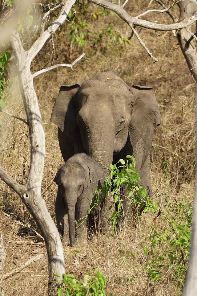
  • Mudumalai National Park — The national park and tiger reserve that Masinagudi sits at the edge of, running along the northern slopes of the Nilgiris where they fall away to the Mysore plateau, at the meeting point of Tamil Nadu, Kerala and Karnataka. The National Tiger Conservation Authority gives it a core or critical tiger habitat of 321.00 sq km and a buffer of 367.59 sq km, 688.59 sq km in all, and it joins Bandipur in Karnataka and Wayanad in Kerala to make one of the largest stretches of protected elephant country in Asia. It was made a sanctuary in 1940, a national park in 1990 and a tiger reserve in April 2007.
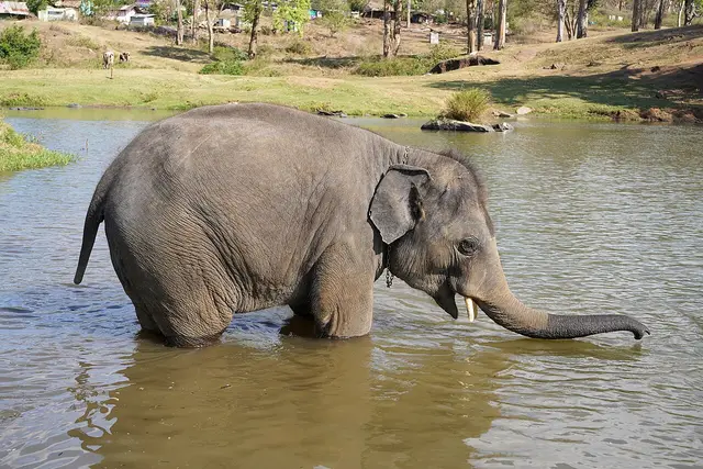
  • Theppakadu Elephant Camp — The elephant camp on the bank of the Moyar inside Mudumalai, 6.7 km from the Masinagudi bus stand, which the Forest Department calls the oldest elephant camp in Asia. It keeps 28 elephants including two calves, and they are working animals rather than an exhibit: they are the kumkis the department sends to drive wild elephants away from villages and to help in captures. Visitors may watch the feeding at 8.30 to 9.00 in the morning and 5.30 to 6.00 in the evening. It became famous far beyond the Nilgiris when The Elephant Whisperers, filmed here with the mahout couple Bomman and Bellie and the orphaned calves Raghu and Ammu, won the Academy Award for best documentary short in March 2023.
  • Maravakandy Dam — The small dam and reservoir on the Maravakandy stream 2.2 km east of the Masinagudi bus stand, and the one place here you can reach on foot from the village in under half an hour. It is a working irrigation and power dam rather than a landscaped one, and the reason to walk out is what comes to drink: the reservoir sits in open scrub on the elephant plateau and is a reliable evening watering point for elephant, gaur and spotted deer. Because the water is the draw, the same rules apply as anywhere in this country — stay in or beside the vehicle, keep your distance, and be off the road before dark.
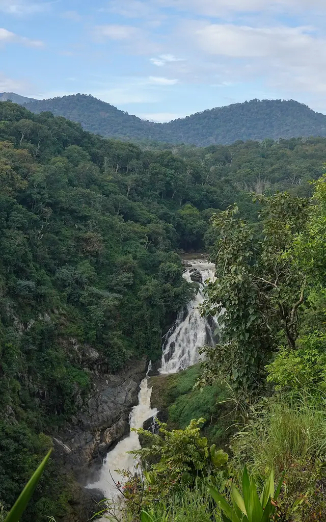
  • Moyar Falls — The fall on the Moyar below Theppakadu, about 5 km from Masinagudi as the crow flies. The position is good but not official: the mapped point and a geotagged photograph of the fall taken in September 2022 agree to about three hundred metres, which for a waterfall is as close as a camera position and a cascade are likely to get, and there is no Wikidata record or government listing to check either against. It lies inside the tiger reserve, so it is not a place to go looking for on your own in any case — the Moyar is seen from the safari and from the road bridge at Theppakadu.
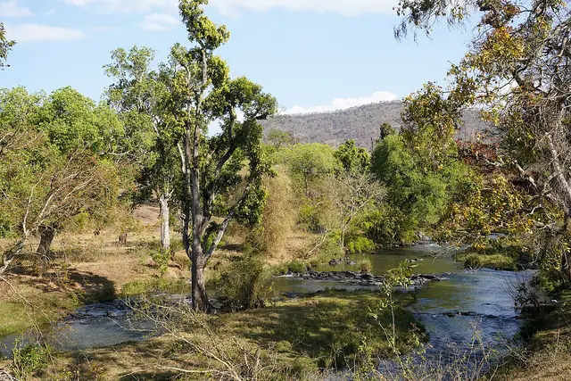
  • Moyar Gorge — The gorge the Moyar has cut along the northern edge of the plateau, running roughly 85 km east from the reserve towards Sathyamangalam and forming the corridor elephants use between the Western and Eastern Ghats. It matters for something most visitors never hear about: the cliffs and the riverside Terminalia arjuna trees hold the largest nesting colony of Gyps vultures left in peninsular India, and the Forest Department is building its first Vulture Safe Zone around this valley. There is a viewpoint marked on the map north of Masinagudi, but it is inside the reserve and there is no public way to it: one routing engine refuses it outright and the other only reaches it by forest track. In practice you see the gorge from the safari or from the rim on the Sigur side.
  • Kalhatti Ghat Road — The road that climbs from Masinagudi to the plateau, and the reason getting to Ooty from here is a harder question than the map suggests. It is MDR 700, mapped as the Thalaikundha–Kallatty–Theppakadu road, and it gains about 1,300 metres in sixteen and a half kilometres, which makes it one of the steepest motorable climbs in southern India. Every guide says it has thirty-six hairpin bends; counted off the mapped geometry of the road, bends sharp enough to fold a vehicle back on itself come to about two dozen, and that count holds however the measurement is set up. It is also restricted: OpenStreetMap records it as open only to vehicles on Nilgiris registration because of the accident rate, checkposts stand on it, and every navigation app built on that data — ours included — refuses to route a car up it and sends you 74.8 km round by Gudalur instead of 29.7 km over the hill. Ask at the checkpost on the day rather than trusting a phone.
Getting there

How to visit

  • Nearest airport: Mysore Mandakalli (MYQ), 89.0 km by routed road and about an hour and ten minutes — and it is in Karnataka. This is the one Nilgiri town whose nearest airport is not Coimbatore: CJB is 171.9 km from here, roughly twice as far, because it lies beyond the whole plateau. Kozhikode is 116.2 km and Bengaluru 269.1 km. Mandakalli is a small airport with a thin schedule, so in practice many visitors still fly into Coimbatore or Bengaluru and drive; if you do, come in from the north through Gundlupet rather than up over the hill.
  • Rail gateway: There is none nearer than another state. Mysuru is the practical railhead at about 99 km, roughly an hour and a quarter, and it is the station to aim for if you are coming by train. Mettupalayam, where the Nilgiri Mountain Railway starts, is 132.3 km away on the far side of the plateau, and Coimbatore Junction is 170.9 km. The mountain railway does not come down this side of the hills at all; the toy train belongs to Ooty and Coonoor, not to Masinagudi.
  • The bus stand in the middle of the village is the point every distance on this page is measured from, with buses west to Gudalur and north over the state line towards Gundlupet and Mysuru. By routed road from it: Maravakandy Dam 2.2 km, Theppakadu elephant camp and the Mudumalai reception centre 6.7 km, the Bandipur reception centre 19.2 km, Gudalur 23.7 km, Sultan Bathery 65.7 km, Ooty 74.8 km, Mysore airport 89.0 km, Coonoor 91.2 km, Mysuru 96.1 km, Kotagiri 101.1 km, Mettupalayam 132.3 km, Kozhikode 133.5 km, Coimbatore Junction 170.9 km, Bengaluru 236.9 km, Chennai 562.2 km. ⚠ The Ooty figure needs explaining. The direct road, the Kalhatti or Sigur ghat, is 29.7 km measured along the mapped road — but it is restricted to vehicles registered in the Nilgiris because of its accident record, and every navigation app built on OpenStreetMap, ours included, refuses to route it and sends you 74.8 km round through Gudalur instead. Ask at the checkpost on the day. ⚠ The highway north through Mudumalai and Bandipur is closed to all traffic between 9 at night and 6 in the morning.

Distance by road

  • Gudalur23.7 km
  • Sultan Bathery65.7 km
  • Ooty74.8 km
  • Mysore Mandakalli Airport89 km
  • Coonoor91.2 km
  • Mysuru96.1 km
  • Kotagiri101.1 km
  • Mettupalayam132.3 km
  • Kozhikode133.5 km
  • Coimbatore Junction170.9 km
  • Bengaluru236.9 km
  • Chennai Central562.2 km

Road distances measured on real routed roads to Masinagudi itself, not to the district headquarters, on 22 August 2026. Driving time is deliberately not published: free-flow routing badly understates these roads, so allow more than the distance suggests.

Timing

Best time to visit Masinagudi

The dry months, and for a reason that has nothing to do with comfort. Masinagudi is in the rain shadow on the northern side of the massif — the western Sigur plateau averages around five hundred millimetres of rain a year against several times that on the plateau above — so the water in this landscape is concentrated, and animals concentrate around it. February to May is when the scrub is driest, the waterholes fewest and the sightings best, though it is also hot down here in a way Ooty never is. October to early December, after the north-east monsoon, is greener and gentler. The reserve can close its tourism zone at short notice for fire risk in the dry months or after heavy rain, so check before you travel rather than after.

Weather in MasinagudiSeasonal guide

Live forecast loads in your browser.

Today at Masinagudi
Sunrise6:14 am
Sunset6:35 pm
Golden hour best light5:35 pm–6:35 pm
Blue hour after sunset6:35 pm–7:00 pm
Sun sets toward compass bearingW · 279°
Moon tonight🌖 Waning gibbous · 85%
South-west monsoon. June to September is the south-west monsoon in Tamil Nadu. Expect heavy showers, mostly in bursts rather than all day — carry rain cover, allow extra time for getting around, and note that ferries and open-air sites are the first things affected.

Sun and moon are calculated for this location and shown in IST. Photography windows are the hour around sunrise and sunset; the sunset bearing is degrees clockwise from true north. Moon phase is accurate to about half a day.

The story

The story of Masinagudi

The village at the bottom of the hill, on the elephant plateau — where the Nilgiris stop being a hill station and become a forest, and where the road to Ooty climbs two dozen hairpin bends that your hired car is probably not allowed to use.

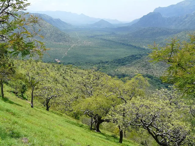
Masinagudi is the odd one out among the Nilgiri towns, and everything interesting about it follows from one number: it stands at about 950 metres. Ooty is at 2,240, Kotagiri near 1,950, Coonoor near 1,850. Those three sit on top of the plateau and look across it at each other. Masinagudi sits underneath them on the Sigur plateau, a dry shelf of scrub and teak on the northern side where the mountain falls away towards the Mysore plains, and it looks up. That is why it is warm here when Ooty is cold, why the vegetation is thorn and teak rather than shola and tea, and why the animal you are most likely to meet on the road at dusk is an elephant rather than a bison.

It is a village, not a town, and the paperwork agrees: the district administration lists Masinagudi as a revenue village in Udhagamandalam taluk, in the Udhagai revenue division, and it is run by a village panchayat rather than a municipality or a town panchayat. The 2011 census counted 8,783 people in 2,393 households, and recorded that a quarter of them are Scheduled Castes and a fifth Scheduled Tribes — a far higher proportion than the hill stations above, and the first clue that this is a working forest settlement rather than a resort town that grew up around a view.

The land belongs, in every sense that matters except the legal one, to the Irula and to the Thaen Kurumba, the honey Kurumba. The Sigur plateau is their country; the settlements scattered through the scrub between here and the Moyar are theirs, and the forest watchers who man the reserve’s thirty-six anti-poaching camps are largely drawn from them. If you have read our Kotagiri page you have already met the organisation that works with these communities across the whole of these hills — the Keystone Foundation, whose headquarters is on the other side of the plateau, an hour and a half away by road but part of the same landscape.

What brings almost everyone here is on the far side of a river. Six point seven kilometres from the Masinagudi bus stand, at Theppakadu, the Moyar runs under a bridge and the Forest Department keeps what it calls the oldest elephant camp in Asia. Twenty-eight elephants live there, including two calves, and they are not an exhibit: they are kumkis, the trained animals the department sends out to drive wild elephants away from villages and to help when a problem animal has to be caught. You can watch them being fed, at half past eight in the morning and half past five in the evening, and those two half-hour windows are the fixed points around which most visits to Masinagudi are arranged.

In March 2023 that camp became famous everywhere. The Elephant Whisperers, made by Kartiki Gonsalves over five years and released by Netflix in December 2022, follows Bomman and Bellie, a mahout couple at Theppakadu, and the orphaned calves Raghu and Ammu. It won the Academy Award for best documentary short — the first Indian film to win in that category — and the number of people who now arrive at Masinagudi asking where the elephants from the film live has changed the village. It is worth knowing before you come that the camp is a working government facility and not a film set, and that the elephants are fed on a schedule that has nothing to do with visitors.

The reserve those elephants belong to is large. The National Tiger Conservation Authority gives Mudumalai a core of 321 square kilometres and a buffer of 367.59, 688.59 in all, and it does not stop at the state line: it runs into Bandipur in Karnataka and Wayanad in Kerala, and it links south to Mukurthi and Silent Valley and east, down the Moyar valley, to Sathyamangalam. Masinagudi is inside the buffer. That is not a technicality. It means the village lives inside a working elephant corridor, and the corridor has been the subject of one of the longest-running land cases in the country.

The short version is this. The Sigur plateau carries the routes elephants use to move between the Western and the Eastern Ghats, and from the 1990s onwards resorts were built across them. The Supreme Court upheld the state’s notification of the corridor in October 2020, ordering resorts in it to be cleared; a committee appointed by the court ordered thirty-five of them demolished in August 2023; the Supreme Court upheld the position again in December 2024; and on 20 July 2026 it disposed of the owners’ remaining appeals, holding that no commercial activity whatsoever may be run at the sites. Some well-known Masinagudi properties have been sealed. If you are booking somewhere here, book somewhere that is certainly still open, and treat any listing you find on a travel site as possibly out of date.

The other thing that makes this village strange is the road. Masinagudi is thirty kilometres below Ooty by the direct route, and that route — the Kalhatti or Sigur ghat, MDR 700 — is one of the steepest motorable climbs in southern India. It is also restricted. OpenStreetMap tags the ghat as private, with a note that only vehicles on Nilgiris registration are permitted because of the accident rate, and every navigation app built on that data, ours included, refuses to send a car up it. So the honest answer to how far Ooty is depends entirely on what you are driving: about thirty kilometres if you are local, and about seventy-five if you are not, round by Gudalur. Ask at the checkpost rather than trusting a phone.

And so the practical geography of Masinagudi points north rather than south. Its nearest airport is not Coimbatore, which serves the other three Nilgiri towns from a hundred and seventy kilometres away, but Mysore Mandakalli, eighty-nine kilometres off and in another state. Its nearest main-line railway station is Mysuru, not Mettupalayam. Gudalur, the town it is administratively tied to for most purposes, is twenty-four kilometres west. Bandipur’s reception centre is nineteen kilometres north. This is a Karnataka-facing village with a Tamil Nadu address, and knowing that is most of what you need to plan a trip here.

Legend & myth

Every guide, forum and hotel page says the Kalhatti ghat has thirty-six hairpin bends, and nobody says where the number comes from. We counted them off the mapped geometry of the road itself: turns of ninety degrees or more come to about two dozen, and the count stays between twenty and twenty-five however the measurement is set up, with every one of them on the sixteen and a half kilometres of ghat.

That is a count of bends sharp enough to turn a vehicle back on itself, and it may well not be what the local count means — bends here may be numbered on the ground in a way we cannot check from a map. What we can say is that the mapped road does not contain thirty-six of them, and that the number is repeated everywhere without a source.

More about Masinagudi

History

Mudumalai was made a wildlife sanctuary in 1940 — about sixty-two square kilometres to begin with, one of the earliest in southern India — and was extended in stages over the next four decades. It was folded into the Nilgiri Biosphere Reserve in 1986, declared a national park in 1990, and notified as a tiger reserve under Project Tiger in April 2007, with the critical tiger habitat notified that December.

The elephant camp at Theppakadu is older than the sanctuary. The Forest Department’s own account says simply that it was established a hundred years ago and is the oldest in Asia; published dates vary between 1917 and the 1920s, with a formal reorganisation in the 1970s, and we have not found a document that settles it. What is not in doubt is the continuity: the mahout families at Theppakadu have worked with these animals across generations, which is the subject the documentary is really about.

The corridor case has run since the 2000s. The Tamil Nadu government notified the Sigur elephant corridor; resort owners challenged it; the Madras High Court upheld the notification and the Supreme Court upheld the High Court in October 2020, directing that resorts standing in the corridor be cleared and ordering twenty-seven of thirty-nine sealed. The Segur Plateau Elephant Corridor Inquiry Committee, appointed by the court, ordered thirty-five resorts demolished in August 2023. On 20 July 2026 the Supreme Court disposed of the last appeals and recorded that no commercial activity whatsoever is to run at those sites, while giving the state liberty to acquire land not owned or held by tribal communities and asking that people who had lost their livelihoods be considered sympathetically.

Why visit

Because it is the only place in the Nilgiris where you sleep at the level the animals live at. The hill stations look down on the biosphere reserve from the top of the plateau; Masinagudi is inside it, in the buffer zone, on the corridor.

The elephant camp at Theppakadu, the reserve’s own safaris, the Moyar gorge with the last large vulture colony in peninsular India, and a dam you can walk to before dinner are all within seven kilometres of a village of under nine thousand people.

Before you go

Masinagudi — at a glance

HoursThe village keeps no hours; the things people come for do, and they are narrow. The elephant camp at Theppakadu is open to visitors for two half-hour windows a day, 8.30 to 9.00 in the morning and 5.30 to 6.00 in the evening. Safaris leave six times a day, at 6.30, 8.00 and 9.30 in the morning and 2.00, 3.30 and 5.00 in the afternoon, each about seventy minutes. Anyone staying in the Forest Department’s own rooms must report at the Theppakadu reception before half past six in the evening or lose the booking. And the highway north is shut from 9 at night. Between them those four facts decide the shape of a day here more than anything else does.

Entry: Nothing to enter the village, and Masinagudi is unusual among Nilgiri bases in that its main attraction has a published, fixed price rather than a turnstile. A jungle safari is 4,200 rupees for the vehicle — not per head — whether that is a gypsy carrying six or a Bolero camper carrying up to thirty, booked through the reserve’s own site or at the Theppakadu counter. Entry to the reserve by vehicle is charged separately at 50 rupees for a light vehicle, 100 for a heavy one and 20 for a motorcycle, with a still camera at 53 rupees and a video camera at 300; foreign visitors pay 500, 1,000 and 200 for those vehicles and 500 and 3,000 for the cameras. The elephant camp at Theppakadu is ticketed per head at the reception counter. Every one of those figures is the Forest Department’s own, from the system it takes bookings through.

Getting here

How to reach Masinagudi

  • ✈︎ By air Mysore Mandakalli (MYQ), 89.0 km by routed road and about an hour and ten minutes — and it is in Karnataka. Masinagudi is the one Nilgiri base whose nearest airport is not Coimbatore: CJB is 171.9 km away, roughly twice as far, because it lies beyond the whole plateau and the ghats. Kozhikode is 116.2 km and Bengaluru 269.1 km. Mandakalli is small and its schedule is thin, so many visitors still fly into Coimbatore or Bengaluru and drive; if you do, come in from the north through Gundlupet rather than trying to descend the hill, and remember the highway through Bandipur and Mudumalai is shut between 9 at night and 6 in the morning.
  • 🚆︎ By train There is no railway here and the nearest useful station is in another state: Mysuru, about 99 km and an hour and a quarter. Mettupalayam, where the Nilgiri Mountain Railway begins its climb, is 132.3 km away on the far side of the plateau, and Coimbatore Junction is 170.9 km. The mountain railway serves Coonoor and Udhagamandalam on top of the hill and never comes down this side of it, so if you want to ride the toy train you are combining two trips, not one.
  • 🚗︎ By road This is the part worth reading twice, because the obvious road may not be open to you. Masinagudi sits on MDR 700, and the direct route to Ooty is the Kalhatti or Sigur ghat, which climbs from the village to the plateau in one of the steepest ascents in southern India. Measured along the mapped road it is 29.7 km from the Masinagudi bus stand to the Ooty bus station that way. But the ghat is mapped as restricted to vehicles registered in the Nilgiris because of its accident record, restrictions on it have been tightened more than once, and there are checkposts on it; every navigation app built on OpenStreetMap, ours included, refuses to route a car up it. The road you will actually be sent on runs west to Gudalur, 23.7 km, and then round and up: 74.8 km to Ooty, about an hour. From the north, Mysuru is 96.1 km and Bengaluru 236.9 km through Gundlupet and Bandipur, and the Bandipur reception centre is 19.2 km. ⚠ That northern highway is closed to all traffic from 9 at night until 6 in the morning, a ban imposed in 2009 and upheld by the Supreme Court in 2019.
Getting around

Getting around Masinagudi

You will need a vehicle, and for once that is not a lazy sentence. The village itself is small enough to cross on foot in ten minutes — the road, the taxi stand, the temple, the mosque, the health centre and the shops are all on or just off MDR 700 — but everything else is kilometres away through forest where walking is genuinely unwise. The one exception is Maravakandy Dam, 2.2 km by road and about twenty-five minutes on foot, which people do walk in daylight. Theppakadu is 6.7 km. The Nilgiri Motor Drivers Union has a taxi stand on the main road, and local drivers matter here for a specific reason: theirs are the vehicles with Nilgiris plates, which on the ghat road is the difference between thirty kilometres and seventy-five.

  • 🚕︎ Online taxis Do not build a plan on an app. We have no evidence of reliable app-cab supply in Masinagudi from any primary source, and the village is small, remote and inside a tiger reserve buffer where drivers will not want to be after dark. Arrange a car through where you are staying or at the Nilgiri Motor Drivers Union stand on the main road, agree the fare before setting off, and settle the return leg at the same time — being stranded at Theppakadu after the evening feed, with the light going and the highway closing at nine, is a genuinely bad position.
Do

Things to do in Masinagudi

  • Take the Forest Department’s safari from Theppakadu, 6.7 km from the bus stand. It is 4,200 rupees for the vehicle, about seventy minutes through the tourism zone, six departures a day. Book it with the department rather than from the roadside: the reserve warns in its own published guidance to "be aware of fraudulent private jeep safari, they won’t take you into the reserve".
  • Watch the feeding at the Theppakadu elephant camp, 8.30 to 9.00 in the morning or 5.30 to 6.00 in the evening. Twenty-eight elephants including two calves live there, on the bank of the Moyar, and they are working kumkis rather than an exhibit. This is where The Elephant Whisperers was filmed, and Raghu and Ammu are real animals in a working government camp.
  • Walk out to Maravakandy Dam, two kilometres east, in the afternoon. It is the only walk from the village on this page, it takes about twenty-five minutes each way, and the reservoir is a dependable evening drinking point for elephant, gaur and spotted deer. Go in daylight and turn back well before dusk.
  • Drive up the Kalhatti ghat, if — and only if — your vehicle is allowed on it. It is the steepest road in these hills and about two dozen of its bends are sharp enough to fold the car back on itself. Ask at the checkpost rather than trusting a navigation app, all of which refuse the road anyway.
  • Stay a night in the Forest Department’s own accommodation. There are log houses and rest houses in Masinagudi itself and more at Theppakadu, Maravakandy, Kargudi and Morgan, bookable online through the reserve, and they are both cheaper and closer to the point than most of what is advertised locally.
  • Look for the vultures if you go east. The Moyar valley holds the largest nesting colony of Gyps vultures left in peninsular India, on riverside arjuna trees, and the Forest Department is building its first Vulture Safe Zone around it — but there is no public road to the gorge rim, so this is something you see from the safari or the Sigur side rather than a destination.
Plan

Good to know

  • Settle the road question before you book anything. If your car is not registered in the Nilgiris, plan on reaching Ooty the long way, 74.8 km through Gudalur rather than 29.7 km up the ghat, and add an hour and a half each way to any day trip you were imagining.
  • Book the safari and the camp through the reserve’s own website. What is sold from the roadside as a jungle safari is frequently a drive on public roads and estate tracks outside the reserve — the department says so itself.
  • Be where you are sleeping before dark. The highway north closes at nine, the Forest Department wants its own guests reporting before half past six, and this is a village inside an elephant corridor where walking at night is not a small risk.
  • The two feeding windows are half an hour each and they fill. If the evening one matters to you, arrive the day before rather than the same afternoon.
  • Check that where you are staying is actually open. Court-ordered clearance of resorts standing in the elephant corridor has closed well-known properties here, and listings on booking sites have not always caught up.
  • Bring what you need. There is a health centre but no hospital, one ATM, and no pharmacy worth relying on for anything specific — Gudalur is twenty-four kilometres away.
Facilities

On site

  • Masinagudi bus stand, in the middle of the village on MDR 700 — the anchor for every distance on this page, with buses to Gudalur and north towards Gundlupet and Mysuru.
  • The Nilgiri Motor Drivers Union taxi stand, a hundred metres from the bus stand on the main road.
  • A government primary health centre in the village. The nearest hospital of any size is at Gudalur, 23.7 km, so this matters more than it would elsewhere.
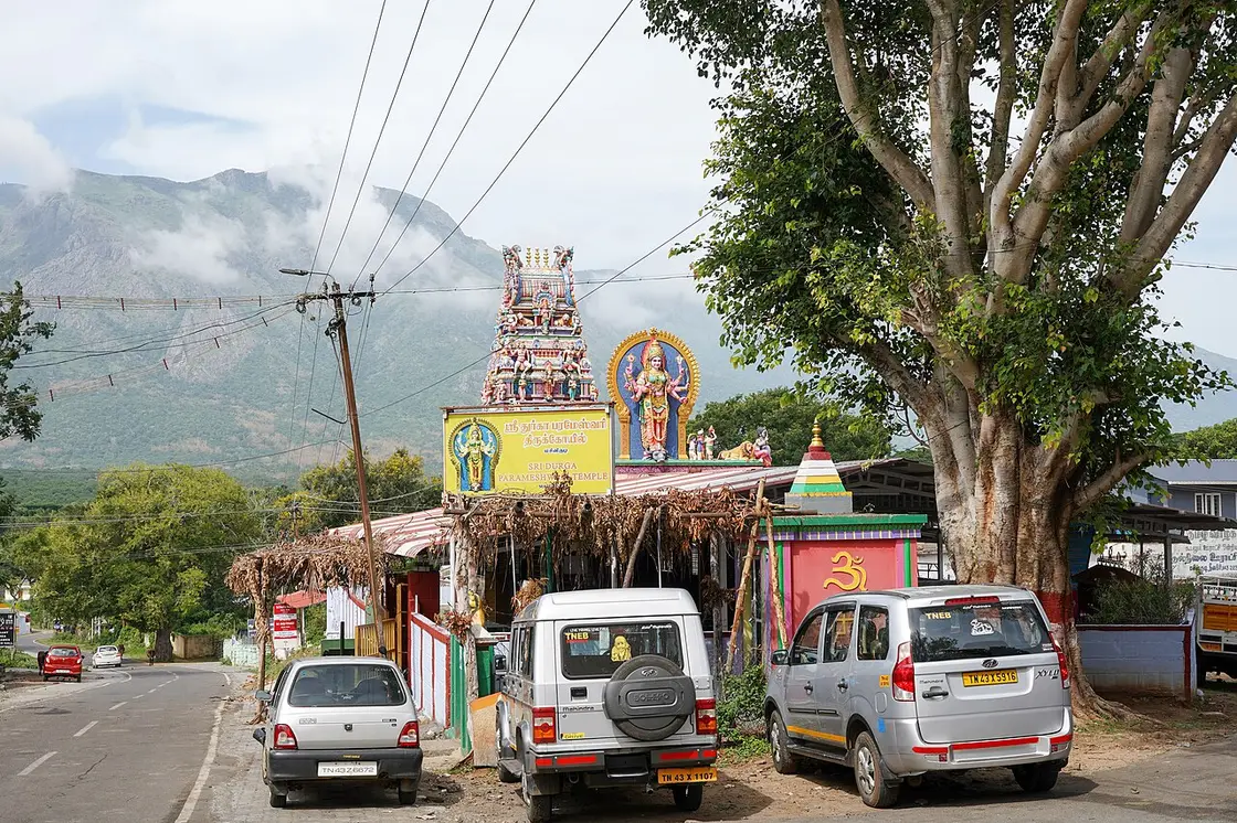
  • Shops and a supermarket on the main road, a State Bank ATM beside them, the Sri Durga Parameshwari temple and a mosque — the whole village fabric is on or just off one road.
  • The Mudumalai reception centre at Theppakadu, 6.7 km, where safari and camp tickets are issued, rest-house bookings are cleared and there is a canteen serving the department’s rooms.
  • No railway station, no airport, no petrol beyond what the village itself carries — fill up in Gudalur or on the Mysore road rather than assuming.
Stay safe

Safety

  • This is elephant country, and not in a figurative sense. The village sits in the buffer zone of a tiger reserve on a notified elephant corridor, and elephants move through the plateau around it. Do not walk between settlements after dark, do not walk on the roads at dusk, and treat any large animal you meet from a vehicle as a reason to stop and wait rather than to pass.
  • The Forest Department tells its own guests plainly not to leave their rooms after seven at night, because its rest houses stand in the core zone. That instruction is a good guide to the whole area, not just to its buildings.
  • The Kalhatti ghat is the most dangerous road anywhere near here and its restriction on outside vehicles exists because of the accident record. If you are permitted on it and you do drive it, go down in low gear, use the horn on the blind bends, and do not attempt it in a heavily loaded or long-wheelbase vehicle.
  • The night traffic ban on the highway through Mudumalai and Bandipur, 9 at night to 6 in the morning, is enforced at check gates. Arriving late does not mean driving carefully; it means not arriving.
  • In the dry months, from roughly February, fire risk is real and the reserve can close its tourism zone without notice. A closed zone means no safari, and no refund of the day you built around one.
Getting around Masinagudi

We have not assessed physical access at this place yet. Across India, step-free routes, handrails and accessible toilets are the exception rather than the rule, and pavements are often interrupted — if step-free access matters to you, contact the site or a local operator before committing to the trip.

If you need help at Masinagudi
112All emergencies (police · fire · medical)The single number to call in any emergency (ERSS).

Emergency numbers are verified against official government and state tourism sources. 112 works anywhere in India.

Practical things near Masinagudi
What the cash actually costs
  • Withdrawing from a bank that is not your own is free for a set number of times a month, then costs up to ₹23 plus GST — about ₹27 a withdrawal. This is not one of the RBI’s six metro centres, so the allowance here is the higher one: at least five free other-bank withdrawals a month, and at least five at your own bank.
  • That free allowance belongs to Indian bank accounts. On a card issued abroad your own bank’s international withdrawal and exchange charges apply instead. If the machine offers to bill you in your home currency, choose rupees — the conversion rate on that offer is set by the machine, not by your bank.
  • Given a choice, use an ATM inside or attached to a branch: it sits in view of staff and cameras, and there is someone to ask if the machine keeps your card. A machine standing alone on a tourist street is the one to be wary of. Banks are listed here alongside the ATMs, but the map data does not record which ATMs sit inside a branch — check when you get there.

Charge cap and free-transaction limits: Reserve Bank of India, in force since 1 May 2025.

Mapped within about 1.2 km of Masinagudi, with real walking routes rather than straight-line distances. Community-mapped data: opening hours are shown only where they are recorded, and this is not a complete list — something unmapped may well be closer. Please confirm on the ground.

Nearby bases

Where to go from Masinagudi

Ooty Lake, OotyFeatured: Ooty Lake
Town / base

Ooty

The Nilgiris capital and queen of hill stations, base for the botanical gardens, Ooty Lake, Doddabetta and the toy train.

Ooty LakeGovernment Botanical Garden, OotyDoddabetta PeakGovernment Rose Garden, Ooty
Open Ooty guide →
Coonoor, CoonoorTea-country town
Town / base

Coonoor

Quieter second hill station below Ooty, ringed by tea estates and viewpoints like Dolphin's Nose and Lamb's Rock.

Nilgiri Mountain RailwayCoonoor railway stationSim's ParkPasteur Institute of India, Coonoor
Open Coonoor guide →
Kotagiri, KotagiriEastern hill town
Town / base

Kotagiri

The oldest of the three Nilgiri hill stations and the middle one for height, on the eastern rim of the plateau — the first place in these hills the British came up to, in 1819, and the gateway to Kodanad, Catherine Falls and a Ramsar-listed shola on the town's own edge.

Kodanad View PointCatherine FallsRangaswamy Pillar and PeakLongwood Shola
Open Kotagiri guide →
Pykara Lake, GudalurFeatured: Pykara Lake
Town / base

Gudalur

North-western forest town on the Mysore road, the western gateway into the Nilgiri Biosphere Reserve and the base for Needle Rock and Frog Hill.

Pykara LakeMukurthi National ParkNeedle Rock View PointFrog Hill View Point
Open Gudalur guide →
Stone House, Ooty, KettiFeatured: Stone House, Ooty
Town / base

Ketti

The village in the Ketti valley on the road between Ooty and Coonoor, looked down on from the Ketti Valley view point and passed by the mountain railway.

Wax World Museum, OotyStone House, OotyDeer Park, OotyElk Hill Murugan Temple, Ooty
Open Ketti guide →
Highfield Tea Estate and Factory, WellingtonFeatured: Highfield Tea Estate and Factory
Town / base

Wellington

The cantonment above Coonoor, home of the Madras Regimental Centre and the Defence Services Staff College, with its own station on the Nilgiri Mountain Railway.

Highfield Tea Estate and FactoryHidden Valley, Coonoor
Open Wellington guide →
Upper Bhavani Reservoir, KundahFeatured: Upper Bhavani Reservoir
Town / base

Kundah

The high, empty western end of the plateau, a country of hydro-electric reservoirs — Upper Bhavani, Parsons Valley, Porthimund — and the Sispara pass over into Kerala, most of it needing Forest Department permission to enter.

Sispara PassBangitappalUpper Bhavani ReservoirParsons Valley Reservoir
Open Kundah guide →
Stay · eat · do · rent · see · shop

Places in Masinagudi

Every verified place in Masinagudi — filter by what you’re after.

F
Forest Department Rest Houses, Masinagudi
Place to stay
Top pick
Government accommodation
Forest Department Rest Houses, Masinagudi

The Tamil Nadu Forest Department's own rooms inside Masinagudi, five log houses and three rest houses booked through the tiger reserve's website. They are the least-known beds in the village and the only ones whose legal position is beyond question.

Commission-freeView details
M
Mudumalai Jungle Safari, Theppakadu
Things to do
Top pick
Wildlife safari
Mudumalai Jungle Safari, Theppakadu

The Forest Department's own safari into the tourism zone of the tiger reserve, from the reception centre at Theppakadu. It costs a flat 4,200 rupees for a vehicle and runs six times a day.

Commission-freeView details
T
Theppakadu Elephant Camp visit
Things to do
Top pick
Elephant camp
Theppakadu Elephant Camp visit

The Forest Department's elephant camp on the bank of the Moyar, open to visitors for half an hour twice a day at feeding time. Twenty-eight elephants live here, including the two calves from The Elephant Whisperers.

Commission-freeView details
B
Bamboo Banks Farm & Guest House
Place to stay
Top pick
Farm guest house
Bamboo Banks Farm & Guest House

A family-run farm guest house on Achakarai Road, one of the older places to stay in the village rather than out in the corridor country. The family takes bookings direct by telephone between nine in the morning and nine at night.

Commission-freeView details
T
The Tiger Paw Resort
Place to stay
Top pick
Resort
The Tiger Paw Resort

A fourteen-room resort at Achakarai on the edge of the village, about a kilometre from the bus stand. Rooms have balconies looking at the wall of the Nilgiris, and the property publishes its own reservation number and address.

Commission-freeView details

Book with the place itself. India’s cyber-crime coordination centre warned in April 2025 that convincing copies of hotel and pilgrimage booking sites are being pushed through sponsored search and social ads, taking payment for rooms the property never hears about. Every listing here links to the business’s own contact details and its own Google or Bing profile — we take no commission and sit in nobody’s payment path. If a booking page reached you through an ad, check the address bar against the property’s own site before you pay. Fraud can be reported on cybercrime.gov.in or on 1930.

Ranked

The best of Masinagudi, ranked

Nearest to the centre of Masinagudi, on foot

Ordered by a real routed walk from the town centre — a different question, and the one that decides what you can do before lunch. Straight-line distance understates a real walk by about half again, so these are walking-network figures, not lines on a map.

Everything around Masinagudi, by distance

Every place we hold for Masinagudi, ordered by a real routed drive from the town centre. Times are free-flow and a real road rarely is, so read them as the floor rather than the estimate — anything that routed over ninety minutes is left out rather than published as a number we do not trust.

Places to visit

The places themselves, around Masinagudi

The best tourist places to visit in Masinagudi — temples, viewpoints, lakes, heritage and nature, each with a full guide, how to reach it and what to see nearby.

Theppakadu Elephant Camp, Masinagudi
PlaceTheppakadu Elephant Camp

The elephant camp on the bank of the Moyar inside Mudumalai, 6.7 km from the Masinagudi bus stand, which the Forest Department calls the oldest elephant camp in Asia. It keeps 28 elephants including two calves, and they are working animals rather than an exhibit: they are the kumkis the department sends to drive wild elephants away from villages and to help in captures. Visitors may watch the feeding at 8.30 to 9.00 in the morning and 5.30 to 6.00 in the evening. It became famous far beyond the Nilgiris when The Elephant Whisperers, filmed here with the mahout couple Bomman and Bellie and the orphaned calves Raghu and Ammu, won the Academy Award for best documentary short in March 2023.

Open guide →
Mudumalai National Park, Masinagudi
PlaceMudumalai National Park

The national park and tiger reserve that Masinagudi sits at the edge of, running along the northern slopes of the Nilgiris where they fall away to the Mysore plateau, at the meeting point of Tamil Nadu, Kerala and Karnataka. The National Tiger Conservation Authority gives it a core or critical tiger habitat of 321.00 sq km and a buffer of 367.59 sq km, 688.59 sq km in all, and it joins Bandipur in Karnataka and Wayanad in Kerala to make one of the largest stretches of protected elephant country in Asia. It was made a sanctuary in 1940, a national park in 1990 and a tiger reserve in April 2007.

Open guide →
Maravakandy Dam, Masinagudi
PlaceMaravakandy Dam

The small dam and reservoir on the Maravakandy stream 2.2 km east of the Masinagudi bus stand, and the one place here you can reach on foot from the village in under half an hour. It is a working irrigation and power dam rather than a landscaped one, and the reason to walk out is what comes to drink: the reservoir sits in open scrub on the elephant plateau and is a reliable evening watering point for elephant, gaur and spotted deer. Because the water is the draw, the same rules apply as anywhere in this country — stay in or beside the vehicle, keep your distance, and be off the road before dark.

Open guide →
Moyar Falls, Masinagudi
PlaceMoyar Falls

The fall on the Moyar below Theppakadu, about 5 km from Masinagudi as the crow flies. The position is good but not official: the mapped point and a geotagged photograph of the fall taken in September 2022 agree to about three hundred metres, which for a waterfall is as close as a camera position and a cascade are likely to get, and there is no Wikidata record or government listing to check either against. It lies inside the tiger reserve, so it is not a place to go looking for on your own in any case — the Moyar is seen from the safari and from the road bridge at Theppakadu.

Open guide →
Moyar Gorge, Masinagudi
PlaceMoyar Gorge

The gorge the Moyar has cut along the northern edge of the plateau, running roughly 85 km east from the reserve towards Sathyamangalam and forming the corridor elephants use between the Western and Eastern Ghats. It matters for something most visitors never hear about: the cliffs and the riverside Terminalia arjuna trees hold the largest nesting colony of Gyps vultures left in peninsular India, and the Forest Department is building its first Vulture Safe Zone around this valley. There is a viewpoint marked on the map north of Masinagudi, but it is inside the reserve and there is no public way to it: one routing engine refuses it outright and the other only reaches it by forest track. In practice you see the gorge from the safari or from the rim on the Sigur side.

Open guide →
Kalhatti Ghat Road, Masinagudi
PlaceKalhatti Ghat Road

The road that climbs from Masinagudi to the plateau, and the reason getting to Ooty from here is a harder question than the map suggests. It is MDR 700, mapped as the Thalaikundha–Kallatty–Theppakadu road, and it gains about 1,300 metres in sixteen and a half kilometres, which makes it one of the steepest motorable climbs in southern India. Every guide says it has thirty-six hairpin bends; counted off the mapped geometry of the road, bends sharp enough to fold a vehicle back on itself come to about two dozen, and that count holds however the measurement is set up. It is also restricted: OpenStreetMap records it as open only to vehicles on Nilgiris registration because of the accident rate, checkposts stand on it, and every navigation app built on that data — ours included — refuses to route a car up it and sends you 74.8 km round by Gudalur instead of 29.7 km over the hill. Ask at the checkpost on the day rather than trusting a phone.

Open guide →
For hotels, homestays and local businesses

Get listed in Masinagudi for free

Roampedia is commission-free. Travellers discover your business, book directly and contact you through official details. Basic listings are free, while Gold and Platinum package upgrades can be requested from the owner dashboard after approval.

List your business — free
Ranked guide modules

Top Masinagudi experiences

6 picks

The places that sit in and around Masinagudi itself, each with its own guide page.

Mudumalai National Park, Masinagudi#1
Masinagudi · wildlife

Mudumalai National Park

The reserve Masinagudi stands inside the buffer of: 321 square kilometres of core and 367.59 of buffer by the National Tiger Conservation Authority’s own figures, joined to Bandipur in Karnataka and Wayanad in Kerala. The Forest Department runs the safaris itself, a flat 4,200 rupees a vehicle, six departures a day from Theppakadu. Book with the department — it warns in its own words about private jeeps that never enter the reserve at all.

MasinagudiwildlifeThe Nilgiris
Theppakadu Elephant Camp, Masinagudi#2
Masinagudi · heritage

Theppakadu Elephant Camp

Six point seven kilometres from the bus stand and about seven minutes, on the bank of the Moyar — the camp the Forest Department calls the oldest in Asia, with 28 elephants including two calves. Come for the feeding, 8.30 to 9.00 in the morning or 5.30 to 6.00 in the evening; those two half-hour windows are the fixed points of a day here. These are working kumkis, the animals sent out to move wild elephants away from villages, and the camp is where The Elephant Whisperers was filmed.

MasinagudiheritageThe Nilgiris
Maravakandy Dam, Masinagudi#3
Masinagudi · dam

Maravakandy Dam

The one thing here you can reach on foot: 2.2 km by road, or about two kilometres and twenty-five minutes walking. A working irrigation dam rather than a landscaped one, and the reason to go is what comes to drink at the reservoir in the evening — elephant, gaur, spotted deer. Go in daylight, stay near the road, and be back before dusk.

MasinagudidamThe Nilgiris
Moyar Falls, Masinagudi#4
Masinagudi · waterfall

Moyar Falls

The fall on the Moyar below Theppakadu, about five kilometres out as the crow flies and inside the reserve, so it is seen from the safari rather than visited. Two independent records agree on where it is to within about three hundred metres, which is as much as anyone can say for it — there is no official listing.

MasinagudiwaterfallThe Nilgiris
Moyar Gorge, Masinagudi#5
Masinagudi · viewpoint

Moyar Gorge

The gorge the river has cut along the northern edge of the plateau, running some 85 km east towards Sathyamangalam and carrying the elephants’ route between the Western and Eastern Ghats. It also holds the largest nesting colony of Gyps vultures left in peninsular India, on the riverside arjuna trees, and the Forest Department is building its first Vulture Safe Zone around it. There is no public way to the rim: it is inside the reserve.

MasinagudiviewpointThe Nilgiris
Kalhatti Ghat Road, Masinagudi#6
Masinagudi · heritage

Kalhatti Ghat Road

The climb from the village to the plateau: about 1,300 metres of height in sixteen and a half kilometres, and the reason Ooty is either half an hour away or an hour and a half depending on your number plate. The ghat is mapped as open only to Nilgiris-registered vehicles and every navigation app refuses to route it, sending cars 74.8 km round through Gudalur instead of 29.7 km over the hill. Everyone prints thirty-six hairpin bends; the mapped road carries about two dozen.

MasinagudiheritageThe Nilgiris
Read before you go

Masinagudi guides, stories & itineraries

Stories & history of Masinagudi

Written about Masinagudi itself — its history, its legends and the arguments about them.

Nearby in The Nilgiris

Wider reading from The Nilgiris. The stories about Masinagudi itself are above.

Tamil Nadu-wide guides & itineraries

Route-level itineraries and practical guides for the rest of the state.

See all 11 The Nilgiris guides & stories →

Map

Where things are in Masinagudi

FAQ

Masinagudi travel FAQs

How do I book a safari, and what does it cost?

Through the reserve’s own site, mudumalaitigerreserve.com, or at the reception counter at Theppakadu. The Forest Department charges a flat 4,200 rupees for a vehicle — either a gypsy, which takes six, or a Bolero camper, which takes up to thirty — and runs six departures a day: 6.30, 8.00 and 9.30 in the morning and 2.00, 3.30 and 5.00 in the afternoon, each about seventy minutes. The department also warns visitors in its own words to "be aware of fraudulent private jeep safari, they won’t take you into the reserve", so book with the department and not with someone offering a jungle trip from the roadside.

When can I see the elephants at Theppakadu?

The feeding is open to visitors from 8.30 to 9.00 in the morning and from 5.30 to 6.00 in the evening. Tickets are booked at the Theppakadu reception centre or online in advance; the camp is 6.7 km from the Masinagudi bus stand, about seven minutes by road.

Can I drive up the short road to Ooty?

Probably not, if your vehicle is not registered in the Nilgiris. The Kalhatti ghat is mapped as restricted to locally registered vehicles because of its accident record, restrictions on it have been tightened more than once, and there are checkposts on the way. Every navigation app that uses OpenStreetMap will send you the long way round through Gudalur instead — about 75 km against the direct road’s 30. Ask at the checkpost on the day rather than relying on a phone.

Is there a night restriction on the roads?

Yes. Traffic on the highway through Bandipur and Mudumalai between Ooty and Gundlupet is closed from 9 at night until 6 in the morning, a ban imposed in 2009, upheld by the Karnataka High Court in 2010 and by the Supreme Court in 2019. Plan to be where you are sleeping well before dark, which is sensible here anyway.

Where is the nearest airport and railway station?

Both are in Karnataka. Mysore Mandakalli airport is 89 km away, about an hour and ten minutes; Mysuru railway station is about 99 km. Coimbatore airport, which serves Ooty, Coonoor and Kotagiri, is 172 km from here, and Mettupalayam, where the mountain railway starts, is 132 km.

Will I see a tiger?

Probably not, and the reserve says so itself: "Tiger reserve is not zoo, so don’t expect to see wildlife everywhere… Wildlife sight-seeing is a matter of chance." What you are very likely to see is elephant, gaur, spotted deer, langur and a great deal of bird life, and the dry months from February to May concentrate animals around the few remaining waterholes. Two mornings give you a far better chance than one.

How does Masinagudi differ from Ooty, Coonoor and Kotagiri?

By about a thousand metres of altitude, and everything follows from that. The three hill stations sit on top of the plateau between 1,850 and 2,240 metres, in tea and shola, and are cool the year round. Masinagudi is at about 950 metres below them on the Sigur plateau, in dry teak and thorn, and it is warm. It is also in the rain shadow: the western Sigur plateau averages around 500 mm of rain a year against several times that on the plateau above. You come up here for animals, not for a climate.

Is it safe to walk around?

In the village itself, in daylight, yes — it is small and everything is on one road. Outside it, no. This is the buffer zone of a tiger reserve on a notified elephant corridor, and elephants move through the country around the village. The Forest Department instructs guests in its own rest houses not to step outside after seven at night. The one walk people do make is out to Maravakandy Dam, two kilometres, in daylight, turning back before dusk.

What is the elephant corridor case, and does it affect me?

It affects where you can stay. The Sigur plateau carries the routes elephants use between the Western and Eastern Ghats, and resorts were built across them. The Supreme Court upheld the corridor notification in October 2020 and again in December 2024, a committee it appointed ordered thirty-five resorts demolished in August 2023, and on 20 July 2026 the court disposed of the owners’ last appeals and held that no commercial activity whatsoever may run at those sites. Some well-known properties here have been sealed. Confirm directly with anywhere you book that it is open.

When is the best time to come?

February to May for wildlife, when the scrub is at its driest and animals gather at the few waterholes — accepting that it is hot down here in a way the hill stations never are. October to early December, after the north-east monsoon, is greener and more comfortable. Be aware that the reserve can close its tourism zone at short notice, for fire risk in the dry months or after heavy rain, and a closed zone means no safari.

Is there an ATM, a chemist, a hospital?

There is a State Bank ATM and a fuel pump on the main road, a government primary health centre in the village, and shops for ordinary supplies. There is no hospital: the nearest is at Gudalur, 23.7 km west. Bring any medicine you actually depend on rather than expecting to buy it here.

Can I stay inside the reserve itself?

Yes, and it is the least-known thing about this place. The Forest Department takes online bookings for its own rest houses and log houses, some of them in Masinagudi itself and others at Theppakadu, Maravakandy, Kargudi and Morgan. The rules are strict: report at the Theppakadu reception before 6.30 in the evening or the room is cancelled, no alcohol, no cooking, and do not step outside after 7 at night, because the rest houses stand in the core zone.

What are the best places to visit in Masinagudi?

Top places to visit in Masinagudi include Theppakadu Elephant Camp, Mudumalai National Park, Maravakandy Dam, Moyar Falls, Moyar Gorge, Kalhatti Ghat Road — each has a full guide with how to reach it and what to see nearby on this page.

Photographs: Timothy A, CC BY-SA 4.0, via Wikimedia Commons (CC BY-SA 4.0). Wikimedia Commons.

Image credits