Places to Visit in Kundah

The high, empty western end of the plateau, a country of hydro-electric reservoirs — Upper Bhavani, Parsons Valley, Porthimund — and the Sispara pass over into Kerala, most of it needing Forest Department permission to enter.

Kundah
Practical guide

Plan Kundah

Who's going?Tailor Kundah to your trip
DistrictThe Nilgiris
RoleReservoir country
Time neededTwo nights for a useful visit without…
Places to visit6Listed businesses25
What to expect

Highlights

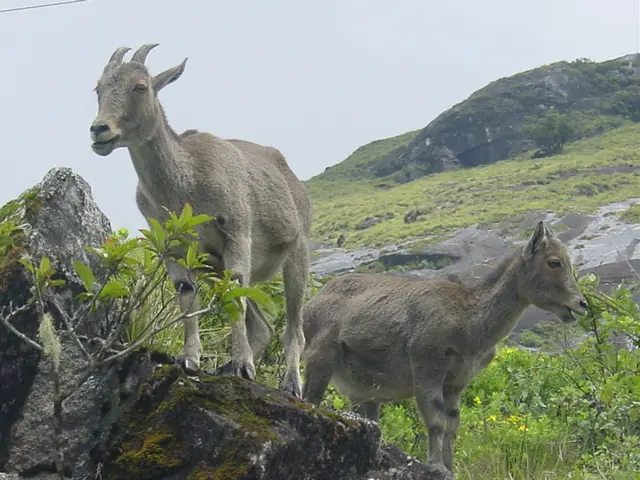
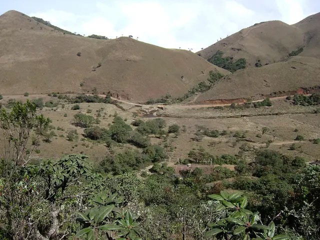
  • Mukurthi National Park — A high-altitude park in the western Nilgiris protecting shola-grassland ecosystems and the endangered Nilgiri tahr, part of the Nilgiri Biosphere Reserve. There is no public road into it; entry is on permit from the Kundah side, and Sispara Pass and Bangitappal lie within its western reach.
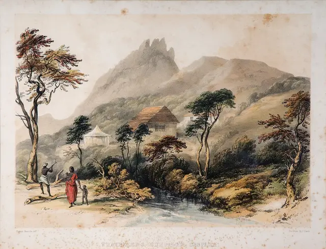
  • Sispara Pass — A historic pass through the western escarpment towards Malabar, now deep inside protected high country. It is not an independent day hike or an ordinary attraction: enter only on the route, date and guide authorised by the Wildlife Warden, and expect that no programme may be available.
  • Bangitappal — A remote grassland basin behind Sispara where streams meet and a trekking shed stands. The shed and track do not make it public: Bangitappal belongs only inside a specifically permitted, guided Mukurthi itinerary.
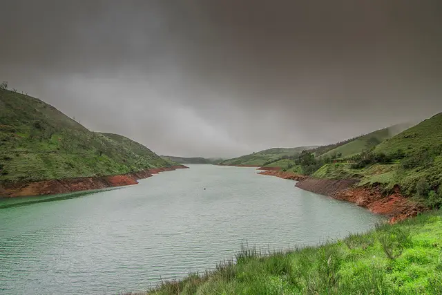
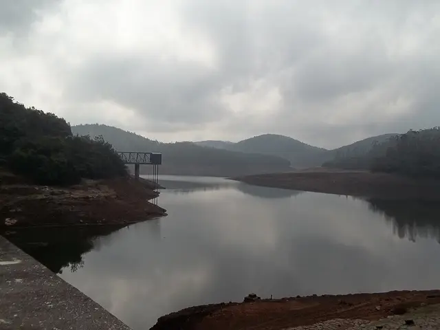
  • Upper Bhavani Reservoir — A high working reservoir in protected shola-grassland at the headwaters of the Bhavani. The approach crosses controlled forest and inspection roads; confirm permission before leaving, stop at every barrier, and do not treat the shore as a picnic or boating area.
  • Parsons Valley Reservoir — A protected drinking-water catchment in dense shola west of Ooty. There are no ordinary visitor hours or shore facilities, and a route drawn over a water-board or forest road is not permission to follow it.
  • Porthimund Dam — A working reservoir in the Kundah hydro-electric system, surrounded by controlled forest and departmental roads. See it only from a safe public-road point when the approach is open; do not pass a power or forest barrier or approach the water.
Timing

Best time to visit Kundah

September to January is the clearest general window for the public-road landscape: the south-west monsoon has filled the reservoirs and freshened the grass, while cloud often breaks between systems. June to August can bring heavy rain, mist, slips and swollen streams. February to May is drier and fire-prone; the Forest Department’s published charter lists Mukurthi as closed in those months. The department’s current written decision always takes precedence over any seasonal sentence on a travel page.

Weather in KundahSeasonal guide

Live forecast loads in your browser.

Today at Kundah
Sunrise6:13 am
Sunset6:06 pm
Golden hour best light5:06 pm–6:06 pm
Blue hour after sunset6:06 pm–6:31 pm
Sun sets toward compass bearingW · 261°
Moon tonight🌒 Waxing crescent · 26%

Sun and moon are calculated for this location and shown in IST. Photography windows are the hour around sunrise and sunset; the sunset bearing is degrees clockwise from true north. Moon phase is accurate to about half a day.

The story

The story of Kundah

Kundah is the part of the Nilgiris where a map is more useful than a street plan. The name belongs to a taluk, a range, a river, a chain of hydro-electric works and a small mapped town beside Manjoor. West of that town the public road runs out among reservoirs and protected shola-grassland. This is not a conventional hill station: it is a working electricity landscape beside a national park, and permission is part of the geography.

Begin with the scale. Kundah taluk contains ten revenue villages — Bikkatty, two Ithalar divisions, Mulligoor, two Balacola divisions, two Kil-Kundah divisions, Kinnakorai and Mel-Kundah — scattered across the south-western Nilgiri plateau. There is no single promenade, market square or compact sightseeing circuit. The named Kundah town node on the map, beside Manjoor, is the useful planning centre because three public roads meet there and Kundah I power house stands just beyond it. The administrative boundary itself stretches far west into country without public roads.

Water explains almost everything visible from those roads. Rain falling on the high western plateau is held in a sequence of reservoirs, carried through tunnels and pressure shafts, dropped through power houses and used again lower down. Tamil Nadu’s statistical handbook lists six Kundah power houses. Their installed capacities are 60, 175, 180, 100, 40 and 30 megawatts — 585 MW together — commissioned in stages from 1960 to 2000. A reservoir here is therefore not a leisure lake. It is drinking water, stored energy, regulated flow and industrial infrastructure at once.

The scheme changed the meaning of remoteness. Upper Bhavani, Avalanche, Emerald, Parsons Valley and Porthimund are sometimes written up as a necklace of scenic lakes. On the ground they are catchments, dam walls, inspection roads, intake structures and guarded forest. Roads were made to build and maintain the system, not to promise public access. A line on a navigation app may end at a locked barrier, a departmental gate or a road on which private vehicles have no authority to continue.

The other half of Kundah is protected because it is one of the last large pieces of the Nilgiris’ natural high country. Mukurthi National Park covers 7,846 hectares. Its characteristic pattern is montane grassland folded around pockets of evergreen shola forest: exposed slopes collect rain and feed streams; the compact sholas shelter water, soil and endemic life. The park is a stronghold of the endangered Nilgiri tahr and forms part of the Western Ghats World Heritage property and the Nilgiri Biosphere Reserve.

The apparent emptiness is misleading. These downs are part of the Toda homeland and sacred landscape. Toda pastoral life is organised around buffalo, dairy temples, waters and hills with ritual identities. Researcher Tarun Chhabra records dozens of deity hills and notes that more than a dozen lie in or around Mukurthi National Park. Some waters may be touched only by a priest and some sacred peaks should not even be pointed at. A visitor entering with the idea that unbuilt land is unused land has already misunderstood it.

Sispara Pass is where this high world breaks open. It lies on the western escarpment above Kerala, at the end of a route once used between the plateau and the Malabar side. Bangitappal is the grassland basin behind it, where streams meet and an old trekking shed stands. Neither is an informal walk from a roadside pin. They are deep inside protected country, reached only through whatever guided and permitted programme the Wildlife Warden authorises at the time.

Manjoor is the practical settlement. It has the bus connections, post office, government hospital, shops and the accommodation addresses that the Ministry of Tourism register places in this taluk. Kundah Bridge post office serves PIN 643219. Ithalar has 643004, while Balacola’s 643203 must be read with the village name because the same PIN also serves Athigaratti in another block. This mundane postal geography matters: it separates an actual Kundah bed from an Ooty or Coonoor property borrowing a hill-country label.

What can an independent visitor honestly do? Drive the public Kundah roads in daylight, stop only where stopping is safe and permitted, see working reservoirs and grassland from public viewpoints, spend time in Manjoor, and ask the Forest Department before planning anything beyond a barrier. If permission is not granted, that is not a failed holiday. It is the protected landscape doing what a protected landscape is supposed to do.

Legend & myth

Toda tradition does not treat the western Nilgiris as anonymous scenery. Hills are the abodes or very forms of deities, streams have ritual lives, and the country around Mukurthi is among the densest parts of that sacred map. Tarun Chhabra’s account records that more than a dozen of the thirty-four recognised deity hills stand in or around the national park.

One tradition follows the sacred river now usually called Pykara or Mukurthi. Its source belongs to a divine landscape: the water begins among deity hills, follows a ritually significant course and is approached with rules that are not recreational etiquette but religious obligation. In Toda practice some sacred waters may be handled only by an ordained dairy priest. The river that engineers later divided between reservoirs and turbines was already a living sacred presence.

Sispara carries the same kind of meaning. The peak above the pass is associated in Toda belief with ancestral spirits, while the far south-western Nilgiris are connected with Amunawdr, the afterworld. This is oral and religious tradition, not a claim that can be tested like a dam’s capacity. It does explain why a traveller should not describe these hills as vacant, conquer a summit for a photograph, or point at a peak that local practice holds sacred.

More about Kundah

History

Long before the power scheme, the western plateau was crossed and named through Toda pastoral use. Sacred dairies, buffalo paths, streams and deity hills formed a cultural map that did not need roads or masonry to be exact. The surviving oral geography is important evidence that Mukurthi was never empty wilderness waiting to be discovered.

The colonial hill station at Ootacamund changed the plateau’s demands. Forest was planted with exotic timber, grassland was altered, and water was impounded for towns, estates and power. The older Pykara hydro-electric station began generation in 1932. Kundah was the much larger post-independence development: the state statistical handbook dates power houses I and II to 1960–64, III to 1965–78, IV to 1966–78, V to 1964–88 and VI to 2000.

Those dates show that “the Kundah scheme” was not one dam-opening ceremony. It was several decades of tunnels, dams, penstocks, power houses and transmission works assembled across a whole range. The first five stations alone total 555 MW; the sixth takes the complex to 585 MW. Water is passed through successive drops, so the geography reads as a system rather than six isolated buildings.

Protection developed alongside engineering. The Nilgiri Biosphere Reserve was designated in 1986, the first biosphere reserve in India. Mukurthi National Park was established in 2001 and the Tamil Nadu Forest Department records its area as 7,846 hectares. In 2012 it became one component of the serial Western Ghats World Heritage property. The protected boundary now covers much of the land through which older trekking routes and engineering tracks run.

That history produces the central tension of visiting Kundah today. Infrastructure makes the interior appear reachable: there are dams, sheds and roads on maps. Conservation law and operational safety make much of it unavailable without authority. The correct question is not “Can a car get there?” but “Is the public allowed to use that road today, and under whose supervision?”

Why visit

To understand how Tamil Nadu turns monsoon water stored above two thousand metres into electricity through a six-station, 585 MW hydro-electric complex.

To see the shola-grassland mosaic on the scale at which it still functions: slopes gathering cloud, small evergreen forests holding water, and streams feeding both wildlife and reservoirs.

For Mukurthi, a 7,846-hectare national park and Western Ghats World Heritage component created around one of the Nilgiri tahr’s principal surviving landscapes.

For the history of Sispara Pass and Bangitappal, which reveal how the plateau once connected on foot to Malabar — provided the Wildlife Warden actually authorises the route.

For the Toda sacred landscape, which makes clear that protection here concerns cultural meaning as well as wildlife and water.

Because Kundah is the corrective to attraction-list tourism: a beautiful place whose most important lesson is where the public road ends and why.

Before you go

Kundah — at a glance

Entry: There is no charge to enter Kundah town, Manjoor or the public roads. The six named places on this page are different: every one involves either Forest Department control, a national-park boundary, or working reservoir infrastructure. Mukurthi, Sispara and Bangitappal are not self-guided attractions. Upper Bhavani, Parsons Valley and Porthimund are not leisure lakes with unrestricted shore access. Permission, a departmental guide or a barrier decision may determine whether a visit can proceed; there is no honest universal ticket price to print.

Getting here

How to reach Kundah

  • ✈︎ By air Coimbatore (CJB) is the practical airport. Reach the Nilgiri plateau through Mettupalayam and Ooty or Coonoor, then continue to Manjoor and Kundah. Allow most of a day: the final kilometres are narrow hill roads, and darkness or heavy rain is a reason to stop rather than press on.
  • 🚆︎ By train There is no railway in Kundah taluk. The Nilgiri Mountain Railway reaches Udhagamandalam and Coonoor, after which the journey is by bus, taxi or authorised departmental vehicle. Mettupalayam is the broad-gauge railhead below the hills. Do not plan a same-day connection around a last bus into the reservoir country.
  • 🚗︎ By road Use Kundah town beside Manjoor as the road base, close to Kundah I power house. Public roads approach from Ooty through Ithalar and Avalanche country, and from Coonoor through Ketti, Balacola and Manjoor. West of the settlements, roads towards dams or trekking sheds may be restricted inspection or forest routes, so follow local signs and access controls.
  • 🚌︎ By bus Government and local buses serve Manjoor from Ooty and Coonoor and connect the surrounding villages, but the frequency thins sharply later in the day. Manjoor is the reliable place to get off for shops, the hospital and onward local information. No scheduled public bus should be assumed to continue to Mukurthi, Sispara, Bangitappal or a reservoir gate.
  • ⛴︎ By boat None. The reservoirs are drinking-water and hydro-electric infrastructure, not boating lakes. Do not launch a boat, swim, fish or walk on an exposed reservoir margin.
Getting around

Getting around Kundah

Use Manjoor and Kundah town as the road base, and separate a public-road day from any permitted forest programme. The centre is hilly but walkable in short pieces; there are no continuous pavements and bends hide vehicles. For the outer circuit use a local driver who knows which road is public and where turning space ends. Never ask a driver to pass a locked barrier or to improvise a forest shortcut. Mukurthi, Bangitappal and Sispara are excluded from ordinary drive rankings because publishing a time would falsely advertise access.

Do

Things to do in Kundah

  • Begin in Manjoor, buy what you need, check the weather and ask locally which public roads and viewpoints are open. This is the last place to assume fuel, food, a pharmacy or a dependable phone signal.
  • Read the hydro-electric landscape from the public road: reservoir above, tunnel and penstock hidden in the slope, power house below. Six Kundah stations total 585 MW; they are a linked machine, not six separate attractions.
  • Look for the boundary between grassland and shola. The grass catches rain and the compact dark forest protects headwater streams; both are parts of one high-elevation ecosystem.
  • If the Wildlife Warden has authorised a Mukurthi programme, follow the named guide and route exactly. A permit for one destination does not authorise a detour to another.
  • Learn the Sispara route as history even if it is closed. The pass connected the Nilgiri plateau to Malabar and Bangitappal was a staging place behind the escarpment; today protection, weather and the absence of a public road make it a controlled expedition.
  • Spend time on the Toda meaning of this country. Hills around Mukurthi are deity hills and waters can carry ritual restrictions. Treat “empty” grassland as inhabited cultural landscape.
  • Photograph only from safe public stopping places. Reservoir works and power houses can be sensitive operational sites; a beautiful frame is not permission to stop on a dam or aim a camera through a gate.
Plan

Good to know

  • Telephone accommodation and the relevant department before leaving Ooty or Coonoor. “Open” on a map or old blog is not current authority.
  • Carry photo identification, written permission and the contact name of the officer who issued it. Keep an offline map, but use it for orientation rather than to defeat a barrier.
  • Fill the vehicle and withdraw cash before the outer circuit. Card networks and mobile data fail in valleys, and a distant homestay may serve food only when asked in advance.
  • Start early and turn back early. Mist can remove visibility in minutes and an unfamiliar reservoir road after dark is a poor place to discover that the next gate is locked.
  • Wear warm waterproof layers and closed shoes even in summer. The west of the plateau is wetter, windier and less sheltered than Ooty town.
  • Do not copy an old trekking itinerary. Park programmes, fire closures, road conditions and guide availability change; the current Wildlife Warden’s instruction is the itinerary.
  • Keep place names paired with their pictures. A general Mukurthi grassland photograph does not prove access to Sispara, and a reservoir photograph should not be relabelled as another dam.
Facilities

On site

  • Manjoor Government Hospital near the Kundah road junction, plus local pharmacies and small clinics in the settlement
  • Kundah Bridge post office, PIN 643219, and shops, tea stalls and basic provisions in Manjoor
  • Local buses and taxis at Manjoor; no guaranteed tourist taxi rank or app-based cab supply in the outer taluk
  • Registered accommodation in Manjoor, Kil Kundah, Ithalar and Balacola, with direct telephone contacts on this page
  • No dependable toilets, food counters, fuel, drinking-water points or mobile coverage at the restricted reservoirs and park routes
  • Forest and electricity-department gates are control points, not visitor-service centres; staff there may refuse entry and are not obliged to create a tour
Stay safe

Safety

  • Never cross a Forest Department, TANGEDCO or water-board barrier, even if a navigation app sends you through it. A route result is not legal access.
  • Do not swim, boat, fish or walk on dam structures and exposed margins. Reservoir levels change, intake currents are invisible and steep grass can conceal a drop.
  • Elephant, gaur and other wildlife use these roads. Stay in the vehicle, give an animal the whole road, never crowd it for a photograph and reverse rather than forcing it to move.
  • Grassland fire is a serious dry-season risk. No smoking, cooking fire or discarded glass; obey a closure immediately.
  • Heavy rain brings fallen trees, slips, flooded culverts and zero visibility. If local buses or residents turn back, turn back too.
  • There is little step-free access beyond the settlements. Dam approaches are uneven and permitted treks are long, wet and remote; this is not suitable terrain for a mobility aid unless the department confirms a vehicle-based programme.
  • Call 112 for an emergency. In forest country give the last named gate, road and village as well as a phone pin; a coordinate alone may describe an unreachable point.
Getting around Kundah

If you need step-free access, contact the site before travelling. Ask about a level entrance, steps along the route, the nearest drop-off point, seating and accessible toilets.

If you need help at Kundah
112All emergencies (police · fire · medical)The single number to call in any emergency (ERSS).

Emergency numbers are verified against official government and state tourism sources. 112 works anywhere in India.

Nearby bases

Where to go from Kundah

Ooty Lake, OotyFeatured: Ooty Lake
Town / base

Ooty

The Nilgiris capital and queen of hill stations, base for the botanical gardens, Ooty Lake, Doddabetta and the toy train.

Ooty LakeGovernment Botanical Garden, OotyDoddabetta PeakGovernment Rose Garden, Ooty
Open Ooty guide →
Coonoor, CoonoorTea-country town
Town / base

Coonoor

Quieter second hill station below Ooty, ringed by tea estates and viewpoints like Dolphin's Nose and Lamb's Rock.

Nilgiri Mountain RailwayCoonoor railway stationSim's ParkPasteur Institute of India, Coonoor
Open Coonoor guide →
Kotagiri, KotagiriEastern hill town
Town / base

Kotagiri

The oldest of the three Nilgiri hill stations and the middle one for height, on the eastern rim of the plateau — the first place in these hills the British came up to, in 1819, and the gateway to Kodanad, Catherine Falls and a Ramsar-listed shola on the town's own edge.

Kodanad View PointCatherine FallsRangaswamy Pillar and PeakLongwood Shola
Open Kotagiri guide →
Masinagudi, MasinagudiWildlife village
Town / base

Masinagudi

The village on the Sigur plateau below the hill stations, at the edge of Mudumalai — the base for the tiger reserve, the Theppakadu elephant camp and the elephant country of the Moyar valley, and the foot of the Kalhatti ghat up to Ooty.

Theppakadu Elephant CampMudumalai National ParkMaravakandy DamMoyar Falls
Open Masinagudi guide →
Needle Rock View Point, GudalurFeatured: Needle Rock View Point
Town / base

Gudalur

The municipality at the western door of the Nilgiris, where the plateau breaks and the road drops into Kerala — a Tamil Nadu town that speaks mostly Malayalam, sitting between the Mudumalai forest, the old Wynaad gold country around Devala and the cinchona slopes of Naduvattam.

Needle Rock View PointFrog Hill View PointNadugani GhatNaduvattam
Open Gudalur guide →
Ketti, KettiValley village
Town / base

Ketti

A revenue village of Coonoor taluk strung along the Ooty–Coonoor road in the valley it is named after, with a station on the Nilgiri Mountain Railway, the needle works the place is known for, and a hillside of boarding schools and colleges above it. Upper Ketti is the separate village of Yellanahalli.

Ketti railway stationKetti Valley View PointNeedle Industries, KettiSt. George's Homes and Laidlaw Memorial School, Ketti
Open Ketti guide →
Wellington, WellingtonCantonment town
Town / base

Wellington

An army cantonment of about twenty thousand people three kilometres above Coonoor, governed by a board under the Ministry of Defence rather than by a municipality, and home to the Madras Regimental Centre and the Defence Services Staff College. It has no bus stand: its station on the Nilgiri Mountain Railway is the way in.

Wellington railway stationWellington CantonmentMadras Regiment War MemorialWellington Gymkhana Club
Open Wellington guide →
Stay · eat · do · rent · see · shop

Places in Kundah

Every verified place in Kundah — filter by what you’re after.

Top pick
Registered bed and breakfast
De Colonial Manor

Registered bed and breakfast at 7/238 Sreet One, Vpn Colony, Ithalar Road. The government register supplies a direct telephone number, while room details, rates and access arrangements must be confirmed with the property.

Directions Commission-freeView details
Top pick
Registered lodge and tourist home
Hotel Tejas Gateway

Registered lodge and tourist home at 384/3 Kundah Taluk Office Road,kotrakandy, Manjoor. The government register supplies a direct telephone number, while room details, rates and access arrangements must be confirmed with the property.

Directions Commission-freeView details
Top pick
Registered resort
H S B Hospitality Services

Registered resort at 6/202, Kathadimattam, Manjore Road, Balacola, The Nilgiris 643 203. The government register supplies a direct telephone number, while room details, rates and access arrangements must be confirmed with the property.

Directions Commission-freeView details
Top pick
Registered bed and breakfast
Reroot Crest

Registered bed and breakfast at No. 2/585 , Yellakandi , Ithalar Village, Kundah Taluk The Nilgiris. The government register supplies a direct telephone number, while room details, rates and access arrangements must be confirmed with the property.

Directions Commission-freeView details
Top pick
Registered bed and breakfast
Silverline Resort

Registered bed and breakfast at Silverline Resort, 2/259, Kathadimattam, Balacola Post,. The government register supplies a direct telephone number, while room details, rates and access arrangements must be confirmed with the property.

Directions Commission-freeView details
Registered bed and breakfast
Bhuvanesh Cottage

Registered bed and breakfast at 3/125b4 Kundha Post Near Post Office Manjoor The Nilgiris Pin : 643219. The government register supplies a direct telephone number, while room details, rates and access arrangements must be confirmed with the property.

Directions Commission-freeView details
Registered bed and breakfast
Little Heaven

Registered bed and breakfast at 2/512 Karikad Corner Ithalar. The government register supplies a direct telephone number, while room details, rates and access arrangements must be confirmed with the property.

Directions Commission-freeView details
Registered bed and breakfast
Aimans Breezy Paradise

Registered bed and breakfast at 2/269, Kathadumattam Street, Balacola Village Panchayat, The Nilgiris. The government register supplies a direct telephone number, while room details, rates and access arrangements must be confirmed with the property.

Directions Commission-freeView details
Registered bed and breakfast
Suejay's Aurora

Registered bed and breakfast at 2/571, Suejay's Aurora,yellagndi, Ithalar Post, Kundah Taluk, The Nilgiris. The government register supplies a direct telephone number, while room details, rates and access arrangements must be confirmed with the property.

Directions Commission-freeView details
Registered bed and breakfast
Vihani's Western Clouds

Registered bed and breakfast at 2/542, Ithalar, Ithalar Panchayat, The Nilgiris - 643004. The government register supplies a direct telephone number, while room details, rates and access arrangements must be confirmed with the property.

Directions Commission-freeView details
Registered bed and breakfast
Mark Holidays

Registered bed and breakfast at 7/408, Thulithalai, Ithalar. The government register supplies a direct telephone number, while room details, rates and access arrangements must be confirmed with the property.

Directions Commission-freeView details
Registered bed and breakfast
Misty Meadows

Registered bed and breakfast at 1/274/A, Balacola Street, Kundah Taluk, The Nilgiris - 643203. The government register supplies a direct telephone number, while room details, rates and access arrangements must be confirmed with the property.

Directions Commission-freeView details
Registered bed and breakfast
Bab's Cloud Resorts

Registered bed and breakfast at 1/444a, Koliyatti, Mel Kundha, The Nilgiris - 643219. The government register supplies a direct telephone number, while room details, rates and access arrangements must be confirmed with the property.

Directions Commission-freeView details
Registered bed and breakfast
Viewsvilla

Registered bed and breakfast at Viewsvilla, No.1/302-D19, Mullimalai Kandimattam,kilkundah Village, Kundah Taluk, The Nilgiris - 643219. The government register supplies a direct telephone number, while room details, rates and access arrangements must be confirmed with the property.

Directions Commission-freeView details
Registered bed and breakfast
7 Stars Retreat Center Cottage

Registered bed and breakfast at 2/499 Ithalar. The government register supplies a direct telephone number, while room details, rates and access arrangements must be confirmed with the property.

Directions Commission-freeView details
Registered bed and breakfast
House Of Joy

Registered bed and breakfast at 1/282, Mahalingam Nagar, Balacola Village, Kundah Taluk. The government register supplies a direct telephone number, while room details, rates and access arrangements must be confirmed with the property.

Directions Commission-freeView details
Registered bed and breakfast
Joshvee

Registered bed and breakfast at Joshvee,2/511. Winter Lake Ithalar, Avalanche Main Road, Ooty, The Nilgiris, Tamil Nadu 643004 India". The government register supplies a direct telephone number, while room details, rates and access arrangements must be confirmed with the property.

Directions Commission-freeView details
Registered homestay
Rishlila Villa

Registered homestay at 2/554 Karikad Corner, Ithalar, Nilgiris District, Tamilnadu 643004. The government register supplies a direct telephone number, while room details, rates and access arrangements must be confirmed with the property.

Directions Commission-freeView details
Registered bed and breakfast
Casa De Amor

Registered bed and breakfast at 2/555, Ithalar Village, The Nilgiris, Tamil Nadu - 643004. The government register supplies a direct telephone number, while room details, rates and access arrangements must be confirmed with the property.

Directions Commission-freeView details
Registered bed and breakfast
Royal Rose Home Stay

Registered bed and breakfast at 2/570 Ithalar. The government register supplies a direct telephone number, while room details, rates and access arrangements must be confirmed with the property.

Directions Commission-freeView details
Registered bed and breakfast
Camellia Crest

Registered bed and breakfast at 2/589, Ithalar Street, Ithalar Village Panchayat, The Nilgiris - 643004. The government register supplies a direct telephone number, while room details, rates and access arrangements must be confirmed with the property.

Directions Commission-freeView details
Registered bed and breakfast
Cindola Gate

Registered bed and breakfast at 2-259, Cindola Gate Ooty, Kathadimattam, Manjoor Road, Kundah Taluk,. The government register supplies a direct telephone number, while room details, rates and access arrangements must be confirmed with the property.

Directions Commission-freeView details
Registered homestay
Rishlila Villa Private Limited

Registered homestay at 2/472, Ithalar, Karikad Corner, The Nilgiris. The government register supplies a direct telephone number, while room details, rates and access arrangements must be confirmed with the property.

Directions Commission-freeView details
Registered bed and breakfast
Kings Bed And Breakfast

Registered bed and breakfast at Door No. 6-672, Old Sy. No. 3-1a2, New Sy No: 1239, Sub Dividion No: 12398, Kundah Ooty Road Part Of Ithalar Village, Kunda Taluk, Nilgiris District. Pin Code : 643004. The government register supplies a direct telephone number, while room details, rates and access arrangements must be confirmed with the property.

Directions Commission-freeView details

Book with the place itself. India’s cyber-crime coordination centre warned in April 2025 that convincing copies of hotel and pilgrimage booking sites are being pushed through sponsored search and social ads, taking payment for rooms the property never hears about. Every listing here links to the business’s own contact details and its own Google or Bing profile — we take no commission and sit in nobody’s payment path. If a booking page reached you through an ad, check the address bar against the property’s own site before you pay. Fraud can be reported on cybercrime.gov.in or on 1930.

Ranked

The best of Kundah, ranked

Everything around Kundah, by distance

Every place we hold for Kundah, ordered by a real routed drive from the town centre. Times are free-flow and a real road rarely is, so read them as the floor rather than the estimate — anything that routed over ninety minutes is left out rather than published as a number we do not trust.

Places to visit

The places themselves, around Kundah

The best tourist places to visit in Kundah — temples, viewpoints, lakes, heritage and nature, each with a full guide, how to reach it and what to see nearby.

Mukurthi National Park, Kundah
PlaceMukurthi National Park

A high-altitude park in the western Nilgiris protecting shola-grassland ecosystems and the endangered Nilgiri tahr, part of the Nilgiri Biosphere Reserve. There is no public road into it; entry is on permit from the Kundah side, and Sispara Pass and Bangitappal lie within its western reach.

Open guide →
Sispara Pass, Kundah
PlaceSispara Pass

A historic pass through the western escarpment towards Malabar, now deep inside protected high country. It is not an independent day hike or an ordinary attraction: enter only on the route, date and guide authorised by the Wildlife Warden, and expect that no programme may be available.

Open guide →
Bangitappal, Kundah
PlaceBangitappal

A remote grassland basin behind Sispara where streams meet and a trekking shed stands. The shed and track do not make it public: Bangitappal belongs only inside a specifically permitted, guided Mukurthi itinerary.

Open guide →
Upper Bhavani Reservoir, Kundah
PlaceUpper Bhavani Reservoir

A high working reservoir in protected shola-grassland at the headwaters of the Bhavani. The approach crosses controlled forest and inspection roads; confirm permission before leaving, stop at every barrier, and do not treat the shore as a picnic or boating area.

Open guide →
Parsons Valley Reservoir, Kundah
PlaceParsons Valley Reservoir

A protected drinking-water catchment in dense shola west of Ooty. There are no ordinary visitor hours or shore facilities, and a route drawn over a water-board or forest road is not permission to follow it.

Open guide →
Porthimund Dam, Kundah
PlacePorthimund Dam

A working reservoir in the Kundah hydro-electric system, surrounded by controlled forest and departmental roads. See it only from a safe public-road point when the approach is open; do not pass a power or forest barrier or approach the water.

Open guide →
For hotels, homestays and local businesses

Get listed in Kundah for free

Roampedia is commission-free. Travellers discover your business, book directly and contact you through official details. Basic listings are free, while Gold and Platinum package upgrades can be requested from the owner dashboard after approval.

List your business — free
Ranked guide modules

The best of Kundah, ranked

6 picks

The places that sit in and around Kundah itself, each with its own guide page.

Mukurthi National Park, Kundah#1
Kundah · wildlife

Mukurthi National Park

A 7,846-hectare national park protecting the western plateau’s shola-grassland and one of the Nilgiri tahr’s principal landscapes. There is no ordinary public road, gate ticket or self-guided trail: go only on a programme authorised by the Wildlife Warden, and accept that permission may not be available.

KundahwildlifeThe Nilgiris
Sispara Pass, Kundah#2
Kundah · heritage

Sispara Pass

The historic way down the western escarpment towards Malabar, now deep in protected country. It is a controlled multi-day expedition when the department runs one, not an independent day trek.

KundahheritageThe Nilgiris
Bangitappal, Kundah#3
Kundah · heritage

Bangitappal

The remote grassland basin and old trekking shed behind Sispara. Both the shed and its track exist, but neither makes it a public attraction. Entry belongs inside a specifically permitted, guided Mukurthi itinerary.

KundahheritageThe Nilgiris
Upper Bhavani Reservoir, Kundah#4
Kundah · heritage

Upper Bhavani Reservoir

High stored water in the working Kundah system, inside controlled forest and reservoir country. It is not a boating lake or an unrestricted drive. Confirm the approach before leaving Manjoor and stop at the first barrier.

KundahheritageThe Nilgiris
Parsons Valley Reservoir, Kundah#5
Kundah · heritage

Parsons Valley Reservoir

A drinking-water catchment within protected shola. The useful fact is the restriction: there are no normal visitor hours or shore facilities, and a navigation line over an inspection road is not public access.

KundahheritageThe Nilgiris
Porthimund Dam, Kundah#6
Kundah · heritage

Porthimund Dam

Part of the hydro-electric landscape rather than a picnic stop. See it only from a public, safe road position if the approach is open; never pass an electricity or forest gate for a photograph.

KundahheritageThe Nilgiris
Read before you go

Kundah guides, stories & itineraries

Stories & history of Kundah

Written about Kundah itself — its history, its legends and the arguments about them.

Nearby in The Nilgiris

Wider reading from The Nilgiris. The stories about Kundah itself are above.

Tamil Nadu-wide guides & itineraries

Route-level itineraries and practical guides for the rest of the state.

See all 49 The Nilgiris guides & stories →

Map

Where things are in Kundah

FAQ

Kundah travel FAQs

Is Kundah a town or a taluk?

The name is used for both a locality near Manjoor and the wider taluk. This guide covers the taluk landscape, whose ten revenue villages extend across the south-western Nilgiris; road distances use the public-road junction near Manjoor as the practical starting point.

Can I visit Mukurthi National Park independently?

Do not assume so. Entry is controlled by the Tamil Nadu Forest Department through the Wildlife Warden at Udhagamandalam. There is no ordinary public road, ticket gate or self-guided trail into the park. Obtain written, current instructions before travelling; a map route is not permission.

Can I drive to Upper Bhavani, Parsons Valley or Porthimund?

Only as far as the public road and the rules on the day allow. These are working reservoir and forest landscapes with barriers, inspection roads and restricted stretches. Private vehicles should not pass a gate or follow a navigation line onto a departmental road without explicit authority.

Is Sispara Pass an ordinary day trek?

No. It is a remote historic pass inside protected high country, associated with a multi-day route through Bangitappal. It requires Forest Department permission, an authorised guide and a route the department has opened. Do not build a plan around an old trek report.

Where should I stay?

Manjoor, Ithalar, Kil Kundah and Balacola are the practical accommodation areas in or near the taluk’s public-road settlements. The listings on this page come from the Government of India’s accommodation register and carry direct telephone contacts. Ring before travelling: registration is not a promise of current rooms, food or transport.

What is the Kundah hydro-electric scheme?

It is a linked system of reservoirs, tunnels, pressure shafts and six power houses. Tamil Nadu’s 2022–23 statistical handbook lists installed capacities of 60, 175, 180, 100, 40 and 30 MW, 585 MW in total, with commissioning dates extending from 1960 to 2000.

When is the best time to visit Kundah?

For public-road scenery, the clearest and most manageable period is generally September to January after the south-west monsoon, with cold mornings and rapidly changing cloud. The Forest Department’s older charter lists Mukurthi as unavailable from February to May; current permission always overrides a printed seasonal rule.

Are there restaurants, fuel and toilets at the reservoirs?

Do not count on any. Manjoor is the service centre. Beyond it, facilities become sparse and the restricted places have none for casual visitors. Fuel before leaving the main plateau towns, carry drinking water in permitted containers, and return with every item you take in.

Why are some attractive places described as unavailable?

Because a reservoir road or national-park track is not automatically a visitor attraction. Water security, power operations, wildlife protection, fire risk and Toda sacred values all impose real limits. The page describes those limits so that a reader does not mistake a pin for an invitation.

What are the best places to visit in Kundah?

Top places to visit in Kundah include Mukurthi National Park, Sispara Pass, Bangitappal, Upper Bhavani Reservoir, Parsons Valley Reservoir, Porthimund Dam — each has a full guide with how to reach it and what to see nearby on this page.

Photographs: Marcus334 (CC BY-SA 3.0), Shyamal (CC BY-SA 3.0), Shyamal L. (CC BY-SA 3.0), L. Shyamal (CC BY-SA 2.5), Timothy A. Gonsalves (CC BY-SA 4.0), Rakeshkdogra (CC BY-SA 4.0), A. J. T. Johnsingh (CC BY-SA 4.0), Azad (CC BY-SA 3.0), Ambigapathy (CC BY-SA 3.0). Wikimedia Commons.

Image credits