Places to Visit in Coonoor

Quieter second hill station below Ooty, ringed by tea estates and viewpoints like Dolphin's Nose and Lamb's Rock.

Coonoor
Practical guide

Plan Coonoor

Who's going?Tailor Coonoor to your trip
DistrictThe Nilgiris
RoleTea-country town
Time neededTwo nights
Places to visit16Listed businesses14
What to expect

Highlights

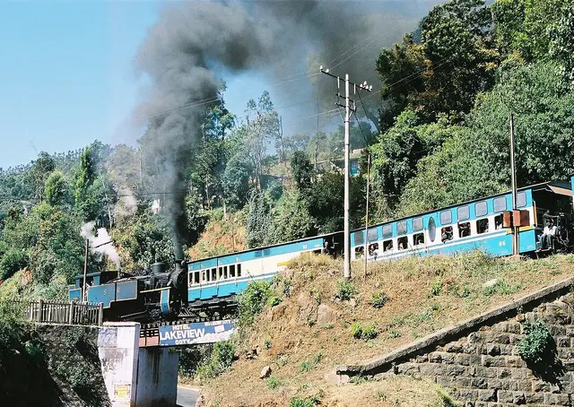
  • Nilgiri Mountain Railway — A UNESCO World Heritage metre-gauge rack railway connecting Mettupalayam to Ooty via Coonoor, opened in stages between 1899 and 1908.
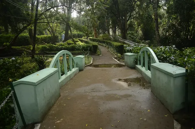
  • Sim's Park — A 12-hectare botanical park in Coonoor established in 1874, laid out in irregular Japanese style with a small lake and rare tree species.
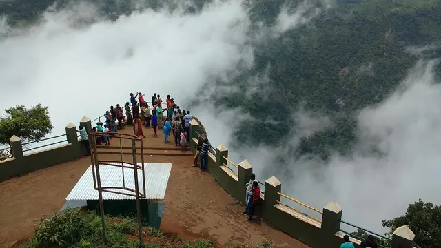
  • Dolphin's Nose, Coonoor — A rocky outcrop near Coonoor offering sweeping views of the Nilgiri escarpment, Catherine Falls, and the plains below.
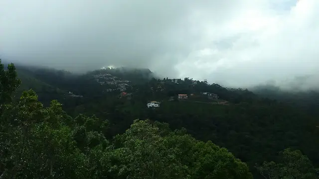
  • Lamb's Rock — A viewpoint near Coonoor overlooking tea and coffee plantations and the Coimbatore plains, named after a former collector of the region.
  • Droog Fort — Droog Fort sits at about 6,000 feet on a hilltop roughly 13 km from Coonoor and is reached by a trek through tea estates and shola. It is said to have been used as an outpost by Tipu Sultan in the 18th century, with surviving remnants including a wall and a clock tower. The summit gives sweeping views over the plains and hills.
  • Law's Falls — Law's Falls lies about 5 km from Coonoor on the Coonoor-Mettupalayam ghat road, where the Coonoor river drops through a wooded gorge. It is named after Colonel Law, who built the Coonoor ghat road in the 1830s. Surrounded by dense greenery, it is a relatively uncrowded picnic spot.
Getting there

How to visit

  • Nearest airport: Coimbatore International (CJB), 88.6 km by routed road and about an hour and three quarters — roughly fifteen kilometres closer than it is from Ooty, because Coonoor sits 350 metres lower and nearer the edge of the plateau. There is no closer airport and no airstrip in the Nilgiris, and the last forty kilometres are still the Kallar ghat, which cannot be driven at plains speeds.
  • Rail gateway: Two different journeys from one platform. Coonoor station is 370 metres from the bus stand and it is the hinge of the Nilgiri Mountain Railway: the Abt rack section up from Kallar ENDS HERE and the run on to Udhagamandalam is worked on plain track. Southern Railway gives the line as 45.88 km of metre gauge from Mettupalayam, 13 km/h maximum on the rack below the town and 30 km/h above it, UNESCO-listed on 15 July 2005. The Coonoor–Ooty shuttles run several times a day against the through train’s once, which makes this the easiest seat on the line. The main-line railhead is Coimbatore Junction, 86.0 km by road; Mettupalayam, where the mountain line starts, is 45.7 km.
  • The bus stand is the middle of the town and the point every distance on this page is measured from, with services up from Mettupalayam and Coimbatore and across the hills to Ooty and Kotagiri. By routed road from it: Coonoor railway station 0.4 km, Wellington 2.7 km, Sim’s Park and the Pasteur Institute 2.8 km each, Highfield tea estate 4.7 km, Kattery Park 5.2 km, Lamb’s Rock 7.4 km, Brooklane tea factory 9.5 km, Ralliah Dam 11.4 km, Katary Falls 11.5 km, Dolphin’s Nose 13.6 km, Droog Fort 13.7 km, Ooty 17.8 km, Catherine Falls 21.5 km, Kotagiri 21.7 km, Doddabetta 22.5 km, Mettupalayam 45.7 km, Gudalur 67.5 km, Coimbatore Junction 86.0 km, Coimbatore airport 88.6 km. ⚠ The estate road east to Lamb’s Rock and Dolphin’s Nose is single-track and takes far longer than the distance suggests; do both, and a tea factory, as one half-day.

Distance by road

  • Ooty17.8 km
  • Kotagiri21.7 km
  • Mettupalayam45.7 km
  • Gudalur67.5 km
  • Coimbatore Junction86 km
  • Coimbatore International Airport88.6 km

Road distances measured on real routed roads to Coonoor itself, not to the district headquarters, on 31 August 2026. Driving time is deliberately not published: free-flow routing badly understates these roads, so allow more than the distance suggests.

Timing

Best time to visit Coonoor

Coonoor’s season is the same as the district’s and its weather is not. March to June is what the hills are built around and it is when the rooms cost the most and the ghat road queues. September to November is the quieter answer and, for a first visit, the better one: the south-west monsoon has finished with these slopes, the tea is at its greenest and the air is clear enough to see the plains from the viewpoints, which is the entire point of Dolphin’s Nose and Lamb’s Rock. December to February is cold and clear — the 1991–2020 record for the town includes a low of −0.5°C — and it is the season for the walks rather than the water. The one thing to know is that Coonoor is wetter than Ooty despite being lower: Southern Railway’s own figures for the railway give 1,400 mm a year here against 1,250 mm at Udhagamandalam and 500 mm at Mettupalayam, and the town’s 1991–2020 climate record puts it higher still at 1,667.7 mm. Whatever the month, bring a jacket.

Weather in CoonoorSeasonal guide

Live forecast loads in your browser.

Today at Coonoor
Sunrise6:12 am
Sunset6:21 pm
Golden hour best light5:21 pm–6:21 pm
Blue hour after sunset6:21 pm–6:46 pm
Sun sets toward compass bearingW · 271°
Moon tonight🌔 Waxing gibbous · 63%
South-west monsoon. June to September is the south-west monsoon in Tamil Nadu. Expect heavy showers, mostly in bursts rather than all day — carry rain cover, allow extra time for getting around, and note that ferries and open-air sites are the first things affected.

Sun and moon are calculated for this location and shown in IST. Photography windows are the hour around sunrise and sunset; the sunset bearing is degrees clockwise from true north. Moon phase is accurate to about half a day.

The story

The story of Coonoor

The second hill station of the Nilgiris, three hundred and fifty metres below the first, where the rack railway from the plains stops climbing and the tea begins.

Coonoor is what Ooty would be if it had never become the capital. It sits at 1,850 metres on the same plateau, seventeen kilometres and half an hour down the road, and the three hundred and fifty metres between them decide almost everything: the evenings are warmer, the growing season is longer, and the slopes are under tea rather than open downs. It is a working municipal town of forty-five thousand people with a bazaar, a bus stand and a railway station, and the great majority of visitors see it through a car window on the way up.

The centre is small and it is on a hill. The bus stand and the railway station sit three hundred and seventy metres apart at the bottom of the town, and everything else runs uphill from there — Sim’s Park is 2.2 km on foot and about twenty-five minutes of climbing, the Pasteur Institute the same, and both of those are pleasant walks down and taxi rides up. Past Bedford the town gives out into estate country, and the road east to the viewpoints becomes a single track between tea slopes.

What the place is actually built on is the leaf. The first trials in these hills were made near Coonoor in 1832 and 1833 by an assistant surgeon named Christie; the Coonoor Tea Estate was established in 1854 and is reckoned the first plantation in the Nilgiris. The town has been the trade’s administrative centre ever since — the Coonoor Tea Trade Association was formed in 1963 so that smallholders would not have to send their leaf down to Cochin, the state set up INDCOSERVE in 1965 to run co-operative factories for them, and on 13 September 2003 Coonoor opened what was then the world’s first electronic tea auction. Around thirty thousand small growers and sixteen factories sit behind that market today.

And then there is the railway, which belongs to this town more than to the one at the top of the line. Coonoor is where the Abt rack ends. The train comes up the gorge from Kallar hauled by a toothed third rail at a maximum of thirteen kilometres an hour, and at this platform the rack simply stops; the run on to Udhagamandalam is worked on plain track at thirty. That is why the locomotive shed is here, why the Coonoor–Ooty shuttles exist, and why the easiest seat on a line that sells out ninety days ahead is the one from this station.

The other thing the town carries is institutions that came for the climate rather than the view. The Pasteur Institute was put on a knoll above Coonoor in 1907 because the air was cool and even, and it has been making vaccine there ever since. Three kilometres up the road, Wellington has been a cantonment since the 1850s and has held the Defence Services Staff College since just after partition. Neither is a sight, exactly. Both are the reason Coonoor is a town with a payroll rather than a season.

Legend & myth

The town’s name has three explanations and no settlement between them. One derives it from the Badaga Kunadur, the village of the Kurumbas, for one of the communities who were on these hills long before anybody came up from the plains. Another takes it from Badaga kunnu and ore, for jagged ground and grazing slopes. A third reads it as plain Tamil — kunru, a hill, and ur, a village. All three describe the same place accurately, which is probably why none of them has won.

Droog, the ruined fort thirteen kilometres east, carries the older story. Locally it is Bakasuran Malai, the hill of Bakasura, the demon of the Mahabharata episode whom Bhima kills after the village of Ekachakra has been feeding him a cartload of food and a man a day. The historical layer is thinner and better attested: the summit was used as an outpost in the eighteenth century under Tipu Sultan, and one wall and the footings of a clock tower are what is left of it.

More about Coonoor

History

The Nilgiris entered British records in 1819, when John Sullivan, then Collector of Coimbatore, went up to investigate what the East India Company’s order called "the origin of the fabulous tales that are circulated concerning the Blue Mountains". What he reported back was a temperate plateau inside the tropics, and what he proposed was a sanatorium — somewhere sick Europeans could be sent instead of home. Coonoor, being the first level ground above the Mettupalayam ghat, is where a good deal of that traffic stopped first: there was an inspection bungalow here by the 1830s, and the town grew as a resting place on the way to Ootacamund before it grew as anything else.

Three kilometres up the road the army arrived in the 1850s. The place was called Jakkatalla; Sir Richard Armstrong proposed renaming it after the Duke of Wellington in 1852 and the name took formally in 1860, by which time the barracks — begun in 1852 — were finished. The Madras Regimental Centre has occupied them since February 1947. The Defence Services Staff College, founded at Deolali in 1905 and moved to Quetta, came to Wellington after partition and ran its first course here in April 1948; by 1950 it was training officers of all three services together. Wellington is a Class II cantonment of about twenty thousand people, and the bridge over the Mynala below it dates from 1878, when it was built of wood.

The medicine came in 1907 and it came because of one death. A young Englishwoman, Lily Pakenham Walsh, died of hydrophobia in 1902 without having been able to reach antirabies treatment in time. The American philanthropist Henry Phipps had given Lord Curzon fifty lakh rupees for medical institutions in India, and one lakh of it was set aside to found the Pasteur Institute of Southern India. Coonoor was chosen for its cool and equitable climate rather than for anything else about it. The institute began work on 6 April 1907 and was formally opened on 25 April by Sir Arthur Lawley, Governor of Madras, on sixteen acres above the town. It has made antirabies vaccine every year since, added the DPT group in 1982, and became the autonomous Pasteur Institute of India on 10 February 1977.

The railway took forty-five years to argue into existence. The first plans for a mountain line from Mettupalayam were drawn in 1854; the case was carried largely by Major Morant of the Royal Engineers, district engineer in the Nilgiris, who published Mountain Railways for the Nilgiri Hills and other papers through the 1870s. The line opened as far as Coonoor on 15 June 1899. The extension from here to Ootacamund followed on 15 October 1908 — eleven and three-quarter miles on the same gauge at a cost of Rs 24,40,000 — and it was built without a rack, because above Coonoor the ground no longer demands one. Morant left the town two other things: the Anglican church at Wellington and the Roman Catholic one, which the Cantonment Board records him building in 1885 and 1888.

Coonoor was made a municipality and has stayed one; it and Udhagamandalam are the only two in the district, which itself was constituted on 1 February 1882. The most recent thing most people know about the town is the worst. On 8 December 2021 an Indian Air Force Mi-17 came down in the hills a few kilometres from the centre. Thirteen of those on board were killed at once and Group Captain Varun Singh, the sole survivor of the crash itself, died of his injuries seven days later.

Why visit

For the railway, from the one station where it makes sense. Coonoor is where the Abt rack from Kallar ends and the plain track to Ooty begins, and the shuttles that work the upper half run several times a day against the through train’s once — the same line and the same scenery, without the ninety-day scramble for a seat.

For the tea, which is not scenery here but the local industry with a market attached. The first Nilgiri trials were made beside this town in the 1830s, the first estate was planted in 1854, and the auction that thirty thousand smallholders sell through still sits in it. Highfield is 4.7 km from the bus stand and Brooklane 9.5 km, and both are working factories.

For two viewpoints that do the one thing the high downs cannot. Lamb’s Rock at 7.4 km and Dolphin’s Nose at 13.6 km stand on the edge of the escarpment rather than on top of the plateau, so what you are looking at is the Coimbatore plain two thousand metres below and the gorge wall opposite with Catherine Falls on it.

For a garden with a slope in it. Sim’s Park has been laid out since 1874 on ground steep enough that the paths switch back, holds over a thousand plant species across twelve hectares, and has none of the crowds of the two big Ooty gardens.

And for the three hundred and fifty metres. Coonoor is the lower hill station, which makes it the warmer one in the evening, the cheaper one to sleep in, and half an hour from everything in Ooty — which is a better arrangement than the reverse and almost nobody uses it.

Before you go

Coonoor — at a glance

HoursThe town keeps no hours; its park and its railway do. Sim’s Park runs daylight hours and closes before dusk, and the last tickets go well before the gate does. The viewpoints have no gate as such, but the estate road out to Dolphin’s Nose and Lamb’s Rock is not one to be on after dark and the parking attendants go home. The mountain railway is the strict one: a single daily train each way between Mettupalayam and Udhagamandalam, plus a handful of shuttles on the Coonoor–Ooty section, with reservations opening ninety days ahead. The full run sells out weeks before the date between April and June. The Coonoor shuttles are the exception and the reason to base yourself here — they are the same scenery and a far easier seat.

Entry: Nothing to enter the town. What costs money is Sim’s Park at its gate, the boats on its lake, and the parking and viewing charges collected at Dolphin’s Nose and Lamb’s Rock on the estate road out. Deliberately not printed here: the figures. Sim’s Park is run by the Tamil Nadu Horticulture Department, which revises its tickets without notice, the travel sites carry three different numbers for the same gate, and we would rather you asked at the counter than budgeted from a stale one. The thing to plan for is not a charge at all. The Nilgiris has banned nineteen categories of single-use plastic since the district gazette of May 2018, and the Madras High Court has added water cans and soft-drink bottles of one to four litres. It is enforced at nine check posts on the roads into the district, and Coonoor sits above the busiest of them — Kallar, on the Mettupalayam climb — where vehicles are inspected, banned items are seized and a fine is charged. Bring a refillable bottle.

Getting here

How to reach Coonoor

  • ✈︎ By air Coimbatore International (CJB), 88.6 km by routed road from the bus stand and about an hour and three quarters. That is the one number on this page where Coonoor beats Ooty outright and it is worth understanding why: Coonoor sits at 1,850 metres and Ooty at 2,200, Coonoor is the lower of the two hill stations and it is the one nearer the edge of the plateau, so it is roughly fifteen kilometres and a quarter of an hour closer to the plain than the district headquarters. There is no closer airport and no airstrip in the Nilgiris. The last forty kilometres are still the Kallar ghat and its hairpins, so this is not a road that can be driven at plains speeds whichever hill station you are aiming at.
  • 🚆︎ By train Two entirely different journeys share one platform, and Coonoor is the only station on the line where that is true. Coonoor station is 370 metres from the bus stand and it is the hinge of the Nilgiri Mountain Railway: the Abt rack that carries the train up from Kallar ENDS HERE, and the run on to Udhagamandalam beyond it is worked without a rack at all. Southern Railway gives the whole line as 45.88 km of metre gauge from Mettupalayam, a maximum of 13 km/h on the rack section below this town and 30 km/h on the plain track above it. It is a scenic railway that takes most of a morning, not a way of covering ground, and the shuttles that work the Coonoor–Ooty half are the easiest seats on the whole line to get. For arriving rather than sightseeing the railhead is Coimbatore Junction, 86.0 km away by road, and Mettupalayam — where the mountain line starts — is 45.7 km. If you want the ride, book Mettupalayam and come up on it; if you want to arrive, book Coimbatore and take the road.
  • 🚗︎ By road Everything is measured in hours rather than kilometres, because every road into the Nilgiris is a ghat and Coonoor is on the steepest of them. Routed from the bus stand: Ooty 17.8 km and about half an hour, Kotagiri 21.7 km, Mettupalayam 45.7 km and about fifty minutes, Gudalur 67.5 km, Coimbatore Junction 86.0 km and about an hour and twenty-five, the airport 88.6 km. Inside the hills the numbers collapse and the times do not — Wellington station is 2.7 km, Sim’s Park and the Pasteur Institute 2.8 km each, Highfield tea estate 4.7 km, Kattery Park 5.2 km, Lamb’s Rock 7.4 km, Ralliah Dam 11.4 km, Dolphin’s Nose 13.6 km, Droog Fort 13.7 km, Catherine Falls 21.5 km, Doddabetta 22.5 km. The last stretch to Dolphin’s Nose and Lamb’s Rock is a single-track estate road and it takes far longer than thirteen kilometres suggests.
  • 🚌︎ By bus The bus is how most people arrive and the stand is the middle of the town, with the railway station 370 metres away and rooms within walking distance of both. Services run up from Mettupalayam and Coimbatore, over the hill from Ooty and across to Kotagiri, and the Ooty buses are frequent enough that Coonoor works as a base for the whole plateau. Two things to plan for. The Mettupalayam–Coonoor road is the one most people are travel-sick on: it climbs about 1,500 metres in thirty-odd kilometres of hairpins, so take the front half of the bus and a daylight departure. And the last buses out to the viewpoints stop early — the estate road to Dolphin’s Nose has no evening service at all, and getting back is a taxi if you have left it late.
  • ⛴︎ By boat None as transport. There are pedal boats on the small lake inside Sim’s Park and that is the whole of it — no water here goes anywhere.
Getting around

Getting around Coonoor

Walk the centre, hire something for the rest, and remember you are on a slope. From the bus stand the railway station is 505 metres and about six minutes, the One Mile Marker 1.0 km, Bedford 1.1 km, and Wellington station just under two kilometres and about twenty-five minutes on foot. Sim’s Park and the Pasteur Institute are both about 2.2 km and rather over twenty-five minutes, and both of those walks are uphill the whole way — they are a pleasant morning down and a taxi back up. Everything past Wellington is a car or a share-taxi: Highfield, Lamb’s Rock, Dolphin’s Nose, Droog, Ralliah and Catherine Falls are all half-day arrangements agreed at the stand or through a hotel, and the usual shape is a half-day rate covering the two viewpoints and a tea factory together, because they are on the same road. Autos work in the town and are plentiful at the stand and at Bedford.

  • 🚕︎ Online taxis Do not build a plan on an app. We have no evidence from any primary source of reliable app-cab supply in Coonoor; an operator’s town landing page is marketing, not proof that a driver will accept at seven in the morning on an estate road. What is certain is the offline trade: taxi and auto stands at the bus stand and at Bedford, hotels arranging cars by the half day, and share-jeeps out to the estate villages. Fares are agreed before you get in and there are no meters. We print no fares, because there is no notified tariff for this district that we can source.
Do

Things to do in Coonoor

  • Ride the mountain railway from the station 370 metres from the bus stand — and understand what Coonoor is on it. Southern Railway gives the line as 45.88 km of metre gauge from Mettupalayam, opened to Coonoor on 15 June 1899 and through to Ooty on 15 October 1908. The Abt rack that hauls the train up the gorge ends at this platform; everything above it is plain track. UNESCO listed the line on 15 July 2005.
  • Walk Sim’s Park, 2.8 km out by road and about twenty-five minutes uphill on foot — twelve hectares laid out from 1874 and named after J. D. Sim, then secretary of the Madras Club, holding over a thousand plant species on a slope steep enough that the paths switch back on themselves. There is a small lake with pedal boats at the bottom and a fruit show every May.
  • Go out to Dolphin’s Nose, 13.6 km east on the estate road — a walled promontory that runs out into the gorge with the drop on three sides, looking across to Catherine Falls on the far wall. Coonoor’s viewpoint is not the Kodaikanal one of the same name and the two are two hundred kilometres apart.
  • Stop at Lamb’s Rock on the way, 7.4 km out on the same road, where the escarpment falls away to the Coimbatore plains. It is named after a former collector of the district and it is the point at which you understand how abruptly these hills end.
  • See the Pasteur Institute knoll, 2.8 km from the stand. It has made antirabies vaccine since 1907 and DPT vaccines since 1982, on sixteen acres chosen for the climate rather than for the view, and it is the reason a small hill town appears in the medical history of southern India.
  • Walk or drive to Wellington, 2.7 km, which the Cantonment Board’s own history says was called Jakkatalla until 1860. The barracks went up between 1852 and 1860, the Madras Regimental Centre has held them since February 1947, and the Defence Services Staff College — founded at Deolali in 1905, moved to Quetta, and re-established here after partition — ran its first course in April 1948.
  • Take a tea factory on the estate road. Highfield is 4.7 km from the stand and Brooklane 9.5 km, and either explains what every slope around you is actually growing: the plucking, the withering, the rolling and the grading, in a working factory rather than a display case.
  • Trek Droog Fort, 13.7 km out and then about three hours on foot — a ruined hilltop outpost at roughly 6,000 feet with one wall left standing, used by Tipu Sultan in the eighteenth century and known locally as Bakasuran Malai after the demon of the story. Wikipedia gives it as 15 km from the town; routed from the bus stand it is 13.7.
  • Drive up to Ralliah Dam, 11.4 km on the Kattabettu road — a 1914 catchment that still supplies drinking water to Coonoor and Kotagiri, ringed by eucalyptus and almost never busy. Do not confuse it with Katary, 11.5 km the other way, which is a different dam and a different catchment with a similar name.
  • Use Coonoor as the base and take Ooty as the day trip rather than the other way round. The district headquarters is 17.8 km and about half an hour by road, or an hour on the shuttle train, and coming back down three hundred and fifty metres in the evening is the whole argument for staying here.
Plan

Good to know

  • Do the two viewpoints as one half-day, not two. Lamb’s Rock at 7.4 km and Dolphin’s Nose at 13.6 km are on the same single-track estate road, and a tea factory sits on it too — one car for the morning covers all three, and going out twice doubles a slow drive for nothing.
  • Take the Coonoor–Ooty shuttle if the full mountain railway is sold out. It is the same line and the same scenery, it runs several times a day rather than once, and it is the half most people never think to book.
  • Coonoor is wetter than Ooty even though it is lower. Southern Railway’s own figures give 1,400 mm a year here against 1,250 at Udhagamandalam, and the town’s climate record is higher still — carry a layer that sheds rain in any month.
  • Bring a refillable bottle and no plastic. Nineteen categories of single-use plastic are banned across the Nilgiris, along with one-to-four-litre water cans and soft-drink bottles under a Madras High Court direction, and every vehicle is checked at the district boundary below the town.
  • Sim’s Park looks close on a map and is uphill all the way. It is 2.2 km on foot and rather over twenty-five minutes of climbing; take an auto up and walk back down if you want the walk.
  • Cloud is not bad weather here, it is the weather. The viewpoints clear and close within minutes, so go twice in a morning rather than waiting once.
  • Stay in Coonoor and day-trip Ooty rather than the reverse. It is 17.8 km and about half an hour, the rooms cost less, and you sleep three hundred and fifty metres lower.
Facilities

On site

  • Coonoor bus stand, in the centre of town — the anchor for every distance on this page, with services to Mettupalayam, Coimbatore, Ooty and Kotagiri
  • Coonoor railway station, 370 metres from the bus stand — where the Nilgiri Mountain Railway’s rack section ends; reservations open ninety days ahead and the Ooty shuttles are the easiest seats on the line
  • Sim’s Park, 2.8 km — run by the Tamil Nadu Horticulture Department, ticketed at the gate, with pedal boats on its lake
  • Taxi and auto stands at the bus stand and at Bedford, plus share-jeeps to the estate villages; no meters, agree the fare before you travel
  • Working tea factories at Highfield, 4.7 km, and Brooklane, 9.5 km, both on the estate road east
  • Government hospital in the town, with private clinics and pharmacies through the bazaar; the Pasteur Institute, 2.8 km, is a vaccine manufacturer and not a walk-in clinic
Stay safe

Safety

  • The ghat roads are the real risk, not the town. The Mettupalayam climb below Coonoor is the steepest approach in the district and it carries heavy weekend traffic; if you are driving yourself, do it in daylight and let the buses past.
  • The viewpoints have walls in some places and nothing in others. Dolphin’s Nose is a promontory with the drop on three sides — stay behind the parapet where there is one and off the wet rock where there is not.
  • Gaur come onto the estate roads, the golf course at Wellington and the town’s edges. An Indian bison that feels crowded is dangerous; do not approach one for a photograph, and give it the whole road.
  • Leeches are common on the Droog trek and in the sholas during and after the monsoon. Socks and closed shoes, and check your ankles afterwards.
  • The Droog walk is three hours of unmarked hill path with no water and no shelter on it. Start early, tell someone, and turn back rather than finish it in failing light.
Getting around Coonoor

If you need step-free access, contact the site before travelling. Ask about a level entrance, steps along the route, the nearest drop-off point, seating and accessible toilets.

If you need help at Coonoor
112All emergencies (police · fire · medical)The single number to call in any emergency (ERSS).

Emergency numbers are verified against official government and state tourism sources. 112 works anywhere in India.

Practical things near Coonoor
Bus stopsMunicipal Bus Stand Coonoor 311 m · 4 min walkMapped Apr 2020DirectionsTaxi & auto standsRickshaw Stand 1.9 km · 23 min walkMapped Jan 2018DirectionsFuelFuel station 335 m · 4 min walkMapped May 2021DirectionsHospitalVasan Eye Care-Coonoor Hospital473 m · 6 min walkMapped Mar 2020DirectionsClinicENT Clinic 117 m · 1 min walkMapped Aug 2020DirectionsPolice stationDSP office Police station866 m · 10 min walkMapped May 2021DirectionsATMState Bank of India 603 m · 7 min walkOpen 24 hoursMapped Mar 2025DirectionsWater & snacksNilgiris Supermarket922 m · 11 min walkMapped Feb 2025DirectionsGroceries & bakeryCrown Bakery 283 m · 3 min walkMapped Aug 2023DirectionsPost officeCoonoor Post Office 865 m · 10 min walkMapped May 2021DirectionsSomewhere to prayCoonoor Chinna Palivasal(Masjid) 200 m · 2 min walkMapped May 2021Directions
What the cash actually costs
  • Withdrawing from a bank that is not your own is free for a set number of times a month, then costs up to ₹23 plus GST — about ₹27 a withdrawal. This is not one of the RBI’s six metro centres, so the allowance here is the higher one: at least five free other-bank withdrawals a month, and at least five at your own bank.
  • That free allowance belongs to Indian bank accounts. On a card issued abroad your own bank’s international withdrawal and exchange charges apply instead. If the machine offers to bill you in your home currency, choose rupees — the conversion rate on that offer is set by the machine, not by your bank.
  • Choose a well-lit ATM, preferably at a bank branch. Shield your PIN, avoid help from strangers and use your bank’s support number if a withdrawal fails or the machine retains your card.

Charge cap and free-transaction limits: Reserve Bank of India, in force since 1 May 2025.

These services are listed within about 1.2 km of Coonoor. Walking distances follow mapped routes; access and opening hours can change. Other services may be closer but are not included here.

Nearby bases

Where to go from Coonoor

Ooty Lake, OotyFeatured: Ooty Lake
Town / base

Ooty

The Nilgiris capital and queen of hill stations, base for the botanical gardens, Ooty Lake, Doddabetta and the toy train.

Ooty LakeGovernment Botanical Garden, OotyDoddabetta PeakGovernment Rose Garden, Ooty
Open Ooty guide →
Kotagiri, KotagiriEastern hill town
Town / base

Kotagiri

The oldest of the three Nilgiri hill stations and the middle one for height, on the eastern rim of the plateau — the first place in these hills the British came up to, in 1819, and the gateway to Kodanad, Catherine Falls and a Ramsar-listed shola on the town's own edge.

Kodanad View PointCatherine FallsRangaswamy Pillar and PeakLongwood Shola
Open Kotagiri guide →
Masinagudi, MasinagudiWildlife village
Town / base

Masinagudi

The village on the Sigur plateau below the hill stations, at the edge of Mudumalai — the base for the tiger reserve, the Theppakadu elephant camp and the elephant country of the Moyar valley, and the foot of the Kalhatti ghat up to Ooty.

Theppakadu Elephant CampMudumalai National ParkMaravakandy DamMoyar Falls
Open Masinagudi guide →
Needle Rock View Point, GudalurFeatured: Needle Rock View Point
Town / base

Gudalur

The municipality at the western door of the Nilgiris, where the plateau breaks and the road drops into Kerala — a Tamil Nadu town that speaks mostly Malayalam, sitting between the Mudumalai forest, the old Wynaad gold country around Devala and the cinchona slopes of Naduvattam.

Needle Rock View PointFrog Hill View PointNadugani GhatNaduvattam
Open Gudalur guide →
Ketti, KettiValley village
Town / base

Ketti

A revenue village of Coonoor taluk strung along the Ooty–Coonoor road in the valley it is named after, with a station on the Nilgiri Mountain Railway, the needle works the place is known for, and a hillside of boarding schools and colleges above it. Upper Ketti is the separate village of Yellanahalli.

Ketti railway stationKetti Valley View PointNeedle Industries, KettiSt. George's Homes and Laidlaw Memorial School, Ketti
Open Ketti guide →
Wellington, WellingtonCantonment town
Town / base

Wellington

An army cantonment of about twenty thousand people three kilometres above Coonoor, governed by a board under the Ministry of Defence rather than by a municipality, and home to the Madras Regimental Centre and the Defence Services Staff College. It has no bus stand: its station on the Nilgiri Mountain Railway is the way in.

Wellington railway stationWellington CantonmentMadras Regiment War MemorialWellington Gymkhana Club
Open Wellington guide →
Kundah, KundahReservoir country
Town / base

Kundah

The high, empty western end of the plateau, a country of hydro-electric reservoirs — Upper Bhavani, Parsons Valley, Porthimund — and the Sispara pass over into Kerala, most of it needing Forest Department permission to enter.

Mukurthi National ParkSispara PassBangitappalUpper Bhavani Reservoir
Open Kundah guide →
Stay · eat · do · rent · see · shop

Places in Coonoor

Every verified place in Coonoor — filter by what you’re after.

N
Neemrana's Wallwood Garden
Place to stay
Top pick
Heritage hotel
Neemrana's Wallwood Garden

A nineteenth-century Scottish-style house on Kotagiri Road, run by Neemrana. It keeps its own award-winning gardens and a tea estate.

Directions Commission-freeView details
I
Ibex Resorts, Coonoor (Leewood)
Place to stay
Top pick
Heritage hotel
Ibex Resorts, Coonoor (Leewood)

A colonial bungalow of 113 years on the Leewood Estate at Highfield. Five grades of room, and lawns used for weddings.

Directions Commission-freeView details
1
180° McIver
Place to stay
Top pick
Boutique hotel
180° McIver

Three grades of room in the old McIver Villa on Orange Grove Road. The view runs right across the Coonoor valley.

Directions Commission-freeView details
T
Tenerife Hill
Place to stay
Top pick
Plantation homestay
Tenerife Hill

A two-bedroom farmstay inside a working tea estate. The kitchen cooks Badaga food, which few places serve visitors.

Directions Commission-freeView details
T
The Sanctuary at Paradise Hill
Place to stay
Top pick
Plantation bungalow
The Sanctuary at Paradise Hill

A two-suite plantation bungalow on Paradise Hill, closed in by hills on three sides. Meals and guided estate walks come with it.

Directions Commission-freeView details
M
Moddy's
Where to eat
Chocolate shop and cafe
Moddy's

A chocolate counter, gelato bar and bakery on Church Road at Bedford. The chocolate is couverture, made with cocoa butter rather than refined oil.

Directions Commission-freeView details
H
Highfield Tea Factory
Shop
Tea factory and shop
Highfield Tea Factory

A working tea factory on Walker Hill Road that walks visitors through the process. Entry is ₹30, or ₹100 with a tasting.

Directions Commission-freeView details
T
Tranquilitea Gourmet Tea Tasting
Things to do
Tea tasting
Tranquilitea Gourmet Tea Tasting

A ninety-minute sit-down tasting of Nilgiri teas at Grays Hill. Two sittings a day, by reservation only.

Directions Commission-freeView details
I
Ibex Resorts, Coonoor (Tapas)
Place to stay
Resort
Ibex Resorts, Coonoor (Tapas)

The smaller of the two Ibex houses at Coonoor, out at Burliar. Three mountain-view rooms with private sit-outs, and a restaurant called Sparrow.

Directions Commission-freeView details
F
Fairy Glen
Place to stay
Guest house
Fairy Glen

A two-bedroom colonial cottage on Hatherly Road, let as a whole house. Meals are cooked to order with a day’s notice.

Directions Commission-freeView details
E
Erin Villa
Place to stay
Guest house
Erin Villa

A house of more than 150 years on six acres, two kilometres out of town. Let by the room or as a whole cottage.

Directions Commission-freeView details
C
Coonoor Club
Place to stay
Members club
Coonoor Club

The town’s club since 1885, with heritage guest suites looking onto the garden. A dining room, a bar, tennis, and a library of 3,000 books.

Directions Commission-freeView details
T
Third Wave Coffee, Coonoor
Where to eat
Cafe
Third Wave Coffee, Coonoor
Open now

The chain’s Coonoor cafe, on Figure of Eight Road beside UPASI. Open nine in the morning to ten at night, every day.

Directions Commission-freeView details
P
Pachu Mehendi
Shop
Beauty salon
Pachu Mehendi

Beauty salon. A6, Thilaga Nagar, Devaiyampalayam, Periyanaickenpalayam, 641020.

Directions Commission-freeView details

Book with the place itself. India’s cyber-crime coordination centre warned in April 2025 that convincing copies of hotel and pilgrimage booking sites are being pushed through sponsored search and social ads, taking payment for rooms the property never hears about. Every listing here links to the business’s own contact details and its own Google or Bing profile — we take no commission and sit in nobody’s payment path. If a booking page reached you through an ad, check the address bar against the property’s own site before you pay. Fraud can be reported on cybercrime.gov.in or on 1930.

Ranked

The best of Coonoor, ranked

Nearest to the centre of Coonoor, on foot

Ordered by a real routed walk from the town centre — a different question, and the one that decides what you can do before lunch. Straight-line distance understates a real walk by about half again, so these are walking-network figures, not lines on a map.

Everything around Coonoor, by distance

Every place we hold for Coonoor, ordered by a real routed drive from the town centre. Times are free-flow and a real road rarely is, so read them as the floor rather than the estimate — anything that routed over ninety minutes is left out rather than published as a number we do not trust.

Places to visit

The places themselves, around Coonoor

The best tourist places to visit in Coonoor — temples, viewpoints, lakes, heritage and nature, each with a full guide, how to reach it and what to see nearby.

Nilgiri Mountain Railway, Coonoor
PlaceNilgiri Mountain Railway

A UNESCO World Heritage metre-gauge rack railway connecting Mettupalayam to Ooty via Coonoor, opened in stages between 1899 and 1908.

Open guide →
C
Coonoor railway station
No photograph yet
PlaceCoonoor railway station

The hinge of the Nilgiri Mountain Railway, 370 m from the Coonoor bus stand. The Abt rack section that carries the train up the gorge from Kallar ends at this platform and the run on to Udhagamandalam above it is worked on plain track, which is why the locomotive shed is here and why the Coonoor-Ooty shuttles exist. Southern Railway gives the whole line as 45.88 km of metre gauge, opened to Coonoor on 15 June 1899.

Open guide →
Sim's Park, Coonoor
PlaceSim's Park

A 12-hectare botanical park in Coonoor established in 1874, laid out in irregular Japanese style with a small lake and rare tree species.

Open guide →
P
Pasteur Institute of India, Coonoor
No photograph yet
PlacePasteur Institute of India, Coonoor

A vaccine institute on sixteen acres above the town, founded after Lily Pakenham Walsh died of hydrophobia in 1902 without reaching treatment in time. One lakh rupees of Henry Phipps's gift to Lord Curzon paid for it, Coonoor was chosen for its cool and equitable climate, and it began work on 6 April 1907. It has made antirabies vaccine ever since and DPT vaccines since 1982. A manufacturer, not a clinic.

Open guide →
Dolphin's Nose, Coonoor, Coonoor
PlaceDolphin's Nose, Coonoor

A rocky outcrop near Coonoor offering sweeping views of the Nilgiri escarpment, Catherine Falls, and the plains below.

Open guide →
Lamb's Rock, Coonoor
PlaceLamb's Rock

A viewpoint near Coonoor overlooking tea and coffee plantations and the Coimbatore plains, named after a former collector of the region.

Open guide →
D
Droog Fort
No photograph yet
PlaceDroog Fort

Droog Fort sits at about 6,000 feet on a hilltop roughly 13 km from Coonoor and is reached by a trek through tea estates and shola. It is said to have been used as an outpost by Tipu Sultan in the 18th century, with surviving remnants including a wall and a clock tower. The summit gives sweeping views over the plains and hills.

Open guide →
R
Ralliah Dam
No photograph yet
PlaceRalliah Dam

Ralliah (Rallia) Dam sits on the Coonoor-Kattabettu-Kotagiri road and was built in 1914 as a catchment supplying drinking water to Coonoor and Kotagiri. Ringed by eucalyptus forest and reached by a short walk, it is a peaceful, little-visited spot popular for gentle trekking.

Open guide →
K
Katary Falls
No photograph yet
PlaceKatary Falls

A waterfall 11.5 km west of Coonoor below the Katary dams, on a different catchment from the Ralliah dam east of the town despite the similar name - a confusion that had put Ralliah's own pin ten kilometres out until it was corrected. Reached off the Coonoor-Ooty road and far less visited than Catherine Falls.

Open guide →
Highfield Tea Estate and Factory, Coonoor
PlaceHighfield Tea Estate and Factory

Highfield is a long-established tea estate and working factory near Coonoor that offers guided tours explaining the tea-making process from plucking to packaging. Visitors can walk the plantation slopes and buy estate-fresh Nilgiri tea, making it one of Coonoor's popular tea-tourism stops.

Open guide →
B
Brooklane Coonoor Tea Factory
No photograph yet
PlaceBrooklane Coonoor Tea Factory

A working tea factory 9.5 km east of the Coonoor bus stand on the estate road toward the viewpoints, where the leaf from the surrounding slopes is withered, rolled, oxidised and graded. Coonoor has been the administrative centre of the Nilgiri tea trade since the first plantation in these hills was established beside it in 1854.

Open guide →
B
Bedford, Coonoor
No photograph yet
PlaceBedford, Coonoor

The junction a kilometre above the bus stand where the town's shops give out and the estate roads begin, and the second place in Coonoor to find an auto. The tea slopes above it run up to Highfield, and the road east from here is the one that leads to Lamb's Rock and Dolphin's Nose.

Open guide →
L
Law's Falls
No photograph yet
PlaceLaw's Falls

Law's Falls lies about 5 km from Coonoor on the Coonoor-Mettupalayam ghat road, where the Coonoor river drops through a wooded gorge. It is named after Colonel Law, who built the Coonoor ghat road in the 1830s. Surrounded by dense greenery, it is a relatively uncrowded picnic spot.

Open guide →
L
Lady Canning's Seat
No photograph yet
PlaceLady Canning's Seat

Lady Canning's Seat is an elevated colonial-era vantage point near Coonoor named after the wife of Lord Canning, Viceroy of India. It is prized for its sunrise and sunset views over the surrounding valleys and tea slopes.

Open guide →
K
Kattery Park
No photograph yet
PlaceKattery Park

Kattery Park is a horticultural park spread over about 5.5 acres near Coonoor, with landscaped flower beds, a children's play area and a small waterfall on the Kallar river nearby. It is a compact garden stop on the outskirts of the town.

Open guide →
A
All Saints Church, Coonoor
No photograph yet
PlaceAll Saints Church, Coonoor

An Anglican church in Coonoor, now of the Church of South India, on the Kattabettu road out of the town — stained glass, antique woodwork and an old pipe organ in a Gothic hall. Its founding is published as both 1851 and 1854 and we have found no official source that settles it, so both are printed. We have no checked coordinate for it, so no distance to it is printed.

Open guide →
For hotels, homestays and local businesses

Get listed in Coonoor for free

Roampedia is commission-free. Travellers discover your business, book directly and contact you through official details. Basic listings are free, while Gold and Platinum package upgrades can be requested from the owner dashboard after approval.

List your business — free
Ranked guide modules

The best of Coonoor, ranked

10 picks

The places that sit in and around Coonoor itself, each with its own guide page.

Nilgiri Mountain Railway, Coonoor#1
Coonoor · activity

Nilgiri Mountain Railway

Coonoor is the hinge of the line, not a stop on it. The Abt rack that hauls the train up from Kallar ends at this platform and the run on to Ooty above it is worked on plain track — which is why the shed is here, and why the Coonoor–Ooty shuttles are the easiest seats on a railway that otherwise sells out ninety days ahead. Southern Railway gives the line as 45.88 km, UNESCO-listed on 15 July 2005.

CoonooractivityThe Nilgiris
Sim's Park, Coonoor#2
Coonoor · park

Sim's Park

Twelve hectares laid out from 1874 on ground steep enough that the paths double back, named after J. D. Sim, then secretary of the Madras Club. Over a thousand plant species, a small lake with pedal boats, and a fruit show every May — 2.8 km from the bus stand by road, about twenty-five uphill minutes on foot.

CoonoorparkThe Nilgiris
Dolphin's Nose, Coonoor, Coonoor#3
Coonoor · viewpoint

Dolphin's Nose, Coonoor

A walled promontory 13.6 km east on a single-track estate road, running out into the gorge with the drop on three sides and Catherine Falls on the opposite wall. Wikipedia gives it as 10 km; routed from the bus stand it is 13.6. Not the Kodaikanal viewpoint of the same name, which is two hundred kilometres away.

CoonoorviewpointThe Nilgiris
Lamb's Rock, Coonoor#4
Coonoor · viewpoint

Lamb's Rock

On the same estate road 7.4 km out, where the plateau simply stops and the Coimbatore plains open two thousand metres below. Named after a former collector of the district. Wikipedia puts it at 5.5 km; routed it is 7.4, and the road is slower than the number looks.

CoonoorviewpointThe Nilgiris
D
Droog Fort
Place
#5
Coonoor · heritage

Droog Fort

Thirteen kilometres east and then about three hours on foot — a ruined outpost at roughly 6,000 feet with one wall left, used under Tipu Sultan in the eighteenth century and called Bakasuran Malai locally, after the demon of the Mahabharata story. Wikipedia gives 15 km; routed it is 13.7.

CoonoorheritageThe Nilgiris
R
Ralliah Dam
Place
#6
Coonoor · heritage

Ralliah Dam

A 1914 catchment 11.4 km out on the Kattabettu road, still supplying drinking water to Coonoor and Kotagiri, ringed by eucalyptus and almost never busy. The pin we held for it was ten kilometres wrong until this page was measured — it sat on Katary, a different dam with a similar name.

CoonoorheritageThe Nilgiris
K
Kattery Park
Place
#7
Coonoor · heritage

Kattery Park

A compact horticultural park 5.2 km below the town toward Runneymede, with landscaped beds and a play area — the shortest outing here and the one that works with small children. It is not Katary, the falls and dams 11.5 km the other way.

CoonoorheritageThe Nilgiris
C
Coonoor railway station
Place
#8
Coonoor · heritage

Coonoor railway station

Three hundred and seventy metres from the bus stand, and the one station on the mountain railway where the engineering changes under you: rack below, plain track above. The nameboard carries the town’s name in three scripts, and a metre-gauge steam locomotive stands plinthed beside the approach.

CoonoorheritageThe Nilgiris
P
Pasteur Institute of India, Coonoor
Place
#9
Coonoor · heritage

Pasteur Institute of India, Coonoor

Sixteen acres on a knoll 2.8 km from the stand, put here in 1907 for the cool and even climate after a young woman died of hydrophobia in 1902 without reaching treatment in time. Antirabies vaccine every year since, DPT since 1982. A manufacturer rather than a sight, and the reason this town appears in medical history.

CoonoorheritageThe Nilgiris
B
Brooklane Coonoor Tea Factory
Place
#10
Coonoor · heritage

Brooklane Coonoor Tea Factory

A working factory 9.5 km out on the estate road, and the stop that explains what every slope you have driven past is for. The first Nilgiri tea trials were made beside this town in 1832–33 and the first plantation in these hills was planted in 1854.

CoonoorheritageThe Nilgiris
Read before you go

Coonoor guides, stories & itineraries

Stories & history of Coonoor

Written about Coonoor itself — its history, its legends and the arguments about them.

Nearby in The Nilgiris

Wider reading from The Nilgiris. The stories about Coonoor itself are above.

Tamil Nadu-wide guides & itineraries

Route-level itineraries and practical guides for the rest of the state.

See all 49 The Nilgiris guides & stories →

Map

Where things are in Coonoor

FAQ

Coonoor travel FAQs

What is the gradient of the Nilgiri Mountain Railway, really?

Southern Railway publishes two different answers on the same page and we are not going to choose between them. Its technical description of the line gives the average gradient as "about 1 in 24.5" and the steepest as 1 in 23. Four paragraphs further down, the same page calls the NMR "the steepest mountain railway in Asia with an average gradient of 1 in 12.5". The "1 in 12" you will read on every travel site is that second figure repeated without the first. What is not in dispute: the line is 45.88 km of metre gauge from Mettupalayam, it is worked with an Abt rack between Kallar and Coonoor at a maximum of 13 km/h, plain track above Coonoor runs at up to 30 km/h, there are 16 tunnels and 250 bridges of which 32 are major, and UNESCO listed it on 15 July 2005.

Should I stay in Coonoor or Ooty?

Coonoor, unless you specifically want the Ooty gardens on your doorstep. It is 17.8 km and about half an hour by road, or an hour on the shuttle train, so nothing in Ooty is out of reach for a day. Coonoor sits 350 metres lower, which means warmer evenings; the rooms cost less; the town is quieter; and the two escarpment viewpoints, the tea factories and the mountain railway’s working half are all on this side. Wikipedia gives the distance between the two towns as 19 km by road; routed from bus stand to bus stand it is 17.8.

How far is Dolphin’s Nose, and is it the same one as Kodaikanal’s?

It is 13.6 km from the Coonoor bus stand, routed, and about twenty minutes on a single-track estate road — Wikipedia gives it as 10 km. And no, it is not the same place: Kodaikanal has a Dolphin’s Nose too, a flat rock above Vattakanal reached by a downhill trek, and the two are about two hundred kilometres apart. Coonoor’s is a walled promontory running out into the gorge with the drop on three sides and Catherine Falls visible on the opposite wall.

Is Coonoor wetter or drier than Ooty?

Wetter, despite being 350 metres lower, and the railway’s own figures are the clearest source for it: Southern Railway gives the annual average as 1,400 mm at Coonoor against 1,250 mm at Udhagamandalam and 500 mm at Mettupalayam. The town’s own 1991–2020 climate record puts Coonoor higher still, at 1,667.7 mm, with a record high of 29.6°C and a record low of −0.5°C. The two figures for Coonoor are measured differently and we print both.

When was Sim’s Park laid out and who was Sim?

From 1874, and J. D. Sim was the secretary of the Madras Club at the time; the park carries his name rather than his design. It covers twelve hectares — about thirty acres — on a slope steep enough that the paths double back, holds over a thousand plant species, has a small lake with pedal boats at the bottom, and runs a fruit show every May. It is 2.8 km from the bus stand by road and about 2.2 km and twenty-five uphill minutes on foot.

Why is there a vaccine institute in a hill town?

Because of the climate and because of one death. Lily Pakenham Walsh died of hydrophobia in 1902 without reaching antirabies treatment in time; Henry Phipps had given Lord Curzon fifty lakh rupees for medical institutions in India and one lakh was allocated to found the Pasteur Institute of Southern India. Coonoor was chosen for its cool, even climate. It began work on 6 April 1907, was opened on 25 April by the Governor of Madras, and has made antirabies vaccine ever since, adding the DPT group in 1982. It is a manufacturer on sixteen acres, not a clinic you can walk into.

How do I get to Coonoor, and is it closer to the airport than Ooty?

Yes, by about fifteen kilometres. Coimbatore International (CJB) is 88.6 km from the Coonoor bus stand by routed road and about an hour and three quarters, against 103.0 km from Ooty’s. Coimbatore Junction is 86.0 km and Mettupalayam, where the mountain railway starts, is 45.7 km. Buses run up from Mettupalayam and Coimbatore and over the hill from Ooty and Kotagiri. The Mettupalayam climb is the steepest road in the district and the one people are travel-sick on — take a daylight bus and sit near the front.

Which places here have no distance on this page, and why?

Three: Law’s Falls, Lady Canning’s Seat and All Saints Church. Dependable visitor entrances are not published for them, so this guide lists the places without inventing road distances. St. George’s Church is now correctly filed under Wellington cantonment, about three kilometres from Coonoor, rather than being confused with St. Antony’s Church in town.

What are the best places to visit in Coonoor?

Top places to visit in Coonoor include Nilgiri Mountain Railway, Coonoor railway station, Sim's Park, Pasteur Institute of India, Coonoor, Dolphin's Nose, Coonoor, Lamb's Rock, and more — each has a full guide with how to reach it and what to see nearby on this page.

What is the best time to visit Coonoor?

November to February is the coolest, most comfortable season to visit Coonoor and the rest of Tamil Nadu. April to June is very hot, and the October–December north-east monsoon brings the delta its main rains.

Photographs: Shijan Kaakkara (CC BY-SA 4.0), Rajeeb Dutta (CC BY-SA 4.0), Yercaud-elango (CC BY-SA 4.0), SHUVADIP (CC BY-SA 4.0), Timothy A. Gonsalves (CC BY-SA 4.0), N. Vivekananthamoorthy (CC BY 4.0), Unknown photographer (Public domain). Wikimedia Commons.

Image credits