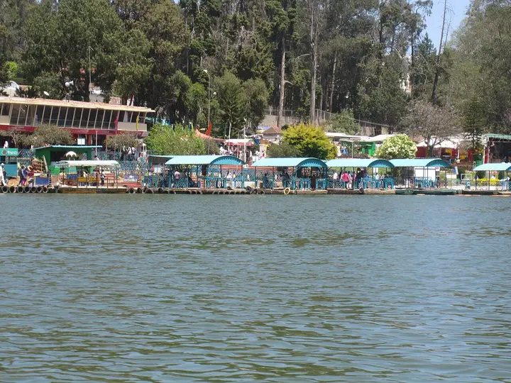
Gudalur is the town where the Nilgiris stop being the Nilgiris. Fifty kilometres west of Ooty the plateau runs out, the tea gives way to forest, and the road tips over the edge and falls into Kerala. It is a Tamil Nadu municipality in which most people speak Malayalam, a hill town at eleven hundred metres that feels like a plains town, and the western door of a tiger reserve — and almost nobody stops in it.
The first thing to understand about Gudalur is that it faces the wrong way. Every other town in this district looks east and south, down towards Coimbatore and the Tamil plains. Gudalur looks west, off the escarpment, towards Nilambur and Calicut. The road that matters here is NH-181 heading down the Nadugani ghat, and the towns it reaches — Nilambur at 49.5 kilometres, Kozhikode at 109.5 — are in another state. Ooty, the district capital, is 49.8 kilometres away in the other direction, and every metre of that is uphill.
That orientation is not an accident of geography alone; it is an accident of administration, and a recent one. Until 31 March 1877 this was South-East Wynad, part of Malabar District, which is to say part of what is now Kerala. On that date it was transferred to the Nilgiris. The border moved; the people did not. At the 2011 census Malayalam was still the language of 46.9 per cent of Gudalur taluk against Tamil at 38.8 and Kannada at 8.8 — the only taluk in Tamil Nadu where the state language comes second in its own hills.
The weather keeps the same allegiance. Gudalur takes about 3,000 millimetres of rain a year and 75 per cent of it arrives on the south-west monsoon between June and August, with only 15 per cent from the north-east. That is the Kerala pattern, not the Tamil Nadu one; most of this state waits for October. Stand on the Nadugani ghat in July and you can watch where the rain is made — cloud coming off the Arabian Sea, hitting the wall of the Ghats and emptying itself on this side of it.
The town itself is small and working: a bus stand on the Gundlupet–Gudalur–Coimbatore road with the government hospital sixty metres from it, a municipal office a quarter of an hour away on foot, lodges along the main street, a post office, churches of four or five denominations within a kilometre of each other, and a Saturday-market kind of busyness that has nothing to do with tourism. There were 49,540 people here at the 2011 census. The sex ratio was 1,032 women to every 1,000 men, comfortably above the national average, which in a plantation district is worth noticing.
What surrounds it is more interesting than what is in it. North and east, the forest of the Mudumalai Tiger Reserve begins; the reception at Theppakadu is 17.1 kilometres away and Gudalur is the reserve’s western approach, though the safaris and the elephant camp belong to Masinagudi, further in. West and south-west, past Devala and Pandalur, is the old Wynaad gold country. East, climbing towards Naduvattam, are cinchona slopes that once supplied an empire with quinine. The two viewpoints everyone comes for, Needle Rock and Frog Hill, are both on that eastern climb.
The plantations are the economy. Tea covers most of the visible ground, with coffee, pepper and cardamom worked in among it and on the smallholdings, and the pattern is a mosaic rather than the great single-owner estates of Coonoor and Valparai — a legacy of the way this land was broken up and fought over through the twentieth century. Between the estates and the reserve there is very little slack, which is why elephants and people meet here as often as they do.
And under all of it there is a fourth Gudalur that the other three tend to obscure. The valley is home to four Adivasi communities — the Paniya, the Betta Kurumba, the Mulla Kurumba and the Kattunayakan, with a smaller number of Irula — whom the Government of India classes as Particularly Vulnerable Tribal Groups. They were here before the coffee, before the gold, before the border moved. The single most remarkable institution in this town is theirs, and it is a hospital.
The town is also the head of its own taluk, and shares the western end of the district with Pandalur taluk next door, 22.9 kilometres down the road. Between them they hold the settlements most visitors never hear named — Devarshola, Naduvattam, Nadugani, Devala, Cherambadi, Bitherkad, Nelliyalam, Padanthorai, Chembakolli — most of them estate villages, most of them founded or reshaped by whichever crop was paying at the time. Gudalur is where all of them come to do business, see a doctor and catch a bus, which is why a town of fifty thousand feels busier than that.
Its churches are worth a moment, because they tell the same story as the language. Within a kilometre and a half of the bus stand there are Roman Catholic, Syrian Orthodox and Protestant congregations, and two Orthodox churches dedicated to St Mary within two hundred metres of each other — the built evidence of a Malayali Christian population that came up the ghat with the plantations and stayed. Alongside them are mosques and Hindu temples on the same streets. For a small hill town the religious geography is unusually layered, and it is layered along the road from Kerala.
Legend & myth
Above the town, on a ridge looking out towards the Pykara river and the country running west to the coast, stands Nambalakottai, which the Mandadan Chetti community holds to be very old indeed — around seventeen centuries, by the account they keep. The deity is Betarayasvami, the Lord of the Hunt, a name that belongs to the forest rather than to any temple town, and the shrine is central to the community’s ritual life.
It is worth being honest about the evidence. The only encyclopedia article on the temple is a short one resting on a single nineteenth-century source, and no dated remains have been published. The age is what is held and told, not what is proved, and it is set down here as that. The site itself needs no argument: whoever chose it picked a ridge with the hills at its back and a view down the whole western approach, and it is easy to see why it would have been a place of consequence long before anyone wrote about it.
The other hill with a story is the one everyone photographs. Needle Rock is Oosi Malai in Tamil — oosi is a needle, malai is a mountain — and the rock earns the name honestly, standing up out of the ridge in a spike you can pick out from fifteen kilometres away. The viewpoint that carries its name is not on it: the rock itself is ten kilometres west of the town, and the lay-by named after it is nine kilometres east. From Frog Hill you can see both at once, which is the neatest way to understand the joke.
More about Gudalur
History
The written history of this corner starts with other people’s ambitions for it. Through the eighteenth century the Wynad country changed hands between local chieftains and the Mysore sultans; after 1799 it passed to the British and was administered from Malabar on the Kerala side. The hills above it were barely touched until John Sullivan came up to Kotagiri in 1819 and the Nilgiris were opened as a hill station. Gudalur, on the wrong side of the plateau for a sanatorium, was left to the planters.
Coffee came first, in the middle of the nineteenth century, and for a while it did well. Then, in 1862, something happened eleven kilometres up the Ooty road that would matter far beyond this district. On 30 August that year the Governor of Madras, Sir William Denison, planted out at Naduvattam the first cinchona permanently established in the Nilgiris. Cinchona bark is where quinine comes from, and quinine is what made European empire in the tropics survivable; the British had spent years trying to get the South American tree to grow anywhere they controlled.
It grew here. A government factory went up around the Naduvattam plantations under W. G. McIvor, the gardener who had raised the seedlings, and the estates were worked with convict labour. At McIvor’s own request five hundred Chinese prisoners were sent up to Naduvattam to do it. It is a piece of Nilgiri history that gets far less telling than the tea does, and the plantations are still on the slopes above the highway.
Then came the gold. Mining in the Wynaad is documented from the 1830s, but the rush belongs to the 1870s. An Australian named Withers founded the Alfa Gold Mine in 1874 — the first company to mine gold in the Wynaad — and bought close to a thousand acres near Devala. In 1879 an Australian expert’s report on the field was published, and at least fifty British and Indian companies came into the Pandalur–Devala hills on the strength of it.
It was a disaster. The gold was real but thin, the companies were largely speculative, and the rush pulled land, labour and capital out of the coffee that had been paying, ruining the district’s coffee industry without ever returning what it cost. What survives is underground: adits driven through these hills that run anywhere from 500 to 3,000 metres, unlit and unmaintained, mostly on private estate land. They are not an attraction and should not be treated as one.
The twentieth century here is a story about land. As the estates were carved out, consolidated and re-carved, the Adivasi communities who had lived in the valley were pushed steadily off it, and by the 1980s they held very little of it and had almost no access to public health or education. In 1986 Stan and Mari Thekkaekara founded ACCORD and helped the communities organise themselves into the Adivasi Munnetra Sangam, a federation of the valley’s tribes. A community health programme followed in 1987.
In 1990 a surgeon, Dr Nandakumar Menon, and his wife Shyla, a gynaecologist, opened the Gudalur Adivasi Hospital — in the organisation’s own words, "in a rented building with a few mattresses on the floor". It moved in 1993 to a building that could take twenty-five patients, still mostly on mattresses. By 2014 it was a fifty-bed secondary-care hospital. It is owned and run by the Adivasi community of the Gudalur and Pandalur taluks, serving around twenty thousand people, and its primary care is delivered by health workers who are Adivasis themselves, backed by volunteers in the villages. An institute of health opened in 2010 and a school of nursing in 2017, training twenty auxiliary nurse midwives a year.
The hospital did not stop at beds. An institute of health opened in 2010 and the ASHWINI Adivasi School of Nursing was inaugurated in 2017, training twenty auxiliary nurse midwives a year — Adivasi women qualifying as nurses in a valley where, forty years ago, the community had almost no access to a clinic at all. The community health programme that feeds the hospital runs through health workers drawn from the communities themselves, working out of area centres across the valley and backed by volunteers in the villages.
That is the thing to know about this town. It is not a hill station that failed to become Ooty. It is a border town that has been argued over — by sultans and collectors, by coffee and gold, by planters and forest and the people who were here first — and the most successful thing anyone has built in it was built in the last forty years by the community with the least.
Why visit
For the two viewpoints, which are as good as any in the district and are free of the coach traffic that fills Ooty’s. Needle Rock repays the kilometre walk in from the road with a panorama that runs from the Wilson pine plantations round to the Mudumalai forest, and Frog Hill, three kilometres further up, gives you the ridge that names it and the needle across the valley.
For the drive down the Nadugani ghat, which is one of the great descents of the southern Ghats and the only road out of this district that both of our routing engines agree on to within two hundred metres. It drops off the plateau through reserved forest into Kerala, and you feel the air change on the way down.
Because it is the sensible base for the western side of the Mudumalai Tiger Reserve — Theppakadu is 17.1 kilometres away, Masinagudi 23.7 — and beds here cost a fraction of what they cost inside the buffer, without any of the questions that hang over building at the forest edge.
For the history nobody tells. The quinine that made tropical empire possible was first grown in this country, at Naduvattam on 30 August 1862, and there was a gold rush here in the 1870s that ruined the coffee crop and left three-kilometre tunnels under the hills. Both are within twenty kilometres of the bus stand and neither has so much as a signboard.
Because it is the only town in the district where three states are genuinely in reach in a morning. Karnataka begins 29 kilometres north up the reserve highway at Bandipur, Kerala 42 kilometres west at Sultan Bathery, and Ooty is 50 kilometres east; the official description calls this the meeting point of Mysore, Ooty and Calicut, and for once the tourism copy is a plain statement of fact.
And for a corrective to the idea that a hill town is a resort. Gudalur is a working municipality where the census language is Malayalam, the rain comes off the Arabian Sea, and the best hospital is owned by the Adivasi communities who run it. If you want to understand the Nilgiris as somewhere people live rather than somewhere people holiday, this is the town to spend a day in.