What to expect
Highlights
- Eastern Nilgiri escarpment
- River-valley panorama
- Tea-country approach
Kodanad View Point looks from the eastern Nilgiri edge across the Moyar and Bhavani country, with the panorama dependent on clear weather.
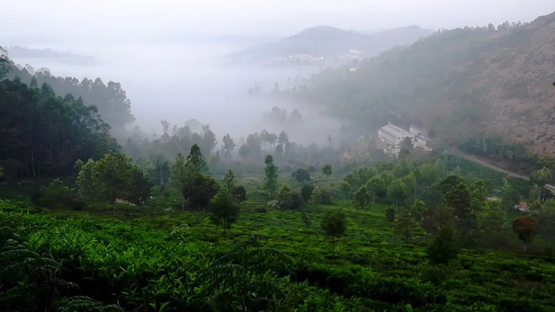
Kodanad View Point looks from the eastern Nilgiri edge across the Moyar and Bhavani country, with the panorama dependent on clear weather. Come for a broad escarpment view, not a guaranteed sight of every landmark named on old signboards. Haze and cloud can erase the plains completely.
The road from Kotagiri passes tea-growing country before reaching the eastern edge. From the managed lookout, terrain falls away toward river valleys and the Mysore plateau.
Read the official orientation board if present and use binoculars for distant features. Do not repeat cross-state identifications unless the feature can actually be established in current visibility.
The return is a substantial hill-road drive. Carry rain protection, settle parking or entry charges at authorised points and leave before mist or darkness makes the road harder.
For the visit itself, allow half a day from Kotagiri. The best time is a clear morning in safe road conditions. Check weather and visibility before the long drive. Use the managed lookout and its barriers. Stay behind barriers and avoid exposed roadside stops.
A clear morning in safe road conditions.
Live forecast loads in your browser.
Sun and moon are calculated for this location and shown in IST. Photography windows are the hour around sunrise and sunset; the sunset bearing is degrees clockwise from true north. Moon phase is accurate to about half a day.
Verified hotels, homestays, restaurants, experiences, sights, shops and rentals around Kodanad View Point — commission-free, with direct contact. Filter by what you need.
The first of the Green Shops, at Johnstone Square in the middle of the town. It sells wild honey, beeswax, spices, millets and coffee gathered by indigenous communities of the Nilgiri Biosphere Reserve.
The organisation that has done more than anything else to make this small town matter, headquartered on Groves Hill Road since the 1990s. Its campus is open to visitors on weekdays and it publishes its own visiting hours.
Last Forest Enterprises was incubated by the Keystone Foundation and registered as a private limited company in 2010, to give indigenous gatherers in the Nilgiri Biosphere Reserve a market they set the price in rather than one an intermediary set for them. Honey is the flagship — the company grew out of the first survey of honey hunters and beekeepers in Tamil Nadu — with beeswax balms, soaps and candles, spices, millets and Toda-embroidered textiles alongside it. Its own material says it operates in ten Indian states and internationally, works with networks including Fair Trade and Slow Food, and sources over half its products from Aadhimalai, the tribal producer company at the same address. Address, telephone and email read off lastforest.in on 31 August 2026.
A producer company owned and run by tribal producers of the Nilgiri Biosphere Reserve, registered in 2013 and based on Groves Hill Road. It won the United Nations Development Programme’s Equator Prize in 2021.
Resort. 1/233 Aravenu, Halakkarai Road, Kotagiri, Tamil Nadu 643103.
A heritage homestay at Hadathorai, in a bungalow its owners date to 1881 and attribute to a Scottish planter named Kay. It takes guests for lunch as well as for stays, and asks that you telephone your arrival time ahead.
A natural history society founded in Kotagiri in 2009 to tell the story of the Nilgiri Biosphere Reserve through field learning rather than display cases. It runs conservation education, film festivals and field programmes across the hills.
A small nature resort on the Kodanad road at S. Kaikatty, near the old Warwick factory. Its own site puts it about twelve kilometres from the Kodanad viewpoint and eight from the John Sullivan Memorial.
A family-run operation near Kotagiri offering homestays, mountain-view domes, plantation stays and camping, booked direct. Its site publishes a booking telephone number and email but no street address, so none is printed here.
Book with the place itself. India’s cyber-crime coordination centre warned in April 2025 that convincing copies of hotel and pilgrimage booking sites are being pushed through sponsored search and social ads, taking payment for rooms the property never hears about. Every listing here links to the business’s own contact details and its own Google or Bing profile — we take no commission and sit in nobody’s payment path. If a booking page reached you through an ad, check the address bar against the property’s own site before you pay. Fraud can be reported on cybercrime.gov.in or on 1930.
Find food, accommodation and activities across Kotagiri. Browse the guides for places to eat, stay and explore along your route.
5 more places around Kotagiri. Open a guide to plan the visit and onward journey.
17.0 km · ~28 min by cab
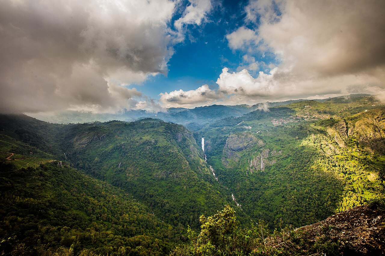
A twin-tiered waterfall near Kotagiri, one of the tallest in the Nilgiris, formed on the Kallar river. Tamil Nadu Tourism and the district administration both say it takes its name from the wife of M.D. Cockburn, the planter credited with bringing coffee to Kotagiri, though the older form St Catherine's Falls was already in use.

6.1 km · ~15 min by auto
A rock pillar and viewpoint east of Kotagiri associated with a local Rangaswamy temple legend, offering views over the Nilgiri plateau. Sources place it differently: OpenStreetMap maps the cliff at one point and Wikipedia gives another about 4.5 km further east, while Wikipedia's own text calls it 20 km from Kotagiri, which matches neither.

10.4 km · ~17 min by cab
A protected shola forest reserve on Kotagiri's eastern edge, known for birdwatching and for sightings of endemic species such as the Nilgiri wood pigeon. It was designated a Ramsar Wetland of International Importance on 24 May 2023, covering 116.01 hectares.
10.9 km · ~18 min by cab
Elk Falls, also called Uyilatty Falls after the village beside it, drops in the hills north of Kotagiri; the district administration lists it among the town's waterfalls and the usual published figure is about 7 km out. The fall itself is on no map we can read, so the marker here sits on Uyilatty village, 7.4 km from the bus stand by routed road, and not on the water.
11.4 km · ~19 min by cab
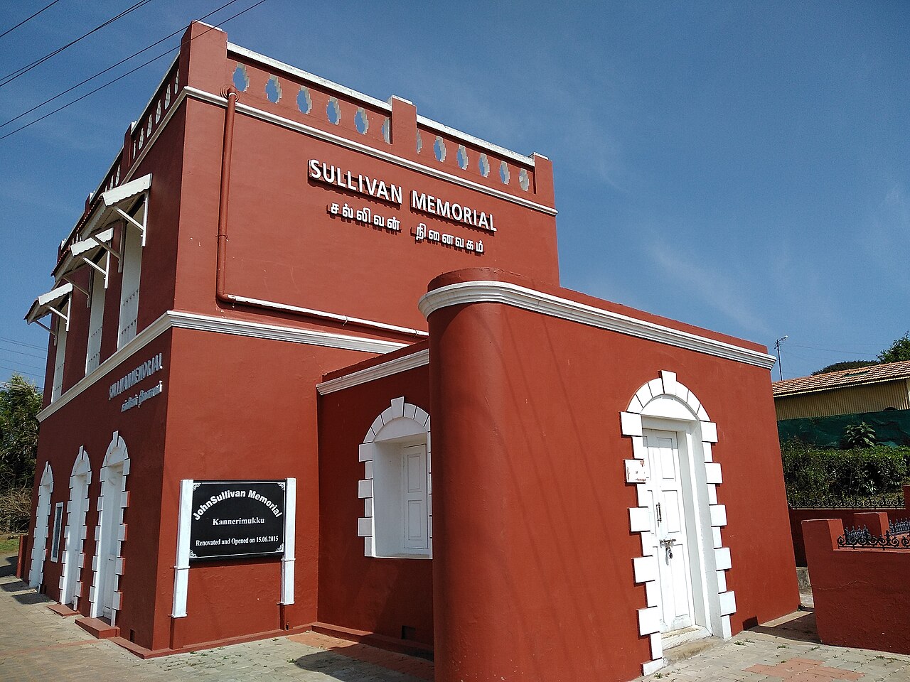
This restored stone bungalow at Kannerimukku near Kotagiri was one of the earliest European residences in the Nilgiris, associated with John Sullivan, the British collector who opened up the hills from 1819. It now houses a memorial and small museum on Nilgiri history run by a heritage trust, 3.4 km from the Kotagiri bus stand by routed road.
Roampedia is commission-free — own or know a stay, eatery, guide or shop near Kodanad View Point? List it and it appears here once verified.
Add a nearby businessEntry: Local entry or parking charges may apply.
A hired vehicle from Kotagiri is the practical choice.
If you need step-free access, contact the site before travelling. Ask about a level entrance, steps along the route, the nearest drop-off point, seating and accessible toilets.
Emergency numbers are verified against official government and state tourism sources. 112 works anywhere in India.
A rock pillar and viewpoint east of Kotagiri associated with a local Rangaswamy temple legend, offering views over the Nilgiri plateau. Sources place it differently: OpenStreetMap maps the cliff at one point and Wikipedia gives another about 4.5 km further east, while Wikipedia's own text calls it 20 km from Kotagiri, which matches neither.
6.1 km · ~15 min by auto · straight lineA protected shola forest reserve on Kotagiri's eastern edge, known for birdwatching and for sightings of endemic species such as the Nilgiri wood pigeon. It was designated a Ramsar Wetland of International Importance on 24 May 2023, covering 116.01 hectares.
10.4 km · ~17 min by cab · straight lineElk Falls, also called Uyilatty Falls after the village beside it, drops in the hills north of Kotagiri; the district administration lists it among the town's waterfalls and the usual published figure is about 7 km out. The fall itself is on no map we can read, so the marker here sits on Uyilatty village, 7.4 km from the bus stand by routed road, and not on the water.
10.9 km · ~18 min by cab · straight lineThis restored stone bungalow at Kannerimukku near Kotagiri was one of the earliest European residences in the Nilgiris, associated with John Sullivan, the British collector who opened up the hills from 1819. It now houses a memorial and small museum on Nilgiri history run by a heritage trust, 3.4 km from the Kotagiri bus stand by routed road.
11.4 km · ~19 min by cab · straight lineA twin-tiered waterfall near Kotagiri, one of the tallest in the Nilgiris, formed on the Kallar river. Tamil Nadu Tourism and the district administration both say it takes its name from the wife of M.D. Cockburn, the planter credited with bringing coffee to Kotagiri, though the older form St Catherine's Falls was already in use.
17.0 km · ~28 min by cab · straight line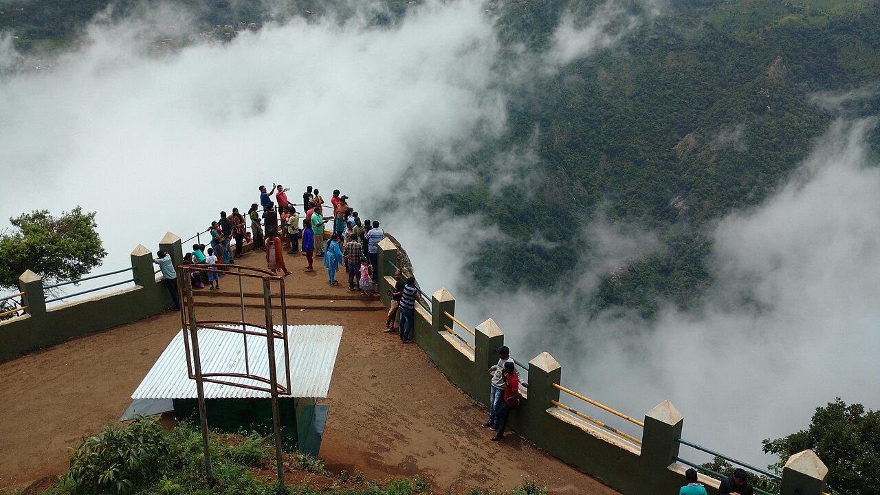
A rocky outcrop near Coonoor offering sweeping views of the Nilgiri escarpment, Catherine Falls, and the plains below.
18.4 km · ~31 min by cab · straight lineRalliah (Rallia) Dam sits on the Coonoor-Kattabettu-Kotagiri road and was built in 1914 as a catchment supplying drinking water to Coonoor and Kotagiri. Ringed by eucalyptus forest and reached by a short walk, it is a peaceful, little-visited spot popular for gentle trekking.
18.9 km · ~31 min by cab · straight lineA working tea factory 9.5 km east of the Coonoor bus stand on the estate road toward the viewpoints, where the leaf from the surrounding slopes is withered, rolled, oxidised and graded. Coonoor has been the administrative centre of the Nilgiri tea trade since the first plantation in these hills was established beside it in 1854.
20.4 km · ~34 min by cab · straight line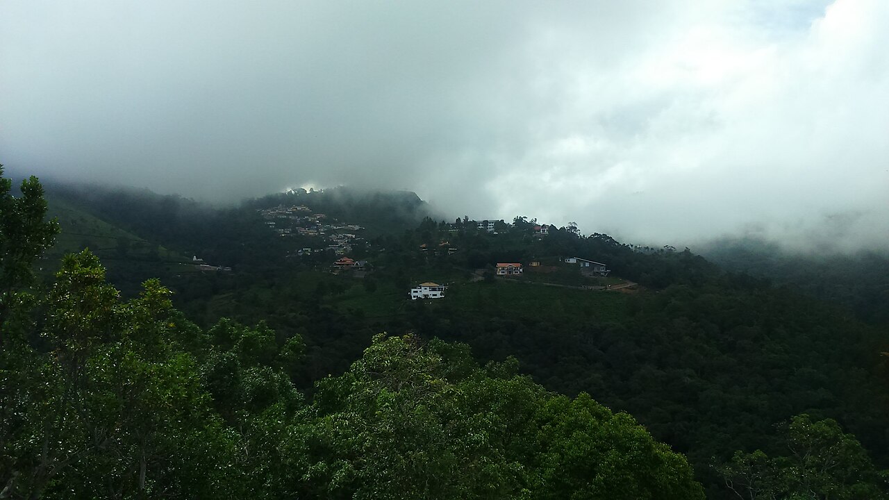
A viewpoint near Coonoor overlooking tea and coffee plantations and the Coimbatore plains, named after a former collector of the region.
21.1 km · ~35 min by cab · straight line
Highfield is a long-established tea estate and working factory near Coonoor that offers guided tours explaining the tea-making process from plucking to packaging. Visitors can walk the plantation slopes and buy estate-fresh Nilgiri tea, making it one of Coonoor's popular tea-tourism stops.
21.8 km · ~36 min by cab · straight line
A garrison club that dates itself from the brick cricket pavilion put up for the troops in 1873, though it only took the name Wellington Gymkhana in 1916, and it now runs an eighteen-hole hill golf course at about six thousand feet. Its own history records a race course here before Ooty's longer track was built, nine-hole golf, polo and rugby by the 1930s, its first Indian member in 1943, and the fact that the whole club stands on military land and pays a yearly rent to the Defence Department.
22.3 km · ~37 min by cab · straight line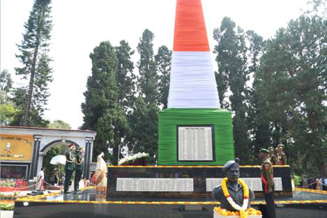
The memorial of the Madras Regiment, the oldest infantry regiment of the Indian Army, raised in 1758 and at Wellington since February 1947. The Cantonment Board's own history places the Defence Services Staff College directly in front of it, which makes this small square the centre of military Wellington rather than the barracks themselves; the ground around it is cantonment land, and what you may photograph is decided at the gate, not by the memorial.
22.5 km · ~37 min by cab · straight lineNo. Distant views depend on haze, cloud and accurate orientation.
No. Plan it as a road excursion with return time.
A clear morning in safe road conditions.
Entry: Local entry or parking charges may apply. Timings: Use daylight and confirm current viewpoint access.
Check weather and visibility before the long drive. Use the managed lookout and its barriers.
Allow half a day from Kotagiri.
Nearby you can pair Rangaswamy Pillar and Peak (6.1 km), Longwood Shola (10.4 km), Elk Falls, Kotagiri (10.9 km), John Sullivan Memorial (Kannerimukku Bungalow), Kotagiri (11.4 km).
Stay behind barriers and avoid exposed roadside stops.
Written about Kodanad View Point itself — its history, its legends and the arguments about them.
These guides explore Kotagiri and the surrounding area. Choose a visit that fits your interests, allowing separately for travel between stops.
Route-level itineraries and practical guides for the rest of Tamil Nadu.
Photographs: Jaseem Hamza (CC BY 3.0), Buvanesh Subramani (CC BY-SA 4.0). Wikimedia Commons.
