What to expect
Longwood Shola
A protected shola forest reserve on Kotagiri's eastern edge, known for birdwatching and for sightings of endemic species such as the Nilgiri wood pigeon. It was designated a Ramsar Wetland of International Importance on 24 May 2023, covering 116.01 hectares.

Practical guide
Plan Longwood Shola
Who's going?Tailor Longwood Shola to your trip
Typepark
Nearest baseKotagiri
DistrictThe Nilgiris
Best timeOctober to March is the cooler, drier…
Time neededAbout an hour
EntryFree
Places to visit6→Listed businesses9→Longwood Shola is planned from Kotagiri, one of the travel bases in The Nilgiris district. Use Kotagiri for stays, food and local transport, then plan this place as a focused stop.
Getting there
How to visit
- Base yourself in Kotagiri or nearby in The Nilgiris, then confirm the last-mile route locally before travel.
- If access depends on temple, museum or seasonal rules, check on the day before you go.
Timing
Best time
October to March is the cooler, drier season in the Cauvery delta.
Weather in Longwood SholaSeasonal guide
Live forecast loads in your browser.
Today at Longwood Shola
Sunrise6:12 am
Sunset6:04 pm
Golden hour best light5:04 pm–6:04 pm
Blue hour after sunset6:04 pm–6:29 pm
Sun sets toward compass bearingW · 261°
Moon tonight🌒 Waxing crescent · 24%
Sun and moon are calculated for this location and shown in IST. Photography windows are the hour around sunrise and sunset; the sunset bearing is degrees clockwise from true north. Moon phase is accurate to about half a day.
Stay · eat · do · rent · see · shop
Stays, food & things to do near Longwood Shola
Verified hotels, homestays, restaurants, experiences, sights, shops and rentals around Longwood Shola — commission-free, with direct contact. Filter by what you need.
4 places to stay near Longwood Shola
2 things to do near Longwood Shola
3 places to shop near Longwood Shola
Top pick
Grocery and forest produce
Green Shop, KotagiriThe first of the Green Shops, at Johnstone Square in the middle of the town. It sells wild honey, beeswax, spices, millets and coffee gathered by indigenous communities of the Nilgiri Biosphere Reserve.
Top pick
Conservation organisation
Keystone FoundationThe organisation that has done more than anything else to make this small town matter, headquartered on Groves Hill Road since the 1990s. Its campus is open to visitors on weekdays and it publishes its own visiting hours.
Top pick
Social enterprise and shop
Last Forest EnterprisesLast Forest Enterprises was incubated by the Keystone Foundation and registered as a private limited company in 2010, to give indigenous gatherers in the Nilgiri Biosphere Reserve a market they set the price in rather than one an intermediary set for them. Honey is the flagship — the company grew out of the first survey of honey hunters and beekeepers in Tamil Nadu — with beeswax balms, soaps and candles, spices, millets and Toda-embroidered textiles alongside it. Its own material says it operates in ten Indian states and internationally, works with networks including Fair Trade and Slow Food, and sources over half its products from Aadhimalai, the tribal producer company at the same address. Address, telephone and email read off lastforest.in on 31 August 2026.
Top pick
Producer company and shop
Aadhimalai Pazhangudiyinar Producer CompanyA producer company owned and run by tribal producers of the Nilgiri Biosphere Reserve, registered in 2013 and based on Groves Hill Road. It won the United Nations Development Programme’s Equator Prize in 2021.
Top pick
Resort
Ibex Resorts, KotagiriResort. 1/233 Aravenu, Halakkarai Road, Kotagiri, Tamil Nadu 643103.
Heritage homestay
La MaisonA heritage homestay at Hadathorai, in a bungalow its owners date to 1881 and attribute to a Scottish planter named Kay. It takes guests for lunch as well as for stays, and asks that you telephone your arrival time ahead.
Natural history society
Nilgiri Natural History SocietyA natural history society founded in Kotagiri in 2009 to tell the story of the Nilgiri Biosphere Reserve through field learning rather than display cases. It runs conservation education, film festivals and field programmes across the hills.
Nature resort
Prakritilaya Nature HomesA small nature resort on the Kodanad road at S. Kaikatty, near the old Warwick factory. Its own site puts it about twelve kilometres from the Kodanad viewpoint and eight from the John Sullivan Memorial.
Homestay and camping
Silvertip StaysA family-run operation near Kotagiri offering homestays, mountain-view domes, plantation stays and camping, booked direct. Its site publishes a booking telephone number and email but no street address, so none is printed here.
Commission-freeView details
Book with the place itself. India’s cyber-crime coordination centre warned in April 2025 that convincing copies of hotel and pilgrimage booking sites are being pushed through sponsored search and social ads, taking payment for rooms the property never hears about. Every listing here links to the business’s own contact details and its own Google or Bing profile — we take no commission and sit in nobody’s payment path. If a booking page reached you through an ad, check the address bar against the property’s own site before you pay. Fraud can be reported on cybercrime.gov.in or on 1930.
Ranked
More ways to explore Kotagiri
Find food, accommodation and activities across Kotagiri. Browse the guides for places to eat, stay and explore along your route.
Across the whole of Kotagiri
Ranked guides
Top experiences around Kotagiri
5 more places around Kotagiri. Open a guide to plan the visit and onward journey.
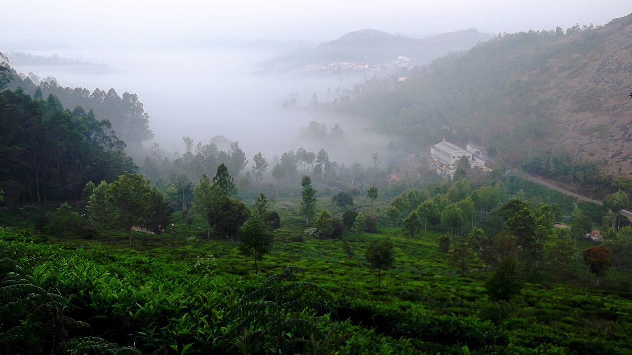
viewpointKodanad View Point
10.4 km · ~17 min by cab
A viewpoint near Kotagiri overlooking the Bhavani valley and, on clear days, the plains beyond.
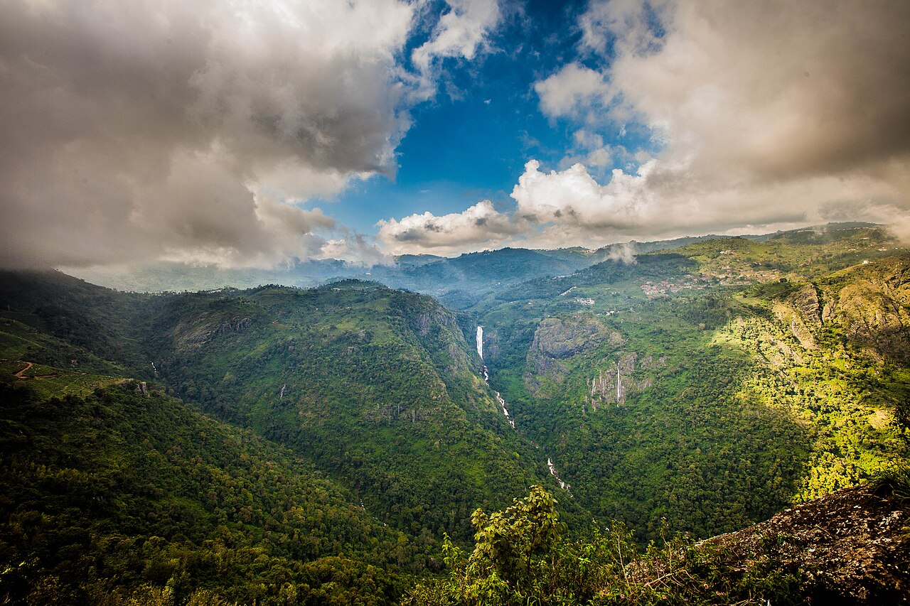
waterfallCatherine Falls
6.6 km · ~16 min by auto
A twin-tiered waterfall near Kotagiri, one of the tallest in the Nilgiris, formed on the Kallar river. Tamil Nadu Tourism and the district administration both say it takes its name from the wife of M.D. Cockburn, the planter credited with bringing coffee to Kotagiri, though the older form St Catherine's Falls was already in use.

viewpointRangaswamy Pillar and Peak
9.2 km · ~15 min by cab
A rock pillar and viewpoint east of Kotagiri associated with a local Rangaswamy temple legend, offering views over the Nilgiri plateau. Sources place it differently: OpenStreetMap maps the cliff at one point and Wikipedia gives another about 4.5 km further east, while Wikipedia's own text calls it 20 km from Kotagiri, which matches neither.
E
Elk Falls, Kotagiri
Place
heritageElk Falls, Kotagiri
5.4 km · ~13 min by auto
Elk Falls, also called Uyilatty Falls after the village beside it, drops in the hills north of Kotagiri; the district administration lists it among the town's waterfalls and the usual published figure is about 7 km out. The fall itself is on no map we can read, so the marker here sits on Uyilatty village, 7.4 km from the bus stand by routed road, and not on the water.
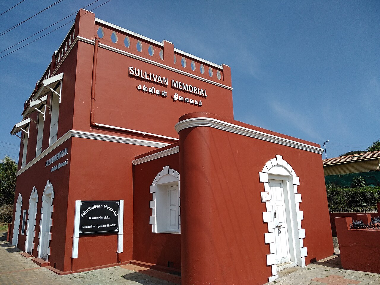
heritageJohn Sullivan Memorial (Kannerimukku Bungalow), Kotagiri
2.3 km · 29 min walk
This restored stone bungalow at Kannerimukku near Kotagiri was one of the earliest European residences in the Nilgiris, associated with John Sullivan, the British collector who opened up the hills from 1819. It now houses a memorial and small museum on Nilgiri history run by a heritage trust, 3.4 km from the Kotagiri bus stand by routed road.
Roampedia is commission-free — own or know a stay, eatery, guide or shop near Longwood Shola? List it and it appears here once verified.
Add a nearby businessBefore you go
Longwood Shola — at a glance
TimingsDaylight hours; early morning for the birds
Best timeSeptember to November and December to February; leech season is June to September
Entry: No gate and no ticket. It is a reserve forest managed by the District Forest Officer, Nilgiris Forest Division; ask locally before going far in.
Getting here
How to reach Longwood Shola
3.4 km and about four minutes from the Kotagiri bus stand by routed road, or 3.9 km and rather under an hour on foot. Coonoor is 21.6 km from the town, Coimbatore Junction 71.8 km, Coimbatore airport (CJB) 74.4 km.
Getting around Longwood Shola
If you need step-free access, contact the site before travelling. Ask about a level entrance, steps along the route, the nearest drop-off point, seating and accessible toilets.
If you need help at Longwood Shola
112All emergencies (police · fire · medical)The single number to call in any emergency (ERSS).100Police101Fire108Ambulance (emergency / EMS)1091Women’s helpline (distress)1098Child helpline1363Tourist helpline (India, 24×7, multilingual)
Emergency numbers are verified against official government and state tourism sources. 112 works anywhere in India.
Nearby
What’s near Longwood Shola
heritageJohn Sullivan Memorial (Kannerimukku Bungalow), Kotagiri
This restored stone bungalow at Kannerimukku near Kotagiri was one of the earliest European residences in the Nilgiris, associated with John Sullivan, the British collector who opened up the hills from 1819. It now houses a memorial and small museum on Nilgiri history run by a heritage trust, 3.4 km from the Kotagiri bus stand by routed road.
2.3 km · 29 min walk · straight lineE
Elk Falls, Kotagiri
Place
heritageElk Falls, Kotagiri
Elk Falls, also called Uyilatty Falls after the village beside it, drops in the hills north of Kotagiri; the district administration lists it among the town's waterfalls and the usual published figure is about 7 km out. The fall itself is on no map we can read, so the marker here sits on Uyilatty village, 7.4 km from the bus stand by routed road, and not on the water.
5.4 km · ~13 min by auto · straight linewaterfallCatherine Falls
A twin-tiered waterfall near Kotagiri, one of the tallest in the Nilgiris, formed on the Kallar river. Tamil Nadu Tourism and the district administration both say it takes its name from the wife of M.D. Cockburn, the planter credited with bringing coffee to Kotagiri, though the older form St Catherine's Falls was already in use.
6.6 km · ~16 min by auto · straight line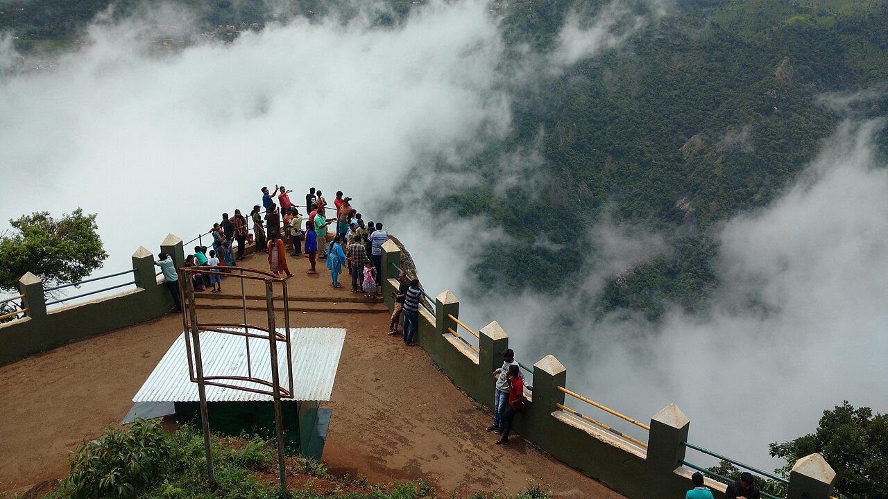
viewpointDolphin's Nose, Coonoor
A rocky outcrop near Coonoor offering sweeping views of the Nilgiri escarpment, Catherine Falls, and the plains below.
8.1 km · ~13 min by cab · straight lineviewpointRangaswamy Pillar and Peak
A rock pillar and viewpoint east of Kotagiri associated with a local Rangaswamy temple legend, offering views over the Nilgiri plateau. Sources place it differently: OpenStreetMap maps the cliff at one point and Wikipedia gives another about 4.5 km further east, while Wikipedia's own text calls it 20 km from Kotagiri, which matches neither.
9.2 km · ~15 min by cab · straight lineR
Ralliah Dam
Place
heritageRalliah Dam
Ralliah (Rallia) Dam sits on the Coonoor-Kattabettu-Kotagiri road and was built in 1914 as a catchment supplying drinking water to Coonoor and Kotagiri. Ringed by eucalyptus forest and reached by a short walk, it is a peaceful, little-visited spot popular for gentle trekking.
9.7 km · ~16 min by cab · straight lineB
Brooklane Coonoor Tea Factory
Place
heritageBrooklane Coonoor Tea Factory
A working tea factory 9.5 km east of the Coonoor bus stand on the estate road toward the viewpoints, where the leaf from the surrounding slopes is withered, rolled, oxidised and graded. Coonoor has been the administrative centre of the Nilgiri tea trade since the first plantation in these hills was established beside it in 1854.
10.0 km · ~17 min by cab · straight lineviewpointKodanad View Point
A viewpoint near Kotagiri overlooking the Bhavani valley and, on clear days, the plains beyond.
10.4 km · ~17 min by cab · straight line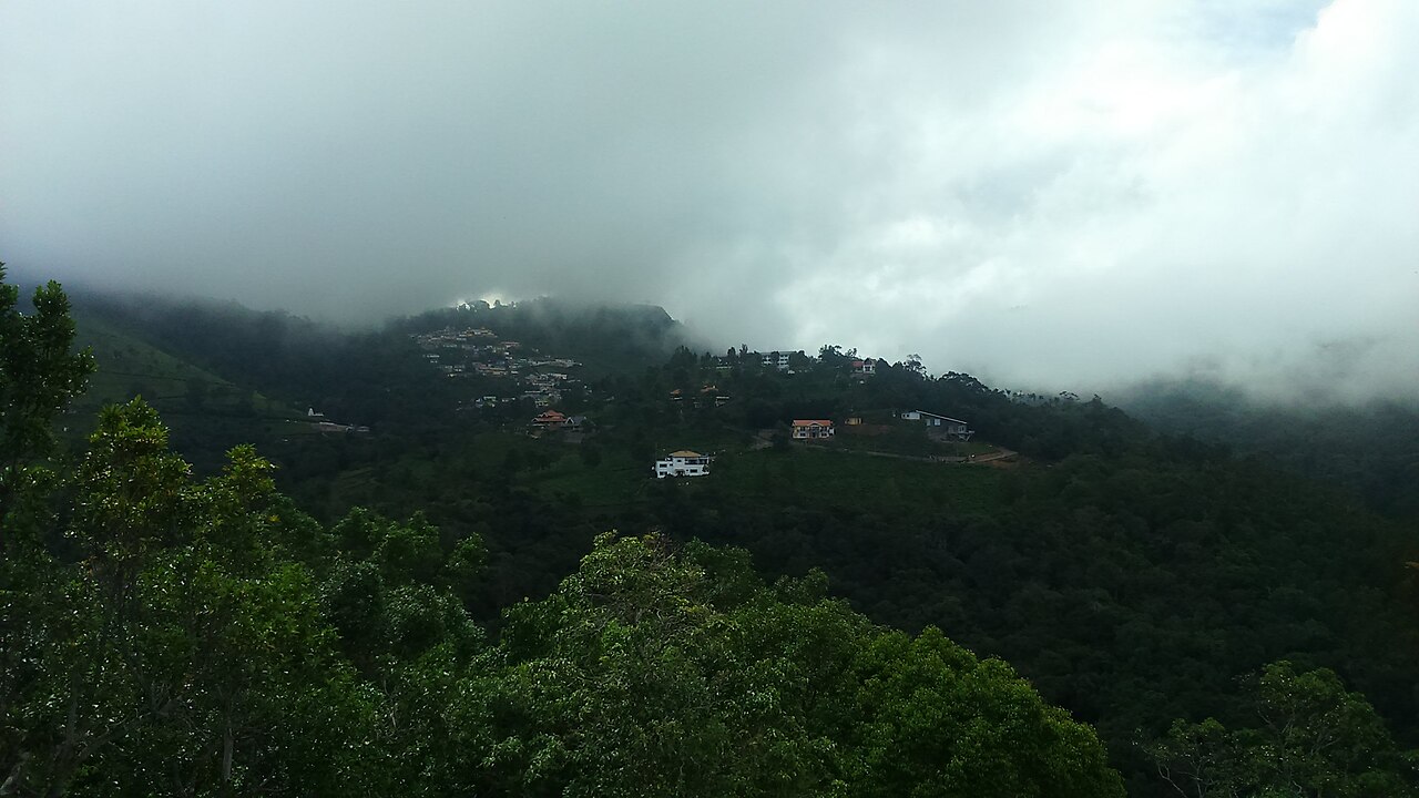
viewpointLamb's Rock
A viewpoint near Coonoor overlooking tea and coffee plantations and the Coimbatore plains, named after a former collector of the region.
10.7 km · ~18 min by cab · straight line
heritageHighfield Tea Estate and Factory
Highfield is a long-established tea estate and working factory near Coonoor that offers guided tours explaining the tea-making process from plucking to packaging. Visitors can walk the plantation slopes and buy estate-fresh Nilgiri tea, making it one of Coonoor's popular tea-tourism stops.
11.7 km · ~20 min by cab · straight line
heritageWellington Gymkhana Club
A garrison club that dates itself from the brick cricket pavilion put up for the troops in 1873, though it only took the name Wellington Gymkhana in 1916, and it now runs an eighteen-hole hill golf course at about six thousand feet. Its own history records a race course here before Ooty's longer track was built, nine-hole golf, polo and rugby by the 1930s, its first Indian member in 1943, and the fact that the whole club stands on military land and pays a yearly rent to the Defence Department.
12.3 km · ~21 min by cab · straight line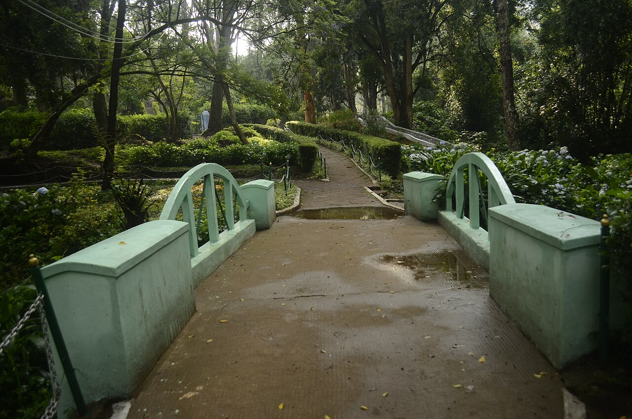
parkSim's Park
A 12-hectare botanical park in Coonoor established in 1874, laid out in irregular Japanese style with a small lake and rare tree species.
12.5 km · ~21 min by cab · straight lineOn the map
Where Longwood Shola is
Good to know
Longwood Shola — frequently asked
When is the best time to visit Longwood Shola?
October to March is the cooler, drier season in the Cauvery delta.
What are the entry fee and timings at Longwood Shola?
Entry: No gate and no ticket. It is a reserve forest managed by the District Forest Officer, Nilgiris Forest Division; ask locally before going far in. Timings: Daylight hours; early morning for the birds.
How do I reach Longwood Shola?
Base yourself in Kotagiri or nearby in The Nilgiris, then confirm the last-mile route locally before travel. If access depends on temple, museum or seasonal rules, check on the day before you go.
How much time do I need for Longwood Shola?
About an hour.
What else is near Longwood Shola?
Nearby you can pair John Sullivan Memorial (Kannerimukku Bungalow), Kotagiri (2.3 km), Elk Falls, Kotagiri (5.4 km), Catherine Falls (6.6 km), Dolphin's Nose, Coonoor (8.1 km).
Read before you go
Longwood Shola guides, stories & itineraries
We have not published a story about Longwood Shola itself yet. These cover Kotagiri and the wider district, with separate journeys between stops.
Around Kotagiri
These guides explore Kotagiri and the surrounding area. Choose a visit that fits your interests, allowing separately for travel between stops.
The story of Elk Falls, Kotagiri
Place story
The story of Elk Falls, Kotagiri
4 min read · Read →
The story of John Sullivan Memorial (Kannerimukku Bungalow), Kotagiri
Place story
The story of John Sullivan Memorial (Kannerimukku Bungalow), Kotagiri
4 min read · Read →

Guide
Kotagiri: A Guide to the Oldest and Quietest Nilgiri Hill Station
7 min read · Read →
Tamil Nadu-wide guides & itineraries
Route-level itineraries and practical guides for the rest of Tamil Nadu.
The story of St. Michael's Church, Shanthoor
Place story
The story of St. Michael's Church, Shanthoor
4 min read · Read →
The story of Hethai Amman Shrine, Ketti
Place story
The story of Hethai Amman Shrine, Ketti
4 min read · Read →
The story of All Saints Church, Coonoor
Place story
The story of All Saints Church, Coonoor
4 min read · Read →
Image credits
Photographs: SeethaG (CC BY-SA 4.0). Wikimedia Commons.