What to expect
Pachaimalai Hills
A low, forested mountain range of the Eastern Ghats lying mainly in Tiruchirappalli district, with elevations between roughly 500 and 1,400 metres. The evergreen hills are fed by the Kallar and Sweata rivers and are home to tribal settlements and waterfalls such as Mangalam Aruvi and Koraiyar Falls. They are a popular destination for trekking and nature outings from Trichy.
P
Pachaimalai Hills
Place
Practical guide
Plan Pachaimalai Hills
Who's going?Tailor Pachaimalai Hills to your trip
Typeviewpoint
Nearest baseUppiliyapuram
DistrictTiruchirappalli
Best timeOctober to March is the cooler, drier…
Time neededAbout an hour
EntryFree
Pachaimalai Hills is planned from Uppiliyapuram, one of the travel bases in Tiruchirappalli district. Use Uppiliyapuram for stays, food and local transport, then plan this place as a focused stop.
Getting there
How to visit
- Base yourself in Uppiliyapuram or nearby in Tiruchirappalli, then confirm the last-mile route locally before travel.
- If access depends on temple, museum or seasonal rules, check on the day before you go.
Timing
Best time
October to March is the cooler, drier season in the Cauvery delta.
Weather in Pachaimalai HillsSeasonal guide
Live forecast loads in your browser.
Today at Pachaimalai Hills
Sunrise6:06 am
Sunset5:59 pm
Golden hour best light4:59 pm–5:59 pm
Blue hour after sunset5:59 pm–6:24 pm
Sun sets toward compass bearingW · 261°
Moon tonight🌒 Waxing crescent · 24%
Retreating monsoon. October and November still see spells of rain from the retreating monsoon, though it is usually lighter than mid-year. Conditions are generally good but worth checking.
Sun and moon are calculated for this location and shown in IST. Photography windows are the hour around sunrise and sunset; the sunset bearing is degrees clockwise from true north. Moon phase is accurate to about half a day.
Stay · eat · do · rent · see · shop
Stays, food & things to do near Pachaimalai Hills
Verified hotels, homestays, restaurants, experiences, sights, shops and rentals around Pachaimalai Hills — commission-free, with direct contact. Filter by what you need.
Verified inventory is being added here.
Verified places are being added. The category filters will fill in as approved stays, restaurants, experiences, sights, shops and nature listings go live.
List your placeRoampedia is commission-free — own or know a stay, eatery, guide or shop near Pachaimalai Hills? List it and it appears here once verified.
Add a nearby businessBefore you go
Pachaimalai Hills — at a glance
TimingsDaylight hours (dawn to dusk)
Best timeOctober to February, when the hills are green and streams flow
Entry: Free
Getting here
How to reach Pachaimalai Hills
About 30 km from Perambalur town; nearest railway Perambalur station on the Trichy-Chennai line (~32 km); nearest airport Tiruchirappalli (TRZ) ~55 km.
Getting around Pachaimalai Hills
If you need step-free access, contact the site before travelling. Ask about a level entrance, steps along the route, the nearest drop-off point, seating and accessible toilets.
If you need help at Pachaimalai Hills
112All emergencies (police · fire · medical)The single number to call in any emergency (ERSS).100Police101Fire108Ambulance (emergency / EMS)1091Women’s helpline (distress)1098Child helpline1363Tourist helpline (India, 24×7, multilingual)
Emergency numbers are verified against official government and state tourism sources. 112 works anywhere in India.
Nearby
What’s near Pachaimalai Hills
P
Puliyancholai Falls
Place
waterfallPuliyancholai Falls
A perennial forest waterfall and picnic spot at the foot of the Pachaimalai hills, about 20 km from Thuraiyur town. Fed by hill streams, it is surrounded by tamarind groves that give the site its name (puliyan cholai). It is one of the most visited natural picnic destinations in Tiruchirappalli district.
12.0 km · ~20 min by cab · straight lineP
Prasanna Venkatachalapathy Temple (Gunaseelam)
Place
templePrasanna Venkatachalapathy Temple (Gunaseelam)
A Vishnu temple on the banks of the Kaveri about 20 km from Trichy, considered an Abhimana Sthalam and often called a southern counterpart of Tirupati. It is renowned for a traditional 48-day cure ritual for mentally ill devotees, who stay within the temple premises. In 1996 the temple established a Tamil Nadu government-licensed mental health rehabilitation centre, the first of its kind in the state.
39.0 km · ~65 min by cab · straight line
parkMukkombu (Upper Anicut)
A popular riverside picnic spot, also called Upper Anaicut, where the Cauvery river bifurcates into the Kollidam and Cauvery branches; the regulator dam is fronted by gardens and boating.
41.1 km · ~68 min by cab · straight line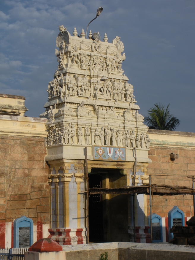
templePundarikakshan Perumal Temple (Thiruvellarai)
A 108 Divya Desam dedicated to Vishnu as Pundarikakshan with his consort Pankajavalli, believed to be older than Srirangam. Set on a white rock, it includes two Pallava- and Chola-era rock-cut cave temples, one from Nandivarman II's reign and another from Rajaraja I's. The temple has an ancient stepped tank and inscriptions spanning the Pallava, Chola, Pandya, Vijayanagara and Nayak periods.
42.7 km · ~71 min by cab · straight line
parkTropical Butterfly Conservatory
A butterfly conservatory and park in the Srirangam area, a family-oriented nature attraction with landscaped gardens and enclosures for observing native butterfly species.
46.2 km · ~77 min by cab · straight line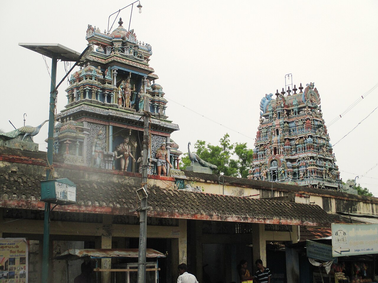
templeVayalur Murugan Temple
A prominent Murugan shrine on the outskirts of Trichy that draws regional pilgrims, especially during Skanda Sashti and other Murugan festival days.
49.1 km · ~82 min by cab · straight lineN
Neelivaneswarar Temple (Thiruppainjeeli)
Place
templeNeelivaneswarar Temple (Thiruppainjeeli)
A Paadal Petra Sthalam Shiva temple about 20 km north of Trichy, praised by the Saivite trio Sambandar, Appar and Sundarar. It is unusual for having a dedicated shrine to Yama, the god of death, in a cave-like chamber said to be built by the Pallava king Mahendravarman. Devotees perform Ayush Homa here to overcome the fear of death, and the temple carries inscriptions of Rajaraja I and Rajendra Chola I.
49.6 km · ~83 min by cab · straight line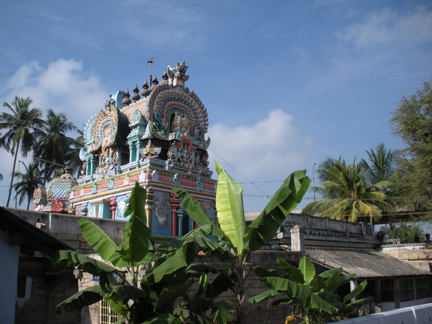
templeUthamar Kovil (Purushothama Perumal Temple)
One of the 108 Divya Desams, glorified in the Nalayira Divya Prabandham by Thirumangai Alvar. It is the only temple where the Trimurti - Brahma, Vishnu (worshipped here as Purushothama Perumal) and Shiva - are enshrined together with their consorts in six separate shrines. Built in Dravidian style, it once formed a four-Divya-Desam circuit with Uraiyur, Srirangam and Thiruvellarai.
51.1 km · ~85 min by cab · straight line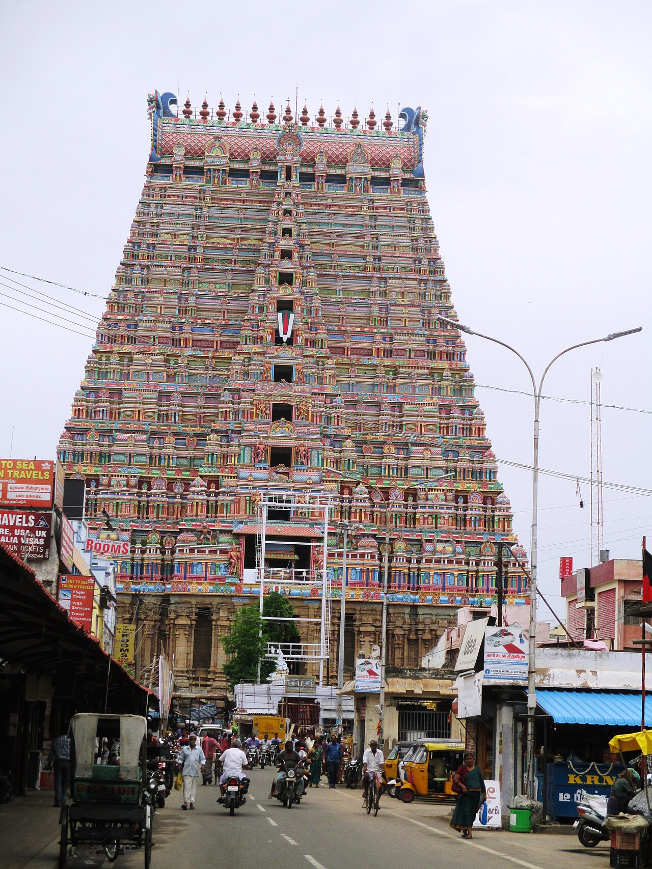
templeRanganathaswamy Temple, Srirangam
Largest functioning Hindu temple complex in the world at 156 acres, dedicated to Vishnu and foremost among the eight self-manifested Vishnu shrines. Its seven concentric enclosures and towering gopurams draw pilgrims year-round.
51.2 km · ~85 min by cab · straight line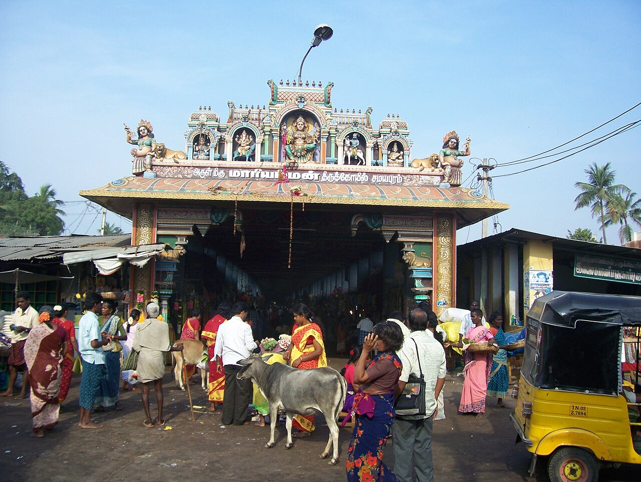
templeSamayapuram Mariamman Temple
Highly popular pilgrimage shrine to Goddess Mariamman, one of the region's major Shakti temples, drawing especially large crowds during the annual Aadi and Panguni festivals.
51.4 km · ~86 min by cab · straight line
templeVekkali Amman Temple
An ancient roofless-sanctum Shakti temple in Uraiyur, the historic capital of the early Chola dynasty, dedicated to the goddess believed to have blessed the Cholas before battle.
51.6 km · ~86 min by cab · straight line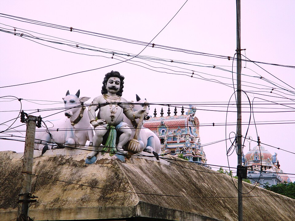
templeUyyakondan Thirumalai Temple (Ujjivanathaswamy)
A Paadal Petra Sthalam Shiva temple built on a rocky hillock beside the Uyyakondan channel of the Kaveri, revered in the 7th-century Tevaram hymns. Shiva is worshipped here as Uyyakondan (Ujjivanathar) with his consort Anjanakshi. The four-acre temple has concentric granite walls and inscriptions recording a crown gifted by the Chola queen Sembiyan Mahadevi.
52.7 km · ~88 min by cab · straight lineOn the map
Where Pachaimalai Hills is
Good to know
Pachaimalai Hills — frequently asked
When is the best time to visit Pachaimalai Hills?
October to March is the cooler, drier season in the Cauvery delta.
What are the entry fee and timings at Pachaimalai Hills?
Entry: Free. Timings: Daylight hours (dawn to dusk).
How do I reach Pachaimalai Hills?
Base yourself in Uppiliyapuram or nearby in Tiruchirappalli, then confirm the last-mile route locally before travel. If access depends on temple, museum or seasonal rules, check on the day before you go.
How much time do I need for Pachaimalai Hills?
About an hour.
What else is near Pachaimalai Hills?
Nearby you can pair Puliyancholai Falls (12.0 km), Prasanna Venkatachalapathy Temple (Gunaseelam) (39.0 km), Mukkombu (Upper Anicut) (41.1 km), Pundarikakshan Perumal Temple (Thiruvellarai) (42.7 km).
Read before you go
Pachaimalai Hills guides, stories & itineraries
We have not published a story about Pachaimalai Hills itself yet. These cover Uppiliyapuram and the wider district, with separate journeys between stops.
Tamil Nadu-wide guides & itineraries
Route-level itineraries and practical guides for the rest of Tamil Nadu.
Neelivaneswarar Temple (Thiruppainjeeli): story and tradition
Story & tradition
Neelivaneswarar Temple (Thiruppainjeeli): story and tradition
4 min read · Read →
Prasanna Venkatachalapathy Temple (Gunaseelam): story and tradition
Story & tradition
Prasanna Venkatachalapathy Temple (Gunaseelam): story and tradition
4 min read · Read →
Pundarikakshan Perumal Temple (Thiruvellarai): story and tradition
Story & tradition
Pundarikakshan Perumal Temple (Thiruvellarai): story and tradition
4 min read · Read →
The story of Nathar Shah Dargah (Nathar Vali Dargah)
Place story
The story of Nathar Shah Dargah (Nathar Vali Dargah)
4 min read · Read →
The story of Uthamar Kovil (Purushothama Perumal Temple)
Place story
The story of Uthamar Kovil (Purushothama Perumal Temple)
4 min read · Read →
The story of Uyyakondan Thirumalai Temple (Ujjivanathaswamy)
Place story
The story of Uyyakondan Thirumalai Temple (Ujjivanathaswamy)
4 min read · Read →