Places to Visit in Chincholi

The forested eastern taluk — the Chincholi wildlife sanctuary and the Chandrampalli dam and backwaters.

Chincholi Wildlife Sanctuary, Chincholi
Practical guide

Plan Chincholi

Who's going?Tailor Chincholi to your trip
DistrictKalaburagi
RoleWildlife & dam base
Time neededOne night
Places to visit2

Chincholi is a taluk headquarters of about twenty-one thousand people on the dry eastern edge of Kalaburagi district, close enough to the Telangana border that its nearest railway station is in another state. The 2011 census counted 20,897 people — 10,852 men and 10,045 women — across roughly 6 sq km, at an average elevation of 462 m. That is plateau country, not hill country, and the distinction governs everything about a visit: the heat, the light, the thin soil and the particular forest that made this taluk worth protecting.

The distance from the district city is quoted three different ways and it is worth knowing which one you are reading. Kannada Wikipedia says about 85 km; Karnataka Tourism publishes 100 km; routed on the real road network from the Kalaburagi bus station to the town itself it is 78 km, and 87 km on to the trek start at Chandrampalli. The spread is not carelessness so much as a large taluk with no single agreed endpoint. Bidar at 60 km is genuinely closer than Kalaburagi, and Hyderabad, at about 162 km on much better road, is the easier approach for most visitors.

Most people arrive for the Chincholi Wildlife Sanctuary, notified in 2011 over 134.88 sq km and described as the first dry-land wildlife sanctuary in South India — that story belongs to the sanctuary’s own page rather than the town’s. What the town is for is the practical business of getting there: it is the last place with hotels, a hospital, fuel and a bus stand before the forest, and the last place to buy water. It is also, quietly, a town that has twice sent someone to the top of Karnataka politics.

What to expect

Highlights

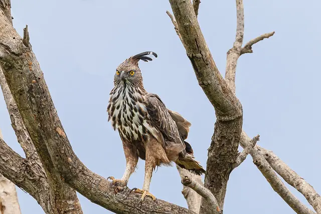
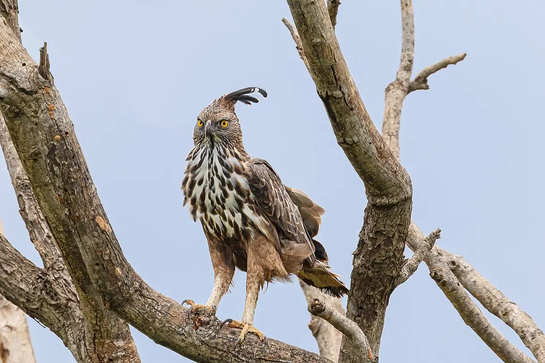
  • Chincholi Wildlife Sanctuary — South India’s first dry-land wildlife sanctuary, notified in 2011 over 134.88 sq km of the district’s eastern taluk — dry and moist deciduous forest with sandalwood and red sanders, where camera traps rediscovered the dhole in 2023, the first record of the species in this region since 1966.
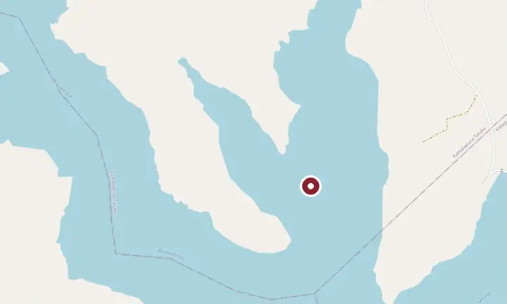
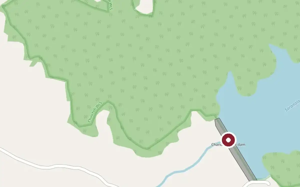
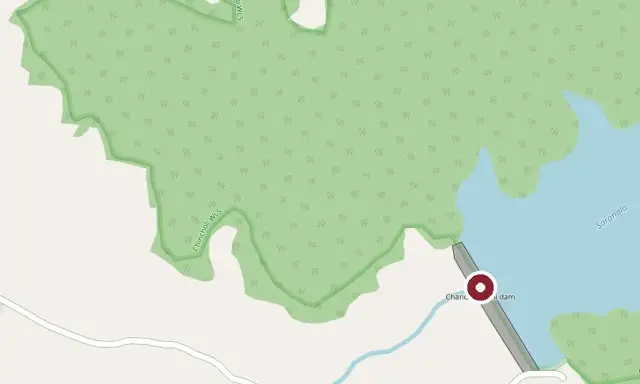
  • Chandrampalli Dam — A 1970s dam across the Mullamari tributary of the Bhima near Chincholi, its reservoir and forested backwaters a scenic day-trip and trekking spot on the edge of the wildlife sanctuary.
Getting there

How to visit

  • Nearest airport: Kalaburagi (GBI), about 65 km; Hyderabad (HYD) at about 163 km has far more flights
  • Rail gateway: Tandur, 31 km across the Telangana border, is the nearest railhead; then Bidar at 62 km and Kalaburagi Junction at 77 km
  • Buses run into Chincholi town from Kalaburagi, Bidar and Humnabad. The last 10 km on to Chandrampalli and the sanctuary is not a bus route — arrange a taxi or auto in the town, and fix the return leg at the same time.

Distance by road

  • Bidar60 km
  • Kalaburagi76 km
  • Hyderabad162 km
  • Solapur204 km
  • Vijayapura227 km
  • Bengaluru589 km

Road distances measured on real routed roads to Chincholi itself, not to the district headquarters, on 24 August 2026. Driving time is deliberately not published: free-flow routing badly understates a Deccan single-carriageway highway, so allow more than the distance suggests.

Timing

Best time to visit Chincholi

October to February, and it is not a close call. This is dry Deccan plateau at 462 m, not hill country — March to May is genuinely punishing, and the June–September south-west monsoon is thinner here than almost anywhere in Karnataka but makes the forest tracks awkward. Mornings are the usable part of any day in this country, in any season.

Weather in ChincholiSeasonal guide

Live forecast loads in your browser.

Today at Chincholi
Sunrise6:07 am
Sunset6:33 pm
Golden hour best light5:33 pm–6:33 pm
Blue hour after sunset6:33 pm–6:58 pm
Sun sets toward compass bearingW · 278°
Moon tonight🌗 Last quarter · 54%
South-west monsoon. June to September is the south-west monsoon in Karnataka. Expect heavy showers, mostly in bursts rather than all day — carry rain cover, allow extra time for getting around, and note that ferries and open-air sites are the first things affected.

Sun and moon are calculated for this location and shown in IST. Photography windows are the hour around sunrise and sunset; the sunset bearing is degrees clockwise from true north. Moon phase is accurate to about half a day.

Visitor notes

  • Chincholi is a service town, not a sightseeing town. There is no monument in it and nothing in it is ticketed — the reason to be here is the sanctuary next door, or a stop between Bidar or Hyderabad and it.
  • Three different distances from Kalaburagi are in print — 85 km, 100 km and 78 km. The 78 km figure is the one routed on the real road network to the town itself; the others measure other things.
  • Kannada is the official language of the town and the working one. Hindi and Urdu are widely understood in this part of the old Hyderabad-Karnataka region; English rather less so than in a Karnataka city.
The story

The story of Chincholi

A dry-country taluk town of twenty-one thousand people, whose railway station is in another state and whose forest is the wrong forest for the Deccan — and which produced a Chief Minister of Karnataka whose sacking, announced on an airport tarmac, changed the shape of the state’s politics for a generation.

Chincholi sits at 462 m on the eastern lip of Kalaburagi district, roughly 6 sq km of town in a taluk that runs to the Telangana line. The 2011 census counted 20,897 people. It borders Sedam and Chittapur inside its own district, Humnabad in Bidar, and Zahirabad and Tandur across the state boundary — and that last fact is the practical one, because the nearest railway station is Tandur, about 30 km away in Telangana, ahead of Sedam at 42 km and Kalaburagi Junction at 77. A town whose closest train is in a neighbouring state tells you most of what you need to know about where it sits.

The town is a small part of the taluk, and the two get conflated. Chincholi town held 20,897 people at the 2011 census; Chincholi taluk held 254,287 across 124 villages, over about 1,550 sq km. So the great majority of the people this town serves do not live in it — they live in those villages, and the town is their market, their bus stand and their taluk office. That is the right way to picture the place: not a destination with a hinterland, but a hinterland with a service town in the middle of it.

The farming is jowar and pulses on black cotton soil, which is what this country grows when the rain is unreliable, and the rain here is unreliable. Water is the recurring local argument rather than a background condition — the two reservoirs, Chandrampalli on the Mullamari and the Nagaral reservoir at the Mullamari lower dam, exist because of it, and summer shortages across the taluk’s villages are a normal feature of the year rather than an emergency. A visitor notices none of this in October and all of it in May.

The land is dry. This is plateau, not ghat: hot from March, properly punishing by May, and dependent on the south-west monsoon that arrives in June and is thinner here than almost anywhere else in Karnataka. The two reservoirs the taluk is known for — Chandrampalli on the Mullamari, a tributary of the Bhima, and the Nagaral reservoir at the Mullamari lower dam — were built to hold what little there is. So the striking thing about Chincholi taluk is not that it is dry but that a substantial deciduous forest survives on it, carrying sandalwood and red sanders and a documented list of medicinal plants, which is what led Karnataka to notify 134.88 sq km of it in 2011 as the state’s twenty-first wildlife sanctuary and the first dry-land sanctuary in South India. The sanctuary is described in the literature as the one area in the old Hyderabad-Karnataka region carrying features of a Western Ghats forest. Its own page tells that story properly, including the 2023 camera-trap rediscovery of the dhole; the town’s job is to be the last place with a hospital, a bus stand, fuel and drinking water before you go in.

The town’s own history is the history of the Deccan’s awkward middle. From 1724 until 1948 this was not part of any Karnataka: it belonged to the Nizam’s Hyderabad State, and the traces the region carries are Satavahana, Rashtrakuta, Kalyani Chalukya, Bahmani and then Asaf Jahi. Hyderabad State was integrated into India in September 1948, and in 1956 the States Reorganisation moved Kalaburagi district into the new Mysore State — two talukas going instead to Andhra Pradesh. That is three sovereignties inside thirty-two years for a town that never moved, and it is the reason the region’s development lag has been treated as a constitutional question rather than merely a budgetary one.

Which brings you to the politics, and to the reason a town this size is worth a paragraph in the history of Karnataka. Veerendra Patil was born in Chincholi on 28 February 1924, when it was still Hyderabad State. He sat in the Hyderabad Legislative Assembly from 1952, was returned from the Chincholi seat in 1957 and 1962, and became Chief Minister of Karnataka twice — from 29 May 1968 to 18 March 1971, and again from 30 November 1989 to 10 October 1990. He was a Lingayat of the Banajiga sub-sect, and in the 1989 election he led the Congress to 178 of the state’s 224 assembly seats, which is among the largest majorities any party has held in Karnataka.

What happened next is the part people still argue about. In October 1990, with communal violence breaking out in parts of the state and Patil recovering from a stroke, the Congress president Rajiv Gandhi announced on the tarmac at Bengaluru’s HAL airport — to reporters who had just raised the Chief Minister’s health with him — that Patil was being replaced. He was: President’s Rule followed, and S. Bangarappa was sworn in. The reading offered by Karnataka’s own press is that the manner of it, more than the fact of it, turned the Lingayat community against the Congress and opened the ground the BJP later occupied in the state. That is an interpretation rather than a document, and we flag it as one; but it is the interpretation carried by the Deccan Herald and by most subsequent accounts, and the electoral record after 1990 is not inconsistent with it. Patil died on 14 March 1997.

Chincholi could not elect another Veerendra Patil today, for a reason worth stating plainly: the constituency, formed in 1951, is now reserved for the Scheduled Castes, which it was not when he contested it as a Lingayat in 1989. It sends its member to the Bidar Lok Sabha constituency and had 203,600 electors at the 2023 state election — an election it decided by 858 votes. Dr Avinash Umesh Jadhav of the BJP took 69,963 votes, or 46.66%; Subhash V. Rathod of the Congress took 69,105, or 46.09%; the margin was 0.57% on a turnout of 73.72%. For a seat whose most famous member commanded 178 of 224, that is a striking amount of distance travelled.

The second political name attached to the town needs a correction, because the Kannada Wikipedia article lists him among Chincholi’s notable people in a way that reads as though he were born here. Vaijnath Patil was not: he was born on 29 July 1938 at Hakyala in Aurad taluk, Bidar district, and settled in Chincholi taluk later. He represented Chincholi in the assembly from 1994 to 1999 and again from 2004 to 2008, sat in the Legislative Council from 1984 to 1990, and held Horticulture under Ramakrishna Hegde and Urban Development under H. D. Deve Gowda. His lasting work was outside office: as president of the Hyderabad Karnataka Horata Samithi he led the movement, over more than a decade, for the special status that became Article 371(J) of the Constitution in 2013 — reservations in education and employment for the region and a Kalyana Karnataka Region Development Board covering Bidar, Ballari, Kalaburagi, Raichur, Koppal and Yadgir. One small caution on the published record: the two Deccan Herald reports of his death give his age as 81 and as 82, so we have not printed a figure.

So the honest summary of Chincholi is this. It is not a sightseeing town and nothing in it is a monument. It is the service town for a forest that has no business being as good as it is, and it is a place whose twentieth-century politics reached a long way past its size. Both of those are reasons to know what you are looking at while you are here, and neither is a reason to stay longer than the sanctuary needs.
More about Chincholi

History

1724–1948 — part of the Nizam’s Hyderabad State, formed as the Mughal empire receded under Nizam-ul-Mulk, Asaf Jah I.

September 1948 — Hyderabad State is integrated into India.

1951 — the Chincholi assembly constituency is formed.

1956 — the States Reorganisation places Kalaburagi district in the new Mysore State; two talukas of the old district go to Andhra Pradesh instead.

28 February 1924 – 14 March 1997 — Veerendra Patil, born in Chincholi, twice Chief Minister of Karnataka (1968–71 and 1989–90).

2011 — Karnataka notifies 134.88 sq km of the taluk as the Chincholi Wildlife Sanctuary, the state’s twenty-first and the first dry-land sanctuary in South India.

2013 — Article 371(J) grants special status to the Kalyana Karnataka region after a decade-long campaign led by Vaijnath Patil, twice the member for Chincholi.

2023 — the assembly seat is decided by 858 votes out of 203,600 electors.

Why visit

It is the working base for the Chincholi Wildlife Sanctuary and the Chandrampalli trek start, and the last town with a hospital, fuel, hotels and drinking water before either.

It is a good place to understand the Kalyana Karnataka region on its own terms — a town that was in Hyderabad State until 1948 and whose development lag became a constitutional amendment in 2013.

Bidar, 60 km away, and Hyderabad, 162 km, are both easy from here, which makes Chincholi a plausible stop rather than a destination in itself.

Before you go

Chincholi — at a glance

Getting here

How to reach Chincholi

  • ✈︎ By air Kalaburagi (GBI) is the nearest airport, quoted between 65 and 80 km. Hyderabad (HYD) at about 162 km has far more services and is the practical arrival for most visitors, at roughly three and a half hours by road.
  • 🚆︎ By train Tandur is the nearest station at about 30 km, and it is in Telangana — worth knowing before you book, because a search for "trains to Chincholi" will not surface it. Sedam is about 42 km, Bidar 62 km, Kalaburagi Junction 77 km. From any of them the last leg is by road.
  • 🚗︎ By road From Kalaburagi it is 78 km to the town, roughly an hour and a half on single-carriageway road; the trek start at Chandrampalli is 87 km. From Bidar it is 60 km, and from Hyderabad about 162 km — the Hyderabad approach is the better road and, for anyone flying in, usually the sensible one. Distances routed on the real network on 24 August 2026.
  • 🚌︎ By bus KSRTC and private buses run into Chincholi from Kalaburagi, Bidar and Humnabad, and there are services towards the neighbouring state. The bus stand is where local taxis and autos are found. 🛑 The last 10 km from the town out to Chandrampalli and the sanctuary is not a bus route.
Getting around

Getting around Chincholi

The town itself is small enough to walk — roughly 6 sq km, flat, and most of what a visitor needs sits along the main road near the bus stand. Everything beyond the town is a vehicle problem, not a walking one: the sanctuary trek start at Chandrampalli is about 10 km out, and the other taluk sites (the Nagaral reservoir, Etti Potta, Gottamgotta) are further and are not served by anything scheduled. The practical arrangement is an auto or a taxi hired at the bus stand for the half-day or the day, agreed as a return trip.

  • 🚕︎ Online taxis Do not plan on Uber or Ola here. Chincholi is a taluk town of about twenty-one thousand people and ride-hailing coverage in this part of Kalaburagi district is not something to depend on; treat the local auto and taxi at the bus stand as the only reliable option, and fix the return leg when you fix the outward one. This matters more than usual because the 10 km out to Chandrampalli has no bus and very little passing traffic.
Getting back

Work out your return before you settle into the day. Services in Karnataka thin out sharply in the evening, and Chincholi is easier to reach than to leave once the last long-distance bus has gone. We do not publish departure times: there is no official live feed we are permitted to republish, and a wrong time here would strand you. Check the operator directly on the day.

Ask at the bus stand for the time of the last service back, not the next one. If you miss it, an auto or a taxi is the fallback — agree the fare before you get in.

Do

Things to do in Chincholi

  • Walk in the Chincholi Wildlife Sanctuary — the 4 km circuit or the 8–9 km route to Gottamgotta, by booked permit only, reporting at Chandrampalli between 6.00 and 6.30 am.
  • The Chandrampalli reservoir and its forested backwaters, about 10 km from the town on the Mullamari.
  • The Nagaral reservoir at the Mullamari lower dam.
  • Etti Potta waterfall — seasonal, and the local accounts are consistent that you need someone who knows the way rather than a map.
  • Sukshetra Buggi, listed in the district’s own tourism material among the taluk’s sites.
Plan

Good to know

  • Buy your water in the town. This is the single most repeated piece of advice about visiting the sanctuary and it is a town-level instruction, not a forest-level one.
  • Fix the return leg of any taxi or auto at the same time as the outward leg.
  • If you are booking trains, search Tandur, not Chincholi — and remember it is a Telangana station.
  • Start early. In this country the usable hours are the first ones, and that is true of the town as well as the forest.
Facilities

On site

  • Hotels in the budget range, a bus stand, fuel and a hospital — the last of each before the forest.
  • Shops for water and food. 🛑 Nothing is sold past the town on the way to Chandrampalli; carry what you will need.
Stay safe

Safety

  • Dry-country heat is the real hazard here, not terrain. March to May is severe and the thin air of the plateau disguises how much water you are losing.
  • Phone signal thins out quickly once you leave the town, and is patchy inside the forest.
  • The nearest hospital is in the town itself; anything serious means Kalaburagi, about an hour and a half away.
Getting around ChincholiPartly wheelchair accessible
Terrain
Flat and paved
From the entrance
The town is flat and compact — roughly 6 sq km on level plateau at 462 m, with the bus stand, the hotels, the hospital and the shops along and just off the main road. Getting around the town on foot is not the difficulty; getting anywhere outside it without a vehicle is.
Step-free access
The town’s own streets are flat, which is genuinely helpful, but surfaces are ordinary small-town Karnataka — kerbs, broken edges and no dropped crossings — and we have not assessed any individual building. What we can say without hedging is that the Chincholi Wildlife Sanctuary, which is the reason most people come, is a guided forest walk on rocky, thin-soiled ground and is not wheelchair accessible.
Prams
Fine within the town on the flat. Not on the sanctuary trails.
  • Dry heat is the main hazard from March to May, and there is no shade to speak of on the approach roads.
  • No bus covers the 10 km between the town and the Chandrampalli trek start, so anyone with limited mobility needs a vehicle arranged both ways.

Checked 24 August 2026 against source 1source 2. Conditions change and surfaces vary with weather — if step-free access is essential, confirm with the site before you travel.

If you need help at Chincholi
112All emergencies (police · fire · medical)The single number to call in any emergency (ERSS).

Emergency numbers are verified against official government and state tourism sources. 112 works anywhere in India.

Nearby bases

Where to go from Chincholi

Chincholi is the forest-and-dam base at the eastern edge of Kalaburagi district, and it is a short town: use it for the sanctuary and the Chandrampalli reservoir, then pick a direction. Kalaburagi city, 78 km west, holds the Bahmani fort, the Jama Masjid and the Khwaja Bande Nawaz dargah; Sannati and Malkhed sit beyond it for the Kanaganahalli stupa and the Rashtrakuta capital; Ganagapur is the Dattatreya pilgrimage town. Bidar, 60 km north, is a different district and the better day out of the two.

In the district

Where Chincholi sits in Kalaburagi district

District HQKalaburagi
LandscapeKalyana-Karnataka Deccan district on the Bhima and Kagina rivers, ~450 m

Kalaburagi district is known for: The Bahmani Gulbarga Fort and Jama Masjid, the Haft Gumbaz tombs, the Khwaja Bande Nawaz dargah and Sharana Basaveshwara temple, the Kanaganahalli Buddhist stupa at Sannati, the Rashtrakuta capital of Malkhed and the Dattatreya town of Ganagapur.

Gulbarga FortKhwaja Bande Nawaz DargahKanaganahalli Buddhist Stupa
Stay · eat · do · rent · see · shop

Places in Chincholi

Every verified place in Chincholi — filter by what you’re after.

Verified inventory is being added here.

Verified places are being added. The category filters will fill in as approved stays, restaurants, experiences, sights, shops and nature listings go live.

List your place
For hotels, homestays and local businesses

Get listed in Chincholi for free

Roampedia is commission-free. Travellers discover your business, book directly and contact you through official details. Basic listings are free, while Gold and Platinum package upgrades can be requested from the owner dashboard after approval.

List your business — free
Read before you go

Chincholi guides, stories & itineraries

Stories & history of Chincholi

Written about Chincholi itself — its history, its legends and the arguments about them.

Nearby in Kalaburagi

Wider reading from Kalaburagi. The stories about Chincholi itself are above.

See all 7 Kalaburagi guides & stories →

Map

Where things are in Chincholi

FAQ

Chincholi travel FAQs

Is Chincholi worth a stay in its own right?

Honestly, no — not as sightseeing. There is no monument in the town and nothing in it is ticketed. It is worth a night if you are walking in the Chincholi Wildlife Sanctuary the next morning, because the trek start at Chandrampalli is about 10 km further on and you want to be reporting there between 6.00 and 6.30 am. Otherwise it is a stop on the way between Bidar or Hyderabad and the sanctuary rather than a place to build a trip around.

How far is Chincholi from Kalaburagi, really? I have seen three different numbers.

All three are in circulation and they measure different things. Kannada Wikipedia gives about 85 km, Karnataka Tourism publishes 100 km, and routed on the real road network on 24 August 2026 it is 78 km from the Kalaburagi bus station to Chincholi town, and 87 km on to the trek start at Chandrampalli. Use 78 km for the town and allow about an hour and a half. Note also that Bidar at 60 km and Hyderabad at 162 km are both perfectly reasonable approaches, and Hyderabad is on the better road.

Which is the nearest railway station to Chincholi?

Tandur, about 30–31 km away — and it is in Telangana, not Karnataka, which catches people out when they book. Sedam is about 42 km, Bidar 62 km and Kalaburagi Junction 77 km. For flights, Kalaburagi (GBI) is the nearest at roughly 65–80 km depending on which source you read, but Hyderabad (HYD) at about 162 km has far more services and is usually the practical choice.

Do Uber and Ola work in Chincholi?

Do not plan on it. Chincholi is a taluk town of about twenty-one thousand people and app-cab coverage in this part of Kalaburagi district is not something to rely on; the working arrangement is a local taxi or auto hired at the bus stand, and the important part is to fix the return leg at the same time you fix the outward one. The last 10 km from the town to Chandrampalli is not a bus route, so if you go out there without arranging the way back you may be walking it.

Who was Veerendra Patil, and why is he attached to this town?

He was born in Chincholi on 28 February 1924 and was twice Chief Minister of Karnataka, from 29 May 1968 to 18 March 1971 and from 30 November 1989 to 10 October 1990. In the 1989 election he led the Congress to 178 of 224 assembly seats. In October 1990, while he was recovering from a stroke, Rajiv Gandhi announced his replacement to reporters on the tarmac at Bengaluru’s HAL airport; President’s Rule followed and S. Bangarappa succeeded him. Karnataka’s press generally reads that episode as the moment the Lingayat community turned away from the Congress. He died on 14 March 1997.

Is there a temple legend or founding story for Chincholi?

We could not find one, and we would rather say so than invent one. Searched on 24 August 2026 in English and in Kannada: neither Wikipedia article records a founding tradition, a name origin or a temple legend for the town, and the district material does not either. The taluk does have sites people visit — Sukshetra Buggi, the Etti Potta waterfall, Gottamgotta and the Nagaral and Chandrampalli reservoirs — but we have not seen a documented legend attached to any of them that we are willing to print as one.

What are the best places to visit in Chincholi?

Top places to visit in Chincholi include Chincholi Wildlife Sanctuary, Chandrampalli Dam — each has a full guide with how to reach it and what to see nearby on this page.

How do I reach Chincholi?

The nearest airport to Chincholi is Kalaburagi (GBI), 12 km east of the city centre and 16 km by road from the fort, but with only one route; Hyderabad (HYD), ~231 km by road, is the practical one. The rail gateway is Kalaburagi Junction (KLBG) on the Mumbai–Chennai line, with Wadi a major junction nearby. NH-150 and NH-50; KSRTC and private buses from Hyderabad (~231 km), Solapur, Vijayapura and Bidar; a car is best for Sannati, Malkhed and Ganagapur.

What is the best time to visit Chincholi?

October to February is the coolest, most comfortable season to visit Chincholi and the rest of Karnataka. March to May is hot on the plains, and the June–September southwest monsoon brings the main rains, heaviest along the coast and Western Ghats.

Photographs: Hari K Patibanda, CC BY 2.0, via Wikimedia Commons (CC BY 2.0). Wikimedia Commons.

Image credits