Gulbarga Fort

The citadel of the first Bahmani capital, held from 1347 to 1424, and the largest monument in Kalaburagi. The Archaeological Survey of India’s board at the gate gives it 74.10 acres inside a three-kilometre circuit, two rings of wall with the inner one higher than the outer, a moat thirty feet deep, fifteen bastions and twenty-six guns — one of them about twenty-nine feet long.

Gulbarga Fort, Kalaburagi
Practical guide

Plan Gulbarga Fort

Who's going?Tailor Gulbarga Fort to your trip
Typefort
Nearest baseKalaburagi
DistrictKalaburagi
Best timeNovember to February
Time neededTwo hours does it properly
EntryFree
Places to visit8Listed businesses52

The fort and the great Jama Masjid standing inside it are listed together as one Monument of National Importance, N-KA-D257. Nothing here is ticketed or interpreted: two signboards, a keep you can climb, an extraordinary 1367 mosque, ruins under vegetation, and a settlement that a High Court has been trying to move since 2019.

The story

A moated Bahmani citadel in the middle of a working north Karnataka city — seventy-four acres of double wall, fifteen bastions and twenty-six cannon, with one of the strangest great mosques in India standing inside it and, at the last count put before the High Court, two hundred and eighty-two families living in the ruins.

The story of Gulbarga Fort

You reach it from the east, over a concrete bridge where a wooden drawbridge used to be. Below you is the moat — still there, thirty feet deep by the Archaeological Survey of India’s own reckoning, and today green from bank to bank with water hyacinth. Above it the wall rises in two lines, the outer one lower and the inner one high, with battlemented bastions standing out of both. That double circuit is the whole idea of the place: this was not a hill fort using a hill, it was a flat-country fort that had to make its own height, and it did it twice over.

Straight through the gate, and unmissable, is the Bala Hisar. Locally it is Ranamandal, and that is the name on the Kannada half of the board beside it. It is a great blunt block of masonry with almost no openings in it, and the board explains why: it was probably begun as a vaulted audience hall and then deliberately filled in, packed solid, to make an elevated keep. The dilapidated interior sits high off the ground, which is the evidence. A flight of steps on the north side takes you up onto the top, and up there are three cannon — the only three of the fort’s twenty-six you can walk up to and put a hand on.

That climb is the reason to come. From the top of the Ranamandal the fort lays itself out beneath you: the line of the walls, the bastions, the ruined ground, and south-west of you the long low roof of the Jama Masjid, which is a building you cannot understand from ground level at all. Beyond the walls, Kalaburagi — a busy, unplanned, traffic-heavy city that grew up around a monument it has never quite decided what to do with.

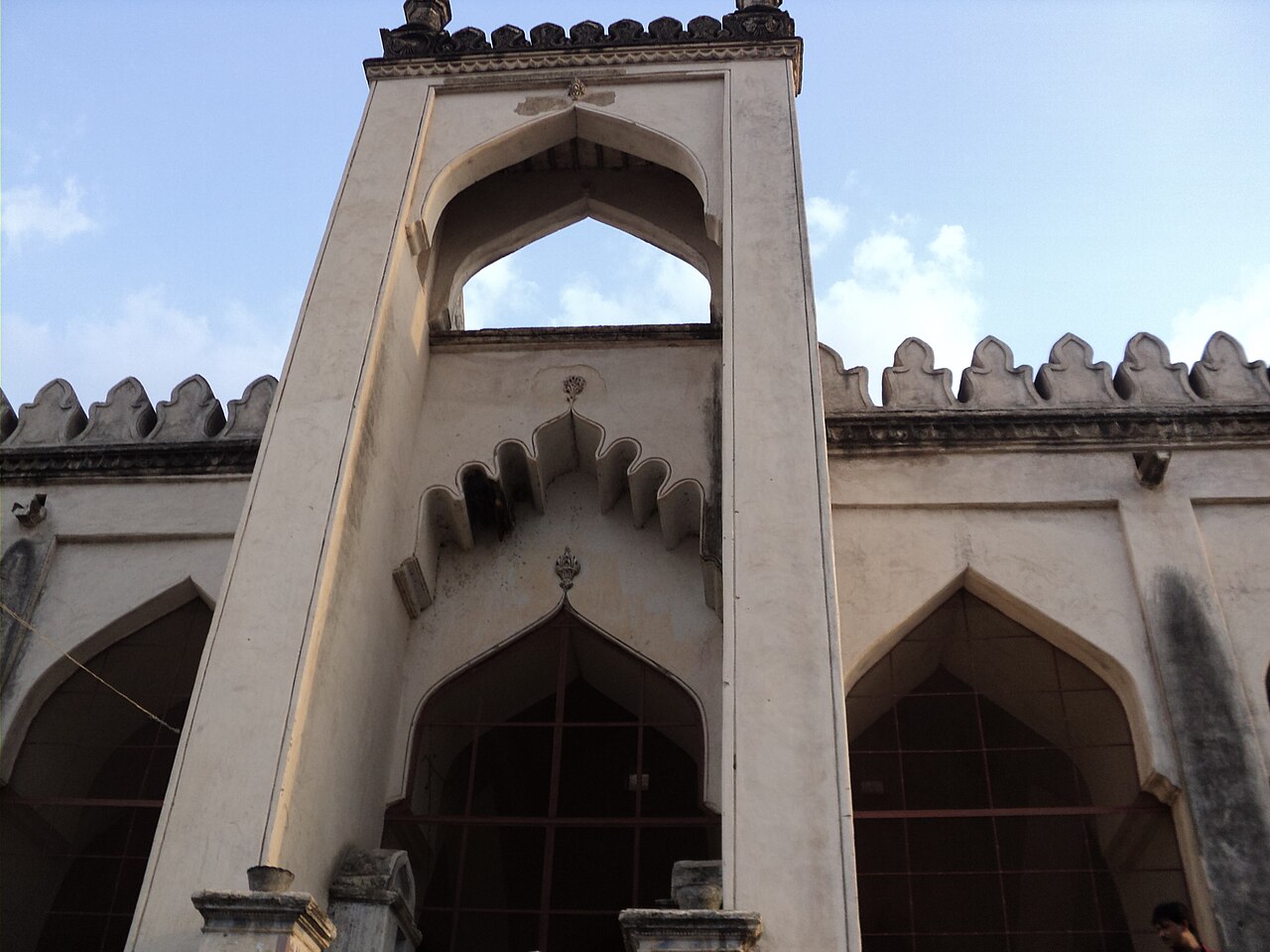
The Jama Masjid is the reason art historians come. It was finished in 1367, one of the earliest Friday mosques in South India, and it is built the wrong way round. A mosque of that period has an open courtyard with arcades round it; this one has no courtyard at all. The space where the courtyard should be is roofed over with small domes, and the outer walls, which would normally be solid, are opened out into low arcades instead, so that the daylight a courtyard would have let in comes in sideways through the arches. Only the qibla wall, on the west, is closed. The effect from inside is a forest of wide, low, interlocking arches on stout piers, running away from you in every direction.

How many domes it has depends on who is counting, and nobody counts the same. The district’s own page and the older reference works say five large domes and seventy-five small ones over two hundred and fifty arches. The Wikipedia article on the mosque itself says sixty-three small domes over the courtyard space. A traveller who went round it in July 2026 counted the lot — one great dome over the mihrab, four at the corners, ten boat-shaped domes down each of the north and south sides and seven along the east, and seventy-five small ones filling in the rest — and got a hundred and seven. We give you all three rather than pick one.

The comparison you will read everywhere is with the Great Mosque of Córdoba, and it is worth being careful with. It is repeated by Karnataka Tourism, by the district administration and by most of the guidebooks, and the resemblance people mean is real enough — the many-columned hall, the repeating arches, the sense of a covered field rather than a room. But it is a description of an effect, not a documented line of influence, and the mosque’s own explanation of itself is nearer to hand: it was built to mark Gulbarga becoming a capital, and it was built by a Persian architect named Rafi, and it is the first thing in the Deccan to do what it does. The wide, stretched arch it experiments with went on to become a signature of Deccani building.

North of the Jama Masjid and west of the keep is the Choti Masjid, a small three-domed mosque with three pointed arches on its east face, and behind both of them a large unnamed bastion which is said to hold the twenty-nine-foot cannon the ASI board mentions — the Bara Gazi Toph, the twelve-yard gun. It was closed for repair through the summer of 2026, and so was the ground around it, which is where the royal buildings stood.

The rest of the fort is the difficult part, and it is the part no other page about this place will tell you. Inside the walls of a Monument of National Importance there is a settlement. Houses have been built into and against the historic structures; other buildings have simply disappeared under vegetation. A public interest petition filed in 2018 put the number of illegal occupants at a hundred and ninety-four, from a Right to Information reply of 2011. By January 2025, when the Karnataka High Court took the authorities apart for having ignored its own five-year-old order, the state’s advocate was talking about rehabilitating two hundred and eighty-two families. Nobody disputes that people live there. What is disputed is whether anything is being done about it.

Two more things are worth knowing before you go, because they change what you are looking at. The first is a photograph. Some time in the 1880s Lala Deen Dayal — the Hyderabad court photographer, and the best-known Indian photographer of the century — set up a plate camera here and took the great mosque from a rise. In his picture the building stands almost alone in an open field of rubble and broken wall, with nothing growing on it and nothing built up against it. Compare it with what is in front of you and you can see exactly what a hundred and forty years of neglect and occupation have added.

The second is that this was not the only capital the Bahmanis built on this plateau, or even the only one they abandoned. Thirty-three kilometres south-west by road, on the Bhima, Sultan Firoz Shah laid out a walled pleasure-capital called Firozabad around 1400 — mosque, palace, gateways, the lot — and it is now a quiet field of ruins that almost nobody visits. Gulbarga at least kept its city. The dynasty had a habit of building somewhere magnificent and then moving on, and in 1424 it did it again, to Bidar, for good.

So this is not a swept, ticketed, interpreted monument, and you should not arrive expecting one. It is a very large piece of fourteenth-century military engineering with a city inside it, free to walk into, with two information boards, no guides, no cafe, almost no shade, and a horse-drawn tonga or two carrying local families round the ruins. What it has instead is scale, an extraordinary mosque, a keep you can climb, and the particular quiet of somewhere that has not been tidied up for you.

Legend & myth

The founding legend of the dynasty that built this fort is one of the best known in the Deccan, and the historians do not believe a word of it.

As Ferishta tells it, writing in the seventeenth century, the man who became Ala-ud-din Bahman Shah began as Hasan, a servant in the household of a Brahmin of Delhi named Gangu. Gangu treated him well — educated him, and in time made him a general. When Hasan rose to a throne of his own in the Deccan in 1347 he took his patron’s name with him: Hasan Gangu, and, in the popular telling, a dynasty called Bahmani because it was really Brahmani, named for the Brahmin who had made him.

It is a story with everything a founding legend needs — the loyal servant, the generous master, the debt honoured from a throne. It has also never been corroborated. Satish Chandra, R. C. Majumdar and S. Bhattacharya all record it and all record that no independent evidence for Gangu, or for the connection, has ever been found. The likeliest reading is that "Gangu" is a corruption of something else in Hasan’s own name and the story grew up afterwards to explain it.

What the Bahmanis themselves claimed was grander and older. They traced their line to the Sasanian kings of Persia — to Bahman, not to any Brahmin — and they put the claim into the buildings. On the crowns of the arches they raised, here and elsewhere, there is a crescent and sometimes a disk, read as the emblem of a Sasanian royal crown. You can find them inside these walls. Whether that lineage is any truer than the other story is not the point; what it tells you is what a new sultanate 1,250 km from Delhi wanted to be seen as descending from.

And there is a third name in the ground beneath both. The fort is older than the sultanate: the ASI’s board credits its first building to Raja Gulchand, a chieftain under the Kakatiyas of Warangal, and local tradition holds that the town of Gulbarga was named for him. It is the sort of attribution that is impossible to prove and equally hard to dislodge, and it sits on a signboard at the gate with the word "probably" doing a great deal of work.

Read the full history of Gulbarga Fort 908 more words

History

Before the Bahmanis. The region passes through the Rashtrakutas, the Chalukyas, the Kalachuris of Kalyani, and then the Yadavas of Devagiri and the Hoysalas. By the thirteenth century the Kakatiyas of Warangal hold this country, and it is under them — as the ASI’s board at the gate puts it, "probably" — that Raja Gulchand builds the first fort here, a stone-and-mud outpost. Kakatiya power is broken in 1321 and the northern Deccan passes to the Delhi Sultanate.

1347. The Muslim officers Delhi had posted to the Deccan revolt against Muhammad bin Tughluq. Their leader is crowned as Ala-ud-din Bahman Shah, and he chooses Gulbarga for his capital, renaming it Ahsanabad. The old outpost is rebuilt into what you see: a double-walled, moated fort of about 74 acres with a three-kilometre circuit, fifteen bastions and, in the middle, a citadel — the Bala Hisar.

1367. The Jama Masjid is built inside the walls, under Sultan Muhammad Shah I, to mark the founding of the capital. The architect named in the tradition is a Persian, Rafi. It is one of the first Friday mosques in South India and the only one of its kind in the country.

1424. Ahmad Shah Wali, the ninth Bahmani ruler, moves the capital to Bidar. Gulbarga has been the seat of the sultanate for seventy-seven years, and never will be again. The Bahmani kingdom itself breaks up in the early sixteenth century.

The Adil Shahis. The fort passes to Bijapur, and the governors posted here carry out repairs. The ASI board makes the point explicitly: the Bala Hisar survives, when almost every other building inside the walls does not, because of Adilshahi renovation work.

1687 onwards. Aurangzeb takes the fort. The Mughal governor of the Deccan, Asaf Jah, makes himself independent in 1724, and Gulbarga becomes part of the Nizam’s Hyderabad State — which is why this is Kalyana Karnataka and not old Mysore, and why the city’s cooking, speech and street life still read as Deccani rather than southern. Hyderabad State is annexed to India in 1948; in 1956 the states are redrawn on language and most of Gulbarga district goes to Mysore State, later Karnataka.

1880s. Lala Deen Dayal photographs the great mosque, and the plate survives: the building standing in an open field of rubble, unencroached, with the fort walls beyond. It is the earliest clear record we have of what the inside of these walls looked like.

2014. Two things happen. In November the city is officially renamed: Gulbarga, Persian for a city of flowers and gardens, becomes Kalaburagi, Kannada for stony land — the same place described by its two histories. And the fort, with the mosque inside it, goes onto UNESCO’s tentative list of World Heritage sites as part of "Monuments and Forts of the Deccan Sultanate", alongside Bidar, Bijapur and Golconda. It has been sitting on that tentative list ever since.

2018 to 2025. A public interest petition over encroachment inside the protected area reaches the Karnataka High Court, citing a 2011 Right to Information reply that named 194 illegal occupants. The court orders removal on 8 November 2019. Five years later nothing has been filed, and on 6 January 2025 a division bench of Chief Justice N V Anjaria and Justice K V Aravind says the authorities’ conduct "cuts a sorry figure", orders personal affidavits by 25 February and tells the ASI to file a pictorial account of what it is doing to protect the monument. The state’s own advocate speaks of rehabilitating 282 families. We have not been able to find any reported outcome after that hearing.

Why visit

For the climb up the Ranamandal, which is the single best thing here. Five minutes of steps buys you the whole fort from above — the double wall, the bastions, the hyacinth-green moat, and the roof of the Jama Masjid spread out below like a diagram of itself. And three fourteenth-century cannon to stand beside at the top, which is three more than you get anywhere else in these walls.

For a mosque built inside out. Roofing over the courtyard and opening up the outer walls is not a variation on the standard plan, it is an inversion of it, and there is nothing else quite like it in India. Go inside and walk it rather than photographing the outside: the point of the building is the sightlines down the arcades, and those only exist from within.

Because it is the first Bahmani capital, and the Deccan sultanates are the part of south Indian history that gets skipped. Hampi is forty minutes from every itinerary; the kingdom Hampi spent two centuries fighting is barely on them. If you have been to Bidar or Bijapur, this is where that story starts.

For the honest state of it. Nothing here is restored for visitors, nothing is roped off and explained, and the ruins have people living in them. That is a real thing to see and think about at a Monument of National Importance, and it will not be true for ever — a court is pushing, slowly, the other way.

And because it costs nothing and asks nothing. No ticket, no queue, photography allowed, a couple of hours at your own pace, ten minutes from the middle of the city. Pair it with the Haft Gumbaz tombs and the echoing Chor Gumbad and you have a half day that most people driving between Hyderabad and Bijapur never stop for.

What to expect

Highlights

  • The Bala Hisar, locally Ranamandal — a solid packed keep you climb by a staircase on its north side, with three of the fort’s twenty-six cannon on top and the whole fort laid out below.
  • The Jama Masjid of 1367: no courtyard at all, the courtyard space roofed with domes and the outer walls opened into arcades instead. Published dome counts run from sixty-three to a hundred and seven.
  • The double wall, the battlemented bastions and the thirty-foot moat, crossed today by a concrete bridge where a drawbridge used to be.
  • The Choti Masjid, a small three-domed mosque west of the keep, and the crescent-and-disk emblems on the arch crowns that the Bahmanis borrowed from Sasanian royal crowns.
Getting there

How to visit

  • In the middle of Kalaburagi, entered by the eastern gate. Kalaburagi Junction is 4.2 km by road and the main KSRTC bus station 3.7 km; the local Super Market Bus Stand is a few minutes’ walk from the gate. Kalaburagi airport is 16 km, about twenty minutes.
  • There is no ticket and no gate charge, and photography is allowed. Nobody publishes an official opening time; visitors report roughly 9 am to 5 pm, and the Ministry of Tourism’s own page gives 9.00 am to 5.30 pm.
  • Go in the morning. The ground inside is open and almost entirely unshaded, and the arcade light in the mosque is better early.
  • Pair it with the Haft Gumbaz tombs, 2.1 km away, and the Chor Gumbad, 4.2 km. One traveller reported ₹600 for a half-day auto covering exactly that circuit in July 2026 — a benchmark to negotiate against, not a fixed rate.

Distance by road

  • Solapur138 km
  • Bidar118 km
  • Vijayapura149 km
  • Hyderabad232 km
  • Bengaluru610 km

Road km to Kalaburagi; ghat roads and traffic vary — allow extra.

Timing

Best time

November to February. This is dry, drought-prone country and summer here is severe — 45°C has been recorded, there is no shade inside the walls and the stone holds heat. Between March and May, go at first light or not at all.

Weather in Gulbarga FortSeasonal guide

Live forecast loads in your browser.

Today at Gulbarga Fort
Sunrise6:09 am
Sunset6:35 pm
Golden hour best light5:35 pm–6:35 pm
Blue hour after sunset6:35 pm–7:00 pm
Sun sets toward compass bearingW · 278°
Moon tonight🌗 Last quarter · 54%
South-west monsoon. June to September is the south-west monsoon in Karnataka. Expect heavy showers, mostly in bursts rather than all day — carry rain cover, allow extra time for getting around, and note that ferries and open-air sites are the first things affected.

Sun and moon are calculated for this location and shown in IST. Photography windows are the hour around sunrise and sunset; the sunset bearing is degrees clockwise from true north. Moon phase is accurate to about half a day.

Visitor notes

  • The Jama Masjid is still the working Friday mosque of the town. Dress modestly, remove footwear, and keep clear at prayer times.
Safety

Good to know

  • The ground inside the walls is genuinely rough — rubble, old foundations, thick vegetation over the ruins and no marked path. Wear shoes you can turn an ankle in safely, and do not walk it in sandals.
  • The staircase up the Bala Hisar has no handrail and the top is an open platform with no barrier at the edge. Take it slowly, hold on to children, and do not go up it in the wet.
  • There is almost no shade anywhere inside, and this is one of the hottest cities in Karnataka. Carry your own water — nothing is sold inside the walls.
  • Do not climb on the walls, the bastions or the cannon. Sections are unrepaired and some of the masonry is loose.
  • Families live inside the fort. Their homes are homes, not part of the ruin — do not photograph people or doorways without asking.
  • Nothing inside is lit and there is no staff presence after dark. Be out by dusk.
  • The moat is covered in water hyacinth, which looks like solid green ground and is not. Stay on the bridge and behind the wall line.
  • Parts of the fort close without notice for repair — the bastion holding the long cannon and the old royal ground were both shut through mid-2026.
  • The nearest hospitals are a few hundred metres outside the walls and the district government hospital is about 1.5 km away.
Stay · eat · do · rent · see · shop

Stays, food & things to do near Gulbarga Fort

Verified hotels, homestays, restaurants, experiences, sights, shops and rentals around Gulbarga Fort — commission-free, with direct contact. Filter by what you need.

M
Maharaja Hotel
Where to eat
Top pick
Restaurant
Maharaja Hotel
1.0 km · 12 min walk Closed now chinese, indian 3-star

The nearest sit-down meal to Gulbarga Fort — a twelve-minute walk from the gate, in the Super Market bazaar. In this part of the Deccan 'hotel' on a board means an eating house, not a place to sleep. The opening hours shown here are from OpenStreetMap rather than from the restaurant, so treat them as a guide and not a guarantee.

Directions Commission-freeView details
G
Gulbarga Residency
Place to stay
Top pick
Stay
Gulbarga Residency
3.7 km · 5 min drive 3-star

A motel on the southern, station-facing side of the city, roughly 3.7 km from the fort by road. Useful if you are arriving late at Kalaburagi Junction; we could not verify its tariffs or whether it takes walk-ins.

Directions Commission-freeView details
J
Janata Cream Parlour
Where to eat
Top pick
Restaurant
Janata Cream Parlour
4.4 km · 5 min drive regional

An ice-cream and cold-drinks parlour about 4.4 km by road from the fort. The kind of place that matters more than it sounds in a city where 45°C has been recorded.

Directions Commission-freeView details
C
Cafe Coffee Day
Where to eat
Top pick
Café
Cafe Coffee Day
2.1 km · 26 min walk coffee shop

Cafe Coffee Day outlet about 2.1 km from the fort, on the newer commercial side of town. Air conditioning and a predictable coffee, which after two hours on unshaded fort ground is not nothing.

Directions Commission-freeView details
P
Planetarium
Sight
Top pick
Museum
Planetarium
2.2 km · 26 min walk

Planetarium in the science-centre grounds about 2.2 km north of the fort. Show times are not published anywhere we could find — ask at the science centre gate rather than travelling out on spec.

DirectionsView details
C
Cloth Bazaar Ladies
Shop
Clothes
Cloth Bazaar Ladies
1.0 km · 12 min walk Closed now

Cloth shop in the bazaar quarter about twelve minutes' walk from the fort. Everyday local textile retail rather than a craft purchase; bidriware, which the tourism copy often attaches to Kalaburagi, is properly from Bidar, 118 km north. The hours shown are from OpenStreetMap, not from the shop.

Directions Commission-freeView details
S
SRINIVAS SILKS & SAREES
Shop
Yes
SRINIVAS SILKS & SAREES
1.1 km · 13 min walk

Silk and saree shop about 1.1 km from the fort, in the old commercial streets between the fort and the town centre. Ordinary local trade; we found no published hours from the business.

Directions Commission-freeView details
B
Big Bazar
Shop
Supermarket
Big Bazar
1.7 km · 20 min walk

A general store about 1.7 km from the fort in the town-centre retail stretch. Everyday shopping for people who live here; not related to the national chain of a similar name as far as we can establish.

Directions Commission-freeView details
R
Ranga Mandir
Sight
See
Ranga Mandir
2.2 km · 27 min walk

The town's public auditorium, about 2.2 km from the fort — the venue for civic functions, drama and music, and a landmark half the hotel addresses in Kalaburagi are given in relation to. Nothing is published about its programme online that we could verify.

DirectionsView details
D
D Mart
Shop
Supermarket
D Mart
3.3 km · 4 min drive Closed now

D Mart superstore about 3.3 km by road from the fort, on the newer southern side. Listed for what it is — the reliable place to buy water and supplies in bulk before a day out at Chincholi or Sannati. The hours shown come from OpenStreetMap rather than from the store.

Directions Commission-freeView details
G
Goli Vada Pav No.1
Where to eat
Restaurant
Goli Vada Pav No.1
4.0 km · 5 min drive chinese, ice cream

Outlet of the Goli Vada Pav chain, about 4 km from the fort — a cheap fast-food counter built on a Maharashtrian street snack, which tells you something about which way the cultural traffic runs in this corner of Karnataka. The cuisine labels on this card come from OpenStreetMap rather than from the chain.

Directions Commission-freeView details
H
Hotel Central Park
Place to stay
Hotel
Hotel Central Park

On the GESCOM stretch of Station Road, the hotel belt that runs between Kalaburagi Junction and the town centre — about 4 km from Gulbarga Fort. Listed by the Kalaburagi district administration on its own accommodation page, which is where the address and the landline come from. Tariffs and current status are not published there and we have not verified them.

Directions Commission-freeView details
L
Lumbini's Grand Hotel
Place to stay
Hotel
Lumbini's Grand Hotel

Beside the public garden near the Rang Mandir auditorium, in the middle of town and roughly 2.5 km from the fort — one of the more central addresses on the district's list. The district administration publishes the address and landline; it does not publish rates, and we have not verified them.

Directions Commission-freeView details
H
Hotel Golden Regency
Place to stay
Hotel
Hotel Golden Regency

Station Road, behind the Asian Grand block and opposite GESCOM — the same hotel row as Central Park and Pariwar, convenient for early trains out of Kalaburagi Junction. From the district administration's own accommodation list; rates unpublished and unverified.

Directions Commission-freeView details
H
Hotel Ashraya
Place to stay
Hotel
Hotel Ashraya

Opposite the City Corporation offices at Jagat Circle, which puts it in the administrative middle of town, about 3 km from the fort. Address and landline from the district administration's published accommodation list; tariffs are not given there.

Directions Commission-freeView details
H
Hotel Kadamba Residency
Place to stay
Hotel
Hotel Kadamba Residency

In the Super Market quarter on Bhavikatti Road — the part of town immediately outside the fort's east gate, which makes this one of the closest entries on the district's list to the monument. Address and landline published by the district administration; rates are not.

Directions Commission-freeView details
H
Hotel Pariwar
Place to stay
Hotel
Hotel Pariwar

Station Road opposite the GESCOM office, in the hotel row serving Kalaburagi Junction. One of nineteen properties the Kalaburagi district administration publishes on its own accommodation page; it lists the address and the landline and nothing else.

Directions Commission-freeView details
H
Hotel Meridian Inn
Place to stay
Hotel
Hotel Meridian Inn

Out at Kapnoor on the Humnabad road, on the northern edge of the city rather than in it — worth knowing if you are driving in from Bidar or Hyderabad and would rather not cross town. From the district administration's accommodation list; rates unpublished.

Directions Commission-freeView details
H
Hotel Sun International
Place to stay
Hotel
Hotel Sun International

On the New Jewargi Road, the southern arterial out of the city. Listed by the Kalaburagi district administration with an address and a landline; nothing about tariffs, facilities or current status is published there and we have not independently verified it.

Directions Commission-freeView details
H
Hotel Mathura Inn
Place to stay
Hotel
Hotel Mathura Inn

At Sardar Vallabhbhai Patel Chowk — Timmapuri circle, on Station Main Road, one of the busiest junctions in the city. Address and landline from the district administration's own accommodation page; rates are not published there.

Directions Commission-freeView details
H
Hotel Aditya
Place to stay
Hotel
Hotel Aditya

By Jagat Circle opposite the City Corporation, a few doors from Hotel Ashraya in the administrative centre of town. One of the nineteen the district administration publishes; it gives the address and the landline and no tariff.

Directions Commission-freeView details
C
Citrus Hotels, Gulbarga
Place to stay
Hotel
Citrus Hotels, Gulbarga

On the third floor of the Gold Hub Mall opposite KBN Hospital, about 3 km from the fort — a business hotel rather than a heritage one, and the property Karnataka Tourism carries on its own accommodation pages. ⚠ It has since been rebranded and now trades under a different chain name, so the name on the district list may not be the name on the door.

Directions Commission-freeView details
H
Hotel Prashanth
Place to stay
Hotel
Hotel Prashanth

Directly opposite Kalaburagi Junction, which is the whole argument for it — this is the city's main line to Mumbai, Bengaluru, Chennai and Hyderabad and trains here run at unsociable hours. Address and landline from the district administration's list; no tariff published.

Directions Commission-freeView details
H
Hotel Rawoor Heritage
Place to stay
Hotel
Hotel Rawoor Heritage

On MSK Mill Road at Jewargi Cross, in the newer commercial belt south of the old town. Published on the Kalaburagi district administration's accommodation page with an address and a landline; despite the name we have found nothing to suggest a historic building.

Directions Commission-freeView details

Book with the place itself. India’s cyber-crime coordination centre warned in April 2025 that convincing copies of hotel and pilgrimage booking sites are being pushed through sponsored search and social ads, taking payment for rooms the property never hears about. Every listing here links to the business’s own contact details and its own Google or Bing profile — we take no commission and sit in nobody’s payment path. If a booking page reached you through an ad, check the address bar against the property’s own site before you pay. Fraud can be reported on cybercrime.gov.in or on 1930.

Ranked

The best of Kalaburagi, ranked

Gulbarga Fort sits in Kalaburagi, and these rank everything verified across the town rather than this one spot — built from the same listings shown above, ordered by the strength of the source evidence behind each entry rather than by anyone's star score. Every card shows how many places are really on it. Nobody pays to appear.

Nearest to Gulbarga Fort, on foot

Ordered by a real routed walk from Gulbarga Fort itself — the walking network, not a line on a map, which understates a real walk by about half again. A different question, and a different answer, from the town-wide lists below.

Across the whole of Kalaburagi

Ranked guides

Top experiences around Kalaburagi

7 more places around Kalaburagi, each worth a day of its own.

mosqueJama Masjid, Gulbarga Fort

60 m · 1 min walk

The grand mosque built inside Gulbarga Fort around 1367, its entire courtyard famously roofed by scores of domes and arched bays — a design often said to echo the Great Mosque of Córdoba, and one of the earliest such mosques in the Deccan.

templeSharana Basaveshwara Temple

2.0 km · 24 min walk

The principal shrine of the 18th-century philosopher-saint Sharana Basaveshwara in the heart of Kalaburagi, set beside a large sacred tank; a major Lingayat pilgrimage centre with a great annual jatre and chariot festival.

heritageKhwaja Bande Nawaz Dargah

2.4 km · 29 min walk

The dargah of the 14th- to 15th-century Sufi saint Khwaja Bande Nawaz Gesu Daraz, one of the most revered Sufi shrines in South India — an Indo-Saracenic complex with painted interiors, a historic library and a vast annual urs.

heritageHaft Gumbaz

2.0 km · 24 min walk

A walled group of seven great Bahmani royal tombs on the eastern edge of the city — "haft gumbaz", the seven domes — the largest being the twin-domed mausoleum of Sultan Firoz Shah Bahmani.

heritageChor Gumbad

4.2 km · 5 min drive

A tall, isolated 14th-century Bahmani tomb on a rise near the city, known for the strong echo under its great dome; its massive proportions are said to have anticipated Bijapur’s Gol Gumbaz.

heritageBuddha Vihar

10.2 km · 12 min drive

A large modern Buddhist vihara opened in 2009 on the Sedam road, its 70-foot central dome and gateways drawing on the Sanchi, Sarnath, Ajanta and Nagpur traditions — a serene, contemporary counterpoint to the city’s medieval monuments.

mosqueLangar Ki Masjid

3.5 km · 5 min drive

A 14th-century Bahmani mosque with a broad arcaded prayer hall and an adjoining square domed tomb, a lesser-visited monument of the old capital.

Roampedia is commission-free — own or know a stay, eatery, guide or shop near Gulbarga Fort? List it and it appears here once verified.

Add a nearby business
Before you go

Gulbarga Fort — at a glance

TimingsNobody publishes an official gate time, and there is no ticket window to enforce one. The two figures that exist do not agree: visitors report the fort as open roughly 9 am to 5 pm, while the Ministry of Tourism’s own Incredible India page gives 9.00 am to 5.30 pm. We are not going to print a single time as though it were settled. In practice the fort is open ground you walk into, the gate is not locked in daylight, and the sensible plan is to be there early — for the light on the mosque arcades and because there is almost no shade inside the walls. Be out by dusk: nothing here is lit and there is no staff presence after dark.
Best timeNovember to February, and the morning rather than the afternoon. This is dry, drought-prone Deccan country with a meagre annual rainfall and a summer that reaches 45°C; there is no shade inside the walls and the stone holds heat. March to May is severe here — go at first light or not at all.

Entry: There is no ticket and no gate charge. Gulbarga Fort and the great mosque inside it are protected together by the Archaeological Survey of India as one Monument of National Importance — N-KA-D257 on the Dharwad Circle roll — but this is not one of ASI’s ticketed sites, and there is no booth, no counter and nobody selling anything at the gate. Photography is free too. What money you spend here you spend on getting to it and between the monuments: a traveller who did the fort, the Haft Gumbaz and the Chor Gumbad by auto in July 2026 reported paying ₹600 for the half day, which is the only figure we have found and is worth treating as a benchmark to negotiate against rather than a rate. Autos in Kalaburagi do not run on a meter and no official chart is published, so agree the fare and the waiting arrangement before you get in. There are no guides for hire at the fort and no audio guide; the interpretation is two metal signboards, one at the gate and one at the Bala Hisar, and they are better than they sound.

Dress code: Nothing is required to walk the fort. The Jama Masjid is a working mosque: dress modestly, cover your shoulders and knees, remove your footwear at the prayer hall, and keep clear at prayer times.

Festivals: The fort itself has no festival. The city’s big event is the annual urs of Khwaja Bande Nawaz at the dargah 2.6 km away, held in the Islamic month of Dhu al-Qadah — in recent years falling in November — which fills Kalaburagi with pilgrims for several days and makes accommodation hard to find. The Sharana Basaveshwara temple in the middle of town holds its chariot festival in March.

Photography: Photography is allowed and free, including inside the Jama Masjid. Two limits are courtesy rather than rule: the mosque is in daily use, so keep clear of anyone praying, and several of the ruined structures inside the walls are lived in — do not photograph people or their doorways without asking.

Parking: There is no marked or mapped car park inside the fort. Vehicles and autos drop you at the east gate and wait on the road outside; the ground inside is open and unmanaged rather than laid out for parking.

Getting here

How to reach Gulbarga Fort

  • ✈︎ By air Kalaburagi airport (GBI) at Srinivas Saradgi is 16 km from the fort, about twenty minutes by road. It is a small airport with a thin schedule, so check what is actually flying before you plan around it. ⚠ The district administration’s own website still names Hyderabad, 235 km away, as the nearest airport, and Karnataka Tourism gives Hyderabad as 140 km — a figure that matches neither the road distance nor the straight line. Hyderabad (HYD) is the practical wide-choice airport at roughly 230 km by road, but it is not the nearest one.
  • 🚆︎ By train Kalaburagi Junction (KLBG) is 4.2 km from the fort and is a main-line station on the Mumbai–Chennai route, with through trains to Mumbai, Bengaluru, Chennai, Hyderabad and Delhi. Wadi Junction, where the line from Hyderabad meets the Mumbai–Chennai route, is the other railhead in this district. An auto from the station to the fort is five minutes.
  • 🚗︎ By road NH-150 and NH-150A pass through the city. Kalaburagi is about 610 km from Bengaluru, roughly 230 km from Hyderabad, 138 km from Solapur, 149 km from Vijayapura and 118 km from Bidar. The approach from Hyderabad is the easy one; from Bengaluru it is a long day.
  • 🚌︎ By bus The main KSRTC bus station is 3.7 km from the fort, with services from Hyderabad, Bidar, Solapur, Vijayapura and Bengaluru. Kalyana Karnataka — the seven northern districts — is also served by KKRTC, the regional corporation carved out of KSRTC, so buses here carry either livery. Long-distance private coaches pick up on the streets around the stand rather than inside it. The local Super Market Bus Stand, a short walk from the fort’s east gate, takes city and short-distance services only.
Getting back

Work out your return before you settle in for the sunset. Public transport here thins out sharply in the evening, and Gulbarga Fort is easier to reach than to leave. We do not publish departure times: there is no official live feed we are permitted to republish, and a wrong time here would strand you. Check the operator directly on the day.

Ask at the bus stand for the time of the last service back, not the next one. If you miss it, an auto or app cab is the fallback — agree the fare before you get in.

Do

Things to do

  • Climb the Bala Hisar. The staircase is on the north side of the keep and the top carries three cannon — the only three of the fort’s twenty-six you can reach. Ten minutes up there is what makes sense of the whole site.
  • Walk into the Jama Masjid, not just around it. Entry is on the north side up a flight of steps. The building is entirely about its interior: aisles of wide, low, interlocking arches running away in three directions, with the light coming in sideways through the outer arcades because there is no courtyard to let it down.
  • Read the two ASI signboards — one just inside the gate, one at the Bala Hisar. Between them they carry the fort’s dimensions, its bastion and gun count, the history of the keep and the reason it survived when the palaces did not. There is no other interpretation anywhere on site.
  • Find the moat from the bridge on the way in. It is thirty feet deep by the ASI’s reckoning and still holds water, though it is now covered bank to bank in water hyacinth.
  • Look for the Choti Masjid, a small three-domed mosque with three pointed arches on its east face, a short walk west of the keep and north of the great mosque.
  • Look up at the crowns of the arches for the crescent, and sometimes a disk — read as the emblem of a Sasanian royal crown, and the Bahmani sultans’ way of claiming descent from the kings of Persia.
  • Take the walls. There is no marked route, but following the inner line round gives you bastions, merlons and the musket openings the signboard describes, and almost nobody else.
Plan

Good to know

  • Go in the morning. The fort is open ground with almost no shade, the stone holds heat, and 45°C has been recorded in this city.
  • Carry your own water. Nothing is sold inside the walls — no stall, no kiosk, no tap.
  • Wear proper shoes. Away from the entrance the ground is rubble, old foundations and grass with no made path.
  • Two hours is right for the fort alone. Add the Haft Gumbaz and the Chor Gumbad and you have a half day.
  • Agree your auto fare and the waiting arrangement before you set off. There is no meter and no published chart in Kalaburagi.
  • Tongas — horse-drawn carriages — work inside the fort and carry local families round it. They are the only ride available past the gate.
  • Parts of the fort close for repair without notice. The bastion said to hold the twenty-nine-foot cannon and the ground around the old royal buildings were both shut through the middle of 2026.
Facilities

On site

  • No ticket window, no gate staff, no visitor centre and no guides for hire.
  • Two Archaeological Survey of India information boards — one at the fort, one at the Bala Hisar — and no other interpretation.
  • No toilets and no drinking water inside the walls. Our sweep of the mapped amenities around the fort found banks, ATMs, clinics and hospitals within a kilometre and no public toilet at all.
  • Nothing for sale inside. The nearest ordinary shops are in the Super Market quarter immediately east of the gate, about eight minutes’ walk.
  • No marked parking; vehicles wait on the road at the gate.
  • No lighting anywhere inside the fort.
  • Several small hospitals stand within a few hundred metres of the walls; the district government hospital is about 1.5 km away.
Stay safe

Safety

  • The staircase up the Bala Hisar has no handrail, and the top is an open platform with no barrier at the edge.
  • Do not climb on the walls, the bastions or the cannon. Sections are unrepaired and some of the masonry is loose.
  • The moat is covered in water hyacinth, which reads as solid green ground and is not. Stay on the bridge and behind the wall line.
  • Heat is the real hazard here, not the ruin. There is no shade and no water; between March and May go at first light or not at all.
  • Nothing inside is lit and nobody is on duty after dark. Be out by dusk.
  • Families live in the ruins. Their doorways are homes — do not photograph people or houses without asking, and do not treat somebody’s front step as scenery.
Getting around Gulbarga FortPartly wheelchair accessible
Terrain
Some steps
Steps
Two places, and both matter. The top of the Bala Hisar is reached by a staircase on the north side of the keep — the ASI’s own board says so — with no handrail and no barrier at the top, which is an open platform carrying three cannon. The Jama Masjid is entered on its north side up a flight of steps to a pointed arched gateway. We have not counted either flight on the ground and print no number.
From the entrance
Level, and shorter than the size of the fort suggests. You come in through the eastern gate over a permanent concrete bridge across the moat — there is no drawbridge and no step at the entrance — and the Bala Hisar stands more or less straight ahead of you. Beyond that first stretch the ground is open ruin: rubble, old foundations, vegetation and no made path, and it is uneven enough that shoes matter. There is almost no shade anywhere inside the walls.
Step-free access
The entrance itself is not the obstacle. The bridge and gate are level, and from just inside you can see the moat, the double wall, the bastions and the whole exterior of the Bala Hisar — tongas carry local visitors around the fort, so the main ground is passable to wheels of some kind. What is not reachable is the top of the keep, which is stairs only, and the inside of the Jama Masjid, which is up a flight of steps at the north door. There is no ramp and no lift anywhere in the fort, and neither the Archaeological Survey of India nor the district administration publishes an accessible route. The surface away from the gate is broken ground rather than paving, so a companion who can push is worth having, and a powered chair will struggle on it.
Prams
A pram is manageable on the entrance stretch and awkward everywhere else — the ground is rubble and grass rather than path. It cannot go up the keep or into the mosque, and there is nowhere supervised to leave one. A carrier is the better answer, and worth having anyway because there is no shade.

Free entry, no ticket window, no gate staff and no visitor centre.Two ASI information boards — one at the fort, one at the Bala Hisar — and no other interpretation, no guides and no audio guide.No toilets, no drinking water and nothing for sale inside the walls. Bring your own water.No mapped parking inside the fort; vehicles and autos drop you at the gate.Tongas — horse-drawn carriages — carry local visitors around the fort, and are the only ride available inside it.No ramp, no lift and no step-free route to the top of the keep or into the mosque that we can find.We could not establish whether any accessible toilet exists nearby, and we are not going to assume one does.

  • The ground inside is unrepaired ruin with no marked path. Wear proper shoes.
  • The staircase up the Bala Hisar has no handrail and the top has no edge barrier.
  • There is almost no shade and this is one of the hottest cities in Karnataka — 45°C has been recorded. Between March and May, go at first light.
  • The moat is covered in water hyacinth, which reads as solid ground and is not.
  • Families live inside the walls. Their doorways are homes, not ruins to photograph.
  • Parts of the fort close for repair without notice — the bastion holding the long cannon and the old royal ground were both shut through mid-2026.
  • Several small hospitals are within a few hundred metres of the walls; the district government hospital is about 1.5 km away.

Checked 26 August 2026 against source 1source 2source 3source 4source 5. Conditions change and surfaces vary with weather — if step-free access is essential, confirm with the site before you travel.

Practical things near Gulbarga Fort
Bus stopsSuper Market Bus Stand 765 m · 9 min walkMapped Oct 2014DirectionsFuelSangamesh Petrol Station 1.9 km · 23 min walkMapped May 2016DirectionsHospitalItgampalli Hospital Maternity and Children's Hospital 495 m · 6 min walkMapped May 2020DirectionsClinicChinnari Children's Clinic 1.6 km · 19 min walkMapped May 2020DirectionsPolice stationPolice Chowk 884 m · 11 min walkMapped Sept 2017DirectionsATMICICI Bank 1.6 km · 19 min walkOpen 24 hoursMapped Sept 2018DirectionsBankAmarnath Co-operative Bank 865 m · 10 min walkMapped Feb 2015DirectionsWater & snacksCity center mall / Sapna bookHouse Supermarket1.2 km · 15 min walkMapped Dec 2016DirectionsPost officeJagath Post Office 1.2 km · 15 min walkMapped Apr 2022DirectionsSomewhere to prayMosque 958 m · 12 min walkMapped Oct 2018DirectionsPark or gardenAmbedkar Park 1.6 km · 19 min walkMapped Oct 2015Directions
What the cash actually costs
  • Withdrawing from a bank that is not your own is free for a set number of times a month, then costs up to ₹23 plus GST — about ₹27 a withdrawal. This is not one of the RBI’s six metro centres, so the allowance here is the higher one: at least five free other-bank withdrawals a month, and at least five at your own bank.
  • That free allowance belongs to Indian bank accounts. On a card issued abroad your own bank’s international withdrawal and exchange charges apply instead. If the machine offers to bill you in your home currency, choose rupees — the conversion rate on that offer is set by the machine, not by your bank.
  • Given a choice, use an ATM inside or attached to a branch: it sits in view of staff and cameras, and there is someone to ask if the machine keeps your card. A machine standing alone on a tourist street is the one to be wary of. Banks are listed here alongside the ATMs, but the map data does not record which ATMs sit inside a branch — check when you get there.

Charge cap and free-transaction limits: Reserve Bank of India, in force since 1 May 2025.

Mapped within about 1.2 km of Gulbarga Fort, with real walking routes rather than straight-line distances. Community-mapped data: opening hours are shown only where they are recorded, and this is not a complete list — something unmapped may well be closer. Please confirm on the ground.

If you need help at Gulbarga Fort
112All emergencies (police · fire · medical)The single number to call in any emergency (ERSS).

Emergency numbers are verified against official government and state tourism sources. 112 works anywhere in India.

Nearby

What’s near Gulbarga Fort

mosqueJama Masjid, Gulbarga Fort 60 m · 1 min walk · straight line
heritageHaft Gumbaz 2.0 km · 24 min walk
mosqueLangar Ki Masjid 3.5 km · 5 min drive
heritageChor Gumbad 4.2 km · 5 min drive
heritageBuddha Vihar 10.2 km · 12 min drive
damBennethora Dam 21.7 km · ~36 min by cab · straight line
heritageFirozabad Ruins 28.8 km · ~48 min by cab · straight line
templeGanagapur (Dattatreya Temple) 36.1 km · ~60 min by cab · straight line
heritageMalkhed (Manyakheta) 38.6 km · ~64 min by cab · straight line
heritageKanaganahalli Buddhist Stupa 57.2 km · ~95 min by cab · straight line

All 8 places to visit in Kalaburagi →

Walking and driving times are real routed distances, except the few marked “straight line”, which are direct-line estimates and will read short. Routing: © openrouteservice.org by HeiGIT | Map data © OpenStreetMap contributors

Nearby toilets, pharmacies, ATMs, seating and vets are community-mapped and may be incomplete or out of date. Map data © OpenStreetMap contributors | Walking times © openrouteservice.org by HeiGIT

On the map

Where Gulbarga Fort is

Good to know

Gulbarga Fort — frequently asked

Is there an entry fee for Gulbarga Fort?

No. The fort is free and non-ticketed, and photography is allowed. It is a centrally protected monument — the Archaeological Survey of India lists the fort and the great mosque inside it together as N-KA-D257 — but it is not one of ASI’s ticketed sites.

What are the opening hours?

Nobody publishes an official gate time, and there is no ticket window to enforce one. Visitors report it as open roughly 9 am to 5 pm; the Ministry of Tourism’s own Incredible India page gives 9.00 am to 5.30 pm. In practice go in the morning: the fort is open ground with very little shade, and the light on the mosque arcades is better early.

How big is Gulbarga Fort really? I have seen "0.5 acres" quoted.

Ignore that figure. It appears on the district administration’s own website and in an old Wikipedia revision, and it is impossible — half an acre cannot enclose a three-kilometre circuit. The Archaeological Survey of India’s board at the fort gives 74.10 acres. We measured the walls independently from the mapped wall lines in OpenStreetMap and got about 25 hectares inside the outer line, an oval roughly 510 m east to west by 640 m north to south, with about 4.5 km of wall in total because the circuit is doubled.

Is the moat 30 feet wide or 30 feet deep?

Deep, if you go by the ASI board at the gate, which says "a 30 feet deep moat around the fort". Wikipedia and the district website both say 30 feet wide instead. They cannot both be right and we have gone with the board, because it is the one written by the body that looks after the monument. Either way the moat is still there and still holds water — under a solid mat of water hyacinth.

Which gate do I go in by?

The eastern one. The ASI board describes principal gateways on the eastern and western sides, both pointed-arched, flanked by bastions and reached by bridges over the moat; today the east gate is the working entrance, and the wooden drawbridge there has been replaced by a permanent concrete bridge. Come in that way and the Bala Hisar is directly ahead of you.

Can I climb the Bala Hisar, and can I see the cannon?

Yes to both. A staircase on the north side of the keep goes to the top, where three of the fort’s twenty-six guns are mounted — the only three that are accessible. The famous one is not up there: the twenty-nine-foot Bara Gazi Toph is said to be in a large unnamed bastion behind the Jama and Choti Masjids, and that bastion was closed for repair in mid-2026.

Can non-Muslims go inside the Jama Masjid?

It is a living mosque and still the Friday mosque of Kalaburagi, and visitors do go in. Treat it as you would any working place of worship: dress modestly, take your footwear off, keep clear at prayer times, and ask if you are unsure. Entry is from the north side, up a flight of steps and through a pointed arched gateway.

Why are there houses inside the fort?

Because people have been living in and against the ruins for a long time and no authority has moved them. A 2011 Right to Information reply named 194 illegal occupants; a public interest petition filed in 2018 took the matter to the Karnataka High Court, which ordered removal in November 2019. At a hearing on 6 January 2025 the court found that nothing had been done in five years and said the authorities’ conduct "cuts a sorry figure", while the state’s advocate spoke of a scheme to rehabilitate 282 families. We could find no reported outcome after that hearing.

How long do I need, and what else should I see with it?

Two hours does the fort properly — the gate and moat, the climb up the Ranamandal, the Jama Masjid from the inside, the Choti Masjid and a walk along the wall. Add the Haft Gumbaz royal tombs, 2.1 km away, and the Chor Gumbad, 4.2 km, and you have a half day. One traveller reported paying ₹600 for a half-day auto covering exactly that circuit in July 2026 — a useful benchmark to negotiate against rather than a fixed rate.

How do I get there from the station, the bus stand or the airport?

Kalaburagi Junction is 4.2 km away by road, about five minutes in an auto — not the "2 km" the district website gives. The main KSRTC bus station is 3.7 km. There is a local stand, Super Market Bus Stand, a few minutes’ walk from the gate. Kalaburagi has its own airport at Srinivas Saradgi, 16 km and about twenty minutes by road; the district site still names Hyderabad, 235 km away, as the nearest airport, and Karnataka Tourism gives Hyderabad as 140 km, which matches nothing we can measure.

Is Gulbarga Fort a UNESCO World Heritage Site?

Not yet, and it may never be. It has been on UNESCO’s tentative list since 2014 as one component of "Monuments and Forts of the Deccan Sultanate", grouped with Bidar, Bijapur and the Qutb Shahi monuments at Hyderabad and Golconda. A tentative listing is a country saying it intends to nominate a site one day. This one has been sitting there for more than a decade.

What is the Bala Hisar, and why is it also called Ranamandal?

They are two names for the same building — the solid keep in the northern part of the citadel. Bala Hisar is Persian for the upper fort; Ranamandal is the Kannada name, and it is the one on the Kannada half of the signboard beside it and the one people here use. The Archaeological Survey of India’s board says it was probably begun as a vaulted audience hall and then filled in solid to make an elevated keep, and that it survives when the palaces do not because the Adil Shahi governors of Bijapur repaired it.

Are there guides at the fort?

No. There are no guides for hire, no audio guide and no visitor centre. The interpretation is two Archaeological Survey of India signboards, one just inside the gate and one at the Bala Hisar, and between them they are better than they sound — the gate board carries the fort’s dimensions, its bastion and gun count and the two principal gateways, and the Bala Hisar board explains the keep.

When is the best time to visit Gulbarga Fort?

November to February. This is dry, drought-prone country and summer here is severe — 45°C has been recorded, there is no shade inside the walls and the stone holds heat. Between March and May, go at first light or not at all.

What are the entry fee and timings at Gulbarga Fort?

Entry: There is no ticket and no gate charge. Gulbarga Fort and the great mosque inside it are protected together by the Archaeological Survey of India as one Monument of National Importance — N-KA-D257 on the Dharwad Circle roll — but this is not one of ASI’s ticketed sites, and there is no booth, no counter and nobody selling anything at the gate. Photography is free too. What money you spend here you spend on getting to it and between the monuments: a traveller who did the fort, the Haft Gumbaz and the Chor Gumbad by auto in July 2026 reported paying ₹600 for the half day, which is the only figure we have found and is worth treating as a benchmark to negotiate against rather than a rate. Autos in Kalaburagi do not run on a meter and no official chart is published, so agree the fare and the waiting arrangement before you get in. There are no guides for hire at the fort and no audio guide; the interpretation is two metal signboards, one at the gate and one at the Bala Hisar, and they are better than they sound.. Timings: Nobody publishes an official gate time, and there is no ticket window to enforce one. The two figures that exist do not agree: visitors report the fort as open roughly 9 am to 5 pm, while the Ministry of Tourism’s own Incredible India page gives 9.00 am to 5.30 pm. We are not going to print a single time as though it were settled. In practice the fort is open ground you walk into, the gate is not locked in daylight, and the sensible plan is to be there early — for the light on the mosque arcades and because there is almost no shade inside the walls. Be out by dusk: nothing here is lit and there is no staff presence after dark.

How do I reach Gulbarga Fort?

In the middle of Kalaburagi, entered by the eastern gate. Kalaburagi Junction is 4.2 km by road and the main KSRTC bus station 3.7 km; the local Super Market Bus Stand is a few minutes’ walk from the gate. Kalaburagi airport is 16 km, about twenty minutes. There is no ticket and no gate charge, and photography is allowed. Nobody publishes an official opening time; visitors report roughly 9 am to 5 pm, and the Ministry of Tourism’s own page gives 9.00 am to 5.30 pm. Go in the morning. The ground inside is open and almost entirely unshaded, and the arcade light in the mosque is better early. Pair it with the Haft Gumbaz tombs, 2.1 km away, and the Chor Gumbad, 4.2 km. One traveller reported ₹600 for a half-day auto covering exactly that circuit in July 2026 — a benchmark to negotiate against, not a fixed rate.

How much time do I need for Gulbarga Fort?

Two hours does it properly — the gate and moat, the climb up the Ranamandal, the mosque from the inside, the Choti Masjid and a stretch of wall. Half a day with the Haft Gumbaz and the Chor Gumbad.

What else is near Gulbarga Fort?

Nearby you can pair Jama Masjid, Gulbarga Fort (60 m), Sharana Basaveshwara Temple (2.0 km), Haft Gumbaz (2.0 km), Khwaja Bande Nawaz Dargah (2.4 km).

What should I know before visiting Gulbarga Fort?

The ground inside the walls is genuinely rough — rubble, old foundations, thick vegetation over the ruins and no marked path. Wear shoes you can turn an ankle in safely, and do not walk it in sandals. The staircase up the Bala Hisar has no handrail and the top is an open platform with no barrier at the edge. Take it slowly, hold on to children, and do not go up it in the wet. There is almost no shade anywhere inside, and this is one of the hottest cities in Karnataka. Carry your own water — nothing is sold inside the walls. Do not climb on the walls, the bastions or the cannon. Sections are unrepaired and some of the masonry is loose. Families live inside the fort. Their homes are homes, not part of the ruin — do not photograph people or doorways without asking. Nothing inside is lit and there is no staff presence after dark. Be out by dusk. The moat is covered in water hyacinth, which looks like solid green ground and is not. Stay on the bridge and behind the wall line. Parts of the fort close without notice for repair — the bastion holding the long cannon and the old royal ground were both shut through mid-2026. The nearest hospitals are a few hundred metres outside the walls and the district government hospital is about 1.5 km away.

Read before you go

Gulbarga Fort guides, stories & itineraries

Stories & history of Gulbarga Fort

Written about Gulbarga Fort itself — its history, its legends and the arguments about them.

Around Kalaburagi

Gulbarga Fort sits in Kalaburagi, so these cover the streets, buildings and surroundings around it.

Image credits

Photographs: Rangan Datta Wiki, CC BY-SA 4.0, via Wikimedia Commons (CC BY-SA 4.0), Rangan Datta Wiki (CC BY-SA 4.0), Kiranpawar3210 (CC BY-SA 4.0), Itsmalay~commonswiki (CC BY-SA 4.0), Hashimpi (CC BY-SA 3.0), Maverick on the move (CC BY-SA 4.0), Dayal, Deen (Public domain). Wikimedia Commons.