Malappuram is a hill town of about 68,127 people at the 2011 census that runs the most populous district in Kerala — some 4.5 million people, roughly one Malayali in eight. The name means, plainly, the town over the hill, and the town is still read in two halves: Kunnummal or Up Hill, where the Collectorate, the KSRTC depot and the Malabar Special Police headquarters sit on the flat crown of the old fort hill, and Kottappadi or Down Hill below it, which is the market. Almost nothing here is a monument. What Malappuram has instead is a Friday mosque with a martyrs’ mausoleum beside it and a four-day nercha every April, a football ground in the middle of the commercial district that the British laid out as a parade square, and a hundred and fifty years of history that the country is still arguing about.
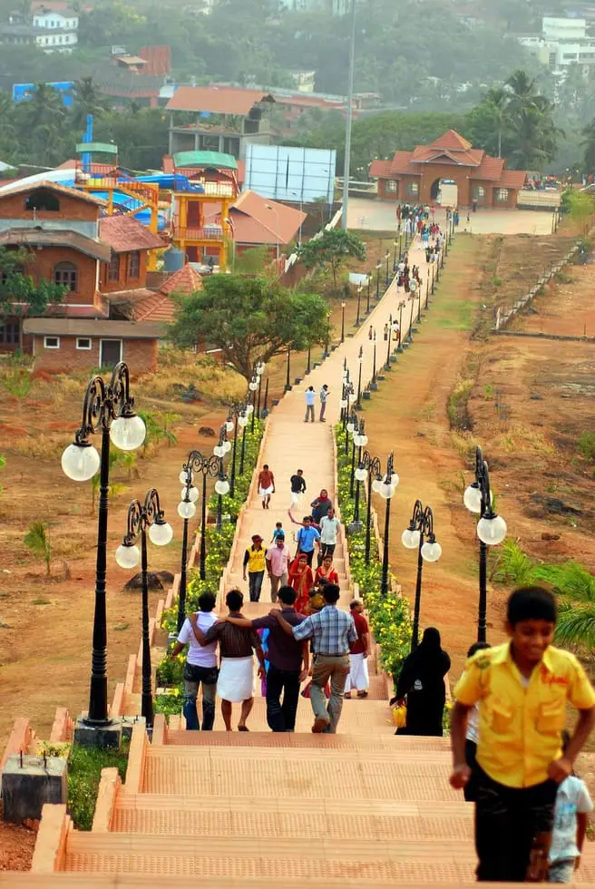
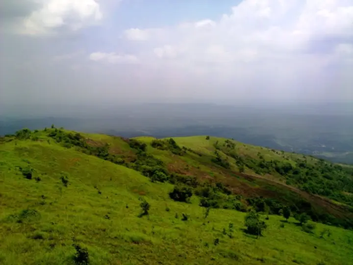
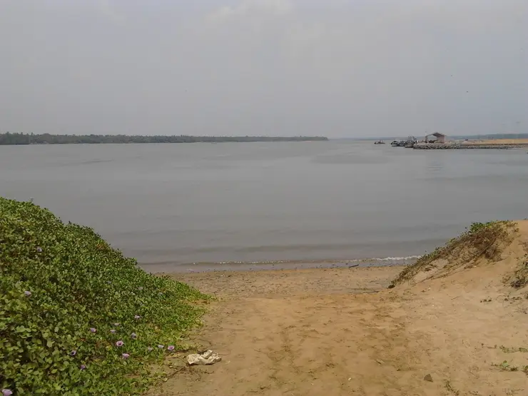
Read the town by height and it makes immediate sense. The flat top of the hill — Kunnummal, universally called Up Hill — carries the Civil Station and the district administration, the KSRTC depot, Kendriya Vidyalaya, St Gemma’s girls’ school and the headquarters of the Malabar Special Police. Below it to the north is Kottappadi, Down Hill, which is where the taluk hospital, the market, the bus traffic and the shopfronts are. West of the town the ground runs out towards Ponmala, Othukkungal and Panakkad; south of it the Kadalundipuzha comes past, and the stretch of the river bank is called Koottilangadi. A smaller stream, rising in the Amminikkad hills and running down through Angadippuram and the old Valluvanad country, joins the Kadalundipuzha below the hill. That confluence is the reason there is a town here at all.
The single most surprising thing about Malappuram’s centre is what occupies it. Drop a drone over Down Hill and the largest open rectangle in the frame is not a maidan or a park but a football pitch with a long terraced stand along one side: the Kottappadi Football Stadium, hemmed on all sides by tiled roofs, sheet awnings, a roundabout and the highway. Very few Indian towns of this size have given their most valuable central land to a football ground and then kept it there for a century.
It got there by accident of empire. Before independence the site was a stud farm, and it became the march-past ground of the British garrison — the old name for it is Kavathu Parambu, the parade ground. The soldiers played football on it, the town watched, and then the town played. Football in Kerala is generally traced to exactly this: British officers of the Malabar Special Police, camped at Malappuram, playing on post-harvest ground, and the locals taking it up. The elders of Kottappadi played the British barefoot. One of them, Irumban Moideen, went from that ground into the Royal Indian Air Force and represented India. After independence the first tournament the ground is recorded as hosting was the Moidu Memorial All-Kerala Football Tournament in 1952; the All-India Civil Service tournament, the Kerala Premier League and the state club championship have all been played on it since.
The game the district actually lives on, though, is not eleven-a-side. Sevens football is a seven-a-side code — goalkeeper, stopper back, two wing backs, one attacker and two supporting attackers, no midfield general, a modified offside rule and sixty minutes of play — and in Malabar it is the popular form of the sport. The season runs roughly November to May, historically on temporary stadiums thrown up in harvested paddy fields and now increasingly under floodlights, and tournaments are routinely staged to raise money for local welfare causes. The Sevens Football Association, which organises something like fifty tournaments across south India, has its headquarters in Malappuram: a first-floor office with the association’s badge and name across the front, above a shop, on an ordinary town street. I. M. Vijayan, Ashique Kuruniyan, C. K. Vineeth, Mohammed Rafi, Anas Edathodika and others credit sevens with making them players. If you have seen the film Sudani from Nigeria, you have seen this circuit — the African professionals who come to play it are a real and long-standing feature of it, not a plot device.
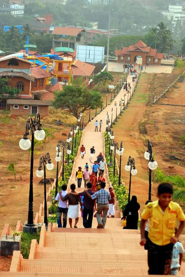
There is a good story in why the district’s big stadium is not in the town. In 1996 Kottakkunnu was transferred to the Malappuram municipality, which had been pressing for years to build an international-standard football ground on it. Studies found that cutting into an ecologically fragile hill would cause problems, so the stadium was built instead at Payyanad, near Manjeri, and the hill got a park. Payyanad — the Malappuram District Sports Complex Stadium, capacity about 30,000 — was inaugurated on 14 January 2014 and opened with the 2013–14 Federation Cup; Kerala won the Santosh Trophy there in 2022, beating Bengal in the final on 2 May. Kottappadi, in town, seats eight to ten thousand and is the home ground of Malappuram FC, with a Kerala Blasters coaching centre working out of it. The judgement was probably right on both counts: the hill did slip. On 9 August 2019 a landslide on Kottakkunnu killed three people from one family, and the district administration has since commissioned a geological study and protection plan for the park.
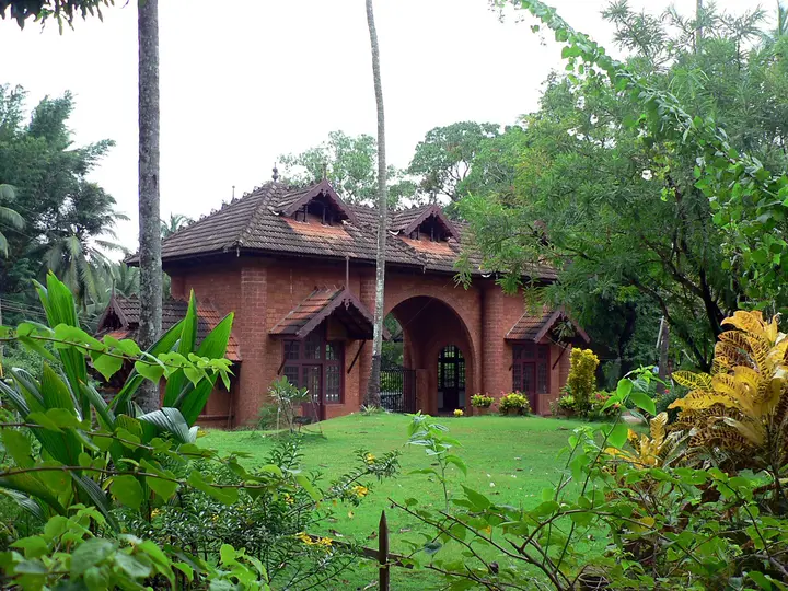
The administrative town is the other half of Malappuram, and it sits directly on the military one. The British built the Haigh Barracks on the top of the hill, above the Kadalundi river, where Tipu Sultan had held a fort; the main barracks building is today the Civil Station, the seat of the district administration. Its gateway is an unremarkable tiled arch off a public road with the words Civil Station Malappuram across it in Malayalam, and behind it are the Collectorate, the district treasury, the RTO, the PWD division office, the district panchayat and the town planning office. Malappuram was one of the five revenue divisions of the old Malabar district, alongside Thalassery, Kozhikode, Palakkad and Fort Cochin, and it kept the habit of being where the paperwork happens.
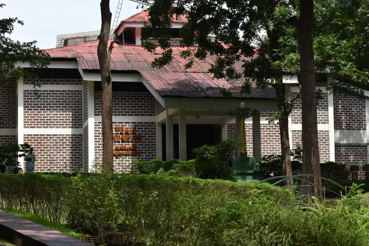
The Malabar Special Police is the institution that ties the two together. It was raised here in 1885 as the Malappuram Special Force, in response to the recurrent Mappila risings of the nineteenth century, and was raised to Malabar Special Police in 1921. Its headquarters is at Perumbaramb, inside the municipality, on ground the British used before it. It is now a Kerala Police unit, and there is a small MSP Centenary Police Museum in the town — a blue-washed, red-tiled colonial barrack building behind a signboard carrying the force’s centenary emblem. It is a modest place and a genuinely unusual one: a police force with a museum about itself, in the town where it was formed, a short walk from the hill where it did the thing it is most remembered for.
Economically Malappuram is a Gulf town. Remittance from workers in the Gulf states is the dominant force in the district’s money, NRI deposits in local banks are very large, and Malappuram is regularly cited among the top ten Indian cities by per-capita bank deposit — a figure worth attributing rather than asserting, since it circulates without a consistent source. What is visible on the ground is retail: vehicles, hotels and bakeries first, then textiles and medical shops. Every major car manufacturer has a showroom here, and the Malappuram RTO has in recent years registered more vehicles than any other in Kerala. The Economist Intelligence Unit’s much-quoted 2020 finding that Malappuram was the fastest-growing urban area in the world, at 44.1 per cent between 2015 and 2020, is about the wider agglomeration rather than the municipality, and is best read as a statement about how fast the surrounding panchayats are urbanising.
Malappuram is also, quietly, one of the seats of Kerala Muslim public life. Panakkad, on the Kadalundipuzha at the western edge of the municipality, is where the Panakkad Thangal family lives; the family has supplied the spiritual leadership of the Indian Union Muslim League for generations, and a great deal of Kerala’s political weather is made in a house there. The country’s largest Hajj training camp is held in Malappuram. Around seventy-five per cent of the town’s population is Muslim, and the balance Hindu and Christian.
For all that, Malappuram is not a town that performs itself. It has a good record for being clean — it was the first municipal body in India to give free Wi-Fi to its residents and the first to hold an ISO certificate, both of which are the kind of thing a small municipality does when it is trying hard — and it is the only million-plus urban agglomeration in Kerala without a municipal corporation anywhere inside it, a gap there is a standing campaign to close. Forty wards, about 19,785 households at the last count, a population density around two thousand to the square kilometre, and a breeze on the hill that people here will tell you is the reason the British stayed.
Legend & myth
Start with the name and the steps. Malappuram is mala and puram — the town over the hill — and the hill in question is the flat-topped rise with a river on three sides and a gorge on the fourth that made an obvious citadel. Varakkal Para Nambi, the Zamorin’s commander who took Malappuram and the country around it from the Valluvakonathiri, built his fort on top of it. What survives of that fort is not masonry but street names: the places called Kottappadi, the commercial centre below the hill, and Moonnam Padi on the Nilambur road, are held locally to be the fort’s first and third gate-steps. You cannot see a wall in Malappuram. You can stand at a bus stop named after one.
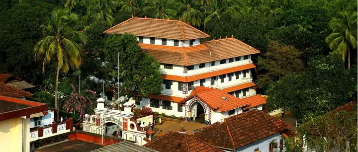
The town’s founding legend is about a Hindu chieftain who built a mosque. As the Malayalam accounts have it, a Para Nambi was defeated in a war with the Punnathrikonathiri, the ruler of Kottakkal, and taken prisoner by the enemy; the Mappila traders of Malappuram fought to free him and did. In gratitude he built the mosque by the Kadalundipuzha that is now the Malappuram Juma Masjid, and the traders made the quarter around it into the commercial centre called Valiyangadi. That is how a garrison became a market: by the early 1700s Malappuram was a trading town as well as a military one. The district administration’s own description of the mosque preserves the same tradition in a single dry sentence — white walls, blue doors, and an architecture that looks like a temple, which it attributes to the mosque having been built by the Nambi family.
Beside that mosque is the mausoleum of the Malappuram shaheeds, and once a year the town gathers there. The Malappuram Nercha is a four-day annual festival held at the mosque in April, and it commemorates a body of Mappila dead whose deeds, in the district administration’s phrase, were immortalised in the Mappila ballads. The nercha is what a martyr cult looks like when it has become a town festival: a vow-offering, a shrine visit and a crowd, held at the same place every year for a killing that happened nearly three centuries ago.
The ballad is a real and famous piece of literature, and it names its own facts. The Malappuram Padappattu, also called the Madhinidhi Mala, was composed in 1883 by Moyinkutty Vaidyar, the presiding poet of Mappilappattu, in sixty-eight ishals with four vambus and a kuthirachaattam. It tells of a quarrel between a Para Nambi and one of his own officers, Ali Marakkar, that escalated into a battle between the landlord’s men and his Mappila and lower-caste Hindu tenants; forty-four Mappilas and one Hindu of the Thattan goldsmith caste were killed, and were afterwards mourned as martyrs. The poem’s ending is not triumph but remorse: the Nambi repents of what he did and makes peace with the Mappilas. It also, in passing, tells the story of Cheraman Perumal sailing to Mecca. On the date, the sources genuinely disagree — English Wikipedia gives 1763, Malayalam Wikipedia gives 1734 and places the fight at Poolakkamannu, and local retellings commonly say 1728. We could not source the 1728 date to anything solid, and we are not going to choose between the other two.
The reason to take these songs seriously is that historians do. The songs on the Malappuram shaheeds are the earliest surviving description of armed conflict between the Mappilas and the landlord class in the years before Mysore rule, and they have been used as source material rather than colour: William Logan cites the related Cherur Padappattu in the Malabar Manual, and Roland Miller quotes it in his study of the Mappila Muslims. The British understood their function perfectly well and confiscated the press that was printing the Cherur ballad. A padappattu is literally a song sung by soldiers going into battle, and these ones were sung around the countryside by travelling bands after almost every rising of the nineteenth century.
A smaller legend belongs to the same chieftain and is worth telling because it inverts the expected story twice. At Mattathur, in Othukkungal on the town’s western edge, the Valiya Jumaat mosque is reckoned about five hundred years old, and the land under it is said to have been given by the Para Nambi of Malappuram — as was the land for the local Scheduled Caste community’s temple on the hill above. The tale attached to it is that the two plots were originally assigned the other way round, and were swapped: someone in the Nambi household fell ill and was cured by a hereditary Muslim physician of the Madathil family at Mattathur, and when the Nambi asked what payment he wanted, the vaidyar said he would like a site for a mosque on the river bank. So the mosque plot became the temple’s and the temple plot became the mosque’s. The Malayalam source that carries it ends, honestly, with the words so the story goes.
One old claim about the town we can neither confirm nor comfortably repeat. Place-names here — Valiyangadi, Koottilangadi, Pallippuram — are read by some writers as traces of a Jain and Buddhist past, and a fifteen-hundred-year-old Jain temple is described at Oorakam Hill, said to stand above two thousand feet. Rock-cut caves and prehistoric relics have indeed been reported at Oorakam, Melmuri, Ponmala and Vengara. But two thousand feet is six hundred metres, and the tallest independent hill in this part of the district, Arimbra, is about four hundred and forty-five. Either the elevation figure is wrong or the temple is not where the sentence implies. We report the tradition and flag the number.
Four legends belong elsewhere and this record refuses them by name. The Kondotty Nercha, the week-long March festival with its inter-religious Petta Varavu, belongs to the Pazhayangadi Mosque at Kondotty and the tomb of the Sufi Muhammad Shah — a different town, a different mosque, a different month, and the single most common thing confused with the Malappuram Nercha. The Mamankam, with its twelve-yearly fair and its chaver warriors, belongs to Tirunavaya on the Bharathappuzha. The goddess who vanished into the ground, leaving a hole where the coconuts are broken, belongs to Kadampuzha, which has its own record under this town. And the closed goods wagon of 19 November 1921 belongs to Tirur station, where it was loaded, and to Tirur’s record, where we have told it.
More about Malappuram town
History
After the Perumals, this country belonged to Valluvanad, whose root seat was the Kuruva Arangottu Swarupam at Makkaraparamba, about five kilometres away across the river, with its capital at Angadippuram some fifteen kilometres off. From the twelfth century the Eradis of the Nedivirippu Swarupam, near Kondotty, built a kingdom out of Kozhikode and became the Zamorins. Varakkal Para Nambi, commanding for them, took Malappuram and its surroundings from the Valluvakonathiri and fortified the hill; he governed Ernad from Kottappadi and campaigned against Valluvanad from the fort above it. Malappuram grew as a garrison, not as a temple town or a port, and the Zamorins held it for something like eight hundred years.
Trade followed the soldiers. Once the Zamorin controlled the stretch of the Kadalundipuzha where the smaller river joins it, goods coming down from the interior had to pay duty at Malappuram or be sold there to Kozhikode merchants — which is why a market called Koottilangadi grew on the river and Valiyangadi grew around the Juma Masjid. A well at Valiyangadi built in 1916 still carries an inscription of the Malappuram Taluk Board on its wall, which is about as close as the town gets to a monument.
The Mysore century changed the fort. When the Zamorin’s campaigns threatened Palakkad, the Palakkad Achan asked Hyder Ali for help, Mysore took Malabar, and the last Zamorin of the old line killed himself by setting fire to his powder store — which ended the Mamankam. Under Tipu Sultan the Malappuram fort was enlarged into a serious arsenal with cannon and powder brought from Mysore, and a road network was driven out from it: Malappuram to Thamarassery, to Palakkad along what is now the national highway, to Feroke, to Parappanangadi, and to Pattambi by way of Kolathur, tying the fort to the Thamarassery, Nadukani, Sispara and Walayar passes. By the 1792 Treaty of Srirangapatnam Malabar passed to the British, the fort came under Manjeri Athan Gurikkal, and when Athan Gurikkal was killed in a fight at Mappattukara near Pattambi in 1806 it passed to the British with him.
The British then removed it. They demolished the fort and put a musketry range on the site, built the Haigh Barracks on the hilltop above the Kadalundi, and made Malappuram one of the most agreeable stations in south India by their own accounts and one of the last. The Malappuram Special Force was raised in 1885 to hold down the Mappila risings and became the Malabar Special Police in 1921; the Leinster and Dorset regiments camped here during the rebellion, and Malappuram in 1921 was the last posting the Leinsters shared with British troops before southern Ireland became a republic. What is left of the fort today is disputed: the district administration’s own history page still says the town has the ruins of an ancient fort built by Tipu, while the Malayalam account states plainly that whatever remained has since been lost to development and misuse.
The rebellion of 1921 is the town’s largest subject and its most contested one, and this record reports the argument rather than settling it. For six months from August 1921 the rising covered about 2,000 square miles, some forty per cent of South Malabar. Official figures put 2,337 rebels killed, 1,652 injured and 45,404 imprisoned, of whom around 20,000 were transported, mostly to the Andamans; unofficial estimates of the dead reach 10,000. Variyamkunnath Kunjahammed Haji, who had declared a parallel state on 25 August 1921 with its own passports, currency and taxation, was tried by court martial and shot on the northern slope of Kottakkunnu on 20 January 1922. What the rising was is the dispute. Contemporary colonial administrators, Annie Besant in New India, the Arya Samaj and B. R. Ambedkar described it as religious violence against Hindus, with an Arya Samaj source quoted by Sumit Sarkar giving about 600 Hindus killed and 2,500 forcibly converted; the District Magistrate reported reliable information on 180 forced conversions and thought the true figure might run into thousands, and Roland E. Miller’s range is 200 to 2,500. Haji himself, in a cable printed in two American newspapers on 7 December 1921, denied the conversions and said the men responsible were British agents his forces had executed. The Indian National Congress repudiated the movement at the time. The Government of Kerala recognised its participants as freedom fighters in 1971. Around the centenary in 2021 the Indian Council of Historical Research considered striking Haji and 386 others from the Dictionary of Martyrs of India’s Freedom Struggle; the names have not been removed. Readers should know that all of these positions are actively held.
The district itself was fought over before it existed. Malappuram was constituted on 16 June 1969 as Kerala’s tenth district, out of four taluks — Ernad, Perinthalmanna, Tirur and Ponnani — with four statutory towns, fourteen development blocks and ninety-five panchayats; Tirurangadi, Nilambur and later Kondotty were carved out afterwards, making seven. The proposal, which was a central demand of the Muslim League’s alliance and was realised under E. M. S. Namboodiripad’s government, drew a serious agitation against it: a section of the Congress under K. Karunakaran, Hindu organisations, and Gandhians including K. Kelappan opposed the new district, and its critics attacked it in print as a Mappilastan and a little Pakistan. Malappuram became the district’s first municipality in 1970. At the 2011 census the municipality held 68,127 people over 33.61 square kilometres; the town as returned in the same census held 101,386. Malappuram district is now the most populous in Kerala with roughly 4.5 million people, about thirteen per cent of the state, and its urban agglomeration is the fourth largest in Kerala and twenty-fifth in India — and still, uniquely among Kerala’s million-plus agglomerations, without a municipal corporation.
Why visit
It is the only town in Kerala where the central football ground was laid out by the British as a parade square and is still, a century later, the largest open space in the commercial district.
The Sevens Football Association is headquartered here, and between November and May the seven-a-side circuit that produced I. M. Vijayan and Ashique Kuruniyan is playing within reach of the town almost every night.
The Malappuram Juma Masjid on the Vengara road has the mausoleum of the Malappuram shaheeds beside it and a four-day nercha every April, and it is the subject of a famous 1883 Mappila ballad.
The Civil Station is the British Haigh Barracks, built on the hilltop where Tipu Sultan kept a fort — the same ground, three regimes deep, still doing administrative work.
The MSP Centenary Police Museum is a genuinely unusual thing: a police force’s museum about itself, in the town where the force was raised in 1885.
It is the working capital of Kerala’s most populous district and makes a sensible, unglamorous base for Kottakkal, Kadampuzha, Arimbra and Manjeri, none of which is more than half an hour away.