A working municipality of about thirty-four thousand people on the last reach of the Periyar, roughly thirty kilometres north of Kochi, which happens to carry the heaviest historical claim in Kerala: that it was Muziris, the pepper port the Romans wrote about and then lost. Kodungallur is where four communities each locate a beginning — a Chera capital, the subcontinent’s traditional first mosque, one of Christianity’s oldest Indian landfalls, and the Jewish Shingly of the copper plates. What it does not have is a ruin to stand in front of. The evidence is scattered across a dozen small sites, several of them in the next district, and the archaeology under the town itself has been stubbornly quiet since 1944. That gap between the size of the claim and the size of the visible remains is the most interesting thing here, and this page is about it.
Kodungallur sits on the northern bank of the Periyar’s final reach, where the river turns west and lets go of its silt. The municipality covers about 29.24 sq km at an elevation of roughly nine metres, and the 2011 census recorded 33,935 people within the municipal limits, with a literacy rate of 95.10 per cent. National Highway 66 runs straight through, and a 3.55 km bypass now carries the through traffic around the town — which is worth knowing, because the old road is where everything actually is.
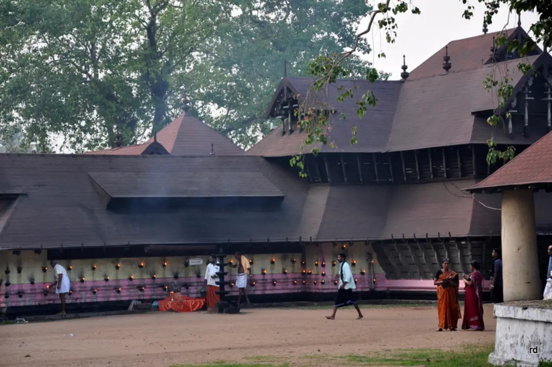
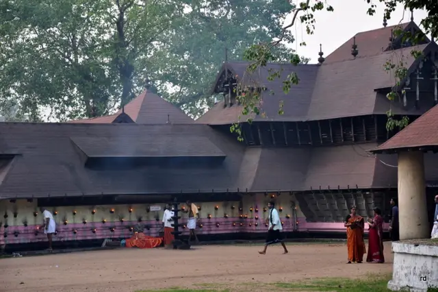
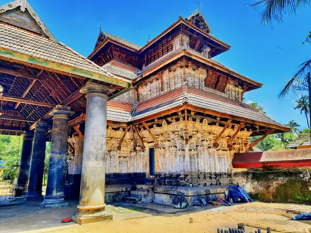
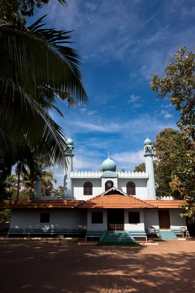
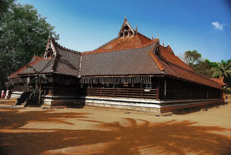
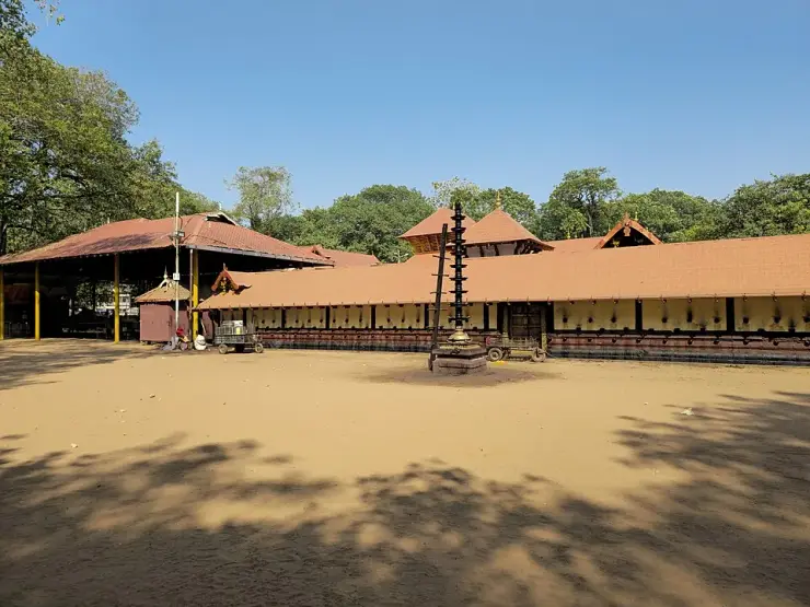
The first practical fact about visiting is that Kodungallur is not a monument, it is a scatter. The Bhagavathy temple is in the middle of the town. The Cheraman Juma Masjid is at Methala, roughly three kilometres out on the Paravur road. Kottappuram, with the excavated fort and the riverside market, is a couple of kilometres north-west on the water. Azhikode and Munakkal, where the estuary meets the sea, are further out again. Cheraman Parambu, the field said to hold the Chera palace, is a separate stop on its own. Nothing is far, but almost nothing is walkable from anything else, and a day here works only if you accept that it is a driving day.
The connective tissue is the Muziris Heritage Project, a Government of Kerala programme launched in 2006 that treats the whole belt from North Paravur in Ernakulam up to Kodungallur in Thrissur as one distributed museum. Sources disagree on which department launched it — the Department of Cultural Affairs in some accounts, the Tourism Department in others — but the shape of it is consistent: a linked network of small museums and conserved sites rather than a single visitor centre. The museums include the Paravur, Chendamangalam and Mala synagogues, the Paliam Palace and Paliam Nalukettu, the Islamic history museum in the Cheraman Juma Masjid complex, and the Kodungallur temple museum. They are generally closed on Mondays and generally shut around 5 pm; treat both as indicative and confirm before you build a day around them.
Kottappuram Fort is the place where expectations most need managing, and it is also, for our money, the most rewarding stop in the town. What survives is not a fort. It is a low grid of excavated laterite foundation courses in a riverside lawn, a few metres high at the tallest surviving bastion stub, sheltered in part by a modern tensile canopy, with a protected-monument notice board planted in the grass and the Periyar sliding past a few metres away. Excavation here began in May 2010 under the Muziris Heritage Project. The boundary stones of the old Travancore and Cochin states stand in the grounds, along with a memorial stone erected by the Travancore government in 1909.
Cheraman Parambu — “the compound of the Chera rulers” — is stranger still. Tradition and a fourteenth-century Sanskrit poem, the Kokasandesha, place the Chera Perumals’ palace here; a ninth-century commentary, the Laghubhaskariyavyakhya, describes a palace in the same quarter of Mahodayapuram. What you find is a paved plaza with a small pyramidal memorial carrying a plaque, and four or five stubs of dressed granite pillars mounted on low plinths. It was declared a protected monument in 1936 and has been badly eaten into by building and quarrying since. It is a site that rewards knowing what it is; it tells you nothing at all if you arrive cold.
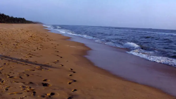
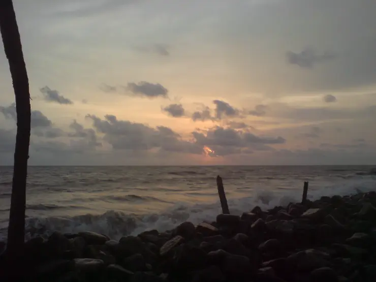
Out at Azhikode the town meets the sea. The Mar Thoma Pontifical Shrine here marks the traditional landfall of the apostle Thomas, and holds a relic of his right forearm brought from Ortona in Italy and enshrined by Eugène Cardinal Tisserant on 6 December 1953 — the relic was carried in from Pulloot by a procession of decorated country boats. Munakkal beach and the estuary mouth are a short way on, and a passenger ferry crosses from Munambam on the Ernakulam side, which is much the best way to arrive if you are coming up from Cherai or Vypin (services are subject to weather and season — confirm locally).
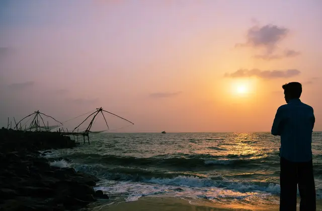
For all the antiquity, this is a fishing and trading town that still works. Chinese cantilever nets — cheena vala — stand out over the Periyar here as they do at Fort Kochi, without any of the crowds, and the riverside at Kottappuram has an old market and a stepped amphitheatre laid out under the heritage project where people come at dusk. St Michael’s Cathedral at Kottappuram, the seat of the Kodungallur diocese, is a short way from the fort. If you have time for only one non-obvious thing in Kodungallur, stand at the fort at low light and look at the river: this is the water everything arrived on.
The town is easiest reached by road. Kochi is about 30 to 40 km south and Thrissur a comparable drive north-east; KSRTC and private buses run frequently to the Kodungallur bus stand from Kochi, Thrissur, North Paravur, Aluva and Guruvayur. The nearest railhead is Irinjalakuda, variously given as 14 to 20 km away depending on whether the source measures to the town or the station, with Thrissur and Aluva the larger and better-served stations. Cochin International Airport at Nedumbassery is about 31 to 32 km away.
Legend & myth
Kodungallur is a town of first things. The first mosque in India, by tradition. One of the first Christian landfalls in Asia, by tradition. The Jewish Shingly of the copper plates. The capital of the Cheras. The port the Romans called the first emporium of India. Almost every one of these is an origin claim, and origin claims are the hardest kind of history to test, because the communities that hold them have every reason to hold them and the evidence that would settle them is exactly the evidence that a river mouth destroys. What follows is each claim with its evidential status attached, which is the only honest way to hand them to a visitor.
Start with the name, because even that is contested. Malayalam tradition offers at least four readings of Kodungallur: kodum-kali, for the fierce goddess of the Kurumba Bhagavathy temple; kodum-kallu, from a stone laid over a ritual offering; a derivation from Kannaki herself; and the bleaker kodum-kolai, Tamil for a great slaughter, attached to some remembered ancient violence. Europeans wrote it Cranganore or Cranganor. And a whole family of medieval foreign spellings — Shingly, Jangli, Cyngilin, Shinkali, Cynkali — is generally traced to the river Changala, the “chain river”, Shrinkhala in Sanskrit. None of these is proven. It is worth noticing that three of the four Malayalam readings point at the goddess, which is precisely what a goddess-town would generate whether or not it were true.
The Jewish tradition is the oldest and, in one narrow respect, the best documented. Cochin Jews knew this place as Shingly and dated their arrival variously — to the age of Solomon, or to the diaspora after the fall of the Second Temple in 70 CE. The founding document is a set of copper plates granting the merchant-leader Joseph Rabban the rank of prince, a principality at Anjuvannam near Cranganore, and the revenue of seventy-two free houses, for as long as the world, sun and moon endure. The plates’ date is itself disputed: they are traditionally assigned to around 1069 CE, and the figure 379 CE also attaches to them in the tradition. Two things are firmer. The Kollam copper plates of 849 CE carry West Asian mercantile signatures and are the earliest physical evidence of the community in Kerala. And the Jewish plate of Bhaskara Ravi Varman, usually placed around 1000 CE, names the place Muyirikkode — which is the single strongest textual tie between the name Muziris and this stretch of coast. The community left: silting drove trade south, and in 1524 the Jews of Cranganore were attacked over their share of the pepper trade and fled to the protection of the Raja of Cochin.
The Christian tradition holds that the apostle Thomas landed near here, at Maliankara by Azhikode, in AD 52, and founded seven churches along the coast. Its evidential status is straightforward and should be stated plainly: it is attested in sources written many centuries later, and there is no first-century archaeology anywhere in Kerala that bears on it. What is documented is the modern devotion — the relic enshrined at Azhikode in December 1953, and a shrine built to draw on the model of St Peter’s in Rome. A dated relic translation proves that people believed this in 1953; it cannot prove what happened in 52.
The Islamic tradition — Cheraman Perumal’s dream of the split moon, his voyage to Arabia, Malik Ibn Dinar arriving with the king’s letters, the mosque and its lamp — is the most famous story attached to Kodungallur, and it is not this page’s to tell. It belongs to the Cheraman Juma Masjid, which has its own record on Roampedia, and retelling it here would be padding. One detail does belong to the town, though, because it is a myth about the myth: the founding year is given as 624 CE in some accounts and 629 CE in others, and neither figure rests on a contemporary document.
Then the flood. The tradition of this whole coast says that in 1341 a catastrophe on the Periyar silted Muziris out of existence in a single convulsion and opened the harbour at Kochi. We tell that story properly from the Kochi side, where it is a birth. From Kodungallur it is a death, and here the counter-evidence deserves its airing. In their study In Search of Muziris, Rajan Gurukkal and Dick Whittaker reconstruct a coastline that has moved a long way: about three kilometres east of the present shore two or three centuries ago, and something like six and a half kilometres inland two millennia before that. On that reading the Roman-period waterfront ran four to five kilometres east of today’s beach, and the river mouth silted up steadily rather than overnight. No eyewitness account of a 1341 flood survives. Something ended here; a single night is the shape memory gives it.
Which leaves the ground, and the ground has been unhelpful. The Cochin Archaeology Department, with the Archaeological Survey of India, dug at Cheraman Parambu in 1944–46 under Anujan Achan; the ASI’s Southern Circle returned around 1968–70 under K. V. Soundara Rajan and K. V. Raman. What came up was dull-red pottery, a cream stoneware with stamped designs, Chinese celadon of the Song period, porcelain, roof tiles, glass beads, iron nails, wells and foundation courses — material of the eighth to sixteenth centuries, with nothing from the excavations at Kodungallur reliably earlier than the thirteenth. A town can be genuinely ancient and still have no ancient layer where the trenches happened to go, particularly if the ancient layer is under four kilometres of newer silt. But it means the sentence “Kodungallur is Muziris” is a hypothesis, not a finding, and anyone who tells you otherwise is telling you a story.
More about Kodungallur
History
The classical record is real and it is specific. The Periplus of the Erythraean Sea, a first-century Greek merchant’s handbook, names Muziris as a port of leading importance in the Chera kingdom, abounding in ships from Arabia and from the Greeks. Pliny the Elder calls it the first emporium of India while grumbling that it was becoming less attractive because of pirates and poor anchorage. Ptolemy places it north of a river identified with the Periyar. The Roman road map known as the Tabula Peutingeriana marks it with a temple of Augustus. Most vividly, a mid-second-century Greek papyrus in Vienna — P. Vindob. G 40822, published in 1985 and known as the Muziris papyrus — records a loan against the cargo of a ship called the Hermapollon, whose consignment is reckoned at something over thirteen thousand talents of black pepper. That is not folklore; that is a bill of lading.
In the medieval centuries Kodungallur was part of Makotai Vanchi, in Sanskrit Mahodayapura — the capital of the Chera Perumals, whose kingdom ruled much of what is now Kerala. Thiruvanchikulam Mahadeva temple stood at its heart and Trikkulasekharapuram, traditionally associated with Kulasekhara Alvar and with the arrival of Vaishnava devotion in Kerala, is close by. The Jewish copper plate of Bhaskara Ravi Varman, around 1000 CE, calls the place Muyirikkode. By the fourteenth century the port was fading, trade shifting south to Kochi and north to Kozhikode.
The Portuguese arrived into that decline and accelerated it. A Portuguese fleet almost completely destroyed the port on 1 September 1504. They later built a fort here — the Fortaleza de São Tomé de Cranganor, known locally as Kottappuram or Kodungallur Fort — and the date is disputed: Kerala Tourism and the English sources give 1523, while the Malayalam Wikipedia account gives 1503. It was enlarged in 1565. A French plan of the fortress, engraved after a survey of 1709 and published in Prévost’s collection in 1747, shows a compact bastioned work at the river mouth with a projected new fort beside it.
The Dutch attacked in 1662 and took the fort in 1663, damaged it heavily, reduced its size and repurposed it around their merchant shipping. On 31 July 1789 the Dutch handed over their establishments at Kodungallur and Azhikode to the Kingdom of Travancore for 300,000 Surat silver rupees, the agreement executed between Raja Kesava Dasa for Travancore and Governor Johan Gerard van Angelbeek for the Dutch. That purchase was a defensive one, and it was tested almost immediately: Tipu Sultan’s campaign against the Travancore Lines came in the winter of 1789–90, and local accounts hold that Kodungallur suffered in it.
The modern archaeology of the region begins with the digs at Cheraman Parambu in the 1940s and around 1970, and takes a different turn in 2007. Between 2007 and 2015 the Kerala Council for Historical Research excavated nine seasons and sixty-one trenches at Pattanam — a village in Paravur taluk of Ernakulam district, two to three kilometres north-west of North Paravur and roughly four kilometres inland, not in Kodungallur and not in Thrissur district. The mound covers about 45 hectares of which perhaps one per cent has been dug. It produced a brick wharf complex with nine bollards, a six-metre dugout canoe of anjili wood with teak mooring posts, amphora sherds, terra sigillata, rouletted ware, carnelian intaglios, Roman glass, beads, black pepper, cardamom and frankincense, and Chera copper coins with the bow-and-arrow device. Habitation appears to run from around the tenth century BCE, with the intense Mediterranean phase between roughly the first century BCE and the fourth century CE.
Whether Pattanam is Muziris remains argued. Rajan Gurukkal accepts it as a Mediterranean merchant settlement and reasons that if Muziris were elsewhere the record ought to show it; R. Nagaswamy, K. N. Panikkar and M. G. S. Narayanan have all urged more analysis before the identification is treated as settled, and Romila Thapar has questioned it. The rival case for Kodungallur rests on its documented medieval role as a port and on the word Muyirikkode in the Jewish plates. A fair reading holds one caution above the rest: no other site on this coast has been excavated to anything like the same standard, so Pattanam’s primacy is partly a fact about where the trenches went. The Muziris Heritage Project, running since 2006 across the belt from North Paravur to Kodungallur, is in effect the institutional form of that uncertainty — it conserves and interprets a region rather than a ruin, because there is no agreed ruin to conserve.
Why visit
To stand on the excavated laterite footings of Kottappuram Fort with the Periyar a few metres away — the single clearest place in Kerala to see how a river mouth eats a fortress.
To visit four faiths’ founding sites within about six kilometres of each other, each with its own claim to have begun here, and to weigh them for yourself.
To use the Muziris Heritage Project properly, as a linked circuit of small museums and conserved sites across two districts rather than as a single attraction.
To see Chinese cantilever nets working over the Periyar without the crowds and the sunset queues of Fort Kochi.
To reach the town by the Munambam–Azhikode ferry, which arrives across the water the way everything historically did.
To pay respects at the Kodungallur Bhagavathy temple and the Cheraman Juma Masjid, both of which have their own full pages on Roampedia.