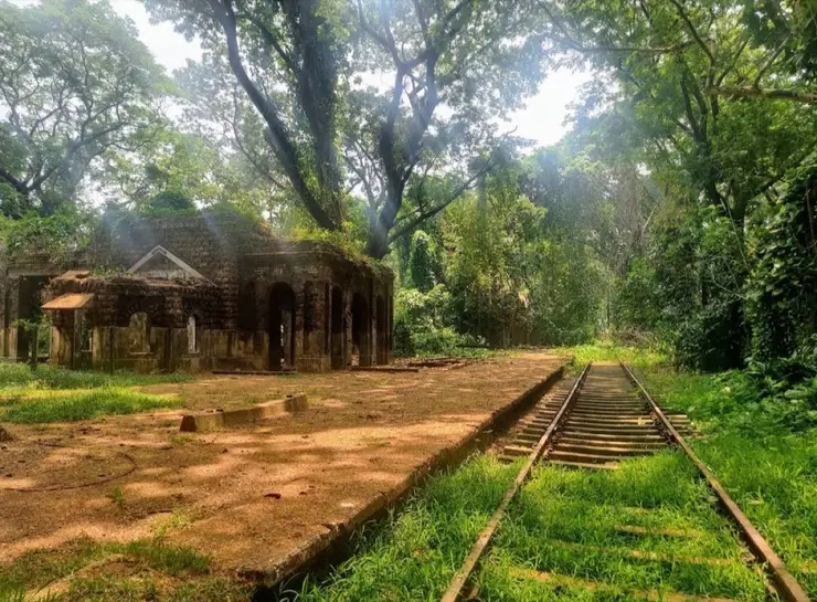
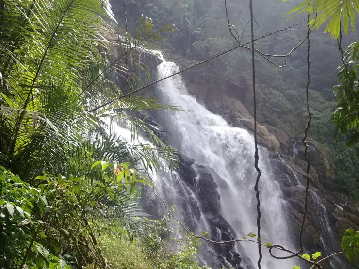
Places to Visit in Vythiri and Lakkidi

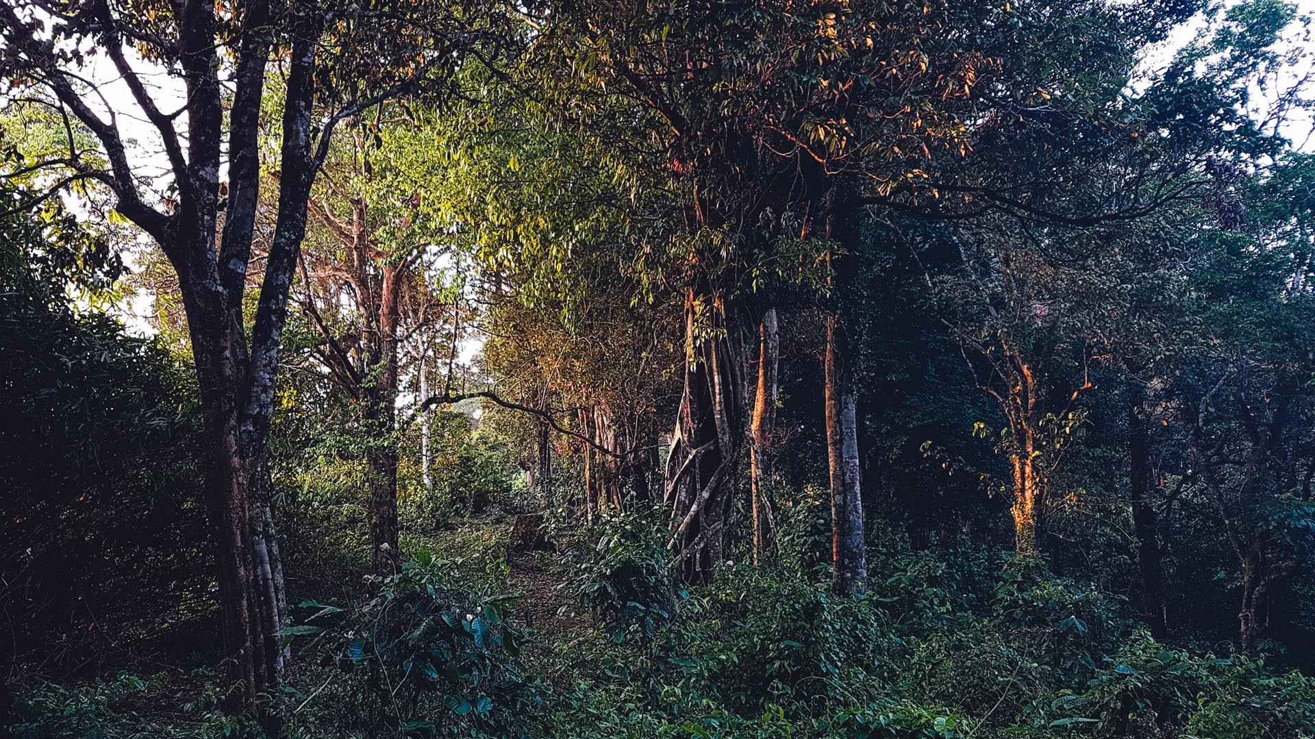
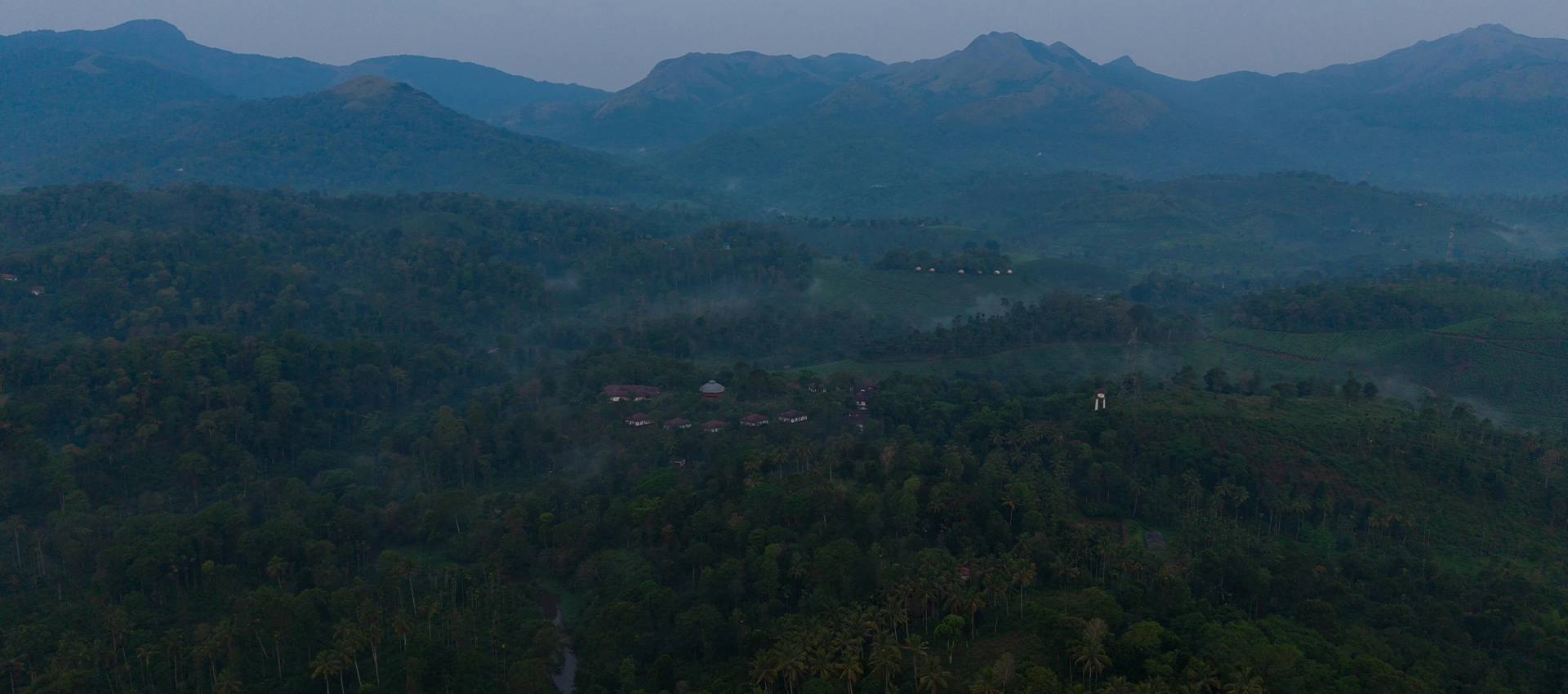
Vythiri and Lakkidi form the practical hill and ghat-road base at Wayanad's Kozhikode entrance, with Lakkidi View Point, Pookode Lake, Chain Tree, En Ooru Tribal Heritage Village, Uravu Bamboo Village, resort stays, adventure parks, bamboo craft experiences, taxis and Kozhikode-side transfers close together. Use it when the trip is built around cooler hill stays, ghat-road views, lake stops and quick access from Kozhikode, while keeping visibility, parking, monsoon mist and transfer timing flexible.

Vythiri and Lakkidi
Practical guide

Plan Vythiri and Lakkidi

Who's going?Tailor Vythiri and Lakkidi to your trip
DistrictWayanad
RoleGhat base
Time neededHalf a day if you are passing through…
Places to visit6Listed businesses37
What to expect

Highlights

  • Lakkidi View Point — Ghat-road viewpoint at the entrance to Wayanad from the Kozhikode side.
  • Pookode Lake — Freshwater lake near Vythiri/Lakkidi, commonly paired with the ghat entrance and En Ooru side.
  • Chain Tree — Lakkidi landmark tied to the Karinthandan legend, usually visited with Lakkidi View Point and Pookode Lake.
  • En Ooru Tribal Heritage Village — Tribal heritage village near Pookode/Vythiri with culture, craft and Wayanad community context.
  • Uravu Bamboo Village — Thrikkaipatta bamboo craft and responsible-tourism village experience, useful from the Vythiri/Lakkidi side.
Getting there

How to visit

  • Nearest airport: Calicut International Airport (CCJ), 71 km by road to the terminal via the Thamarassery-Lakkidi ghat — decisively nearer than Kannur (106 km)
  • Rail gateway: Kozhikode railway station (CLT), 63 km by road down the churam; Wayanad has no rail station
  • KSRTC/private buses and taxis connect Kalpetta, Sulthan Bathery and Mananthavady from Kozhikode/Calicut, Mysuru and Bengaluru; confirm current ghat-road timings before travel.

Distance by road

  • Kozhikode62 km
  • Kannur130 km
  • Mysuru148 km
  • Coimbatore201 km
  • Kochi247 km
  • Bengaluru288 km

Road distances measured on real routed roads to Vythiri and Lakkidi itself, not to the district headquarters, on 24 August 2026. Driving time is deliberately not published: free-flow routing badly understates a Kerala ghat road, so allow more than the distance suggests.

Timing

Best time to visit Vythiri and Lakkidi

October to March for clear ghat views and easy driving. June to August is the heaviest rain in one of the wettest inhabited belts in India — atmospheric, but expect zero visibility on the top bends and district red-alert closures of hill roads and ecotourism sites.

Weather in Vythiri and LakkidiSeasonal guide

Live forecast loads in your browser.

Today at Vythiri and Lakkidi
Sunrise6:15 am
Sunset6:25 pm
Golden hour best light5:25 pm–6:25 pm
Blue hour after sunset6:25 pm–6:50 pm
Sun sets toward compass bearingW · 272°
Moon tonight🌓 First quarter · 52%
South-west monsoon. June to September is the south-west monsoon in Kerala. Expect heavy showers, mostly in bursts rather than all day — carry rain cover, allow extra time for getting around, and note that ferries and open-air sites are the first things affected.

Sun and moon are calculated for this location and shown in IST. Photography windows are the hour around sunrise and sunset; the sunset bearing is degrees clockwise from true north. Moon phase is accurate to about half a day.

Visitor notes

  • Vythiri is the town and Lakkidi the ghat-crest strip 5.4 km back down the road — a stay sold as “Vythiri” can sit anywhere along that stretch or off it on an estate road, so check the actual pin before choosing by walkability.
  • En Ooru does not admit private vehicles: you park at the Pookode veterinary-college gate, buy the ticket there, and ride the site’s shared jeep. Budget for the jeep and for the last entry at 4.30 pm.
  • The mist is weather, not a photo opportunity that waits: views at Lakkidi open and close within minutes, and an afternoon arrival in the monsoon can mean no view at all.
  • Deliberately not guessed, because sources conflict or revise: current Pookode boating tariffs, adventure-park ride prices and En Ooru’s fee sheet. The counters at each gate carry the current rates.
The story

The story of Vythiri and Lakkidi

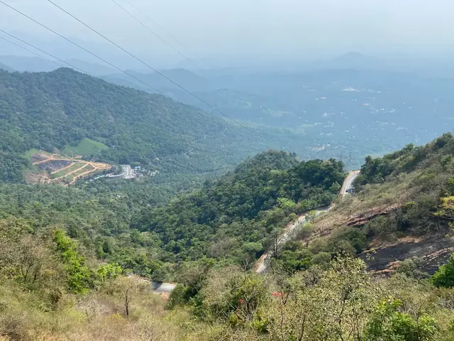
Vythiri and Lakkidi are less two settlements than the two ends of one working road. Lakkidi sits on the lip of the Thamarassery churam, the nine-hairpin ghat that carries National Highway 766 up from the Kozhikode plain onto the Wayanad plateau; Vythiri, about five kilometres further in, is the taluk town that services it — the revenue office, the buses, the taxis, the resorts spread through the tea and the shola. Almost everything that reaches Wayanad from the coast — vegetables, cement, tourists, ambulances — comes through this gap, and almost everything that constrains Wayanad’s economy is visible from it: a single vulnerable carriageway, a rainfall regime among the heaviest in India, slopes that fail, and a tunnel being driven through the mountain a few valleys south to try to end the dependence.

The churam is short and it is the whole point. From Adivaram, the village whose name simply means “foot of the hill”, the highway climbs through nine numbered hairpin bends to Lakkidi at the top. The Malayalam Wikipedia article on the pass gives the climb as about twelve kilometres; several Kerala tourism descriptions, and our own Lakkidi page, put it nearer fourteen. Nobody publishes a surveyed figure and the two numbers are close enough that the difference is probably where you start counting. What is not in dispute is the gradient, the retaining walls stacked in courses below the outer bends, and the fact that this is the main road link between Kerala’s third city and a district of some 846,000 people.

That single dependency is the reason the churam behaves less like a scenic road than like a utility. When it closes — for a landslip, a jackknifed lorry on bend four, a felled tree after a night of rain — Wayanad does not have a quick second option. Traffic diverts north to the Periya and Palchuram ghats towards Kannur, or right around by Nilambur and Gudalur, and every one of those detours costs hours. Kerala’s district administrations also impose blanket closures of hill roads and ecotourism sites during red-alert rainfall, and in a place where the monsoon runs hard from June into August those closures are a normal part of the calendar rather than an emergency.

The second constraint sits outside Kerala altogether. NH 766 runs 272 kilometres from Kozhikode to Kollegal, of which 117 kilometres are in Kerala and 155 in Karnataka, and about 19.7 kilometres of the Karnataka stretch passes through Bandipur. Karnataka bans all vehicles through that section between 9 pm and 6 am, and two-wheelers from 6 pm to 6 am, to reduce roadkill. The signed alternative for night traffic is a 352-kilometre detour by Mananthavady, Gonikoppal and Hunsur. For anyone driving Kozhikode to Mysuru the practical effect is that the churam has a curfew at its far end, and Lakkidi fills up with parked lorries waiting for six in the morning.

Lakkidi itself is a strip rather than a town: a bend in the road, a school, a church, a run of tea and honey stalls, and a dense cluster of resorts that begins almost at the crest. Vythiri, the taluk headquarters five kilometres on, is where the ordinary business happens — the taluk office, banks, the bus stand, the vegetable market that restocks half the plateau. Vythiri grama panchayat covers 47.84 square kilometres and fourteen wards, Lakkidi among them, and recorded 14,459 people at the 2001 census with 86.7 per cent literacy. It is a small place carrying a large amount of the district’s traffic.

The tourism economy that now dominates both settlements arrived quickly and reshaped the land. District figures put Wayanad’s visitor numbers at 1.51 million in 2022, with arrivals across the district up about 72 per cent between 2003 and 2023. Studies cited after the 2024 disaster found that roughly 62 per cent of the district’s green cover disappeared between 1950 and 2018 while the area under tea rose by something near 1,800 per cent. Resorts, homestays and adventure parks have taken the next layer, and around Lakkidi they occupy exactly the steep, high-rainfall slopes that hydrologists would rather nobody built on.

That tension is not hypothetical here. The Western Ghats Ecology Expert Panel chaired by Madhav Gadgil classified all three Wayanad taluks — Vythiri, Sulthan Bathery and Mananthavady — as Ecologically Sensitive Zone I, with restrictions on construction and quarrying. The recommendation was never implemented. On 30 July 2024 the slopes above Mundakkai and Chooralmala, in Meppadi panchayat of this same Vythiri taluk, failed after 204.5 mm of rain in twenty-four hours followed by 372.6 mm in the next, and hundreds of people were killed. Those villages have their own page and their own dead; the honest thing to say from Vythiri is only that they are in the same taluk and on the same rain.

The long-argued answer to the churam has been a second alignment, and one is finally being built — not a bypass of the pass but a tunnel under a different ridge. The Anakkampoyil–Kalladi–Meppadi project on State Highway 83 is a twin-tube, four-lane road tunnel: 8.73 kilometres of alignment including the approach from Marippuzha to the Meenakshi bridge, of which 8.11 kilometres are tunnel. Sanctioned at ₹2,134.5 crore, it is being delivered for the Kerala government by the Konkan Railway Corporation as special purpose vehicle, with the civil contract won by Dilip Buildcon at about ₹1,341 crore. The foundation was laid on 31 August 2025 and rock excavation began in early 2026.

It has not been smooth. On 7 July 2026 monsoon rain triggered a mudslide at the Kalladi site, where excavated spoil and rock came down onto the works; reported death tolls ranged from three to six, construction was suspended, and the state ordered inquiries into spoil disposal and engineering practice. Completion dates published for the project vary between 2029 and 2030. If it opens it should cut the Anakkampoyil–Meppadi road distance from around 42 kilometres to under 20 and give freight a gentler gradient than nine hairpins. It will not, however, run through Vythiri or Lakkidi, and what a second door does to a town that has lived off being the only door is the open question here.

For a visitor, the practical shape of the place follows from all of this. Lakkidi is a stop, not a stay-put destination: pull in, look down the valley, and move on before the afternoon cloud closes the view. Vythiri is the better base if you want a bed, a chemist and a taxi in the same street. Drive the churam in the morning, in daylight, in low gear, and expect to be behind a bus for most of it. And treat every published opening time in this taluk as provisional, because rainfall, not the tourism department, sets the timetable.

Legend & myth

The mountain that carries this road carries a body of Adivasi tradition that is older than the road, and the honest way into it is through the Paniya, who make up the largest single tribal community in Wayanad — 92,787 people at the last full count, in a district where Scheduled Tribes are 18.86 per cent of the population, the highest proportion in Kerala.

The oldest written record of a Paniya origin tradition ties it directly to this pass. C. Gopalan Nair’s Wynad: Its Peoples and Traditions, published in 1911, reports that the Paniya said their original home was Ippimala, “a hill which no one in Wynad could localise and which is said to be somewhere near the Tamaracherry ghats”. In the tradition as he sets it down, the Paniya lived in the forest and the caves of that hill until landowners of the plateau trapped a number of them in nets — thandati — and, over six months, taught them the language of the plains and put them to work; those who had been taken then drew others down after them, and the community spread across Wayanad, Coorg and Mysore. Gopalan Nair adds that by his day the only surviving trace of Ippimala in ordinary speech was the exclamation “Ippi”, which a Paniyan uttered when frightened.

That last detail is where the source has to be read against itself. Gopalan Nair completes the sentence by saying the word came out when a Paniyan’s master thrashed him, and elsewhere in the same passage he calls the community savages and worse. The book is a colonial officer’s book and its contempt is on every page of the chapter. What it nonetheless preserves is a genuine tradition, recorded from Paniya speakers more than a century ago, in which a hill near the Thamarassery ghats is the lost homeland and the descent to the plateau is remembered as capture rather than migration. No later travel account we have seen carries it at all.

The same 1911 chapter records the community’s religious practice: the god Kuli and the goddess Kali, offerings made to them and to the ancestors on Ucharal day after the harvest, when the Paniya of a padi gathered to hear the words of the komaram, the oracle. That is a functioning ritual calendar attached to this landscape, not a legend about a road, and it is the part of Paniya tradition that outside writing has almost entirely ignored in favour of one story about a chain.

The one story everyone does tell is Karinthandan’s, and it belongs to the Chain Tree at Lakkidi, which has its own page on this site. We are not going to retell it here. What is worth setting down instead is its evidential status, because almost nothing published about it does. There is no contemporary document of any kind: the Malayalam Wikipedia entry, which places Karinthandan roughly between 1750 and 1799 and identifies him as Paniya, states plainly that no written record of his life exists and that the account survives only in tribal oral tradition. The versions also disagree with each other. In the most repeated telling a British engineer takes the route from him and kills him; in the version given in the Malayalam article on the churam itself, the road is opened when Tipu Sultan marches from Mysore into Malabar, with Karinthandan’s help, and the British betrayal comes later. In some tellings the spirit is bound by a mantravadi, a sorcerer; in others by a Muslim saint.

One documented fact sits awkwardly across all of these versions and is worth stating. Gopalan Nair records that in 1773 a Mysorean army marched through Wayanad and down to Calicut by the Tamarasseri ghat. Whatever route that army used, a practicable way over this shoulder of the Ghats was in military use before any British engineer is supposed to have gone looking for one. The legend can be read as a memory of who was never credited for the road rather than as a claim that the road was unknown; it is a story about theft of recognition, and on that reading its historical accuracy is beside the point.

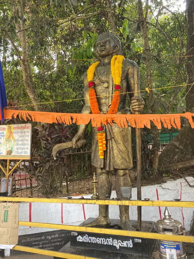
The tradition is also no longer only oral. A statue of Karinthandan now stands beside the Chain Tree at Lakkidi, at roughly 11°31′07″N 76°01′15″E, and Malayalam press reported a memorial portrait of him as early as 2012. Leela Santhosh — born 18 December 1988 in Panamaram, a Paniya woman and the first Adivasi woman to direct in Malayalam cinema, educated at Kanavu, the alternative school founded by the writer K. J. Baby — announced a feature film called Karinthandan with Vinayakan in the lead. The Malayalam Wikipedia entry on her records that the project has stalled and remains unmade. That a Paniya director has been trying to put a Paniya story on screen, and has not been able to finish it, is itself part of how this legend is currently being held.

There is one more devotional use of the pass, and it is Christian rather than tribal. Malayalam sources describe the churam as the setting for a very large Way of the Cross procession, walked up the ghat road in Holy Week by the Catholic congregations of the Thamarassery side — an observance that belongs to the twentieth-century migration that settled these hills, not to anything older. We have not found an official diocesan figure for attendance and we do not repeat the round numbers that circulate; what is well attested is that it happens, on this road, every year.

More about Vythiri and Lakkidi

History

Wayanad’s recorded history reaches the churam early. Under the Kottayam rajas the plateau was reached by a set of forest ghats from the Malabar coast, and C. Gopalan Nair’s 1911 account records that in 1773 a Mysorean army passed through the country by the Tamarasseri ghat on its way to Calicut. Hyder Ali’s forces had been in Malabar since 1766; in 1786 Tipu Sultan extracted from Ravi Varma of Kottayam a deed relinquishing his rights over Wayanad. The pass mattered because whoever held it held the plateau’s access to the sea.

The road as an engineered thing belongs to the colonial period that followed, and to coffee. Gopalan Nair describes British officers of a detachment planting coffee experimentally on a Wayanad hill, and a partner of Parry & Co. passing through around 1820 on his way to estates in Mysore — the beginning of the plantation economy that made a cart road up the ghats worth paying for. Tea, pepper and cardamom followed, and the road up the churam has been widened, re-aligned and re-walled repeatedly since, but the line of the nine bends is essentially the line first cut into the mountainside.

The administrative geography is more recent than most visitors assume. Wayanad was a taluk of the old Malabar district; on 1 January 1957 Malabar was divided into Kannur, Kozhikode and Palakkad and Wayanad taluk was split into North and South Wayanad, with South Wayanad moving to Kozhikode district on 15 March 1957. Wayanad became Kerala’s twelfth district on 1 November 1980, and it was at that point that South Wayanad was divided to create the taluks of Vythiri and Sulthan Bathery. Vythiri taluk today comprises eighteen villages, including Lakkidi, Vythiri, Chundale and Meppadi.

Vythiri also acquired an institution that has nothing to do with tourism. The Kerala Veterinary and Animal Sciences University was created by Ordinance No. 29 of 2010, dated 12 June 2010, and constituted in December that year with its headquarters at Pookode, between Vythiri and Lakkidi. The College of Veterinary and Animal Sciences and the College of Dairy Science and Technology both sit on that campus, which makes this small ghat-head settlement the administrative centre of veterinary education for the whole state.

The other twentieth-century arrival was people. Vythiri town holds St Joseph’s church, described as the first Catholic church in Wayanad, along with St Mary’s Orthodox church, a Mariamman temple and the Vythiri Juma Masjid within a few hundred metres of each other — a compressed record of the mid-century migration of Syrian Christian farmers from Travancore, of Tamil plantation labour, and of the older Mappila trade up the ghats. The mix is visible in the shopfronts before it is visible in any history book.

Why visit

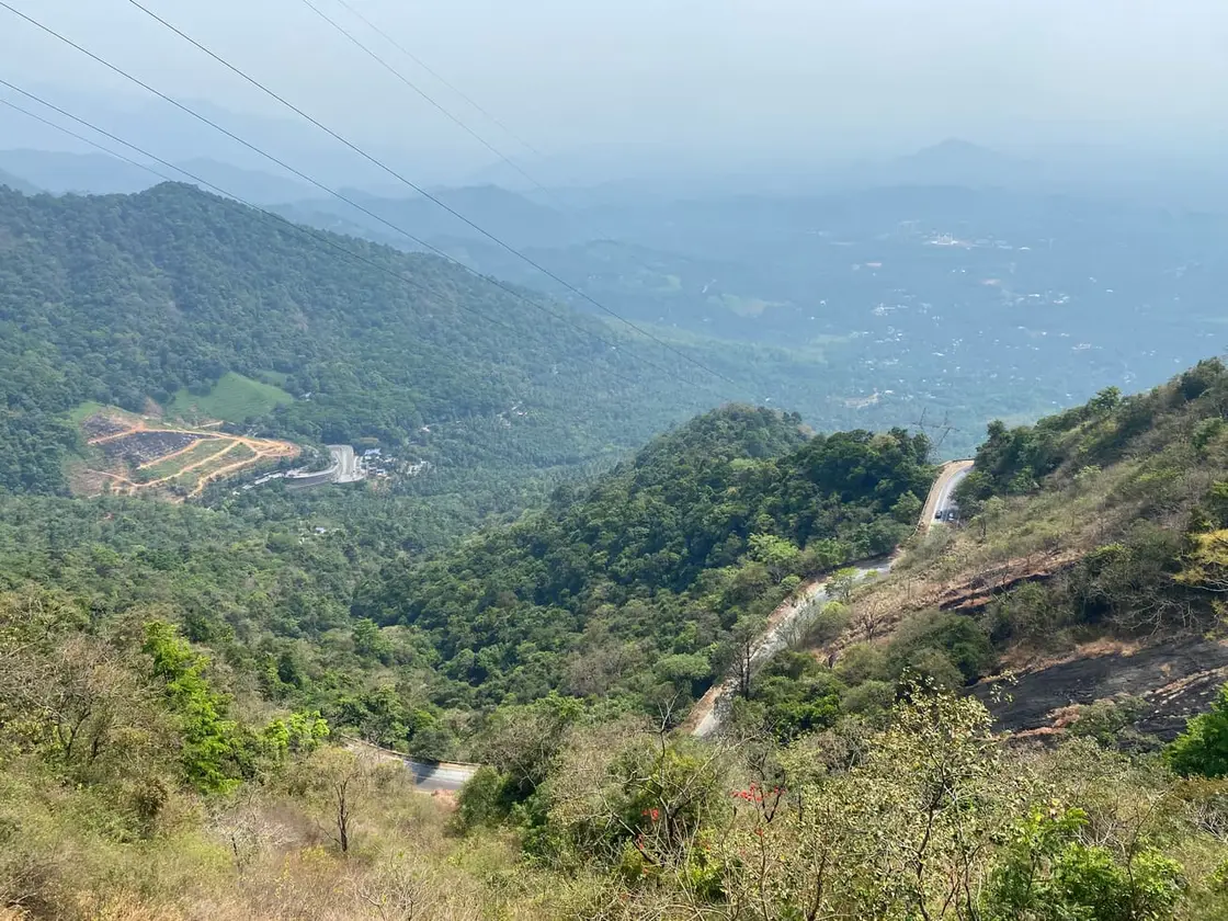
It is the front door: the nine-hairpin climb of the Thamarassery churam is the most dramatic way anyone arrives in Wayanad, and Lakkidi is where it ends.

Vythiri is the most practical base on this side of the district — taluk office, buses, taxis, a chemist and a bank in one short street, with Kalpetta about ten kilometres on.

The cloud is not a nuisance here but the local weather: this stretch is among the wettest inhabited ground in India and the mist genuinely does close and reopen the valley within minutes.

Everything on the plateau’s western side is close — Pookode Lake, the Chain Tree, En Ooru and the Uravu bamboo village at Thrikkaipetta are all short drives from Vythiri.

It is a good place to understand what is happening to the Western Ghats, between the resort belt on the slopes and the tunnel being driven through the mountain a few valleys south.

Tea, honey, pepper and cardamom are sold at the ghat-top stalls by people who grow them a few kilometres away, which is not true of most roadside stalls in Kerala.
Before you go

Vythiri and Lakkidi — at a glance

HoursOpen at all hours as a place, but the Thamarassery churam is not a road to drive after dark or in heavy rain, and Karnataka closes the Bandipur section of NH 766 beyond Sulthan Bathery to all vehicles from 9 pm to 6 am (two-wheelers from 6 pm).

Entry: No ticket. Vythiri and Lakkidi are a taluk town and a ghat-top settlement on a public highway; individual attractions nearby (Pookode Lake, En Ooru, the adventure parks) charge their own admission at their own gates.

Getting here

How to reach Vythiri and Lakkidi

  • ✈︎ By air Not close, whatever the resort brochure says. Calicut International at Karipur (CCJ) is 71 km to the terminal — down the ghat and south past Kozhikode — and decisively the nearer one; Kannur International (CNN) is 106 km via Mananthavady. Both runs include hill road, so think in hours, not kilometres: the CCJ leg is a two-and-a-half to three hour drive on a good day.
  • 🚆︎ By train There is no railway anywhere in Wayanad. Kozhikode (station code CLT), 63 km to the station down the churam, is the railhead with the full coastal network — nothing a booking site offers nearer is a real arrival. Mysore Junction, 150 km the other way across Bandipur, only makes sense when the night closure fits your timings.
  • 🚗︎ By road This town IS the road: Lakkidi stands at the crest of the Thamarassery churam, the nine-hairpin climb that carries NH 766 up from the Kozhikode plain, and Vythiri is 5.4 km further in. Measured by road: Kozhikode 62 km, Kalpetta 10, Kannur 130, Mysuru 148, Coimbatore 201, Kochi 247, Bengaluru 288. Drive the ghat in daylight and in low gear.
  • 🚌︎ By bus One stop, not a stand: Vythiri’s bus stop is on the highway in the middle of the village, and every Kozhikode–Kalpetta–Sulthan Bathery service — KSRTC and private, running all day — passes through it and through Lakkidi. There is no bus station; you wait at the roadside stop, and for Pookode or Lakkidi you simply ask to be set down.
  • ⛴︎ By boat There is no water transport in Wayanad. The boating visitors do here — pedal and rowing boats on Pookode Lake — is an activity inside a ticketed site, part of the visit rather than a way of getting anywhere.
Getting around

Getting around Vythiri and Lakkidi

Vythiri village itself is one short street and is walked — the bus stop, the taluk offices, the chemist and the churches sit within a few hundred metres. Everything else is strung along or just off the highway: Pookode Lake 2.4 km, the En Ooru gate 3.9, the Chain Tree 5.6, Lakkidi View Point 6.6. Autos do the highway hops; for a proper day — the lake, Lakkidi, a Kalpetta-side add-on — the working pattern is the Wayanad one, a taxi or jeep hired for the day through your stay or the local operators. For En Ooru, note that private vehicles stop at the veterinary-college gate and the last stretch is the site’s own shared jeep.

  • 🚕︎ Online taxis Not dependable out here. Uber and Ola have no working presence in Vythiri or Lakkidi — the app pages that claim otherwise are boilerplate, and as in Kalpetta and Bathery, app cabs are not something to plan a Wayanad day around. A pre-booked app car can still bring you up from Kozhikode as an intercity leg. Locally the trade is real taxi operators — Vythiri has its own, and one holds a listing on this page. Kerala Savaari, the state-run app, still runs full-scale only in Kochi and Thiruvananthapuram; a statewide rollout has been announced but has not happened. Where an app does respond, prices are set in-app; we print no fares.
Getting back

Check your return bus or ferry with the operator before setting out. Leave time to reach the stop or jetty after your visit, and arrange a return vehicle in advance for a remote outing.

Ask at the jetty or the stand for the time of the last service back, not the next one. If you miss it, an auto or a taxi is the fallback — agree the fare before you get in.

Do

Things to do in Vythiri and Lakkidi

  • Stop at Lakkidi View Point at the ghat crest — early morning, before the cloud sits down on the bends — and look back down the nine hairpins you have just climbed.
  • Walk the shore path and take a boat at Pookode Lake, 2.4 km from Vythiri; the freshwater aquarium and the stalls make it the easiest family half-day on this side of the district.
  • Visit En Ooru, the tribal heritage village at Pookode — park at the veterinary-college gate, take the shared jeep up, and let the resident artisans, not a display case, do the showing.
  • Pay your respects at the Chain Tree at Lakkidi and read the Karinthandan story on its own page — the statue beside the tree is the district’s memorial to the guide the road never credited.
  • Give a morning to Uravu’s bamboo village at Thrikkaipetta, 21 km out — a working craft campus, not a show village, from the NGO that has run on bamboo since 1996.
  • Walk a tea path on the Vythiri–Chundale side in the late light — the slopes around the town are working estates, and the mist coming over them is the local weather doing what it does.
  • Watch the evening lorry queue build at Lakkidi if you are curious about how a road works: the Bandipur night ban at the far end of NH 766 parks the through traffic here until morning.
Plan

Good to know

  • Through traffic to Mysuru and Bengaluru stacks up around Lakkidi in the evening because of the Bandipur night ban; if you are heading that way, cross Sulthan Bathery well before 9 pm or plan on the 352 km night detour via Mananthavady, Gonikoppal and Hunsur.
  • The nine hairpins are numbered on the road from Adivaram upward, so a breakdown or a landslip is usually reported by bend number in local traffic bulletins — worth knowing before you set out in the monsoon.
  • Pookode, between Vythiri and Lakkidi, is not only the lake: the Kerala Veterinary and Animal Sciences University has its headquarters and two colleges there, which is why the settlement has more student traffic and cheaper food than a resort strip normally would.
  • Calicut airport, not Kannur, is the airport for this side of Wayanad — 71 km against 106, both measured to the terminal. The “Kannur about 82 km” that circulates is a district-level figure measured from somewhere else.
Facilities

On site

  • One highway bus stop in Vythiri village served all day by the Kozhikode–Kalpetta–Bathery corridor — the nearest full bus stations are at Kalpetta, 10 km on
  • Taluk headquarters services in the village — taluk office, treasury, police station, sub-jail, post office, banks and the taluk hospital
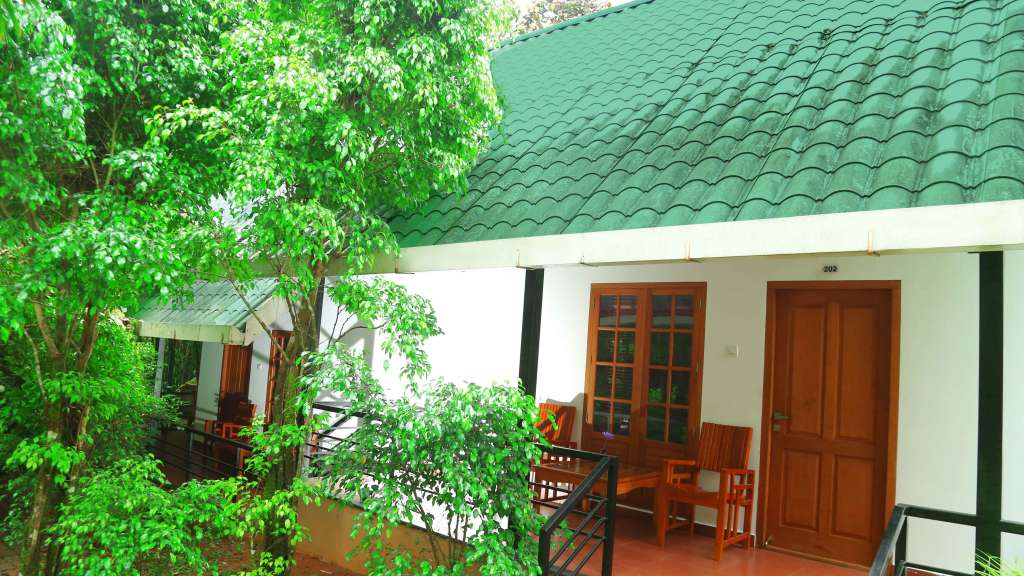
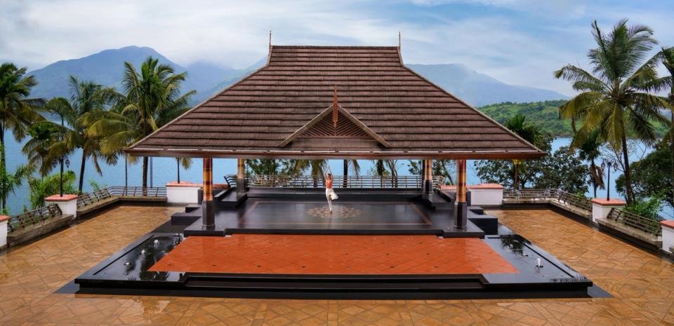
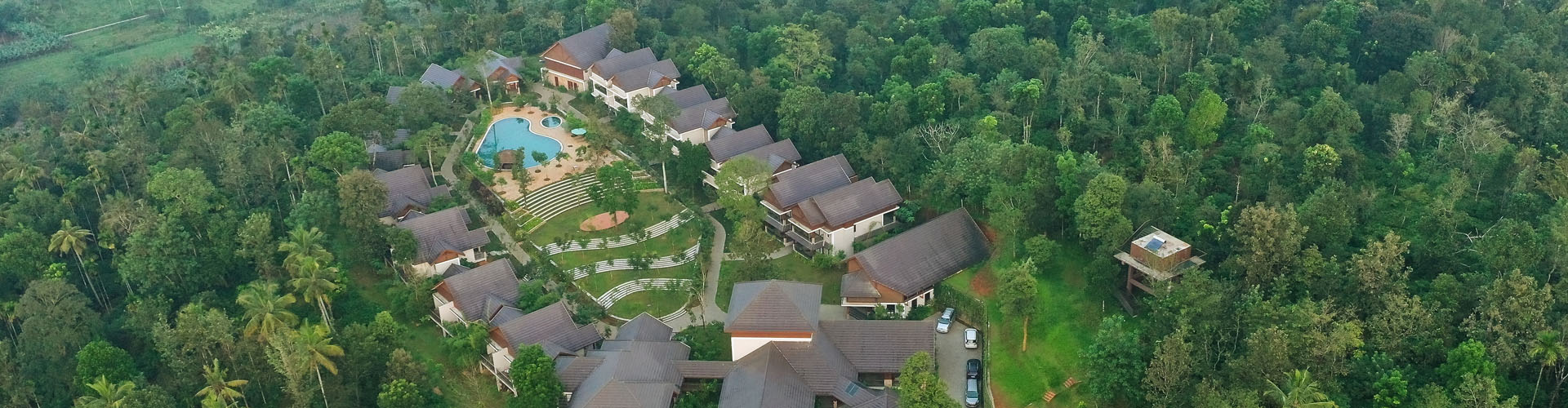
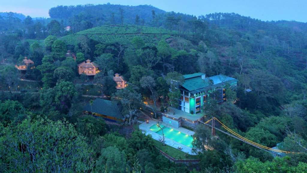
  • Stays from budget rooms to the resort belt on the slopes — about 25 hotels, resorts and homestays hold listings on this page
  • Restaurants and cafes in Vythiri village and along the Pookode–Lakkidi strip, several inside the resorts and open to non-residents
  • Local taxi and jeep operators for ghat transfers, day circuits and the En Ooru jeep leg — the fuel stations and the reliable ATMs are in Vythiri and Kalpetta
Stay safe

Safety

  • The churam is the hazard here: nine hairpins, buses on the outside line, and cloud that can drop visibility to a few metres. Drive it in daylight, in low gear, and pull in rather than crawl when the mist closes.
  • District red-alert rainfall closes hill roads and ecotourism sites across Wayanad as routine policy — on a red-alert day, the closures are the plan, not an obstacle to it.
  • This is elephant and monkey country at the edges: heed Forest Department advisories on the forest fringes, and at Lakkidi guard food against the monkeys on the parapet.
  • The slopes above this taluk have failed before, at Mundakkai and Chooralmala in 2024 — treat every monsoon-season landslip advisory as real, and do not drive the ghat at night in heavy rain.
Getting around Vythiri and Lakkidi

If you need step-free access, contact the site before travelling. Ask about a level entrance, steps along the route, the nearest drop-off point, seating and accessible toilets.

If you need help at Vythiri and Lakkidi
112All emergencies (police · fire · medical)The single number to call in any emergency (ERSS).

Emergency numbers are verified against official government and state tourism sources. 112 works anywhere in India.

Nearby bases

Where to go from Vythiri and Lakkidi

Use Vythiri and Lakkidi as the ghat-road hill base, then choose Lakkidi View Point, Pookode Lake, Chain Tree, resort stays, Chundale adventure stops, Uravu craft experiences, Kalpetta logistics or Meppadi/Chembra side trips depending on road and weather conditions.

In the district

Where Vythiri and Lakkidi sits in Wayanad district

Local transportUse local taxis, autos and verified drivers for Lakkidi View Point, Pookode Lake, Chain Tree, resort transfers, Chundale adventure stops, Uravu/Thrikkaipatta craft visits and Kalpetta-side extensions.
District HQKalpetta
LandscapeWestern Ghats highland — forests & plantations

Wayanad district is known for: Wildlife sanctuary, waterfalls, caves and spice estates.

Confirm current ghat-road traffic, fog, rain and parking conditions before planning Lakkidi viewpoint stops.Keep extra buffer for Kozhikode rail/airport transfers, especially in monsoon, mist and holiday traffic.Vythiri and Lakkidi work best as the Wayanad gateway base for hill stays, lake stops, short adventure activities and fast Kozhikode-side access.Wayanad Wildlife SanctuaryEdakkal CavesChembra Peak & waterfalls
Stay · eat · do · rent · see · shop

Places in Vythiri and Lakkidi

Every verified place in Vythiri and Lakkidi — filter by what you’re after.

25 places to stay in Vythiri and Lakkidi

Vythiri Greens Holiday Resort — Resort in Vythiri and Lakkidi
Verified
Resort · Vythiri and Lakkidi
Vythiri Greens Holiday Resort

Kerala Tourism-listed Vythiri stay record — a source-backed resort option for the Pookode, Lakkidi and ghat-road side of the plateau.

Directions Commission-freeView details
Safari Hills Resort Vythiri — Villa resort in Vythiri and Lakkidi
Verified
Villa resort · Vythiri and Lakkidi
Safari Hills Resort Vythiri

Villa-style resort on Charity Road at Old Vythiri — family and group stays a short hop off the highway, positioned for Pookode Lake, Lakkidi and the Kozhikode-side transfers.

Directions Commission-freeView details
Wayanad Wild CGH Earth Lakkidi — Luxury nature resort in Vythiri and Lakkidi
Verified
Luxury nature resort · Vythiri and Lakkidi
Wayanad Wild CGH Earth Lakkidi

Wayanad Wild, CGH Earth’s nature-led resort at Lakkidi — a high-comfort forest-edge stay at the ghat crest, with the naturalist programme and dining room holding their own listings here.

Directions Commission-freeView details
Jeevess Retreat Wayanad — Luxury Ayurveda resort in Vythiri and Lakkidi
Verified
Luxury Ayurveda resort · Vythiri and Lakkidi
Jeevess Retreat Wayanad
5-star

Five-star wellness and Ayurveda retreat at Achooranam/Pozhuthana with Panchakarma, yoga and Kalaripayattu context.

Directions Commission-freeView details
Taj Wayanad Resort and Spa — Luxury resort and spa in Vythiri and Lakkidi
Verified
Luxury resort and spa · Vythiri and Lakkidi
Taj Wayanad Resort and Spa
5-star

Taj Wayanad Resort and Spa is a luxury resort beside Banasura Lake with cottages, waterfront villas, spa/wellness, dining and curated experiences, useful for high-end Wayanad stays around the Vythiri, Padinjarathara and Banasura side. Luxury resort and spa · Luxury resort, Spa resort, Banasura Lake.

Directions Commission-freeView details
Petals Resorts Wayanad — Resort in Vythiri and Lakkidi
Verified
Resort · Vythiri and Lakkidi
Petals Resorts Wayanad

Petals Resorts is a Thariode-side Wayanad resort near the Vythiri-Tharuvana route, useful for Banasura-side stays and direct resort enquiries. Thariode, Vythiri road, Resort.

Directions Commission-freeView details
Morickap Resort Wayanad — Resort in Vythiri and Lakkidi
Verified
Resort · Vythiri and Lakkidi
Morickap Resort Wayanad

Resort on the Banasura Sagar Dam road at Pinangode — dining, spa and event space between Vythiri and the reservoir side, booked direct.

Directions Commission-freeView details
Vythiri Village Resort — Resort in Vythiri and Lakkidi
Verified
Resort · Vythiri and Lakkidi
Vythiri Village Resort

Five-star nature resort on a 30-acre sanctuary beside Vythiri town. It sits 2,600 feet above sea level in the mist-covered hills.

Directions Commission-freeView details
Vythiri Mist Resort — Resort in Vythiri and Lakkidi
Verified
Resort · Vythiri and Lakkidi
Vythiri Mist Resort

Heritage retreat over 14 acres in the Poonchola Hills at Old Vythiri. Its tea, cardamom and coffee estates host 60-plus bird species.

Directions Commission-freeView details
Vythiri Resort Wayanad — Resort in Vythiri and Lakkidi
Verified
Resort · Vythiri and Lakkidi
Vythiri Resort Wayanad

Kerala Tourism-listed rainforest resort at Lakkidi P.O., up the estate road from Vythiri — the area’s best-known jungle resort name, with direct reservation contact on the state listing.

Directions Commission-freeView details
V
Vythiri Resort
Place to stay
Top pick
Hotel · Vythiri and Lakkidi
Vythiri Resort

Family jungle retreat deep inside a rainforest plantation near Lakkidi. Its treehouses sit up to 90 ft above the forest canopy.

Directions Commission-freeView details
W
Wayanad Silverwoods
Place to stay
Top pick
Hotel · Vythiri and Lakkidi
Wayanad Silverwoods

Luxury resort spread over 16 acres at Manjoora near Pozhuthana. It overlooks the Banasura Sagar reservoir and surrounding hills.

Directions Commission-freeView details
V
Vythiri Wild Resort
Place to stay
Top pick
Hotel · Vythiri and Lakkidi
Vythiri Wild Resort

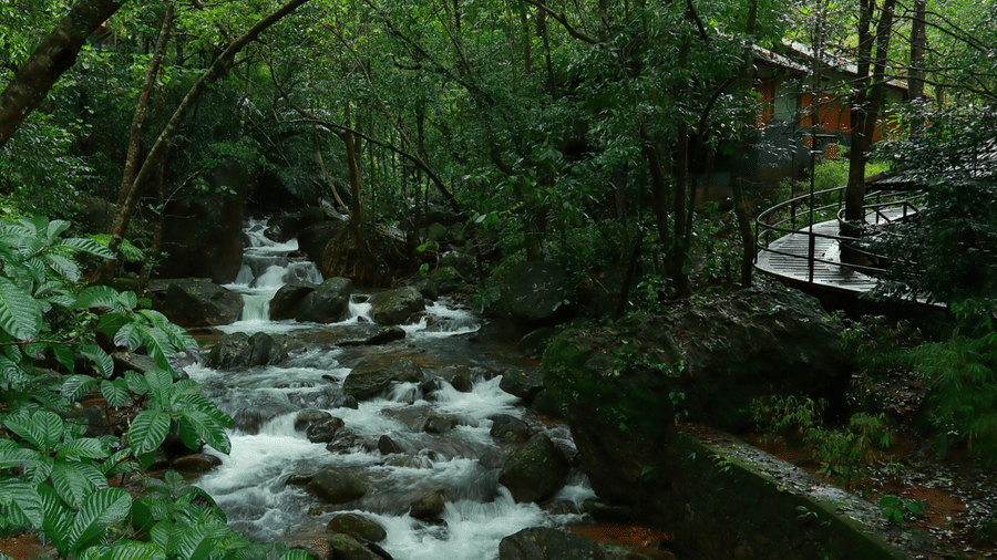
Forest resort tucked into the Vythiri rainforest belt of Wayanad. Deluxe cottages overlook natural streams and wildlife-rich jungle.

Directions Commission-freeView details
V
Vythiri Greens Resort
Place to stay
Top pick
Hotel · Vythiri and Lakkidi
Vythiri Greens Resort

Three-star cottage resort in the Lakkidi rainforest on Aramala road. It has a temperature-controlled pool and multi-cuisine dining.

Directions Commission-freeView details
A
Abad Brookside Lakkidi
Place to stay
Top pick
Hotel · Vythiri and Lakkidi
Abad Brookside Lakkidi

Rain-themed retreat set across seven acres in the misty hills of Lakkidi. It has 32 rooms, pool villas and an infinity pool.

Directions Commission-freeView details
W
Wayanad Wild - A CGH Earth Experience
Place to stay
Hotel · Vythiri and Lakkidi
Wayanad Wild - A CGH Earth Experience

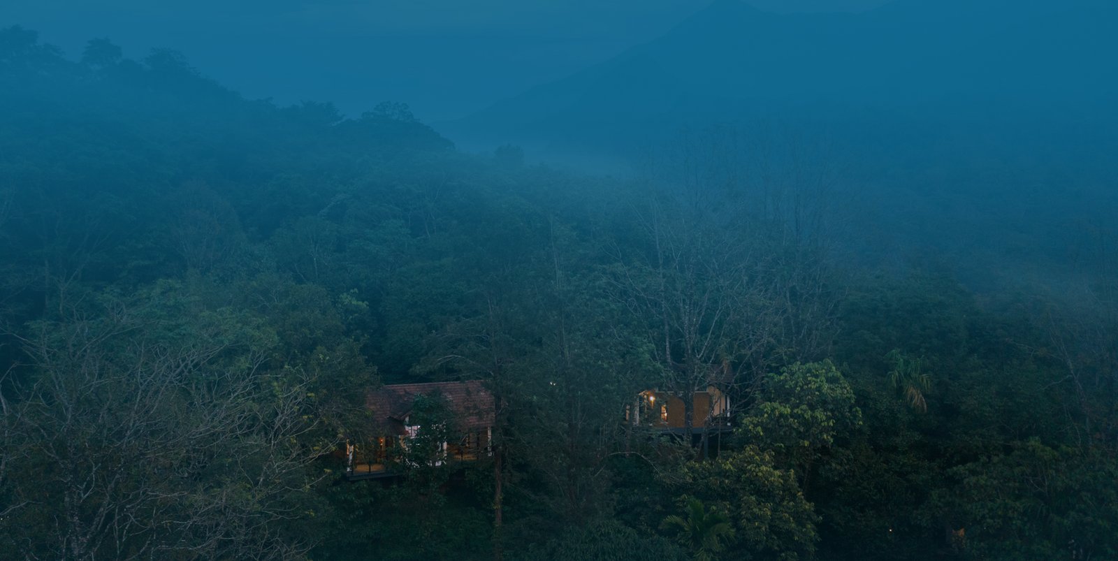
Off-grid eco lodge reached by a 3.5 km jungle track above Lakkidi. Rooms sit at 2,900 feet with no AC, cooled by the rainforest.

Directions Commission-freeView details
J
Jungle Park Resort
Place to stay
Hotel · Vythiri and Lakkidi
Jungle Park Resort

Solar-powered mountain resort past Vythiri near Pookode Lake. Lakeview duplex suites sit at 4,300 feet in the Western Ghats.

Directions Commission-freeView details
G
Grassroots Wayanad
Place to stay
Hotel · Vythiri and Lakkidi
Grassroots Wayanad

Glamping resort of luxury Swiss tents at the foothills of the Vythiri ranges. It overlooks tea and coffee estates at Pozhuthana.

Directions Commission-freeView details
V
Vythiri Holiday Resort
Place to stay
Hotel · Vythiri and Lakkidi
Vythiri Holiday Resort

Nature resort beside the rainforest at Old Vythiri near Charity Church. It rests high in the Western Ghats amid green mountains.

Directions Commission-freeView details
V
Vythiri Tea Valley
Place to stay
Hotel · Vythiri and Lakkidi
Vythiri Tea Valley

Adventure resort of custom glamping domes on Ulahannan Hills, Pozhuthana. Set among tea estates, it offers stargazing and treks.

Directions Commission-freeView details
V
Vythiri Palace Resort
Place to stay
Hotel · Vythiri and Lakkidi
Vythiri Palace Resort

Boutique mountain retreat at Old Vythiri surrounded by misty forests. Pet-friendly, it has a pool, campfire and highland views.

Directions Commission-freeView details
L
Lakkidi Village Resort
Place to stay
Hotel · Vythiri and Lakkidi
Lakkidi Village Resort

Eco-resort of 30 cottages in a hill-locked valley at Lakkidi. A natural stream flows through the virgin-forest property.

Directions Commission-freeView details
A
Annapara Home Stay
Place to stay
Hotel · Vythiri and Lakkidi
Annapara Home Stay

Boutique hilltop homestay in the Vythiri forest built for a digital detox. Its heritage rooms date to 1951, set in the Western Ghats.

Directions Commission-freeView details
W
Wayanad Resort
Place to stay
Hotel · Vythiri and Lakkidi
Wayanad Resort

A suite-villa resort with sites at Vythiri and Ambalavayal. It is known for a glass-bridge tree house alongside mud houses and tent villas.

Directions Commission-freeView details

Book with the place itself. India’s cyber-crime coordination centre warned in April 2025 that convincing copies of hotel and pilgrimage booking sites are being pushed through sponsored search and social ads, taking payment for rooms the property never hears about. Every listing here links to the business’s own contact details and its own Google or Bing profile — we take no commission and sit in nobody’s payment path. If a booking page reached you through an ad, check the address bar against the property’s own site before you pay. Fraud can be reported on cybercrime.gov.in or on 1930.

Ranked

The best of Vythiri and Lakkidi, ranked

Nearest to the centre of Vythiri and Lakkidi, on foot

Ordered by a real routed walk from the town centre — a different question, and the one that decides what you can do before lunch. Straight-line distance understates a real walk by about half again, so these are walking-network figures, not lines on a map.

Everything around Vythiri and Lakkidi, by distance

Every place we hold for Vythiri and Lakkidi, ordered by a real routed drive from the town centre. Times are free-flow and a real road rarely is, so read them as the floor rather than the estimate — anything that routed over ninety minutes is left out rather than published as a number we do not trust.

Places to visit

The places themselves, around Vythiri and Lakkidi

The best tourist places to visit in Vythiri and Lakkidi — temples, viewpoints, lakes, heritage and nature, each with a full guide, how to reach it and what to see nearby.

Lakkidi View Point, Vythiri and Lakkidi
PlaceLakkidi View Point

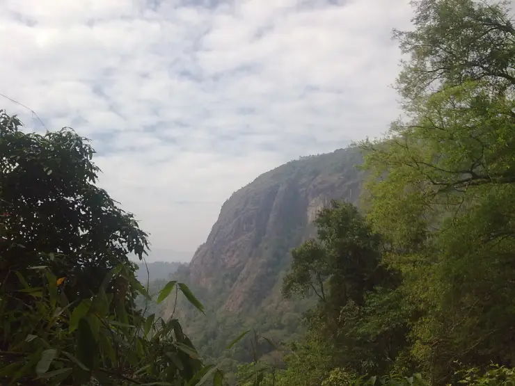
The railing at the top of the nine hairpins — the crest of the Thamarassery churam, where the Kozhikode plain drops away below and the cloud pours over the pass. Come early: the view is a morning creature, and by afternoon in season the mist can sit on the bends for the day. Watch the monkeys on the parapet.

Open guide →
Pookode Lake, Vythiri and Lakkidi
PlacePookode Lake

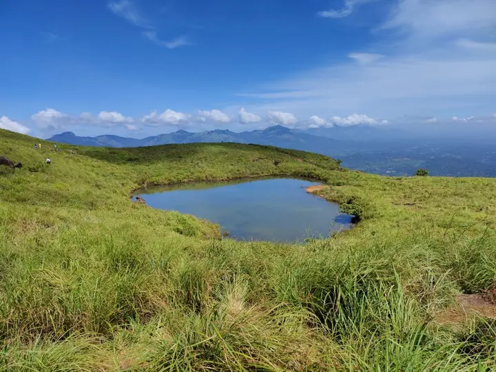
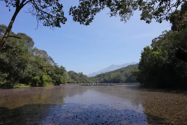
A perennial forest lake at about 770 metres, 2.4 km from Vythiri, said to mirror the map of India in outline and home to a small cyprinid fish recorded in no other water. Boating, a freshwater aquarium and a shore path make it the easiest family half-day on this side of the district.

Open guide →
Chain Tree, Vythiri and Lakkidi
PlaceChain Tree

A ficus by the roadside at Lakkidi with a heavy chain run into its branches — the tree of the Karinthandan legend, the tribal guide the ghat road never credited, whose statue now stands beside it. A ten-minute stop that carries more of Wayanad’s history than most full attractions.

Open guide →
En Ooru Tribal Heritage Village, Vythiri and Lakkidi
PlaceEn Ooru Tribal Heritage Village

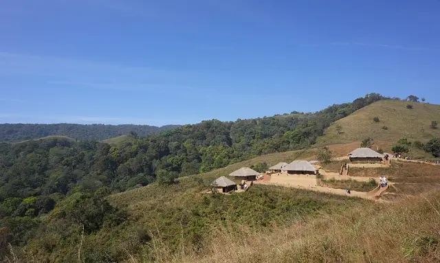
The tribal heritage village on a hillock at Pookode, opened in 2022 after a decade’s building — ten huts in the styles of Wayanad’s communities, a craft workshop and a market, run by residents who live there. Private cars stop at the veterinary-college gate; the site’s shared jeep does the last climb.

Open guide →
Uravu Bamboo Village, Vythiri and Lakkidi
PlaceUravu Bamboo Village

Thrikkaipetta, 21 km out via Kalpetta, where the URAVU study centre has built livelihoods on bamboo since 1996 — a working craft campus of nurseries, training and a workshop floor, not a show village. Go on a working morning and buy at the outlet; the sales are the model.

Open guide →
Resort stays, Vythiri and Lakkidi
PlaceResort stays

The resort belt is this area’s own attraction: jungle, tea-slope and ghat-crest properties strung from the Kunnathidavaka valley to Old Vythiri and Lakkidi, many at the end of narrow estate roads. About 25 stays hold listings on this page — check each one’s actual pin, because a "Vythiri" address can sit anywhere within ten kilometres.

Open guide →
For hotels, homestays and local businesses

Get listed in Vythiri and Lakkidi for free

Roampedia is commission-free. Travellers discover your business, book directly and contact you through official details. Basic listings are free, while Gold and Platinum package upgrades can be requested from the owner dashboard after approval.

List your business — free
Ranked guide modules

The best of Vythiri and Lakkidi, ranked

10 picks

Vythiri and Lakkidi-scoped cards for ghat-road planning: Lakkidi View Point, Pookode Lake, Chain Tree, resort stays, taxis, adventure parks, Uravu craft visits and Kozhikode-side transfer context.

Lakkidi View Point, Vythiri and Lakkidi#1
Vythiri and Lakkidi · Ghat viewpoint

Lakkidi View Point

Classic Kozhikode-Wayanad gateway viewpoint best planned around visibility, parking and ghat-road traffic.

Ghat roadViewpointWeather check
Pookode Lake, Vythiri and Lakkidi#2
Vythiri and Lakkidi · Lake stop

Pookode Lake

Vythiri-side lake stop for lighter family routing, short walks and boating checks where operating.

LakeFamily stopVythiri
Vythiri Resort Wayanad, Vythiri and Lakkidi#3
Vythiri and Lakkidi · Hill stay

Vythiri Resort Wayanad

Kerala Tourism-listed Vythiri/Lakkidi resort base with direct-source contact evidence for hill-stay planning.

ResortHill stayKerala Tourism
Vythiri Village Resort, Vythiri and Lakkidi#4
Vythiri and Lakkidi · Resort and dining

Vythiri Village Resort

Direct-source Vythiri resort near town for family stays, dining, spa and NH-766 access.

VythiriResortDining
Teenzania Adventure Park Lakkidi, Vythiri and Lakkidi#5
Vythiri and Lakkidi · Adventure park

Teenzania Adventure Park Lakkidi

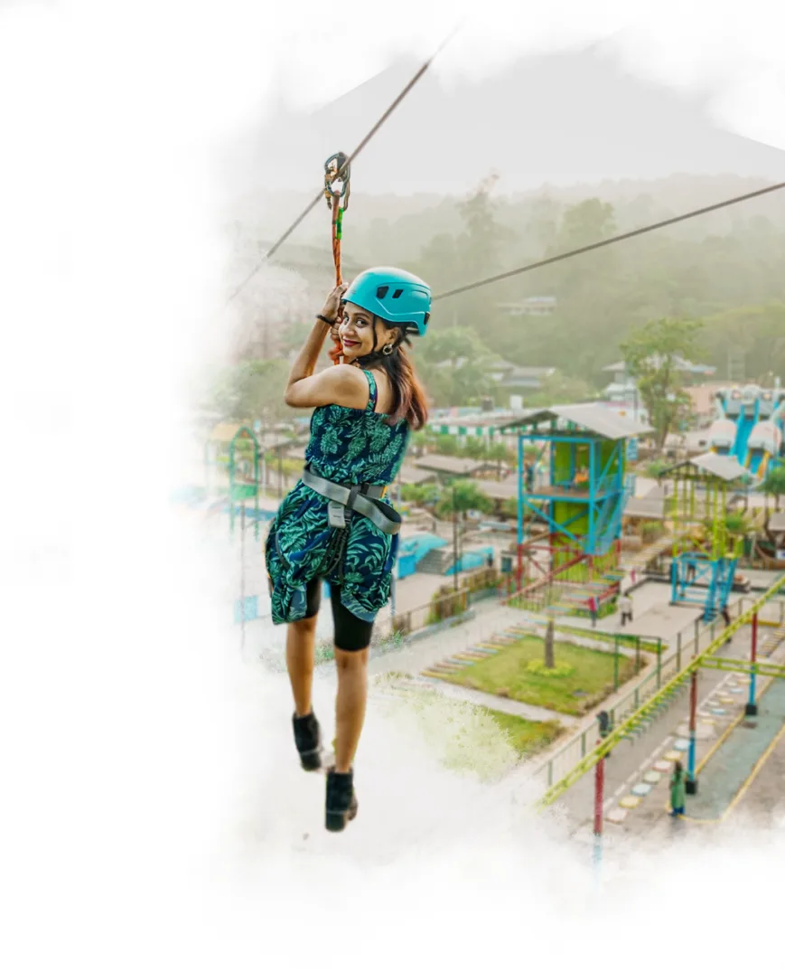
Kerala Tourism-accredited Lakkidi zipline operator opposite Chain Tree with direct phone and email evidence.

ZiplineLakkidiAccredited
Wayanad Adventure Park by Wonders of Wayanad, Vythiri and Lakkidi#6
Vythiri and Lakkidi · Adventure operator

Wayanad Adventure Park by Wonders of Wayanad

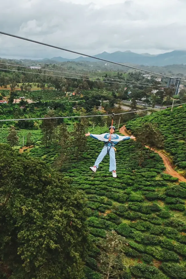
Kerala Tourism-accredited Chundale operator for high ropes, jeep safari, nature walks and zipline.

ChundaleHigh ropesOperator
Vythiri Taxi, Vythiri and Lakkidi#7
Vythiri and Lakkidi · Transport

Vythiri Taxi

Direct-source Vythiri taxi provider for airport transfers, Wayanad sightseeing and local/outstation routes.

TaxiAirport transferSightseeing
Uravu Bamboo Responsible Tourism Wayanad, Vythiri and Lakkidi#8
Vythiri and Lakkidi · Craft experience

Uravu Bamboo Responsible Tourism Wayanad

Thrikkaipatta bamboo craft and responsible-tourism organisation for workshops and community experience planning.

Bamboo craftResponsible tourismWorkshop
Chain Tree, Vythiri and Lakkidi#9
Vythiri and Lakkidi · Legend stop

Chain Tree

Short Lakkidi roadside stop tied to the Karinthandan legend and the ghat-road entrance story.

LakkidiLegendShort stop
Vythiri Village Restaurant, Vythiri and Lakkidi#10
Vythiri and Lakkidi · Food stop

Vythiri Village Restaurant

Direct-source resort restaurant record for Vythiri/Lakkidi food planning near hill-stay routes.

RestaurantResort diningVythiri
Search guides

Hotels, restaurants and stay-budget guides in Vythiri and Lakkidi

Dedicated town guides for high-intent searches. Pages with limited verified supply stay visible for planning but are not submitted for search indexing until enough evidence-backed listings exist.

Food5 matches

Restaurants in Vythiri and Lakkidi

Evidence-backed shortlist with verified local matches, direct planning context and clear next steps.

Search-ready guideOpen guide →
Hotels10 matches

Hotels in Vythiri and Lakkidi

Evidence-backed shortlist with verified local matches, direct planning context and clear next steps.

Search-ready guideOpen guide →
Homestays2 matches

Homestays in Vythiri and Lakkidi

Planning preview kept visible for travellers while more verified listings are added before search indexing.

Planning previewOpen guide →
Resorts10 matches

Resorts in Vythiri and Lakkidi

Evidence-backed shortlist with verified local matches, direct planning context and clear next steps.

Search-ready guideOpen guide →
Wellness5 matches

Ayurveda and wellness places in Vythiri and Lakkidi

Evidence-backed shortlist with verified local matches, direct planning context and clear next steps.

Search-ready guideOpen guide →
Operators2 matches

Tour operators in Vythiri and Lakkidi

Planning preview kept visible for travellers while more verified listings are added before search indexing.

Planning previewOpen guide →
Transport1 match

Taxi and transport providers in Vythiri and Lakkidi

Planning preview kept visible for travellers while more verified listings are added before search indexing.

Planning previewOpen guide →
Budget stays1 match

Cheap places to stay in Vythiri and Lakkidi

Planning preview kept visible for travellers while more verified listings are added before search indexing.

Planning previewOpen guide →
Budget stays1 match

Budget stays in Vythiri and Lakkidi

Planning preview kept visible for travellers while more verified listings are added before search indexing.

Planning previewOpen guide →
Affordable hotels1 match

Affordable hotels in Vythiri and Lakkidi

Planning preview kept visible for travellers while more verified listings are added before search indexing.

Planning previewOpen guide →
Mid-range stays3 matches

Mid-range stays in Vythiri and Lakkidi

Evidence-backed shortlist with verified local matches, direct planning context and clear next steps.

Search-ready guideOpen guide →
Premium stays10 matches

Premium stays in Vythiri and Lakkidi

Evidence-backed shortlist with verified local matches, direct planning context and clear next steps.

Search-ready guideOpen guide →
Luxury stays3 matches

Luxury stays in Vythiri and Lakkidi

Evidence-backed shortlist with verified local matches, direct planning context and clear next steps.

Search-ready guideOpen guide →
Ultra luxury stays2 matches

Ultra luxury stays in Vythiri and Lakkidi

Planning preview kept visible for travellers while more verified listings are added before search indexing.

Planning previewOpen guide →
Town plans

2-day and 3-day plans for Vythiri and Lakkidi

Practical Vythiri and Lakkidi routes built from the town inventory, famous places and official access checks. Confirm activity status, weather, permits and road timing before travel.

2 days

Vythiri and Lakkidi in 2 days

A ghat-side Wayanad plan using Vythiri/Lakkidi for Lakkidi View Point, Pookode Lake, Chain Tree, resort stays, adventure operators and Kozhikode-side transfers.

Hill staysKozhikode-side arrivalShort Wayanad trip
Easy to moderate, with one ghat/lake day and one activity or craft day
3 days

Vythiri and Lakkidi in 3 days

A fuller hill-base route with Lakkidi/Pookode, resort and adventure time, then a Kalpetta, Banasura or Meppadi extension with proper transfer buffers.

Slow hill stayFamiliesAdventure and craft mix
Comfortable, with one arrival day, one local activity day and one wider Wayanad day
Stay safe

Emergency numbers in Vythiri and Lakkidi

Save these before travelling around Vythiri and Lakkidi and Wayanad. Use 112 for any emergency, and confirm local attraction or forest access through official contacts before remote trips.

Read before you go

Vythiri and Lakkidi guides, stories & itineraries

Stories & history of Vythiri and Lakkidi

Written about Vythiri and Lakkidi itself — its history, its legends and the arguments about them.

Nearby in Wayanad

Wider reading from Wayanad. The stories about Vythiri and Lakkidi itself are above.

Planning a trip to Vythiri and Lakkidi

The practical half — what is actually here, in what order to see it, and how to arrive.

Kerala-wide guides & itineraries

Route-level itineraries and practical guides for the rest of the state.

See all 55 Wayanad guides & stories →

Map

Where things are in Vythiri and Lakkidi

FAQ

Vythiri and Lakkidi travel FAQs

How wet is Lakkidi, really?

Wetter than almost anywhere inhabited in Kerala, but the popular figure is doubtful. Travel sites and the English Wikipedia article give 600–650 cm a year, which is about 6,000–6,500 mm. District and agricultural sources describe Lakkidi, Vythiri and Meppadi as Wayanad’s high-rainfall belt with 3,000–4,000 mm, against a district mean of 3,381 mm from IMD data for 1901–2000. The two families of figures differ by nearly a factor of two and we can find no gauge record supporting the higher one. The related claim that Lakkidi has the second-highest rainfall in the world is simply wrong — Mawsynram and Cherrapunji average well over 10,000 mm.

How long is the Thamarassery churam and how many hairpins does it have?

Nine hairpin bends, numbered on the road, from Adivaram at the foot to Lakkidi at the top. The length is given as about 12 km by the Malayalam Wikipedia article on the pass and as roughly 14 km by several tourism descriptions, including our own Lakkidi page. We have not found a surveyed figure that settles it.

Why do lorries pile up at Lakkidi at night?

Because NH 766 has a curfew at its far end. Karnataka closes the 19.7 km through Bandipur to all vehicles from 9 pm to 6 am, and to two-wheelers from 6 pm to 6 am. The signposted night alternative is a 352 km detour via Mananthavady, Gonikoppal and Hunsur, so most through traffic simply waits for six o’clock.

Will the new tunnel replace the churam?

Not for Vythiri and Lakkidi. The Anakkampoyil–Kalladi–Meppadi twin-tube tunnel on State Highway 83 runs from Kozhikode district to Meppadi, several valleys south, and reaches the plateau without touching this pass. It is 8.73 km of alignment, 8.11 km of it tunnel, sanctioned at ₹2,134.5 crore, built for the state by Konkan Railway Corporation with Dilip Buildcon on the civil contract. Foundation 31 August 2025; excavation from early 2026; completion published variously as 2029 and 2030.

Is Vythiri the same as Vythiri taluk?

The town is the headquarters of the taluk, but the taluk is much larger — eighteen villages, including Meppadi and Chundale. Vythiri taluk was created on 1 November 1980, when Wayanad became a district and South Wayanad taluk was split into Vythiri and Sulthan Bathery. It is not a recent creation.

Should we retell the Chain Tree legend on this page?

No, and we deliberately have not. The Karinthandan legend belongs to the Chain Tree and to our Lakkidi View Point page. What we set down here instead is its evidential status — no written record, several mutually inconsistent versions, and a documented 1773 army crossing of the same ghat that complicates the usual framing — together with Paniya traditions about this mountain that almost nobody publishes.

When is the worst time to drive up?

Late afternoon in the monsoon, when cloud sits on the top bends and visibility on the outside of a hairpin can drop to a few metres, and any day the district has a red rainfall alert, when hill roads and ecotourism sites across Wayanad are routinely closed outright. Early morning in dry weather is the easiest drive and the clearest view.

What are the best places to visit in Vythiri and Lakkidi?

Top places to visit in Vythiri and Lakkidi include Lakkidi View Point, Pookode Lake, Chain Tree, En Ooru Tribal Heritage Village, Uravu Bamboo Village, Resort stays — each has a full guide with how to reach it and what to see nearby on this page.

How do I reach Vythiri and Lakkidi?

The nearest airport to Vythiri and Lakkidi is Calicut (CCJ), ~95 km. The rail gateway is Kozhikode (CLT), ~80–100 km (no rail in Wayanad). KSRTC/private buses and taxis connect Kalpetta, Sulthan Bathery and Mananthavady from Kozhikode/Calicut, Mysuru and Bengaluru; confirm current ghat-road timings before travel.

What is the best time to visit Vythiri and Lakkidi?

October to March is the driest and most comfortable season to visit Vythiri and Lakkidi and the rest of Kerala. The June–September monsoon is lush and green but wet, and often brings lower low-season prices.
Photographs: Keerikkadanjose (CC BY-SA 4.0), Sreeraj PS aka Ezhuttukari (CC BY-SA 3.0), Outlander07 (CC BY-SA 3.0), Athulvis (CC BY-SA 4.0), Vengolis (CC BY-SA 4.0). Wikimedia Commons.

Image credits