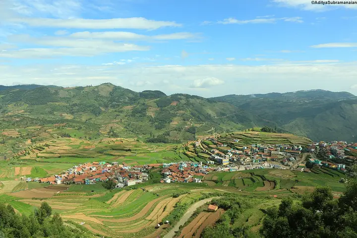
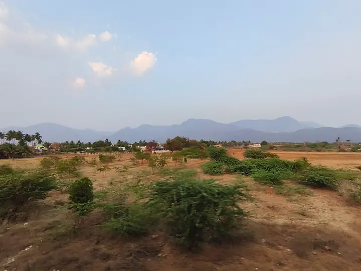
Places to Visit in Kodaikanal

The star-shaped-lake hill station base for Coaker's Walk, Pillar Rocks, the sholas, falls and Berijam Lake.

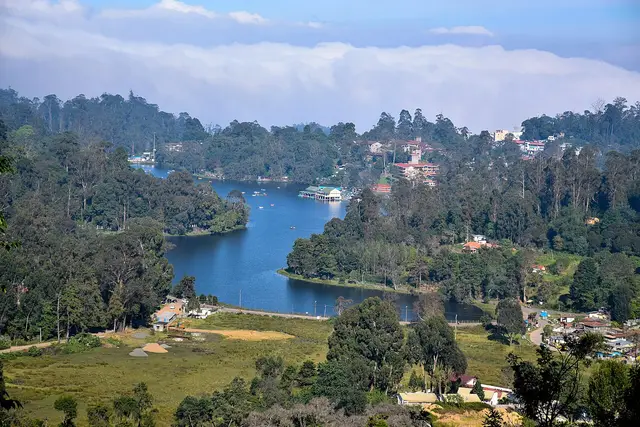
Kodaikanal Lake, Kodaikanal
Practical guide

Plan Kodaikanal

Who's going?Tailor Kodaikanal to your trip
DistrictDindigul
RoleHill-station base
Time neededTwo nights, three if you want Berijam
Places to visit21Listed businesses31
What to expect

Highlights

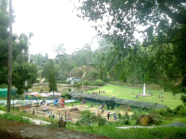
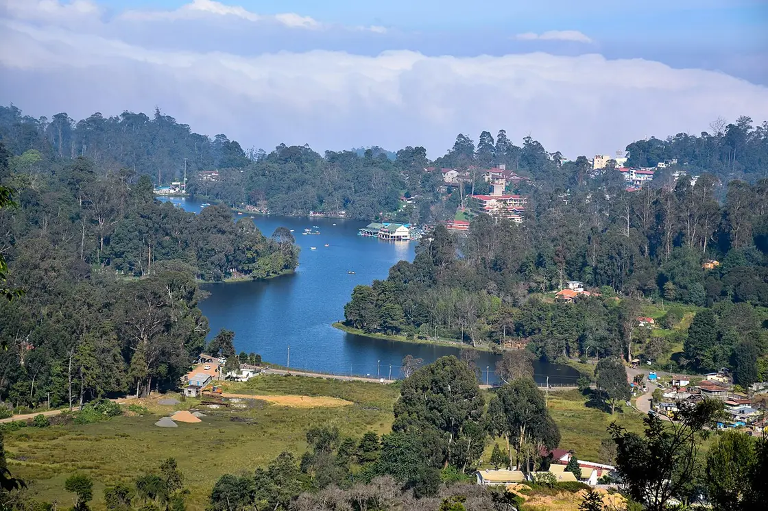
  • Kodaikanal Lake — Star-shaped artificial lake built in 1863 by Vere Henry Levinge, the recreational centre of Kodaikanal, popular for boating and cycling around its bund.
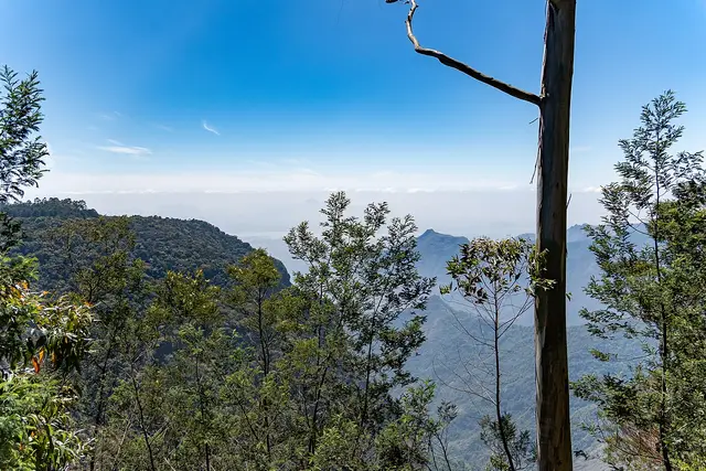
  • Coaker's Walk — A 1 km paved cliff-edge promenade laid out by Lt. Coaker in 1872, offering panoramic views over the valley and plains below Kodaikanal.
  • Bryant Park — A 20-acre botanical garden beside Kodaikanal Lake laid out in 1908, home to hundreds of species of trees, shrubs and cacti and an annual flower show.
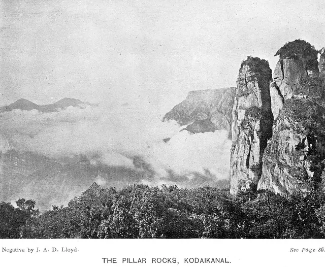
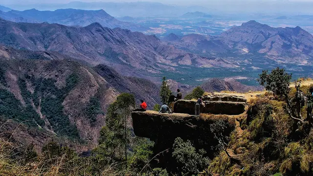
  • Pillar Rocks — Three giant granite boulders rising about 122 m vertically, a landmark viewpoint roughly 7 km from Kodaikanal Lake.
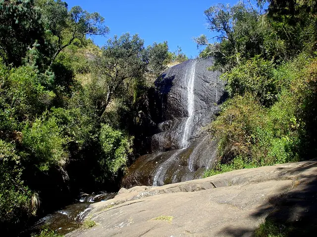
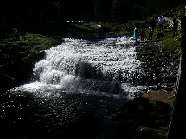
  • Bear Shola Falls — A seasonal cascade set in forest about 3 km from Kodaikanal Lake, named for bears that once came here to drink; flow depends on the monsoon.
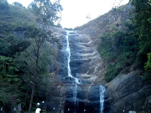
  • Silver Cascade Falls — A roughly 30 m (100 ft) waterfall formed by the overflow of Kodaikanal Lake, on the ghat road about 8 km from town.
Getting there

How to visit

  • Nearest airport: Madurai International (IXM), 132.9 km by routed road and about two hours forty — Tamil Nadu Tourism says about 115 km, and the last stretch is a ghat road you cannot drive at plains speed. Coimbatore International (CJB) is about 170 km on the same official page; we have not routed that one. Neither is a short transfer: budget half a day from the aircraft door.
  • Rail gateway: The station called Kodaikanal is not in Kodaikanal. Kodaikkanal Road (KQN), in Southern Railway’s Madurai division, stands at Ammaianayakkanur down on the plains — 87.6 km and about an hour and fifty away, almost all of it climbing. Palani (PLNI) is the closer railhead at 57.5 km and about an hour and a quarter, and Dindigul Junction (DG) is the biggest at 98.6 km. The train is only ever the first half of the journey here.
  • The bus stand is in the middle of town, 500 metres from the centre, with services listed by Tamil Nadu Tourism from Madurai Aarappalayam, Batlagundu, Palani, Oddanchatram, Kodai Road and Dindigul. By routed road from the town centre: Kurinji Andavar 3.6 km, the Solar Observatory 4.2 km, Silver Cascade 4.3 km, Dolphin’s Nose 5.0 km, Pillar Rocks 7.4 km, Guna Caves 8.3 km, Moir Point 10.3 km, Poombarai 19.8 km, Berijam Lake 23.5 km, Mannavanur 33.5 km, Palani station 57.5 km, Kodai Road station 87.6 km, Dindigul 95.2 km, Madurai 125.4 km.
Timing

Best time to visit Kodaikanal

The state’s own tourism page says April to June, and that is the season the town is built around — the summer festival, the flower show at Bryant Park in May, and the plains at their worst so the hills at their busiest. It is also when rooms cost the most and the roads are full. September to November is the quieter answer: cool, green, and with the north-east monsoon rolling cloud through the sholas, which is either the best thing about a hill station or the reason you cannot see anything, depending on the day. The town averages 1,578.7 mm of rain a year, about 19.8 °C in summer and 8.3 °C in winter, so bring a jacket in any month. One date is a twelve-year clock: the Kurinji shrub flowers once every twelve years and turns the slopes blue when it does.

Weather in KodaikanalSeasonal guide

Live forecast loads in your browser.

Today at Kodaikanal
Sunrise6:10 am
Sunset6:18 pm
Golden hour best light5:18 pm–6:18 pm
Blue hour after sunset6:18 pm–6:43 pm
Sun sets toward compass bearingW · 271°
Moon tonight🌔 Waxing gibbous · 63%
South-west monsoon. June to September is the south-west monsoon in Tamil Nadu. Expect heavy showers, mostly in bursts rather than all day — carry rain cover, allow extra time for getting around, and note that ferries and open-air sites are the first things affected.

Sun and moon are calculated for this location and shown in IST. Photography windows are the hour around sunrise and sunset; the sunset bearing is degrees clockwise from true north. Moon phase is accurate to about half a day.

The story

The story of Kodaikanal

A town the British built to escape the heat, around a lake that did not exist until somebody dug it, on a hill the Palaiyar had lived on for centuries before either.

Kodaikanal announces itself by temperature. You come up from the Madurai plain in the heat, the road starts to bend, and somewhere around the fortieth hairpin you put the window up. That is the whole reason the town is here. It sits at a little over two thousand metres on the southern rim of the Palani hills — the district administration says 7,200 feet, Tamil Nadu Tourism says about 7,000, and the metric figure usually quoted is 2,225 metres, which is 7,300. Nobody agrees on the number and everybody agrees on the effect: it averages about 19.8 °C in summer and 8.3 °C in winter, and it takes 1,578.7 mm of rain a year.

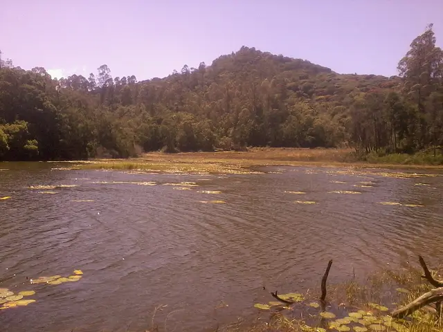
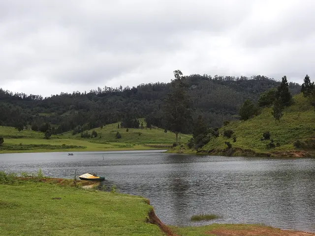
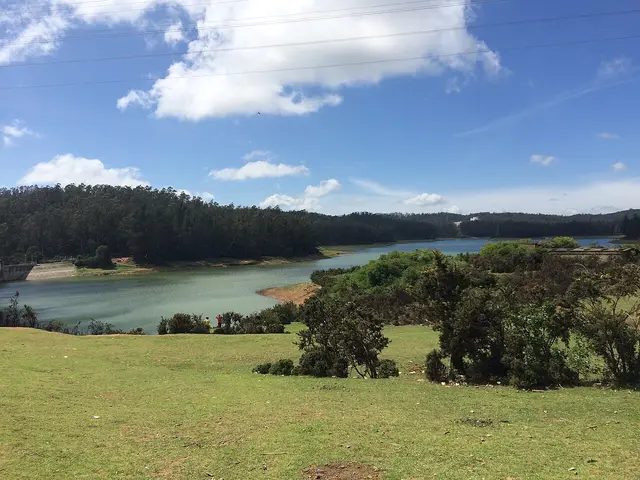
The centre of the town is a lake that is younger than the town. It was made in 1863, on the suggestion of the collector Sir Vere Levinge, by damming three streams into the marshy valley floor — 45 hectares, roughly star-shaped, about five kilometres round. Everything the visitor does is arranged around it: the boat house, the hired cycles, the pony rides, the shore road that is the only flat walk in Kodaikanal. It looks like the oldest thing here and it is one of the newest.

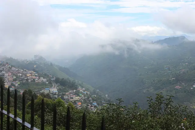
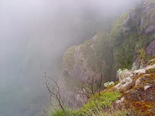
Above it runs Coaker’s Walk, a paved kilometre cut along the cliff edge in 1872 by Lt. Coaker and open from 7 am to 7 pm. On a clear morning you look down two thousand metres to the plains. On a cloudy one you look at cloud, from inside it, and the whole valley appears and disappears while you stand there. Both are the real Kodaikanal; the second is more common, and people who wait for the first often miss the second.

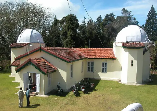
The town has a scientific life that has nothing to do with tourism. The Kodaikanal Solar Observatory was established in 1899, took its first observations in 1901, and has watched the sun almost every clear day since — which makes its plate archive one of the longest continuous solar records anywhere on earth. It is 4.2 km west of the centre and it lets the public in: the museum charges Rs 50 a head, shows a live image of the sun and the Fraunhofer spectrum, and asks for a form fifteen days ahead. A great deal of travel writing says it shuts on Sundays. The Institute’s own page publishes Sunday hours of 9 am to 1 pm.

Go west past the observatory and the town runs out quickly. Pillar Rocks at 7.4 km — three granite masses standing about 122 metres clear of the ground — then Guna Caves at 8.3, then Moir Point at 10.3, where the tarred road ends and the forest road to Berijam begins. Berijam Lake is 23.5 km out inside a reserved forest, and you cannot simply drive there: the Forest Department issues a limited number of vehicle permits in the morning at its office in town, the check post turns back anyone without one, and the gate closes to outbound traffic in the middle of the afternoon. Travel sites give the daily cap as twenty, thirty, thirty-five and fifty vehicles. We could not find the Forest Department saying which, so we do not print a number.

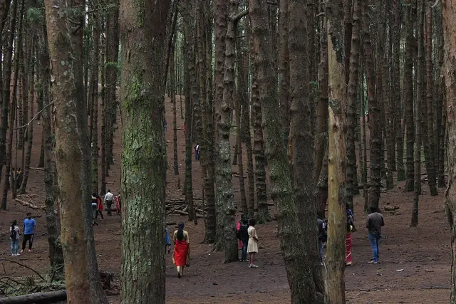
The forest itself is the part of Kodaikanal that is least looked at and most interesting. The native vegetation of these hills is shola — stunted, dense, wet evergreen forest in the folds, with grassland on the ridges — and much of what a visitor now photographs as scenery is not that at all. After the British settled here, sholas were felled and replaced with plantations of introduced pine and eucalyptus, and the Pine Forest that appears on every itinerary is exactly that: a plantation, planted, in rows. Among the surviving native plants is the Kurinji, the shrub that flowers once in about twelve years and turns whole slopes blue when it does, and which gives the Kurinji Andavar temple, 3.6 km north of town, its name.

People were living up here long before any of this. The Palaiyar are the indigenous people of the Palani hills, and when Lieutenant B. S. Ward surveyed the range in 1821 he reported beautiful hills with a healthy climate and about four thousand people already living in well-structured villages. The town that exists now dates from the 1840s onward and was made by American missionaries of the Madurai Mission and by British officials looking for somewhere to survive the hot season — David Coit Scudder arrived in 1862, and by the end of the century the place was a regular summer retreat for missionaries and European officials. In 1909 it had 151 houses, a post office, churches, clubs, schools and shops. It has been a municipality since 1899 and a Special Grade Municipality since 31 May 1994, and about 36,501 people (2011 census) live across its 21.45 square kilometres.

And there is a chapter the brochures leave out. From the early 1980s a thermometer factory operated here, brought from the United States — accounts give the year as 1982 and as 1983 — and taken over by Hindustan Unilever in 1987. The Tamil Nadu Pollution Control Board shut it in March 2001 after mercury waste was found dumped near the Pambar shola. Some 290 tonnes of contaminated waste were shipped to the United States for recycling in 2003; in March 2016 the company reached an out-of-court settlement with its former workers, whose number is given as 511 in one account and 591 in another; and the site was remediated to a standard of 20 mg/kg of mercury in soil, set by the Pollution Control Board, in work that ran from 2017. Campaigners argued at the time that the standard was far laxer than international practice. None of this is visible on a weekend visit, and all of it is part of why the town is careful about waste now — as anyone who buys a plastic bottle here will discover.

Legend & myth

The name is usually translated as gift of the forest, from kodai and kanal, and that reading is on half the signboards in town. It is not the only one. Tamil offers kodai as summer as readily as gift, and kanal as something seen or a clearing as readily as forest, so the same two words support the summer forest, the gift of the forest and the place seen in summer, and Tamil scholars have argued for more than one. We print the popular reading because it is the one the town uses, and we say plainly that it is a reading and not a settled fact.

The Kurinji carries the older story. In classical Tamil poetry the landscape of hills and forest is itself called kurinji, named for this flower, and it is the landscape of lovers meeting in secret — each of the five ancient landscapes had its own mood, and the mountains had this one. That a shrub which blooms once in twelve years should be the emblem of clandestine love is the sort of thing that sounds invented and is genuinely two thousand years old.

More about Kodaikanal

History

The British came for the climate and came slowly. Lieutenant B. S. Ward surveyed the Palani hills in 1821 and reported a healthy climate and about four thousand people already living in the villages there; the revenue collector J. C. Wroughten and C. R. Cotton of the Board explored the range in 1834. Settlement is conventionally dated to 1845, when American missionaries of the Madurai Mission established a hill retreat, but the first permanent house on record is Major J. M. Partridge’s in 1852, and there were still only six or seven houses in 1853. Both dates are printed here because both are current and they do not agree.

The lake made the town. Sir Vere Levinge, the collector, proposed damming the three streams that ran through the marshy valley, and the 45-hectare sheet of water that resulted in 1863 gave the settlement a centre it had not had. Coaker’s Walk followed in 1872, Bryant Park was laid out in 1908, and by 1909 there were 151 houses with a post office, churches, clubs, schools and shops. Municipal status came in 1899 — the same year the Solar Observatory was established, which took its first observations in 1901.

Independence turned a missionaries’ retreat into a mass destination, and the hill has been paying for it since. Native shola forest was replaced with pine and eucalyptus plantations; the lake, the viewpoints and the ghat road now take weekend traffic the town was never built for; and the mercury contamination of 2001 forced a reckoning that is still working itself out. The most recent chapter is a legal one: the Madras High Court has banned plastic bottles under five litres in Kodaikanal, with the District Collector announcing a green tax of Rs 20 a bottle, and inspectors who fine and can seal a shop. It is the first thing most visitors now notice about the town’s attitude to itself.

Why visit

For the temperature, which is still the honest answer after a hundred and eighty years. Summer averages about 19.8 °C. If you have been in the Tamil plains in May, that sentence is the whole argument.

For the walking. The lake circuit is five kilometres and flat, Coaker’s Walk is a paved kilometre along a cliff, and Dolphin’s Nose at 5.0 km is a downhill path to a rock over a gorge — three completely different walks, none of them requiring a guide or a permit.

For the observatory, which almost nobody visits. A hundred and twenty-five years of unbroken solar observation, a live image of the sun, Rs 50, and a form sent a fortnight ahead. There is nothing else like it in a South Indian hill station.

For the far side of the hills. Poombarai at 19.8 km and Mannavanur at 33.5 are terraced villages and high grassland with a fraction of the traffic of the lake road, and Berijam at 23.5 km is a reserved forest you need a morning permit to enter — which is precisely why it is quiet.

And for the cloud. Kodaikanal is at its best when the weather is at its worst: cloud pours through the sholas, the viewpoints open and close in minutes, and the town looks like the place the missionaries described rather than the one on the postcards.
Before you go

Kodaikanal — at a glance

HoursThe town keeps no hours, but three things do and they catch people out. The Solar Observatory museum runs on the Indian Institute of Astrophysics’ own timetable — groups at the main gate either 9:30 am to 12:45 pm or 2:00 pm to 4:00 pm, and on a Sunday 9:00 am to 1:00 pm, with the form submitted at least fifteen days before you come and ninety minutes on the campus. That last detail matters: a great deal of travel writing says the observatory is closed on Sundays, and its own page publishes Sunday hours. Coaker’s Walk is open 7 am to 7 pm on the state tourism page. Berijam permits are issued in the morning only, and the forest gate closes to outbound traffic in the middle of the afternoon, so Berijam is a morning trip or it is nothing.

Entry: Nothing to enter the town. Almost everything that costs money here is small and paid at the gate: Bryant Park, the boat house on the lake, the pony rides, the cycle hire round the lake, and a ticket at Coaker’s Walk. Two are worth knowing in advance. The Solar Observatory museum charges Rs 50 a head and government schools and colleges go free on request with their papers, on the Indian Institute of Astrophysics’ own published terms. Berijam Lake sits inside a reserved forest and needs a Forest Department permit, issued in the morning in limited numbers. Deliberately not printed here: the Berijam permit fee and the daily vehicle cap. Travel sites give the cap as 20, 30, 35 and 50 vehicles and the fee as several different figures, we could find no statement from the Forest Department itself, and a wrong number here would send someone up a mountain road for nothing.

Getting here

How to reach Kodaikanal

  • ✈︎ By air Madurai International (IXM) is the airport, and it is further than the official page says. Tamil Nadu Tourism gives it as about 115 km; routed from the town centre it is 132.9 km and about two hours and forty minutes, because the last stretch is a ghat road with hairpins and you cannot drive it at plains speeds. Coimbatore International (CJB) is the other option at about 170 km on the same official page — we have not routed that one, so treat it as the published figure rather than a measured one. Neither is a short transfer: budget half a day from the aircraft door to the hotel.
  • 🚆︎ By train The station called Kodaikanal is not in Kodaikanal. Kodaikkanal Road (KQN), in the Madurai division of Southern Railway, stands at Ammaianayakkanur on the plains — 87.6 km and about an hour and fifty minutes away by routed road, almost all of it climbing. The name has sent visitors down the wrong road for decades. Palani (PLNI) is the closer railhead at 57.5 km and about an hour and a quarter, though the state’s own page gives it as 64 km. Dindigul Junction (DG), the biggest station of the three, is 98.6 km and about two hours. Whichever you pick, the train is only the first half of the journey and a bus or taxi up the ghat is the second.
  • 🚗︎ By road The town is at the top of a ghat road and everything is measured in hours rather than kilometres. Routed from the town centre: Madurai 125.4 km and about two and a half hours, Dindigul 95.2 km and about an hour and fifty. Inside the hills the numbers collapse — the bus stand is 500 metres from the centre, Bryant Park 700, Coaker’s Walk 900 metres, the lake 1.8 km round the shore road, Bear Shola Falls 2.0 km, the Kurinji Andavar temple 3.6 km, Silver Cascade 4.3 km, the Solar Observatory 4.2 km, Dolphin’s Nose 5.0 km, Pillar Rocks 7.4 km, Guna Caves 8.3 km, Moir Point 10.3 km, Poombarai 19.8 km, Berijam Lake 23.5 km and Mannavanur 33.5 km. Those last three take far longer than the distance suggests: Berijam is half an hour of forest road beyond a check post and Mannavanur about thirty-five minutes.
  • 🚌︎ By bus The bus is how most people actually arrive, and the stand is in the middle of town — 500 metres from the centre, so you can walk to a hotel with a bag. Tamil Nadu Tourism lists services from Madurai Aarappalayam, Batlagundu, Palani, Oddanchatram, Kodai Road and Dindigul. Batlagundu and Kodai Road are the two junctions to know: both sit at the foot of the hill, and the last leg from either is the climb. Buses run this road in the dark and in monsoon cloud; if you are prone to travel sickness, the front half of the bus and a daylight departure are worth planning for.
  • ⛴︎ By boat None as transport. There is rowing and pedalling on Kodaikanal Lake and on Berijam, but no boat goes anywhere — these are hill lakes with no outlet you can travel on.
Getting around

Getting around Kodaikanal

Walk the centre and hire something for the rest. The bus stand, the lake, Bryant Park, Coaker’s Walk and the bazaar are all inside a kilometre of each other, and walking is the pleasure of the place — it is cool, it is downhill and uphill in equal measure, and the views arrive between buildings. Everything else is strung along mountain roads in three directions: the Observatory, Pillar Rocks, Guna Caves and Moir Point west; Silver Cascade and the Kurinji temple north; Dolphin’s Nose and Vattakanal south. The working pattern is a car or a share-taxi for a half day of sights, and taxis wait at the bus stand and round the lake. Cycles are hired by the hour at the lake and are lovely on the shore road and hard work anywhere else — this is a hill station, and every road out of the centre climbs.

  • 🚕︎ Online taxis Do not build a plan on an app. We have no evidence of reliable app-cab supply in Kodaikanal from any primary source, and an operator city page is marketing, not proof of drivers — that is the trap we walked into in Kerala. What is certain is the offline trade: taxis at the bus stand and along the lake, hotels arranging cars by the half day, and share-jeeps to the outlying villages. Fares are agreed before you get in, and there are no meters. We print no fares because we have no notified tariff for this district.
Do

Things to do in Kodaikanal

  • Walk the lake before the day starts. It is a 45-hectare star-shaped sheet of water made in 1863 by damming three streams, about five kilometres round, and the shore road is the one flat walk in Kodaikanal. Cycles and pedal boats are hired at the boat house.
  • Take Coaker’s Walk at first light and again at dusk, and accept that you may see nothing at all. It is a one-kilometre paved path cut along the cliff edge in 1872 by Lt. Coaker, open 7 am to 7 pm, and on a clear morning you see down to the plains; on a cloudy one you see the inside of a cloud. Both are worth the ticket.
  • Go into the Solar Observatory museum, and send the form first. The observatory was established in 1899, has taken solar observations for over a hundred years without a break, and the museum shows a live solar image and the Fraunhofer spectrum. Rs 50 a head, ninety minutes, and a coordinator walks you round.
  • Drive the western road to Pillar Rocks (7.4 km) — three granite pillars standing about 122 metres above the ground — and carry on to Guna Caves at 8.3 km and Moir Point at 10.3, where the forest road to Berijam begins.
  • Get the Berijam permit early and go. The lake is 23.5 km out through reserved forest, half an hour beyond the check post, and the permit is issued in the morning to a limited number of vehicles at the Forest Department office in town. Nobody is let in without one.
  • Walk down to Dolphin’s Nose, 5.0 km from the centre near Vattakanal — a flat rock over a gorge, reached on foot downhill, which means the walk back up is the real one.
  • See Bryant Park, laid out in 1908 beside the lake, twenty acres of trees, shrubs and cacti. If you are here in May, the annual flower show is the town’s biggest event.
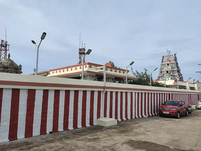
  • Go up to the Kurinji Andavar temple, 3.6 km north, for the view along the Palani range and for the plant it is named after — the Kurinji, which flowers once in twelve years.
  • Drive to Poombarai (19.8 km) or Mannavanur (33.5 km) for the other Kodaikanal: terraced village fields, a high grassland lake, and a sheep farm, with a fraction of the crowds of the lake road.
Plan

Good to know

  • Bring a refillable bottle. Plastic bottles under five litres are banned under a Madras High Court order, there is a green tax of Rs 20 a bottle, and the ban is enforced with inspections.
  • Bring warm clothes in every month. Winter averages 8.3 °C and the evenings are cold at 2,000-plus metres even in May.
  • Do not plan Berijam for the afternoon. Permits are issued in the morning and the forest gate closes early; there is no way in without one.
  • The station named Kodaikanal Road is 87.6 km away on the plains. Book to Palani (57.5 km) or Dindigul Junction (98.6 km) if the connection suits, and expect a bus or taxi up the ghat either way.
  • Cloud is not bad weather here, it is the weather. Viewpoints clear and close within minutes, so go twice rather than waiting.
Facilities

On site

  • Kodaikanal bus stand, in the centre of town — 500 metres from the town centre, with services from Madurai Aarappalayam, Batlagundu, Palani, Oddanchatram, Kodai Road and Dindigul
  • Boat house on Kodaikanal Lake — rowing and pedal boats, and cycle hire on the shore road
  • Bryant Park, 700 metres from the centre — a twenty-acre botanical garden laid out in 1908, with the annual flower show in May
  • Kodaikanal Solar Observatory museum, 4.2 km west — Rs 50 a head, entry by a form submitted at least fifteen days ahead
  • Forest Department office in town — the only place a Berijam Lake permit is issued, mornings only
  • Taxi and share-jeep stands at the bus stand and around the lake; no metered fares, agree before you travel
Stay safe

Safety

  • The ghat roads are the real risk, not the town. Hairpins, cloud and heavy tourist traffic at weekends; if you are driving yourself, do it in daylight.
  • Cliff-edge viewpoints here have no continuous railing. Green Valley View carries its old nickname for a reason, and every year people go over the edge taking photographs.
  • Leeches are common in the sholas in and after the monsoon. Socks and closed shoes, and check your ankles after a forest walk.
  • Do not feed or approach the gaur. Indian bison come into the town’s edges and gardens, and a gaur that feels crowded is dangerous.
Getting around Kodaikanal

If you need step-free access, contact the site before travelling. Ask about a level entrance, steps along the route, the nearest drop-off point, seating and accessible toilets.

If you need help at Kodaikanal
112All emergencies (police · fire · medical)The single number to call in any emergency (ERSS).

Emergency numbers are verified against official government and state tourism sources. 112 works anywhere in India.

Practical things near Kodaikanal
ToiletsPublic toilet 375 m · 5 min walkCharges a feeMapped Feb 2011DirectionsTaxi & auto standsTaxi / auto stand 345 m · 4 min walkMapped Feb 2011DirectionsParkingParking 1.3 km · 16 min walkMapped Feb 2011DirectionsFuelBharat Petroleum Fuel station188 m · 2 min walkMapped Jun 2023DirectionsPharmacyMaruti medicals Pharmacy271 m · 3 min walkMapped Mar 2020DirectionsHospitalVan Allen Hospital 515 m · 6 min walkMapped Feb 2020DirectionsPolice stationDYSP Police station 553 m · 7 min walkMapped Jul 2025DirectionsATMATM 137 m · 2 min walkOpen 24 hoursMapped Mar 2025DirectionsBankHDFC Bank 186 m · 2 min walkMapped Jun 2023DirectionsWater & snacksKaleswari super market 178 m · 2 min walkMapped Oct 2019DirectionsGroceries & bakeryPastry corner Bakery234 m · 3 min walkMapped Mar 2025DirectionsPost officeKodaikanal S.O Post office553 m · 7 min walkMapped Dec 2016DirectionsSomewhere to prayCSI Church 219 m · 3 min walkMapped Feb 2013DirectionsSomewhere to sitBench 379 m · 5 min walkMapped Apr 2015DirectionsPark or gardenPark 1.4 km · 17 min walkMapped Jan 2024DirectionsVetKodai Veterinary Hospital 1.3 km · 16 min walkDaily 08:00–12:00, 15:00–17:00Mapped May 2022Directions
What the cash actually costs
  • Withdrawing from a bank that is not your own is free for a set number of times a month, then costs up to ₹23 plus GST — about ₹27 a withdrawal. This is not one of the RBI’s six metro centres, so the allowance here is the higher one: at least five free other-bank withdrawals a month, and at least five at your own bank.
  • That free allowance belongs to Indian bank accounts. On a card issued abroad your own bank’s international withdrawal and exchange charges apply instead. If the machine offers to bill you in your home currency, choose rupees — the conversion rate on that offer is set by the machine, not by your bank.
  • Choose a well-lit ATM, preferably at a bank branch. Shield your PIN, avoid help from strangers and use your bank’s support number if a withdrawal fails or the machine retains your card.

Charge cap and free-transaction limits: Reserve Bank of India, in force since 1 May 2025.

These services are listed within about 1.2 km of Kodaikanal. Walking distances follow mapped routes; access and opening hours can change. Other services may be closer but are not included here.

Nearby bases

Where to go from Kodaikanal

Dindigul Fort, DindigulFeatured: Dindigul Fort
Town / base

Dindigul

The district-town base for the Rock Fort, the Begambur mosque and the Thadikombu temple.

Dindigul FortSoundararaja Perumal Temple, ThadikombuBegambur Big MosqueAbirami Amman Temple, Dindigul
Open Dindigul guide →
Arulmigu Dhandayuthapani Swamy Temple, PalaniFeatured: Arulmigu Dhandayuthapani Swamy Temple
Town / base

Palani

The pilgrimage-town base for the hilltop Dhandayuthapani Swamy temple, the winch railway and the Idumban shrine.

Arulmigu Dhandayuthapani Swamy TemplePalani Winch and Rope-CarIdumban TempleThiru Avinankudi Temple, Palani
Open Palani guide →
Sirumalai Hills, SirumalaiFeatured: Sirumalai Hills
Town / base

Sirumalai

The low eastern hill range base above the Dindigul plains.

Sirumalai HillsVaradhamanadhi Dam
Open Sirumalai guide →
Nilakottai base
Town / base

Nilakottai

Nilakottai area of the district.

Vellimalai Sivan Temple, SirumalaiAnjaneyar Temple, Anaipatti
Open Nilakottai guide →
Christ the King Church, Kodaikanal, VellagaviFeatured: Christ the King Church, Kodaikanal
Town / base

Vellagavi

Vellagavi area of the district.

La Salette Church, KodaikanalChrist the King Church, KodaikanalVellagavi
Open Vellagavi guide →
Poombarai Village, PoombaraiFeatured: Poombarai Village
Town / base

Poombarai

Poombarai area of the district.

Poombarai Village
Open Poombarai guide →
Manjalar Dam, BatlagunduFeatured: Manjalar Dam
Town / base

Batlagundu

Batlagundu area of the district.

Manjalar Dam
Open Batlagundu guide →
Athoor base
Town / base

Athoor

Athoor area of the district.

Kamarajar LakeMarudhanadhi Dam
Open Athoor guide →
Chinnalapatti, ChinnalapattiChinnalapatti base
Town / base

Chinnalapatti

Chinnalapatti area of the district.

Chinnalapatti
Open Chinnalapatti guide →
Stay · eat · do · rent · see · shop

Places in Kodaikanal

Every verified place in Kodaikanal — filter by what you’re after.

1 thing to do in Kodaikanal

K
Kodai Jeep Trip
Things to do
Tour operator
Kodai Jeep Trip

Jeep safaris and guided walks — Perumal Peak, Dolphin's Nose, the pine forest, Bear Shola and Vattakanal. Address and phone from its own site.

Directions Commission-freeView details

Book with the place itself. India’s cyber-crime coordination centre warned in April 2025 that convincing copies of hotel and pilgrimage booking sites are being pushed through sponsored search and social ads, taking payment for rooms the property never hears about. Every listing here links to the business’s own contact details and its own Google or Bing profile — we take no commission and sit in nobody’s payment path. If a booking page reached you through an ad, check the address bar against the property’s own site before you pay. Fraud can be reported on cybercrime.gov.in or on 1930.

Ranked

The best of Kodaikanal, ranked

Nearest to the centre of Kodaikanal, on foot

Ordered by a real routed walk from the town centre — a different question, and the one that decides what you can do before lunch. Straight-line distance understates a real walk by about half again, so these are walking-network figures, not lines on a map.

Everything around Kodaikanal, by distance

Every place we hold for Kodaikanal, ordered by a real routed drive from the town centre. Times are free-flow and a real road rarely is, so read them as the floor rather than the estimate — anything that routed over ninety minutes is left out rather than published as a number we do not trust.

Places to visit

The places themselves, around Kodaikanal

The best tourist places to visit in Kodaikanal — temples, viewpoints, lakes, heritage and nature, each with a full guide, how to reach it and what to see nearby.

Kodaikanal Lake, Kodaikanal
PlaceKodaikanal Lake

Star-shaped artificial lake built in 1863 by Vere Henry Levinge, the recreational centre of Kodaikanal, popular for boating and cycling around its bund.

Open guide →
Coaker's Walk, Kodaikanal
PlaceCoaker's Walk

A 1 km paved cliff-edge promenade laid out by Lt. Coaker in 1872, offering panoramic views over the valley and plains below Kodaikanal.

Open guide →
Bryant Park, Kodaikanal
PlaceBryant Park

A 20-acre botanical garden beside Kodaikanal Lake laid out in 1908, home to hundreds of species of trees, shrubs and cacti and an annual flower show.

Open guide →
Pillar Rocks, Kodaikanal
PlacePillar Rocks

Three giant granite boulders rising about 122 m vertically, a landmark viewpoint roughly 7 km from Kodaikanal Lake.

Open guide →
Bear Shola Falls, Kodaikanal
PlaceBear Shola Falls

A seasonal cascade set in forest about 3 km from Kodaikanal Lake, named for bears that once came here to drink; flow depends on the monsoon.

Open guide →
Silver Cascade Falls, Kodaikanal
PlaceSilver Cascade Falls

A roughly 30 m (100 ft) waterfall formed by the overflow of Kodaikanal Lake, on the ghat road about 8 km from town.

Open guide →
Dolphin's Nose, Kodaikanal
PlaceDolphin's Nose

A flat rock projecting over a steep gorge near Vattakanal, reached by a downhill trek, giving sweeping views over the deep valley below Kodaikanal.

Open guide →
Guna Caves, Kodaikanal
PlaceGuna Caves

Deep, dangerous rock crevices among the Pillar Rocks, originally known as Devil's Kitchen and renamed after the 1991 Tamil film Guna was shot here.

Open guide →
Berijam Lake, Kodaikanal
PlaceBerijam Lake

An artificial reservoir about 22 km from Kodaikanal inside a reserved forest, requiring a forest-department permit to enter, known for its clear water and wildlife.

Open guide →
Green Valley View (Suicide Point), Kodaikanal
PlaceGreen Valley View (Suicide Point)

A viewpoint near the golf course overlooking a deep drop into the valley and Vaigai dam plains, formerly called Suicide Point.

Open guide →
Kurinji Andavar Temple, Kodaikanal
PlaceKurinji Andavar Temple

A Murugan temple built in 1936, associated with the Kurinji flower that blooms once every twelve years, offering hill views about 3 km from Kodaikanal Lake.

Open guide →
Mannavanur Lake, Kodaikanal
PlaceMannavanur Lake

A tranquil high-altitude lake near Mannavanur village about 35 km from Kodaikanal, set amid grassland and a sheep and rabbit farm.

Open guide →
Kodaikanal Solar Observatory, Kodaikanal
PlaceKodaikanal Solar Observatory

A solar and astronomical observatory established in 1899 by the Indian Institute of Astrophysics, holding one of the world's longest continuous records of solar images.

Open guide →
Thalaiyar Falls, Kodaikanal
PlaceThalaiyar Falls

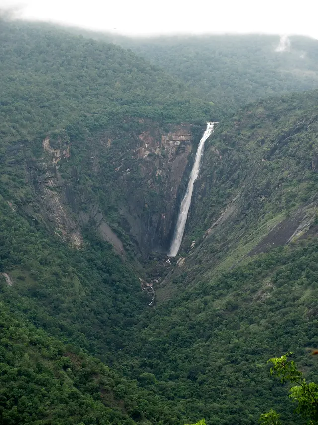
Also called Rat Tail Falls, at about 297 m it is one of the tallest waterfalls in Tamil Nadu, plunging down the Palani hills and visible from the Kodaikanal ghat road.

Open guide →
Pine Forest, Kodaikanal
PlacePine Forest

A dense man-made plantation of tall pine trees started in 1906, a popular scenic and photography spot on the way to Pillar Rocks.

Open guide →
Moir Point, Kodaikanal
PlaceMoir Point

A forest viewpoint on the road to Berijam Lake, named after the engineer who planned the Kodai-Munnar forest road, marking the entry to the reserved forest.

Open guide →
Kuzhandai Velappar Temple, Poombarai, Kodaikanal
PlaceKuzhandai Velappar Temple, Poombarai

An ancient Murugan temple at Poombarai village near Kodaikanal, believed to predate the Palani temple, set among terraced hill farms.

Open guide →
Kamaraj Sagar Dam, Kodaikanal
PlaceKamaraj Sagar Dam

A small dam and reservoir near Kodaikanal, also known as Shola Dam, a quiet picnic and film-shooting spot away from the crowded lake.

Open guide →
Fairy Falls, Kodaikanal, Kodaikanal
PlaceFairy Falls, Kodaikanal

An offbeat waterfall reached by a scenic forest trek from the Vattakanal area of Kodaikanal. The stream cascades over granite through dense woodland, forming small natural pools. It is favoured by trekkers seeking quieter spots away from the main tourist circuit.

Open guide →
Silent Valley View, Kodaikanal, Kodaikanal
PlaceSilent Valley View, Kodaikanal

A quiet, often overlooked viewpoint near Kodaikanal that lives up to its name. Early mornings offer views over cloud-filled valleys and dew-covered landscapes of the Palani Hills. It is a peaceful alternative to the busier Coaker's Walk and Green Valley viewpoints.

Open guide →
K
Kodaikanal Golf Club
No photograph yet
PlaceKodaikanal Golf Club

A historic golf course established in the colonial era on the rolling grasslands of Kodaikanal. Set amid pine and shola forest, it is one of the older hill-station golf clubs in South India. Its scenic fairways are counted among Kodaikanal's notable attractions.

Open guide →
For hotels, homestays and local businesses

Get listed in Kodaikanal for free

Roampedia is commission-free. Travellers discover your business, book directly and contact you through official details. Basic listings are free, while Gold and Platinum package upgrades can be requested from the owner dashboard after approval.

List your business — free
Ranked guide modules

The best of Kodaikanal, ranked

10 picks

The places that sit in and around Kodaikanal itself, each with its own guide page.

Kodaikanal Lake, Kodaikanal#1
Kodaikanal · dam

Kodaikanal Lake

Start at the water. It is man-made — three streams dammed in 1863 — about five kilometres round, and the shore road is the one flat walk in town.

KodaikanaldamDindigul
Coaker's Walk, Kodaikanal#2
Kodaikanal · viewpoint

Coaker's Walk

A paved kilometre along the cliff edge, cut in 1872 and open 7 am to 7 pm. On a clear morning you see the plains; on a cloudy one you stand inside the cloud.

KodaikanalviewpointDindigul
Bryant Park, Kodaikanal#3
Kodaikanal · park

Bryant Park

Twenty acres of trees and lawn laid out in 1908 beside the lake, run by the Horticulture Department. The May flower show is the town’s biggest event.

KodaikanalparkDindigul
Pillar Rocks, Kodaikanal#4
Kodaikanal · viewpoint

Pillar Rocks

Three granite masses standing about 122 metres clear of the slope, 7.4 km west of town on the road that also takes in Guna Caves and Moir Point.

KodaikanalviewpointDindigul
Bear Shola Falls, Kodaikanal#5
Kodaikanal · waterfall

Bear Shola Falls

A seasonal cascade in forest 2.0 km from the centre, named for the bears that once drank here. Worth the short walk after rain and not much before it.

KodaikanalwaterfallDindigul
Silver Cascade Falls, Kodaikanal#6
Kodaikanal · waterfall

Silver Cascade Falls

The lake’s overflow on the ghat road. Every source says it is about 8 km from town; routed it is 4.3 km, and the pin is confirmed twice.

KodaikanalwaterfallDindigul
Dolphin's Nose, Kodaikanal#7
Kodaikanal · viewpoint

Dolphin's Nose

A flat rock over a gorge near Vattakanal, 5.0 km out and reached on foot downhill — which means the walk back up is the real one.

KodaikanalviewpointDindigul
Guna Caves, Kodaikanal#8
Kodaikanal · cave

Guna Caves

Deep rock clefts among the pines 8.3 km west, fenced off after deaths inside them — you see them from the walkway, not from within.

KodaikanalcaveDindigul
Berijam Lake, Kodaikanal#9
Kodaikanal · dam

Berijam Lake

A reserved-forest lake 23.5 km out that you cannot simply drive to: the Forest Department issues a limited number of vehicle permits in the morning, and the gate closes early. A morning trip or nothing.

KodaikanaldamDindigul
Kurinji Andavar Temple, Kodaikanal#10
Kodaikanal · temple

Kurinji Andavar Temple

A Murugan temple 3.6 km north named for the Kurinji, the shrub that flowers once in about twelve years and turns whole slopes blue.

KodaikanaltempleDindigul
Read before you go

Kodaikanal guides, stories & itineraries

Stories & history of Kodaikanal

Written about Kodaikanal itself — its history, its legends and the arguments about them.

Nearby in Dindigul

Wider reading from Dindigul. The stories about Kodaikanal itself are above.

Planning a trip to Kodaikanal

The practical half — what is actually here, in what order to see it, and how to arrive.

More from Dindigul

Wider guides to Dindigul — its coast, its culture and the routes through it.

See all 26 Dindigul guides & stories →

Map

Where things are in Kodaikanal

FAQ

Kodaikanal travel FAQs

Is the railway station called Kodaikanal Road actually in Kodaikanal?

No, and the name has misled visitors for decades. Kodaikkanal Road (KQN) stands at Ammaianayakkanur on the plains, in the Madurai division of Southern Railway, 87.6 km from the town by routed road and about an hour and fifty minutes of climbing. Palani (PLNI) is nearer at 57.5 km, and Dindigul Junction (DG) is 98.6 km. Whichever you use, a bus or taxi up the ghat is the second half of the journey. Tamil Nadu Tourism gives Kodai Road as 80 km and Palani as 64; those are the published figures, and ours are measured.

Do I need a permit for Berijam Lake, and can I get one on the day?

Yes, you need one, and yes, it is issued on the day — in the morning only, at the Forest Department office in town, to a limited number of vehicles. The lake is inside a reserved forest, the check post beyond Moir Point turns back anyone without a permit, and the gate closes to outbound traffic in the middle of the afternoon, so this is a morning trip or it does not happen. We deliberately do not print the daily vehicle cap or the fee: travel sites quote the cap as twenty, thirty, thirty-five and fifty, we could find no statement from the Forest Department itself, and being wrong about it would cost you a morning.

Can I bring plastic water bottles?

No. Plastic bottles under five litres are banned in Kodaikanal under a Madras High Court order protecting the Western Ghats, and the District Collector announced a green tax of Rs 20 a bottle. A monitoring committee makes surprise inspections, fines establishments and can seal shops. The newspaper that reported the start date printed two different ones, in September and in October 2024; what matters is that it is in force. Bring a refillable bottle.

What is the Kurinji, and when does it flower next?

It is a hill shrub whose flowering is synchronised across whole slopes about once in twelve years, turning them blue. It is why the Kurinji Andavar temple 3.6 km north of town has that name, and it is the plant that gives its name to the mountain landscape of classical Tamil poetry. Flowering years are quoted differently by different sources and local flowerings do not always happen everywhere at once, so we are not going to name a year for you. Ask locally before travelling for it specifically.

Is the Pine Forest a natural forest?

No. It is a plantation, planted in rows, and that is why it photographs the way it does. The native vegetation of these hills is shola — dense wet evergreen forest in the valley folds with grassland on the ridges — and a great deal of it was felled and replaced with introduced pine and eucalyptus after the British settled here. Both are worth seeing. Only one of them is what was here.

Is Kodaikanal worth a day trip from Madurai?

We would not. Madurai is 125.4 km away by routed road and about two and a half hours each way, almost all of the last part on a ghat road, so a day trip spends five hours travelling to buy about four hours in the hills. Two nights is the sensible minimum — one day for the town and the lake, one for the western road and its viewpoints — and three if you want Berijam, whose permit forces you into a morning of its own.

What was the mercury factory, and does it affect visitors?

A thermometer factory operated here from the early 1980s, taken over by Hindustan Unilever in 1987 and shut by the Tamil Nadu Pollution Control Board in March 2001 after mercury waste was found dumped near the Pambar shola. Some 290 tonnes went to the United States for recycling in 2003, the company settled out of court with its former workers in March 2016, and the site was remediated to the Pollution Control Board’s standard of 20 mg/kg from 2017 — a standard campaigners argued was too lax. It is history rather than a live hazard for a visitor, and we include it because it is a real part of what happened to this town.

What are the best places to visit in Kodaikanal?

Top places to visit in Kodaikanal include Kodaikanal Lake, Coaker's Walk, Bryant Park, Pillar Rocks, Bear Shola Falls, Silver Cascade Falls, and more — each has a full guide with how to reach it and what to see nearby on this page.

What is the best time to visit Kodaikanal?

November to February is the coolest, most comfortable season to visit Kodaikanal and the rest of Tamil Nadu. April to June is very hot, and the October–December north-east monsoon brings the delta its main rains.

Photographs: Thangaraj Kumaravel (CC BY 2.0), Thamizhpparithi Maari (CC BY-SA 3.0), Ahmed Mahin Fayaz (CC BY 2.0), Vinayaraj (CC BY-SA 4.0), Ishfaq Shams (CC BY 3.0), sowrirajan s (CC BY 2.0), Rainer Halama (CC BY-SA 4.0). Wikimedia Commons.

Image credits