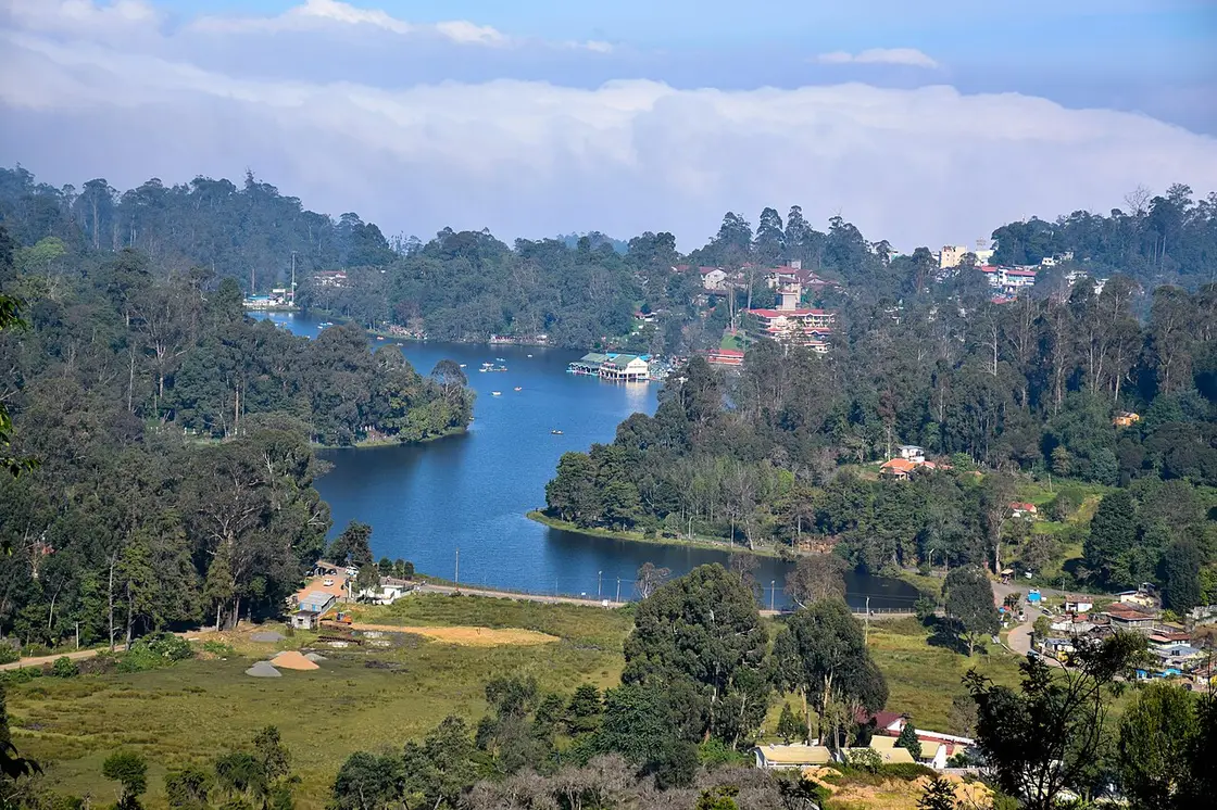
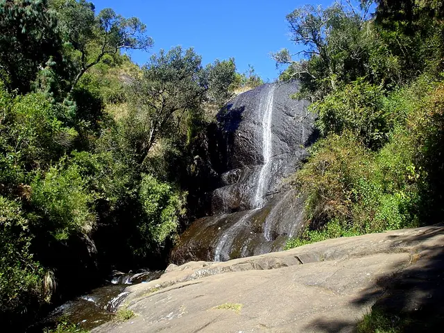
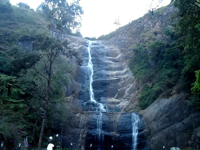
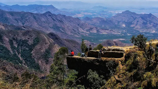
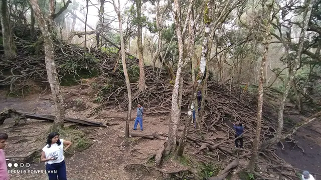
A town the British built to escape the heat, around a lake that did not exist until somebody dug it, on a hill the Palaiyar had lived on for centuries before either.
Kodaikanal announces itself by temperature. You come up from the Madurai plain in the heat, the road starts to bend, and somewhere around the fortieth hairpin you put the window up. That is the whole reason the town is here. It sits at a little over two thousand metres on the southern rim of the Palani hills — the district administration says 7,200 feet, Tamil Nadu Tourism says about 7,000, and the metric figure usually quoted is 2,225 metres, which is 7,300. Nobody agrees on the number and everybody agrees on the effect: it averages about 19.8 °C in summer and 8.3 °C in winter, and it takes 1,578.7 mm of rain a year.
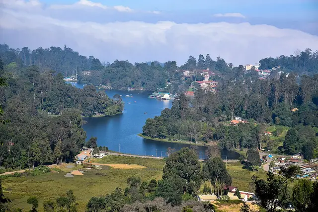
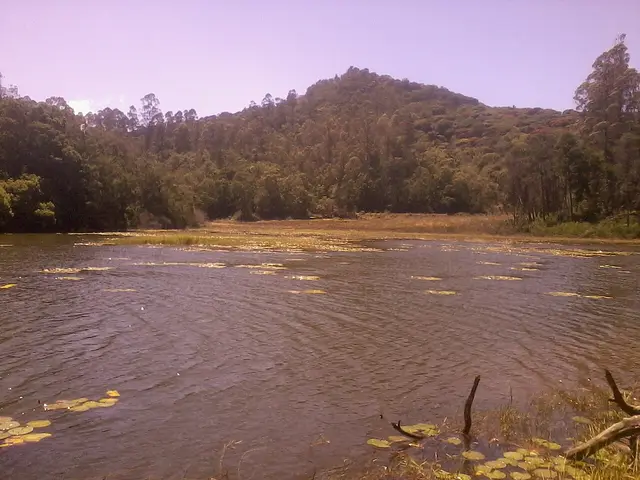
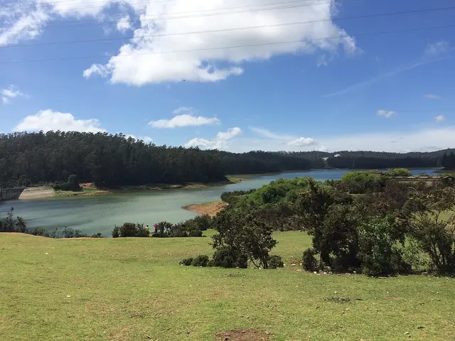
The centre of the town is a lake that is younger than the town. It was made in 1863, on the suggestion of the collector Sir Vere Levinge, by damming three streams into the marshy valley floor — 45 hectares, roughly star-shaped, about five kilometres round. Everything the visitor does is arranged around it: the boat house, the hired cycles, the pony rides, the shore road that is the only flat walk in Kodaikanal. It looks like the oldest thing here and it is one of the newest.
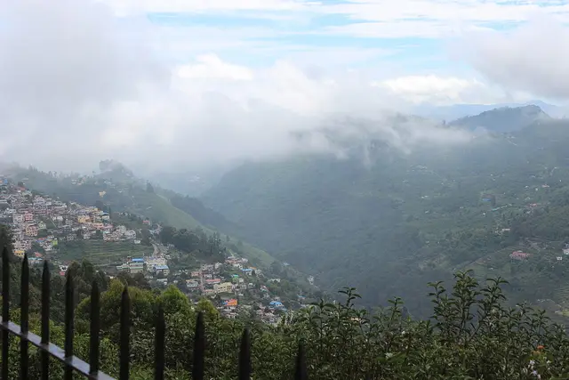
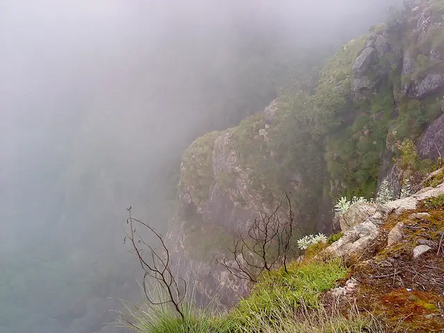
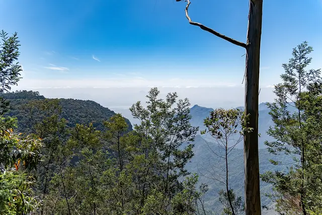
Above it runs Coaker’s Walk, a paved kilometre cut along the cliff edge in 1872 by Lt. Coaker and open from 7 am to 7 pm. On a clear morning you look down two thousand metres to the plains. On a cloudy one you look at cloud, from inside it, and the whole valley appears and disappears while you stand there. Both are the real Kodaikanal; the second is more common, and people who wait for the first often miss the second.
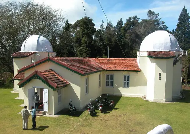
The town has a scientific life that has nothing to do with tourism. The Kodaikanal Solar Observatory was established in 1899, took its first observations in 1901, and has watched the sun almost every clear day since — which makes its plate archive one of the longest continuous solar records anywhere on earth. It is 4.2 km west of the centre and it lets the public in: the museum charges Rs 50 a head, shows a live image of the sun and the Fraunhofer spectrum, and asks for a form fifteen days ahead. A great deal of travel writing says it shuts on Sundays. The Institute’s own page publishes Sunday hours of 9 am to 1 pm.
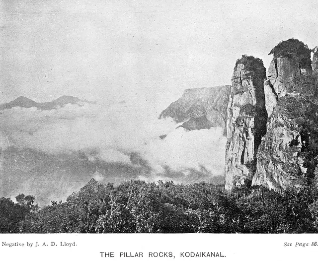
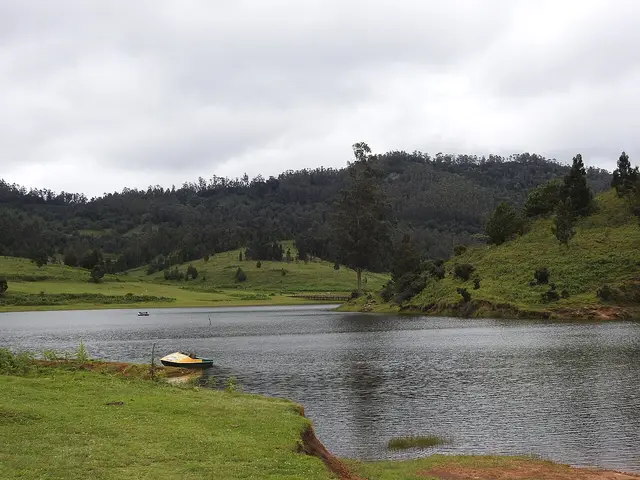
Go west past the observatory and the town runs out quickly. Pillar Rocks at 7.4 km — three granite masses standing about 122 metres clear of the ground — then Guna Caves at 8.3, then Moir Point at 10.3, where the tarred road ends and the forest road to Berijam begins. Berijam Lake is 23.5 km out inside a reserved forest, and you cannot simply drive there: the Forest Department issues a limited number of vehicle permits in the morning at its office in town, the check post turns back anyone without one, and the gate closes to outbound traffic in the middle of the afternoon. Travel sites give the daily cap as twenty, thirty, thirty-five and fifty vehicles. We could not find the Forest Department saying which, so we do not print a number.
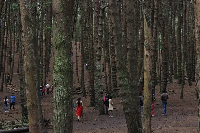
The forest itself is the part of Kodaikanal that is least looked at and most interesting. The native vegetation of these hills is shola — stunted, dense, wet evergreen forest in the folds, with grassland on the ridges — and much of what a visitor now photographs as scenery is not that at all. After the British settled here, sholas were felled and replaced with plantations of introduced pine and eucalyptus, and the Pine Forest that appears on every itinerary is exactly that: a plantation, planted, in rows. Among the surviving native plants is the Kurinji, the shrub that flowers once in about twelve years and turns whole slopes blue when it does, and which gives the Kurinji Andavar temple, 3.6 km north of town, its name.
People were living up here long before any of this. The Palaiyar are the indigenous people of the Palani hills, and when Lieutenant B. S. Ward surveyed the range in 1821 he reported beautiful hills with a healthy climate and about four thousand people already living in well-structured villages. The town that exists now dates from the 1840s onward and was made by American missionaries of the Madurai Mission and by British officials looking for somewhere to survive the hot season — David Coit Scudder arrived in 1862, and by the end of the century the place was a regular summer retreat for missionaries and European officials. In 1909 it had 151 houses, a post office, churches, clubs, schools and shops. It has been a municipality since 1899 and a Special Grade Municipality since 31 May 1994, and about 36,501 people (2011 census) live across its 21.45 square kilometres.
And there is a chapter the brochures leave out. From the early 1980s a thermometer factory operated here, brought from the United States — accounts give the year as 1982 and as 1983 — and taken over by Hindustan Unilever in 1987. The Tamil Nadu Pollution Control Board shut it in March 2001 after mercury waste was found dumped near the Pambar shola. Some 290 tonnes of contaminated waste were shipped to the United States for recycling in 2003; in March 2016 the company reached an out-of-court settlement with its former workers, whose number is given as 511 in one account and 591 in another; and the site was remediated to a standard of 20 mg/kg of mercury in soil, set by the Pollution Control Board, in work that ran from 2017. Campaigners argued at the time that the standard was far laxer than international practice. None of this is visible on a weekend visit, and all of it is part of why the town is careful about waste now — as anyone who buys a plastic bottle here will discover.
Legend & myth
The name is usually translated as gift of the forest, from kodai and kanal, and that reading is on half the signboards in town. It is not the only one. Tamil offers kodai as summer as readily as gift, and kanal as something seen or a clearing as readily as forest, so the same two words support the summer forest, the gift of the forest and the place seen in summer, and Tamil scholars have argued for more than one. We print the popular reading because it is the one the town uses, and we say plainly that it is a reading and not a settled fact.
The Kurinji carries the older story. In classical Tamil poetry the landscape of hills and forest is itself called kurinji, named for this flower, and it is the landscape of lovers meeting in secret — each of the five ancient landscapes had its own mood, and the mountains had this one. That a shrub which blooms once in twelve years should be the emblem of clandestine love is the sort of thing that sounds invented and is genuinely two thousand years old.
More about Kodaikanal
History
The British came for the climate and came slowly. Lieutenant B. S. Ward surveyed the Palani hills in 1821 and reported a healthy climate and about four thousand people already living in the villages there; the revenue collector J. C. Wroughten and C. R. Cotton of the Board explored the range in 1834. Settlement is conventionally dated to 1845, when American missionaries of the Madurai Mission established a hill retreat, but the first permanent house on record is Major J. M. Partridge’s in 1852, and there were still only six or seven houses in 1853. Both dates are printed here because both are current and they do not agree.
The lake made the town. Sir Vere Levinge, the collector, proposed damming the three streams that ran through the marshy valley, and the 45-hectare sheet of water that resulted in 1863 gave the settlement a centre it had not had. Coaker’s Walk followed in 1872, Bryant Park was laid out in 1908, and by 1909 there were 151 houses with a post office, churches, clubs, schools and shops. Municipal status came in 1899 — the same year the Solar Observatory was established, which took its first observations in 1901.
Independence turned a missionaries’ retreat into a mass destination, and the hill has been paying for it since. Native shola forest was replaced with pine and eucalyptus plantations; the lake, the viewpoints and the ghat road now take weekend traffic the town was never built for; and the mercury contamination of 2001 forced a reckoning that is still working itself out. The most recent chapter is a legal one: the Madras High Court has banned plastic bottles under five litres in Kodaikanal, with the District Collector announcing a green tax of Rs 20 a bottle, and inspectors who fine and can seal a shop. It is the first thing most visitors now notice about the town’s attitude to itself.
Why visit
For the temperature, which is still the honest answer after a hundred and eighty years. Summer averages about 19.8 °C. If you have been in the Tamil plains in May, that sentence is the whole argument.
For the walking. The lake circuit is five kilometres and flat, Coaker’s Walk is a paved kilometre along a cliff, and Dolphin’s Nose at 5.0 km is a downhill path to a rock over a gorge — three completely different walks, none of them requiring a guide or a permit.
For the observatory, which almost nobody visits. A hundred and twenty-five years of unbroken solar observation, a live image of the sun, Rs 50, and a form sent a fortnight ahead. There is nothing else like it in a South Indian hill station.
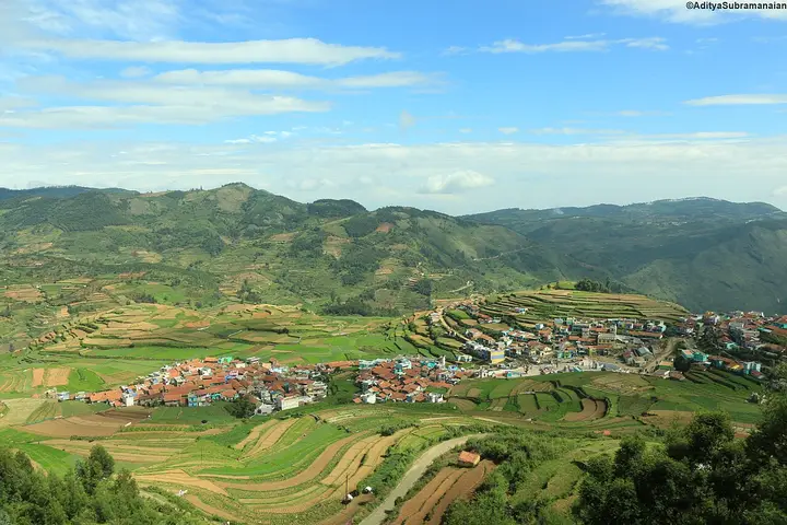
For the far side of the hills. Poombarai at 19.8 km and Mannavanur at 33.5 are terraced villages and high grassland with a fraction of the traffic of the lake road, and Berijam at 23.5 km is a reserved forest you need a morning permit to enter — which is precisely why it is quiet.
And for the cloud. Kodaikanal is at its best when the weather is at its worst: cloud pours through the sholas, the viewpoints open and close in minutes, and the town looks like the place the missionaries described rather than the one on the postcards.