Droog Fort

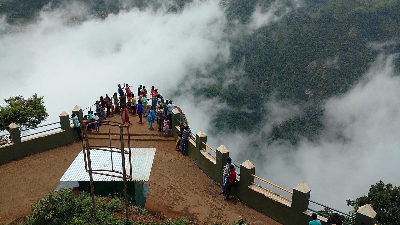
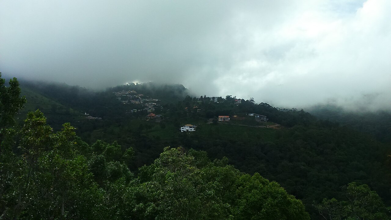
Droog Fort sits at about 6,000 feet on a hilltop roughly 13 km from Coonoor and is reached by a trek through tea estates and shola. It is said to have been used as an outpost by Tipu Sultan in the 18th century, with surviving remnants including a wall and a clock tower.

D
Droog Fort
Place
Practical guide

Plan Droog Fort

Who's going?Tailor Droog Fort to your trip
Typeheritage
Nearest baseCoonoor
DistrictThe Nilgiris
Best timeChoose a cooler daylight visit and…
Time neededAllow about one to two hours at Droog…
Places to visit16Listed businesses14

Droog Fort works best as a focused visit from Coonoor, with enough time to understand its defining feature and follow current access rules.

The story

Droog Fort sits at about 6,000 feet on a hilltop roughly 13 km from Coonoor and is reached by a trek through tea estates and shola. It is said to have been used as an outpost by Tipu Sultan in the 18th century, with surviving remnants including a wall and a clock tower. The summit gives sweeping views over the plains and hills.

The story of Droog Fort

Droog Fort sits at about 6,000 feet on a hilltop roughly 13 km from Coonoor and is reached by a trek through tea estates and shola. For Droog Fort, it is said to have been used as an outpost by Tipu Sultan in the 18th century, with surviving remnants including a wall and a clock tower. For Droog Fort, the summit gives sweeping views over the plains and hills. For Droog Fort, what survives on the ground may be fragmentary, fenced or under conservation, and the absence of a conventional visitor centre does not make restricted ground public.

Before leaving Coonoor for Droog Fort, confirm the public entrance and the latest local instructions. For Droog Fort, the final section may be a village street, hill path, institutional gate or active religious precinct, so the route must be judged on the day rather than from distance alone.

Read Droog Fort at walking pace from the permitted public route. For Droog Fort, its setting in The Nilgiris explains part of the story, but nearby land does not automatically belong to the attraction and should not be entered without invitation.

For Droog Fort, finish the visit while transport and visibility are still dependable. For Droog Fort, take litter back to Coonoor, avoid intrusive portraits and record any changed entrance or rule instead of trying to work around it.

Legend & myth

The tradition attached to Droog Fort is part of how worshippers and local communities understand the site. This guide keeps that account explicitly labelled as tradition: it explains the place's living meaning without presenting sacred narrative as independently dated history.

At Droog Fort, traditional accounts should be read alongside inscriptions, architecture, museum interpretation or other physical evidence available on site. These forms of knowledge answer different questions and should not be blurred together.

Read the full history of Droog Fort 295 more words

History

Droog Fort sits at about 6,000 feet on a hilltop roughly 13 km from Coonoor and is reached by a trek through tea estates and shola. It is said to have been used as an outpost by Tipu Sultan in the 18th century, with surviving remnants including a wall and a clock tower. The summit gives sweeping views over the plains and hills. This documented core is the safest starting point for understanding Droog Fort. Dates, dynastic associations and superlatives repeated without a named inscription, conservation record or official interpretation should be treated cautiously rather than added as fact.

Droog Fort also belongs to the history of Coonoor and the wider The Nilgiris district. Its present condition reflects continuing use, repair, environmental exposure or changing settlement around it; the surviving place is not an unchanged remnant of one period.

A useful historical visit compares the defining feature described above with what is visible now. Notice materials, plan, landscape and present use, and allow a locked area, altered structure or living ritual to remain part of the honest account rather than filling the gap with an unsupported reconstruction.

Why visit

Visit Droog Fort for the specific surviving archaeological evidence and its setting described on this page, rather than as a generic stop in The Nilgiris.

The most useful visit combines close observation at Droog Fort with a realistic return plan through Coonoor; it does not depend on an unverified ticket, unrestricted access or a promised experience.

Its value is clearest when you give the place enough time to understand the feature named in its story instead of reducing the stop to a photograph.

The surrounding Coonoor context makes Droog Fort practical to combine with verified local food, accommodation and visitor services while keeping the attraction itself in focus.
What to expect

Highlights

  • Read the defining surviving feature and physical setting of Droog Fort.
  • Understand how Droog Fort belongs to Coonoor and The Nilgiris rather than treating it as an isolated map pin.
  • Separate documented evidence from local tradition, later alteration and unsupported online claims.
  • Use the verified Coonoor inventory for practical trip support without assuming every listing is beside the entrance.
Getting there

How to visit

  • Reach Droog Fort from Coonoor using the map link, then use signed public entrances and visitor paths.
  • Review the venue's published schedule, admission details and visitor rules before travel.
  • Arrange the return journey before beginning the visit, particularly outside the town centre.
Timing

Best time

Choose a cooler daylight visit and verify the current operating or worship session for Droog Fort; festivals, maintenance and weather can change access.

Weather in Droog FortSeasonal guide

Live forecast loads in your browser.

Today at Droog Fort
Sunrise6:12 am
Sunset6:05 pm
Golden hour best light5:05 pm–6:05 pm
Blue hour after sunset6:05 pm–6:30 pm
Sun sets toward compass bearingW · 261°
Moon tonight🌒 Waxing crescent · 24%

Sun and moon are calculated for this location and shown in IST. Photography windows are the hour around sunrise and sunset; the sunset bearing is degrees clockwise from true north. Moon phase is accurate to about half a day.

Visitor notes

  • Confirm the exact visitor entrance, current access and last safe return from Droog Fort on the day of travel.
  • Ask before photographing interiors, worship, residents or working areas at Droog Fort.
  • Treat the map as a locator and follow signs or staff directions to the currently open public entrance.
Safety

Good to know

  • Obey barriers and staff instructions at Droog Fort; do not climb structures, enter restricted ground or block worship and working access.
  • Use suitable footwear, carry water and keep enough daylight for the return to Coonoor.
  • Keep children close around traffic, water, drops, crowds and uneven surfaces; seek local advice where the visitor boundary is unclear.
Stay · eat · do · rent · see · shop

Stays, food & things to do near Droog Fort

Verified hotels, homestays, restaurants, experiences, sights, shops and rentals around Droog Fort — commission-free, with direct contact. Filter by what you need.

9 places to stay near Droog Fort

Top pick
Heritage hotel
Neemrana's Wallwood Garden

A nineteenth-century Scottish-style house on Kotagiri Road, run by Neemrana. It keeps its own award-winning gardens and a tea estate.

Directions Commission-freeView details
Top pick
Heritage hotel
Ibex Resorts, Coonoor (Leewood)

A colonial bungalow of 113 years on the Leewood Estate at Highfield. Five grades of room, and lawns used for weddings.

Directions Commission-freeView details
Top pick
Boutique hotel
180° McIver

Three grades of room in the old McIver Villa on Orange Grove Road. The view runs right across the Coonoor valley.

Directions Commission-freeView details
Top pick
Plantation homestay
Tenerife Hill

A two-bedroom farmstay inside a working tea estate. The kitchen cooks Badaga food, which few places serve visitors.

Directions Commission-freeView details
Top pick
Plantation bungalow
The Sanctuary at Paradise Hill

A two-suite plantation bungalow on Paradise Hill, closed in by hills on three sides. Meals and guided estate walks come with it.

Directions Commission-freeView details
Resort
Ibex Resorts, Coonoor (Tapas)

The smaller of the two Ibex houses at Coonoor, out at Burliar. Three mountain-view rooms with private sit-outs, and a restaurant called Sparrow.

Directions Commission-freeView details
Guest house
Fairy Glen

A two-bedroom colonial cottage on Hatherly Road, let as a whole house. Meals are cooked to order with a day’s notice.

Directions Commission-freeView details
Guest house
Erin Villa

A house of more than 150 years on six acres, two kilometres out of town. Let by the room or as a whole cottage.

Directions Commission-freeView details
Members club
Coonoor Club

The town’s club since 1885, with heritage guest suites looking onto the garden. A dining room, a bar, tennis, and a library of 3,000 books.

Directions Commission-freeView details

Book with the place itself. India’s cyber-crime coordination centre warned in April 2025 that convincing copies of hotel and pilgrimage booking sites are being pushed through sponsored search and social ads, taking payment for rooms the property never hears about. Every listing here links to the business’s own contact details and its own Google or Bing profile — we take no commission and sit in nobody’s payment path. If a booking page reached you through an ad, check the address bar against the property’s own site before you pay. Fraud can be reported on cybercrime.gov.in or on 1930.

Ranked

More ways to explore Coonoor

Droog Fort is planned from Coonoor in The Nilgiris district; listings on the page cover that wider town base and are not all beside the entrance.

Across the whole of Coonoor

Ranked guides

Top experiences around Droog Fort

15 more places around Coonoor. Open a guide to plan the visit and onward journey.

activityNilgiri Mountain Railway

5.7 km · ~14 min by auto

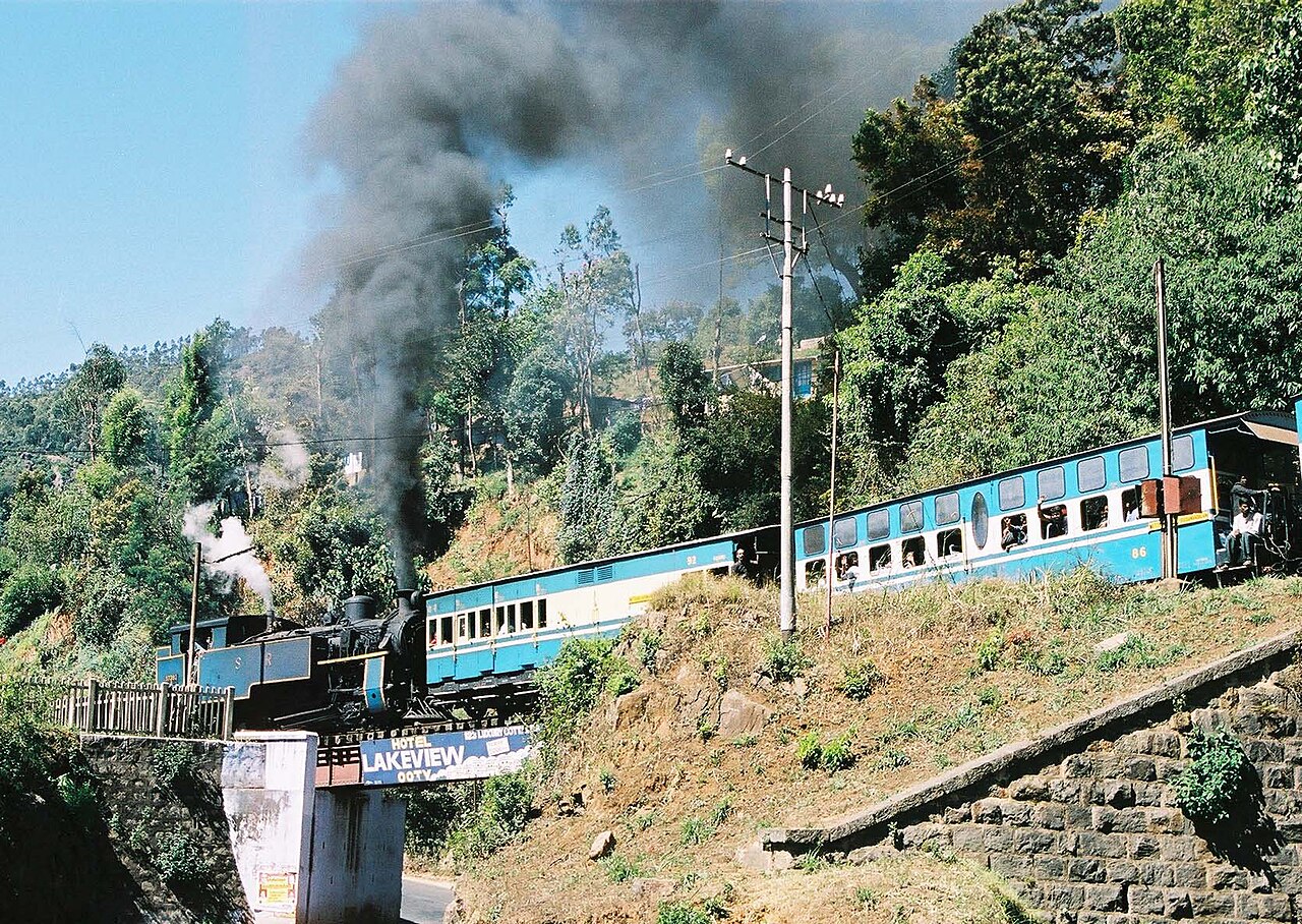
A UNESCO World Heritage metre-gauge rack railway connecting Mettupalayam to Ooty via Coonoor, opened in stages between 1899 and 1908.

parkSim's Park

5.9 km · ~15 min by auto

A 12-hectare botanical park in Coonoor established in 1874, laid out in irregular Japanese style with a small lake and rare tree species.

viewpointDolphin's Nose, Coonoor

6.4 km · ~16 min by auto

A rocky outcrop near Coonoor offering sweeping views of the Nilgiri escarpment, Catherine Falls, and the plains below.

viewpointLamb's Rock

3.9 km · ~10 min by auto

A viewpoint near Coonoor overlooking tea and coffee plantations and the Coimbatore plains, named after a former collector of the region.

L
Law's Falls
Place
heritageLaw's Falls

4.6 km · ~12 min by auto

Law's Falls lies about 5 km from Coonoor on the Coonoor-Mettupalayam ghat road, where the Coonoor river drops through a wooded gorge. It is named after Colonel Law, who built the Coonoor ghat road in the 1830s. Surrounded by dense greenery, it is a relatively uncrowded picnic spot.

R
Ralliah Dam
Place
heritageRalliah Dam

Ralliah (Rallia) Dam sits on the Coonoor-Kattabettu-Kotagiri road and was built in 1914 as a catchment supplying drinking water to Coonoor and Kotagiri. Ringed by eucalyptus forest and reached by a short walk, it is a peaceful, little-visited spot popular for gentle trekking.

L
Lady Canning's Seat
Place
heritageLady Canning's Seat

6.2 km · ~15 min by auto

Lady Canning's Seat is an elevated colonial-era vantage point near Coonoor named after the wife of Lord Canning, Viceroy of India. It is prized for its sunrise and sunset views over the surrounding valleys and tea slopes.

K
Kattery Park
Place
heritageKattery Park

4.0 km · ~10 min by auto

Kattery Park is a horticultural park spread over about 5.5 acres near Coonoor, with landscaped flower beds, a children's play area and a small waterfall on the Kallar river nearby. It is a compact garden stop on the outskirts of the town.

A
All Saints Church, Coonoor
Place
heritageAll Saints Church, Coonoor

6.2 km · ~16 min by auto

An Anglican church in Coonoor, now of the Church of South India, on the Kattabettu road out of the town — stained glass, antique woodwork and an old pipe organ in a Gothic hall. Its founding is published as both 1851 and 1854 and we have found no official source that settles it, so both are printed. We have no checked coordinate for it, so no distance to it is printed.

C
Coonoor railway station
Place
heritageCoonoor railway station

5.8 km · ~14 min by auto

The hinge of the Nilgiri Mountain Railway, 370 m from the Coonoor bus stand. The Abt rack section that carries the train up the gorge from Kallar ends at this platform and the run on to Udhagamandalam above it is worked on plain track, which is why the locomotive shed is here and why the Coonoor-Ooty shuttles exist. Southern Railway gives the whole line as 45.88 km of metre gauge, opened to Coonoor on 15 June 1899.

P
Pasteur Institute of India, Coonoor
Place
heritagePasteur Institute of India, Coonoor

5.7 km · ~14 min by auto

A vaccine institute on sixteen acres above the town, founded after Lily Pakenham Walsh died of hydrophobia in 1902 without reaching treatment in time. One lakh rupees of Henry Phipps's gift to Lord Curzon paid for it, Coonoor was chosen for its cool and equitable climate, and it began work on 6 April 1907. It has made antirabies vaccine ever since and DPT vaccines since 1982. A manufacturer, not a clinic.

B
Brooklane Coonoor Tea Factory
Place
heritageBrooklane Coonoor Tea Factory

4.7 km · ~12 min by auto

A working tea factory 9.5 km east of the Coonoor bus stand on the estate road toward the viewpoints, where the leaf from the surrounding slopes is withered, rolled, oxidised and graded. Coonoor has been the administrative centre of the Nilgiri tea trade since the first plantation in these hills was established beside it in 1854.

K
Katary Falls
Place
waterfallKatary Falls

A waterfall 11.5 km west of Coonoor below the Katary dams, on a different catchment from the Ralliah dam east of the town despite the similar name - a confusion that had put Ralliah's own pin ten kilometres out until it was corrected. Reached off the Coonoor-Ooty road and far less visited than Catherine Falls.

B
Bedford, Coonoor
Place
heritageBedford, Coonoor

5.3 km · ~13 min by auto

The junction a kilometre above the bus stand where the town's shops give out and the estate roads begin, and the second place in Coonoor to find an auto. The tea slopes above it run up to Highfield, and the road east from here is the one that leads to Lamb's Rock and Dolphin's Nose.

heritageHighfield Tea Estate and Factory

Highfield is a long-established tea estate and working factory near Coonoor that offers guided tours explaining the tea-making process from plucking to packaging. Visitors can walk the plantation slopes and buy estate-fresh Nilgiri tea, making it one of Coonoor's popular tea-tourism stops.

Roampedia is commission-free — own or know a stay, eatery, guide or shop near Droog Fort? List it and it appears here once verified.

Add a nearby business
Before you go

Droog Fort — at a glance

TimingsUse Droog Fort's published visitor schedule and admission information when planning the day.
Best timePrefer a cooler daylight session and recheck current access on the day.

Festivals: Droog Fort does not have a reliably documented fixed public festival in the source record. Plan around current opening, weather and local-event notices instead of travelling for an assumed celebration.

Photography: Photography rules can change with worship, conservation, security and private activity. Follow signs and ask before photographing interiors, ceremonies, collections or identifiable people at Droog Fort.

Parking: Parking at Droog Fort has not been independently confirmed. Use only a signed public or operator-designated area, keep gates and village streets clear, and never treat a roadside shoulder as secure parking.

Getting here

How to reach Droog Fort

  • ✈︎ By air Use the airport serving The Nilgiris and complete the journey to Coonoor by road or rail; verify the transfer time before booking a same-day visit to Droog Fort.
  • 🚆︎ By train Use the practical railhead for Coonoor, then confirm the final local-road connection to Droog Fort; the geographically nearest station may not have the most useful service.
  • 🚗︎ By road Travel to Coonoor, follow the map link to Droog Fort, and use public streets and marked visitor paths at the destination.
  • 🚌︎ By bus Check current TNSTC or local-bus service to Coonoor and ask for the correct stop for Droog Fort. Confirm the last usable return before starting the visit.
Getting around

Getting around Droog Fort

Coonoor is the practical movement base. Use walking, an auto-rickshaw, a locally arranged taxi or current public transport according to distance, and agree the return plan before entering Droog Fort.

Online taxis: App-cab availability can change by time and locality. Check the live Uber or Ola app before relying on a pickup at Droog Fort, and keep the local bus or auto-rickshaw option as a fallback.

Do

Things to do

  • Identify the feature that gives Droog Fort its visitor value.
  • Read the site in relation to Coonoor and The Nilgiris.
  • Distinguish documented history from living tradition and later alteration.
  • Combine it only with genuinely nearby stops that preserve a safe return margin.
  • Pause at the principal viewpoint, shrine, exhibit or surviving feature instead of treating Droog Fort as a drive-by photo stop.
Plan

Good to know

  • Save the route offline before leaving Coonoor.
  • Carry water and sun or rain protection.
  • Accept an exterior-only visit when current access does not permit entry.
  • Keep identification, personal medication and enough cash for local transport.
Facilities

On site

  • Carry water and weather protection suited to Droog Fort, and use designated public facilities where provided.
  • Plan dependable food, cash and essential purchases in Coonoor.
  • Use posted notices or on-site staff for visitor assistance.
Stay safe

Safety

  • Follow current site, worship and security instructions.
  • Do not cross barriers, climb structures or enter unstable, private or restricted ground.
  • Keep enough daylight and transport margin for the return to Coonoor.
Getting around Droog Fort

If you need step-free access, contact the site before travelling. Ask about a level entrance, steps along the route, the nearest drop-off point, seating and accessible toilets.

If you need help at Droog Fort
112All emergencies (police · fire · medical)The single number to call in any emergency (ERSS).

Emergency numbers are verified against official government and state tourism sources. 112 works anywhere in India.

Eat nearby

What to eat in Coonoor

Coonoor is the sensible meal base for a visit to Droog Fort. These are regional dishes to look for, not claims that food is sold at the attraction; check current opening hours and dietary requirements directly.

Explore food in Coonoor →
01

Nilgiri tea

Taste locally grown black tea without assuming every flavoured packet was made on the estate named on its label. A plain brew makes it easier to notice the brisk, fragrant character.

02

Badaga-style dishes

When a reputable local kitchen offers them, try avarai bean preparations, millet food or bathalu-style accompaniments associated with Nilgiri communities; availability is seasonal and not universal.

03

Warm South Indian tiffin

Idli, pongal, vadai and dosai are reliable in Coonoor, Ooty and Gudalur, particularly on cold or wet mornings. Eat in town before a remote trail or reservoir visit.

Nearby

What’s near Droog Fort

viewpointLamb's Rock

A viewpoint near Coonoor overlooking tea and coffee plantations and the Coimbatore plains, named after a former collector of the region.

3.9 km · ~10 min by auto · straight line
K
Kattery Park
Place
heritageKattery Park

Kattery Park is a horticultural park spread over about 5.5 acres near Coonoor, with landscaped flower beds, a children's play area and a small waterfall on the Kallar river nearby. It is a compact garden stop on the outskirts of the town.

4.0 km · ~10 min by auto · straight line
L
Law's Falls
Place
heritageLaw's Falls

Law's Falls lies about 5 km from Coonoor on the Coonoor-Mettupalayam ghat road, where the Coonoor river drops through a wooded gorge. It is named after Colonel Law, who built the Coonoor ghat road in the 1830s. Surrounded by dense greenery, it is a relatively uncrowded picnic spot.

4.6 km · ~12 min by auto · straight line
B
Brooklane Coonoor Tea Factory
Place
heritageBrooklane Coonoor Tea Factory

A working tea factory 9.5 km east of the Coonoor bus stand on the estate road toward the viewpoints, where the leaf from the surrounding slopes is withered, rolled, oxidised and graded. Coonoor has been the administrative centre of the Nilgiri tea trade since the first plantation in these hills was established beside it in 1854.

4.7 km · ~12 min by auto · straight line
B
Bedford, Coonoor
Place
heritageBedford, Coonoor

The junction a kilometre above the bus stand where the town's shops give out and the estate roads begin, and the second place in Coonoor to find an auto. The tea slopes above it run up to Highfield, and the road east from here is the one that leads to Lamb's Rock and Dolphin's Nose.

5.3 km · ~13 min by auto · straight line
activityNilgiri Mountain Railway

A UNESCO World Heritage metre-gauge rack railway connecting Mettupalayam to Ooty via Coonoor, opened in stages between 1899 and 1908.

5.7 km · ~14 min by auto · straight line
P
Pasteur Institute of India, Coonoor
Place
heritagePasteur Institute of India, Coonoor

A vaccine institute on sixteen acres above the town, founded after Lily Pakenham Walsh died of hydrophobia in 1902 without reaching treatment in time. One lakh rupees of Henry Phipps's gift to Lord Curzon paid for it, Coonoor was chosen for its cool and equitable climate, and it began work on 6 April 1907. It has made antirabies vaccine ever since and DPT vaccines since 1982. A manufacturer, not a clinic.

5.7 km · ~14 min by auto · straight line
C
Coonoor railway station
Place
heritageCoonoor railway station

The hinge of the Nilgiri Mountain Railway, 370 m from the Coonoor bus stand. The Abt rack section that carries the train up the gorge from Kallar ends at this platform and the run on to Udhagamandalam above it is worked on plain track, which is why the locomotive shed is here and why the Coonoor-Ooty shuttles exist. Southern Railway gives the whole line as 45.88 km of metre gauge, opened to Coonoor on 15 June 1899.

5.8 km · ~14 min by auto · straight line
parkSim's Park

A 12-hectare botanical park in Coonoor established in 1874, laid out in irregular Japanese style with a small lake and rare tree species.

5.9 km · ~15 min by auto · straight line
L
Lady Canning's Seat
Place
heritageLady Canning's Seat

Lady Canning's Seat is an elevated colonial-era vantage point near Coonoor named after the wife of Lord Canning, Viceroy of India. It is prized for its sunrise and sunset views over the surrounding valleys and tea slopes.

6.2 km · ~15 min by auto · straight line
A
All Saints Church, Coonoor
Place
heritageAll Saints Church, Coonoor

An Anglican church in Coonoor, now of the Church of South India, on the Kattabettu road out of the town — stained glass, antique woodwork and an old pipe organ in a Gothic hall. Its founding is published as both 1851 and 1854 and we have found no official source that settles it, so both are printed. We have no checked coordinate for it, so no distance to it is printed.

6.2 km · ~16 min by auto · straight line
viewpointDolphin's Nose, Coonoor

A rocky outcrop near Coonoor offering sweeping views of the Nilgiri escarpment, Catherine Falls, and the plains below.

6.4 km · ~16 min by auto · straight line

All 16 places to visit in Coonoor →

On the map

Where Droog Fort is

Good to know

Droog Fort — frequently asked

What should I verify before visiting Droog Fort?

Confirm the current public entrance, opening session, permission or ticket rule and return transport from Coonoor. Site management and local notices take priority over an undated listing.

How much time should I allow for Droog Fort?

Allow about an hour at the site, plus the complete approach, any worship or security queue and a comfortable daylight margin for returning to Coonoor.

What is significant about Droog Fort?

Droog Fort sits at about 6,000 feet on a hilltop roughly 13 km from Coonoor and is reached by a trek through tea estates and shola. It is said to have been used as an outpost by Tipu Sultan in the 18th century, with surviving remnants including a wall and a clock tower. The summit gives sweeping views over the plains and hills.

Can I photograph Droog Fort?

Do not assume that every interior, ceremony, resident, object or protected area may be photographed. Follow current signs and ask the responsible staff or worship authority before taking pictures.

Is Droog Fort accessible without steps?

A vehicle reaching the mapped point does not prove a step-free visit. Confirm the actual entrance, surface, gradients, thresholds, seating and toilet access before travelling.

When is the best time to visit Droog Fort?

Choose a cooler daylight visit and verify the current operating or worship session for Droog Fort; festivals, maintenance and weather can change access.

What are the entry fee and timings at Droog Fort?

Timings: Use Droog Fort's published visitor schedule and admission information when planning the day.

How do I reach Droog Fort?

Reach Droog Fort from Coonoor using the map link, then use signed public entrances and visitor paths. Review the venue's published schedule, admission details and visitor rules before travel. Arrange the return journey before beginning the visit, particularly outside the town centre.

How much time do I need for Droog Fort?

Allow about one to two hours at Droog Fort, plus the complete approach, any queue and the return to Coonoor.

What else is near Droog Fort?

Nearby you can pair Lamb's Rock (3.9 km), Kattery Park (4.0 km), Law's Falls (4.6 km), Brooklane Coonoor Tea Factory (4.7 km).

What should I know before visiting Droog Fort?

Obey barriers and staff instructions at Droog Fort; do not climb structures, enter restricted ground or block worship and working access. Use suitable footwear, carry water and keep enough daylight for the return to Coonoor. Keep children close around traffic, water, drops, crowds and uneven surfaces; seek local advice where the visitor boundary is unclear.

Read before you go

Droog Fort guides, stories & itineraries

Stories & history of Droog Fort

Written about Droog Fort itself — its history, its legends and the arguments about them.

Around Coonoor

These reads cover nearby destinations, each with its own arrival point and visit arrangements.

Tamil Nadu-wide guides & itineraries

Route-level itineraries and practical guides for the rest of Tamil Nadu.

See all 49 The Nilgiris guides & stories →